Overview
Jefferson County GIS Data – For CAD
Equator helps civil engineering, architecture and consulting firms with the tools to instantly find, process and download accurate LiDAR, contours, parcel data, building footprints, DEMs, point clouds and other GIS data for Jefferson County in an online web mapping portal.
Jefferson County GIS Data →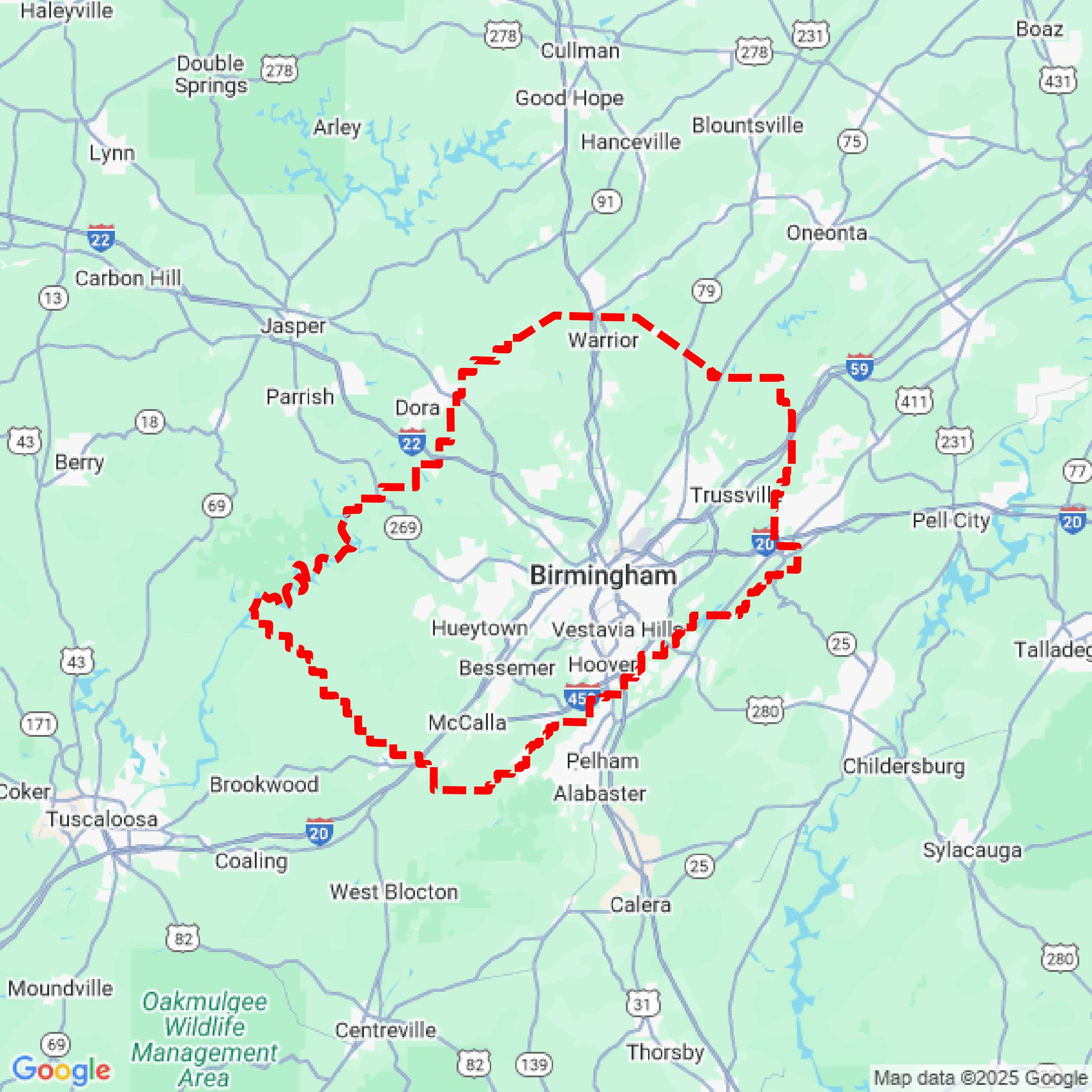

Data Available
Download GIS Data for Jefferson County
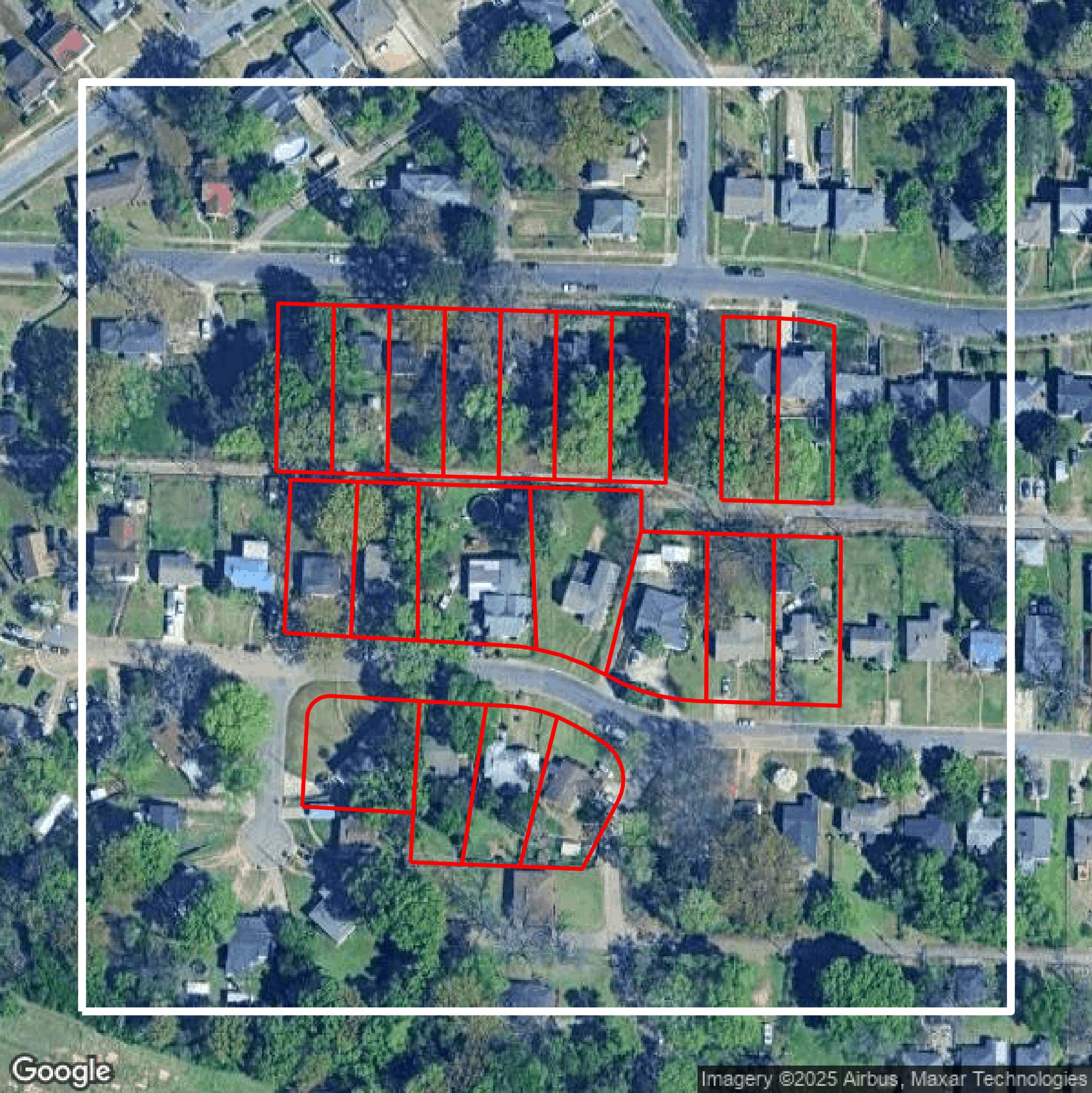
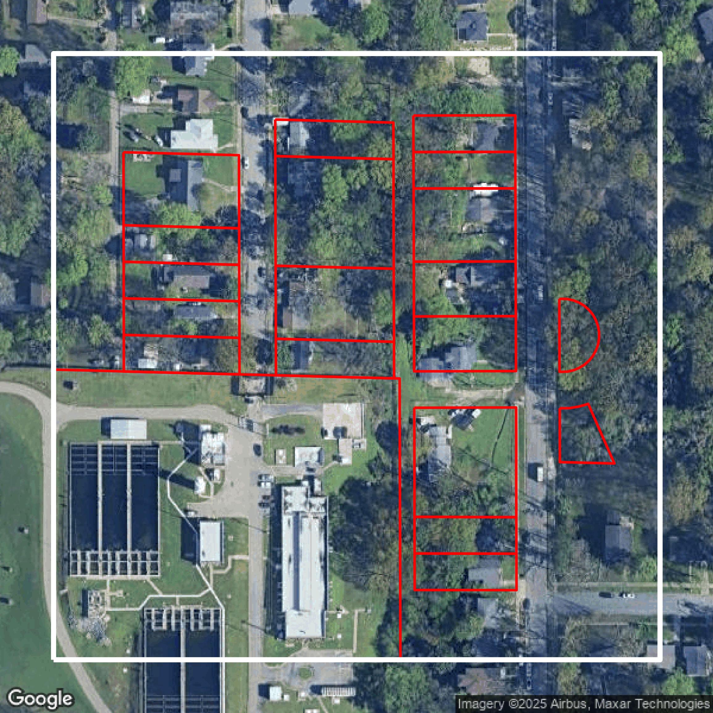
Parcels and Buildings
This image shows parcel and building data in Jefferson County created using GIS data in Equator.
Get Parcels and Buildings for Jefferson County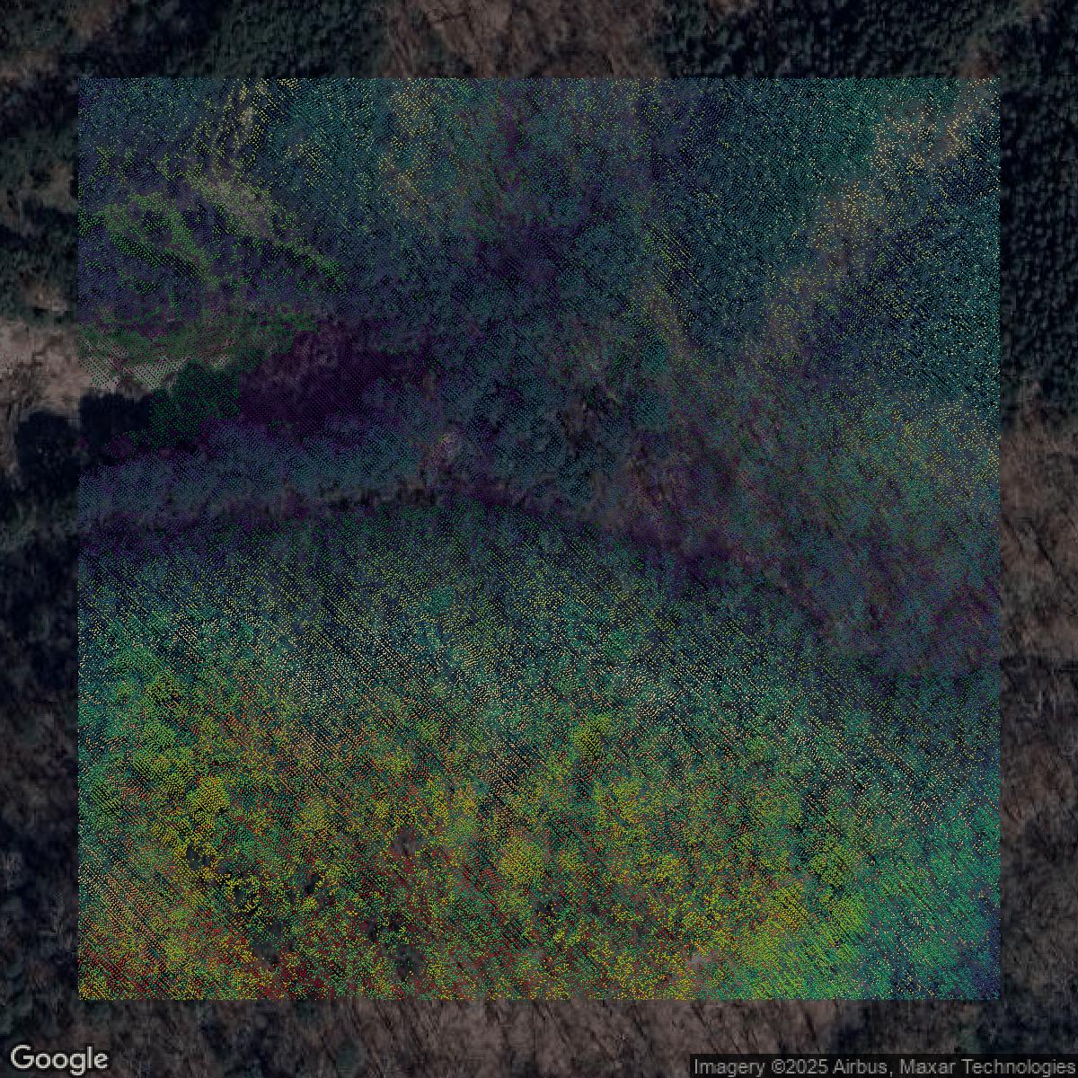
LiDAR
This image shows a LiDAR point cloud in Jefferson County created using GIS data in Equator.
Get LiDAR for Jefferson County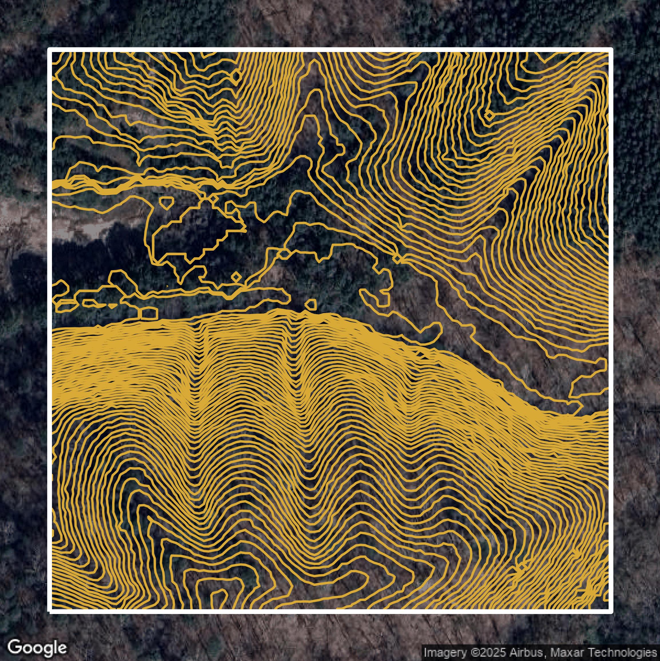
Contours
This image shows a contour map in Jefferson County created using GIS data in Equator.
Get Contours for Jefferson CountyFormats Available
Export Your Data Ready to Use in Multiple Formats
DWG
AutoCAD Drawing - Industry-standard CAD format
Supported Data:
Contour, Parcel, Building Outline
SHP
Shapefile - Standard GIS vector format
Supported Data:
Contour, Parcel, Building Outline
DXF
Drawing Exchange Format - Universal CAD interchange
Supported Data:
Contour, Building Outline
GeoJSON
Geographic JSON - Web-friendly spatial data format
Supported Data:
Contour, Parcel, Building Outline
LAZ
Compressed LAS - Efficient LiDAR point cloud format
Supported Data:
Point Cloud
SVG
Scalable Vector Graphics - Web vector format
Supported Data:
Contour, Building Outline
GPKG (Coming Soon)
GeoPackage - Modern OGC spatial database format
Supported Data:
Contour, Parcel, Building Outline
LandXML (Coming Soon)
Land XML - Civil engineering data exchange format
Supported Data:
Point Cloud
TIN (Coming Soon)
Triangulated Irregular Network - 3D surface model
Supported Data:
Point Cloud
XYZ (Coming Soon)
XYZ Point Cloud - Simple ASCII point cloud format
Supported Data:
Point Cloud
Background
GIS Data for Jefferson County
The Jefferson County, Alabama Open Data website (https://data-jeffco-al.opendata.arcgis.com/) is the community’s public platform for exploring, downloading, and analyzing open data to help solve important local issues. Visitors can visualize data in interactive dashboards covering topics like new COVID-19 cases and changes over time with tools such as the Swipe tool (2015 to 2023). The site offers easy access to apps including Flood Zones Search, Zoning Lookup for Unincorporated Jefferson County, Parcel Locator, and Parcel Buffer Lookup, designed for citizens and visitors alike. The Open Data Hub empowers users to unlock and download Jefferson County’s Geodata free of charge, explore spatial datasets, perform analyses, and build new web or mobile applications using ESRI resources. Users can create ArcGIS Online Public Accounts to share maps and apps, utilize Open APIs for innovation, and engage with the community through local events and professional groups like URISA – Alabama and the Alabama Geographical Alliance. This platform encourages collaborative knowledge sharing to make Jefferson County an even better community.
Access Jefferson County GIS Data in Equator →Jefferson County Portal →Showcase
Sample GIS Data for Jefferson County
Parcels and Buildings
Parcel and building data in Jefferson County are used in a variety of fields including architecture, real estate, and urban planning.
Get Parcels and Buildings for Jefferson County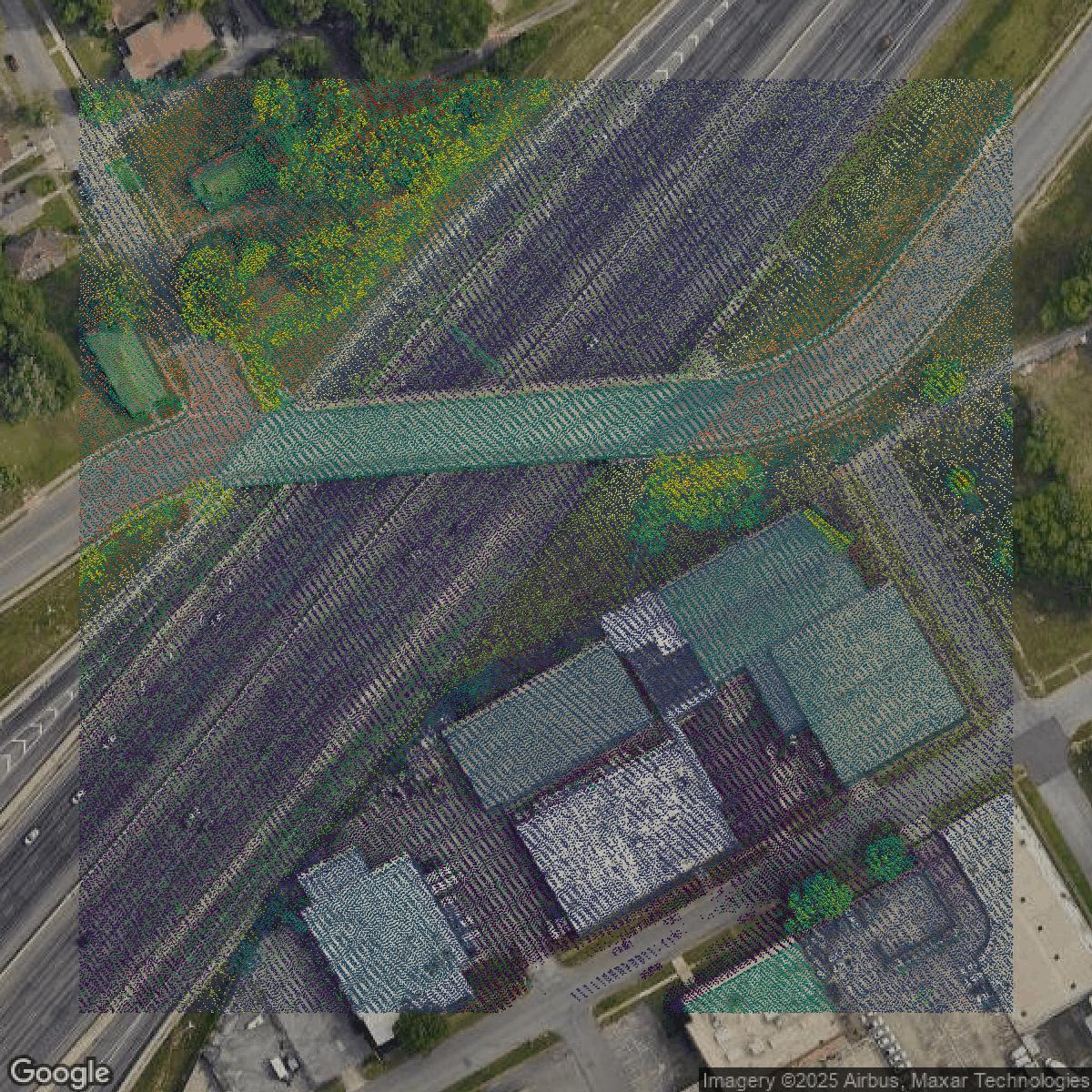
LiDAR
Point clouds (LiDAR) in Jefferson County can produce highly accurate 3D models of terrain, structures, and vegetation.
Get LiDAR for Jefferson County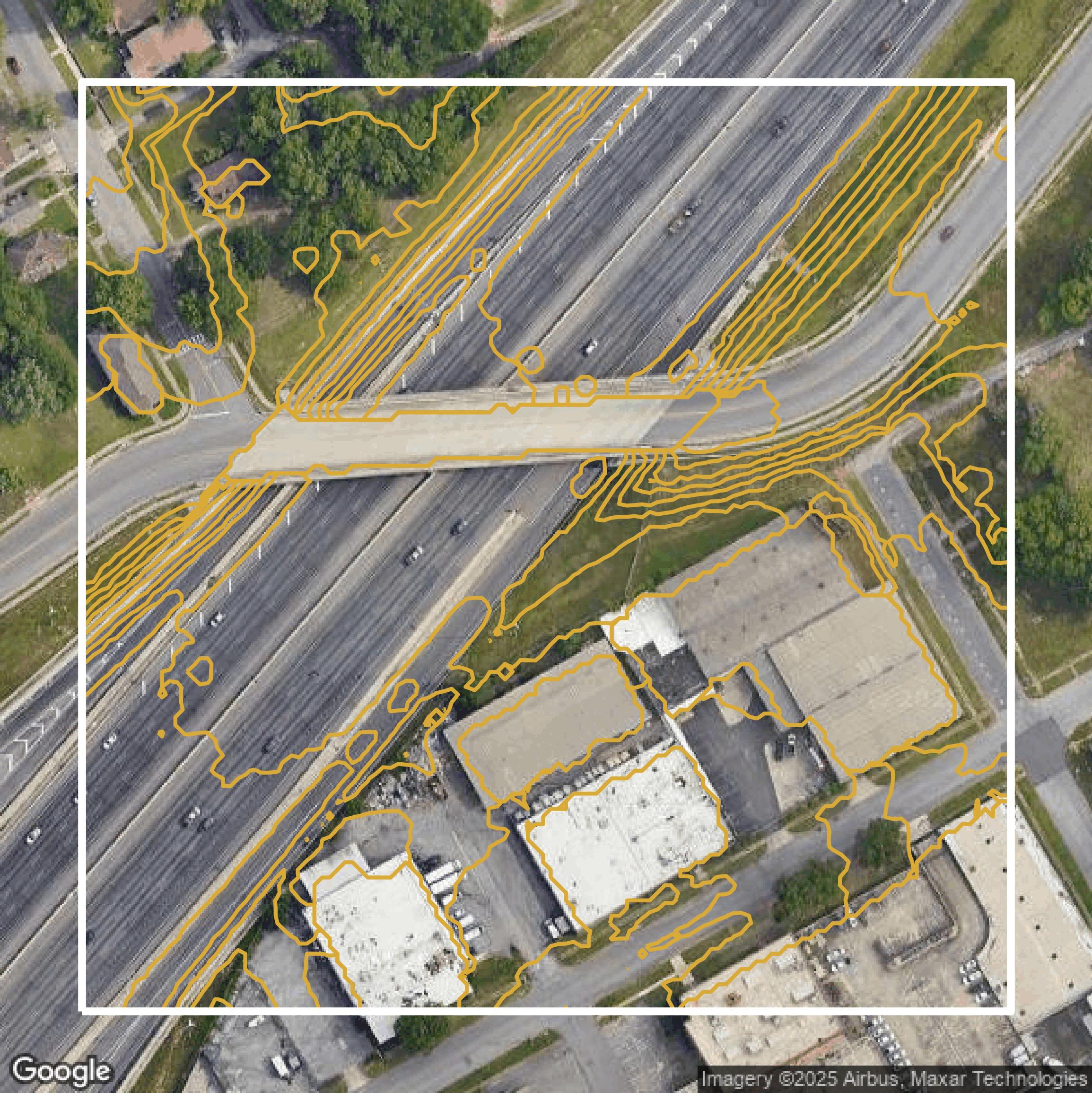
Contours
Contours in Jefferson County visualize 3D elevations on a 2D surface allowing you to better understand your site.
Get Contours for Jefferson County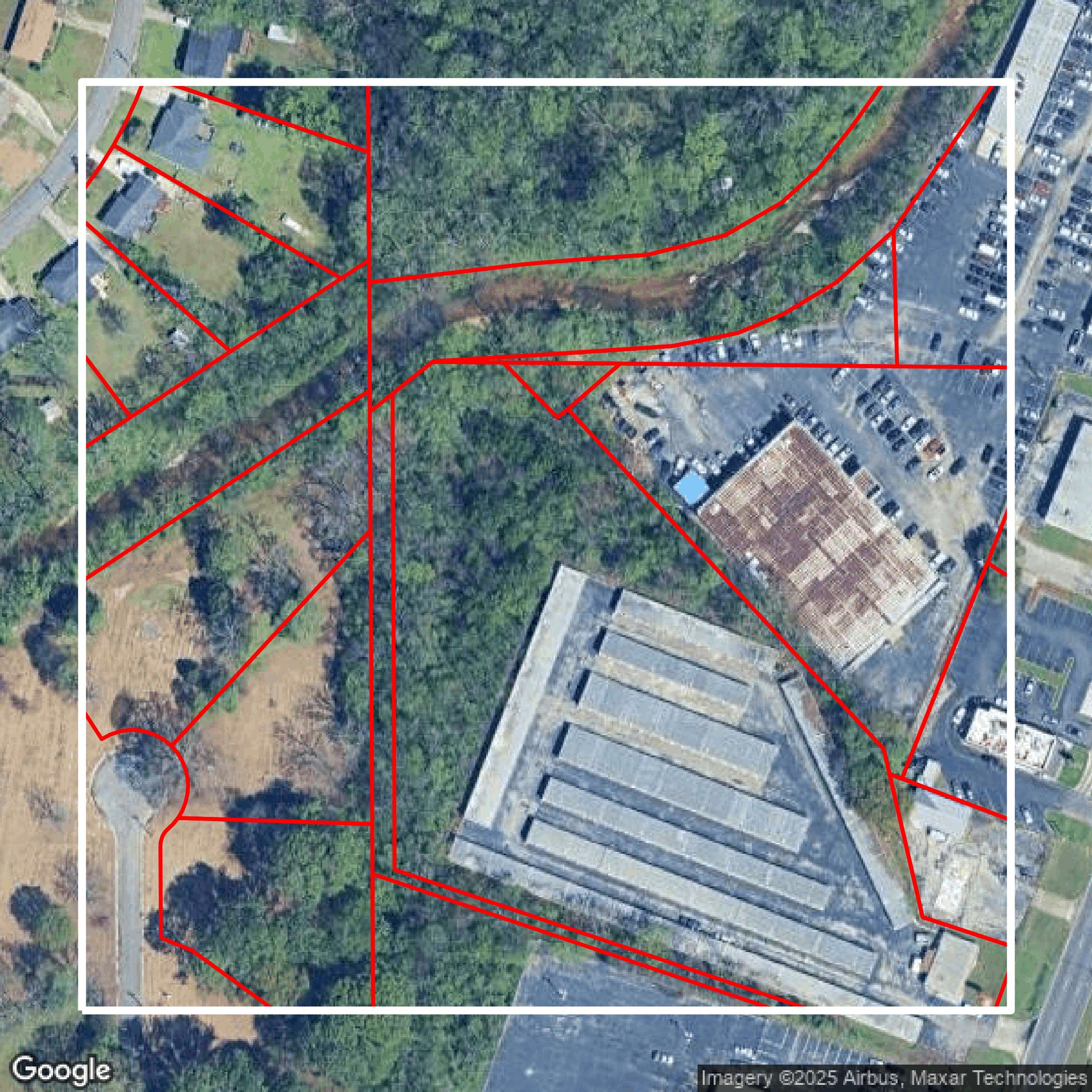
Parcels and Buildings
Accessing Jefferson County parcel and building data on Equator gives you access to coverage across the US.
Get Parcels and Buildings for Jefferson County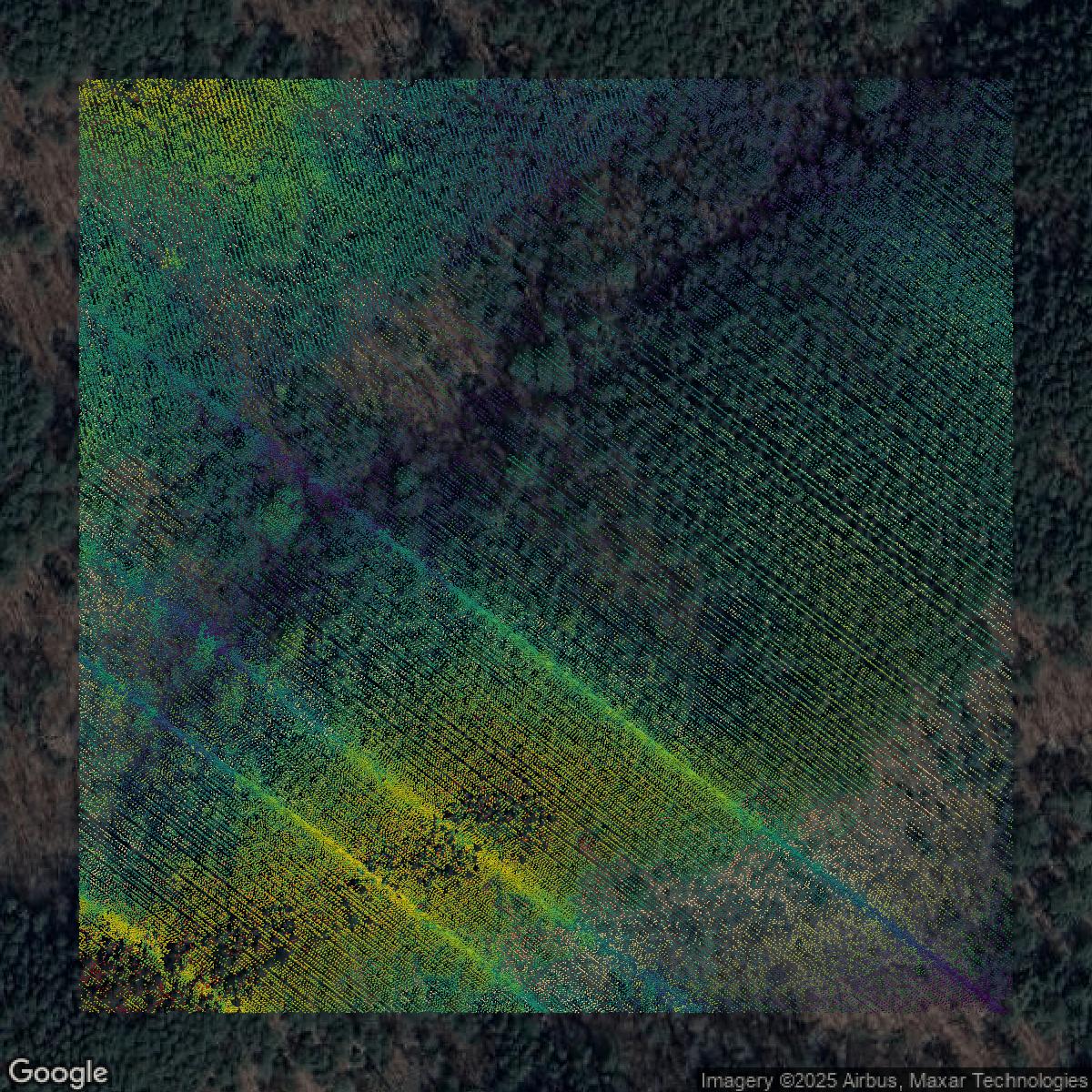
LiDAR
Jefferson County LiDAR uses include land surveying, analyzing crop health, or even archaeological studies.
Get LiDAR for Jefferson County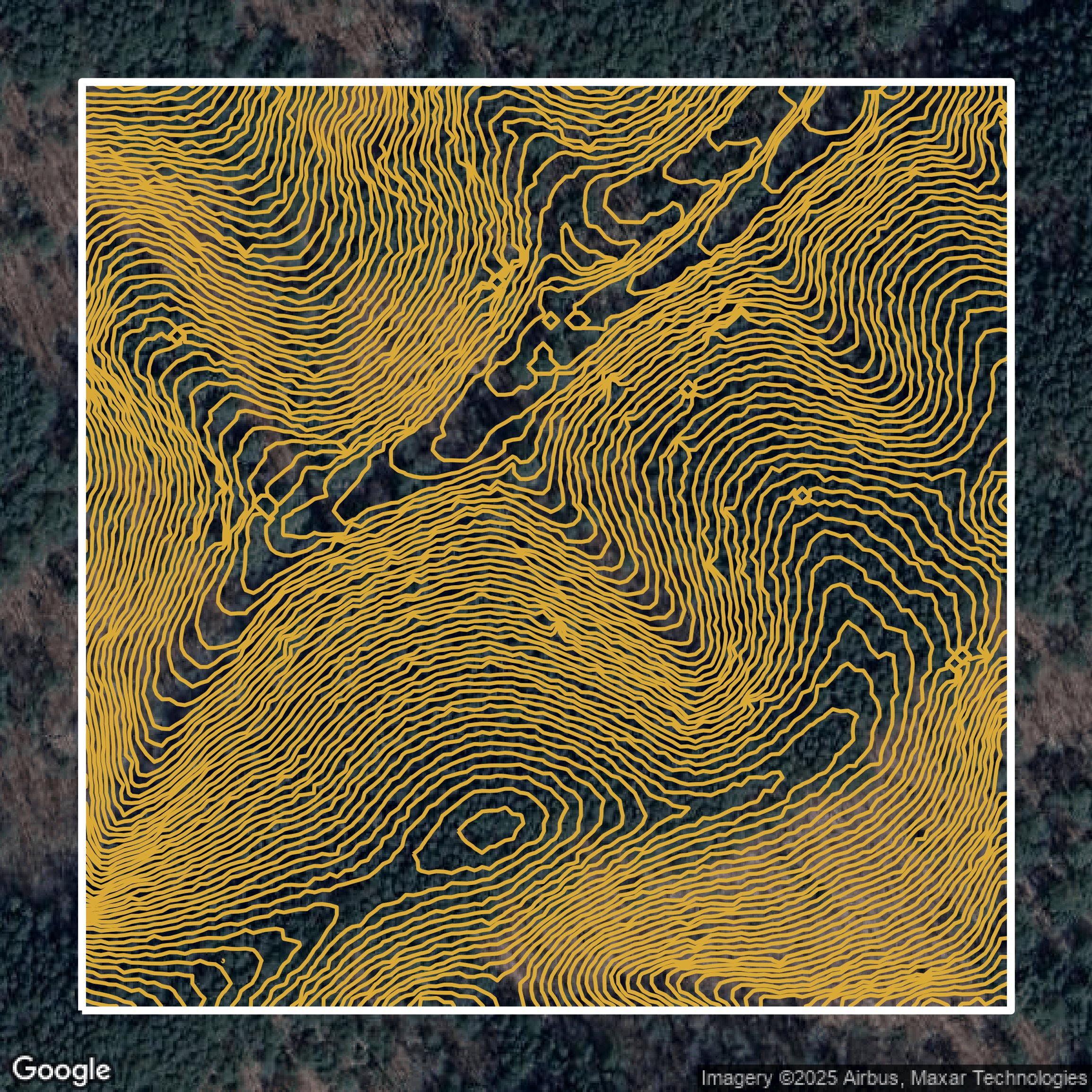
Contours
Jefferson County contours can be used for construction & engineering, environmental science, and more.
Get Contours for Jefferson County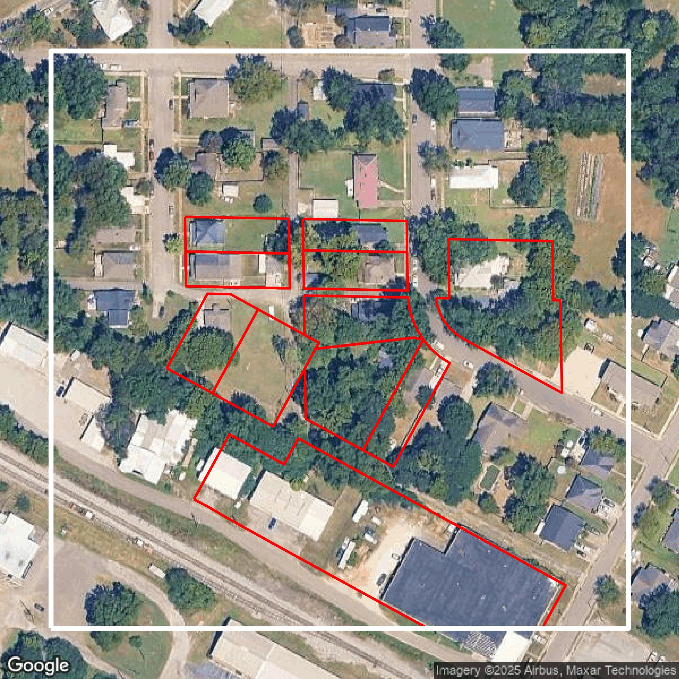
Parcels and Buildings
Dozens of fields are contained within each Jefferson County parcel and building data, including zoning, owners, and year built.
Get Parcels and Buildings for Jefferson County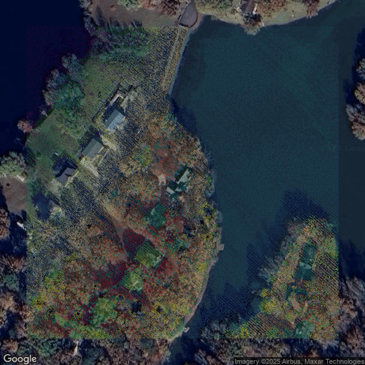
LiDAR
Equator turns Jefferson County LiDAR point clouds into various lidar-derived data sets, including DEMs.
Get LiDAR for Jefferson County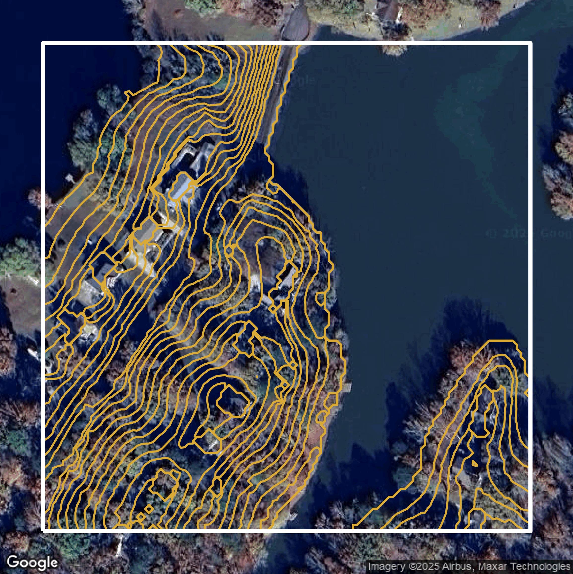
Contours
Jefferson County contours on Equator are produced from LiDAR coverage, allowing for high precision
Get Contours for Jefferson County