Overview
Los Angeles County GIS Data - For CAD
Equator helps civil engineering, architecture and consulting firms with the tools to instantly find, process and download accurate LiDAR, contours, parcel data, building footprints, DEMs, point clouds and other GIS data for Los Angeles County in an online web mapping portal.
Los Angeles County GIS Data ->
Data Available
Download GIS Data for Los Angeles County
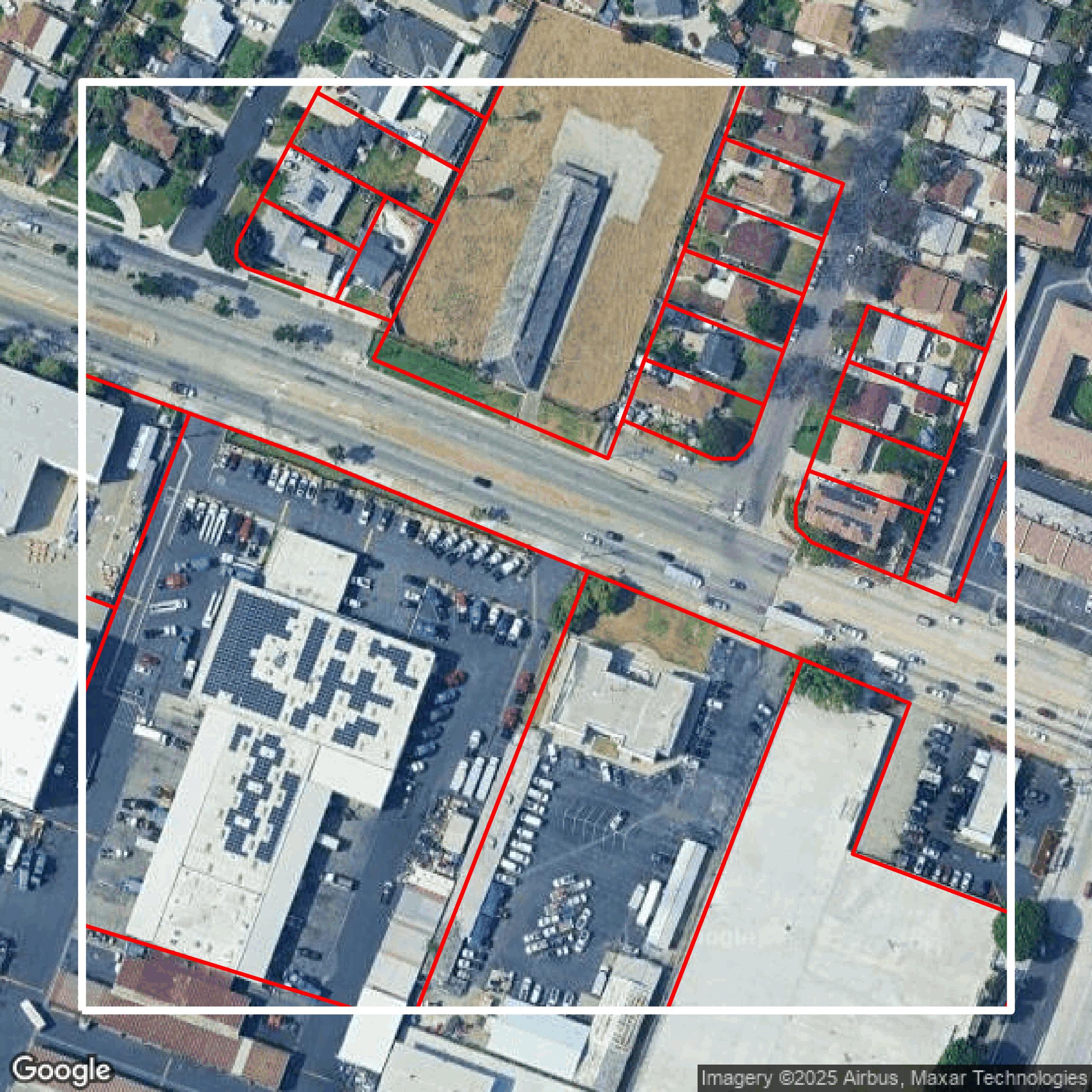
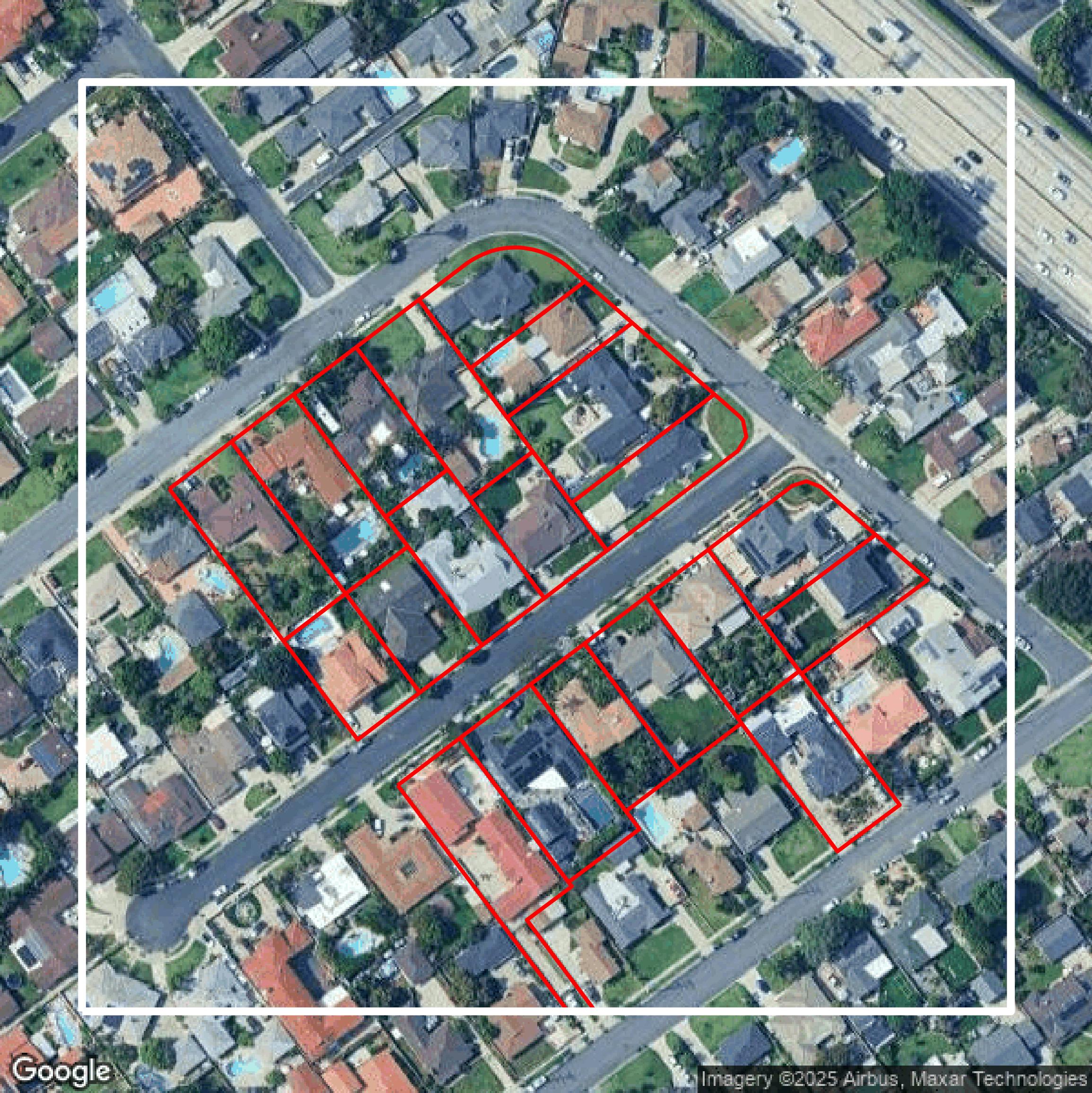
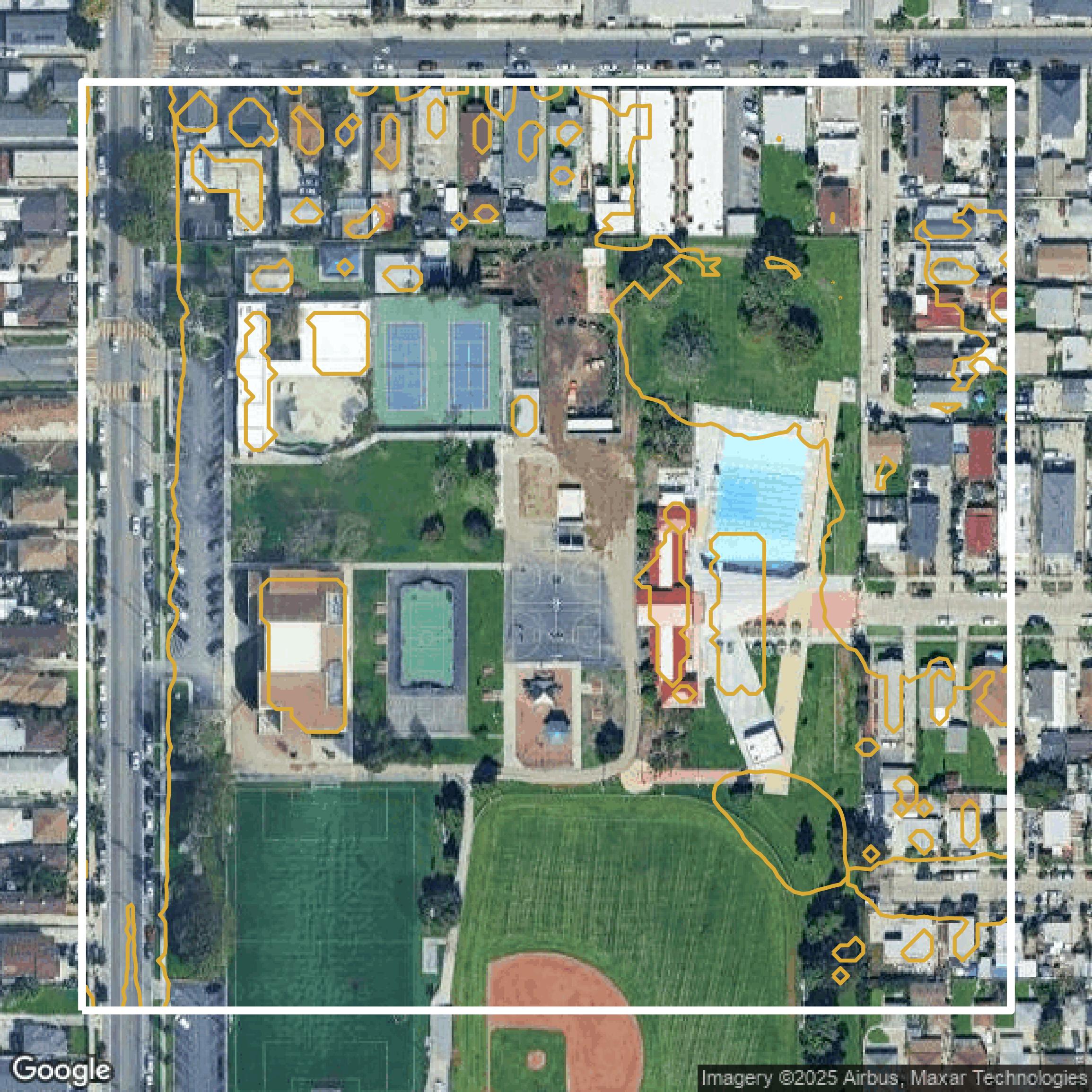
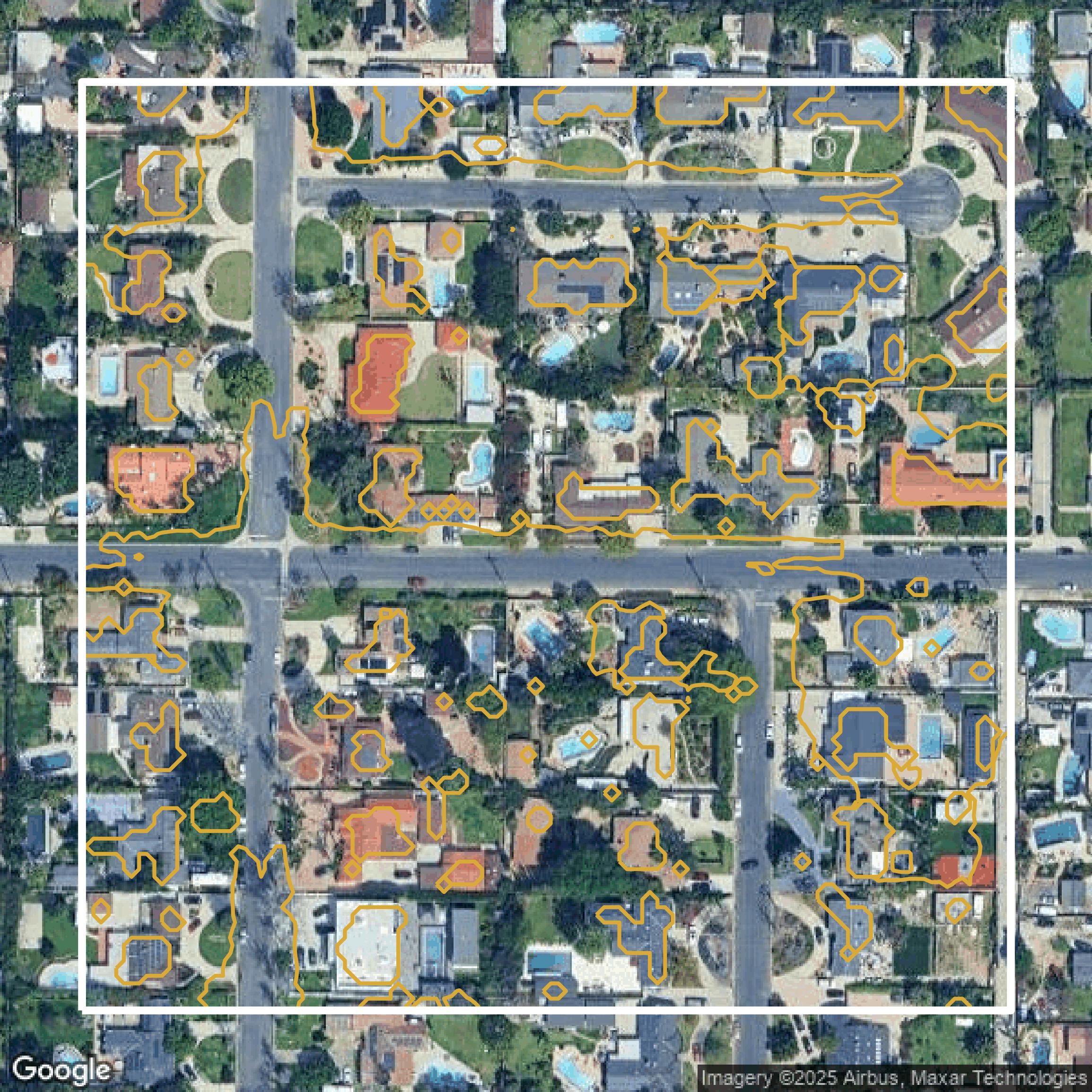
Parcels and Buildings
This image shows parcel and building data in Los Angeles County created using GIS data in Equator.
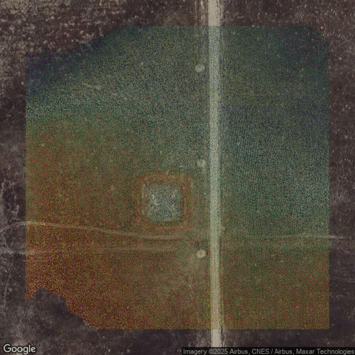
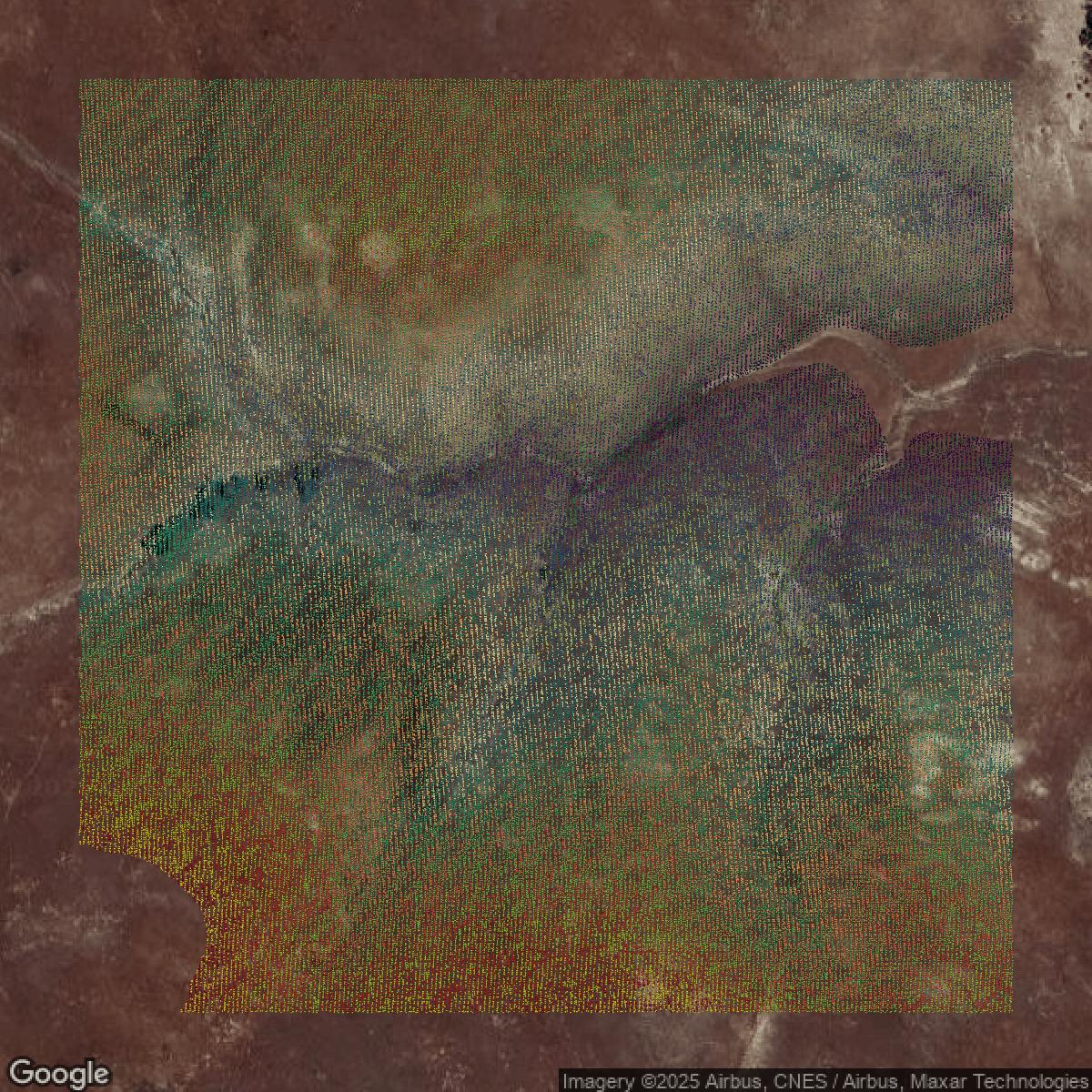
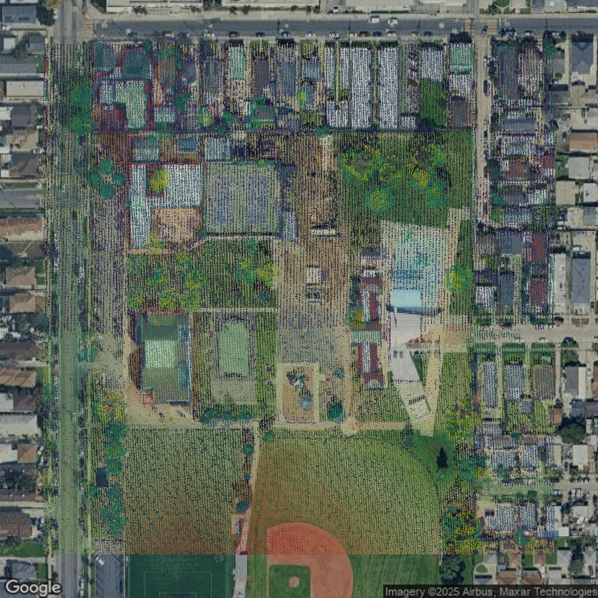
LiDAR
This image shows a LiDAR point cloud in Los Angeles County created using GIS data in Equator.
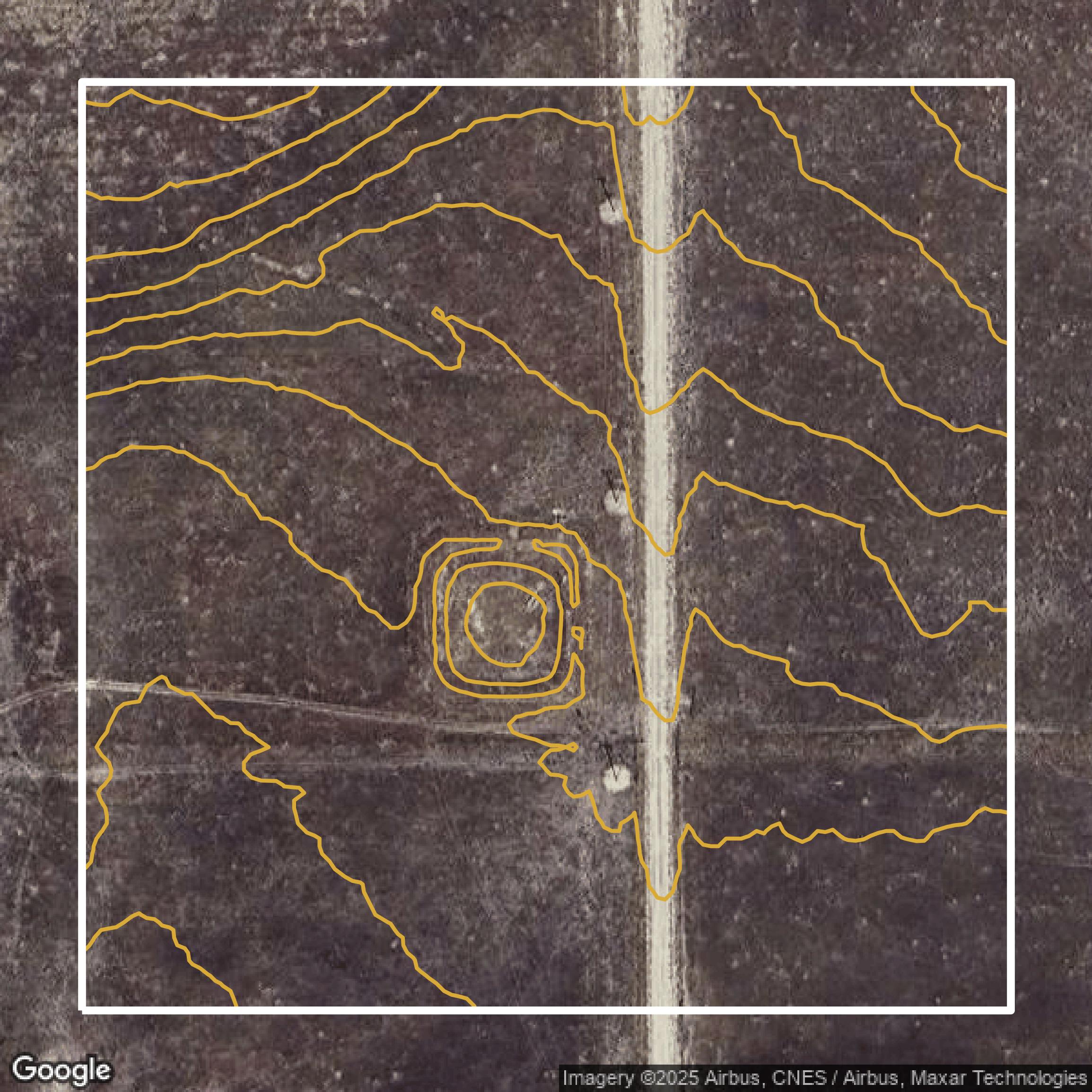
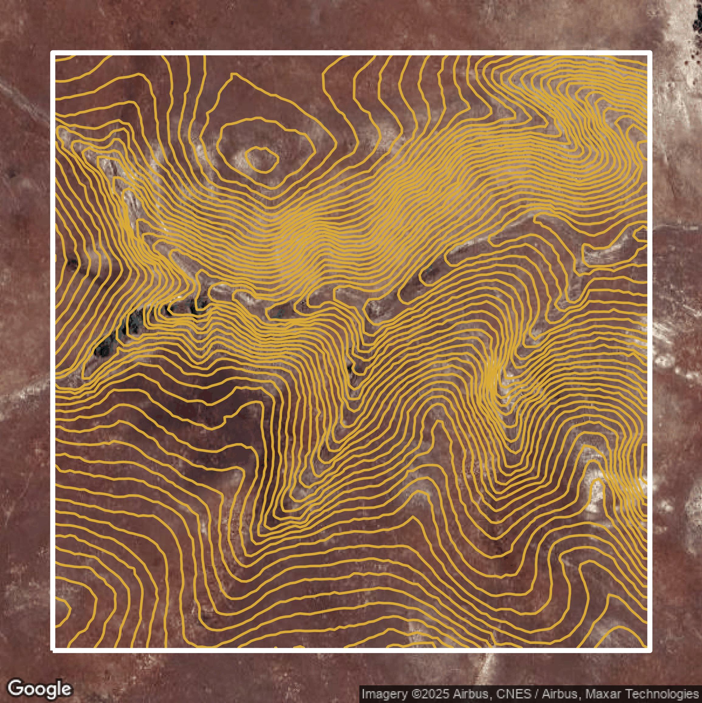
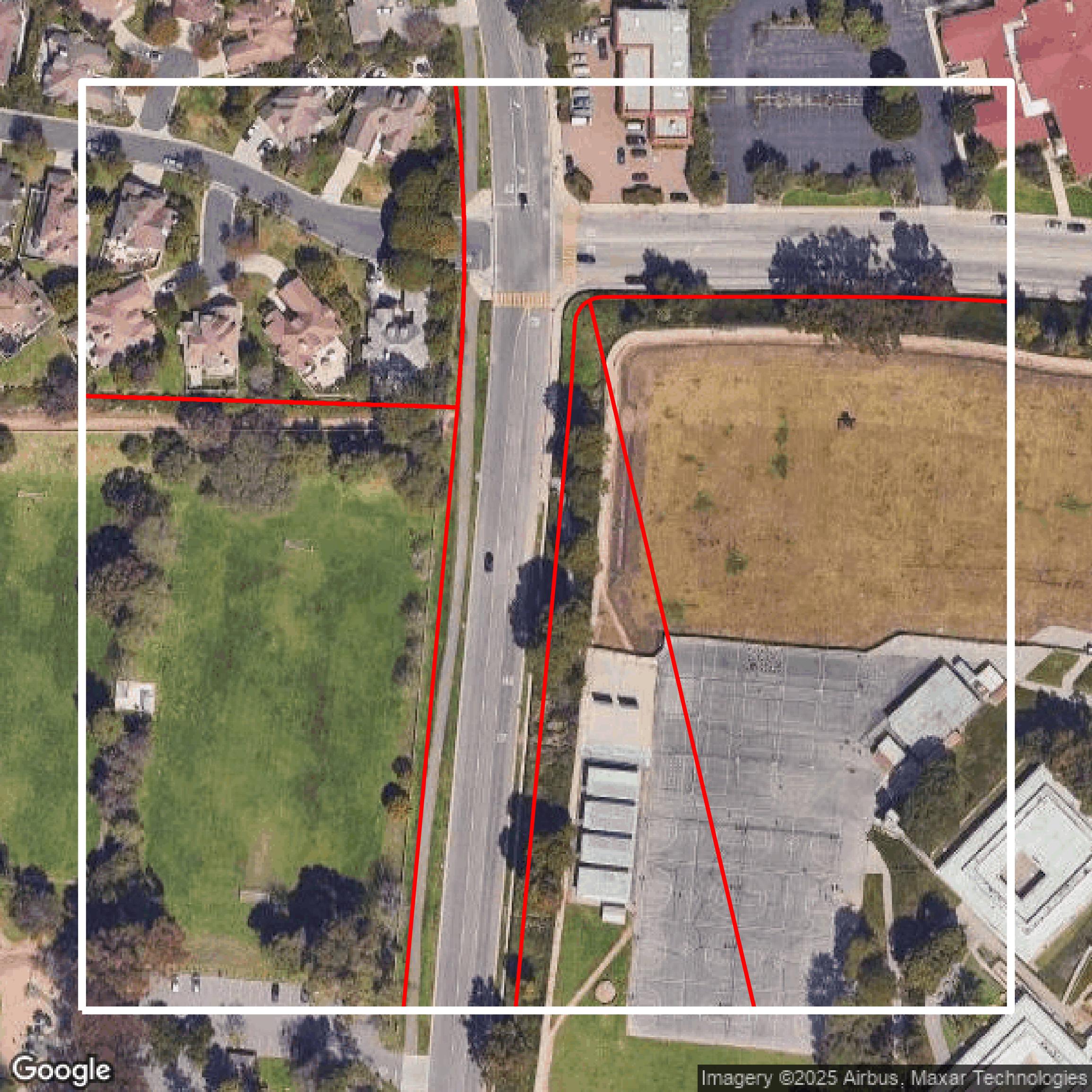
Contours
This image shows a contour map in Los Angeles County created using GIS data in Equator.
Formats Available
Export Your Data Ready to Use in Multiple Formats
DWG
AutoCAD Drawing - Industry-standard CAD format
Supported Data:
Contour, Parcel, Building Outline
SHP
Shapefile - Standard GIS vector format
Supported Data:
Contour, Parcel, Building Outline
DXF
Drawing Exchange Format - Universal CAD interchange
Supported Data:
Contour, Building Outline
GeoJSON
Geographic JSON - Web-friendly spatial data format
Supported Data:
Contour, Parcel, Building Outline
LAZ
Compressed LAS - Efficient LiDAR point cloud format
Supported Data:
Point Cloud
SVG
Scalable Vector Graphics - Web vector format
Supported Data:
Contour, Building Outline
GPKG
GeoPackage - Modern OGC spatial database format
Supported Data:
Contour, Parcel, Building Outline
LandXML (Coming Soon)
Land XML - Civil engineering data exchange format
Supported Data:
Point Cloud
TIN (Coming Soon)
Triangulated Irregular Network - 3D surface model
Supported Data:
Point Cloud
XYZ (Coming Soon)
XYZ Point Cloud - Simple ASCII point cloud format
Supported Data:
Point Cloud
Background
GIS Data for Los Angeles County
The Interactive GIS Web Mapping Apps on the Los Angeles County Department of Regional Planning website offer a comprehensive suite of spatial tools and detailed planning and zoning data for unincorporated areas in Los Angeles County. Visitors can explore key apps like GIS-NET PUBLIC, which provides planning and zoning information via an easy-to-use mobile-compatible viewer; A-NET, the Airport Land Use Commission viewer showcasing airport locations, influence areas, noise contours, and runway protection zones; HOUSING-NET designed to assist with SB 330 Preliminary Applications under the Housing Crisis Act; and Z-NET, which delivers land use, zoning, and overlay maps with automatic property zoning lookup by address or parcel. Additionally, specialized apps include the Santa Monica Mountains communities map, Alcohol Beverage Sales Locations, the Equity Indicators Tool measuring jurisdictional equity, the Green Zones Program highlighting areas with high pollution near sensitive receptors, housing rezoning story maps, Limited English Proficiency service areas, Major Transit Stops & Corridors, and Wireless Facility Locations supporting the Delete the Divide Initiative. Users can expect layered aerial imagery, subdivision activities, and detailed overlays to support research, application filing, and environmental review, with all apps designed to enable in-depth spatial understanding of land use, zoning enforcement, and planning efforts across LA County.
Access Los Angeles County GIS Data in Equator →Los Angeles County Portal →Showcase
Sample GIS Data for Los Angeles County
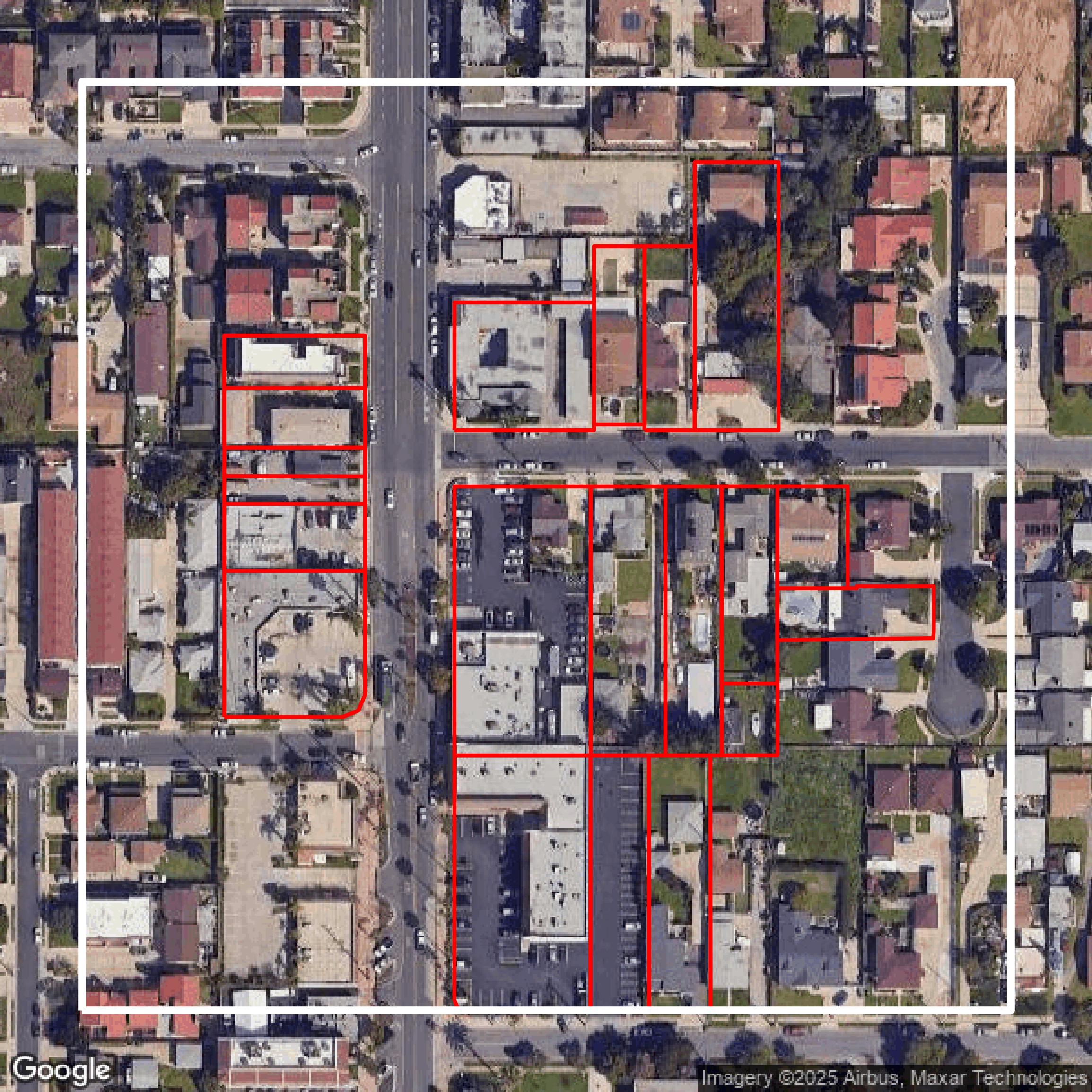
Parcels and Buildings
Parcel and building data in Los Angeles County are used in a variety of fields including architecture, real estate, and urban planning.
LiDAR
Point clouds (LiDAR) in Los Angeles County can produce highly accurate 3D models of terrain, structures, and vegetation.
Contours
Contours in Los Angeles County visualize 3D elevations on a 2D surface allowing you to better understand your site.
Showcase
Sample GIS Data for Los Angeles County
Parcels and Buildings
Accessing Los Angeles County parcel and building data on Equator gives you access to coverage across the US.
LiDAR
Los Angeles County LiDAR uses include land surveying, analyzing crop health, or even archaeological studies.
Contours
Los Angeles County contours can be used for construction & engineering, environmental science, and more.
Showcase
Sample GIS Data for Los Angeles County
Parcels and Buildings
Dozens of fields are contained within each Los Angeles County parcel and building data, including zoning, owners, and year built.
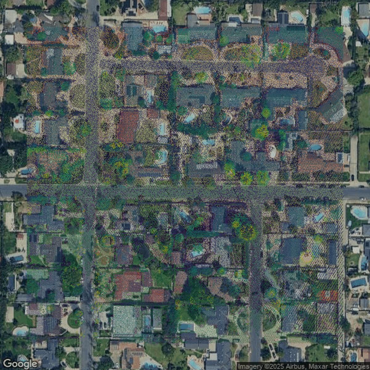
LiDAR
Equator turns Los Angeles County LiDAR point clouds into various lidar-derived data sets, including DEMs.
Contours
Los Angeles County contours on Equator are produced from LiDAR coverage, allowing for high precision