Overview
District of Columbia GIS Data – For CAD
Equator helps civil engineering, architecture and consulting firms with the tools to instantly find, process and download accurate LiDAR, contours, parcel data, building footprints, DEMs, point clouds and other GIS data for District of Columbia in an online web mapping portal.
District of Columbia GIS Data →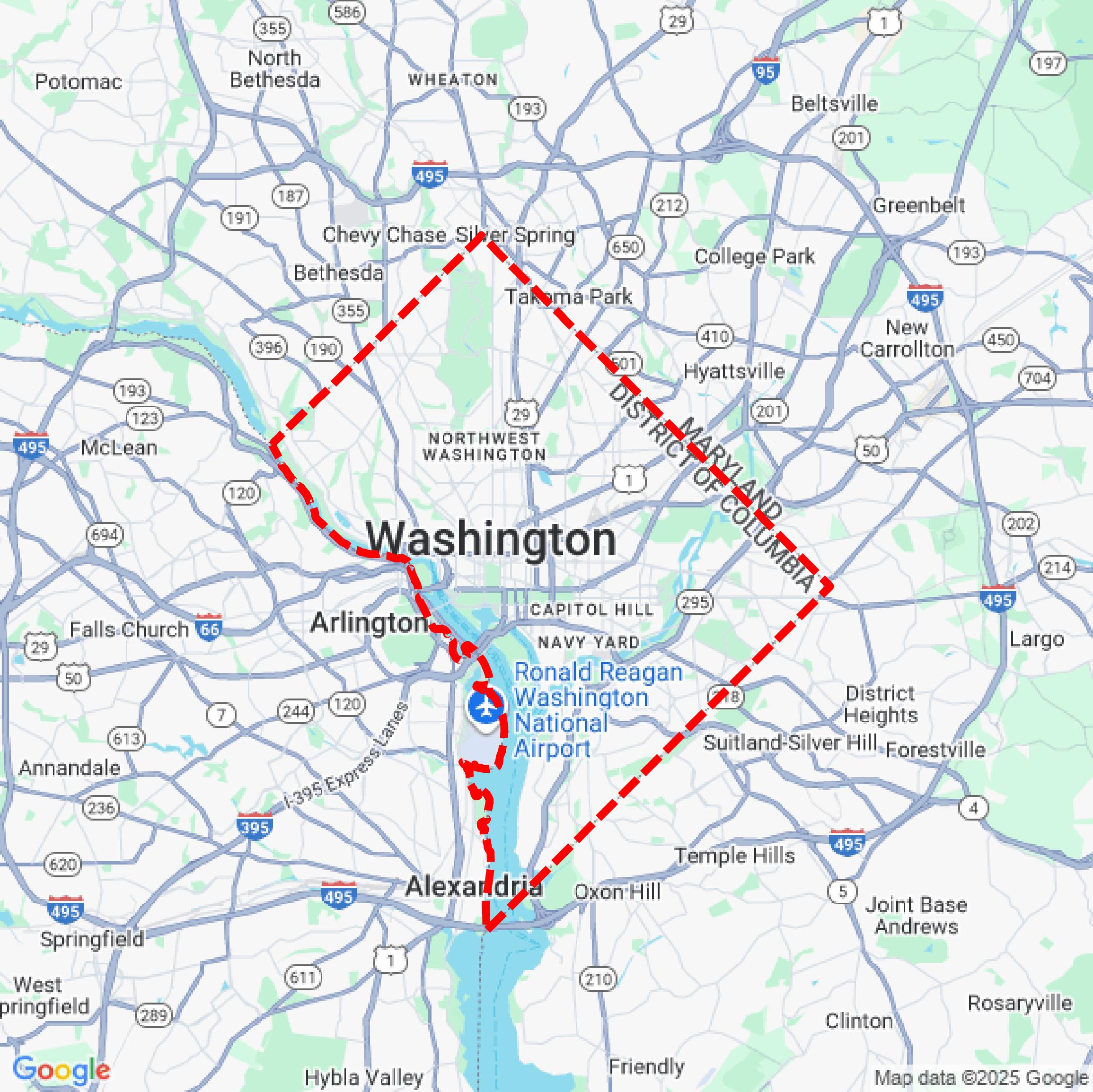

Data Available
Download GIS Data for District of Columbia
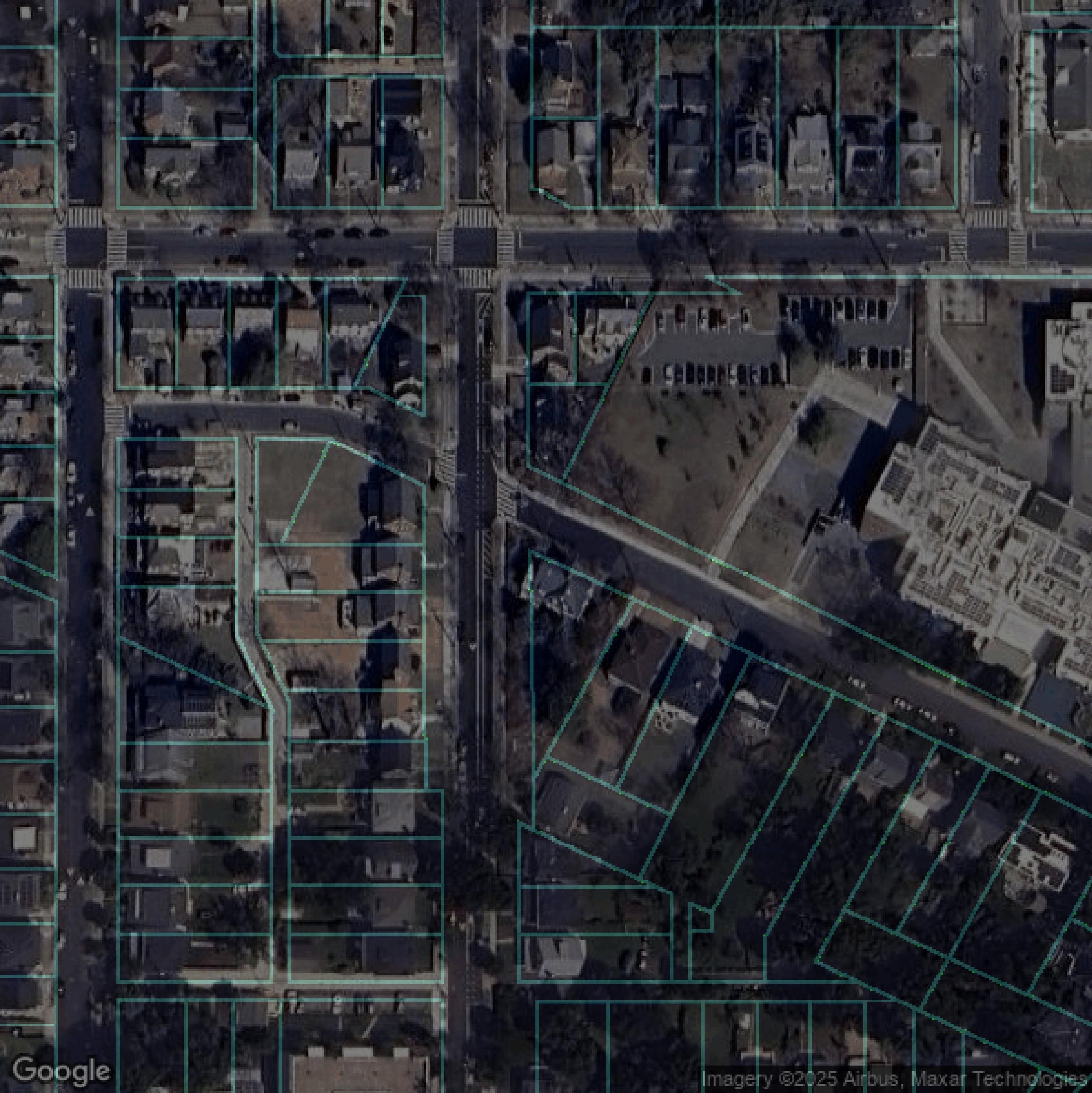
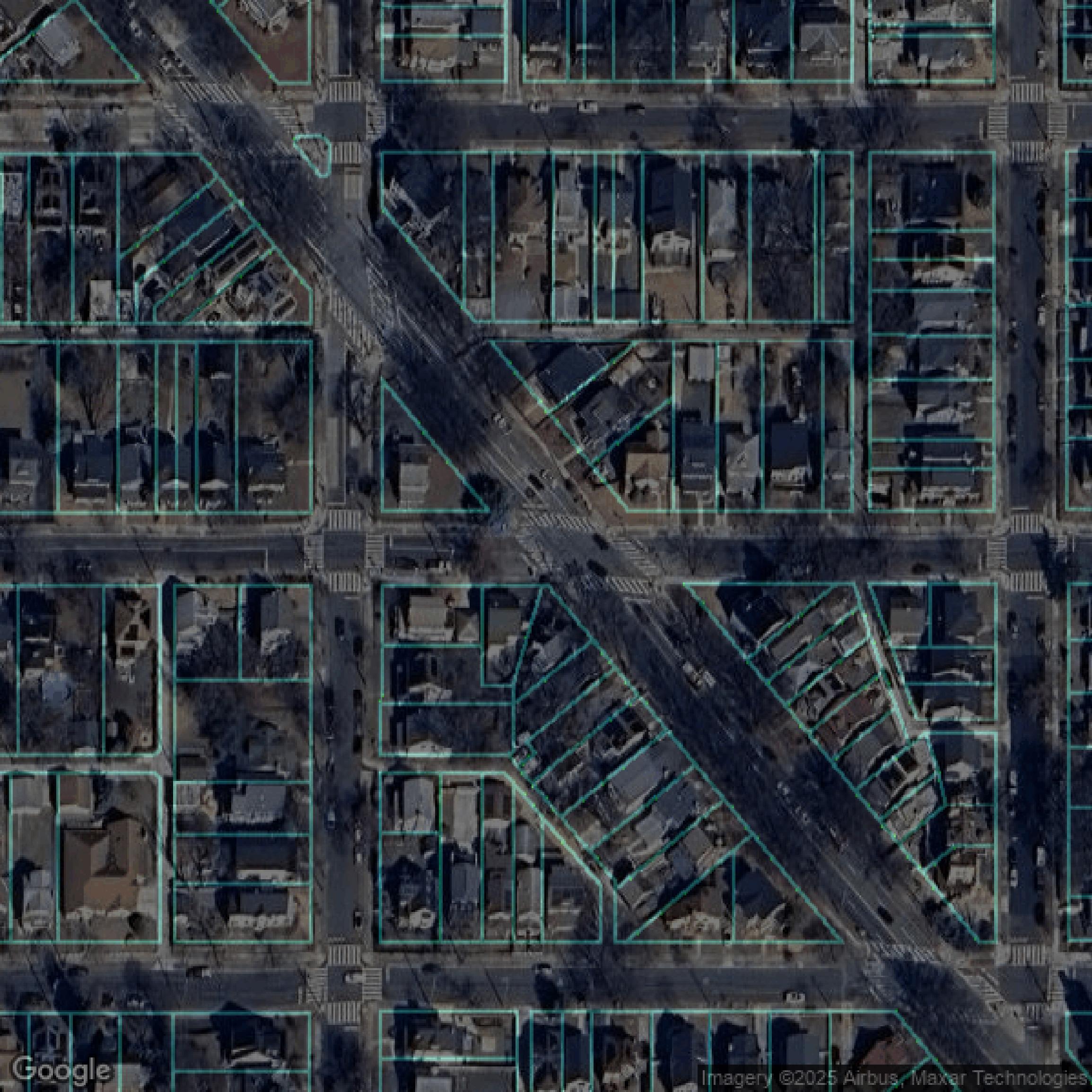
Parcels and Buildings
This image shows parcel and building data in District of Columbia created using GIS data in Equator.
Get Parcels and Buildings for District of Columbia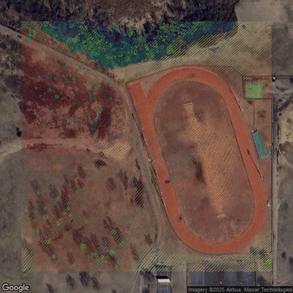
LiDAR
This image shows a LiDAR point cloud in District of Columbia created using GIS data in Equator.
Get LiDAR for District of Columbia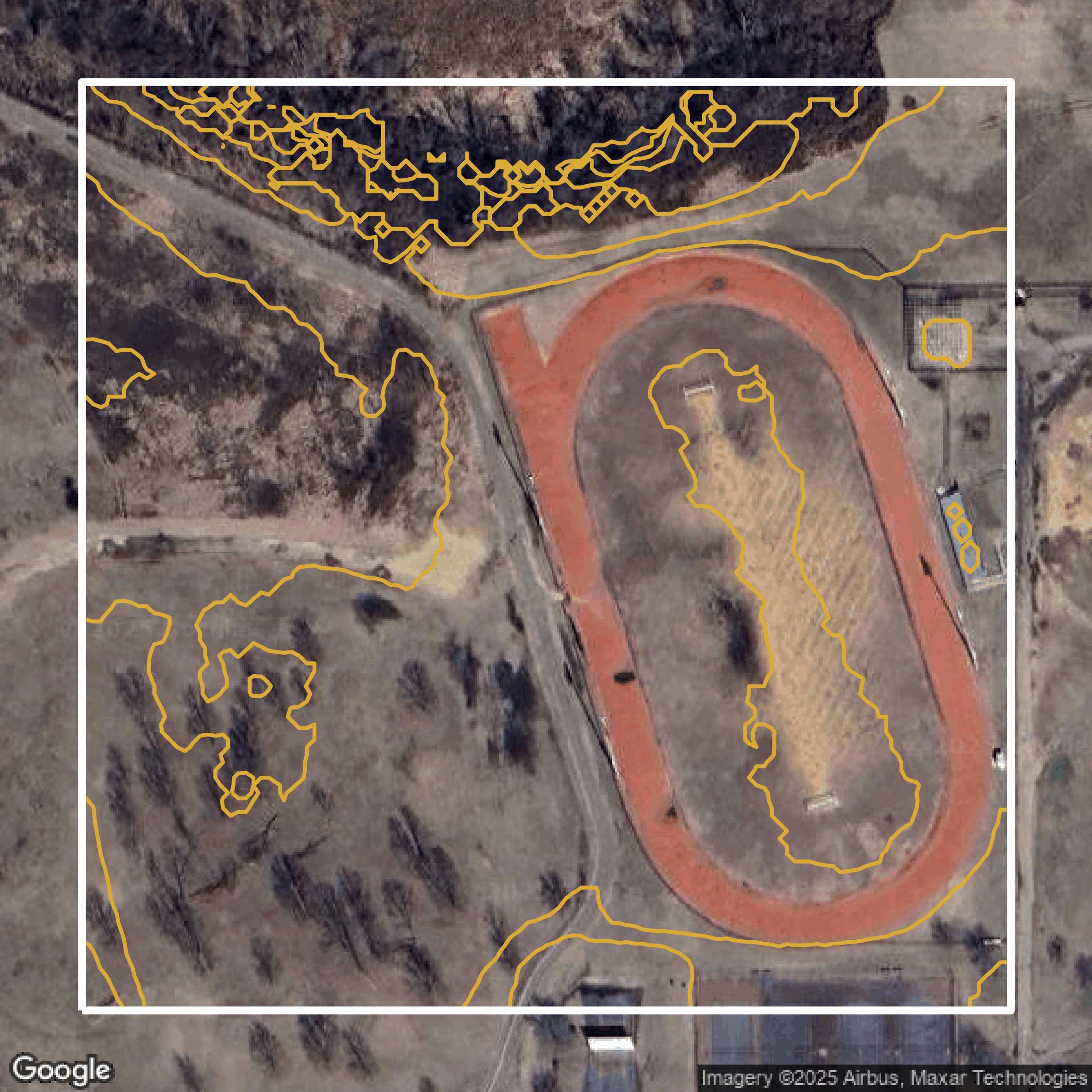
Contours
This image shows a contour map in District of Columbia created using GIS data in Equator.
Get Contours for District of ColumbiaFormats Available
Export Your Data Ready to Use in Multiple Formats
DWG
AutoCAD Drawing - Industry-standard CAD format
Supported Data:
Contour, Parcel, Building Outline
SHP
Shapefile - Standard GIS vector format
Supported Data:
Contour, Parcel, Building Outline
DXF
Drawing Exchange Format - Universal CAD interchange
Supported Data:
Contour, Building Outline
GeoJSON
Geographic JSON - Web-friendly spatial data format
Supported Data:
Contour, Parcel, Building Outline
LAZ
Compressed LAS - Efficient LiDAR point cloud format
Supported Data:
Point Cloud
SVG
Scalable Vector Graphics - Web vector format
Supported Data:
Contour, Building Outline
GPKG (Coming Soon)
GeoPackage - Modern OGC spatial database format
Supported Data:
Contour, Parcel, Building Outline
LandXML (Coming Soon)
Land XML - Civil engineering data exchange format
Supported Data:
Point Cloud
TIN (Coming Soon)
Triangulated Irregular Network - 3D surface model
Supported Data:
Point Cloud
XYZ (Coming Soon)
XYZ Point Cloud - Simple ASCII point cloud format
Supported Data:
Point Cloud
Background
GIS Data for District of Columbia
Open Data DC offers a comprehensive platform where visitors can engage with the District of Columbia’s government open data through a rich collection of datasets and interactive tools. Users can explore DC's urban landscape via "Apps & Maps," gain insights from "Data Stories" demonstrating how data is used for operations and civic participation, and analyze trends with dynamic "Dashboards." The site features specialized datasets across key topics including "Economic Development," "Environment," "Housing," "Education," "Public Safety," and "Transportation." Foundational data such as "Addressing in DC," "Imagery & LiDAR," "Roadway Centerlines," "Property Lots in DC," and "Public Lands in DC" serve as the basis for deeper analysis. Developers can leverage various resources including "Web Map Services," "MAR Web Services" for geocoding, and developer tools integrating REST Endpoints and APIs with platforms like Tableau and MicroStrategy via the "Data Developer's Portal." The innovative "DC Compass" AI assistant offers pilot public beta access for questions about publicly available information. Governance and data quality are maintained through established "Data Policy," the "Data Handbook," and the "Interagency Data Team," ensuring a secure and trusted open data environment. The platform also fosters civic engagement through the "Open Data DC Community," enabling residents, stakeholders, and developers to create, share, and collaborate on web maps, dashboards, and datasets.
Access District of Columbia GIS Data in Equator →District of Columbia Portal →Showcase
Sample GIS Data for District of Columbia
Parcels and Buildings
Parcel and building data in District of Columbia are used in a variety of fields including architecture, real estate, and urban planning.
Get Parcels and Buildings for District of Columbia
LiDAR
Point clouds (LiDAR) in District of Columbia can produce highly accurate 3D models of terrain, structures, and vegetation.
Get LiDAR for District of ColumbiaContours
Contours in District of Columbia visualize 3D elevations on a 2D surface allowing you to better understand your site.
Get Contours for District of ColumbiaParcels and Buildings
Accessing District of Columbia parcel and building data on Equator gives you access to coverage across the US.
Get Parcels and Buildings for District of ColumbiaLiDAR
District of Columbia LiDAR uses include land surveying, analyzing crop health, or even archaeological studies.
Get LiDAR for District of ColumbiaContours
District of Columbia contours can be used for construction & engineering, environmental science, and more.
Get Contours for District of ColumbiaParcels and Buildings
Dozens of fields are contained within each District of Columbia parcel and building data, including zoning, owners, and year built.
Get Parcels and Buildings for District of ColumbiaLiDAR
Equator turns District of Columbia LiDAR point clouds into various lidar-derived data sets, including DEMs.
Get LiDAR for District of ColumbiaContours
District of Columbia contours on Equator are produced from LiDAR coverage, allowing for high precision
Get Contours for District of Columbia