Overview
Miami-Dade County GIS Data - For CAD
Equator helps civil engineering, architecture and consulting firms with the tools to instantly find, process and download accurate LiDAR, contours, parcel data, building footprints, DEMs, point clouds and other GIS data for Miami-Dade County in an online web mapping portal.
Miami-Dade County GIS Data ->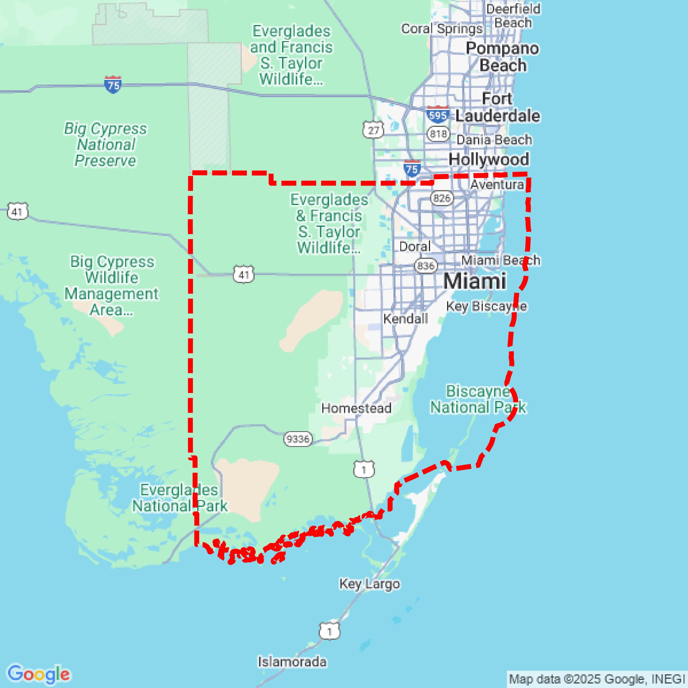

Data Available
Download GIS Data for Miami-Dade County
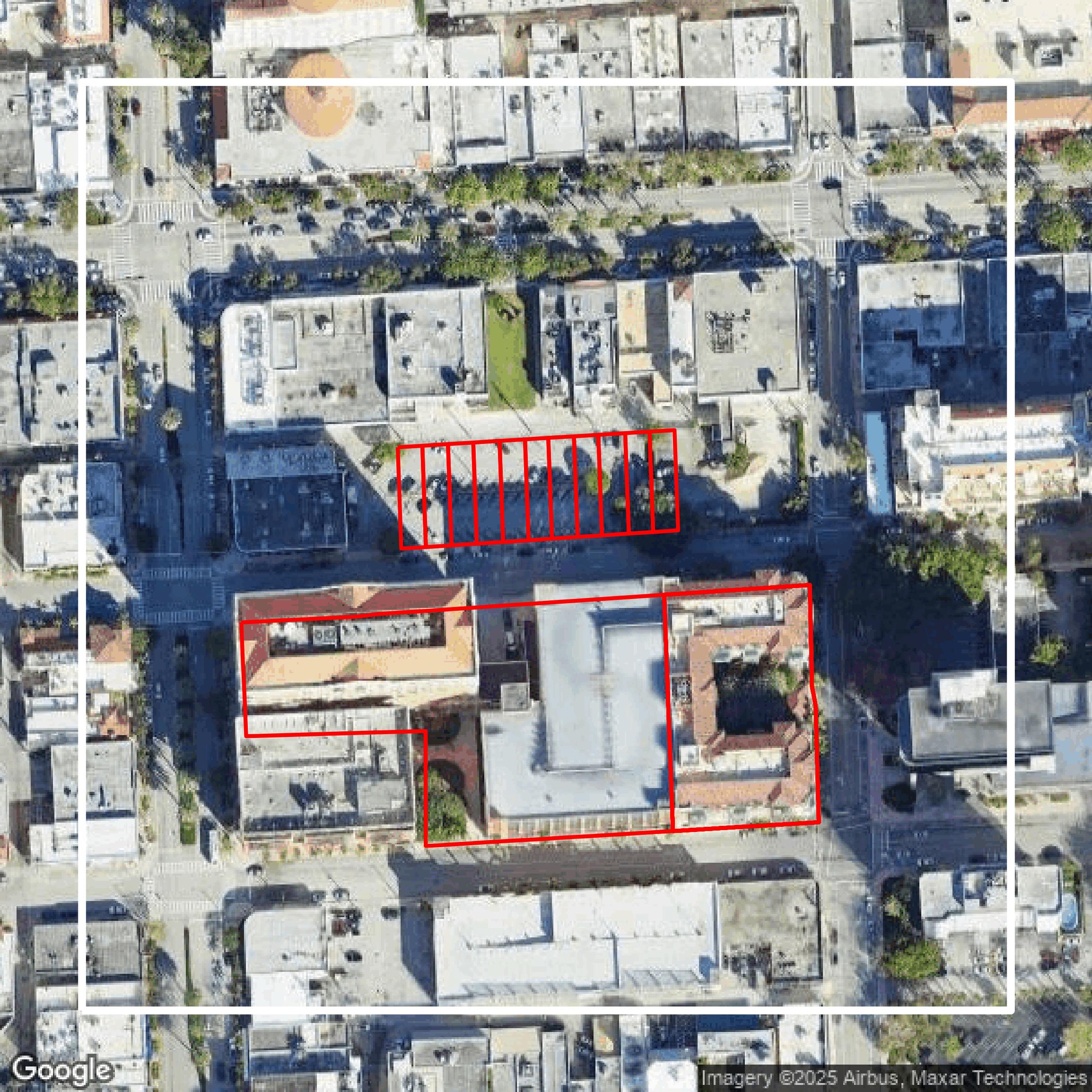
Parcels and Buildings
This image shows parcel and building data in Miami-Dade County created using GIS data in Equator.
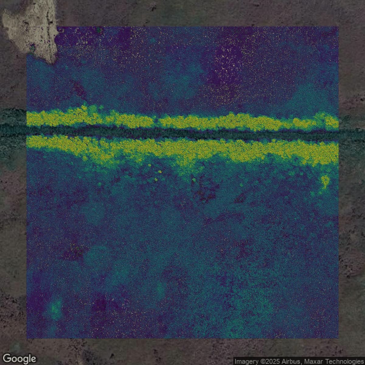
LiDAR
This image shows a LiDAR point cloud in Miami-Dade County created using GIS data in Equator.
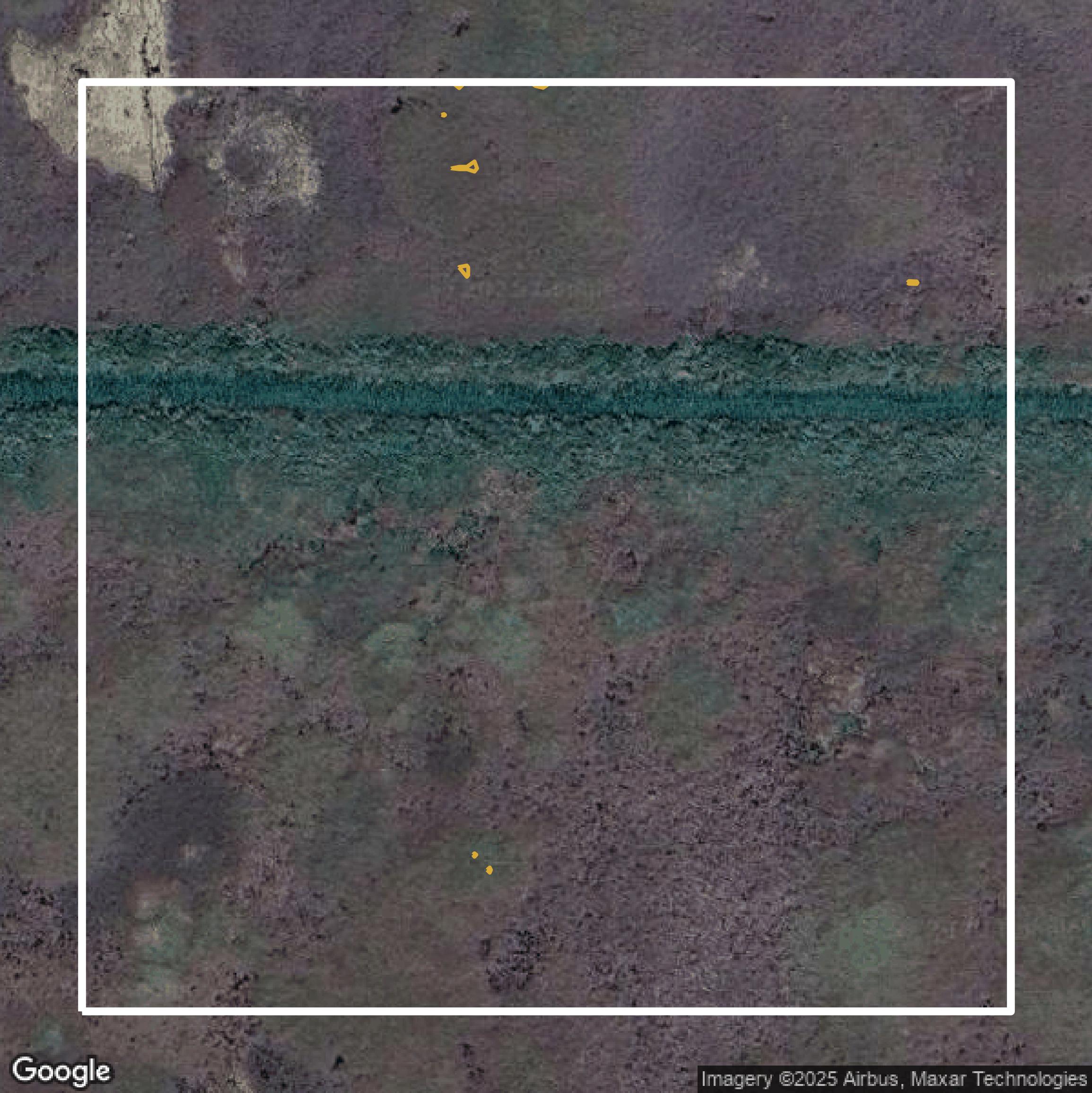
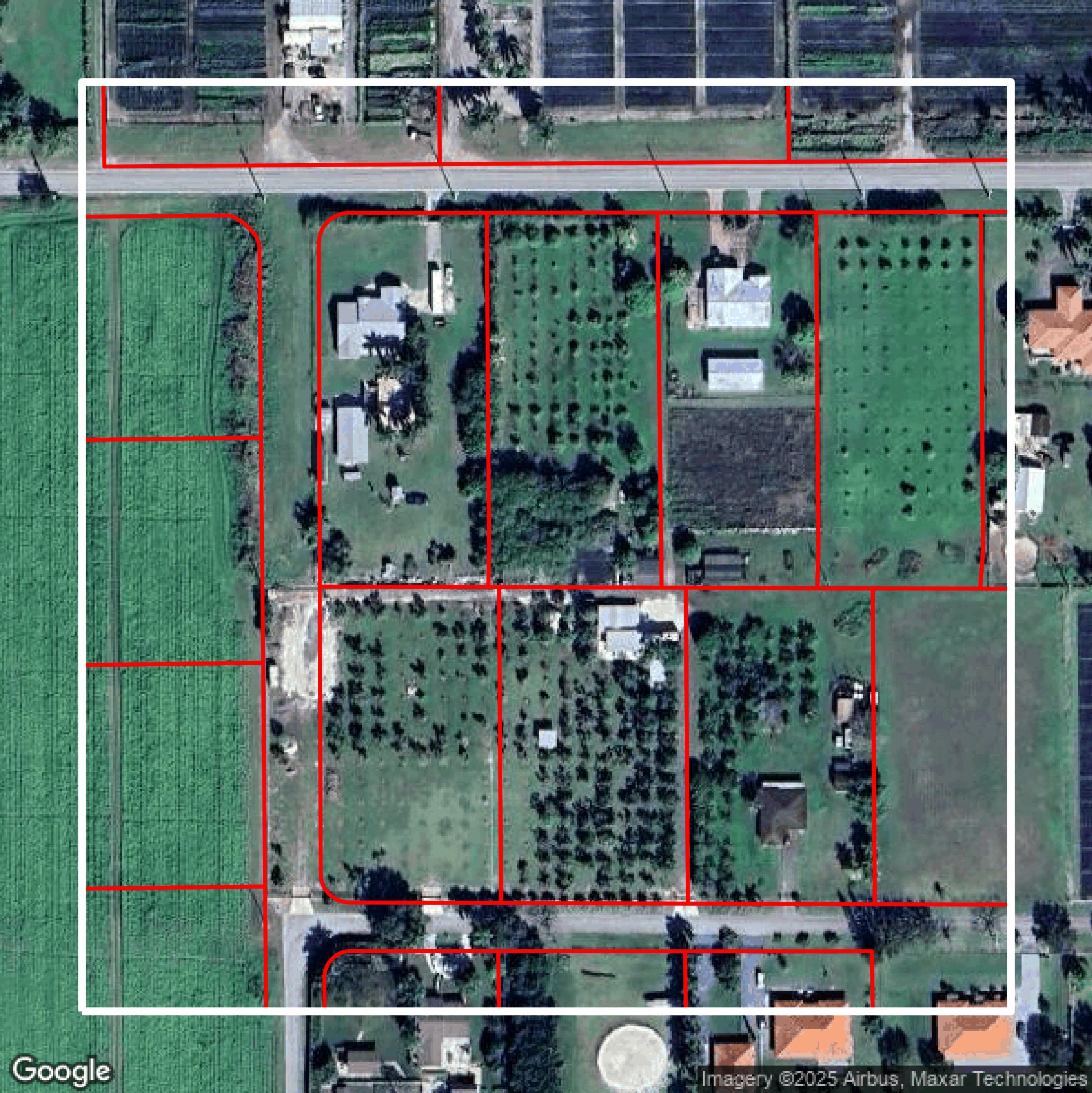
Contours
This image shows a contour map in Miami-Dade County created using GIS data in Equator.
Formats Available
Export Your Data Ready to Use in Multiple Formats
DWG
AutoCAD Drawing - Industry-standard CAD format
Supported Data:
Contour, Parcel, Building Outline
SHP
Shapefile - Standard GIS vector format
Supported Data:
Contour, Parcel, Building Outline
DXF
Drawing Exchange Format - Universal CAD interchange
Supported Data:
Contour, Building Outline
GeoJSON
Geographic JSON - Web-friendly spatial data format
Supported Data:
Contour, Parcel, Building Outline
LAZ
Compressed LAS - Efficient LiDAR point cloud format
Supported Data:
Point Cloud
SVG
Scalable Vector Graphics - Web vector format
Supported Data:
Contour, Building Outline
GPKG
GeoPackage - Modern OGC spatial database format
Supported Data:
Contour, Parcel, Building Outline
LandXML (Coming Soon)
Land XML - Civil engineering data exchange format
Supported Data:
Point Cloud
TIN (Coming Soon)
Triangulated Irregular Network - 3D surface model
Supported Data:
Point Cloud
XYZ (Coming Soon)
XYZ Point Cloud - Simple ASCII point cloud format
Supported Data:
Point Cloud
Background
GIS Data for Miami-Dade County
Miami-Dade County's Open Data Hub (https://gis-mdc.opendata.arcgis.com/) is a comprehensive resource offering a wide range of machine-readable raw datasets including tabular and spatial data from various County departments such as Community Action & Human Services, Culture Affairs, Fire Rescue, and many more. Visitors can explore, download, visualize, embed, and share datasets without needing an account, making it accessible for both data consumers and application developers. The site features specific categories including GIS Apps, Boundaries, Buildings, Demographics, Elections, Education, Environment, Health, Hydrology, Imagery, Infrastructure, Location, Parks, Planning, Property, Public Safety, Transportation, and Zoning, each hosting detailed data like municipal boundaries, parcel information, urban land use, and public safety locations. Developers can leverage the API and documentation to build custom applications. The site is actively maintained with frequent updates, currently hosting 826 shared items, and supports extensive engagement as reflected by millions of recent data hits. Miami-Dade also offers specialized mobile applications such as Ready MDC for hurricane preparedness. Please note the data is provided "as is" for illustrative purposes and is not suitable for site-specific decision-making or financial commitments.
Access Miami-Dade County GIS Data in Equator →Miami-Dade County Portal →Showcase
Sample GIS Data for Miami-Dade County
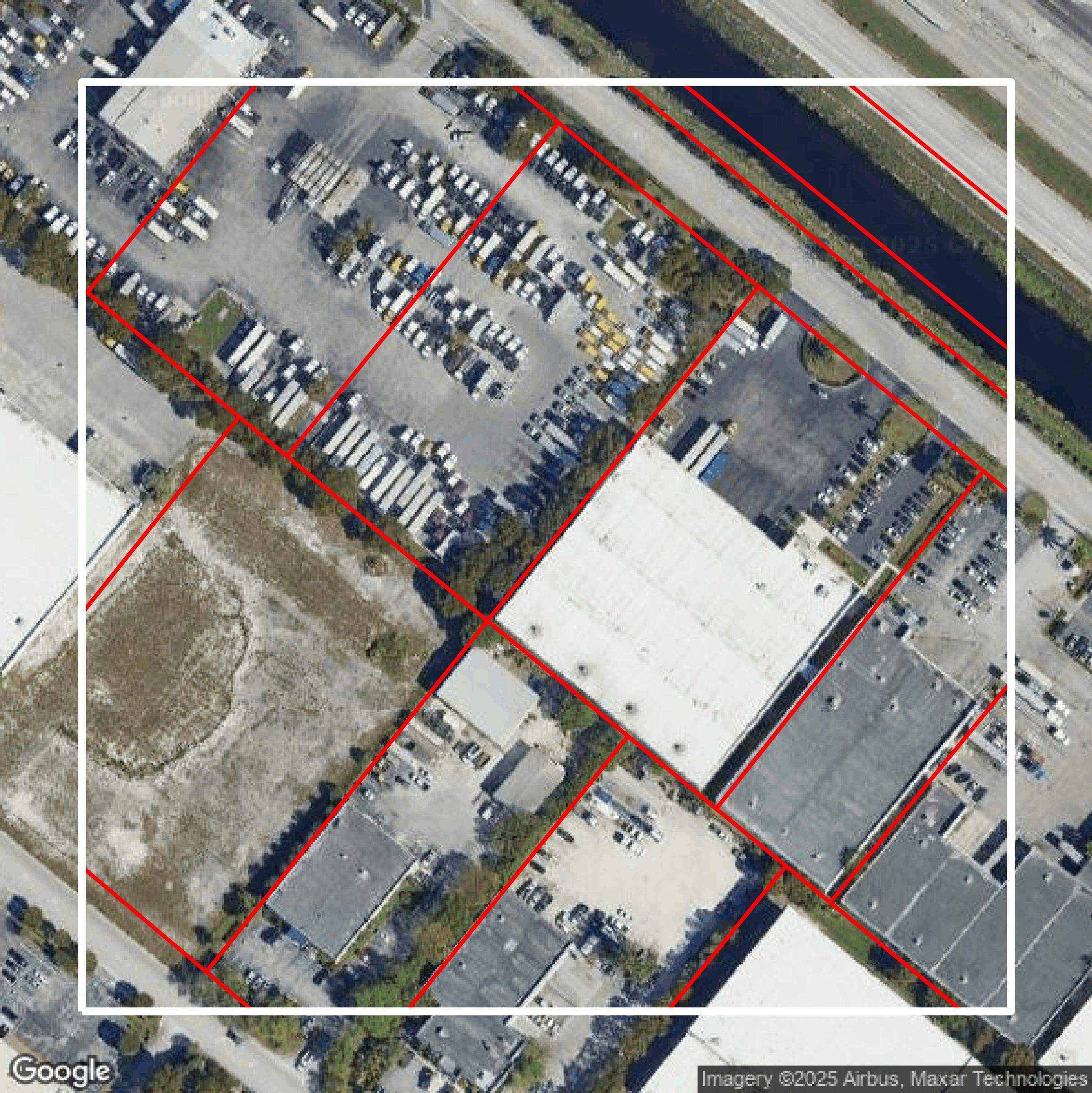
Parcels and Buildings
Parcel and building data in Miami-Dade County are used in a variety of fields including architecture, real estate, and urban planning.

LiDAR
Point clouds (LiDAR) in Miami-Dade County can produce highly accurate 3D models of terrain, structures, and vegetation.

Contours
Contours in Miami-Dade County visualize 3D elevations on a 2D surface allowing you to better understand your site.
Showcase
Sample GIS Data for Miami-Dade County
Parcels and Buildings
Accessing Miami-Dade County parcel and building data on Equator gives you access to coverage across the US.

LiDAR
Miami-Dade County LiDAR uses include land surveying, analyzing crop health, or even archaeological studies.

Contours
Miami-Dade County contours can be used for construction & engineering, environmental science, and more.
Showcase
Sample GIS Data for Miami-Dade County

Parcels and Buildings
Dozens of fields are contained within each Miami-Dade County parcel and building data, including zoning, owners, and year built.

LiDAR
Equator turns Miami-Dade County LiDAR point clouds into various lidar-derived data sets, including DEMs.

Contours
Miami-Dade County contours on Equator are produced from LiDAR coverage, allowing for high precision