Overview
Chatham County GIS Data – For CAD
Equator helps civil engineering, architecture and consulting firms with the tools to instantly find, process and download accurate LiDAR, contours, parcel data, building footprints, DEMs, point clouds and other GIS data for Chatham County in an online web mapping portal.
Chatham County GIS Data →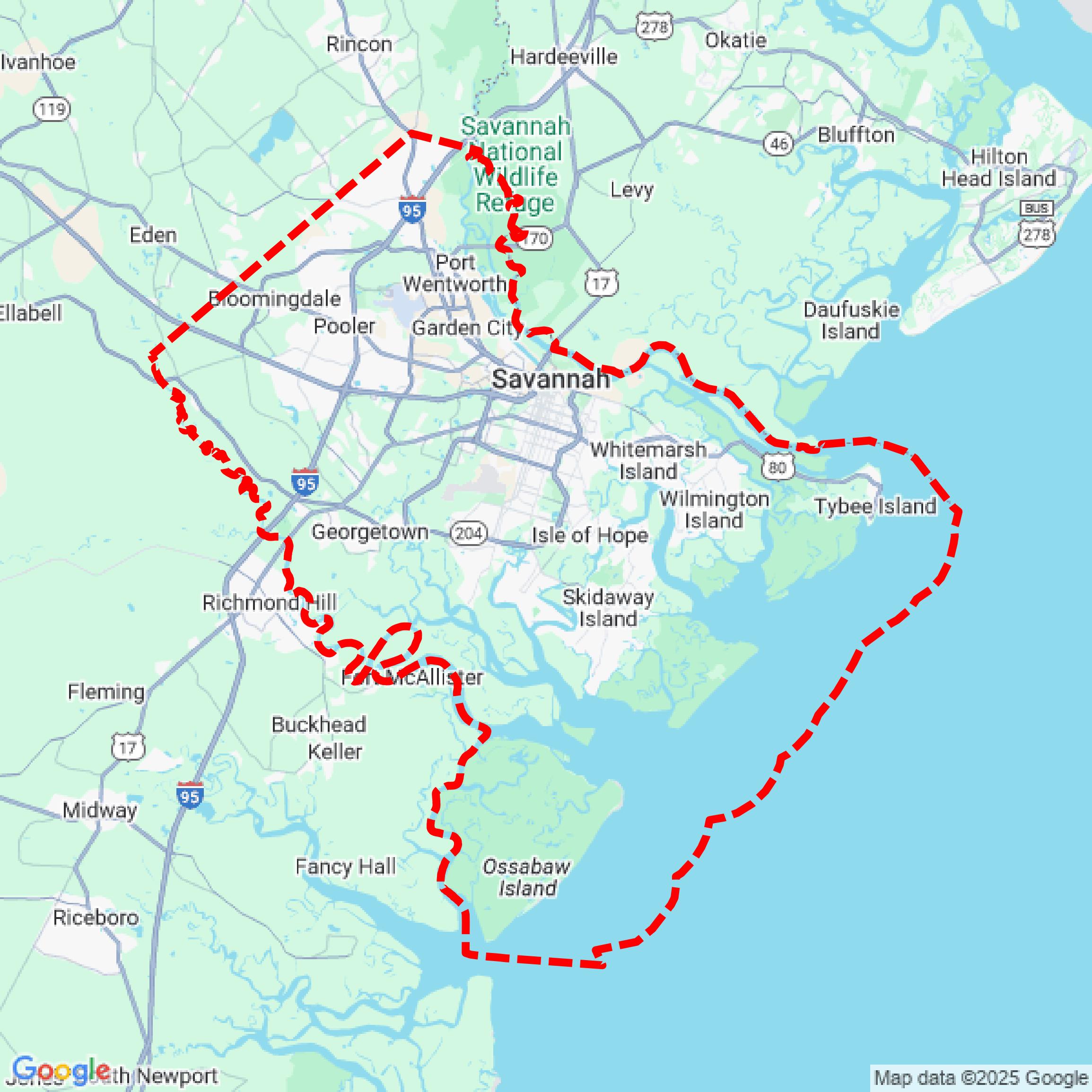

Data Available
Download GIS Data for Chatham County
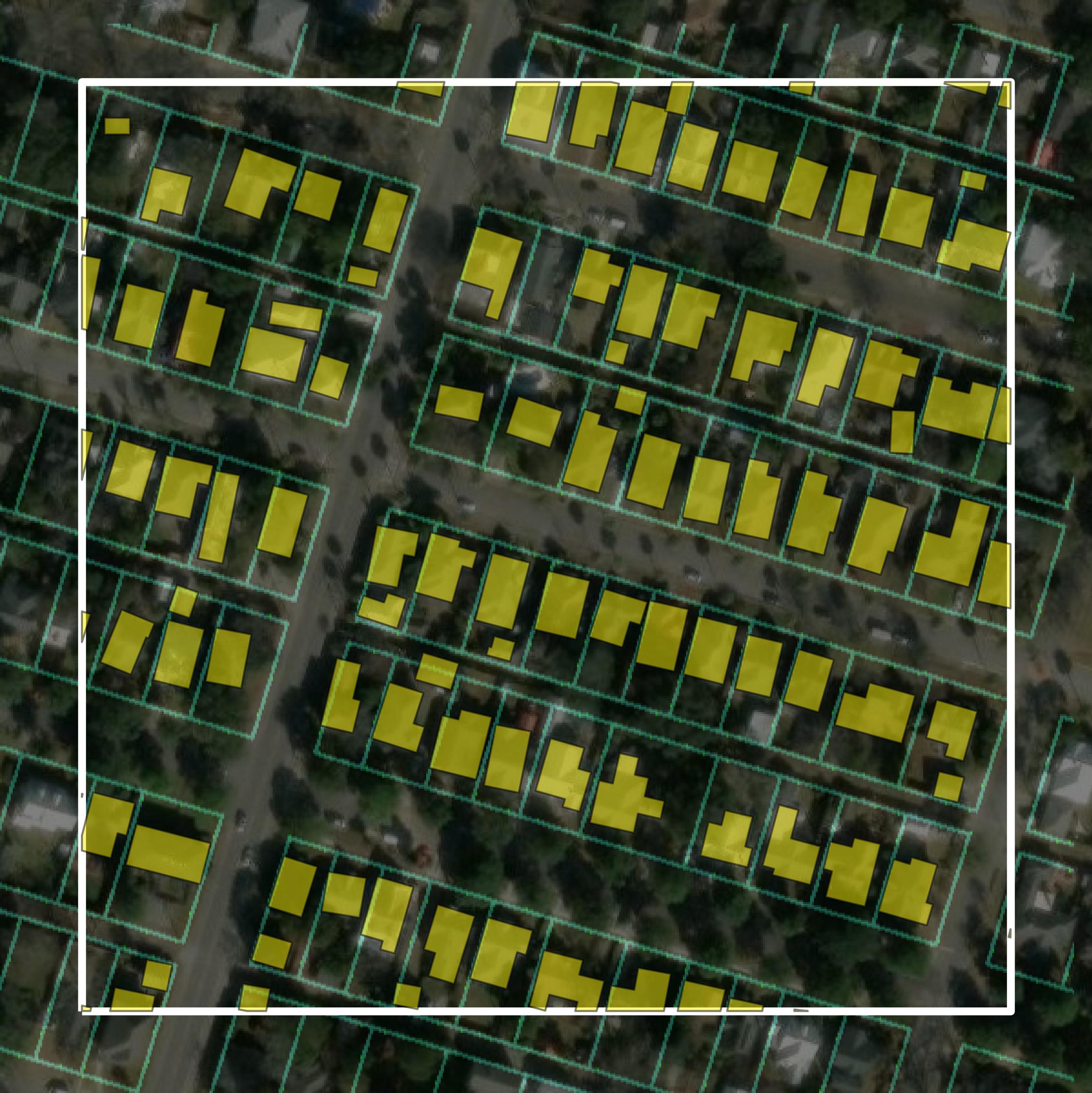
Parcels and Buildings
This image shows parcel and building data in Chatham County created using GIS data in Equator.
Get Parcels and Buildings for Chatham County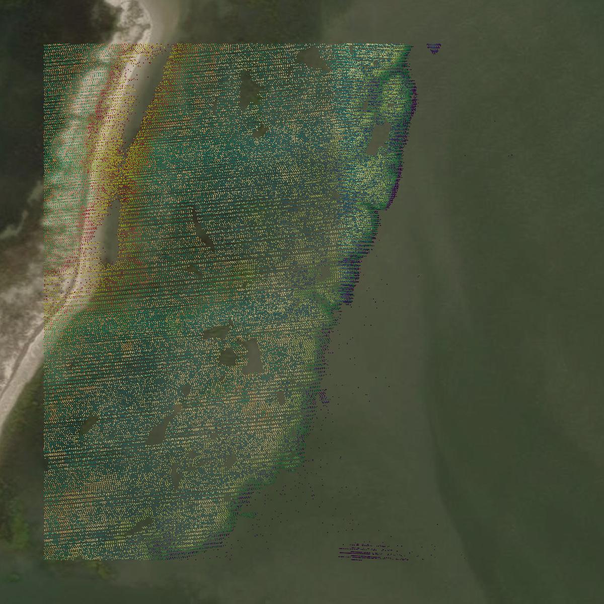
LiDAR
This image shows a LiDAR point cloud in Chatham County created using GIS data in Equator.
Get LiDAR for Chatham County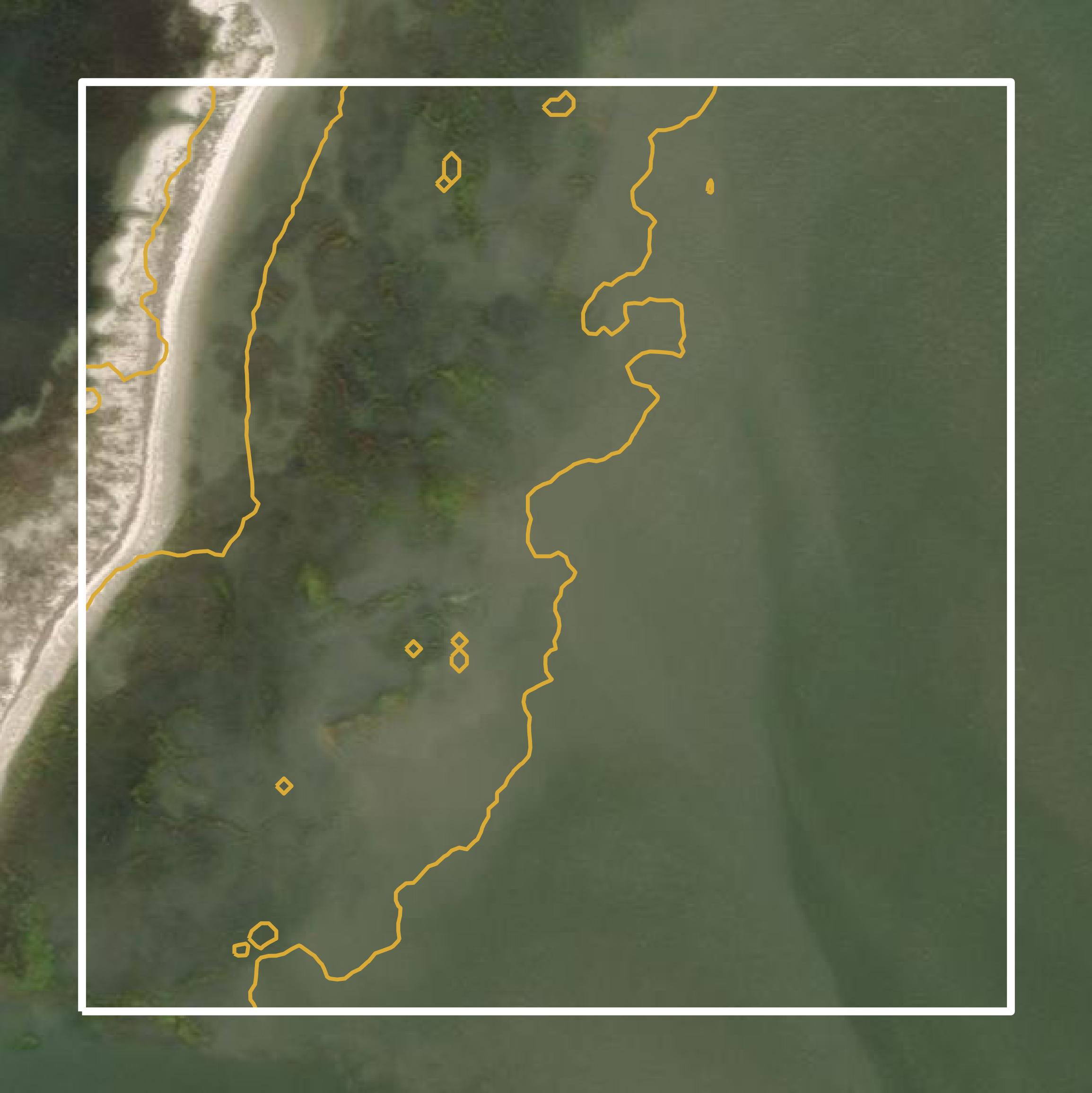
Contours
This image shows a contour map in Chatham County created using GIS data in Equator.
Get Contours for Chatham CountyFormats Available
Export Your Data Ready to Use in Multiple Formats
DWG
AutoCAD Drawing - Industry-standard CAD format
Supported Data:
Contour, Parcel, Building Outline
SHP
Shapefile - Standard GIS vector format
Supported Data:
Contour, Parcel, Building Outline
DXF
Drawing Exchange Format - Universal CAD interchange
Supported Data:
Contour, Building Outline
GeoJSON
Geographic JSON - Web-friendly spatial data format
Supported Data:
Contour, Parcel, Building Outline
LAZ
Compressed LAS - Efficient LiDAR point cloud format
Supported Data:
Point Cloud
SVG
Scalable Vector Graphics - Web vector format
Supported Data:
Contour, Building Outline
GPKG (Coming Soon)
GeoPackage - Modern OGC spatial database format
Supported Data:
Contour, Parcel, Building Outline
LandXML (Coming Soon)
Land XML - Civil engineering data exchange format
Supported Data:
Point Cloud
TIN (Coming Soon)
Triangulated Irregular Network - 3D surface model
Supported Data:
Point Cloud
XYZ (Coming Soon)
XYZ Point Cloud - Simple ASCII point cloud format
Supported Data:
Point Cloud
Background
GIS Data for Chatham County
The Chatham County, Georgia Resiliency webpage provides a comprehensive overview of the county's initiatives aimed at enhancing sustainability and resilience against climate change. It features information on various GIS datasets and spatial data resources, including flood hazard modeling, which utilizes the Interdependent Networked Community Resilience Modeling Environment (IN-CORE) platform to simulate flood events and assess community resilience. The site highlights ongoing projects, such as the Smart Sea Level Sensors Project, which aims to install a network of water level sensors to monitor coastal flooding risks. Additionally, it discusses the integration of climate action into the county's Comprehensive Plan, with a focus on infrastructure, community health, and economic stability. Users can access reports, project updates, and educational resources related to these efforts.
Access Chatham County GIS Data in Equator →Chatham County Portal →Showcase
Sample GIS Data for Chatham County
Parcels and Buildings
Parcel and building data in Chatham County are used in a variety of fields including architecture, real estate, and urban planning.
Get Parcels and Buildings for Chatham County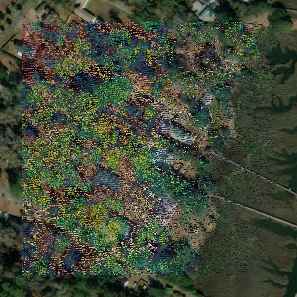
LiDAR
Point clouds (LiDAR) in Chatham County can produce highly accurate 3D models of terrain, structures, and vegetation.
Get LiDAR for Chatham County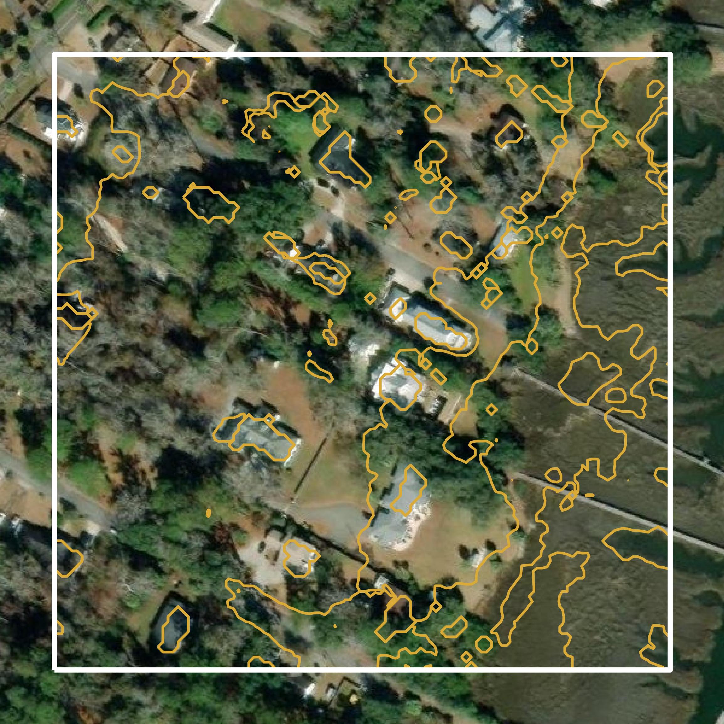
Contours
Contours in Chatham County visualize 3D elevations on a 2D surface allowing you to better understand your site.
Get Contours for Chatham County