Overview
Clay County GIS Data - For CAD
Equator helps civil engineering, architecture and consulting firms with the tools to instantly find, process and download accurate LiDAR, contours, parcel data, building footprints, DEMs, point clouds and other GIS data for Clay County in an online web mapping portal.
Clay County GIS Data ->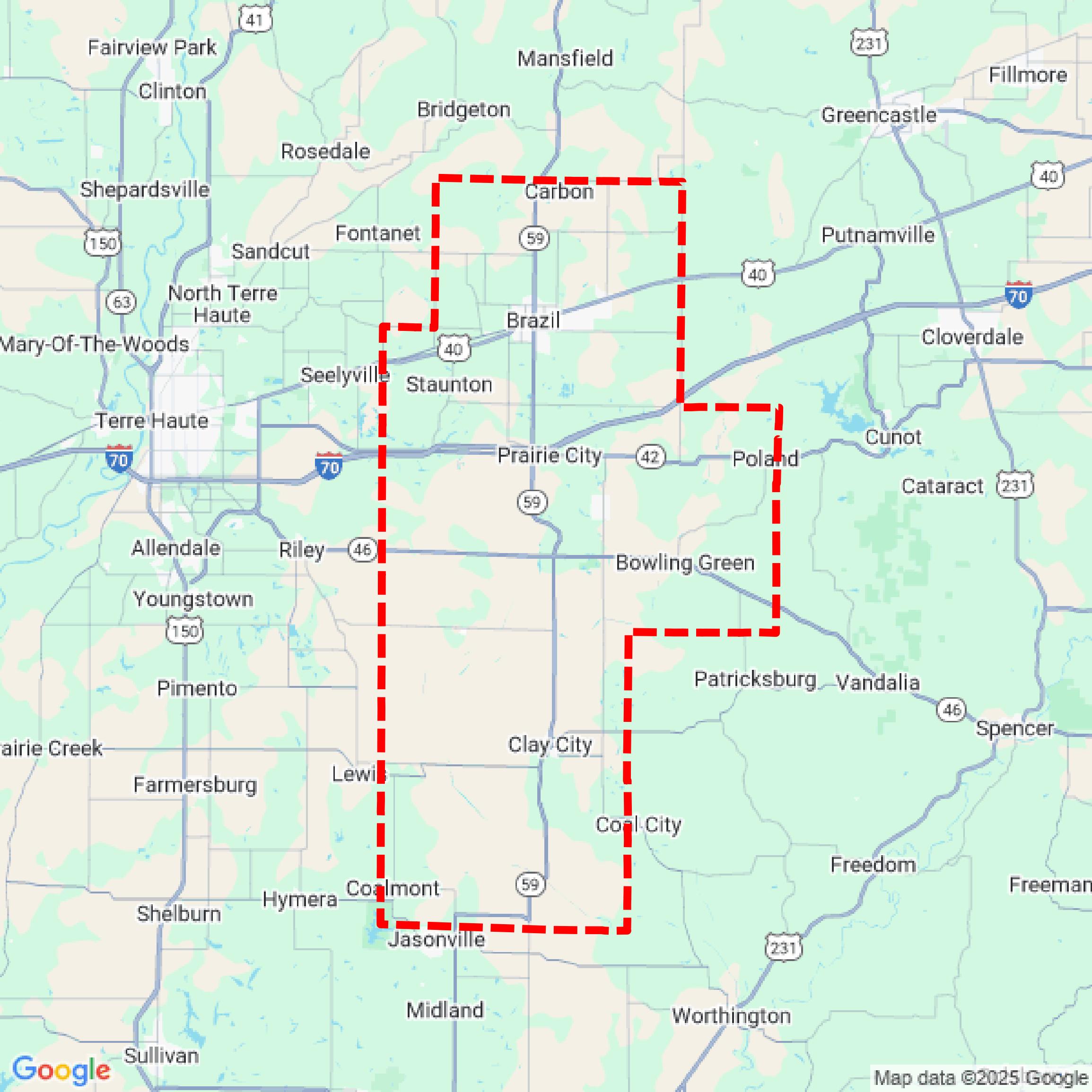

Data Available
Download GIS Data for Clay County
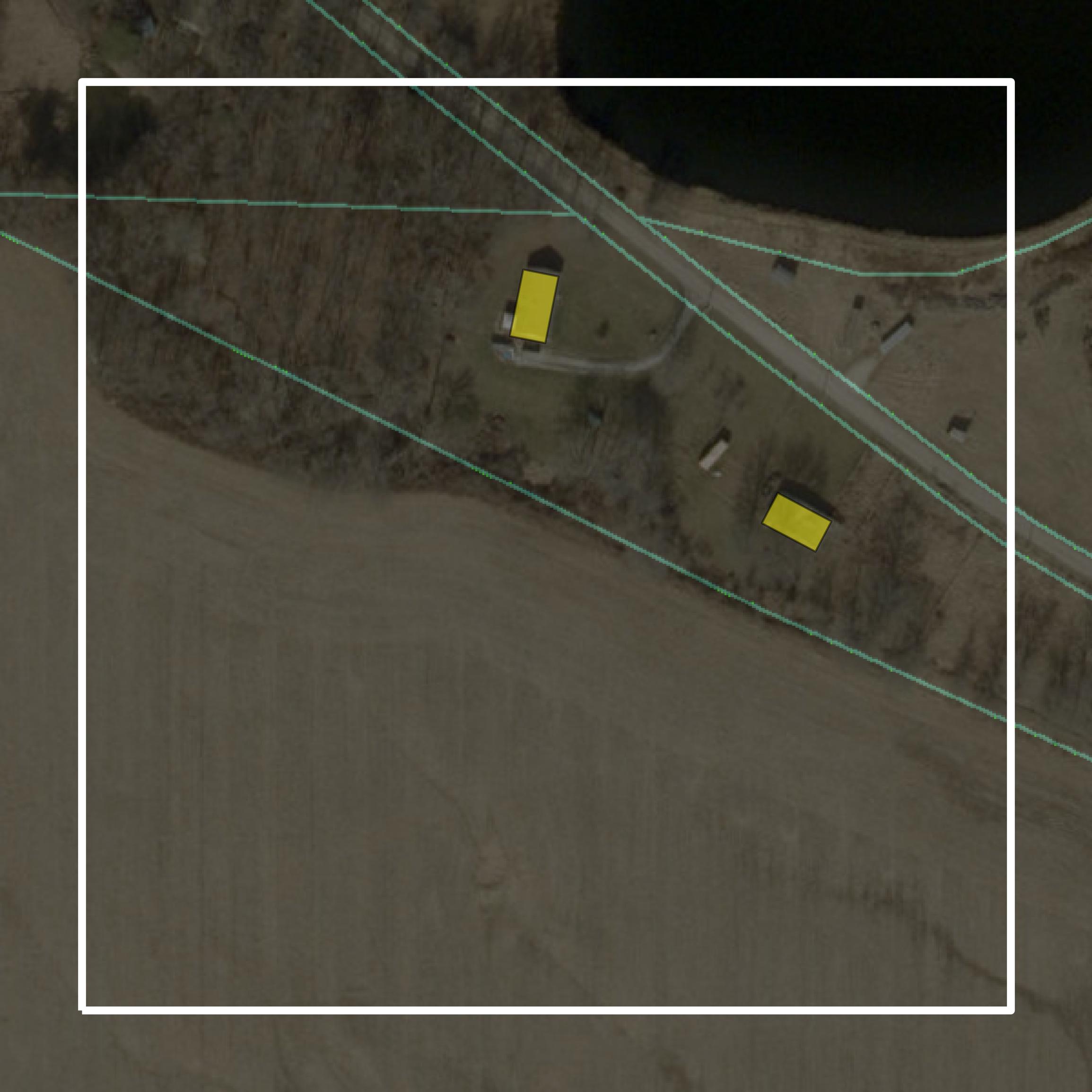
Parcels and Buildings
This image shows parcel and building data in Clay County created using GIS data in Equator.
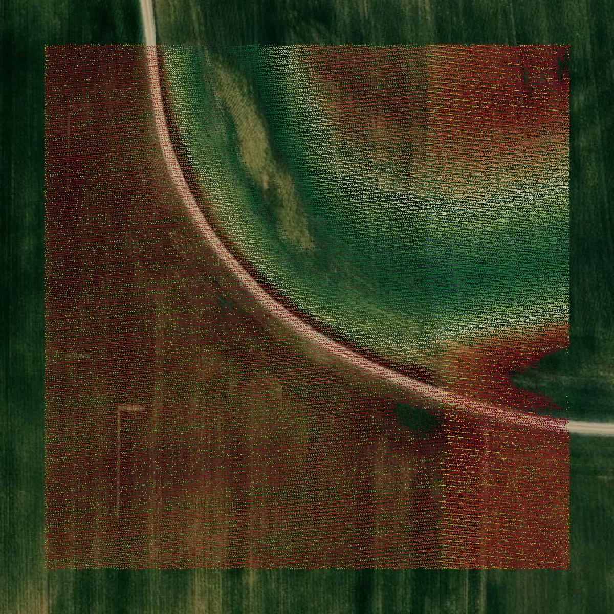
LiDAR
This image shows a LiDAR point cloud in Clay County created using GIS data in Equator.
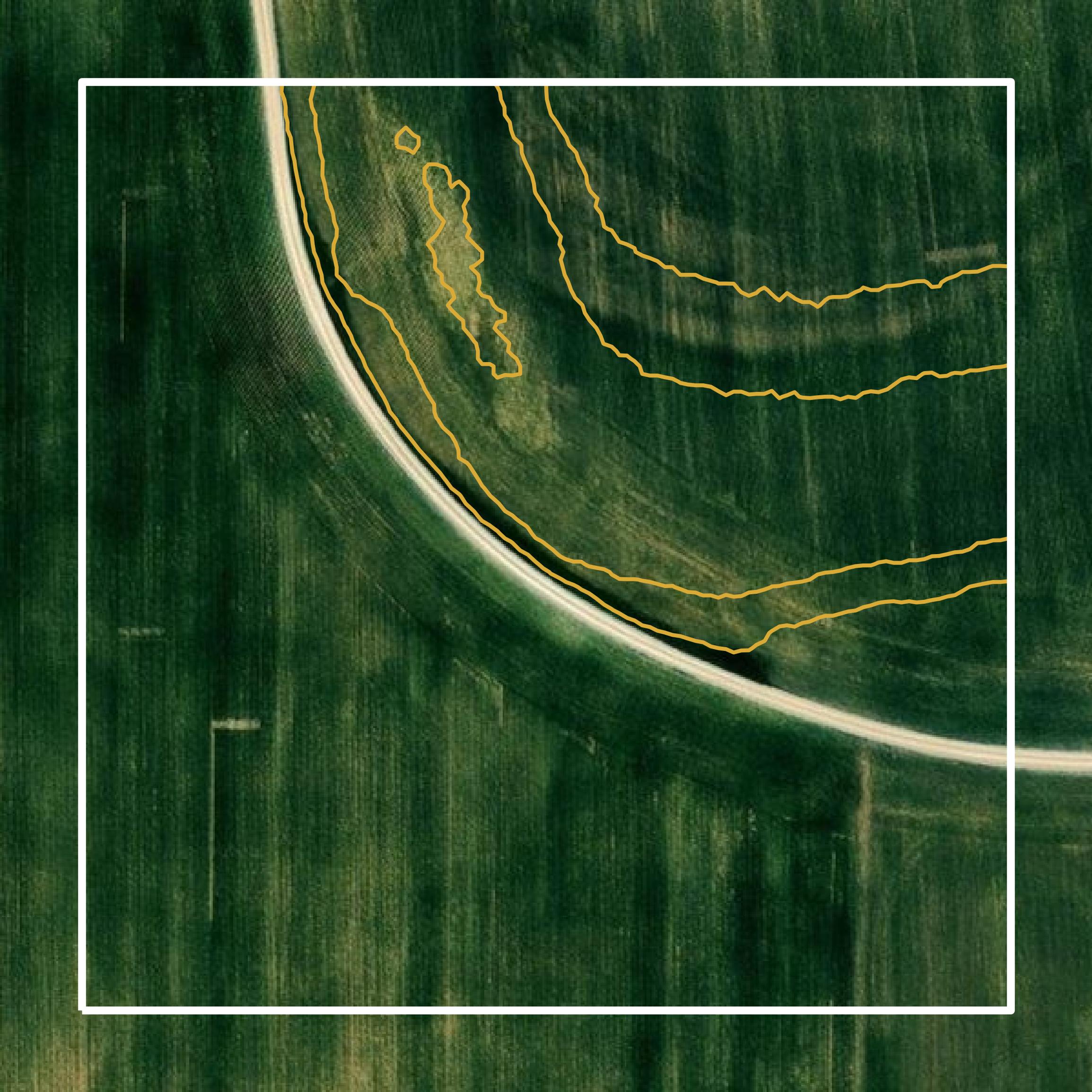
Contours
This image shows a contour map in Clay County created using GIS data in Equator.
Formats Available
Export Your Data Ready to Use in Multiple Formats
DWG
AutoCAD Drawing - Industry-standard CAD format
Supported Data:
Contour, Parcel, Building Outline
SHP
Shapefile - Standard GIS vector format
Supported Data:
Contour, Parcel, Building Outline
DXF
Drawing Exchange Format - Universal CAD interchange
Supported Data:
Contour, Building Outline
GeoJSON
Geographic JSON - Web-friendly spatial data format
Supported Data:
Contour, Parcel, Building Outline
LAZ
Compressed LAS - Efficient LiDAR point cloud format
Supported Data:
Point Cloud
SVG
Scalable Vector Graphics - Web vector format
Supported Data:
Contour, Building Outline
GPKG
GeoPackage - Modern OGC spatial database format
Supported Data:
Contour, Parcel, Building Outline
LandXML (Coming Soon)
Land XML - Civil engineering data exchange format
Supported Data:
Point Cloud
TIN (Coming Soon)
Triangulated Irregular Network - 3D surface model
Supported Data:
Point Cloud
XYZ (Coming Soon)
XYZ Point Cloud - Simple ASCII point cloud format
Supported Data:
Point Cloud
Background
GIS Data for Clay County
The webpage for Clay County, Indiana, provides access to a comprehensive collection of ordinances and resolutions dating from 2001 to 2025. It features various documents related to local governance, including ordinances concerning zoning, public safety, and fiscal management. While the primary focus is on legislative documents, the portal may also include references to spatial data resources such as zoning maps and land use regulations, which are essential for understanding the county's planning and development framework. Users can access downloadable files in PDF and Word formats for detailed examination of specific ordinances and resolutions.
Access Clay County GIS Data in Equator →Clay County Portal →Showcase
Sample GIS Data for Clay County
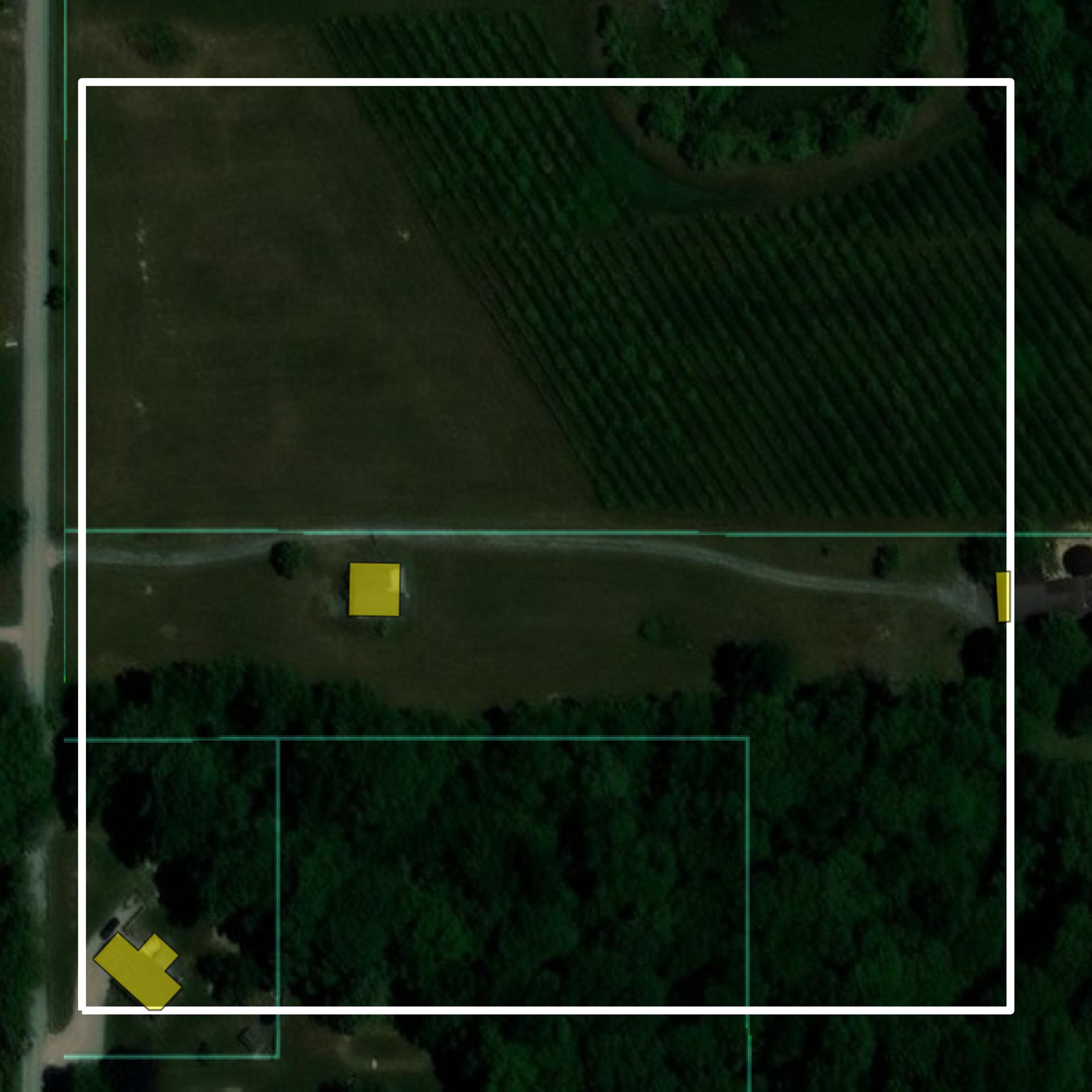
Parcels and Buildings
Parcel and building data in Clay County are used in a variety of fields including architecture, real estate, and urban planning.
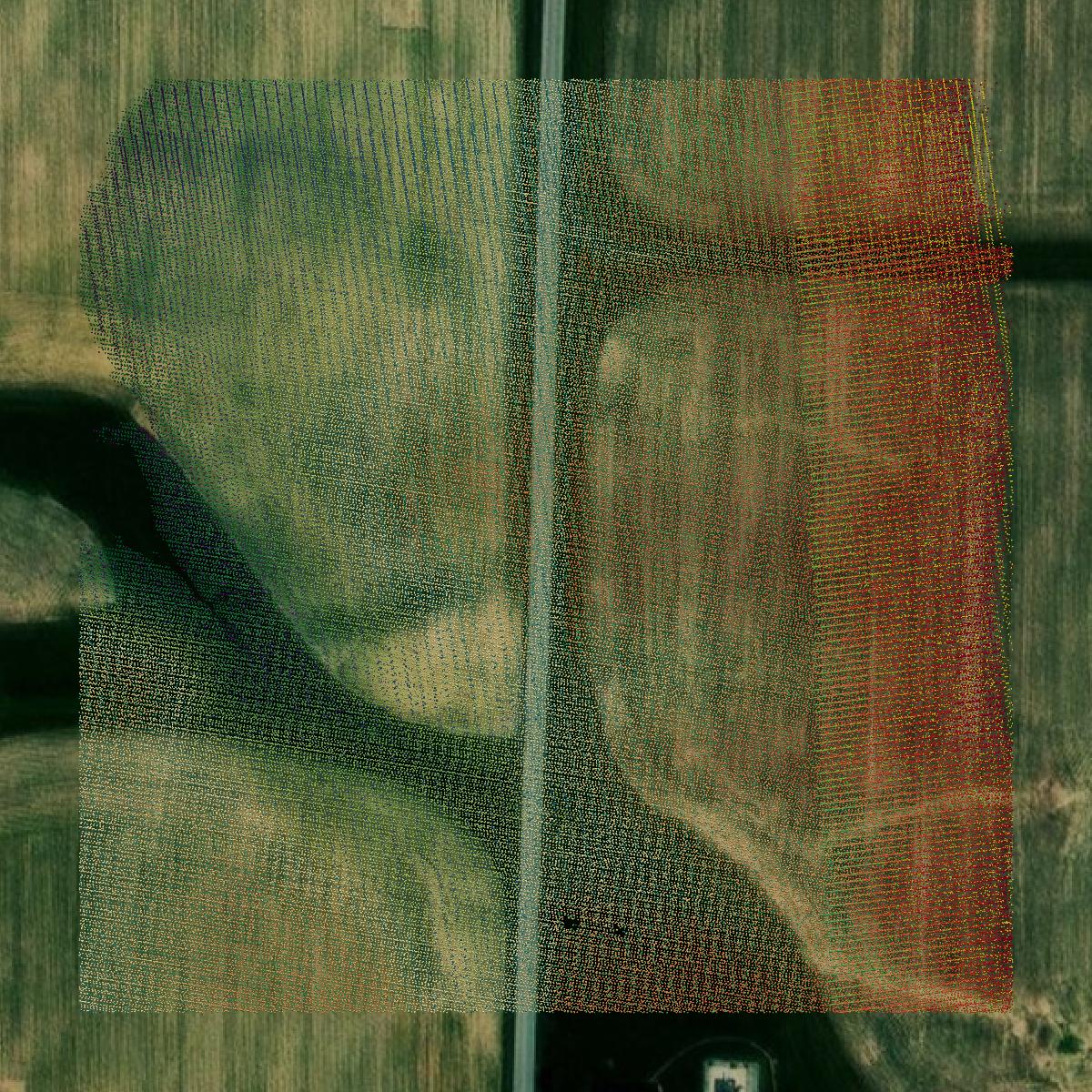
LiDAR
Point clouds (LiDAR) in Clay County can produce highly accurate 3D models of terrain, structures, and vegetation.
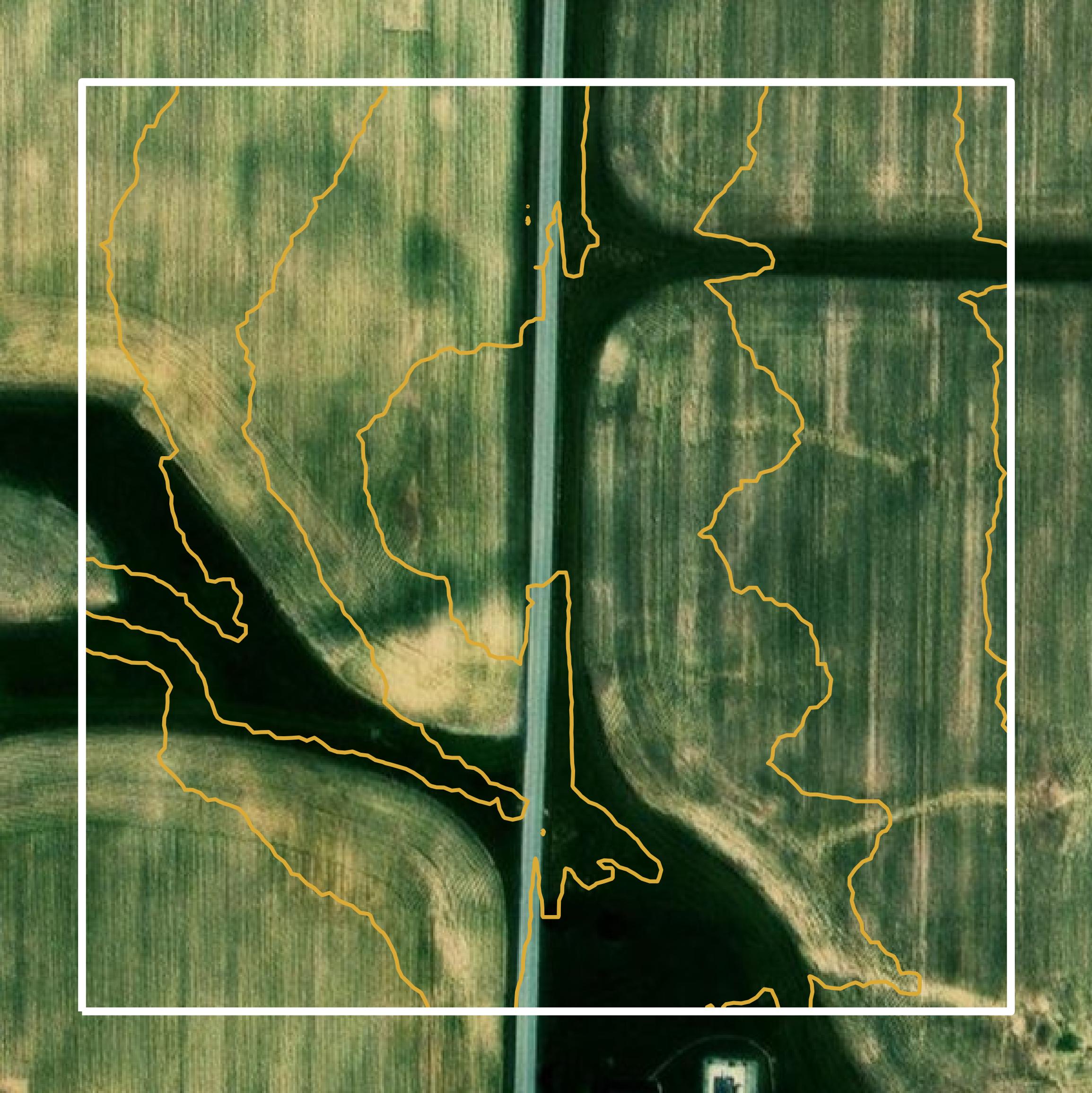
Contours
Contours in Clay County visualize 3D elevations on a 2D surface allowing you to better understand your site.