Overview
Polk County GIS Data – For CAD
Equator helps civil engineering, architecture and consulting firms with the tools to instantly find, process and download accurate LiDAR, contours, parcel data, building footprints, DEMs, point clouds and other GIS data for Polk County in an online web mapping portal.
Polk County GIS Data →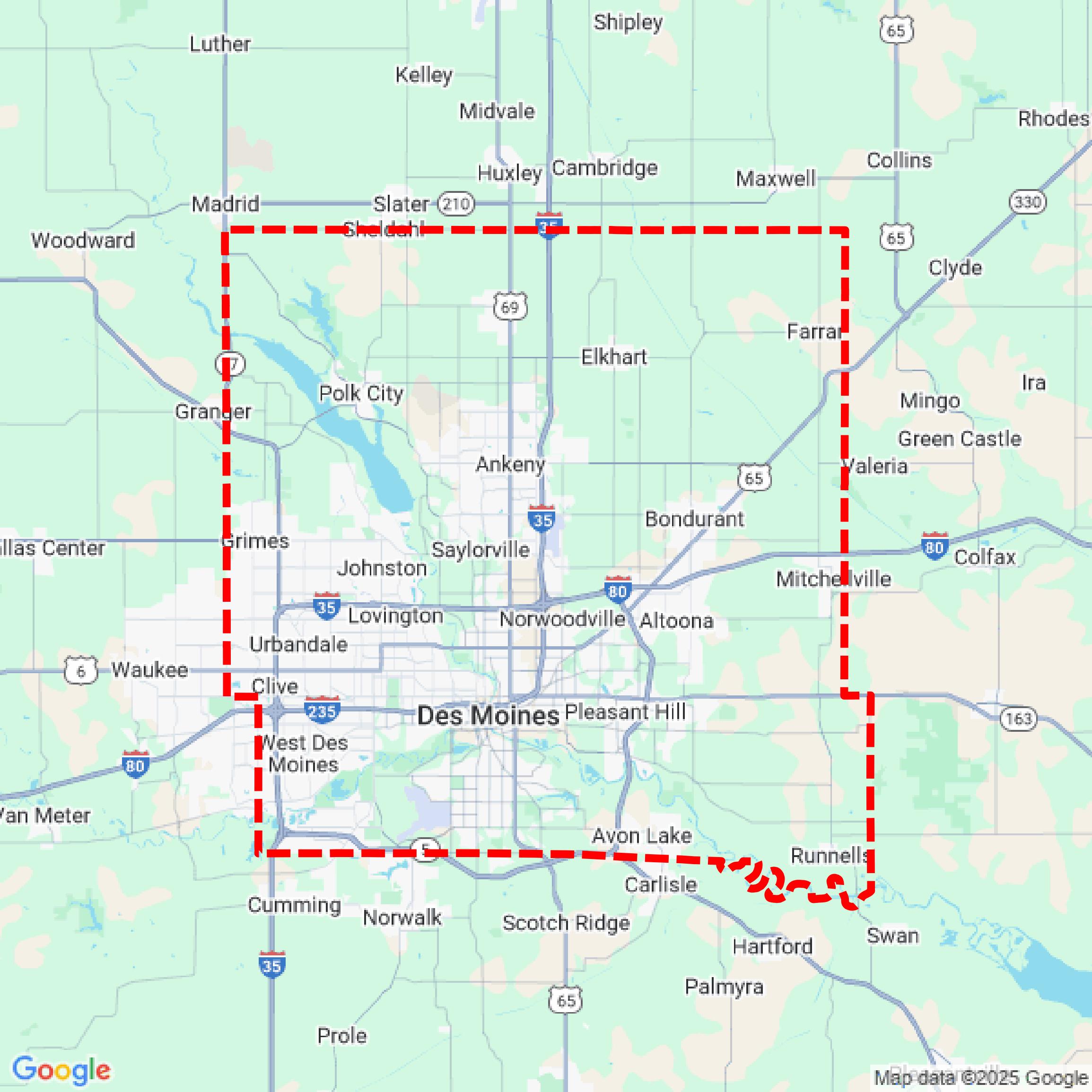

Data Available
Download GIS Data for Polk County
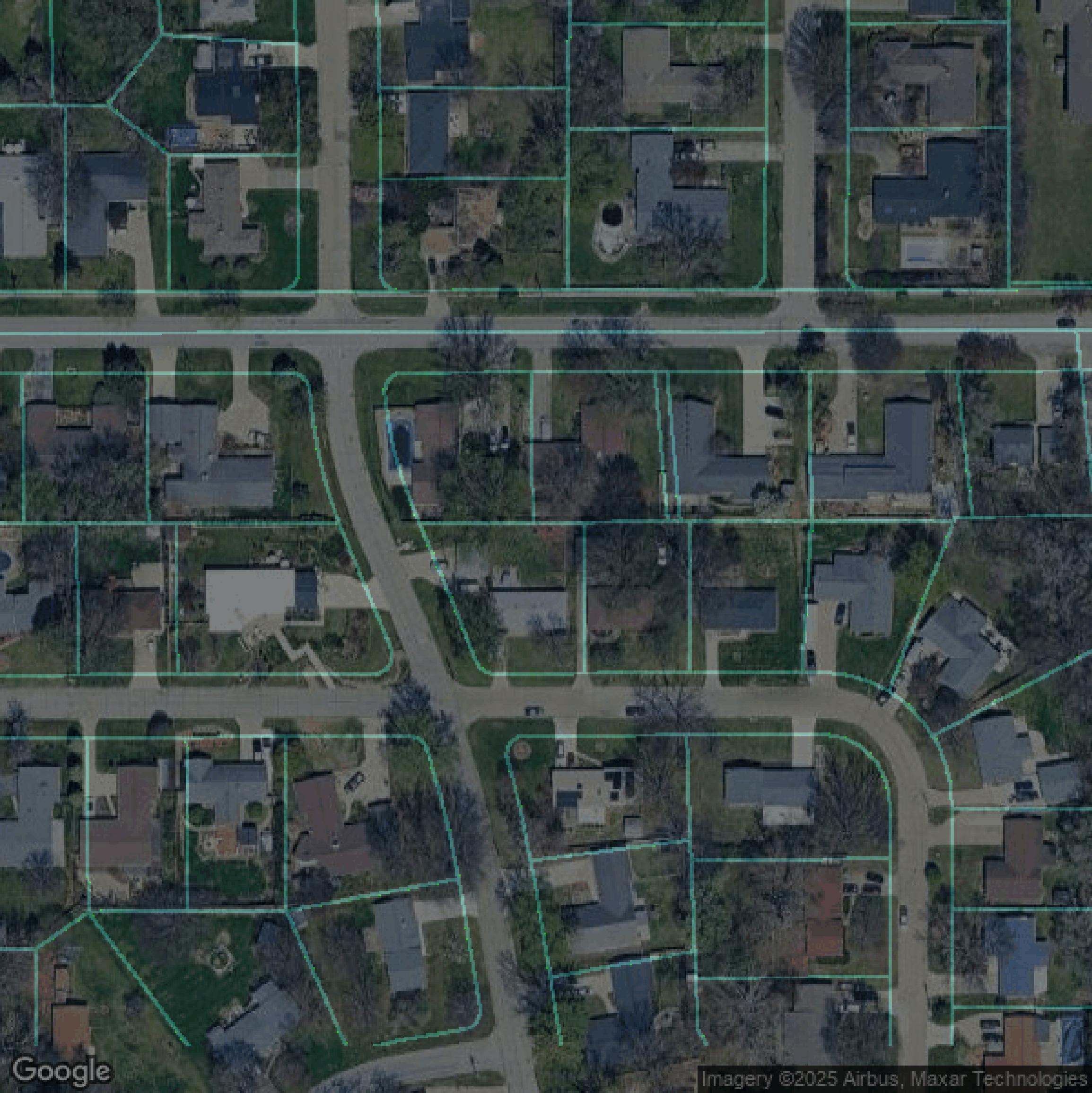
Parcels and Buildings
This image shows parcel and building data in Polk County created using GIS data in Equator.
Get Parcels and Buildings for Polk County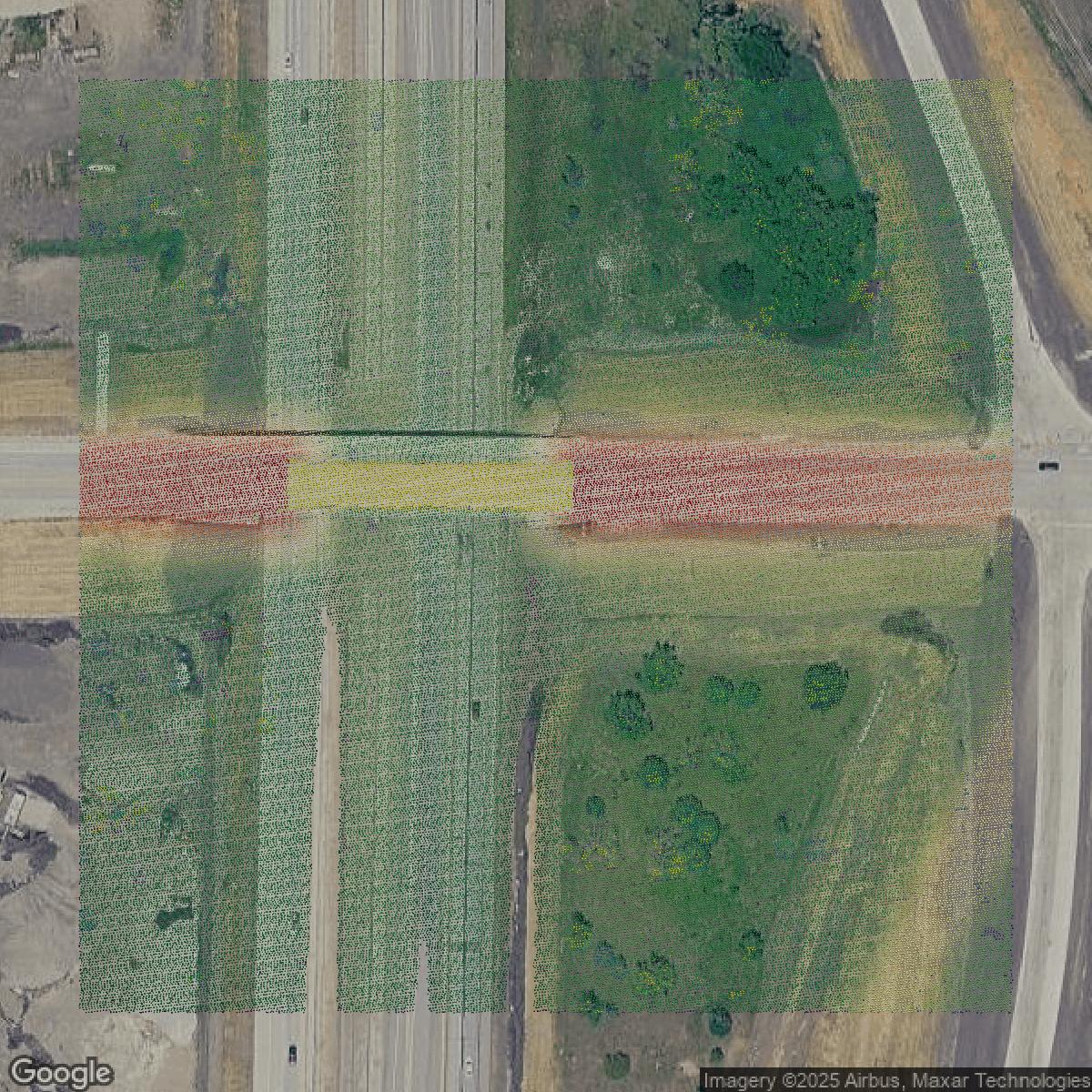
LiDAR
This image shows a LiDAR point cloud in Polk County created using GIS data in Equator.
Get LiDAR for Polk County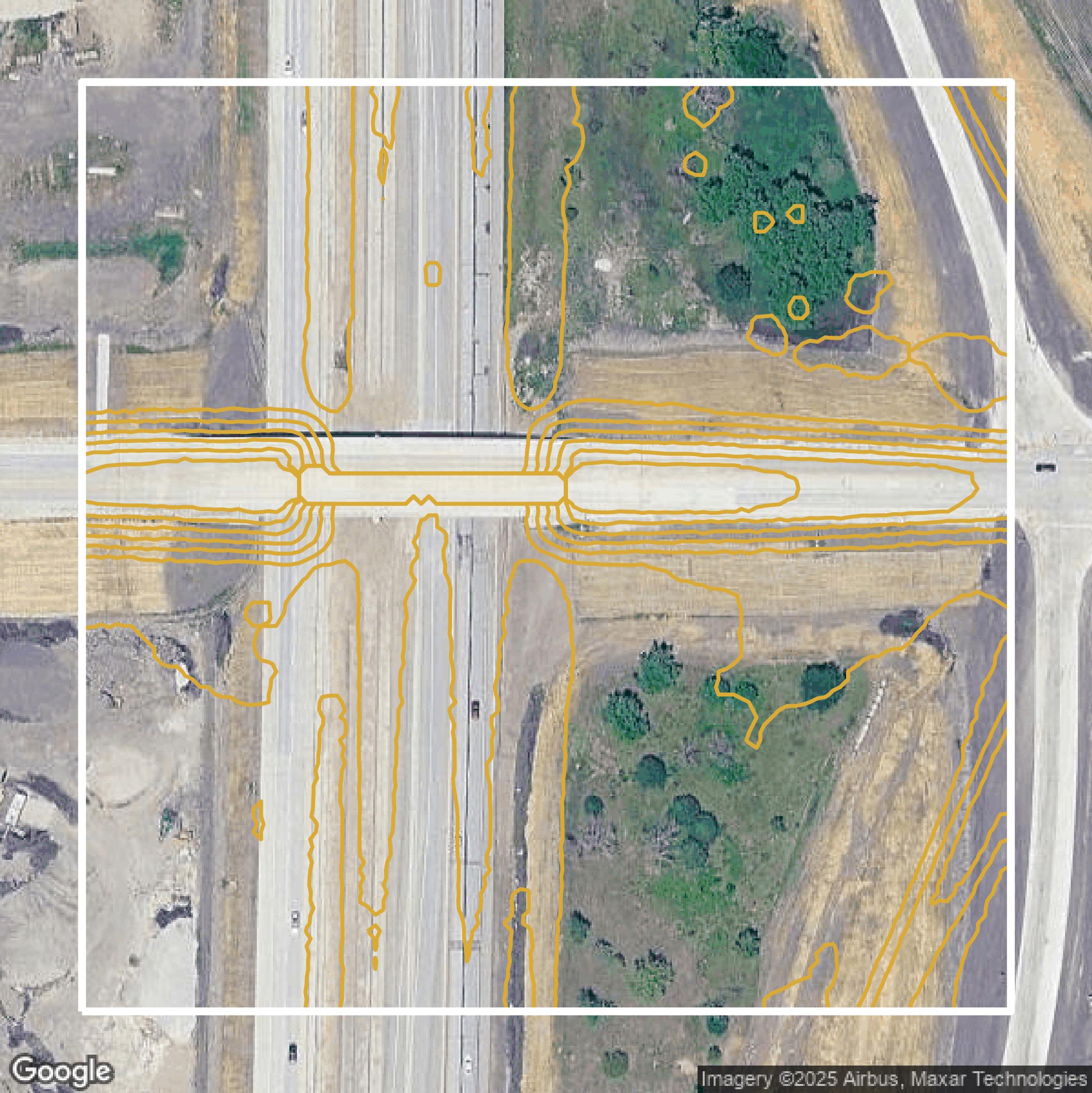
Contours
This image shows a contour map in Polk County created using GIS data in Equator.
Get Contours for Polk CountyFormats Available
Export Your Data Ready to Use in Multiple Formats
DWG
AutoCAD Drawing - Industry-standard CAD format
Supported Data:
Contour, Parcel, Building Outline
SHP
Shapefile - Standard GIS vector format
Supported Data:
Contour, Parcel, Building Outline
DXF
Drawing Exchange Format - Universal CAD interchange
Supported Data:
Contour, Building Outline
GeoJSON
Geographic JSON - Web-friendly spatial data format
Supported Data:
Contour, Parcel, Building Outline
LAZ
Compressed LAS - Efficient LiDAR point cloud format
Supported Data:
Point Cloud
SVG
Scalable Vector Graphics - Web vector format
Supported Data:
Contour, Building Outline
GPKG (Coming Soon)
GeoPackage - Modern OGC spatial database format
Supported Data:
Contour, Parcel, Building Outline
LandXML (Coming Soon)
Land XML - Civil engineering data exchange format
Supported Data:
Point Cloud
TIN (Coming Soon)
Triangulated Irregular Network - 3D surface model
Supported Data:
Point Cloud
XYZ (Coming Soon)
XYZ Point Cloud - Simple ASCII point cloud format
Supported Data:
Point Cloud
Background
GIS Data for Polk County
The webpage for the Social Vulnerability Index (SVI) in Polk County, Iowa, offers access to GIS datasets and maps that illustrate the social vulnerability of various communities within the county. The SVI utilizes 15 census variables to assess resilience against external stresses, such as natural disasters or disease outbreaks. Users can interact with a map to view SVI scores for specific census tracts, which range from 0 (lowest vulnerability) to 1 (highest vulnerability), along with additional socio-economic data. The page also provides a link to access the interactive SVI map, enhancing the understanding of community needs and preparedness.
Access Polk County GIS Data in Equator →Polk County Portal →Showcase
Sample GIS Data for Polk County
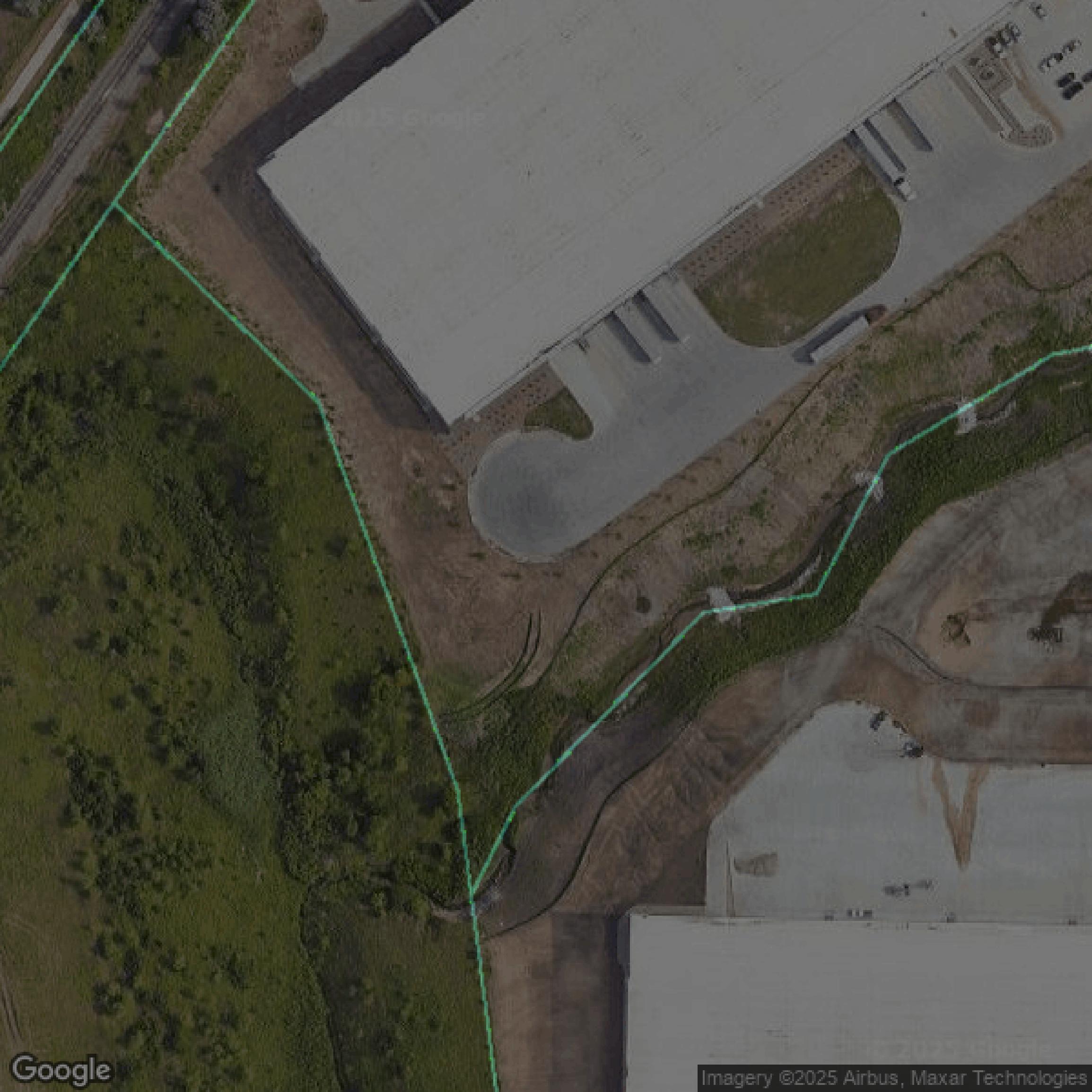
Parcels and Buildings
Parcel and building data in Polk County are used in a variety of fields including architecture, real estate, and urban planning.
Get Parcels and Buildings for Polk County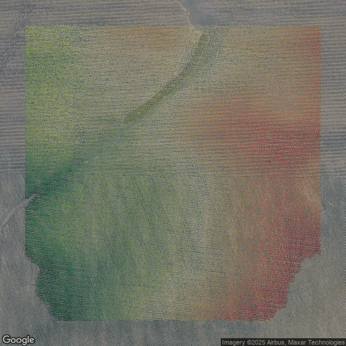
LiDAR
Point clouds (LiDAR) in Polk County can produce highly accurate 3D models of terrain, structures, and vegetation.
Get LiDAR for Polk County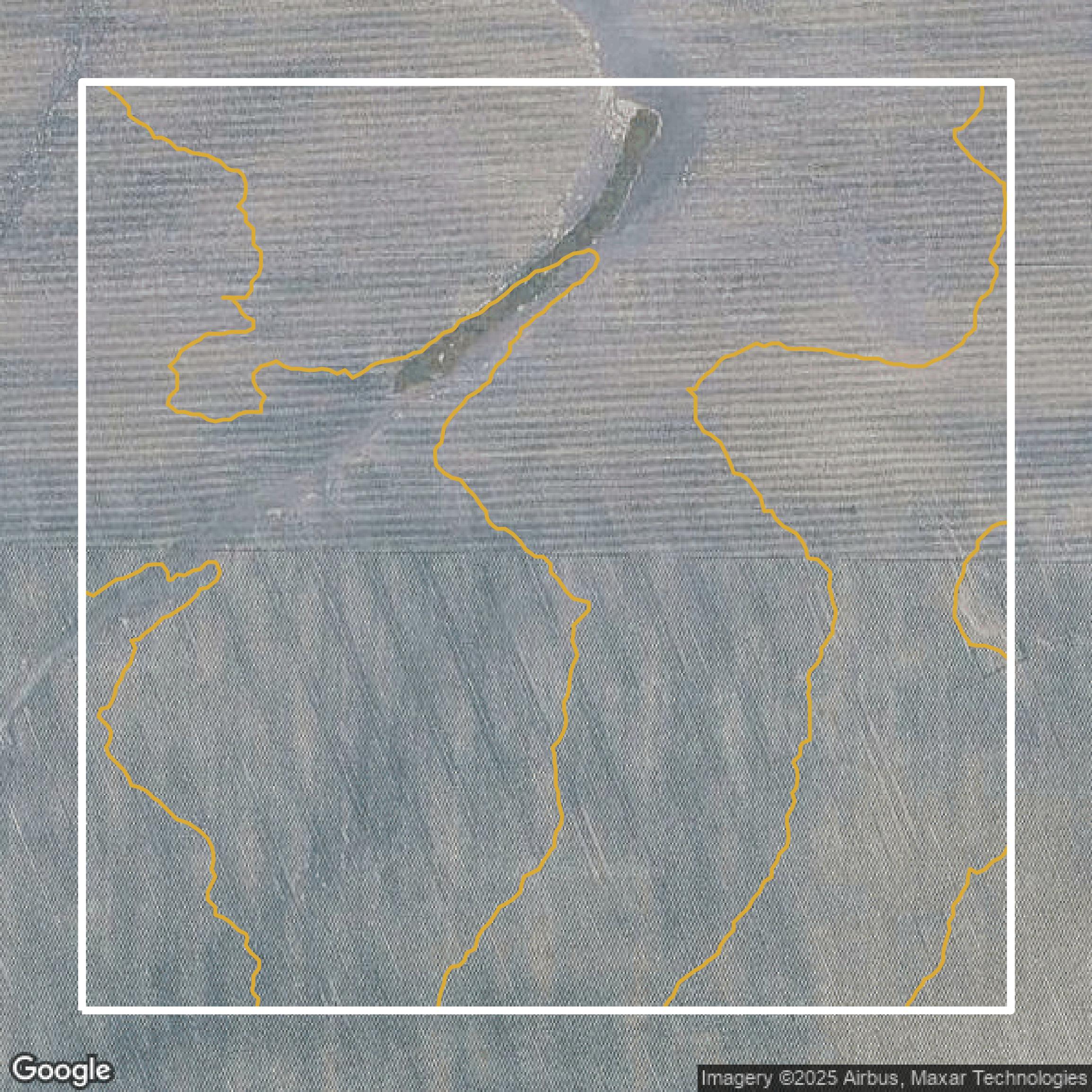
Contours
Contours in Polk County visualize 3D elevations on a 2D surface allowing you to better understand your site.
Get Contours for Polk County