Overview
Jefferson County GIS Data – For CAD
Equator helps civil engineering, architecture and consulting firms with the tools to instantly find, process and download accurate LiDAR, contours, parcel data, building footprints, DEMs, point clouds and other GIS data for Jefferson County in an online web mapping portal.
Jefferson County GIS Data →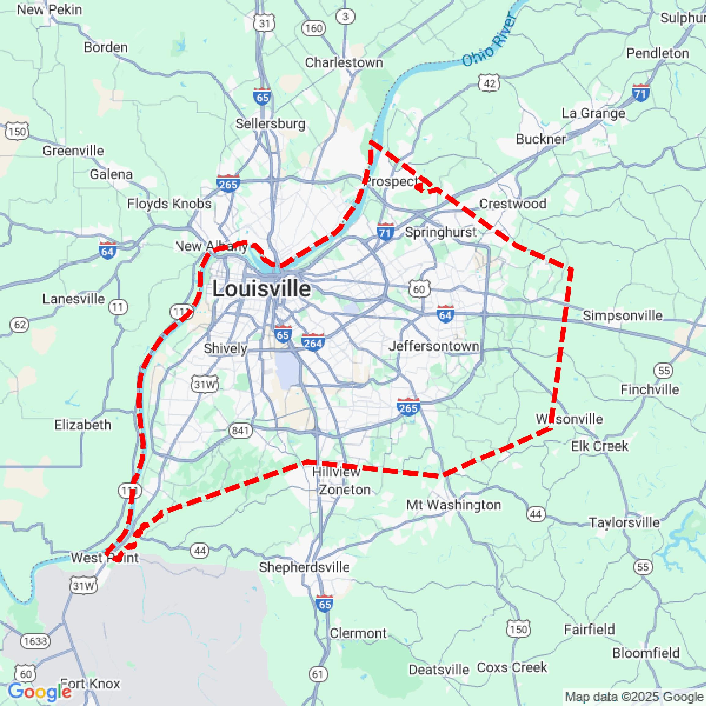

Data Available
Download GIS Data for Jefferson County
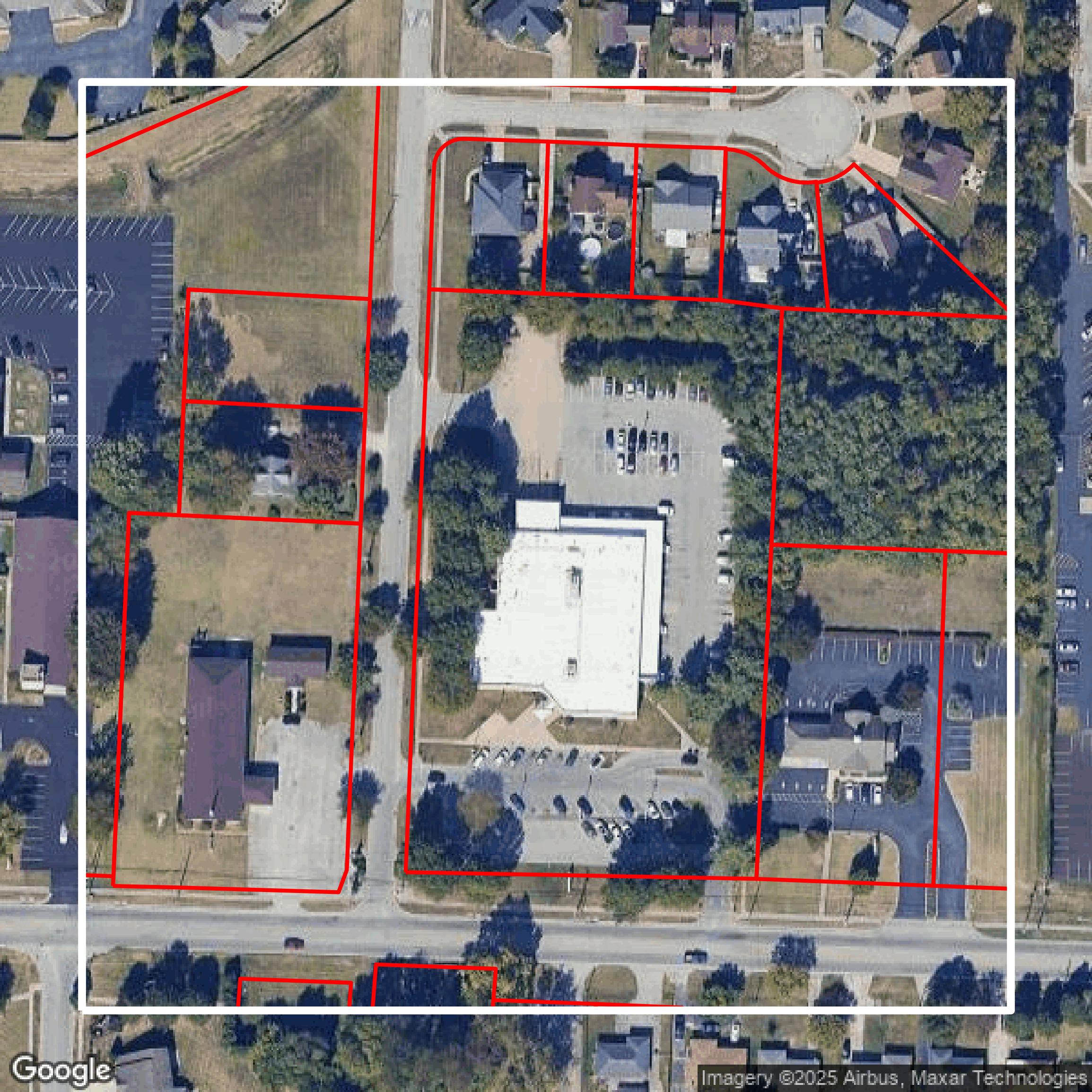
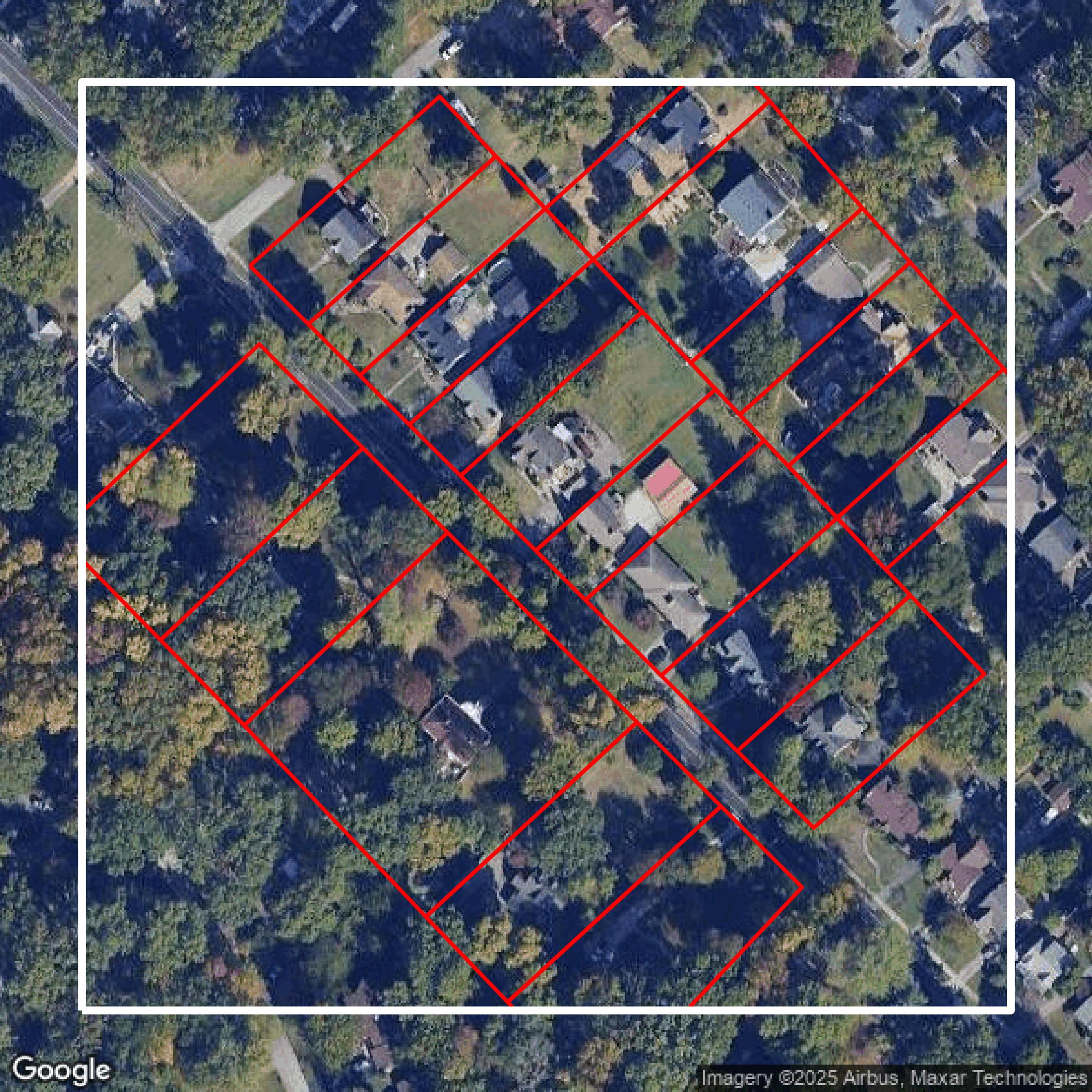
Parcels and Buildings
This image shows parcel and building data in Jefferson County created using GIS data in Equator.
Get Parcels and Buildings for Jefferson County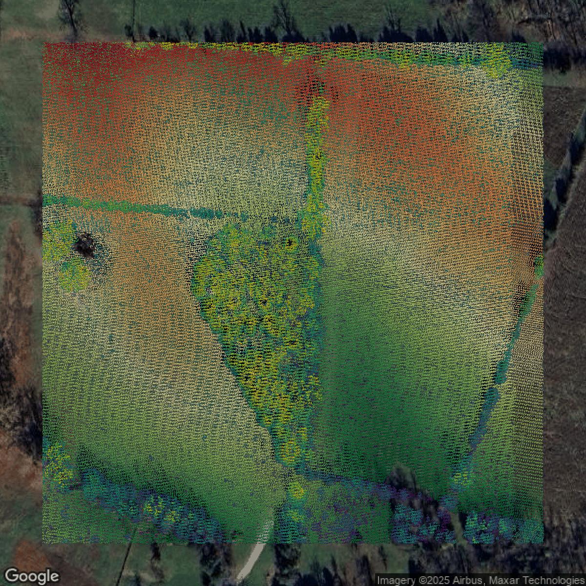
LiDAR
This image shows a LiDAR point cloud in Jefferson County created using GIS data in Equator.
Get LiDAR for Jefferson County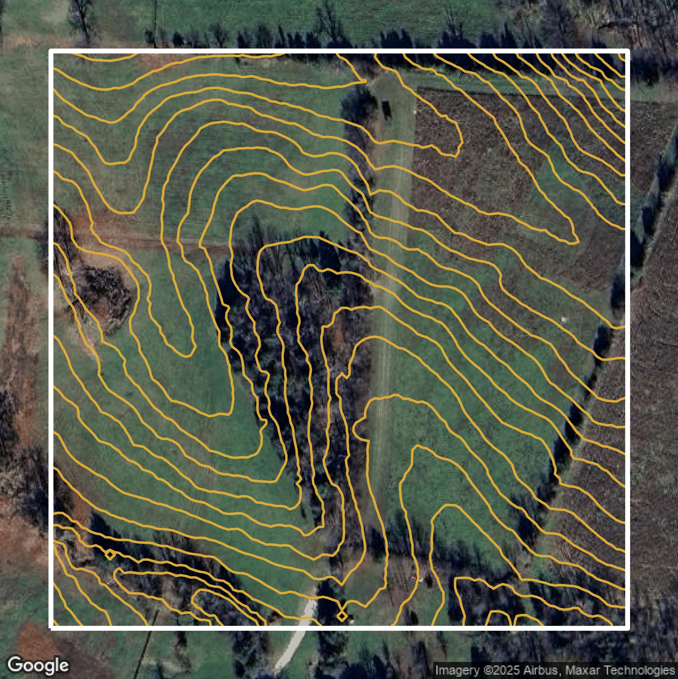
Contours
This image shows a contour map in Jefferson County created using GIS data in Equator.
Get Contours for Jefferson CountyFormats Available
Export Your Data Ready to Use in Multiple Formats
DWG
AutoCAD Drawing - Industry-standard CAD format
Supported Data:
Contour, Parcel, Building Outline
SHP
Shapefile - Standard GIS vector format
Supported Data:
Contour, Parcel, Building Outline
DXF
Drawing Exchange Format - Universal CAD interchange
Supported Data:
Contour, Building Outline
GeoJSON
Geographic JSON - Web-friendly spatial data format
Supported Data:
Contour, Parcel, Building Outline
LAZ
Compressed LAS - Efficient LiDAR point cloud format
Supported Data:
Point Cloud
SVG
Scalable Vector Graphics - Web vector format
Supported Data:
Contour, Building Outline
GPKG (Coming Soon)
GeoPackage - Modern OGC spatial database format
Supported Data:
Contour, Parcel, Building Outline
LandXML (Coming Soon)
Land XML - Civil engineering data exchange format
Supported Data:
Point Cloud
TIN (Coming Soon)
Triangulated Irregular Network - 3D surface model
Supported Data:
Point Cloud
XYZ (Coming Soon)
XYZ Point Cloud - Simple ASCII point cloud format
Supported Data:
Point Cloud
Background
GIS Data for Jefferson County
The LOJIC website offers a comprehensive suite of interactive maps, story maps, and printable map PDFs that provide detailed geographic information for Jefferson County, including data on parcels, taxing districts, zoning, and utilities. Visitors can explore "LOJIC Online," a geographic overview of the community, or browse the "Map Hub" featuring interactive apps for neighborhoods, political districts, and snow events. The site’s "Open Data Portal" enables users to explore, analyze, and download key countywide datasets such as "Address Points," "Metro Council Districts," "Parcels," and "Street Centerlines." Additionally, LOJIC provides custom services including site-specific data extraction in AutoCAD or Esri formats and creation of custom maps up to 36 inches in one dimension. Technical assistance is also available to help users navigate the interactive maps and datasets, ensuring access to precise and actionable geographic information for Louisville Metro and Jefferson County.
Access Jefferson County GIS Data in Equator →Jefferson County Portal →Showcase
Sample GIS Data for Jefferson County
Parcels and Buildings
Parcel and building data in Jefferson County are used in a variety of fields including architecture, real estate, and urban planning.
Get Parcels and Buildings for Jefferson County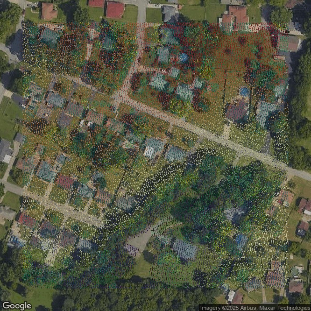
LiDAR
Point clouds (LiDAR) in Jefferson County can produce highly accurate 3D models of terrain, structures, and vegetation.
Get LiDAR for Jefferson County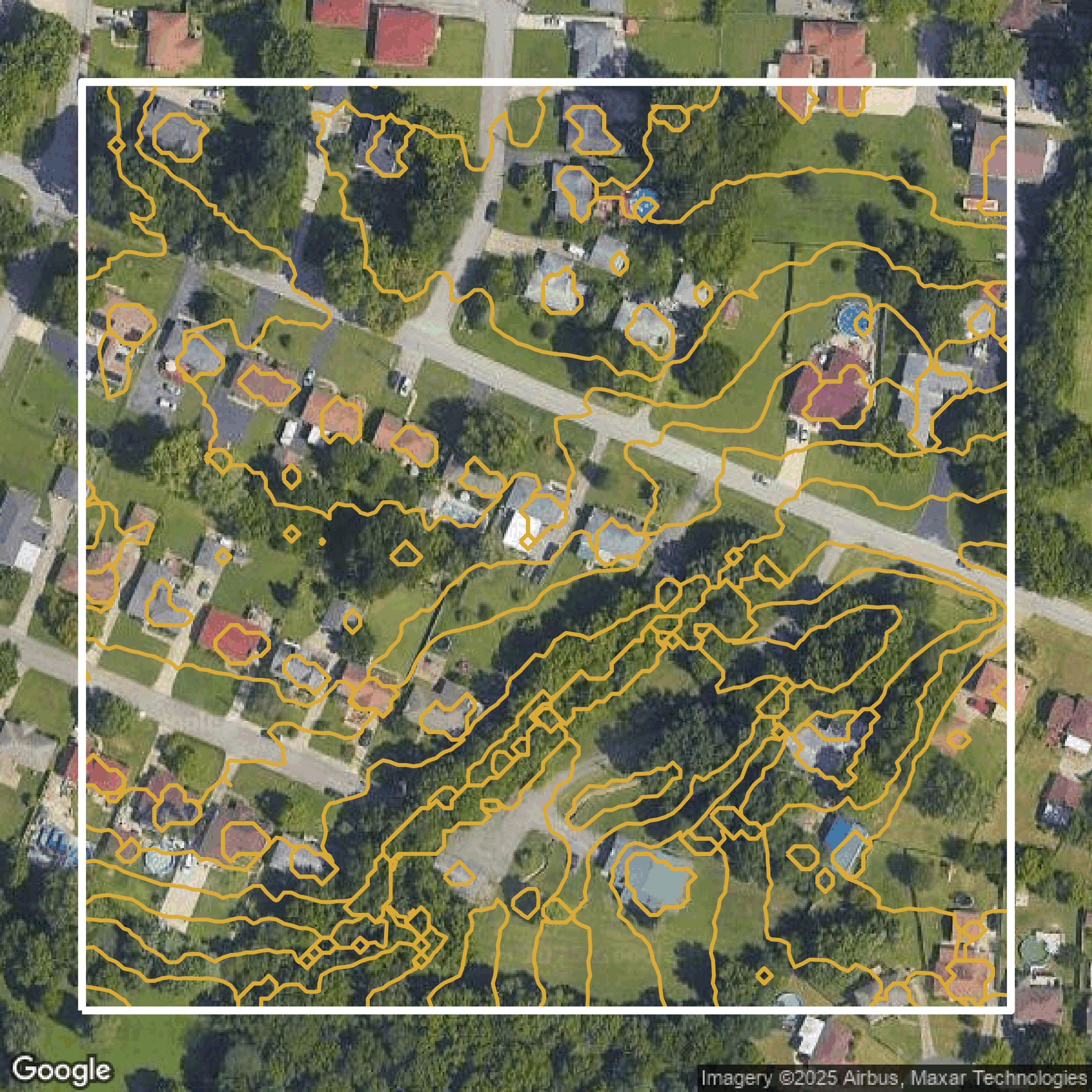
Contours
Contours in Jefferson County visualize 3D elevations on a 2D surface allowing you to better understand your site.
Get Contours for Jefferson County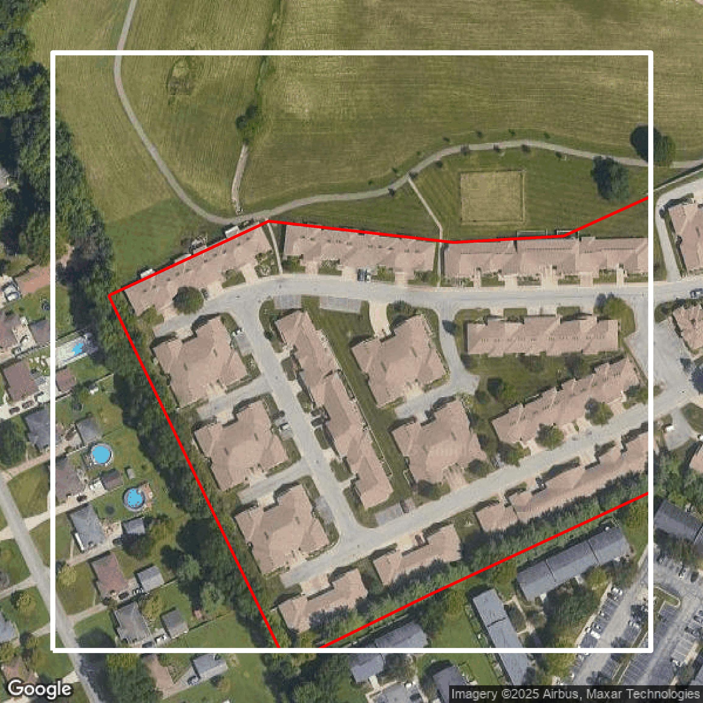
Parcels and Buildings
Accessing Jefferson County parcel and building data on Equator gives you access to coverage across the US.
Get Parcels and Buildings for Jefferson County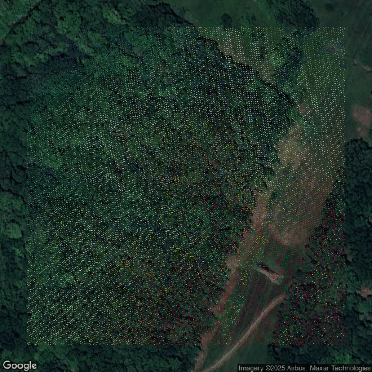
LiDAR
Jefferson County LiDAR uses include land surveying, analyzing crop health, or even archaeological studies.
Get LiDAR for Jefferson County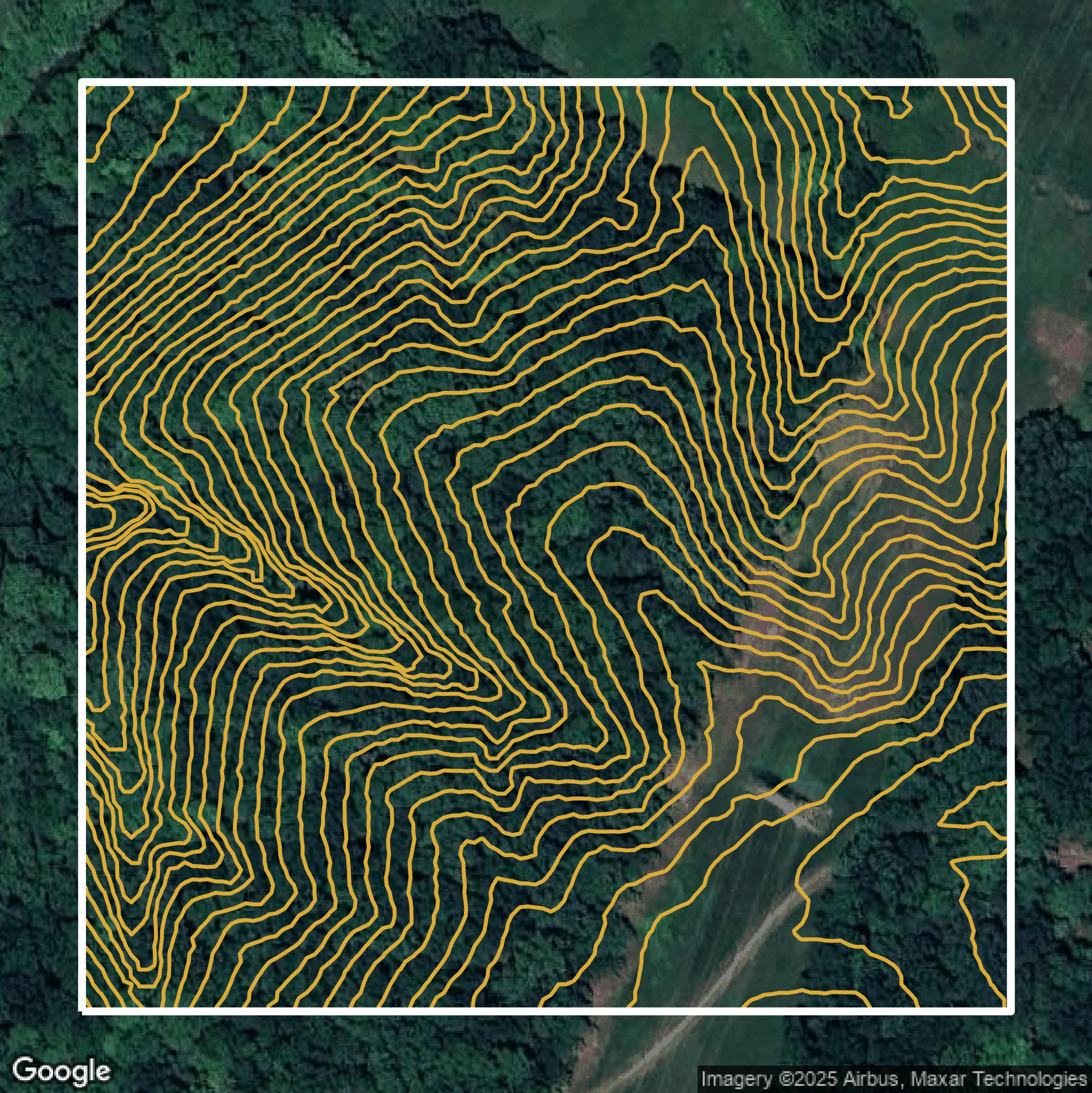
Contours
Jefferson County contours can be used for construction & engineering, environmental science, and more.
Get Contours for Jefferson County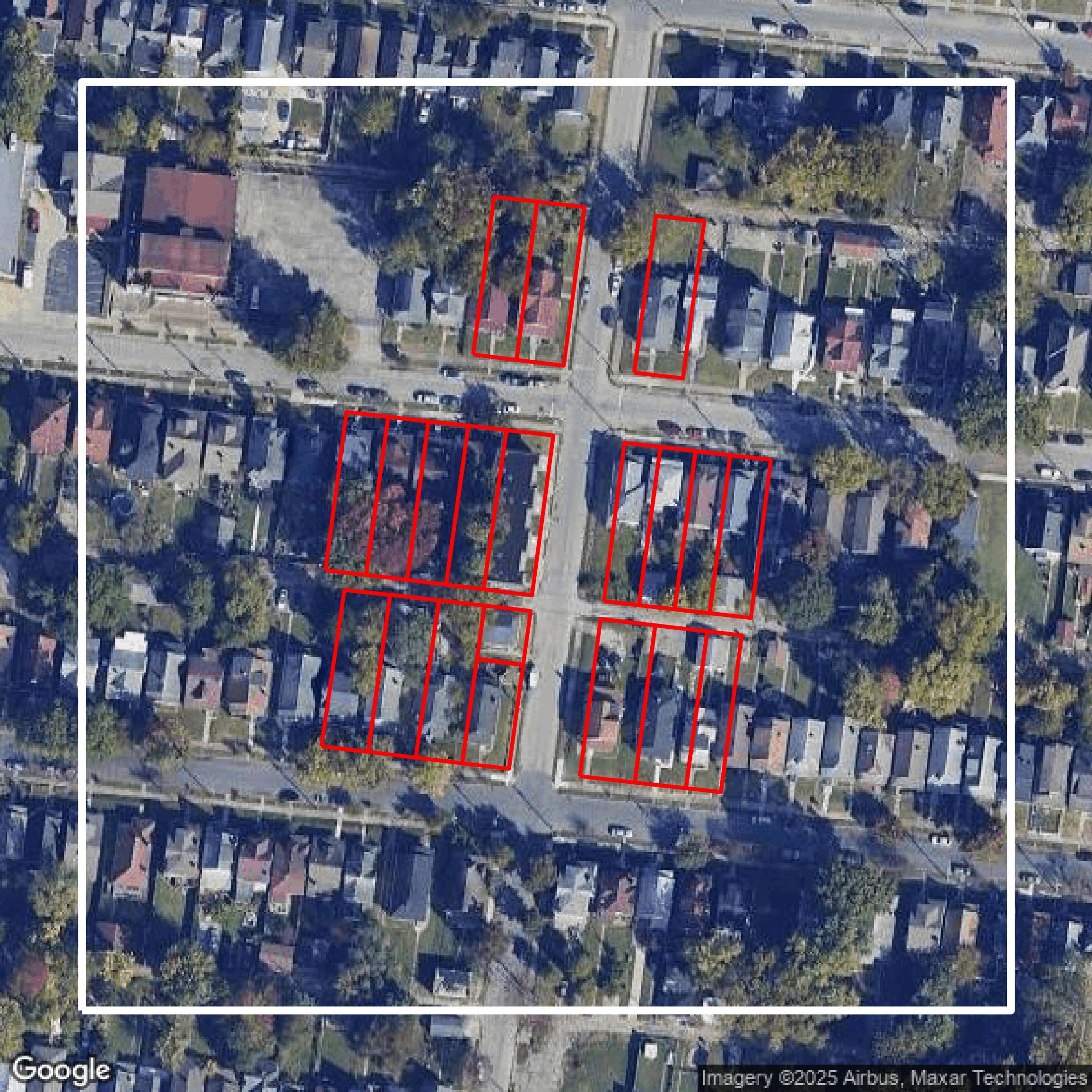
Parcels and Buildings
Dozens of fields are contained within each Jefferson County parcel and building data, including zoning, owners, and year built.
Get Parcels and Buildings for Jefferson County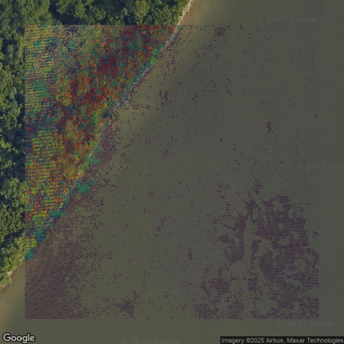
LiDAR
Equator turns Jefferson County LiDAR point clouds into various lidar-derived data sets, including DEMs.
Get LiDAR for Jefferson County
Contours
Jefferson County contours on Equator are produced from LiDAR coverage, allowing for high precision
Get Contours for Jefferson County