Overview
Cottonwood County GIS Data - For CAD
Equator helps civil engineering, architecture and consulting firms with the tools to instantly find, process and download accurate LiDAR, contours, parcel data, building footprints, DEMs, point clouds and other GIS data for Cottonwood County in an online web mapping portal.
Cottonwood County GIS Data ->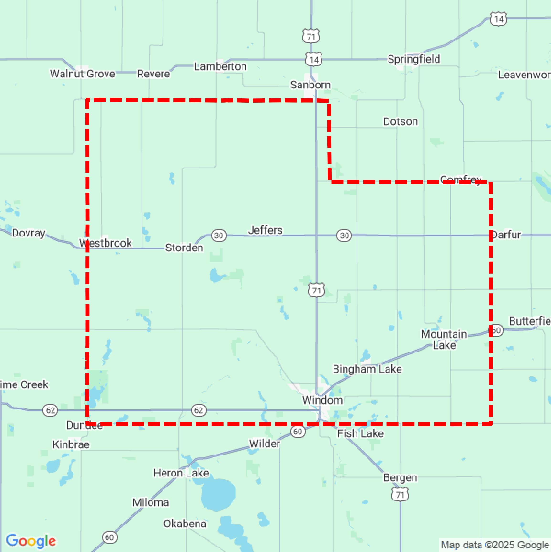

Data Available
Download GIS Data for Cottonwood County
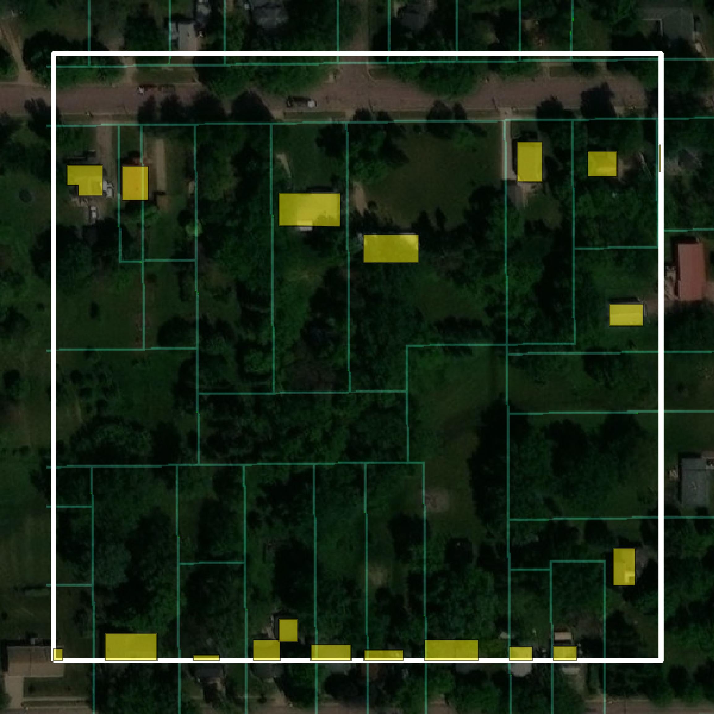
Parcels and Buildings
This image shows parcel and building data in Cottonwood County created using GIS data in Equator.
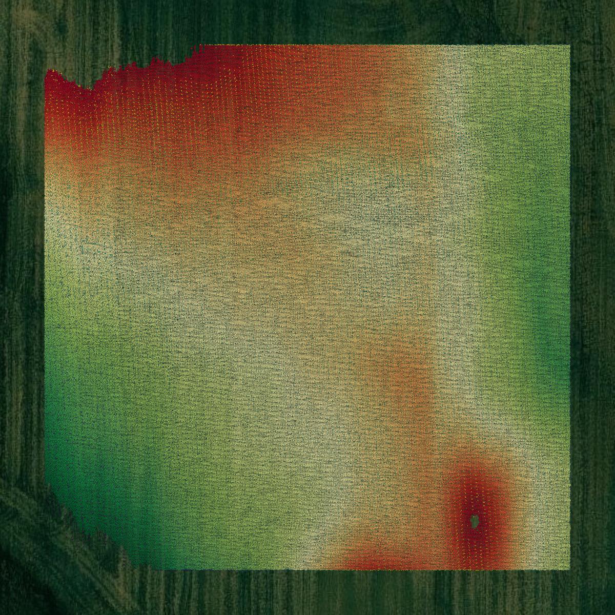
LiDAR
This image shows a LiDAR point cloud in Cottonwood County created using GIS data in Equator.
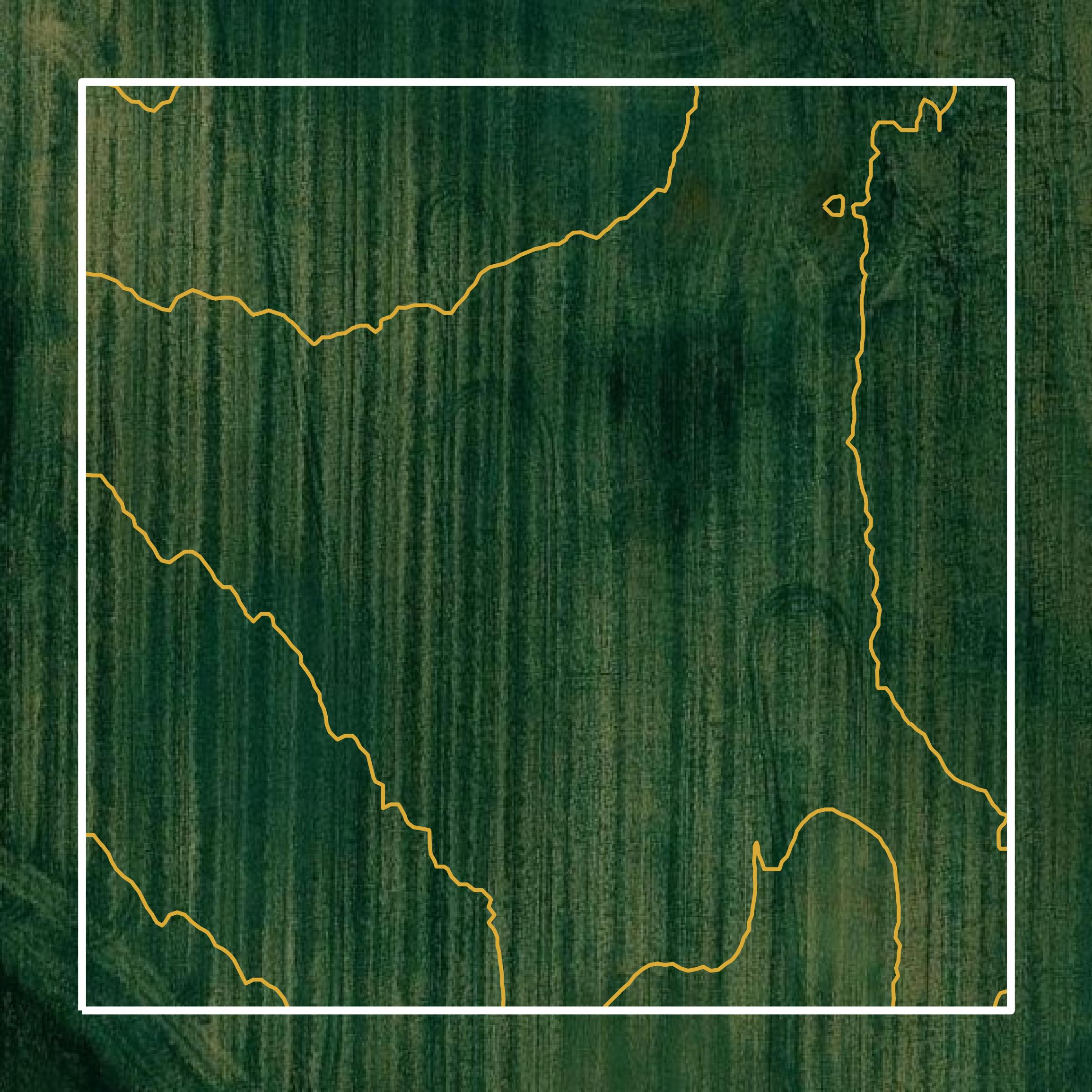
Contours
This image shows a contour map in Cottonwood County created using GIS data in Equator.
Formats Available
Export Your Data Ready to Use in Multiple Formats
DWG
AutoCAD Drawing - Industry-standard CAD format
Supported Data:
Contour, Parcel, Building Outline
SHP
Shapefile - Standard GIS vector format
Supported Data:
Contour, Parcel, Building Outline
DXF
Drawing Exchange Format - Universal CAD interchange
Supported Data:
Contour, Building Outline
GeoJSON
Geographic JSON - Web-friendly spatial data format
Supported Data:
Contour, Parcel, Building Outline
LAZ
Compressed LAS - Efficient LiDAR point cloud format
Supported Data:
Point Cloud
SVG
Scalable Vector Graphics - Web vector format
Supported Data:
Contour, Building Outline
GPKG
GeoPackage - Modern OGC spatial database format
Supported Data:
Contour, Parcel, Building Outline
LandXML (Coming Soon)
Land XML - Civil engineering data exchange format
Supported Data:
Point Cloud
TIN (Coming Soon)
Triangulated Irregular Network - 3D surface model
Supported Data:
Point Cloud
XYZ (Coming Soon)
XYZ Point Cloud - Simple ASCII point cloud format
Supported Data:
Point Cloud
Background
GIS Data for Cottonwood County
The Cottonwood County GIS portal, accessible via RecordEASE Web Access, provides a range of spatial data resources, including parcel data, zoning information, and historical aerial imagery dating back to 1871. Users can search for property-related documents by various criteria, such as grantor names and legal descriptions. The portal also features a document indexing system that includes records from as far back as 1970, with ongoing efforts to enhance historical data access. Additional functionalities include viewing images of related documents and filtering search results by document type. The site supports online payments for document access and search fees, facilitating efficient retrieval of land records.
Access Cottonwood County GIS Data in Equator →Cottonwood County Portal →Showcase
Sample GIS Data for Cottonwood County
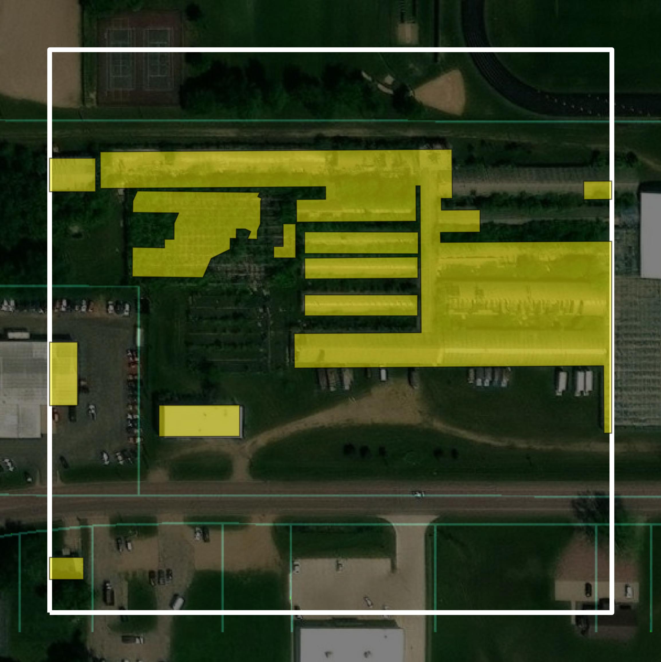
Parcels and Buildings
Parcel and building data in Cottonwood County are used in a variety of fields including architecture, real estate, and urban planning.
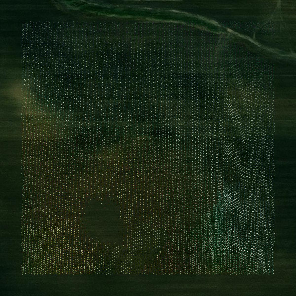
LiDAR
Point clouds (LiDAR) in Cottonwood County can produce highly accurate 3D models of terrain, structures, and vegetation.
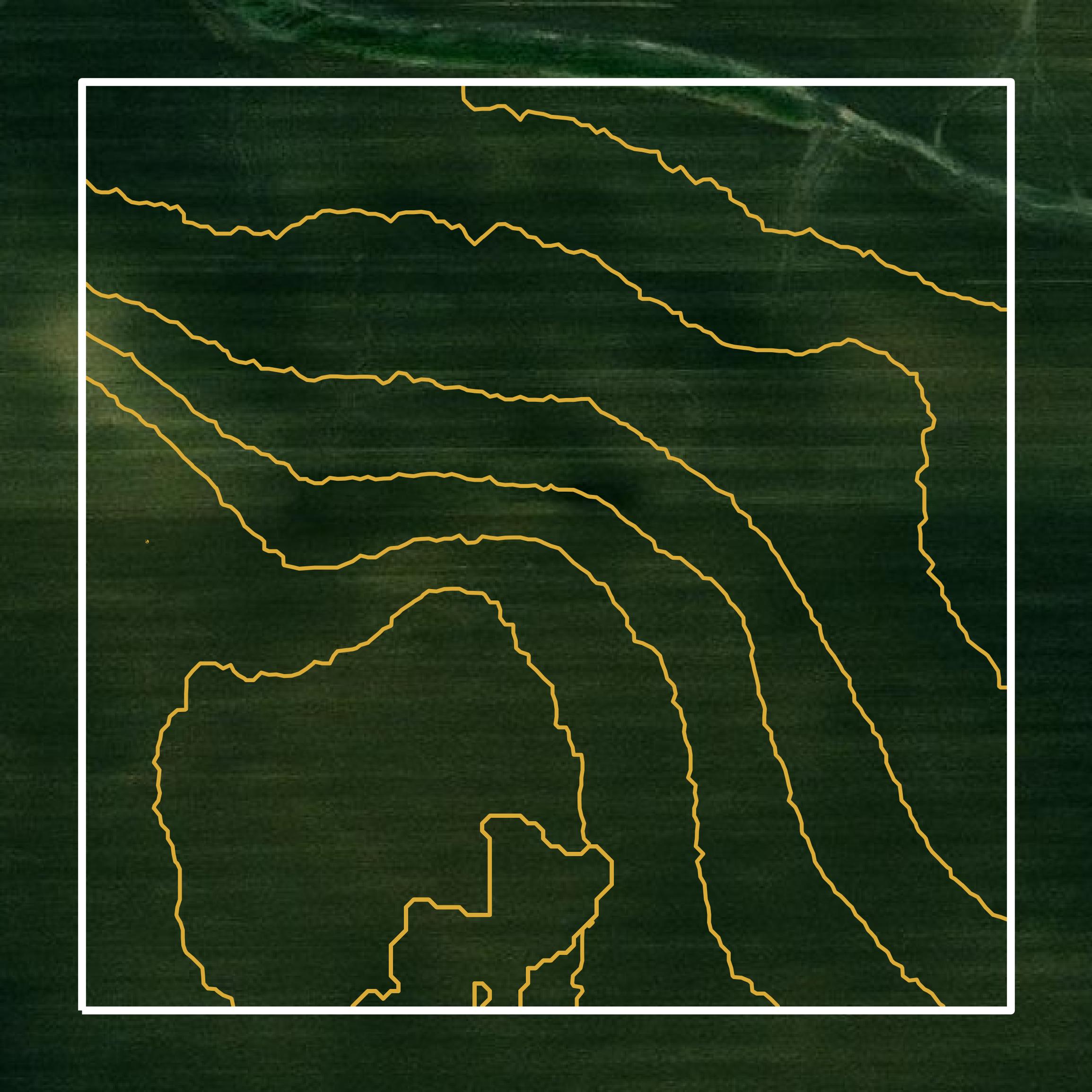
Contours
Contours in Cottonwood County visualize 3D elevations on a 2D surface allowing you to better understand your site.