Overview
Clay County GIS Data - For CAD
Equator helps civil engineering, architecture and consulting firms with the tools to instantly find, process and download accurate LiDAR, contours, parcel data, building footprints, DEMs, point clouds and other GIS data for Clay County in an online web mapping portal.
Clay County GIS Data ->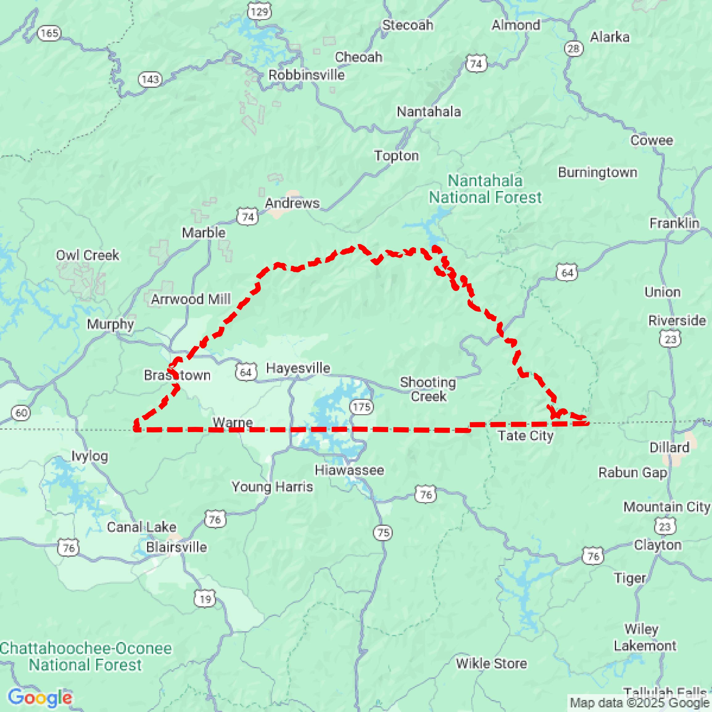

Data Available
Download GIS Data for Clay County
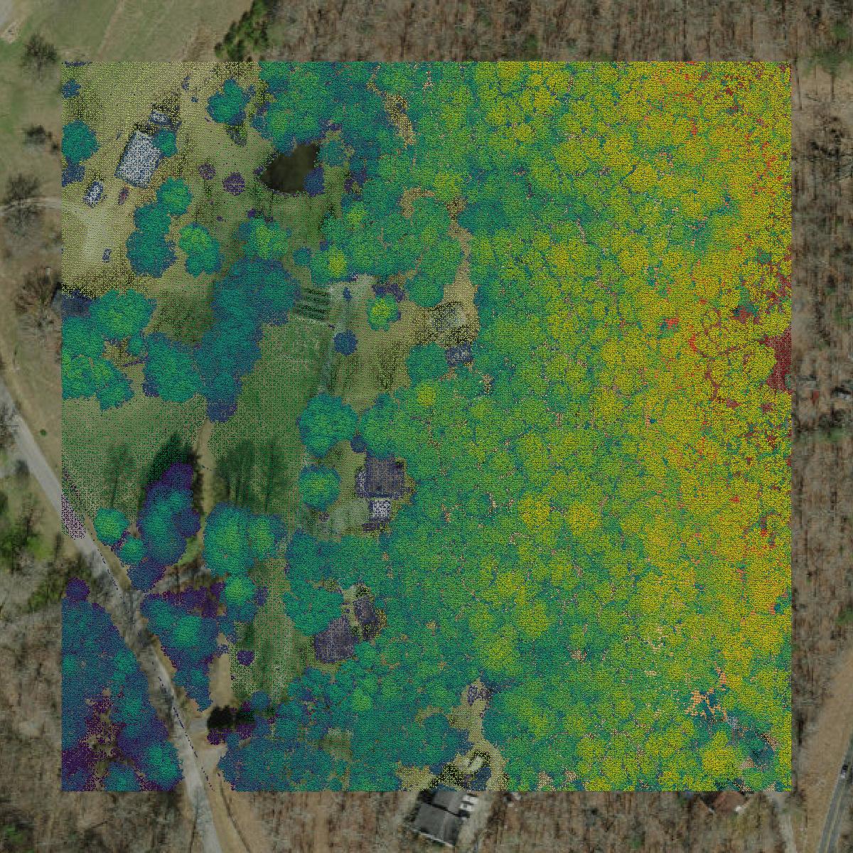
Parcels and Buildings
This image shows parcel and building data in Clay County created using GIS data in Equator.
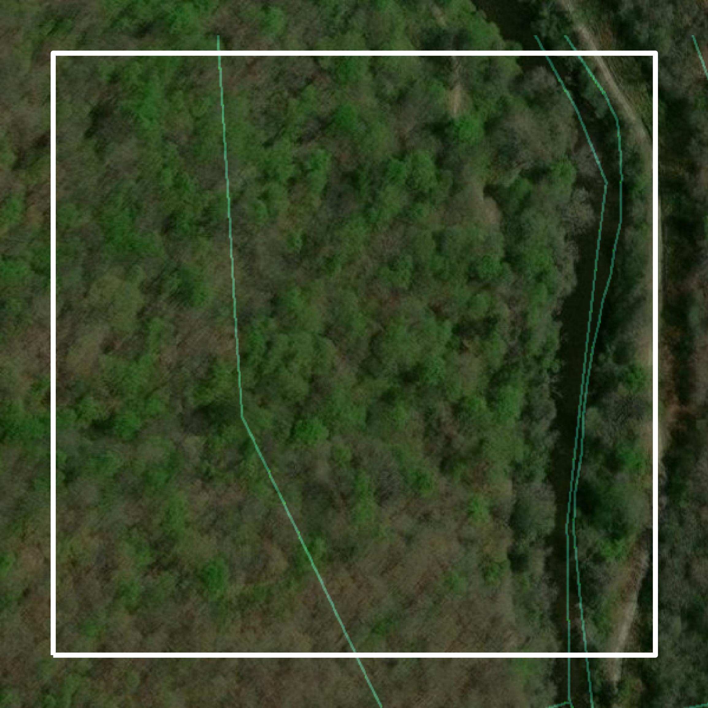
LiDAR
This image shows a LiDAR point cloud in Clay County created using GIS data in Equator.
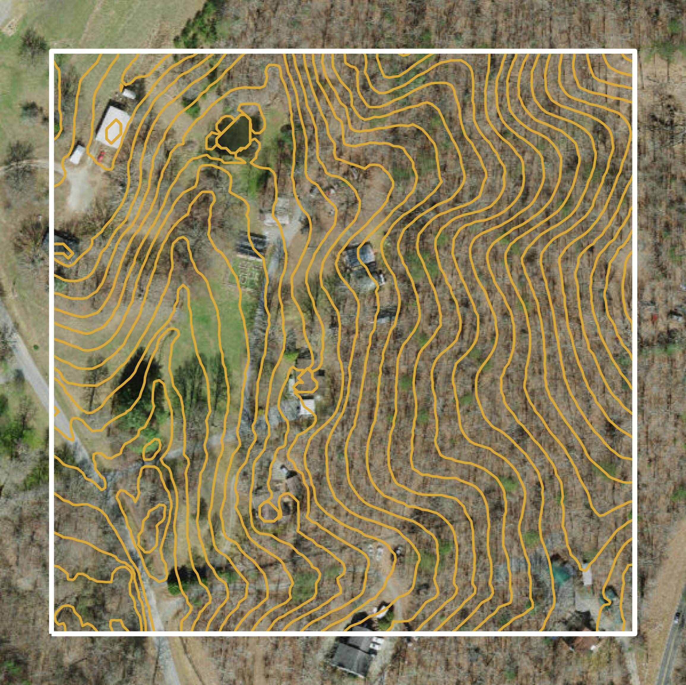
Contours
This image shows a contour map in Clay County created using GIS data in Equator.
Formats Available
Export Your Data Ready to Use in Multiple Formats
DWG
AutoCAD Drawing - Industry-standard CAD format
Supported Data:
Contour, Parcel, Building Outline
SHP
Shapefile - Standard GIS vector format
Supported Data:
Contour, Parcel, Building Outline
DXF
Drawing Exchange Format - Universal CAD interchange
Supported Data:
Contour, Building Outline
GeoJSON
Geographic JSON - Web-friendly spatial data format
Supported Data:
Contour, Parcel, Building Outline
LAZ
Compressed LAS - Efficient LiDAR point cloud format
Supported Data:
Point Cloud
SVG
Scalable Vector Graphics - Web vector format
Supported Data:
Contour, Building Outline
GPKG
GeoPackage - Modern OGC spatial database format
Supported Data:
Contour, Parcel, Building Outline
LandXML (Coming Soon)
Land XML - Civil engineering data exchange format
Supported Data:
Point Cloud
TIN (Coming Soon)
Triangulated Irregular Network - 3D surface model
Supported Data:
Point Cloud
XYZ (Coming Soon)
XYZ Point Cloud - Simple ASCII point cloud format
Supported Data:
Point Cloud
Background
GIS Data for Clay County
The GIS Mapping page for Clay County, North Carolina, provides access to various geographic information system (GIS) datasets and mapping resources. It includes parcel data, which is essential for property assessment and inventory, as well as zoning information and aerial imagery. The site emphasizes the importance of verifying GIS data against primary sources, as it may contain inaccuracies due to variations in scale and collection methods. Users are advised to consult original public records for confirmation of the data presented. The GIS data is projected using the North Carolina State Plane system, with measurements in feet.
Access Clay County GIS Data in Equator →Clay County Portal →Showcase
Sample GIS Data for Clay County
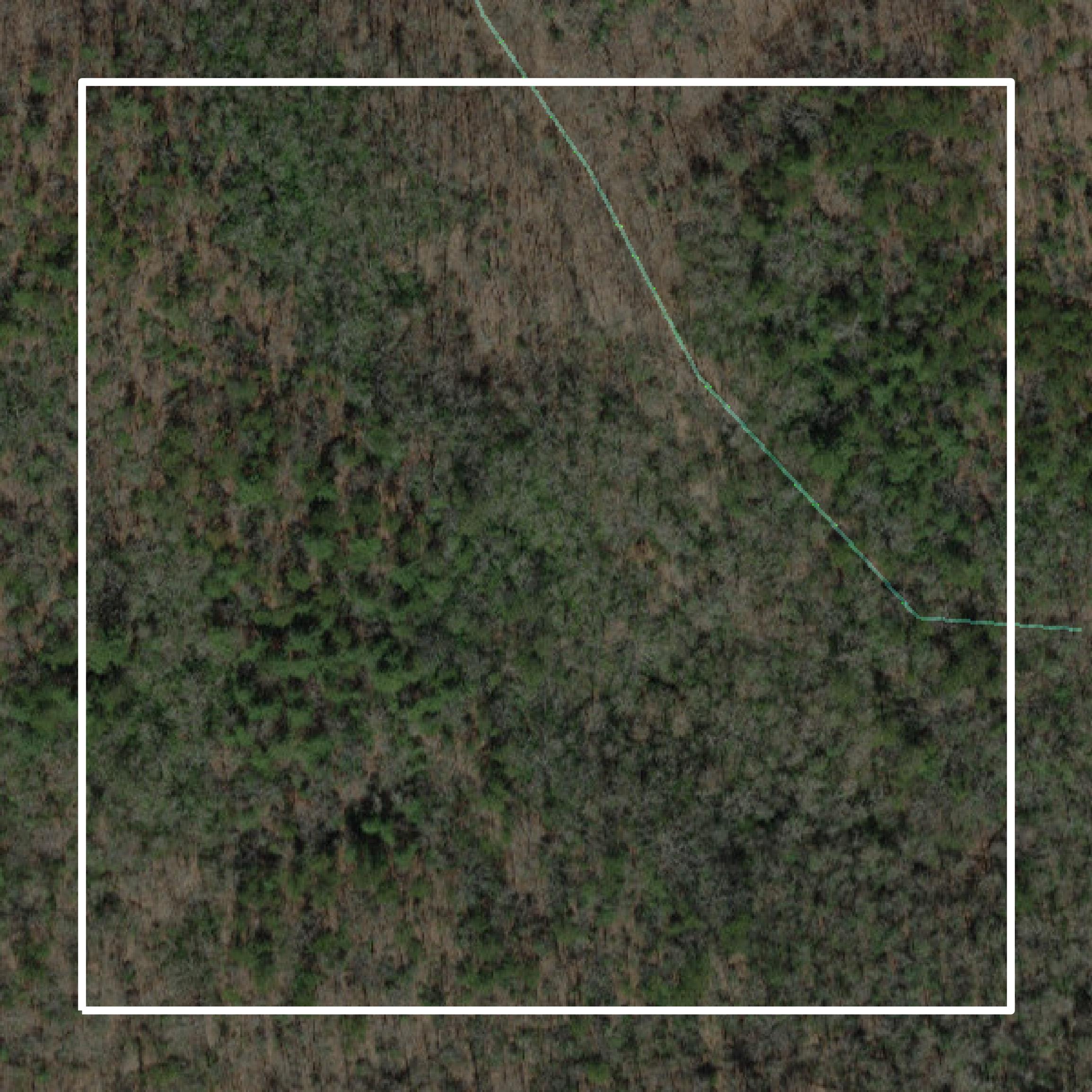
Parcels and Buildings
Parcel and building data in Clay County are used in a variety of fields including architecture, real estate, and urban planning.
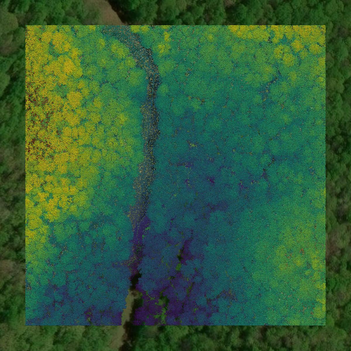
LiDAR
Point clouds (LiDAR) in Clay County can produce highly accurate 3D models of terrain, structures, and vegetation.
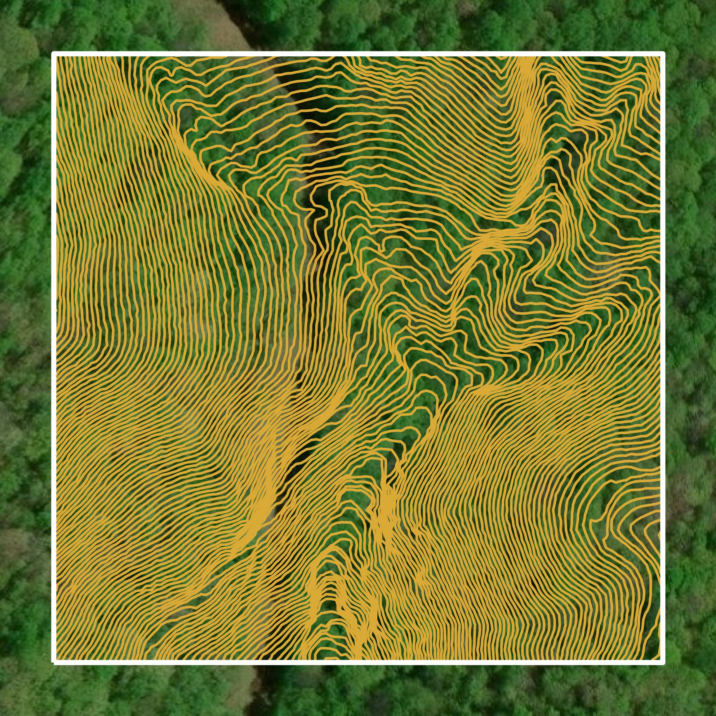
Contours
Contours in Clay County visualize 3D elevations on a 2D surface allowing you to better understand your site.