Overview
Mecklenburg County GIS Data – For CAD
Equator helps civil engineering, architecture and consulting firms with the tools to instantly find, process and download accurate LiDAR, contours, parcel data, building footprints, DEMs, point clouds and other GIS data for Mecklenburg County in an online web mapping portal.
Mecklenburg County GIS Data →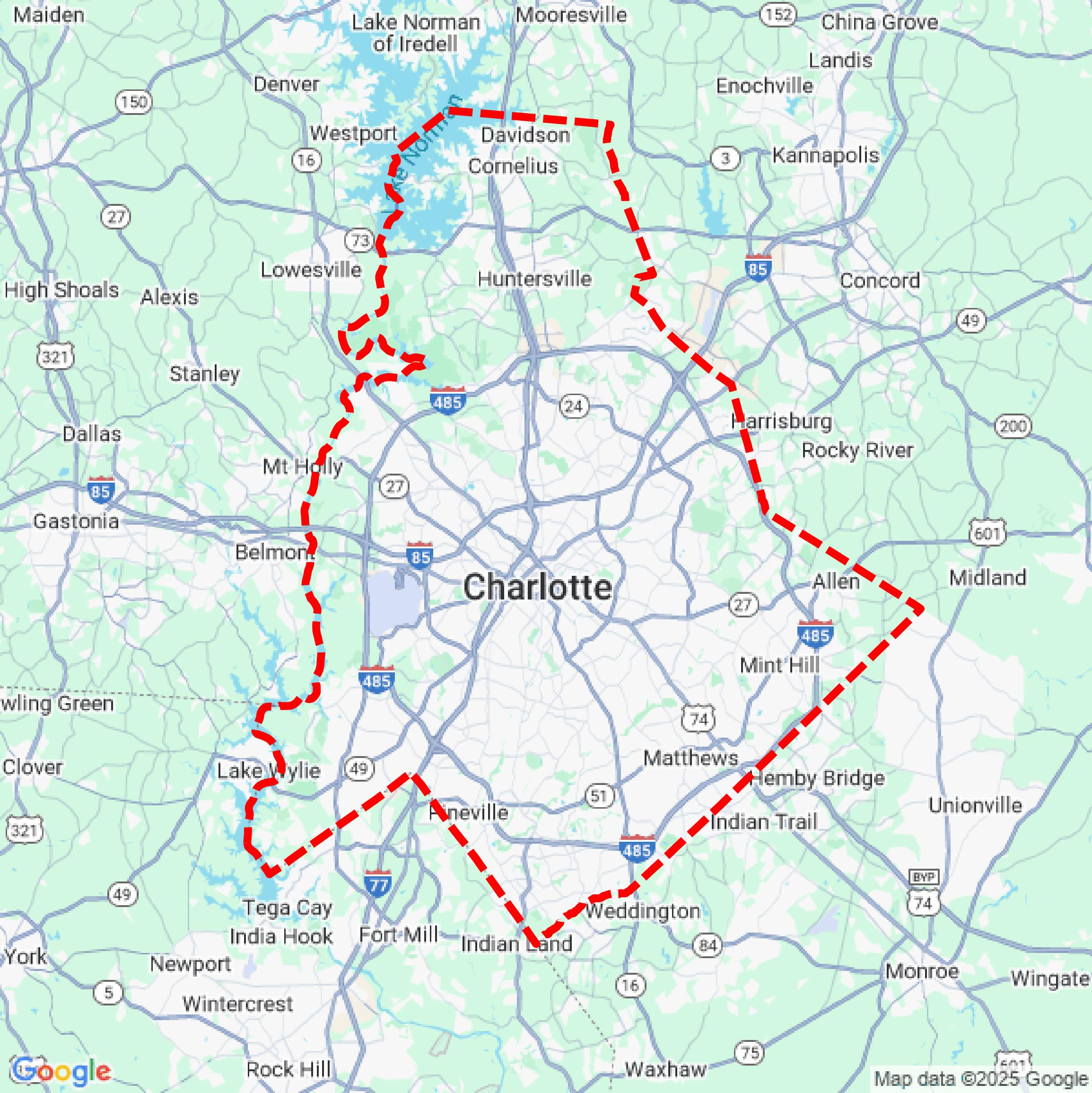

Data Available
Download GIS Data for Mecklenburg County
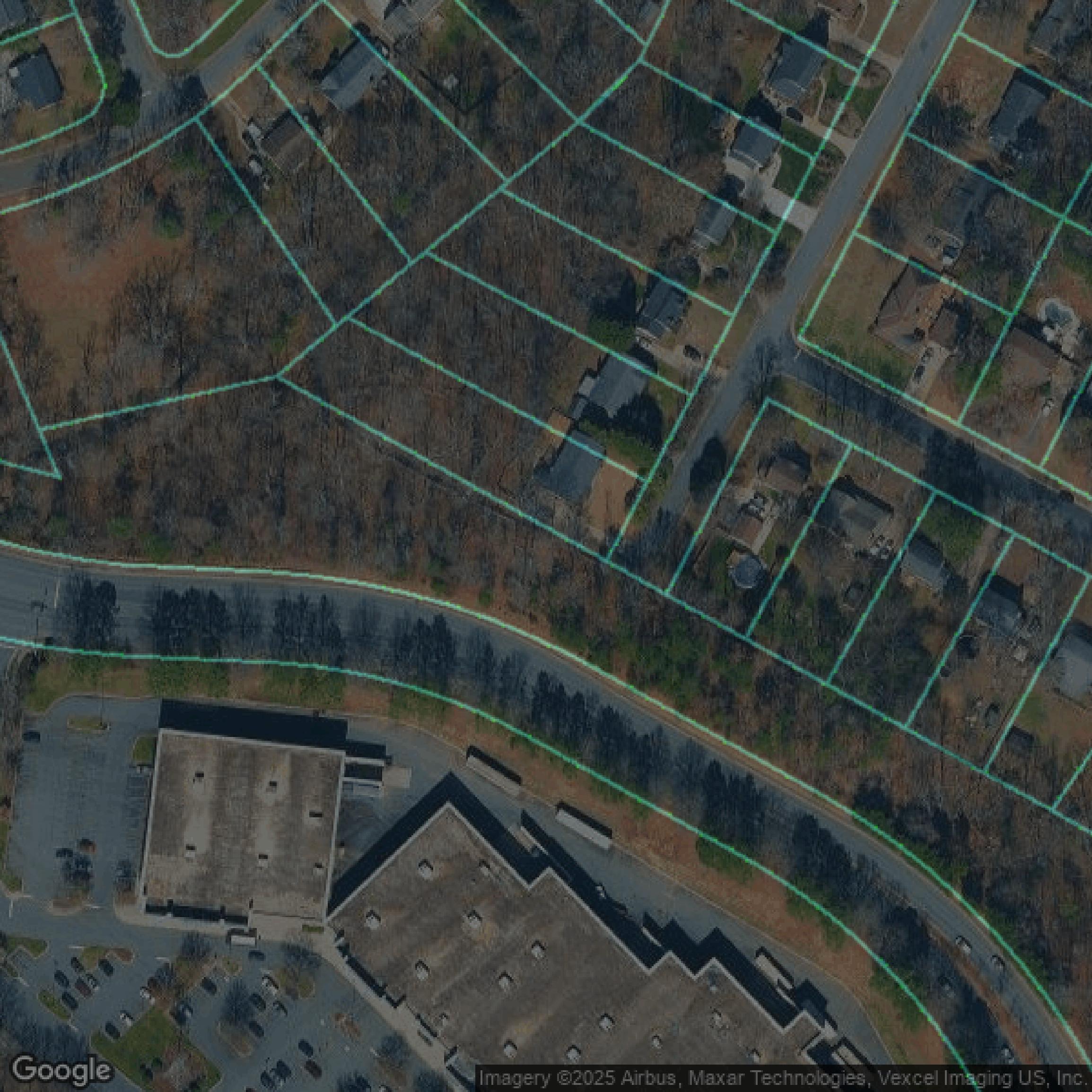
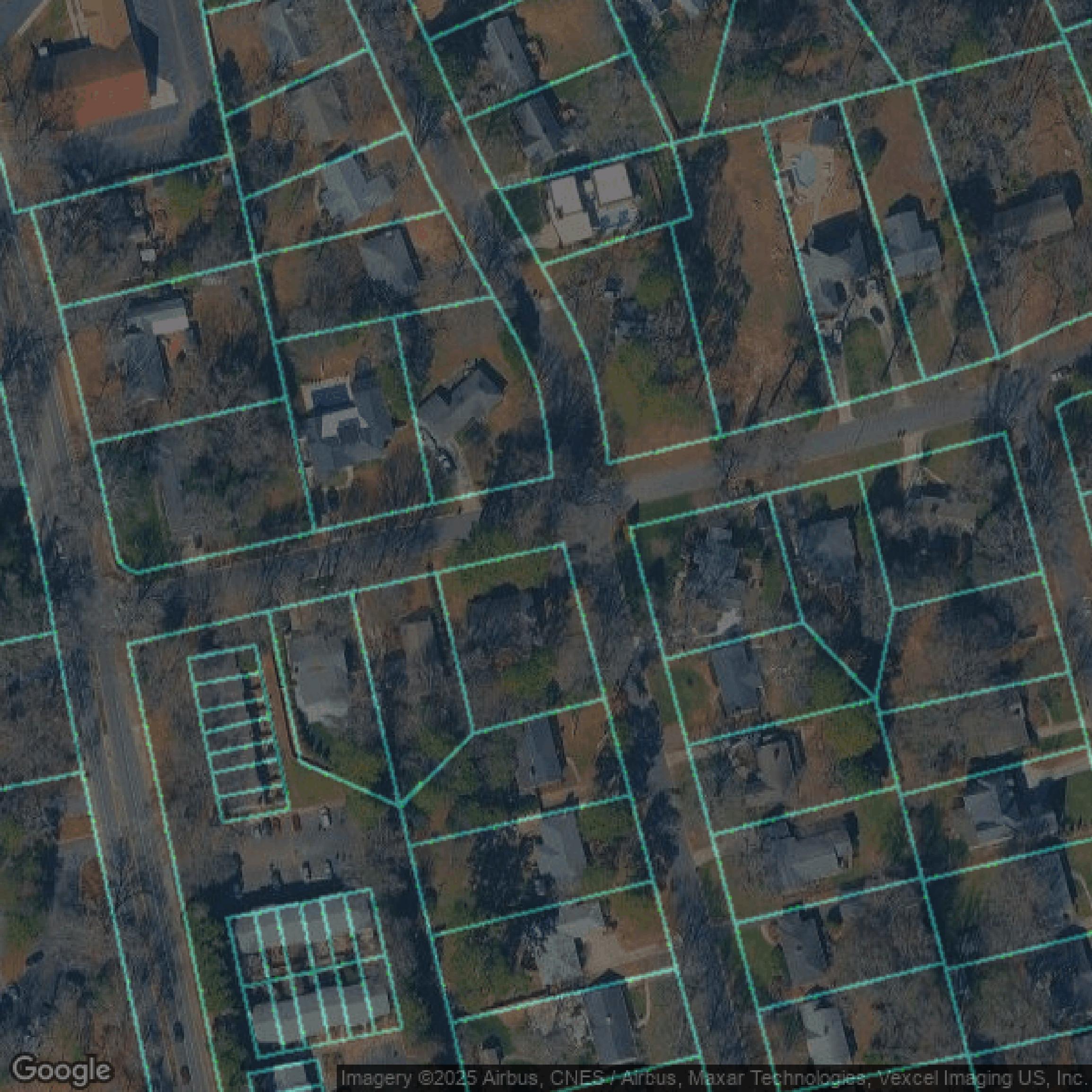
Parcels and Buildings
This image shows parcel and building data in Mecklenburg County created using GIS data in Equator.
Get Parcels and Buildings for Mecklenburg County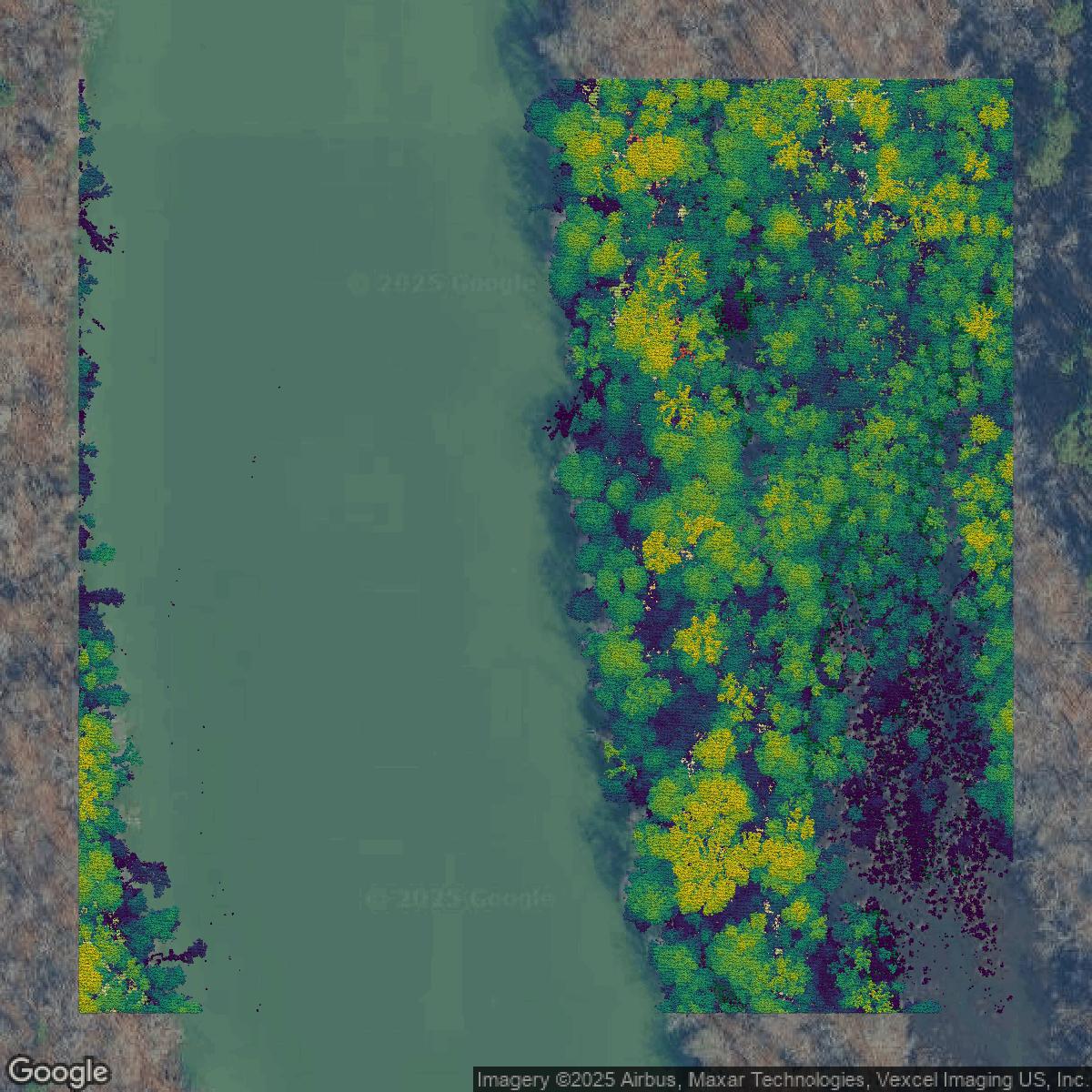
LiDAR
This image shows a LiDAR point cloud in Mecklenburg County created using GIS data in Equator.
Get LiDAR for Mecklenburg County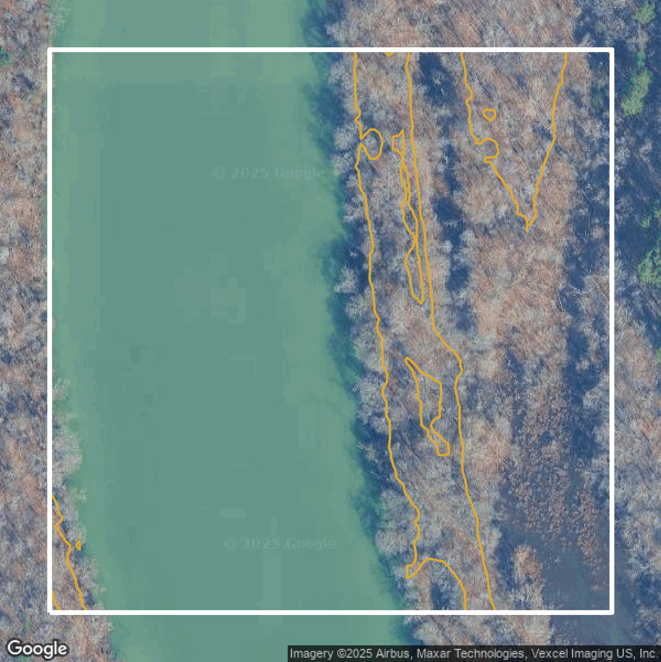
Contours
This image shows a contour map in Mecklenburg County created using GIS data in Equator.
Get Contours for Mecklenburg CountyFormats Available
Export Your Data Ready to Use in Multiple Formats
DWG
AutoCAD Drawing - Industry-standard CAD format
Supported Data:
Contour, Parcel, Building Outline
SHP
Shapefile - Standard GIS vector format
Supported Data:
Contour, Parcel, Building Outline
DXF
Drawing Exchange Format - Universal CAD interchange
Supported Data:
Contour, Building Outline
GeoJSON
Geographic JSON - Web-friendly spatial data format
Supported Data:
Contour, Parcel, Building Outline
LAZ
Compressed LAS - Efficient LiDAR point cloud format
Supported Data:
Point Cloud
SVG
Scalable Vector Graphics - Web vector format
Supported Data:
Contour, Building Outline
GPKG (Coming Soon)
GeoPackage - Modern OGC spatial database format
Supported Data:
Contour, Parcel, Building Outline
LandXML (Coming Soon)
Land XML - Civil engineering data exchange format
Supported Data:
Point Cloud
TIN (Coming Soon)
Triangulated Irregular Network - 3D surface model
Supported Data:
Point Cloud
XYZ (Coming Soon)
XYZ Point Cloud - Simple ASCII point cloud format
Supported Data:
Point Cloud
Background
GIS Data for Mecklenburg County
The Mecklenburg County GIS Data Center offers an extensive range of geospatial data and tools designed to enhance transparency, public participation, and collaboration. Visitors can expect to find downloadable datasets through the Open Mapping site, including detailed GIS data sets—though aerial imagery and LIDAR require a Data Request Form due to large file sizes. The site features the "GIS Apps Gallery," a curated collection of web and mobile-friendly GIS applications tailored for residents and businesses. Additionally, users can access the "Integrated Data Store (IDS)" comprising regularly updated databases from various administrative systems for comprehensive snapshots of county activity. The Data Center emphasizes open data principles, providing datasets in open, non-proprietary formats with rights to access, redistribute, modify, and create derivative works, fostering innovation within the community. Users are encouraged to verify data accuracy by consulting primary sources, and the County supports data requests and inquiries through dedicated staff contact.
Access Mecklenburg County GIS Data in Equator →Mecklenburg County Portal →Showcase
Sample GIS Data for Mecklenburg County
Parcels and Buildings
Parcel and building data in Mecklenburg County are used in a variety of fields including architecture, real estate, and urban planning.
Get Parcels and Buildings for Mecklenburg County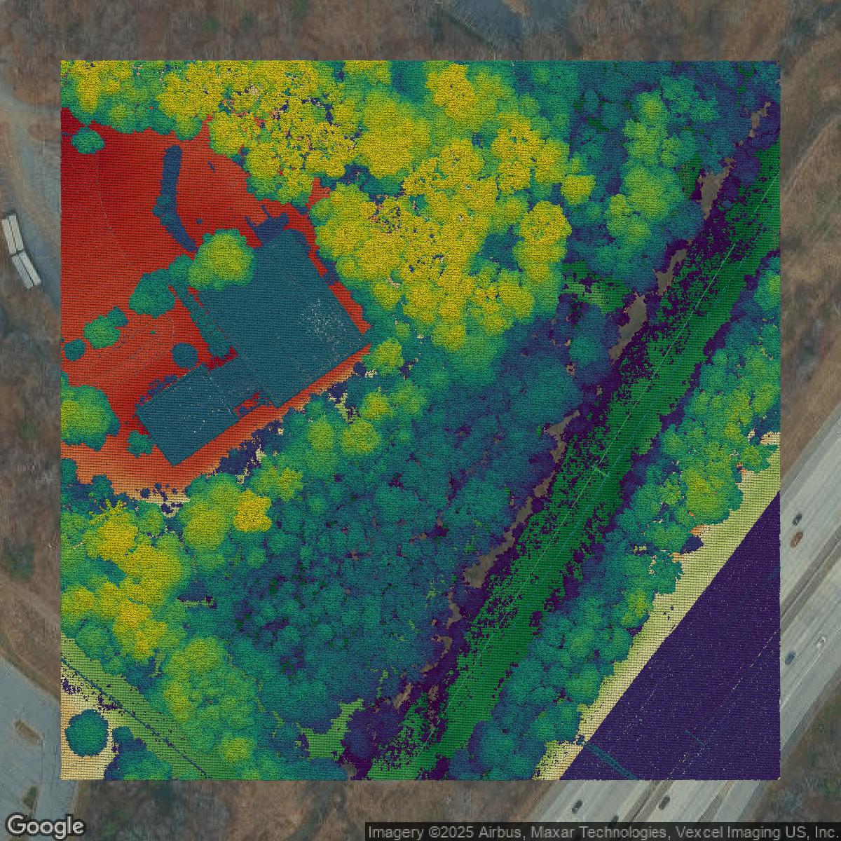
LiDAR
Point clouds (LiDAR) in Mecklenburg County can produce highly accurate 3D models of terrain, structures, and vegetation.
Get LiDAR for Mecklenburg County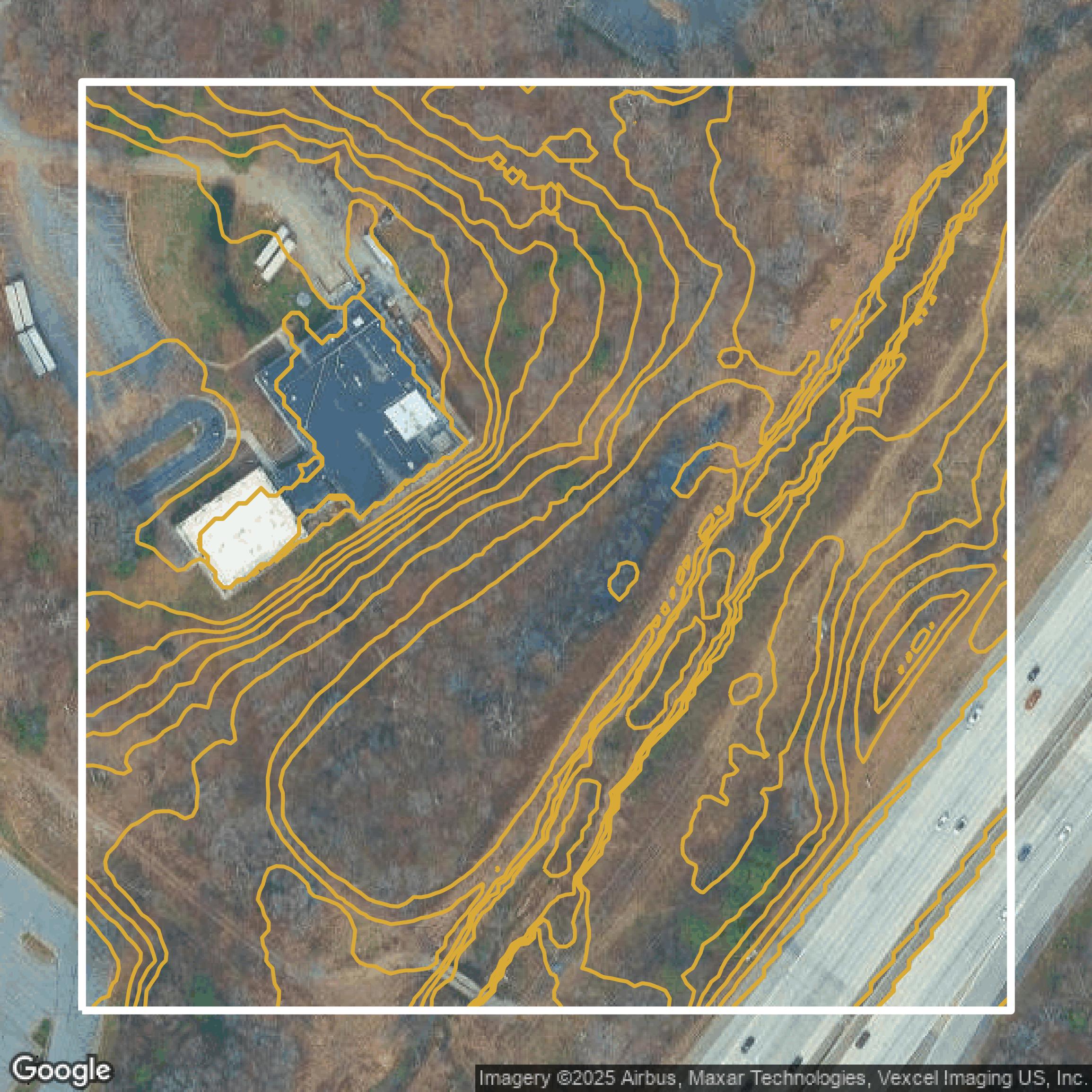
Contours
Contours in Mecklenburg County visualize 3D elevations on a 2D surface allowing you to better understand your site.
Get Contours for Mecklenburg County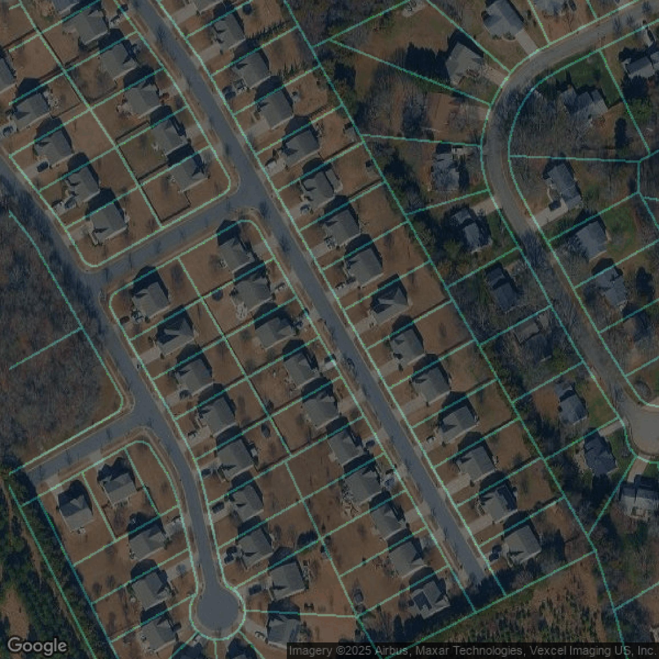
Parcels and Buildings
Accessing Mecklenburg County parcel and building data on Equator gives you access to coverage across the US.
Get Parcels and Buildings for Mecklenburg County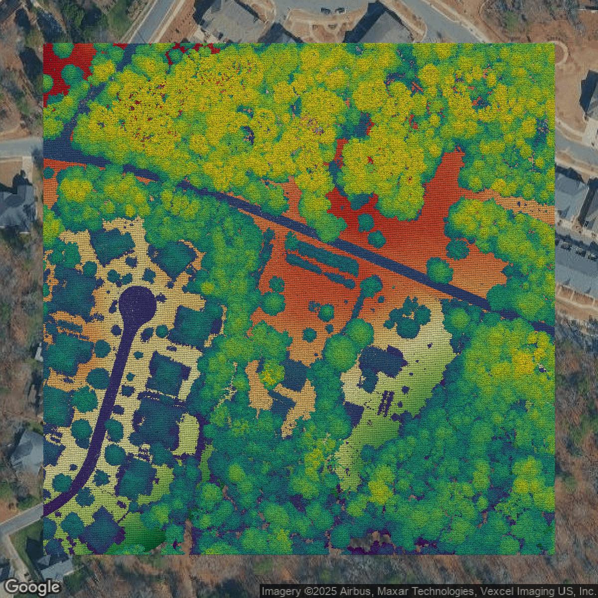
LiDAR
Mecklenburg County LiDAR uses include land surveying, analyzing crop health, or even archaeological studies.
Get LiDAR for Mecklenburg County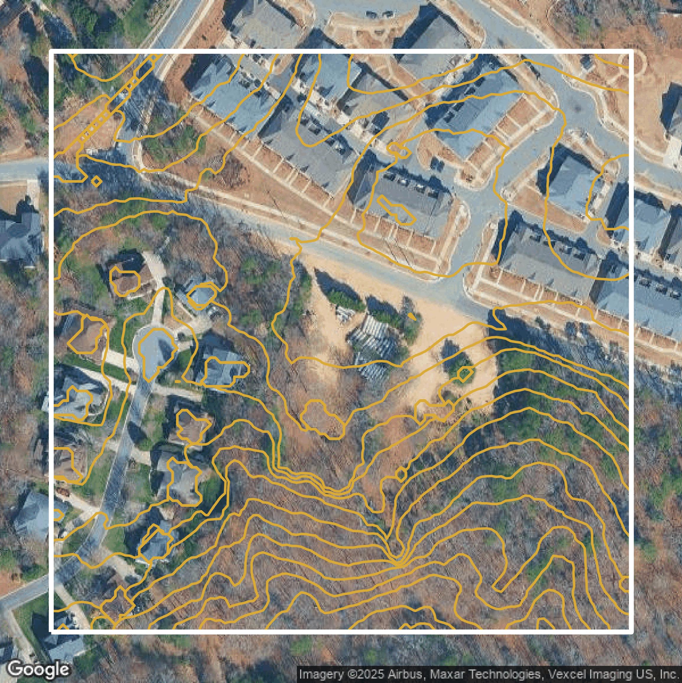
Contours
Mecklenburg County contours can be used for construction & engineering, environmental science, and more.
Get Contours for Mecklenburg County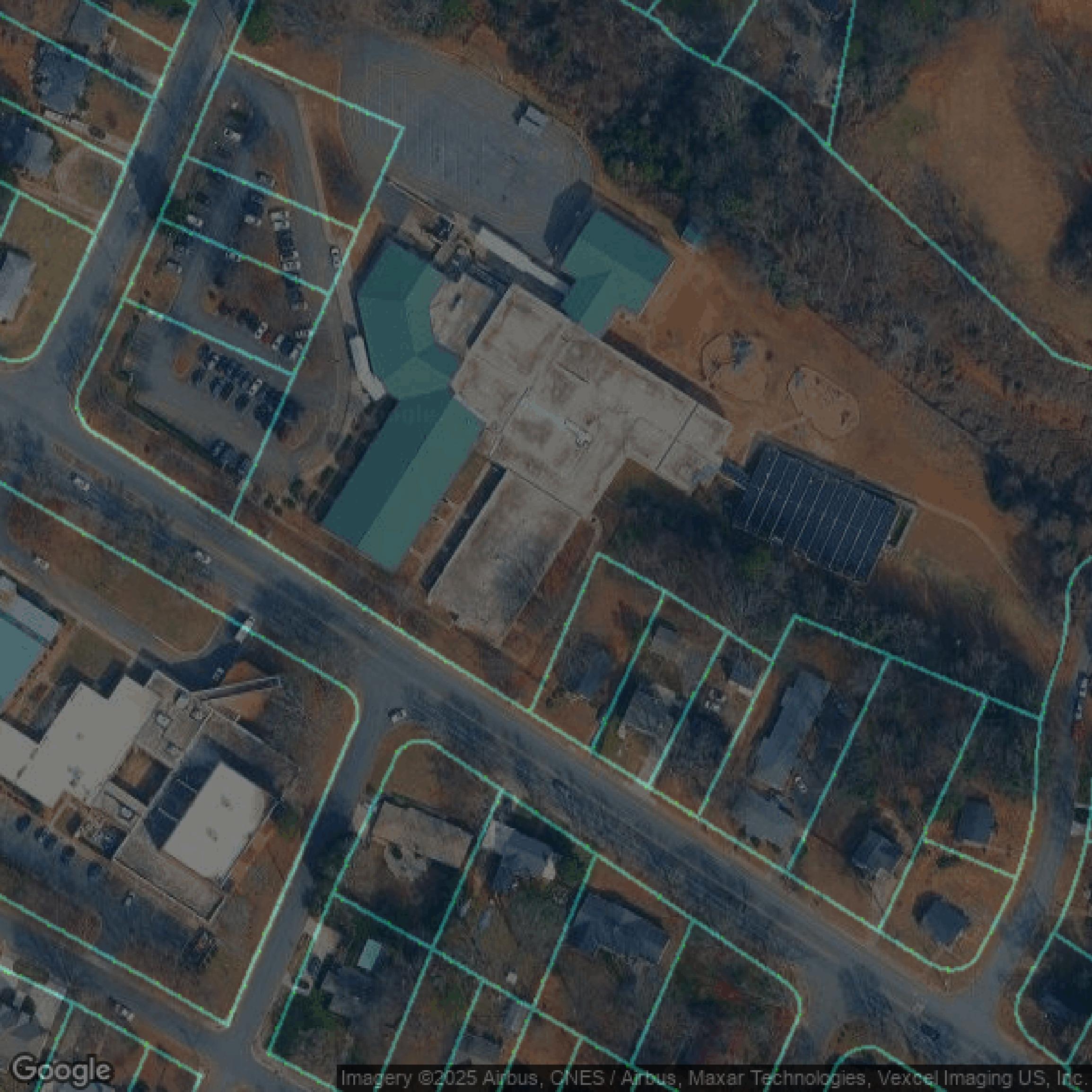
Parcels and Buildings
Dozens of fields are contained within each Mecklenburg County parcel and building data, including zoning, owners, and year built.
Get Parcels and Buildings for Mecklenburg County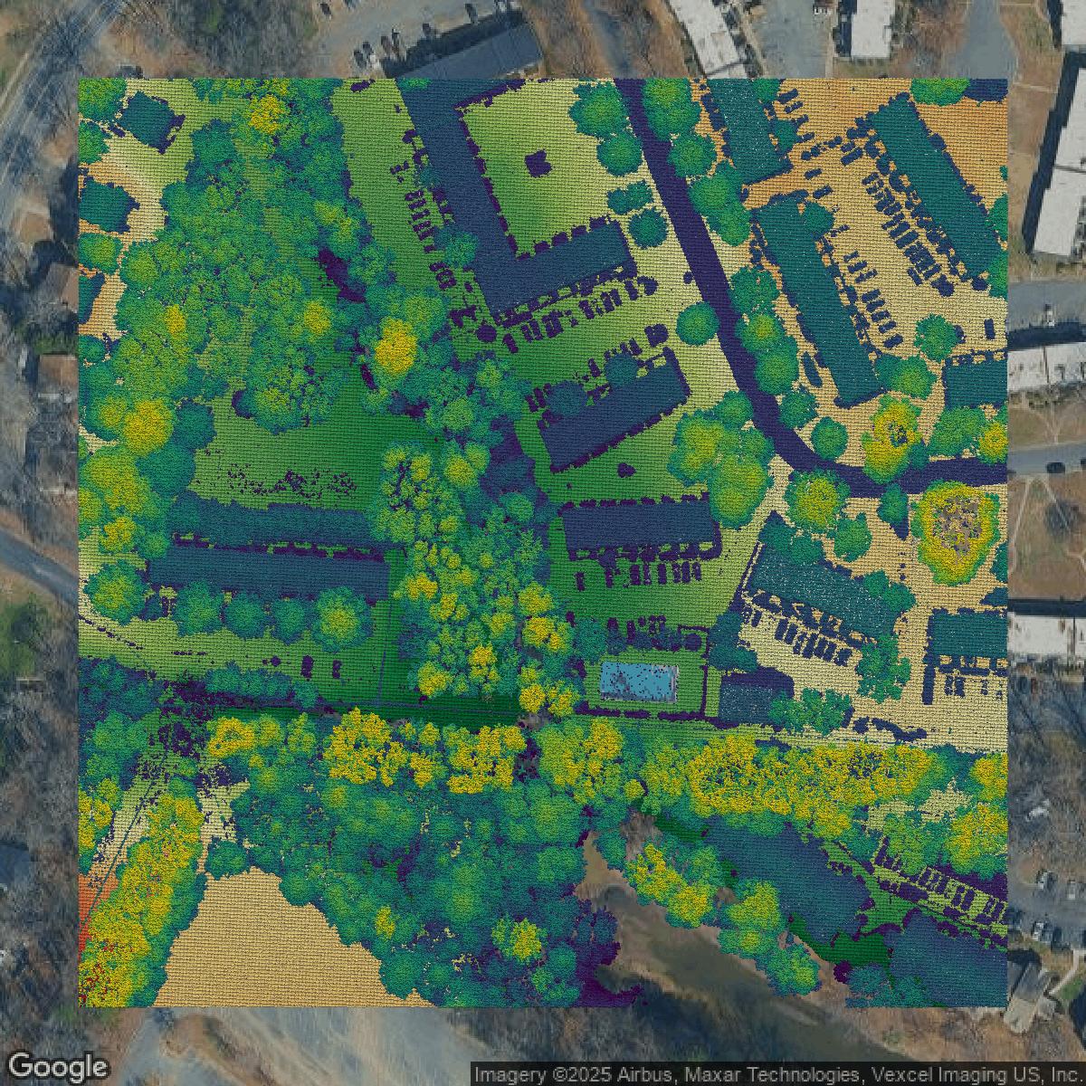
LiDAR
Equator turns Mecklenburg County LiDAR point clouds into various lidar-derived data sets, including DEMs.
Get LiDAR for Mecklenburg County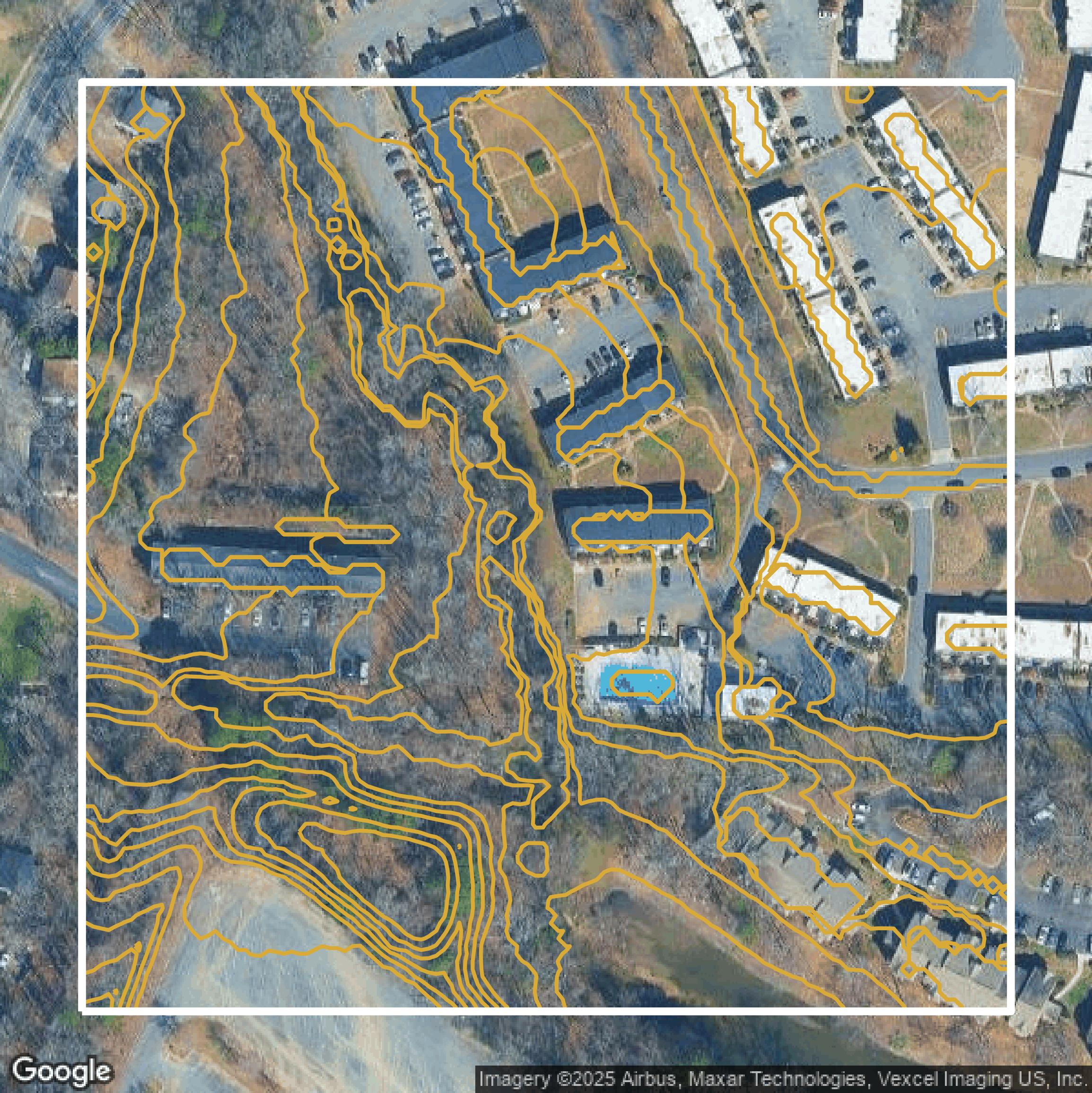
Contours
Mecklenburg County contours on Equator are produced from LiDAR coverage, allowing for high precision
Get Contours for Mecklenburg County