Overview
Wake County GIS Data – For CAD
Equator helps civil engineering, architecture and consulting firms with the tools to instantly find, process and download accurate LiDAR, contours, parcel data, building footprints, DEMs, point clouds and other GIS data for Wake County in an online web mapping portal.
Wake County GIS Data →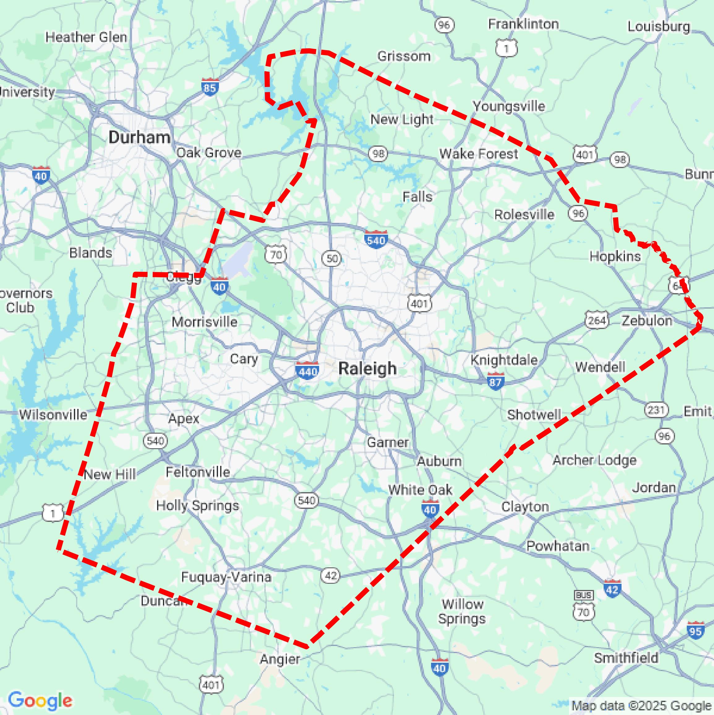

Data Available
Download GIS Data for Wake County
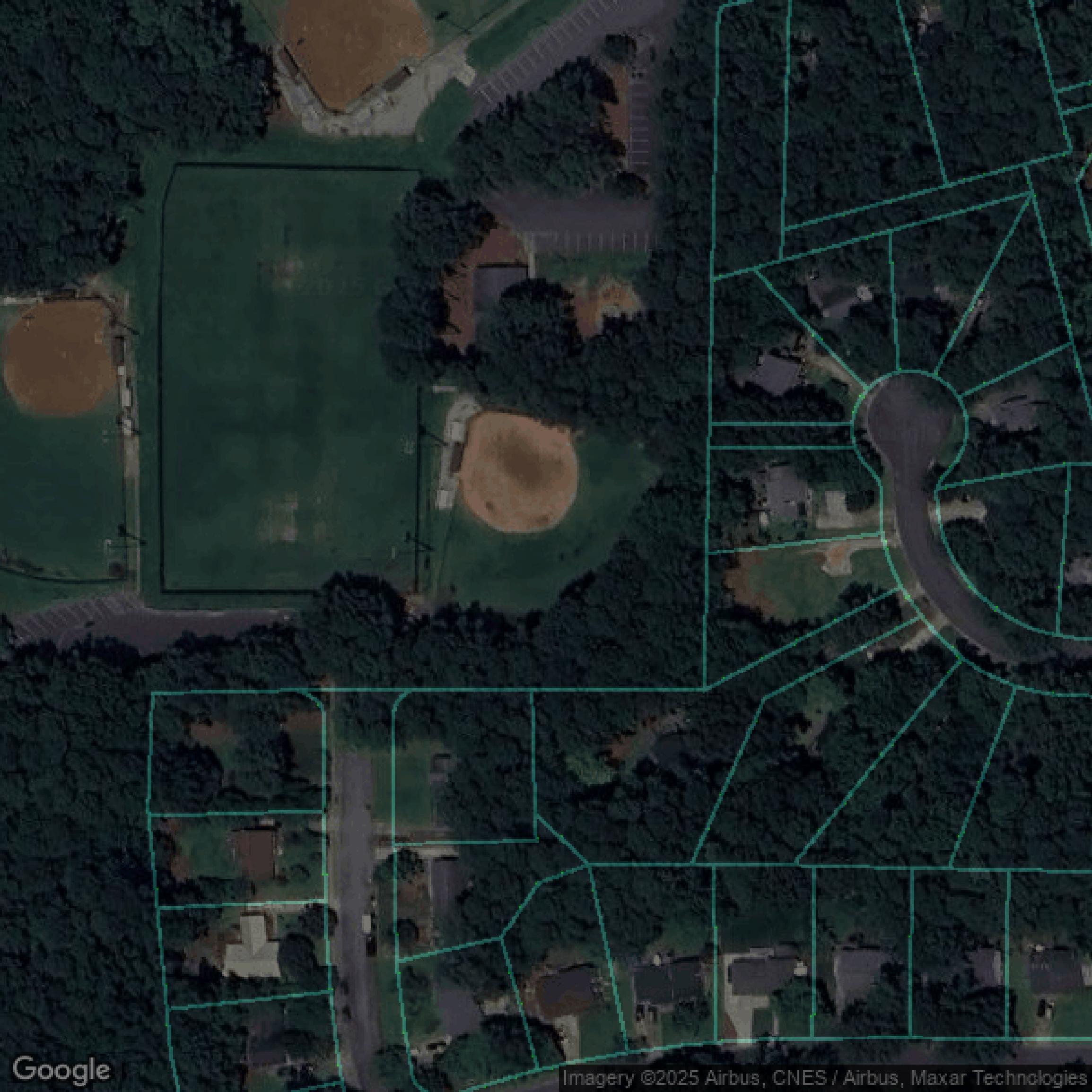
Parcels and Buildings
This image shows parcel and building data in Wake County created using GIS data in Equator.
Get Parcels and Buildings for Wake CountyLiDAR
This image shows a LiDAR point cloud in Wake County created using GIS data in Equator.
Get LiDAR for Wake CountyContours
This image shows a contour map in Wake County created using GIS data in Equator.
Get Contours for Wake CountyFormats Available
Export Your Data Ready to Use in Multiple Formats
DWG
AutoCAD Drawing - Industry-standard CAD format
Supported Data:
Contour, Parcel, Building Outline
SHP
Shapefile - Standard GIS vector format
Supported Data:
Contour, Parcel, Building Outline
DXF
Drawing Exchange Format - Universal CAD interchange
Supported Data:
Contour, Building Outline
GeoJSON
Geographic JSON - Web-friendly spatial data format
Supported Data:
Contour, Parcel, Building Outline
LAZ
Compressed LAS - Efficient LiDAR point cloud format
Supported Data:
Point Cloud
SVG
Scalable Vector Graphics - Web vector format
Supported Data:
Contour, Building Outline
GPKG (Coming Soon)
GeoPackage - Modern OGC spatial database format
Supported Data:
Contour, Parcel, Building Outline
LandXML (Coming Soon)
Land XML - Civil engineering data exchange format
Supported Data:
Point Cloud
TIN (Coming Soon)
Triangulated Irregular Network - 3D surface model
Supported Data:
Point Cloud
XYZ (Coming Soon)
XYZ Point Cloud - Simple ASCII point cloud format
Supported Data:
Point Cloud
Background
GIS Data for Wake County
The Wake County "Maps, Apps & Data" website offers a comprehensive suite of geographic information services featuring a wide range of interactive mapping tools and data resources. Visitors can explore the "iMAPS" online mapping application, designed for viewing property and geographic data, along with helpful "iMAPS Help" documentation. The site provides direct access to the "Open Data Site" and "Open Data Catalog," where users can download diverse datasets previously found on the Download Data page. Specialized apps such as the "Park Locator App," "Solid Waste Recycle & Disposal Drop Off Locator App," and the "Electoral Districts Locator App" facilitate easy location-based searches. Additional resources include detailed "Zoning Maps," "Voting Precinct & District Maps," "Septic Permits Results Map," "Water Quality Results Map," and unique tools like the "Mobile Tour of Parks & Preserves," "Recreational Waters Status Map," and the "Farmland Preservation Viewer App." For customized needs, users can access "Special Purpose and Custom Maps" plus a variety of "Assorted Maps" relating to environmental, agricultural, and community planning. This rich collection of data sets and mapping applications supports residents, businesses, and government agencies in planning, decision-making, and staying informed about local geographic and environmental conditions in Wake County.
Access Wake County GIS Data in Equator →Wake County Portal →Showcase
Sample GIS Data for Wake County
Parcels and Buildings
Parcel and building data in Wake County are used in a variety of fields including architecture, real estate, and urban planning.
Get Parcels and Buildings for Wake CountyLiDAR
Point clouds (LiDAR) in Wake County can produce highly accurate 3D models of terrain, structures, and vegetation.
Get LiDAR for Wake CountyContours
Contours in Wake County visualize 3D elevations on a 2D surface allowing you to better understand your site.
Get Contours for Wake CountyParcels and Buildings
Accessing Wake County parcel and building data on Equator gives you access to coverage across the US.
Get Parcels and Buildings for Wake CountyLiDAR
Wake County LiDAR uses include land surveying, analyzing crop health, or even archaeological studies.
Get LiDAR for Wake CountyContours
Wake County contours can be used for construction & engineering, environmental science, and more.
Get Contours for Wake CountyParcels and Buildings
Dozens of fields are contained within each Wake County parcel and building data, including zoning, owners, and year built.
Get Parcels and Buildings for Wake CountyLiDAR
Equator turns Wake County LiDAR point clouds into various lidar-derived data sets, including DEMs.
Get LiDAR for Wake CountyContours
Wake County contours on Equator are produced from LiDAR coverage, allowing for high precision
Get Contours for Wake County