Overview
Tulsa County GIS Data – For CAD
Equator helps civil engineering, architecture and consulting firms with the tools to instantly find, process and download accurate LiDAR, contours, parcel data, building footprints, DEMs, point clouds and other GIS data for Tulsa County in an online web mapping portal.
Tulsa County GIS Data →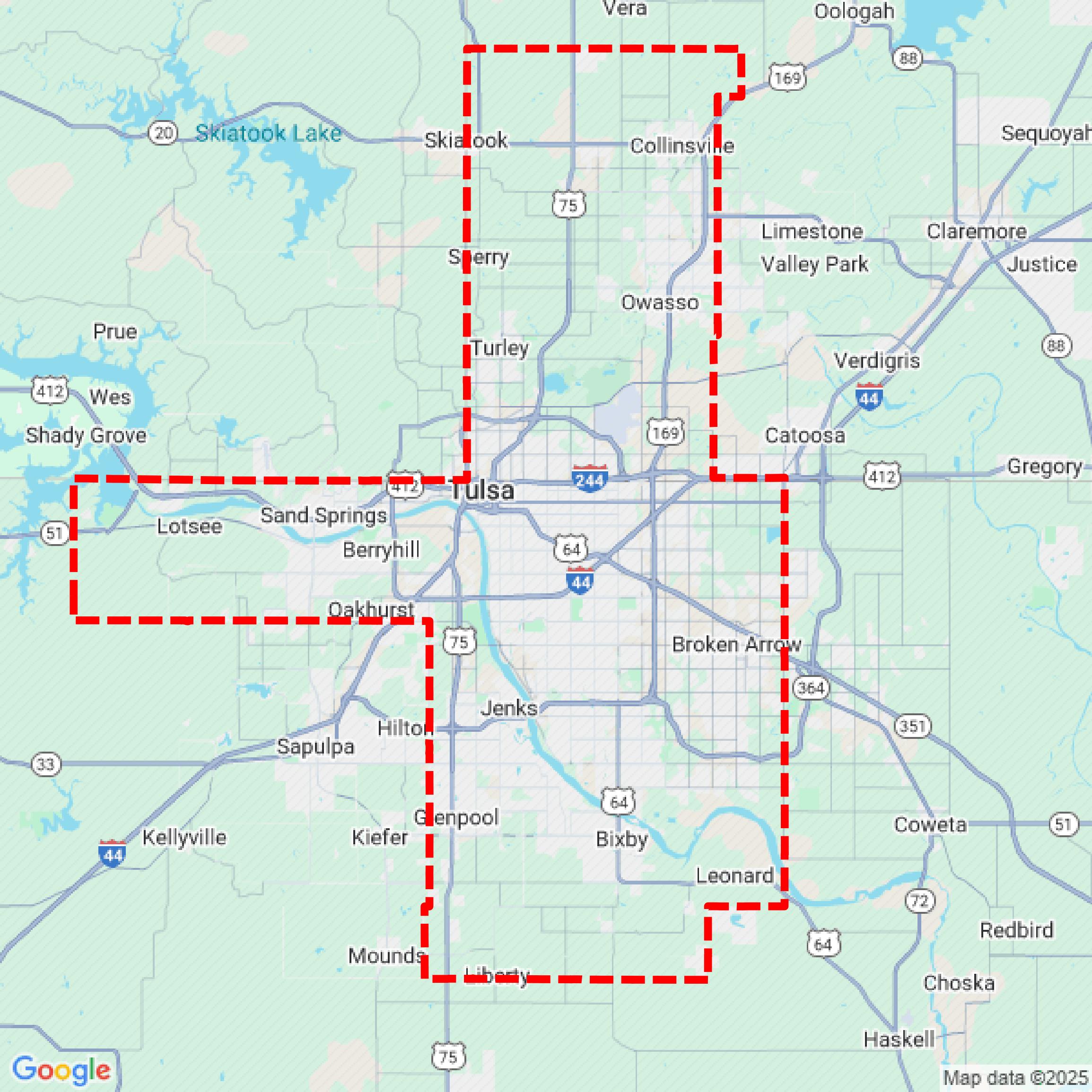

Data Available
Download GIS Data for Tulsa County
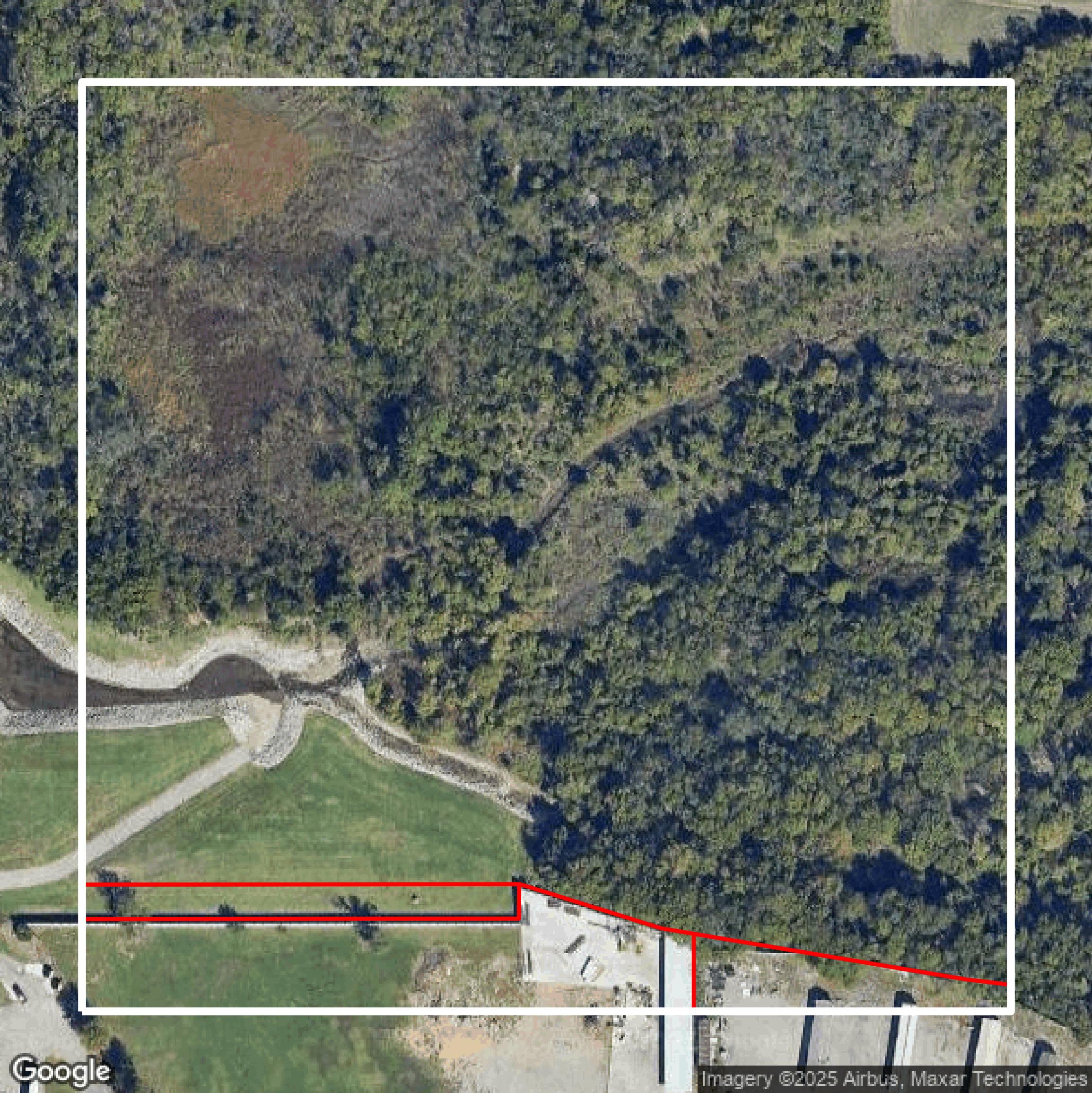
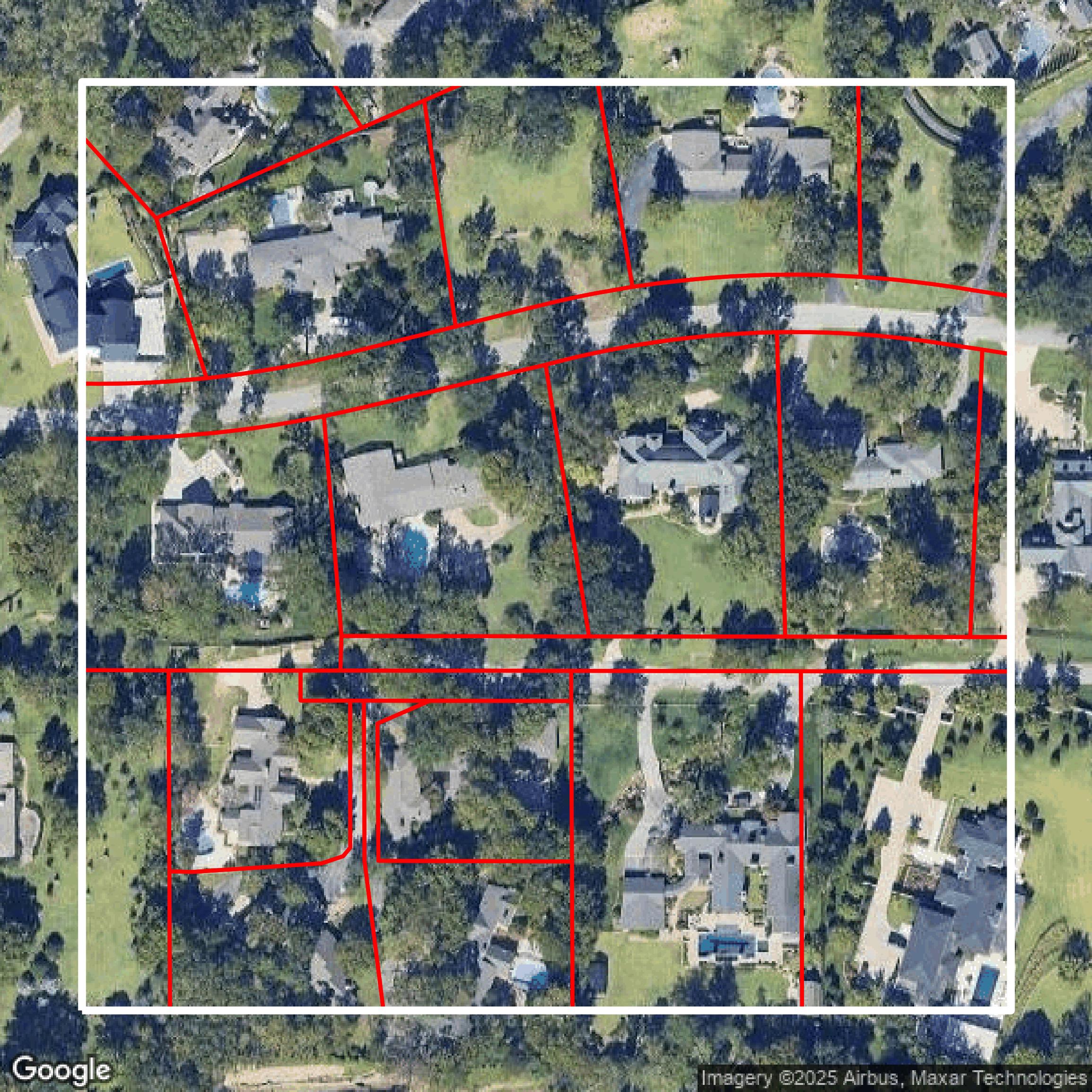
Parcels and Buildings
This image shows parcel and building data in Tulsa County created using GIS data in Equator.
Get Parcels and Buildings for Tulsa County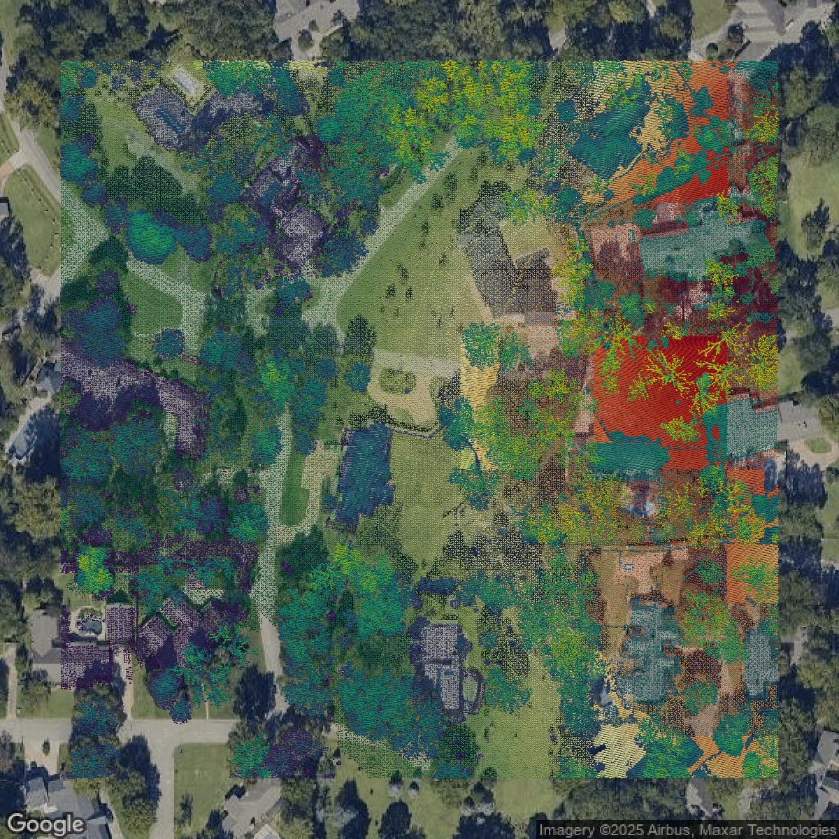
LiDAR
This image shows a LiDAR point cloud in Tulsa County created using GIS data in Equator.
Get LiDAR for Tulsa County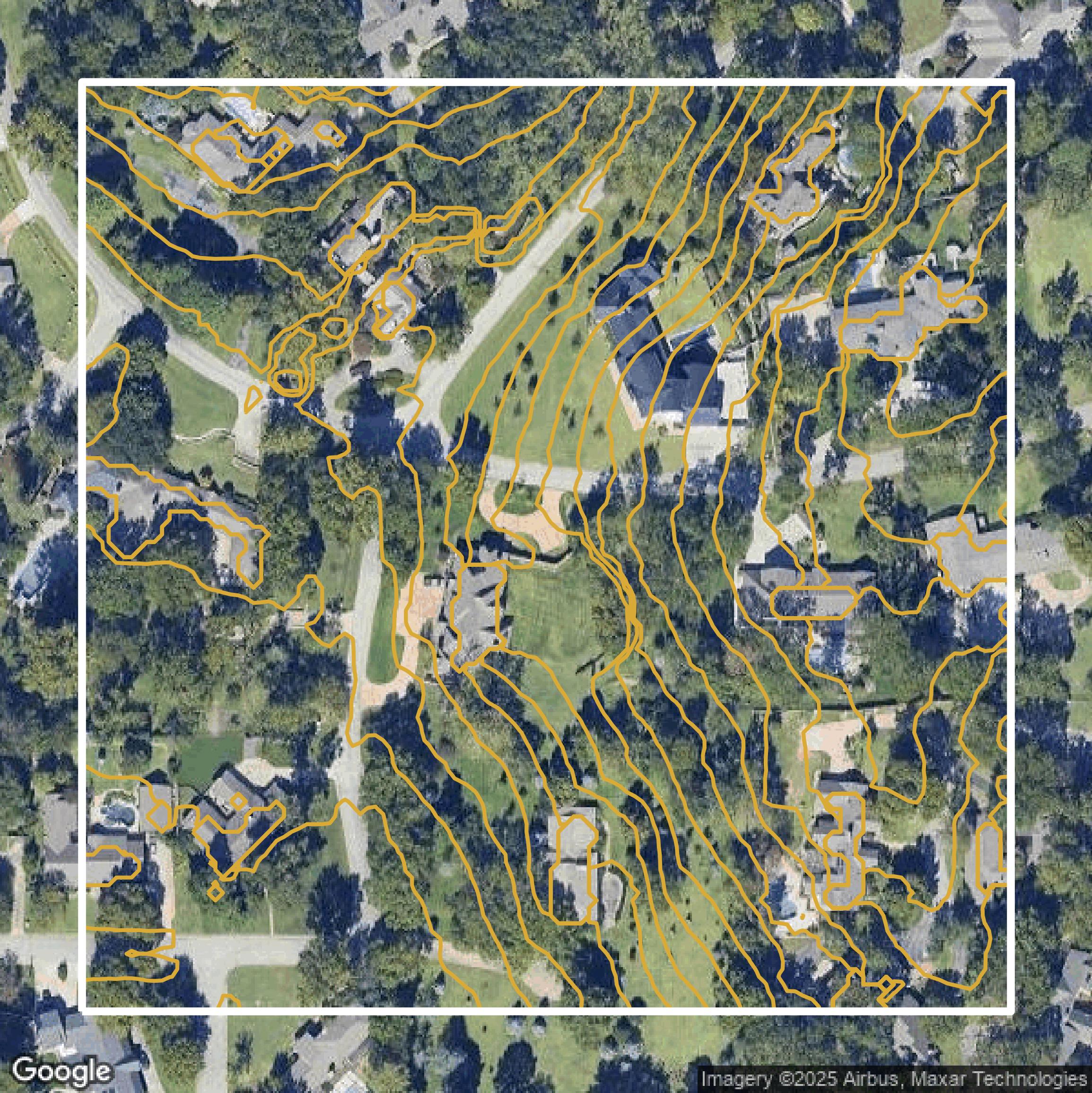
Contours
This image shows a contour map in Tulsa County created using GIS data in Equator.
Get Contours for Tulsa CountyFormats Available
Export Your Data Ready to Use in Multiple Formats
DWG
AutoCAD Drawing - Industry-standard CAD format
Supported Data:
Contour, Parcel, Building Outline
SHP
Shapefile - Standard GIS vector format
Supported Data:
Contour, Parcel, Building Outline
DXF
Drawing Exchange Format - Universal CAD interchange
Supported Data:
Contour, Building Outline
GeoJSON
Geographic JSON - Web-friendly spatial data format
Supported Data:
Contour, Parcel, Building Outline
LAZ
Compressed LAS - Efficient LiDAR point cloud format
Supported Data:
Point Cloud
SVG
Scalable Vector Graphics - Web vector format
Supported Data:
Contour, Building Outline
GPKG (Coming Soon)
GeoPackage - Modern OGC spatial database format
Supported Data:
Contour, Parcel, Building Outline
LandXML (Coming Soon)
Land XML - Civil engineering data exchange format
Supported Data:
Point Cloud
TIN (Coming Soon)
Triangulated Irregular Network - 3D surface model
Supported Data:
Point Cloud
XYZ (Coming Soon)
XYZ Point Cloud - Simple ASCII point cloud format
Supported Data:
Point Cloud
Background
GIS Data for Tulsa County
The Tulsa County Assessor website offers a comprehensive suite of data and tools designed to assist property owners and the public in navigating property assessment and taxation information. Visitors can utilize the **Property Search** tool to locate any of the 278,614 parcels in Tulsa County by address, owner name, subdivision, or account number, with helpful search commands and filters. The **Tax Calculator** helps estimate property taxes based on fair cash values. An **Interactive Map** and **Static Maps** provide visualization of parcel and property information. The site details various **Exemptions**, including **Homestead**, **Senior Freeze**, **Veterans**, and **Circuit Breaker**, with filing information and important dates. The **Personal Property** section covers Business and Farm Personal Property, Manufactured (Mobile) Homes, and Exempt Manufacturing. Additionally, the **Resources** area provides access to downloadable forms, public data, open records requests, a calendar of events, and an FAQ to support users. With clear guidance and a mission focused on integrity and fairness, this site is a valuable portal for accessing accurate property assessments and related county data.
Access Tulsa County GIS Data in Equator →Tulsa County Portal →Showcase
Sample GIS Data for Tulsa County
Parcels and Buildings
Parcel and building data in Tulsa County are used in a variety of fields including architecture, real estate, and urban planning.
Get Parcels and Buildings for Tulsa County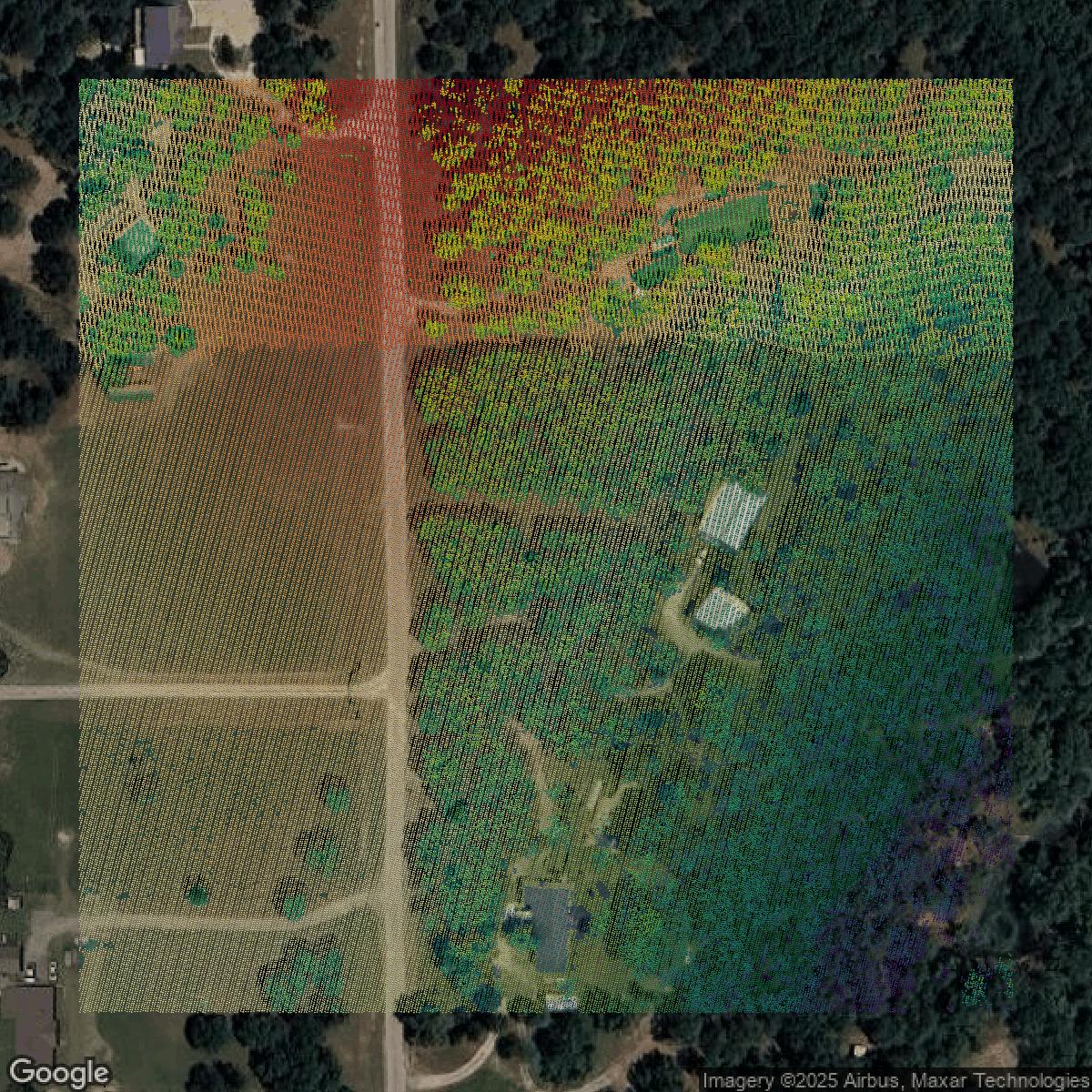
LiDAR
Point clouds (LiDAR) in Tulsa County can produce highly accurate 3D models of terrain, structures, and vegetation.
Get LiDAR for Tulsa County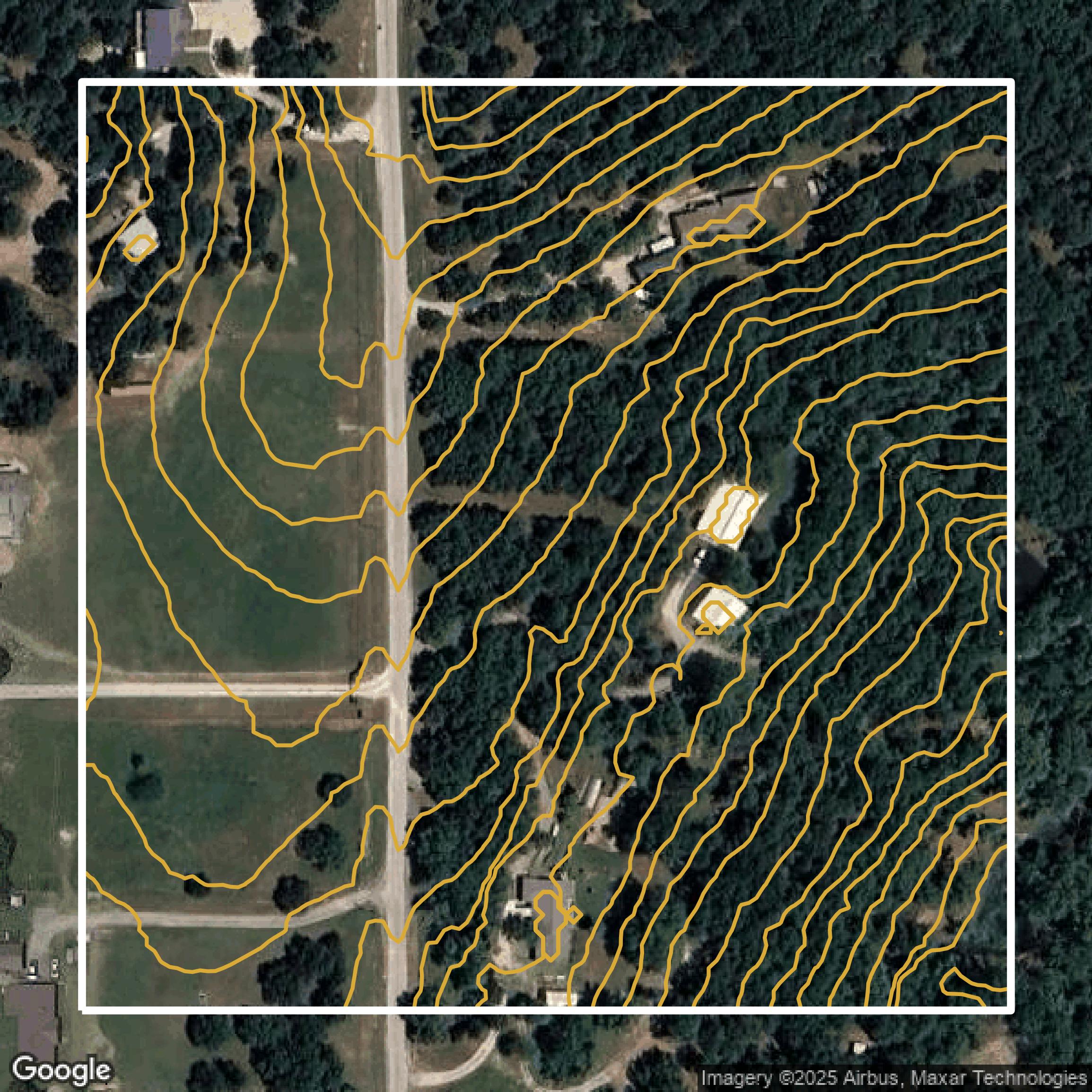
Contours
Contours in Tulsa County visualize 3D elevations on a 2D surface allowing you to better understand your site.
Get Contours for Tulsa County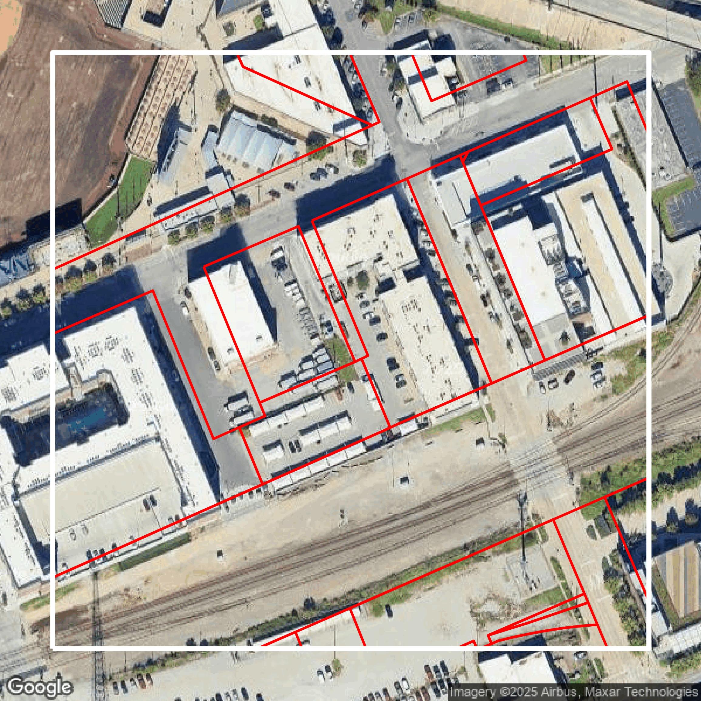
Parcels and Buildings
Accessing Tulsa County parcel and building data on Equator gives you access to coverage across the US.
Get Parcels and Buildings for Tulsa County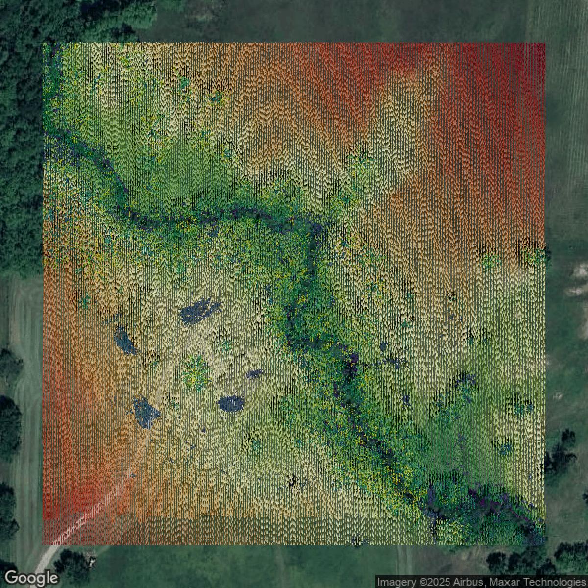
LiDAR
Tulsa County LiDAR uses include land surveying, analyzing crop health, or even archaeological studies.
Get LiDAR for Tulsa County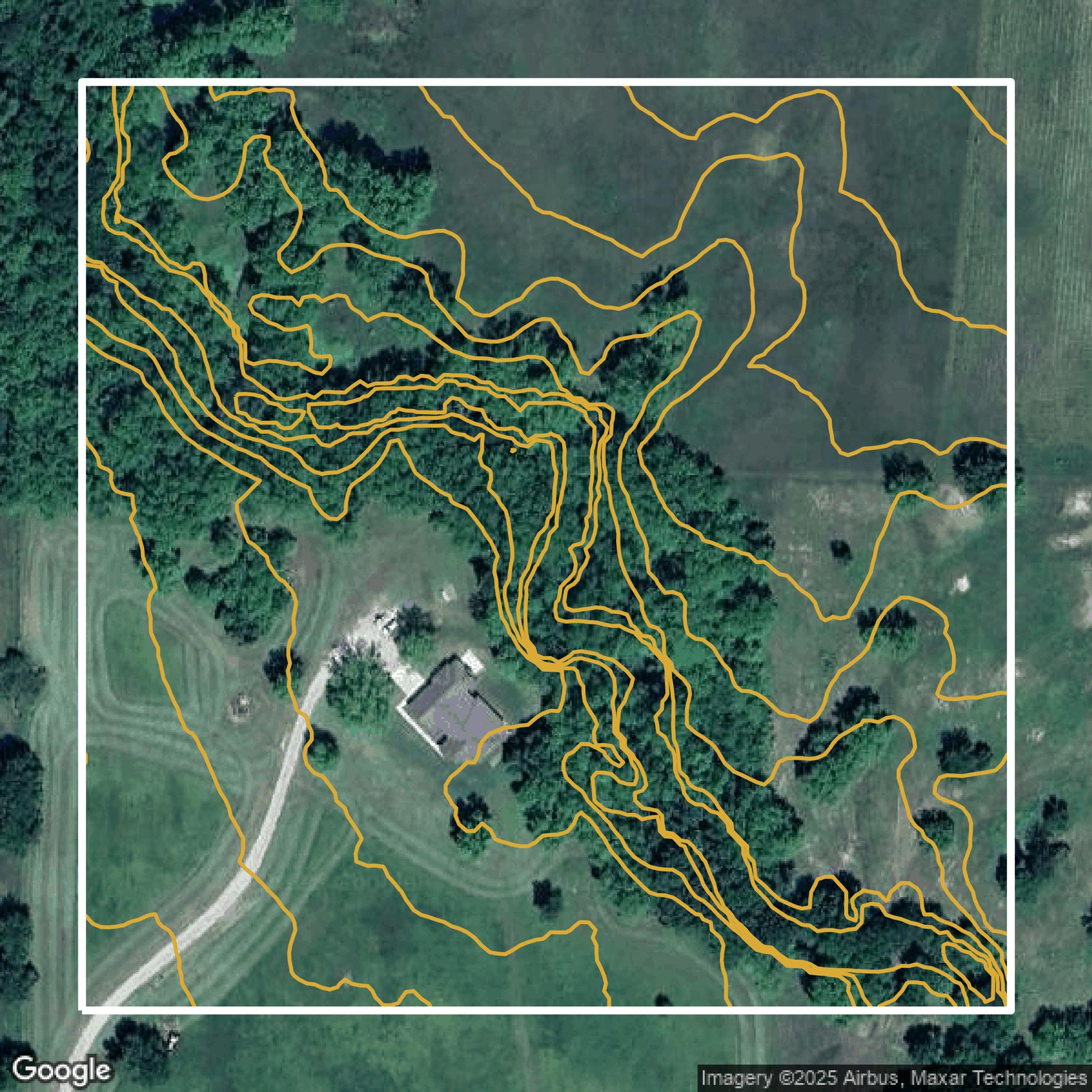
Contours
Tulsa County contours can be used for construction & engineering, environmental science, and more.
Get Contours for Tulsa County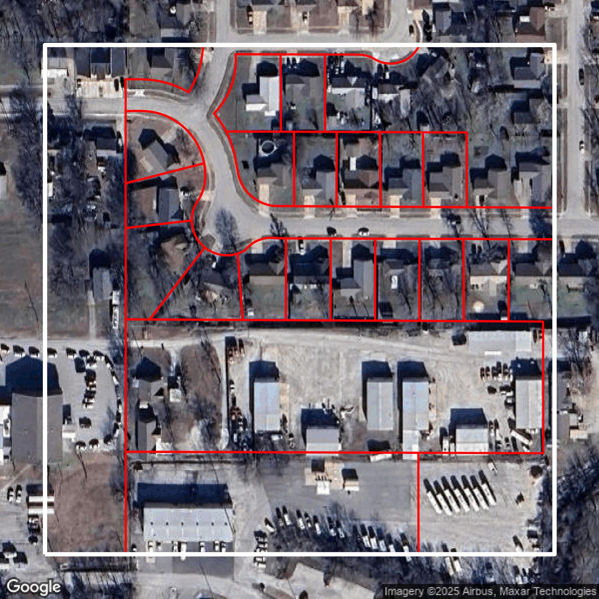
Parcels and Buildings
Dozens of fields are contained within each Tulsa County parcel and building data, including zoning, owners, and year built.
Get Parcels and Buildings for Tulsa County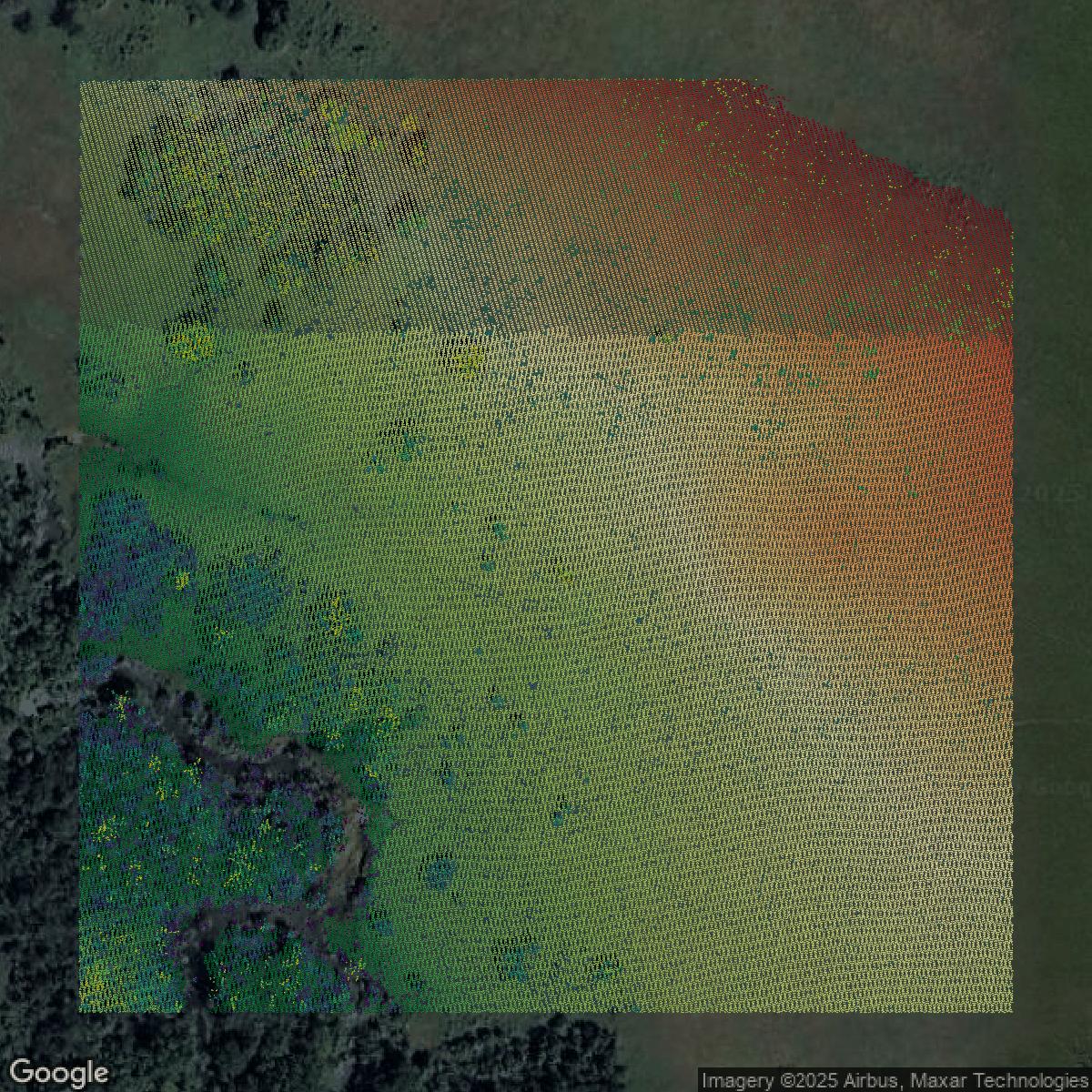
LiDAR
Equator turns Tulsa County LiDAR point clouds into various lidar-derived data sets, including DEMs.
Get LiDAR for Tulsa County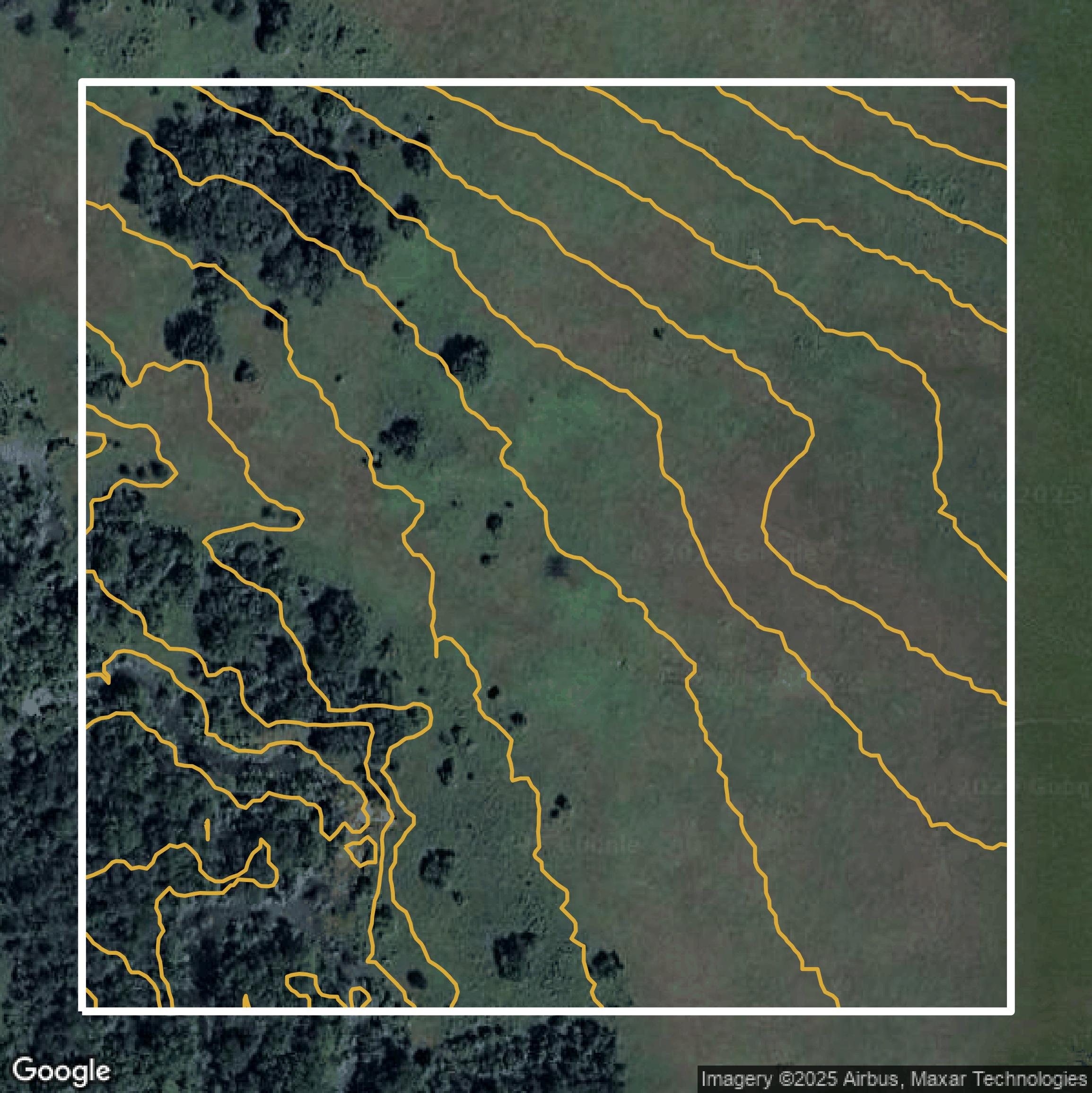
Contours
Tulsa County contours on Equator are produced from LiDAR coverage, allowing for high precision
Get Contours for Tulsa County