Overview
Montgomery County GIS Data – For CAD
Equator helps civil engineering, architecture and consulting firms with the tools to instantly find, process and download accurate LiDAR, contours, parcel data, building footprints, DEMs, point clouds and other GIS data for Montgomery County in an online web mapping portal.
Montgomery County GIS Data →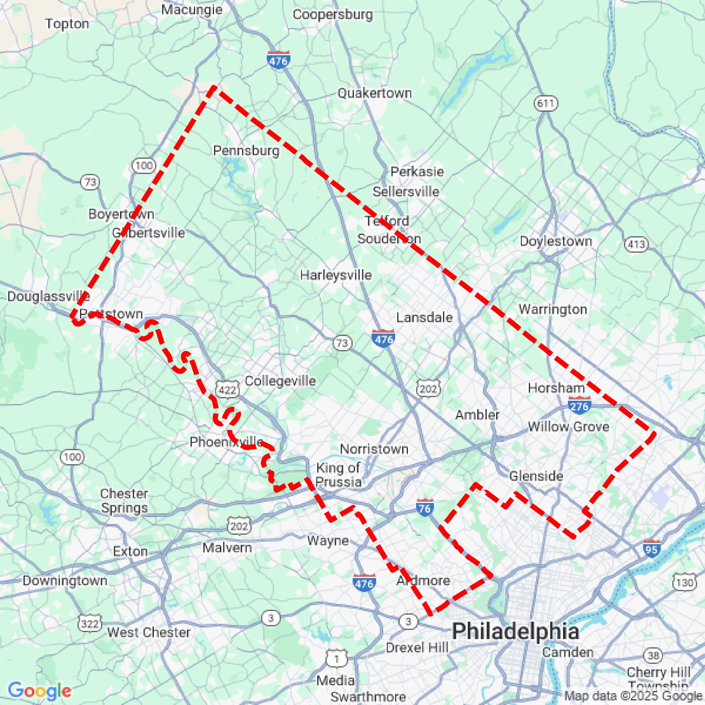

Data Available
Download GIS Data for Montgomery County
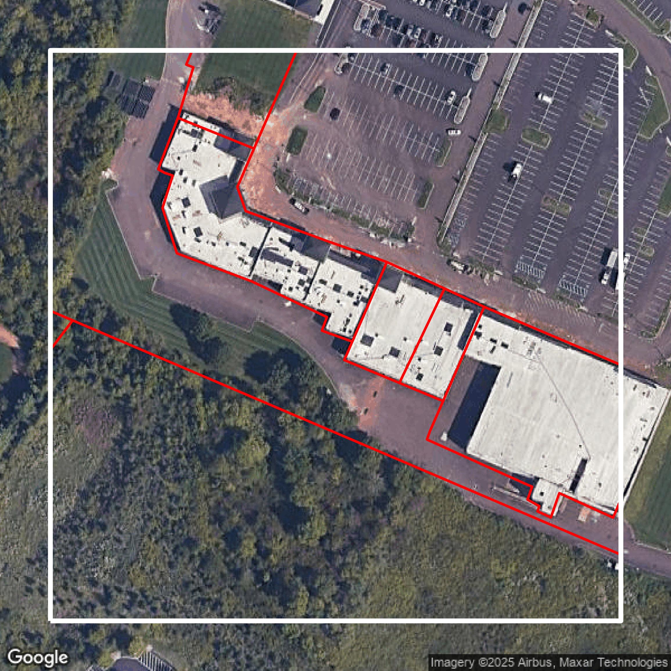
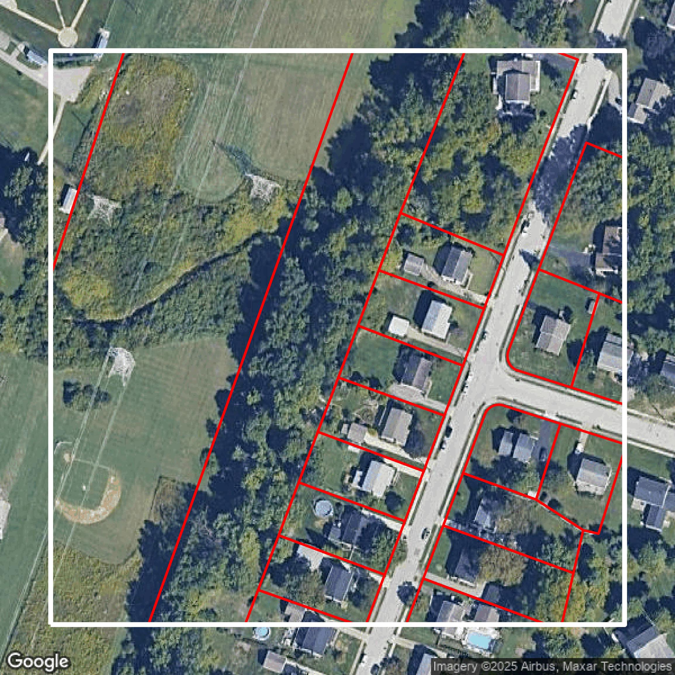
Parcels and Buildings
This image shows parcel and building data in Montgomery County created using GIS data in Equator.
Get Parcels and Buildings for Montgomery County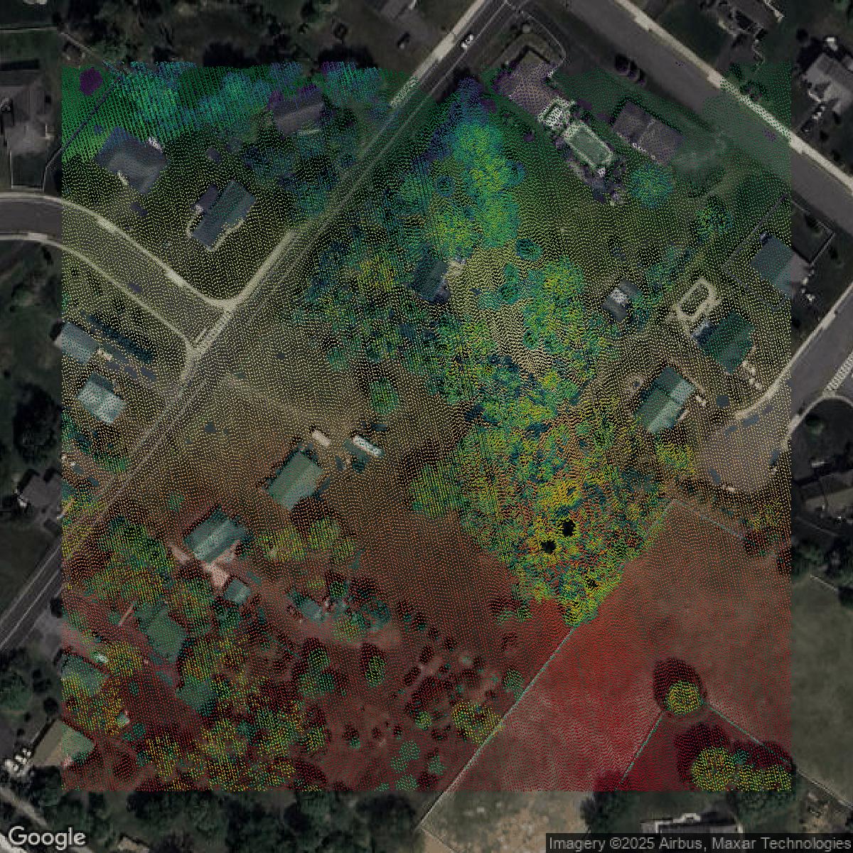
LiDAR
This image shows a LiDAR point cloud in Montgomery County created using GIS data in Equator.
Get LiDAR for Montgomery County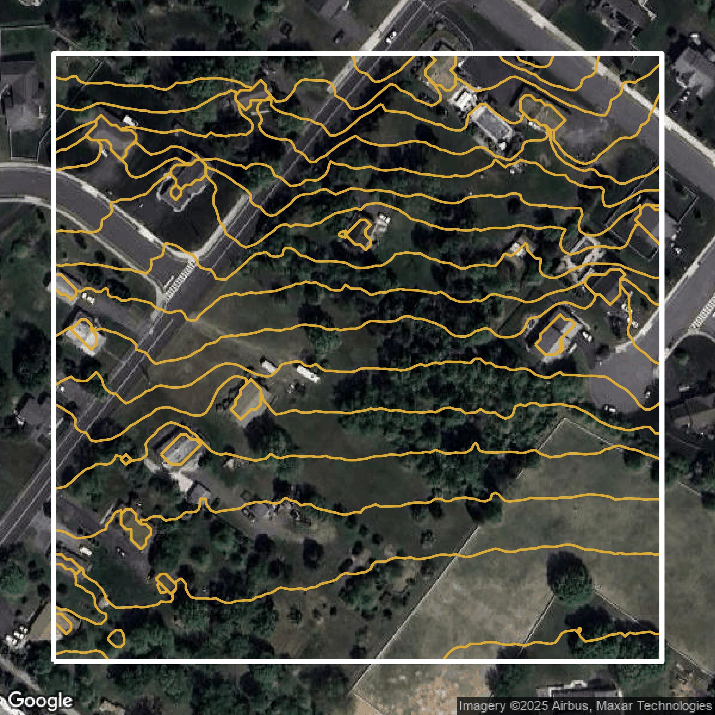
Contours
This image shows a contour map in Montgomery County created using GIS data in Equator.
Get Contours for Montgomery CountyFormats Available
Export Your Data Ready to Use in Multiple Formats
DWG
AutoCAD Drawing - Industry-standard CAD format
Supported Data:
Contour, Parcel, Building Outline
SHP
Shapefile - Standard GIS vector format
Supported Data:
Contour, Parcel, Building Outline
DXF
Drawing Exchange Format - Universal CAD interchange
Supported Data:
Contour, Building Outline
GeoJSON
Geographic JSON - Web-friendly spatial data format
Supported Data:
Contour, Parcel, Building Outline
LAZ
Compressed LAS - Efficient LiDAR point cloud format
Supported Data:
Point Cloud
SVG
Scalable Vector Graphics - Web vector format
Supported Data:
Contour, Building Outline
GPKG (Coming Soon)
GeoPackage - Modern OGC spatial database format
Supported Data:
Contour, Parcel, Building Outline
LandXML (Coming Soon)
Land XML - Civil engineering data exchange format
Supported Data:
Point Cloud
TIN (Coming Soon)
Triangulated Irregular Network - 3D surface model
Supported Data:
Point Cloud
XYZ (Coming Soon)
XYZ Point Cloud - Simple ASCII point cloud format
Supported Data:
Point Cloud
Background
GIS Data for Montgomery County
The Montgomery County GIS Data website offers free and open access to authoritative geospatial data provided by the Mapping & Data Services Division, supporting government agencies, businesses, and the public. Visitors can explore a comprehensive Open Data Portal featuring downloadable GIS data sets and numerous interactive mapping applications centered on Montgomery County initiatives and services. Using ESRI ArcGIS technology, the site’s Map Viewers and Applications enable users to display, find, and identify map features across the county. Key resources available include “GIS DATA,” “Aerials,” “Maps,” “Next Gen 9-1-1” data, “GIS Governance” information, and real-time “WebCAD 911 Incidents.” These tools collectively provide detailed geographic layers and applications intended as a public resource, facilitating informed decisions and enhanced understanding of Montgomery County’s geography and services.
Access Montgomery County GIS Data in Equator →Montgomery County Portal →Showcase
Sample GIS Data for Montgomery County
Parcels and Buildings
Parcel and building data in Montgomery County are used in a variety of fields including architecture, real estate, and urban planning.
Get Parcels and Buildings for Montgomery County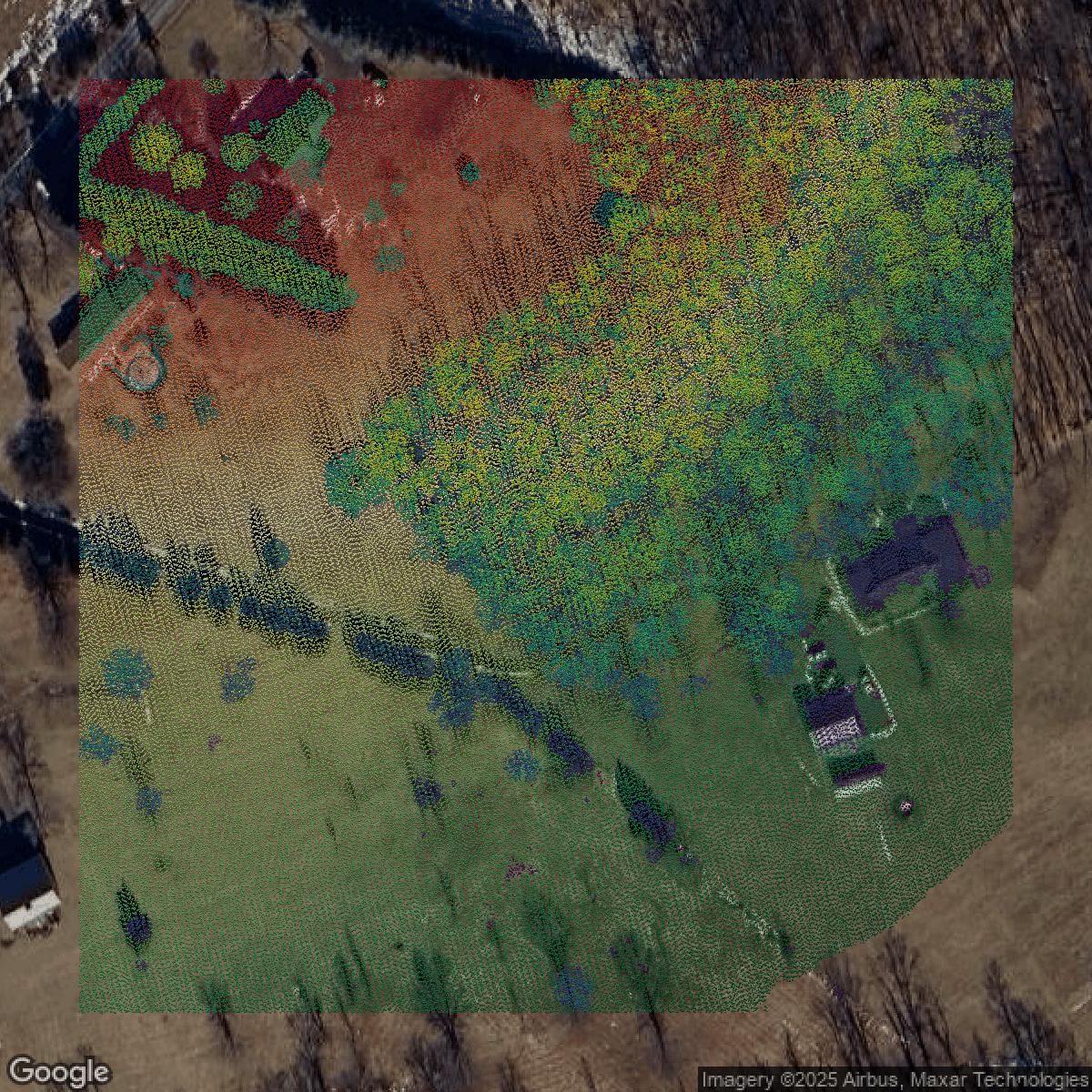
LiDAR
Point clouds (LiDAR) in Montgomery County can produce highly accurate 3D models of terrain, structures, and vegetation.
Get LiDAR for Montgomery County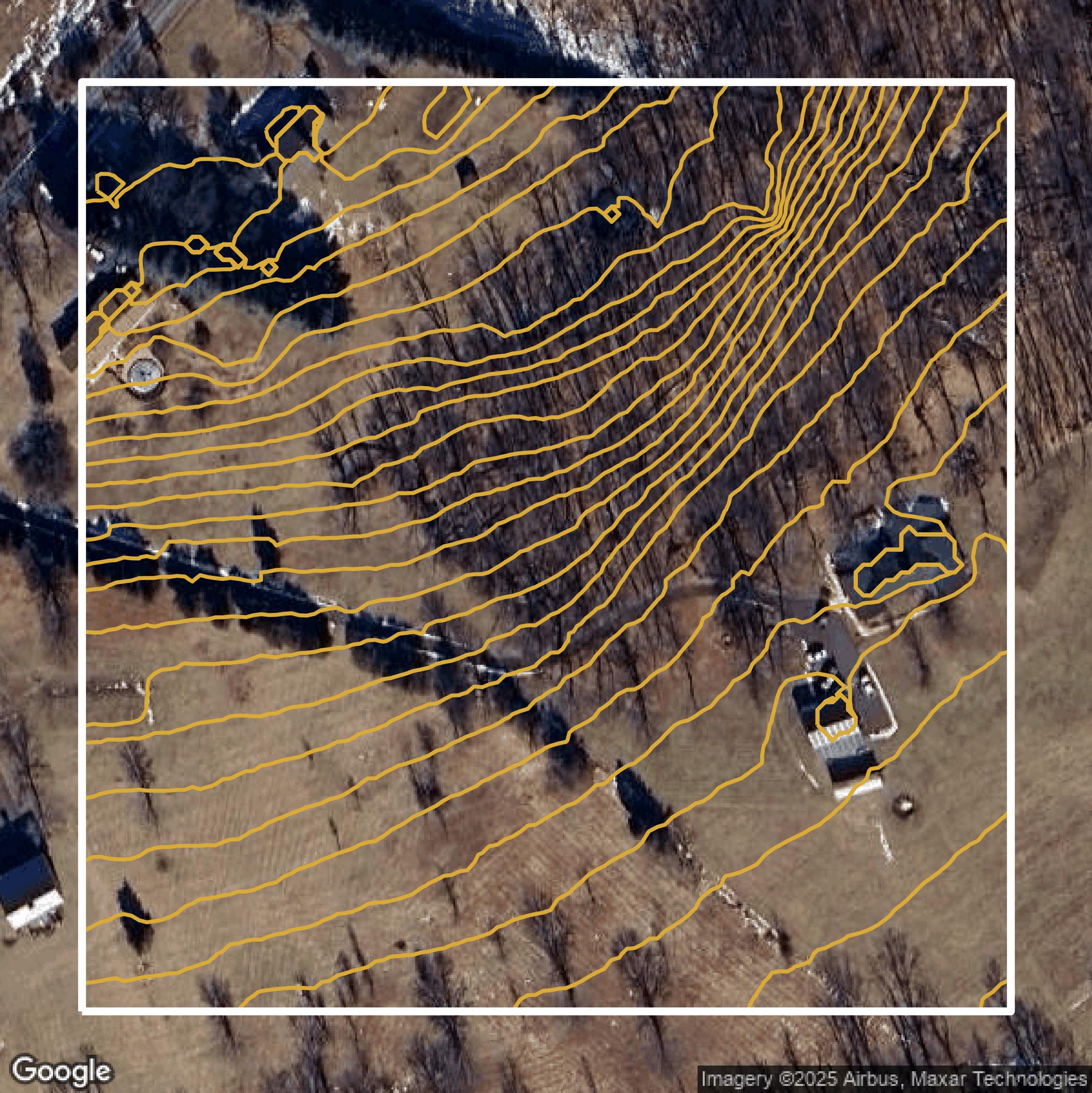
Contours
Contours in Montgomery County visualize 3D elevations on a 2D surface allowing you to better understand your site.
Get Contours for Montgomery County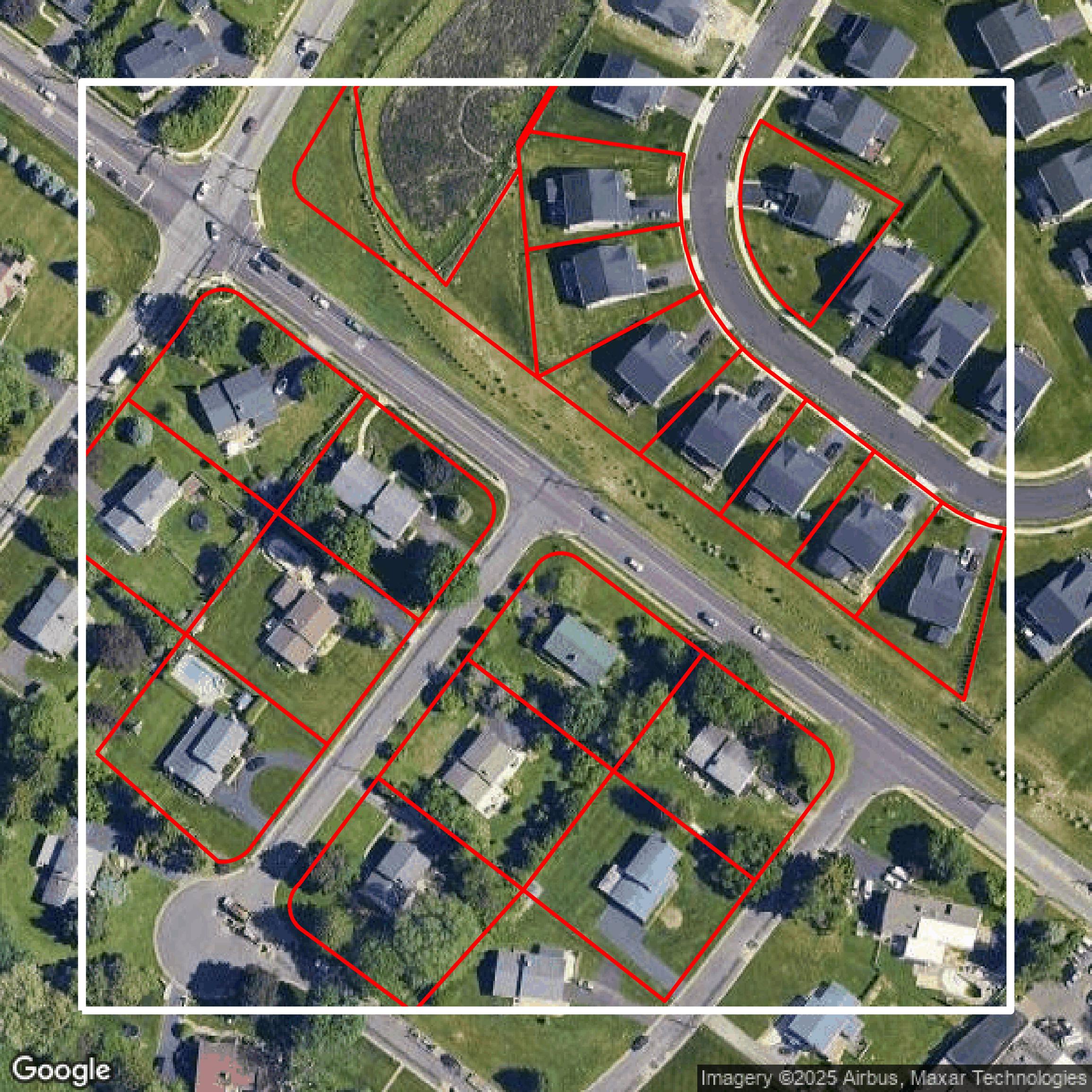
Parcels and Buildings
Accessing Montgomery County parcel and building data on Equator gives you access to coverage across the US.
Get Parcels and Buildings for Montgomery County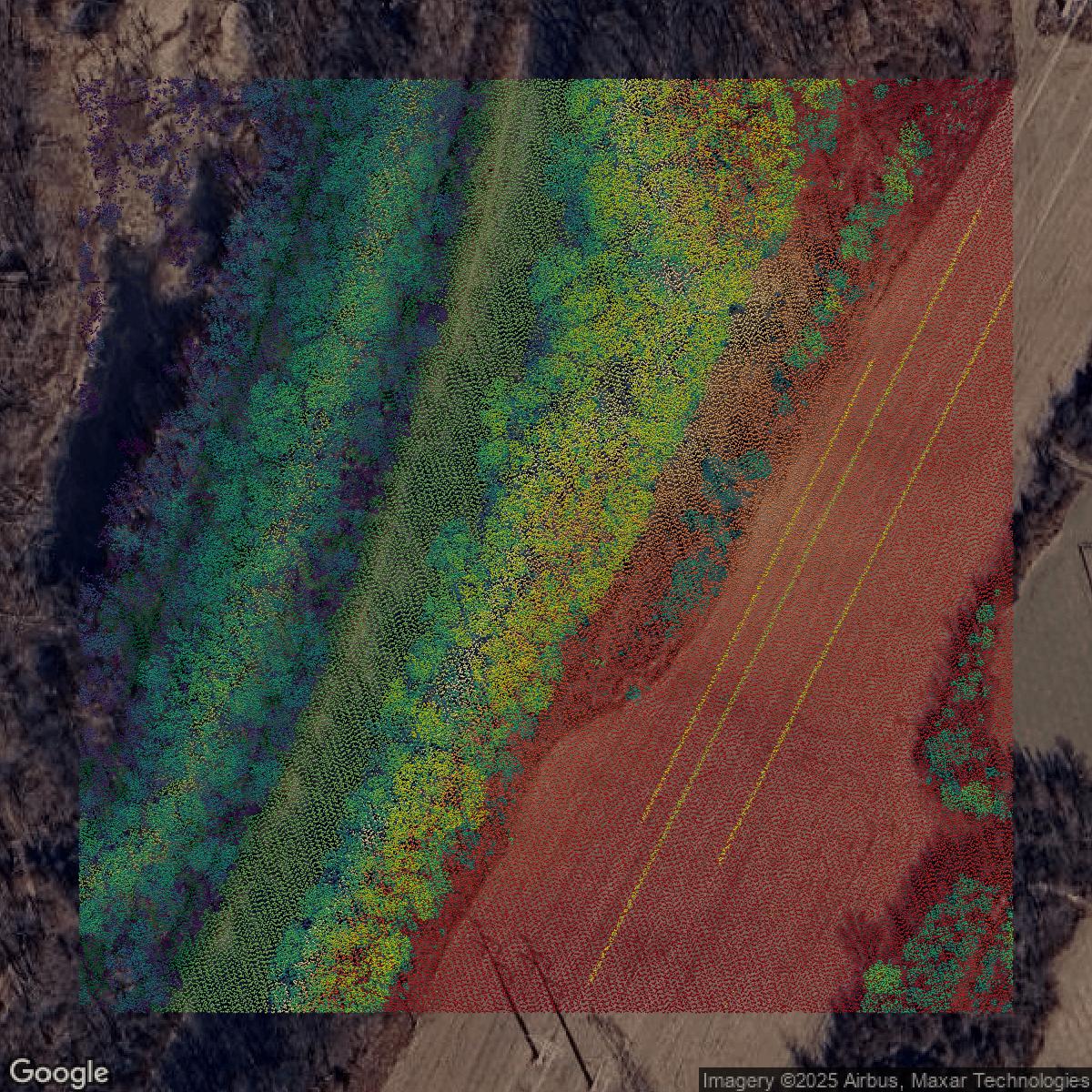
LiDAR
Montgomery County LiDAR uses include land surveying, analyzing crop health, or even archaeological studies.
Get LiDAR for Montgomery County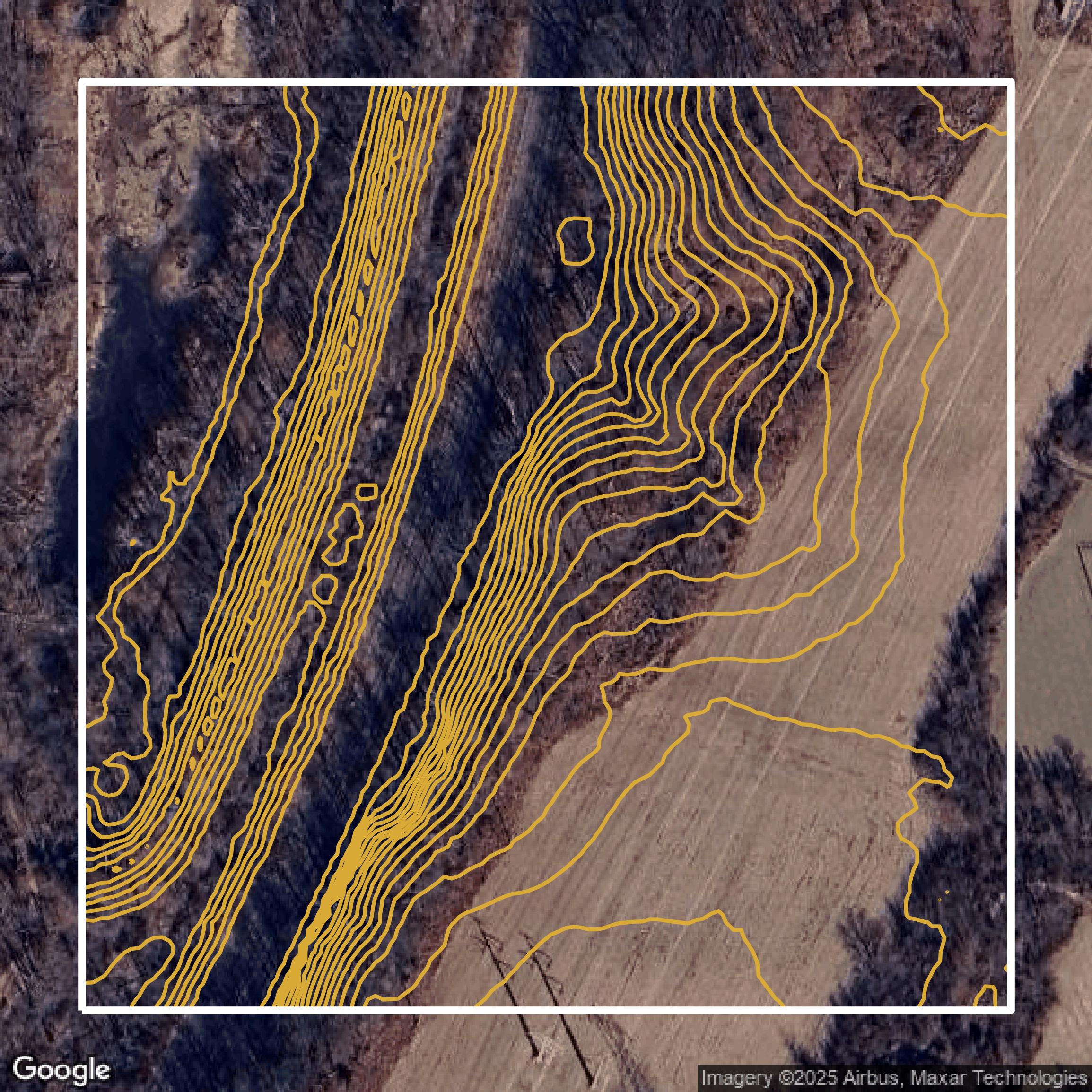
Contours
Montgomery County contours can be used for construction & engineering, environmental science, and more.
Get Contours for Montgomery County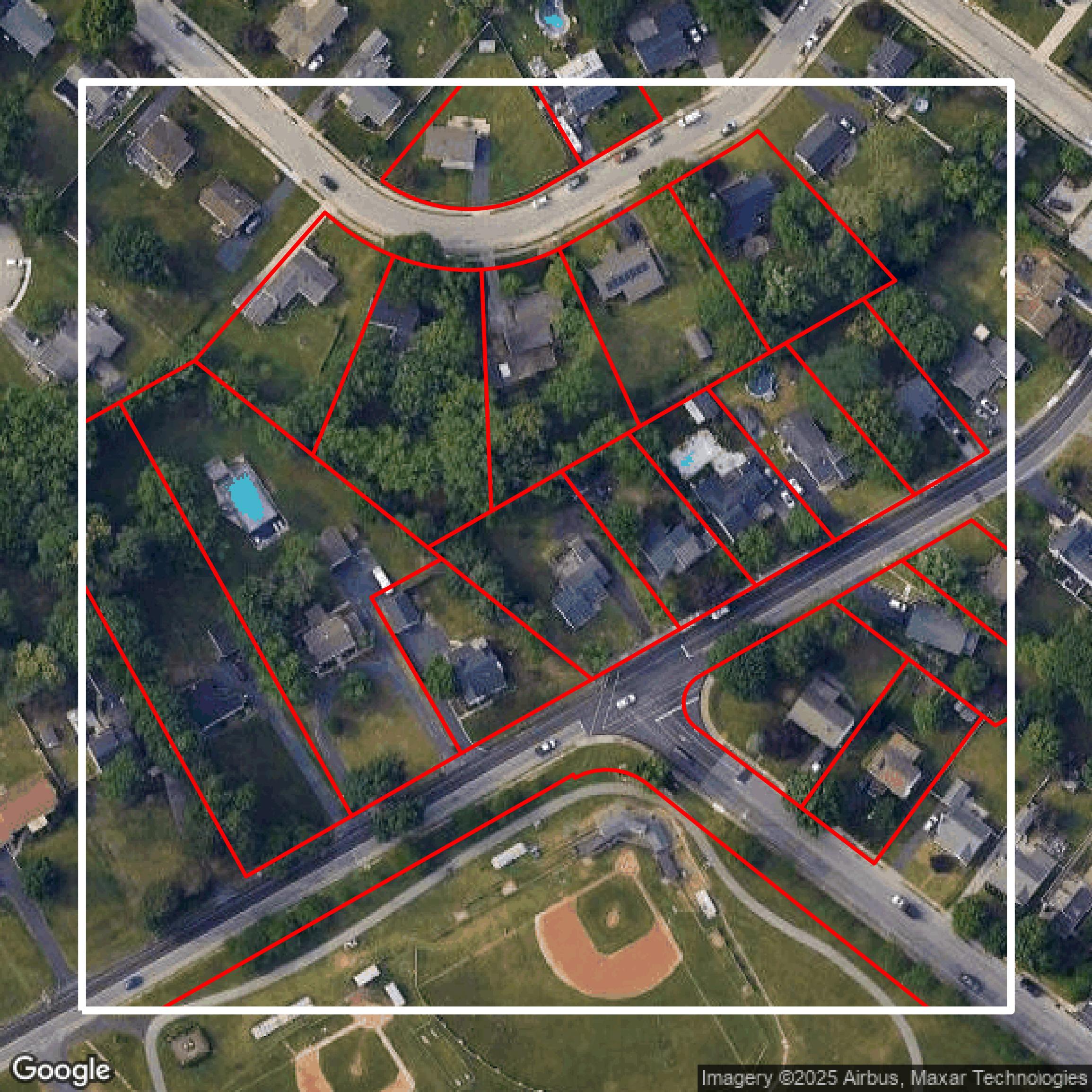
Parcels and Buildings
Dozens of fields are contained within each Montgomery County parcel and building data, including zoning, owners, and year built.
Get Parcels and Buildings for Montgomery County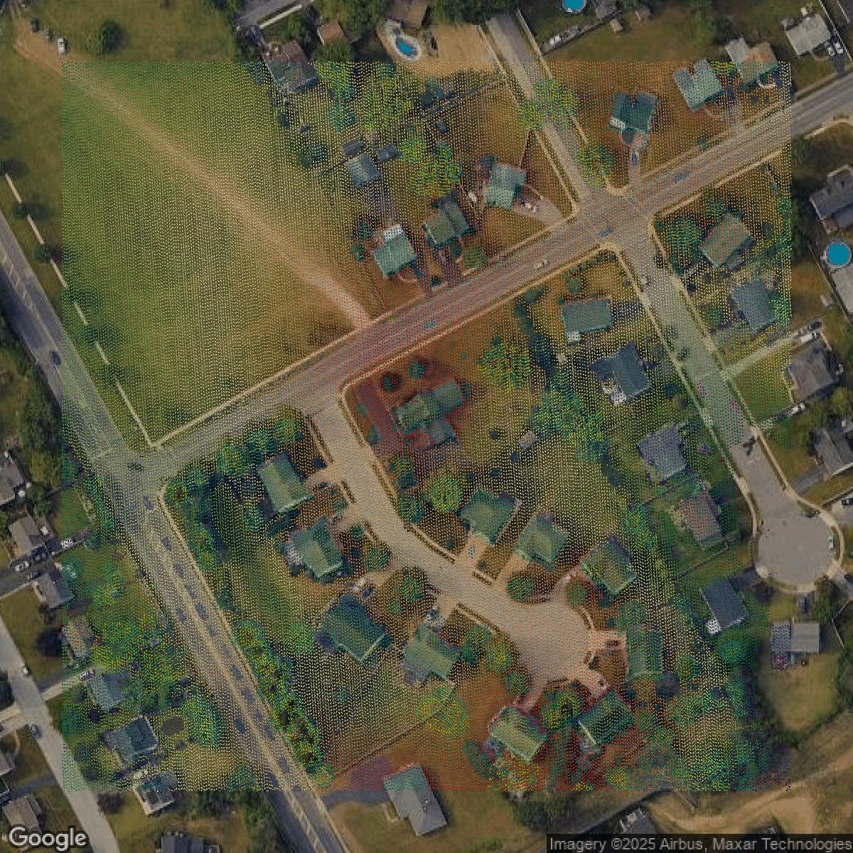
LiDAR
Equator turns Montgomery County LiDAR point clouds into various lidar-derived data sets, including DEMs.
Get LiDAR for Montgomery County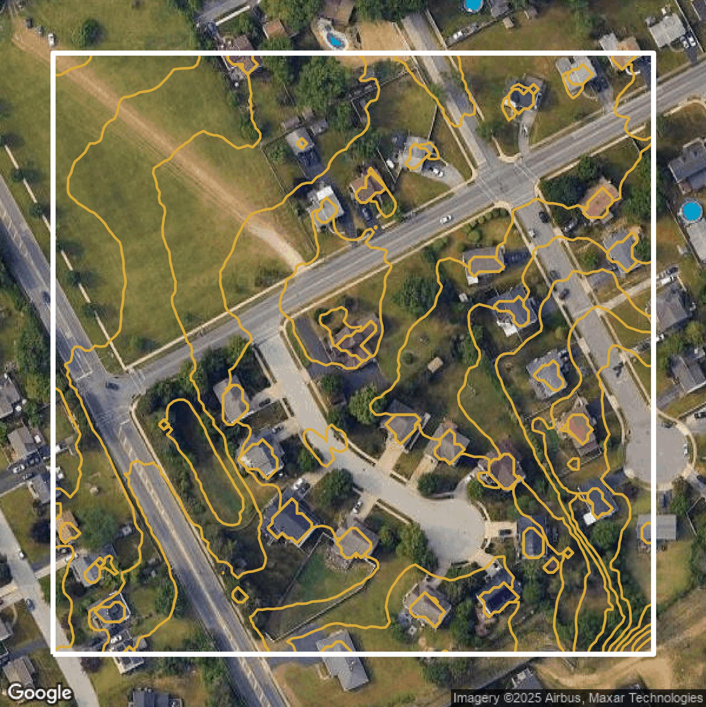
Contours
Montgomery County contours on Equator are produced from LiDAR coverage, allowing for high precision
Get Contours for Montgomery County