Overview
Brazos County GIS Data - For CAD
Equator helps civil engineering, architecture and consulting firms with the tools to instantly find, process and download accurate LiDAR, contours, parcel data, building footprints, DEMs, point clouds and other GIS data for Brazos County in an online web mapping portal.
Brazos County GIS Data ->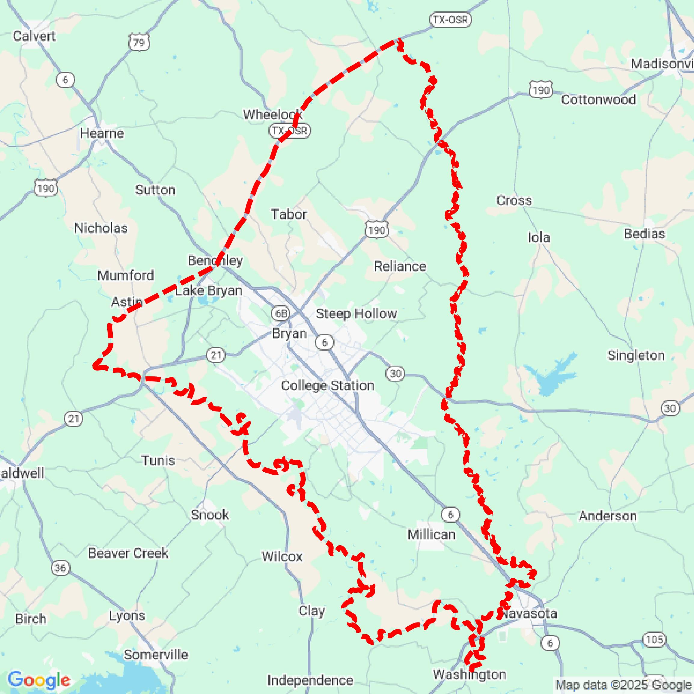

Data Available
Download GIS Data for Brazos County
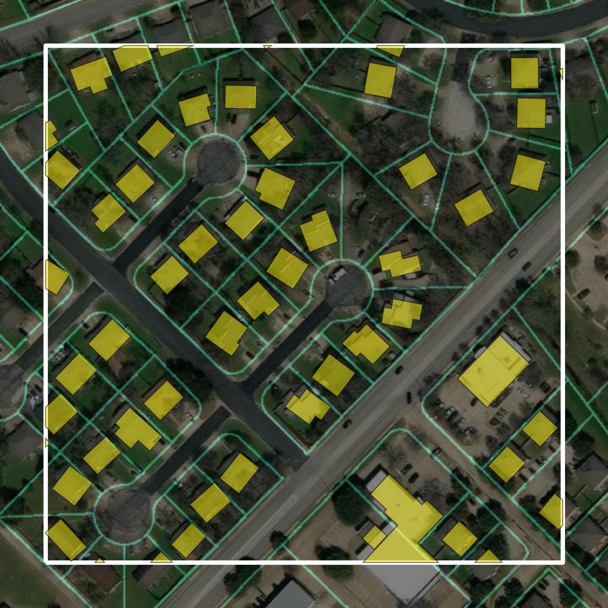
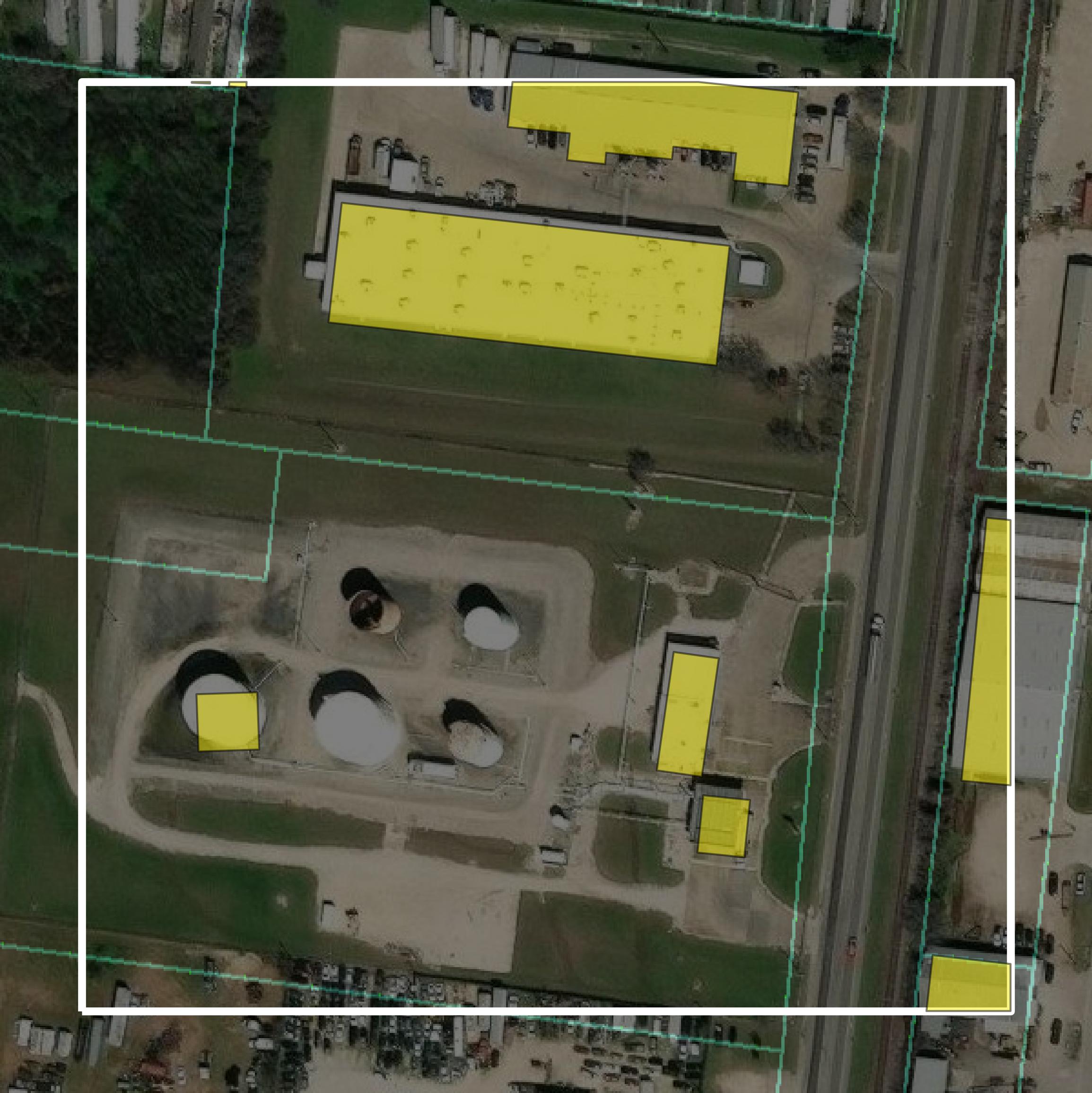
Parcels and Buildings
This image shows parcel and building data in Brazos County created using GIS data in Equator.
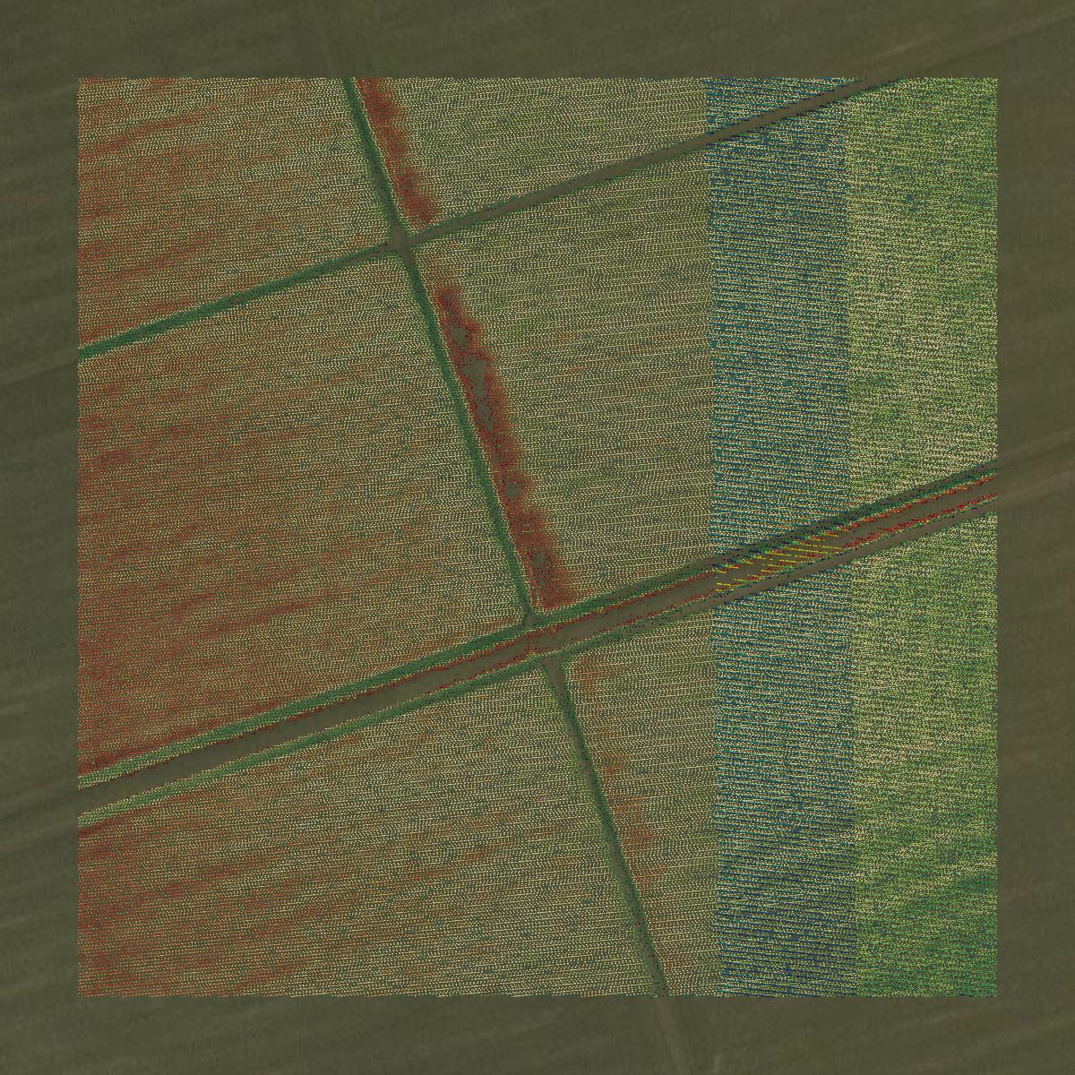
LiDAR
This image shows a LiDAR point cloud in Brazos County created using GIS data in Equator.
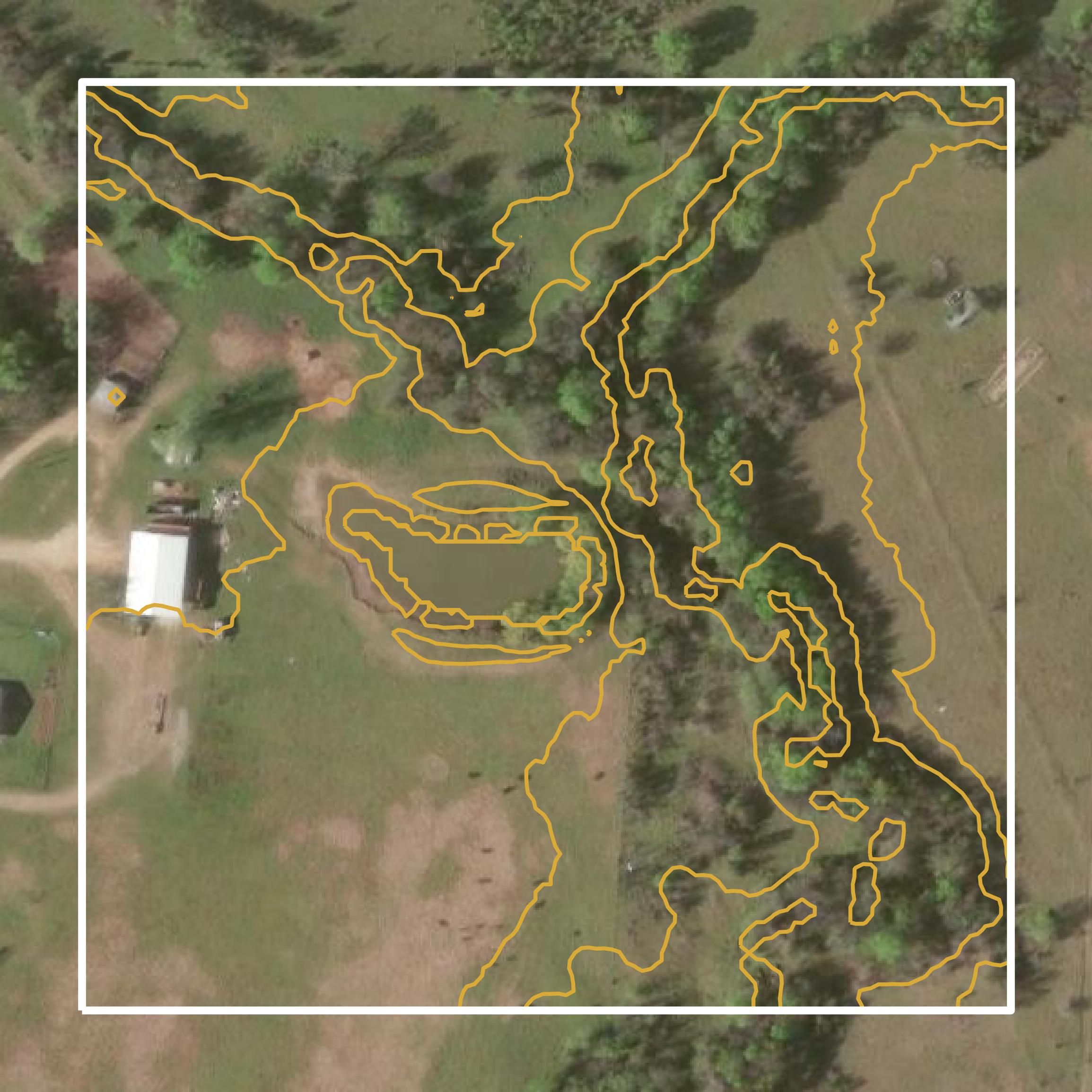
Contours
This image shows a contour map in Brazos County created using GIS data in Equator.
Formats Available
Export Your Data Ready to Use in Multiple Formats
DWG
AutoCAD Drawing - Industry-standard CAD format
Supported Data:
Contour, Parcel, Building Outline
SHP
Shapefile - Standard GIS vector format
Supported Data:
Contour, Parcel, Building Outline
DXF
Drawing Exchange Format - Universal CAD interchange
Supported Data:
Contour, Building Outline
GeoJSON
Geographic JSON - Web-friendly spatial data format
Supported Data:
Contour, Parcel, Building Outline
LAZ
Compressed LAS - Efficient LiDAR point cloud format
Supported Data:
Point Cloud
SVG
Scalable Vector Graphics - Web vector format
Supported Data:
Contour, Building Outline
GPKG
GeoPackage - Modern OGC spatial database format
Supported Data:
Contour, Parcel, Building Outline
LandXML (Coming Soon)
Land XML - Civil engineering data exchange format
Supported Data:
Point Cloud
TIN (Coming Soon)
Triangulated Irregular Network - 3D surface model
Supported Data:
Point Cloud
XYZ (Coming Soon)
XYZ Point Cloud - Simple ASCII point cloud format
Supported Data:
Point Cloud
Background
GIS Data for Brazos County
The GIS webpage for Brazos County, Texas, provides access to a variety of geographic information system (GIS) datasets and mapping resources. It includes detailed maps showcasing roads and bridges, along with associated data such as length, surface types, and location. The site features digital orthographic photography, GPS-acquired data, and collaborative datasets from local agencies and the Texas Department of Transportation. Additionally, it offers information on GPS monuments used for surveying, which are essential for determining precise geographical coordinates. Users can view the county's map collection, although the maps are intended for general guidance and may not be entirely accurate.
Access Brazos County GIS Data in Equator →Brazos County Portal →Showcase
Sample GIS Data for Brazos County
Parcels and Buildings
Parcel and building data in Brazos County are used in a variety of fields including architecture, real estate, and urban planning.
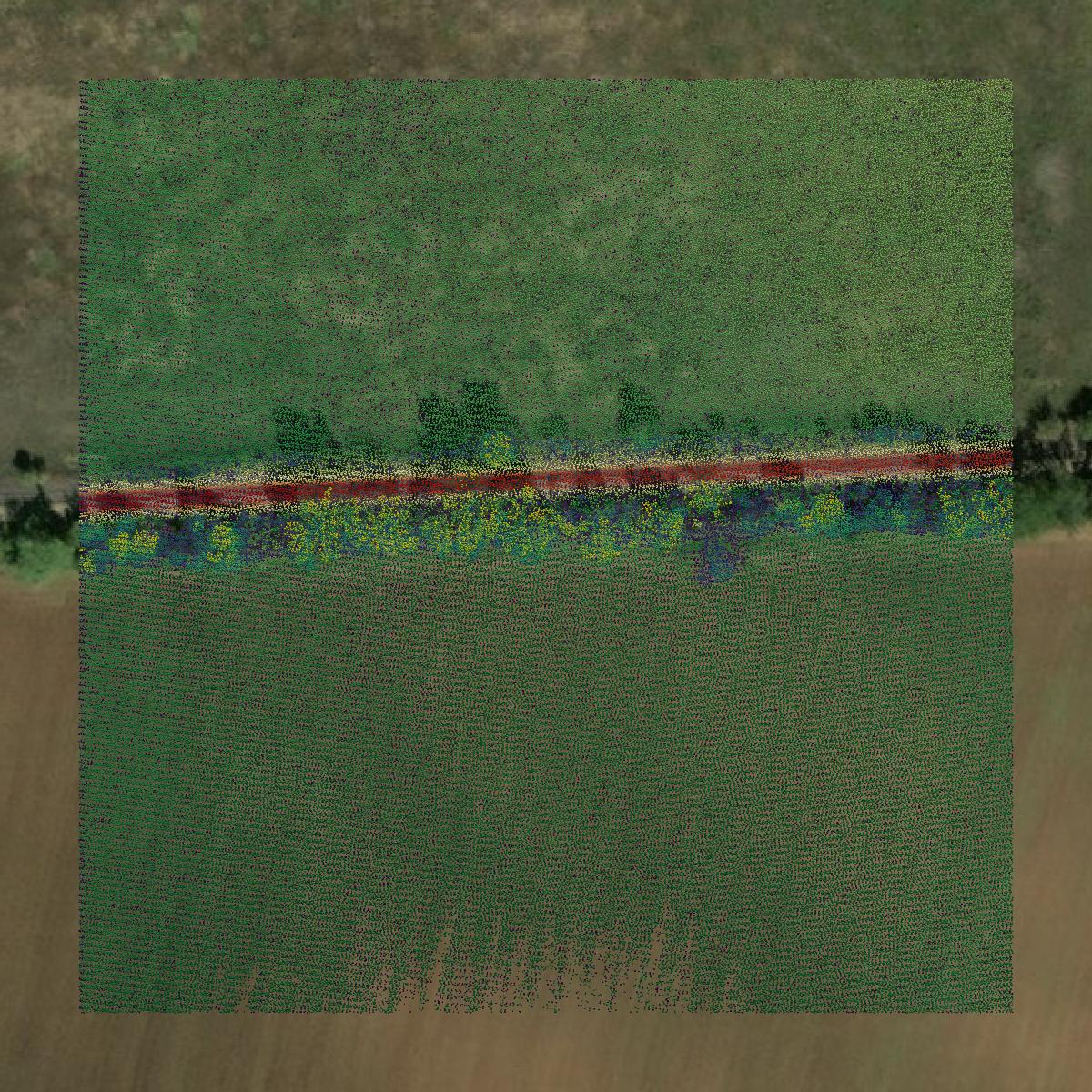
LiDAR
Point clouds (LiDAR) in Brazos County can produce highly accurate 3D models of terrain, structures, and vegetation.
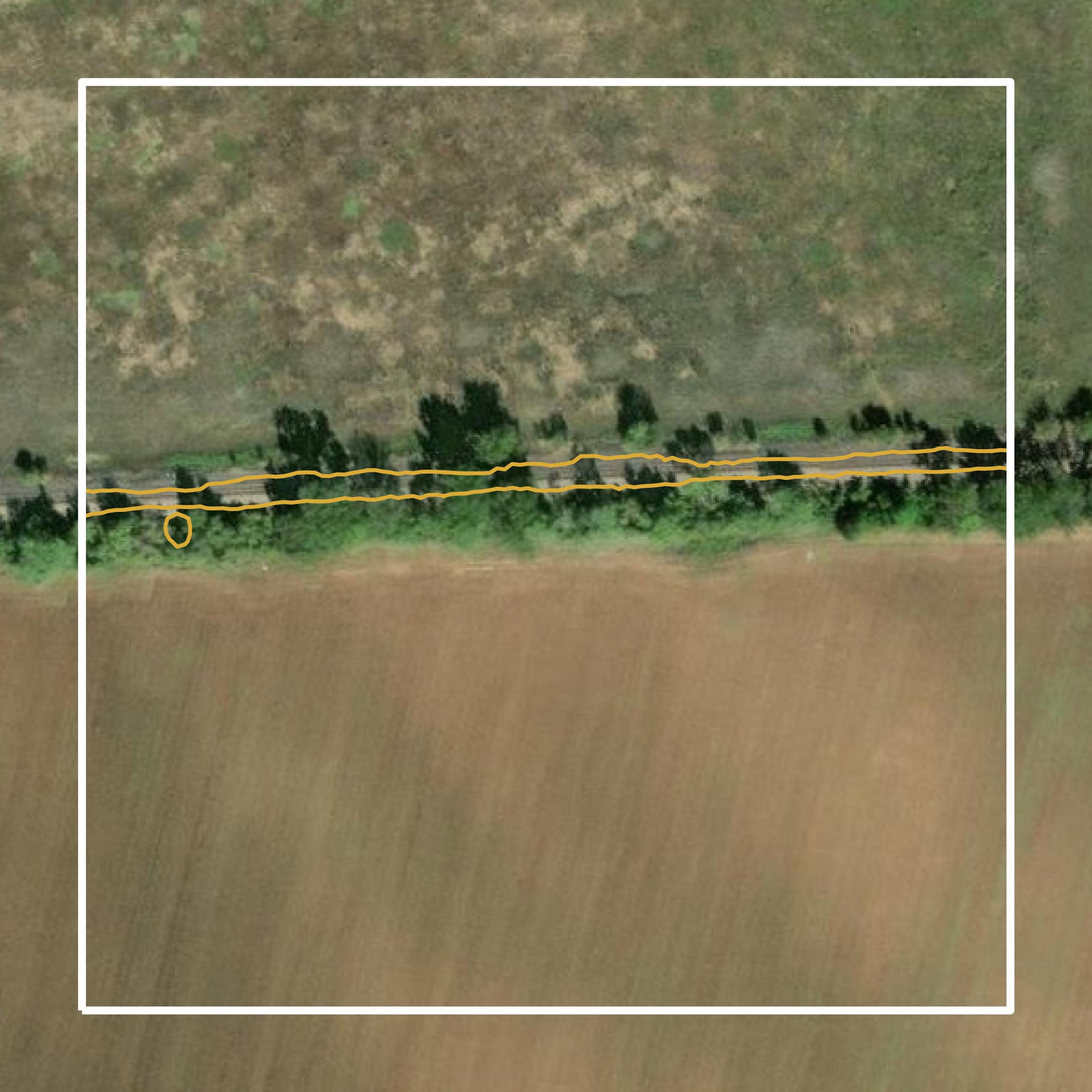
Contours
Contours in Brazos County visualize 3D elevations on a 2D surface allowing you to better understand your site.