Overview
Collin County GIS Data – For CAD
Equator helps civil engineering, architecture and consulting firms with the tools to instantly find, process and download accurate LiDAR, contours, parcel data, building footprints, DEMs, point clouds and other GIS data for Collin County in an online web mapping portal.
Collin County GIS Data →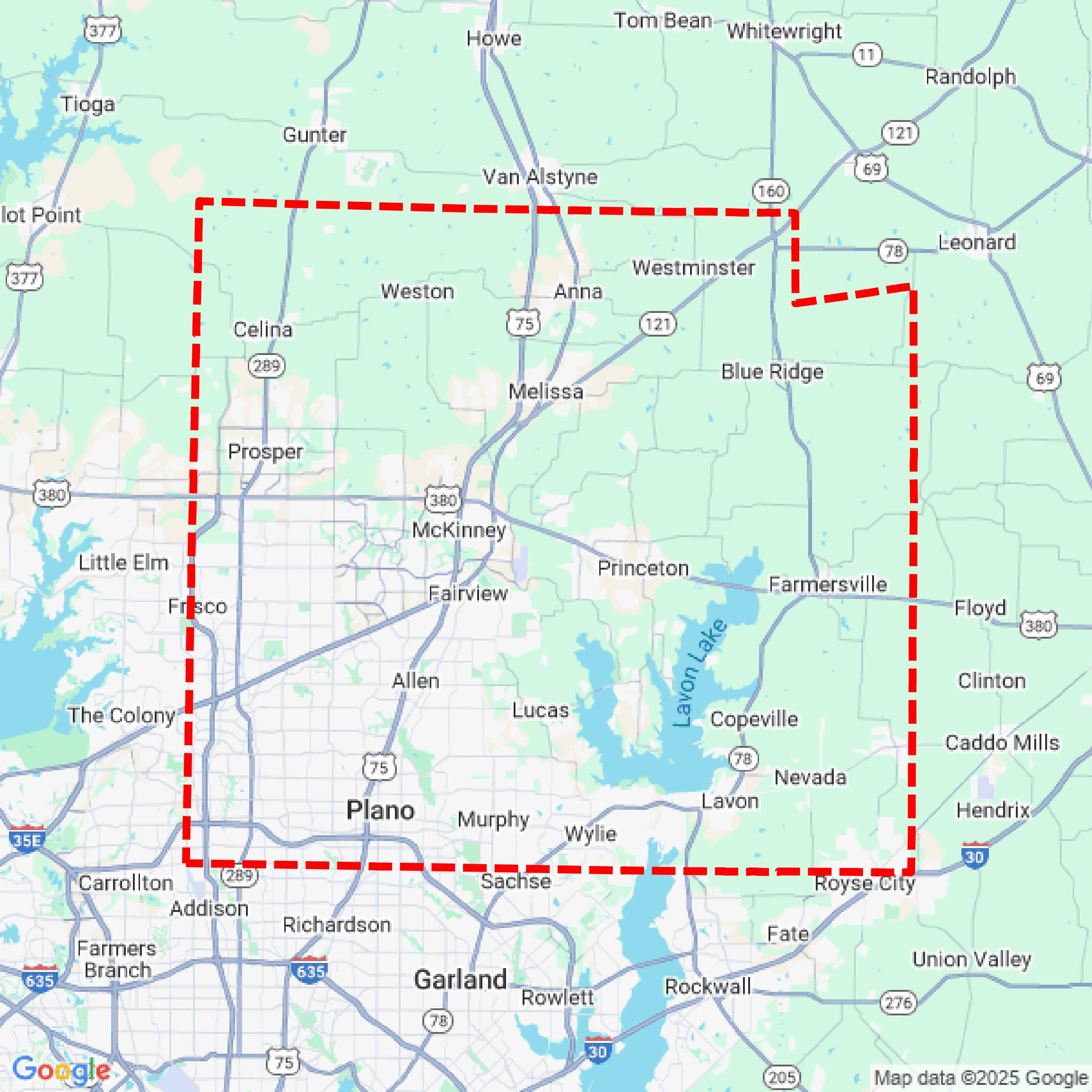

Data Available
Download GIS Data for Collin County
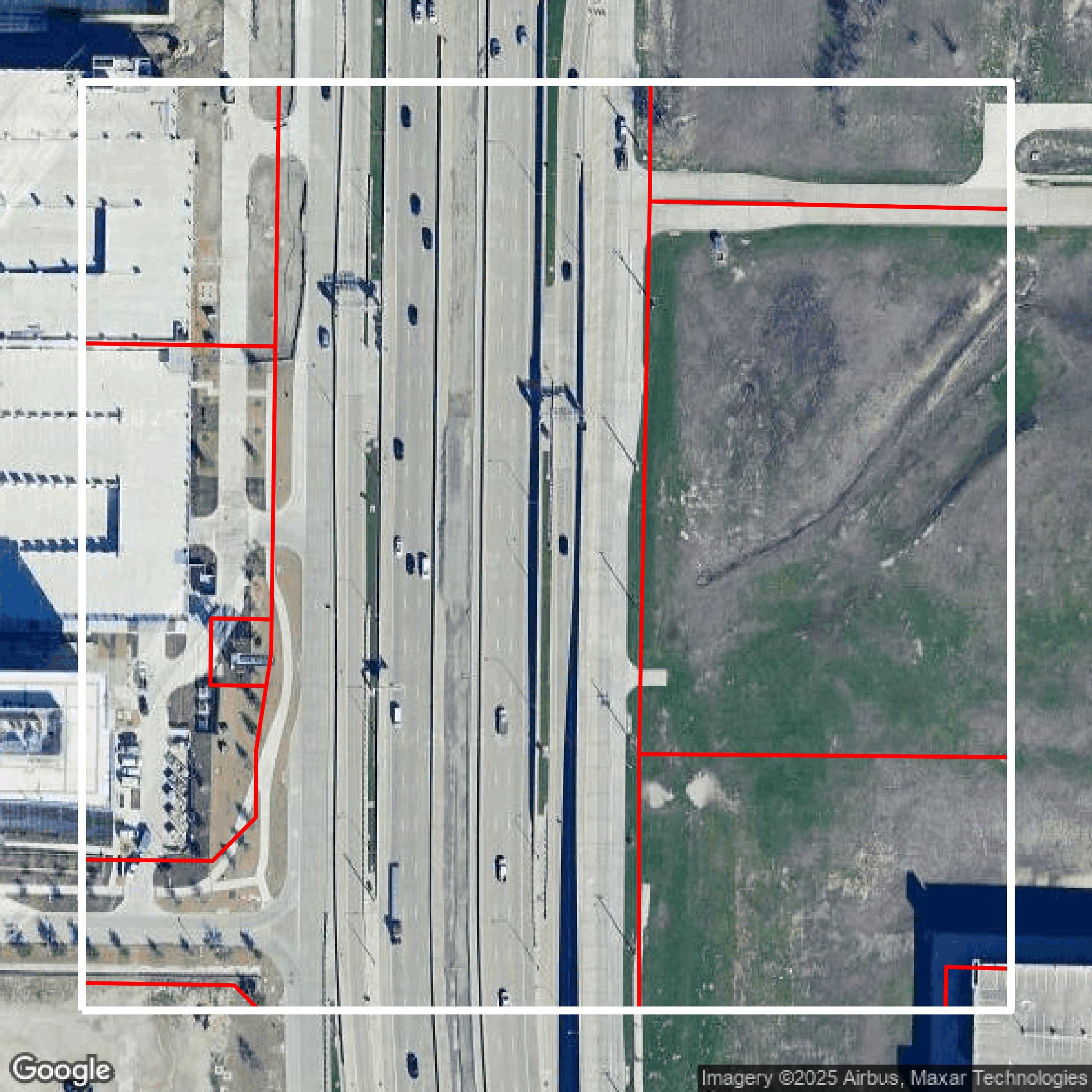
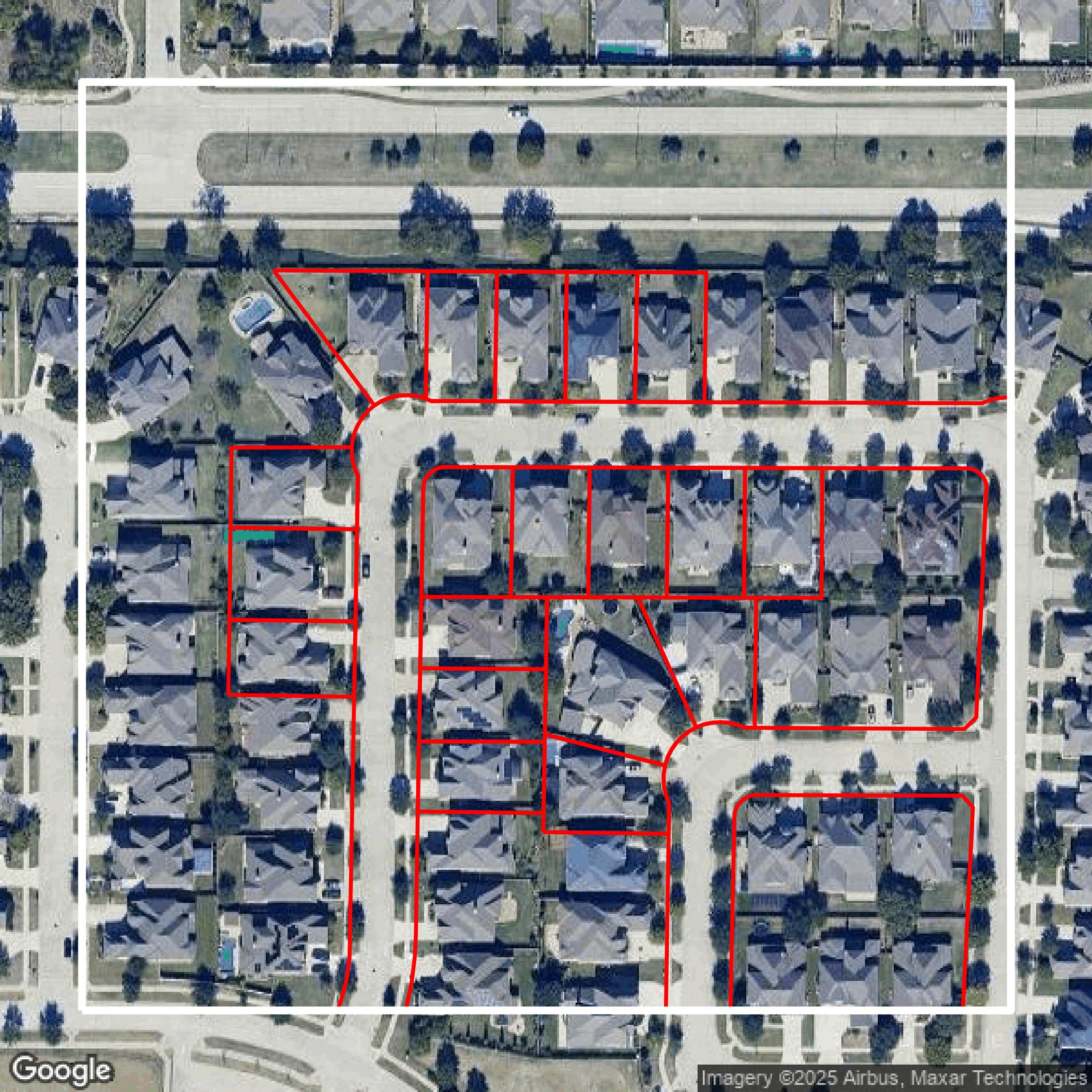
Parcels and Buildings
This image shows parcel and building data in Collin County created using GIS data in Equator.
Get Parcels and Buildings for Collin County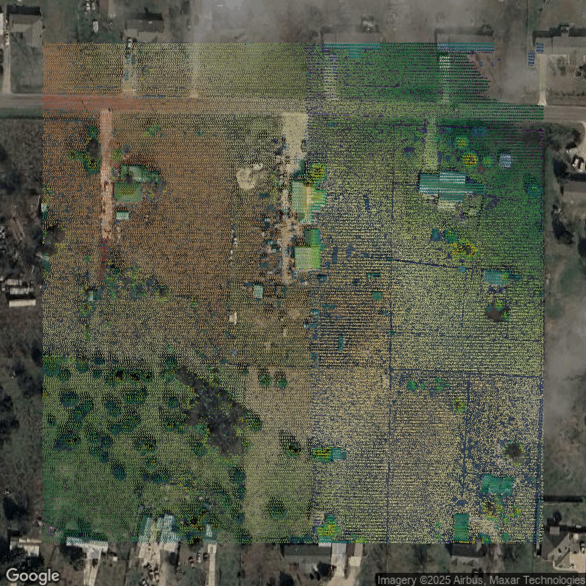
LiDAR
This image shows a LiDAR point cloud in Collin County created using GIS data in Equator.
Get LiDAR for Collin County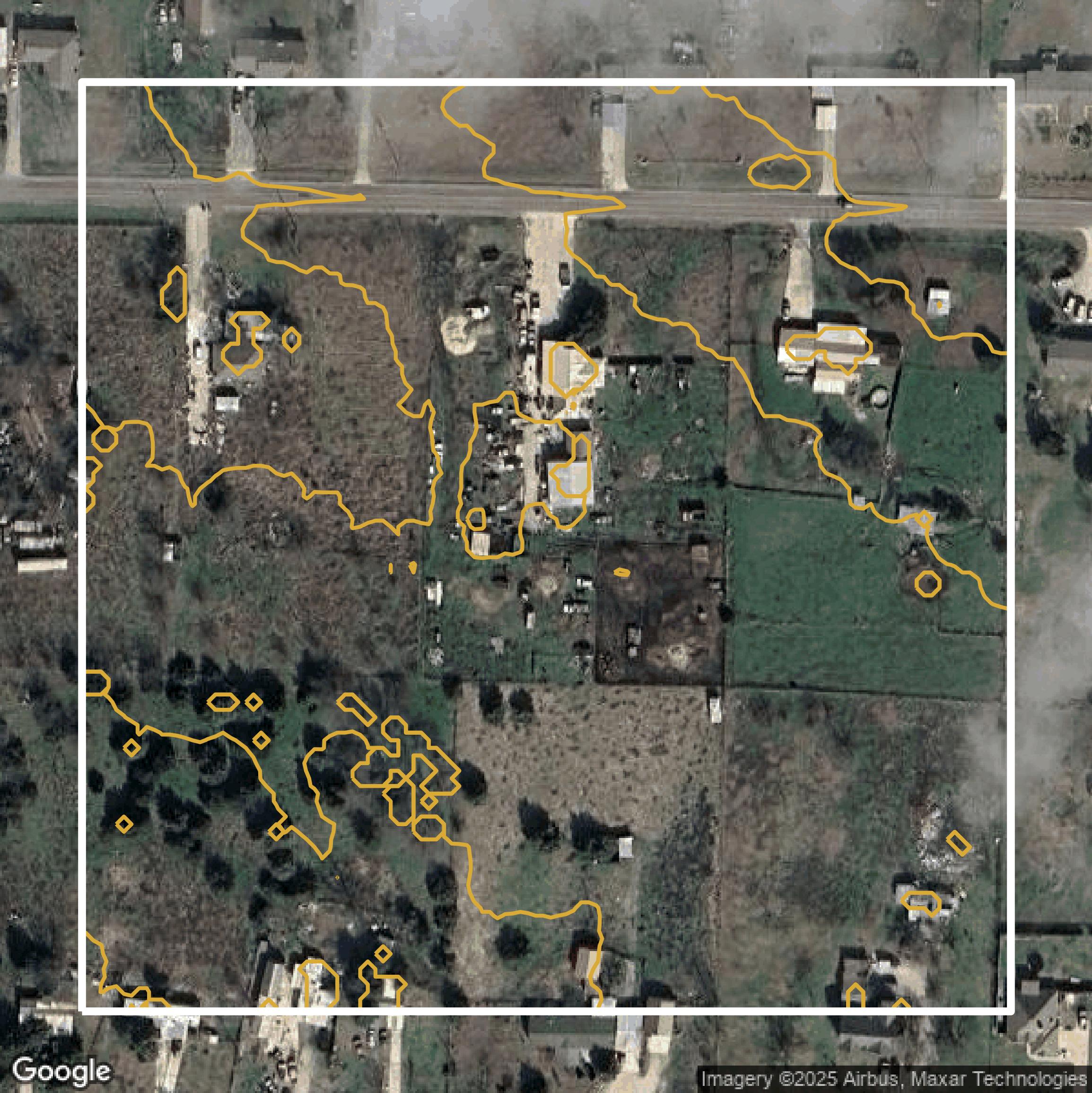
Contours
This image shows a contour map in Collin County created using GIS data in Equator.
Get Contours for Collin CountyFormats Available
Export Your Data Ready to Use in Multiple Formats
DWG
AutoCAD Drawing - Industry-standard CAD format
Supported Data:
Contour, Parcel, Building Outline
SHP
Shapefile - Standard GIS vector format
Supported Data:
Contour, Parcel, Building Outline
DXF
Drawing Exchange Format - Universal CAD interchange
Supported Data:
Contour, Building Outline
GeoJSON
Geographic JSON - Web-friendly spatial data format
Supported Data:
Contour, Parcel, Building Outline
LAZ
Compressed LAS - Efficient LiDAR point cloud format
Supported Data:
Point Cloud
SVG
Scalable Vector Graphics - Web vector format
Supported Data:
Contour, Building Outline
GPKG (Coming Soon)
GeoPackage - Modern OGC spatial database format
Supported Data:
Contour, Parcel, Building Outline
LandXML (Coming Soon)
Land XML - Civil engineering data exchange format
Supported Data:
Point Cloud
TIN (Coming Soon)
Triangulated Irregular Network - 3D surface model
Supported Data:
Point Cloud
XYZ (Coming Soon)
XYZ Point Cloud - Simple ASCII point cloud format
Supported Data:
Point Cloud
Background
GIS Data for Collin County
The Collin County GIS/Rural Addressing website offers comprehensive geographic information system (GIS) services including the development and modification of the county’s geographic database, spatial analyses, and map production. Visitors can access key tools such as the **Interactive Map** for detailed spatial data and refer to extensive collections in **Maps and Data** hosted on the Collin County ArcGIS Hub. The site specifically supports rural emergency 9-1-1 street address assignments and provides links to contact GIS/Rural Addressing staff for assistance. Additionally, users will find valuable resources like **Cities and Towns** boundaries, public safety information, and access to county-wide data useful for decision-making and community services. The site emphasizes customer service to citizens, user departments, and agencies, helping streamline permit processes through a connection with Development Services. Overall, this portal serves as a critical hub for spatial information, public safety addressing, and map-based resources to enhance operational efficiency and community engagement throughout Collin County.
Access Collin County GIS Data in Equator →Collin County Portal →Showcase
Sample GIS Data for Collin County
Parcels and Buildings
Parcel and building data in Collin County are used in a variety of fields including architecture, real estate, and urban planning.
Get Parcels and Buildings for Collin County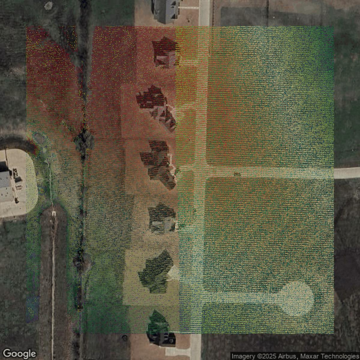
LiDAR
Point clouds (LiDAR) in Collin County can produce highly accurate 3D models of terrain, structures, and vegetation.
Get LiDAR for Collin County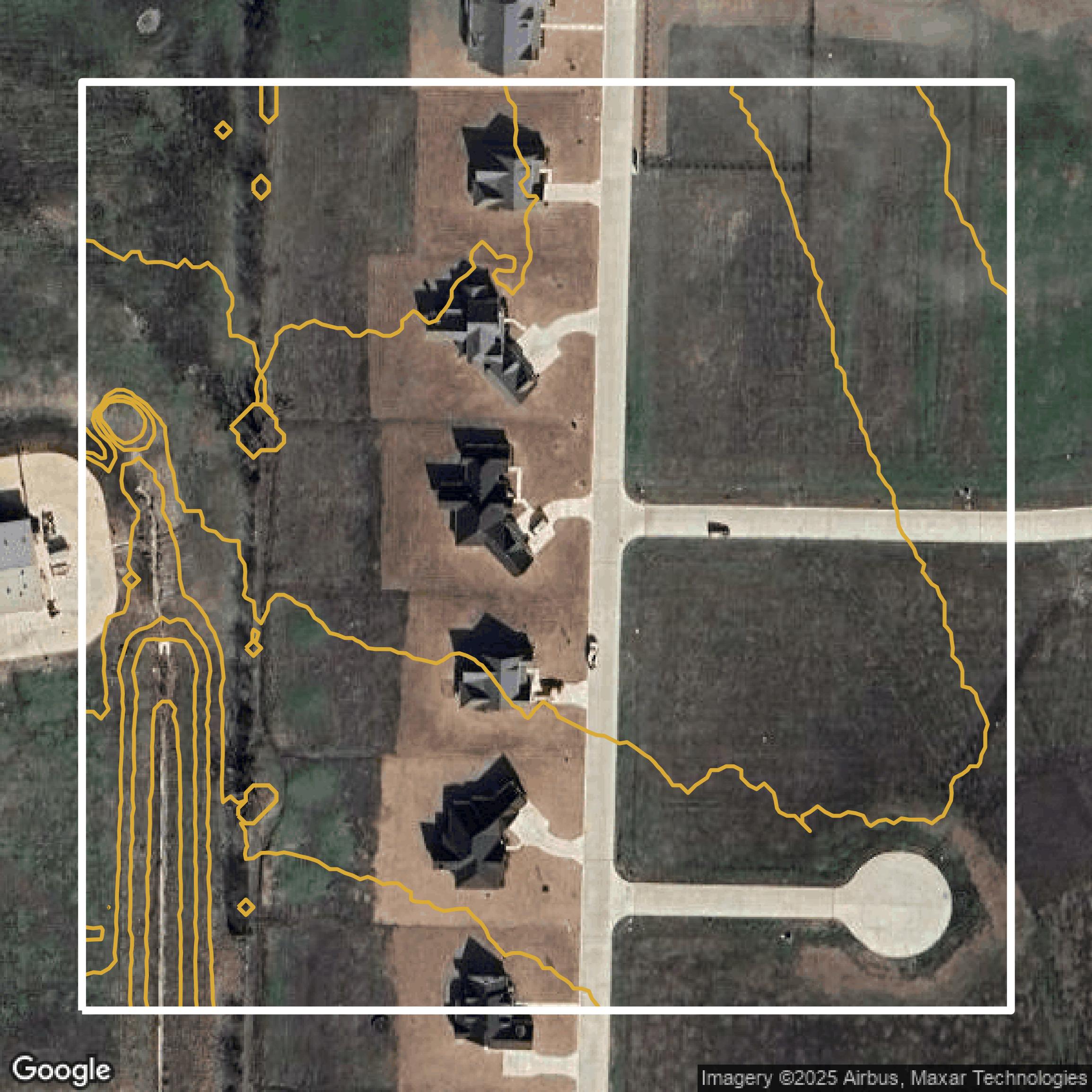
Contours
Contours in Collin County visualize 3D elevations on a 2D surface allowing you to better understand your site.
Get Contours for Collin County
Parcels and Buildings
Accessing Collin County parcel and building data on Equator gives you access to coverage across the US.
Get Parcels and Buildings for Collin County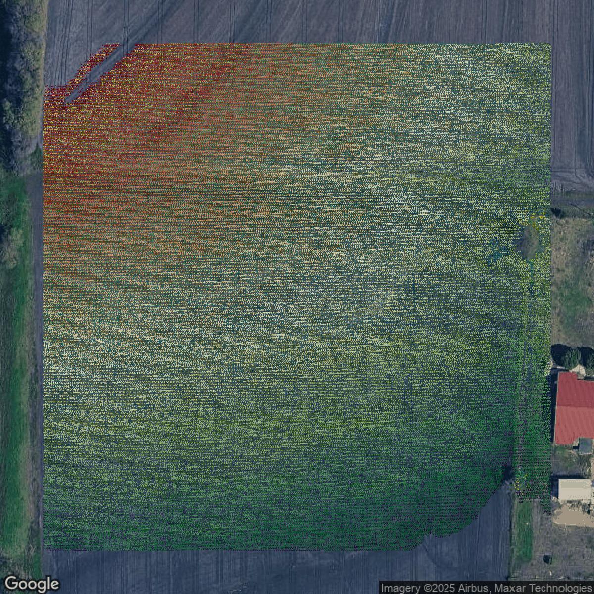
LiDAR
Collin County LiDAR uses include land surveying, analyzing crop health, or even archaeological studies.
Get LiDAR for Collin County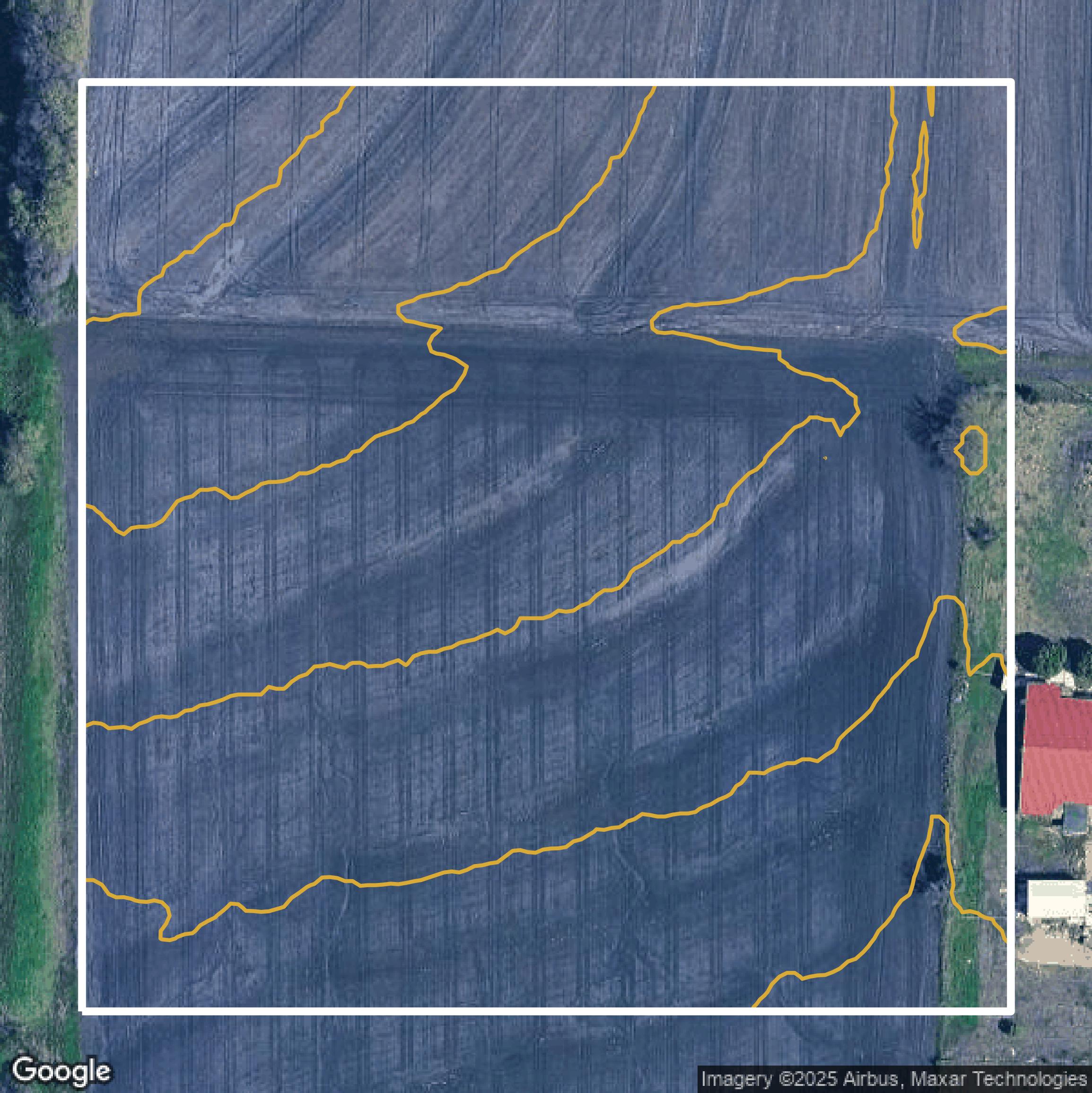
Contours
Collin County contours can be used for construction & engineering, environmental science, and more.
Get Contours for Collin County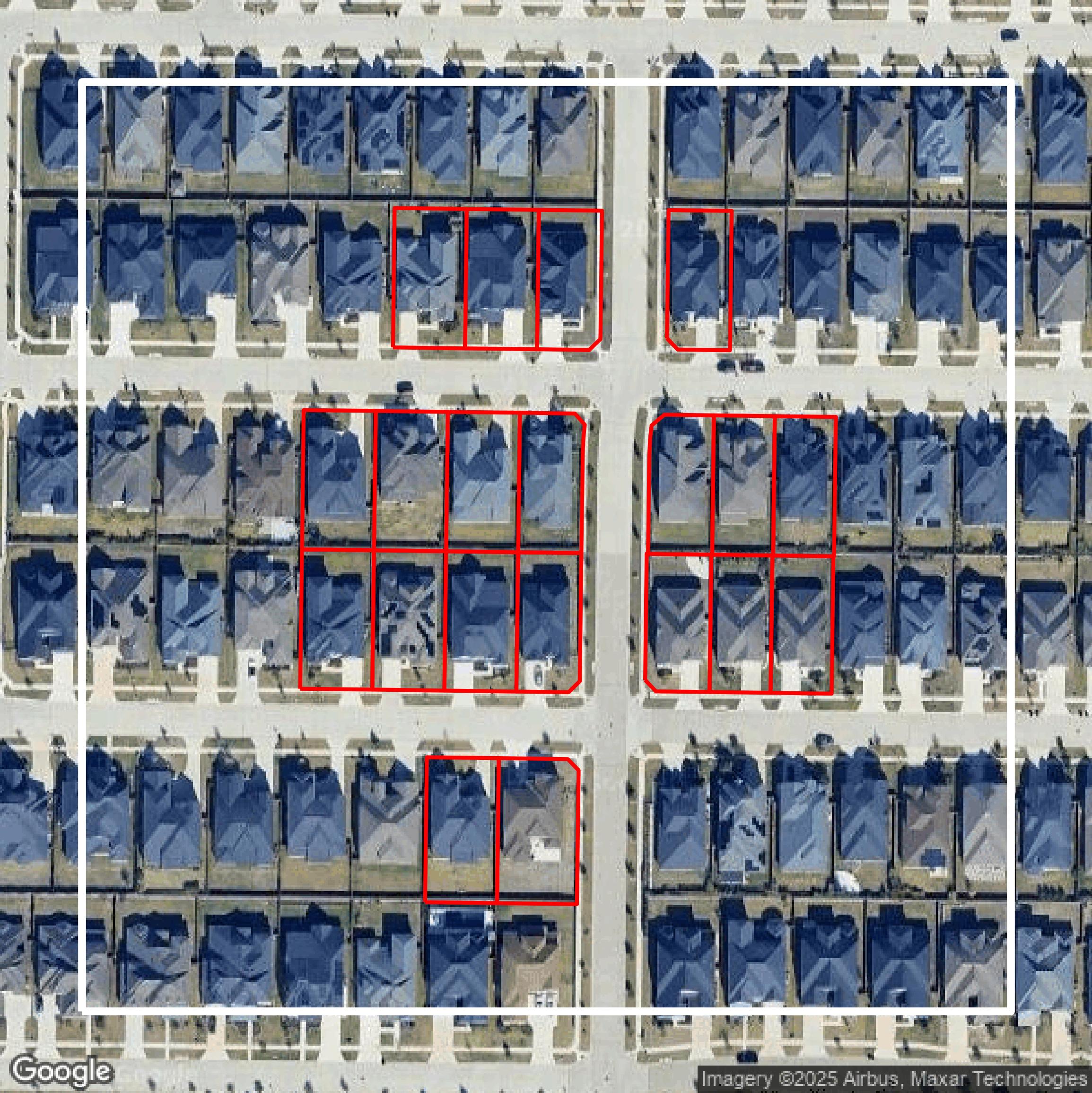
Parcels and Buildings
Dozens of fields are contained within each Collin County parcel and building data, including zoning, owners, and year built.
Get Parcels and Buildings for Collin CountyLiDAR
Equator turns Collin County LiDAR point clouds into various lidar-derived data sets, including DEMs.
Get LiDAR for Collin CountyContours
Collin County contours on Equator are produced from LiDAR coverage, allowing for high precision
Get Contours for Collin County