Overview
Salt Lake County GIS Data – For CAD
Equator helps civil engineering, architecture and consulting firms with the tools to instantly find, process and download accurate LiDAR, contours, parcel data, building footprints, DEMs, point clouds and other GIS data for Salt Lake County in an online web mapping portal.
Salt Lake County GIS Data →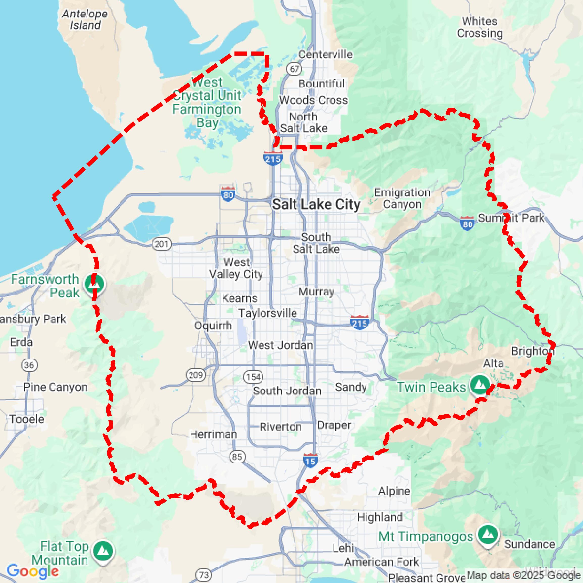

Data Available
Download GIS Data for Salt Lake County
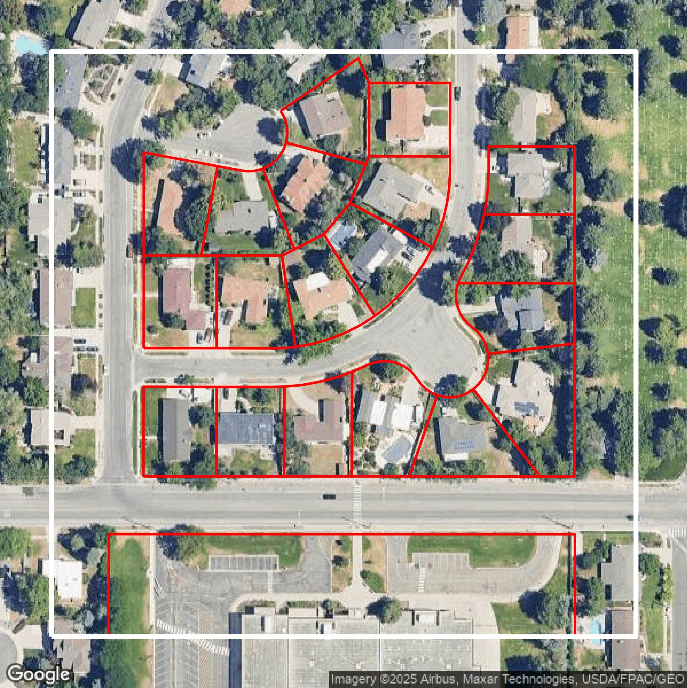
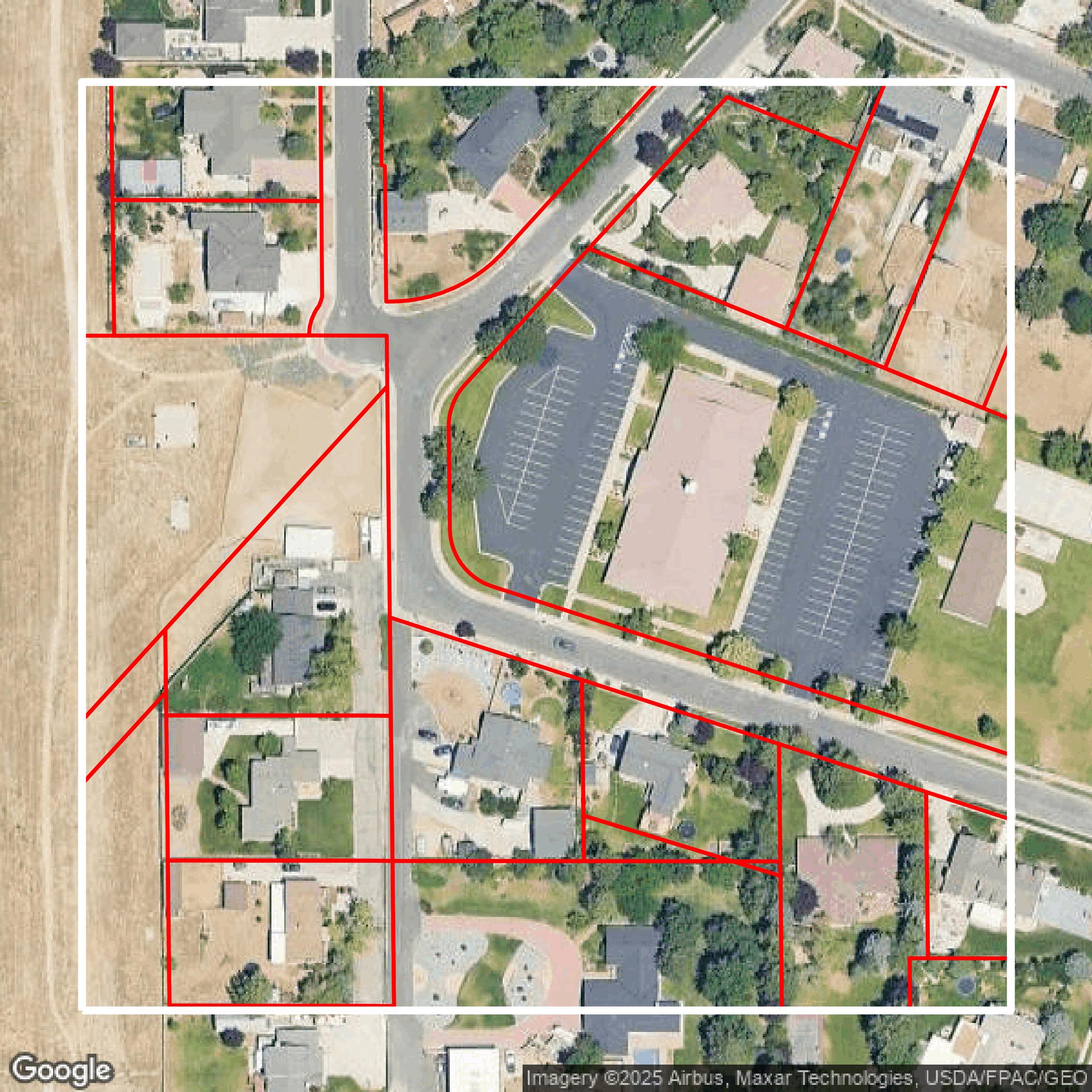
Parcels and Buildings
This image shows parcel and building data in Salt Lake County created using GIS data in Equator.
Get Parcels and Buildings for Salt Lake County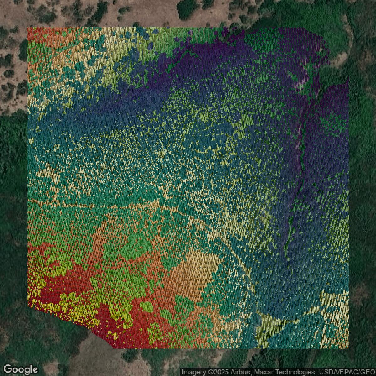
LiDAR
This image shows a LiDAR point cloud in Salt Lake County created using GIS data in Equator.
Get LiDAR for Salt Lake County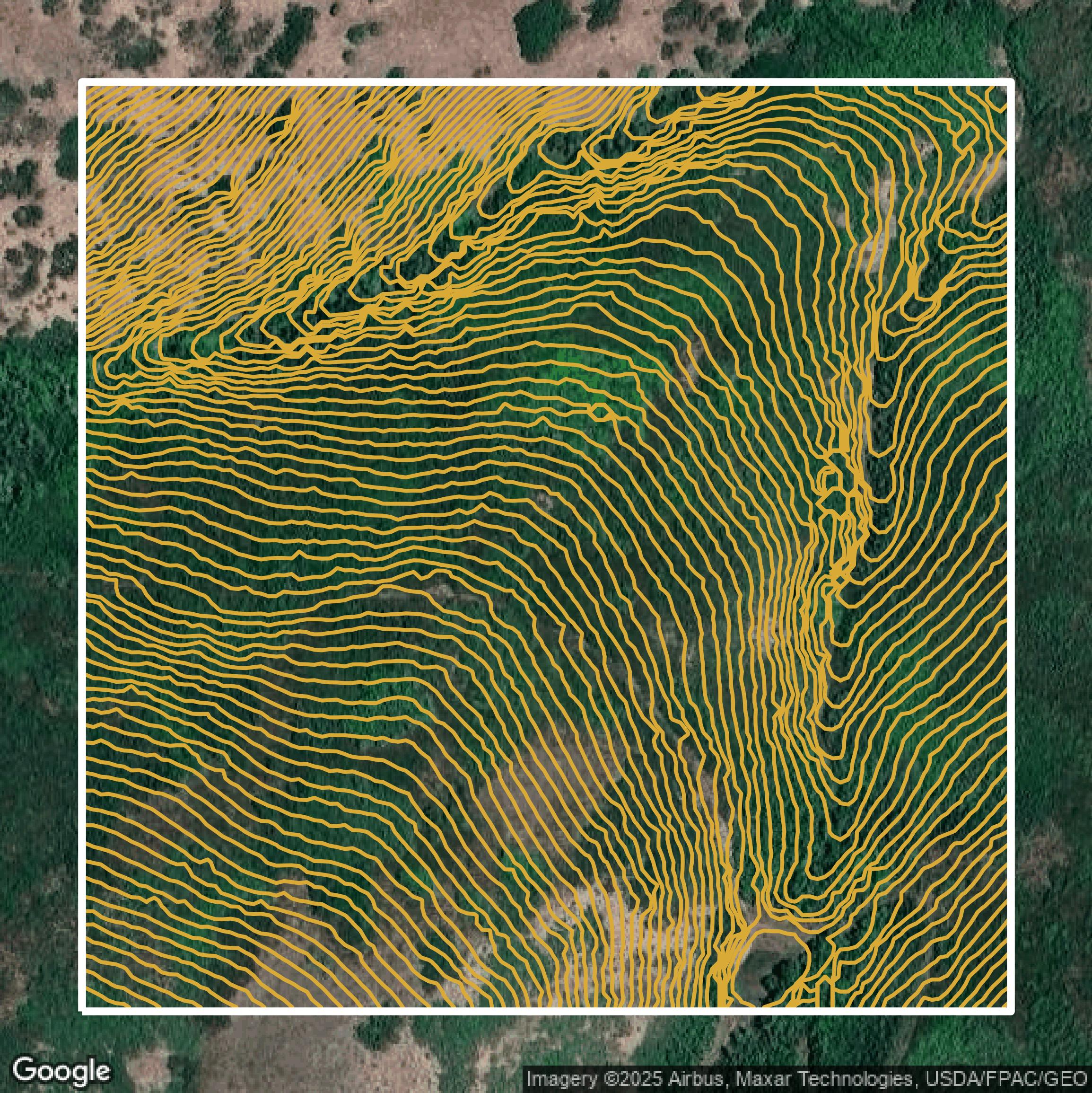
Contours
This image shows a contour map in Salt Lake County created using GIS data in Equator.
Get Contours for Salt Lake CountyFormats Available
Export Your Data Ready to Use in Multiple Formats
DWG
AutoCAD Drawing - Industry-standard CAD format
Supported Data:
Contour, Parcel, Building Outline
SHP
Shapefile - Standard GIS vector format
Supported Data:
Contour, Parcel, Building Outline
DXF
Drawing Exchange Format - Universal CAD interchange
Supported Data:
Contour, Building Outline
GeoJSON
Geographic JSON - Web-friendly spatial data format
Supported Data:
Contour, Parcel, Building Outline
LAZ
Compressed LAS - Efficient LiDAR point cloud format
Supported Data:
Point Cloud
SVG
Scalable Vector Graphics - Web vector format
Supported Data:
Contour, Building Outline
GPKG (Coming Soon)
GeoPackage - Modern OGC spatial database format
Supported Data:
Contour, Parcel, Building Outline
LandXML (Coming Soon)
Land XML - Civil engineering data exchange format
Supported Data:
Point Cloud
TIN (Coming Soon)
Triangulated Irregular Network - 3D surface model
Supported Data:
Point Cloud
XYZ (Coming Soon)
XYZ Point Cloud - Simple ASCII point cloud format
Supported Data:
Point Cloud
Background
GIS Data for Salt Lake County
The Salt Lake County Recorder Data Services website offers a subscription-based platform providing comprehensive property record searches, including owner of record, parcel number history, property legal descriptions, recorded documents, tract index, chain of title, recorded subdivision maps, and plat maps. Visitors can expect streamlined access through various subscription options such as a $5 Token for 24-hour access or Data Packages for consistent and extended use. Payments are handled exclusively online by credit or debit card, and the service includes account management and customer support to assist with login or purchasing issues. This site is ideal for users needing detailed, reliable property data with flexible access tailored to occasional or frequent needs.
Access Salt Lake County GIS Data in Equator →Salt Lake County Portal →Showcase
Sample GIS Data for Salt Lake County
Parcels and Buildings
Parcel and building data in Salt Lake County are used in a variety of fields including architecture, real estate, and urban planning.
Get Parcels and Buildings for Salt Lake County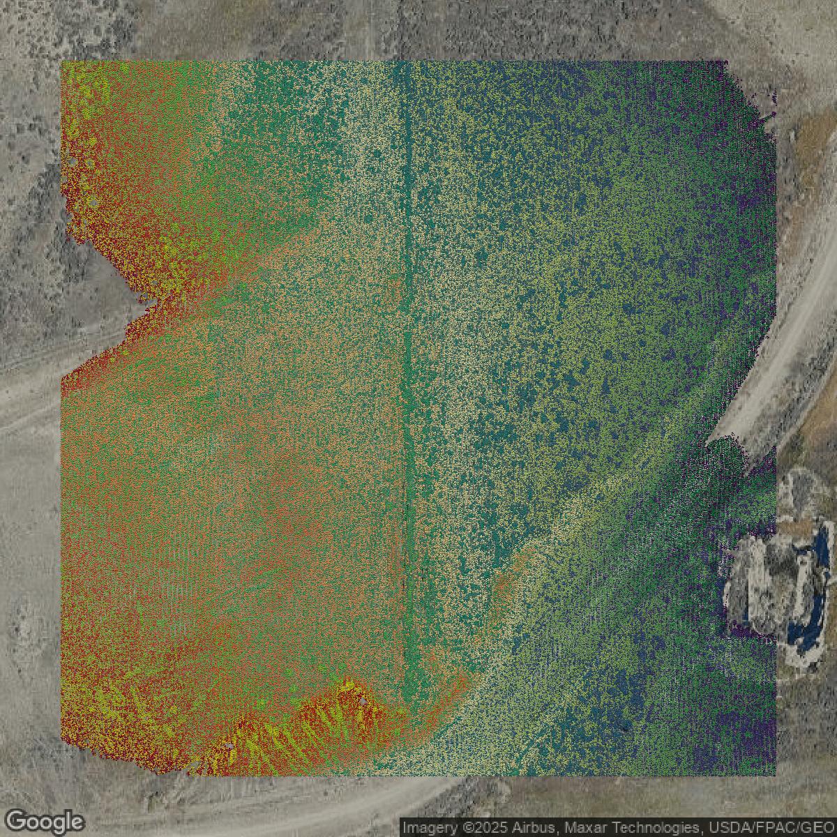
LiDAR
Point clouds (LiDAR) in Salt Lake County can produce highly accurate 3D models of terrain, structures, and vegetation.
Get LiDAR for Salt Lake County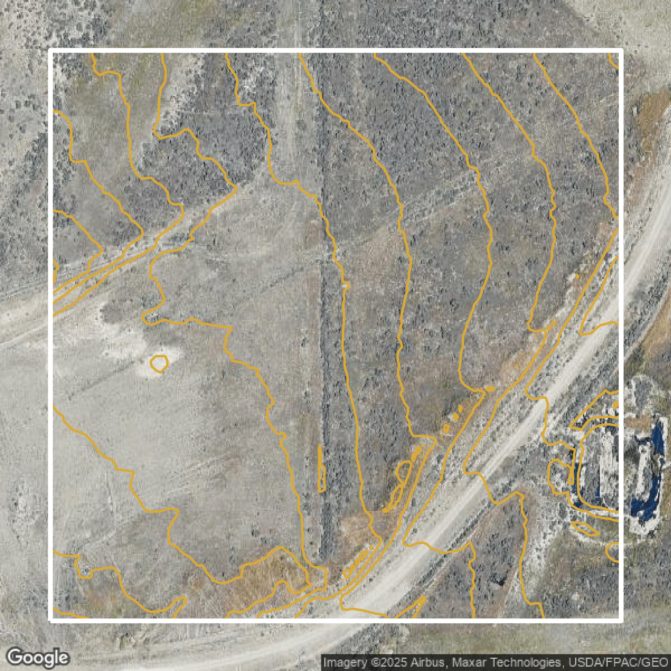
Contours
Contours in Salt Lake County visualize 3D elevations on a 2D surface allowing you to better understand your site.
Get Contours for Salt Lake County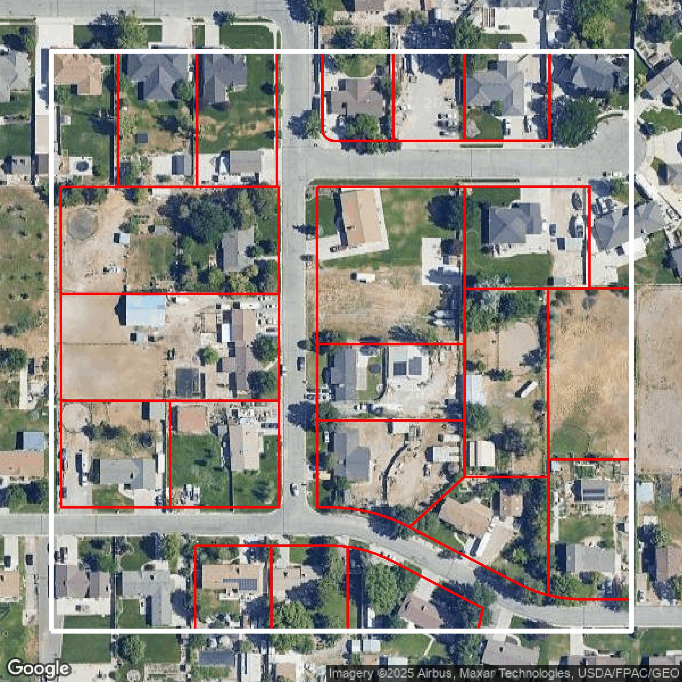
Parcels and Buildings
Accessing Salt Lake County parcel and building data on Equator gives you access to coverage across the US.
Get Parcels and Buildings for Salt Lake County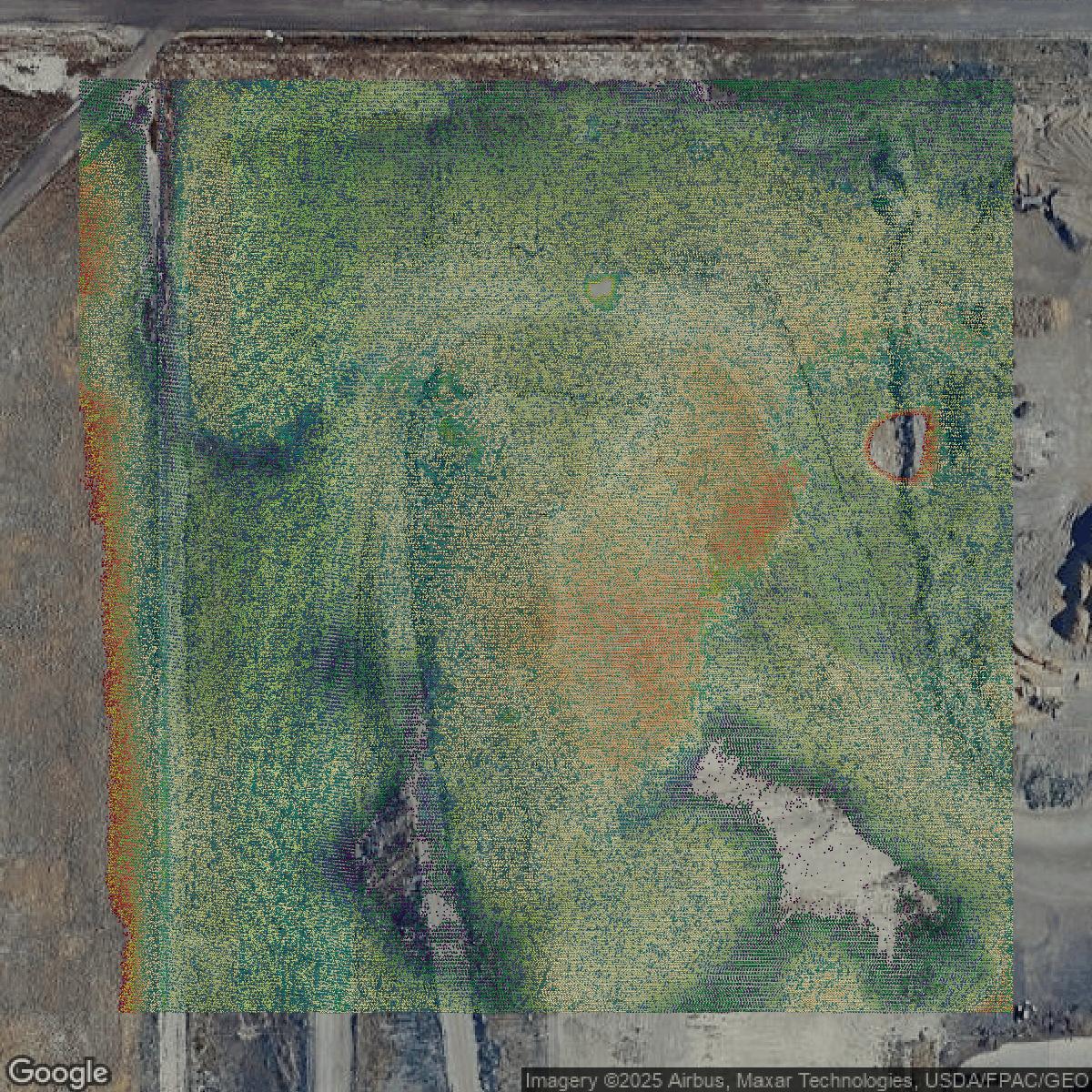
LiDAR
Salt Lake County LiDAR uses include land surveying, analyzing crop health, or even archaeological studies.
Get LiDAR for Salt Lake County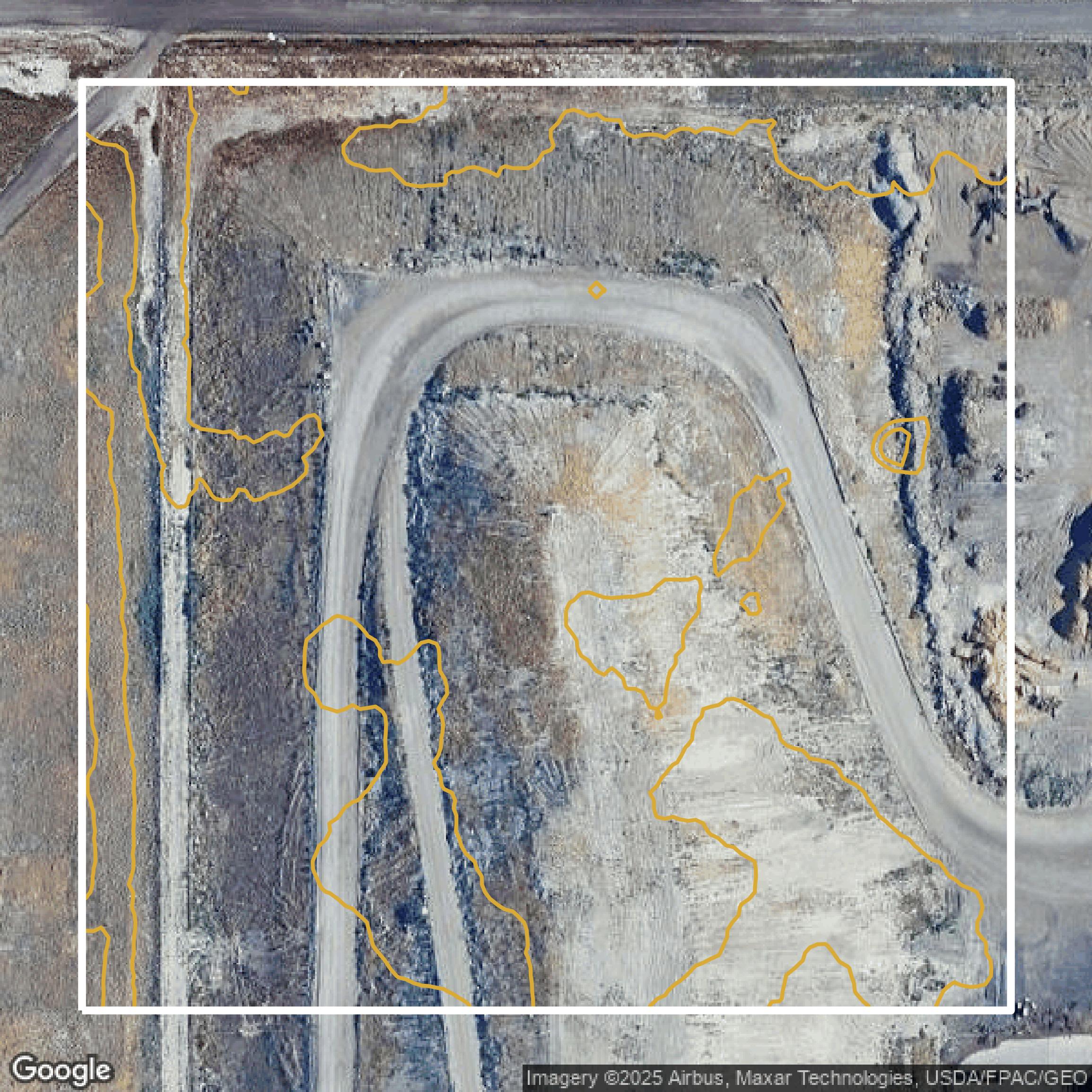
Contours
Salt Lake County contours can be used for construction & engineering, environmental science, and more.
Get Contours for Salt Lake County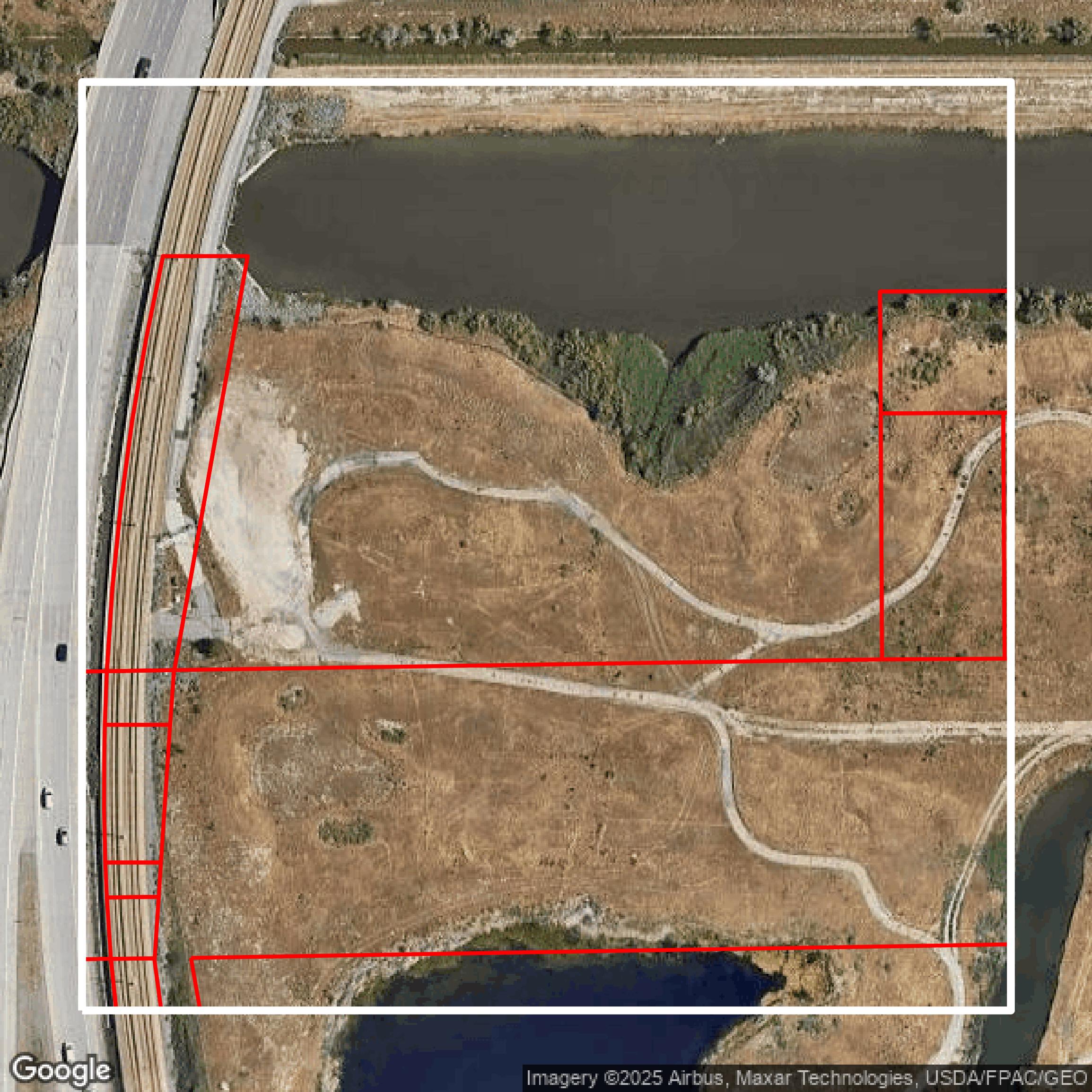
Parcels and Buildings
Dozens of fields are contained within each Salt Lake County parcel and building data, including zoning, owners, and year built.
Get Parcels and Buildings for Salt Lake County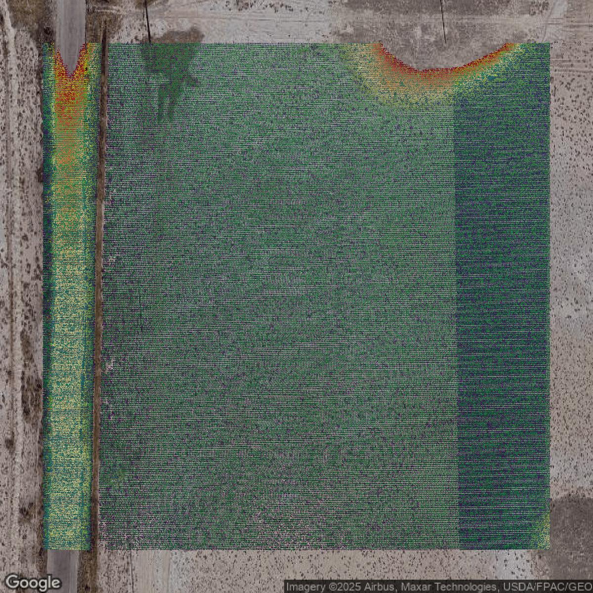
LiDAR
Equator turns Salt Lake County LiDAR point clouds into various lidar-derived data sets, including DEMs.
Get LiDAR for Salt Lake County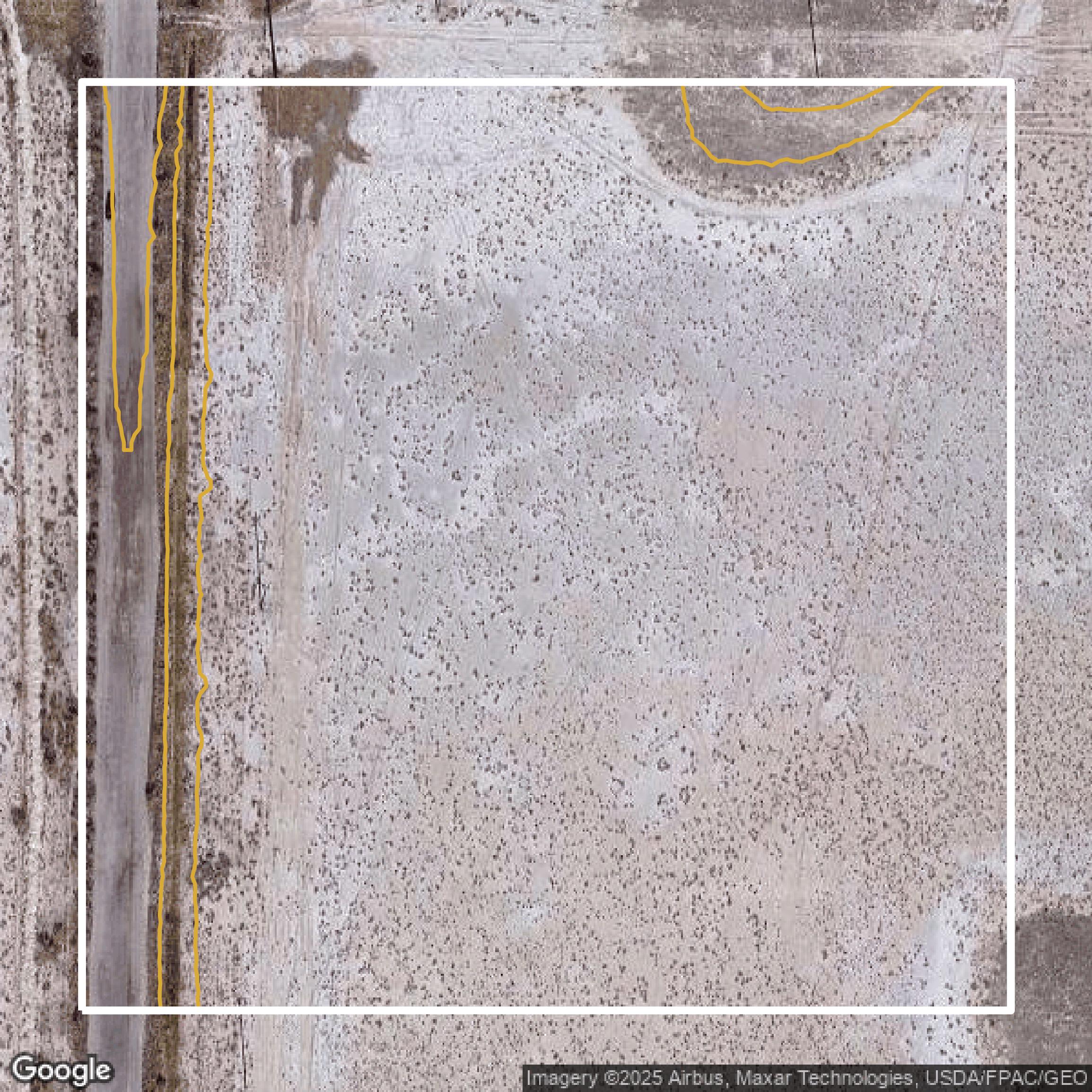
Contours
Salt Lake County contours on Equator are produced from LiDAR coverage, allowing for high precision
Get Contours for Salt Lake County