Overview
Lynchburg city GIS Data - For CAD
Equator helps civil engineering, architecture and consulting firms with the tools to instantly find, process and download accurate LiDAR, contours, parcel data, building footprints, DEMs, point clouds and other GIS data for Lynchburg city in an online web mapping portal.
Lynchburg city GIS Data ->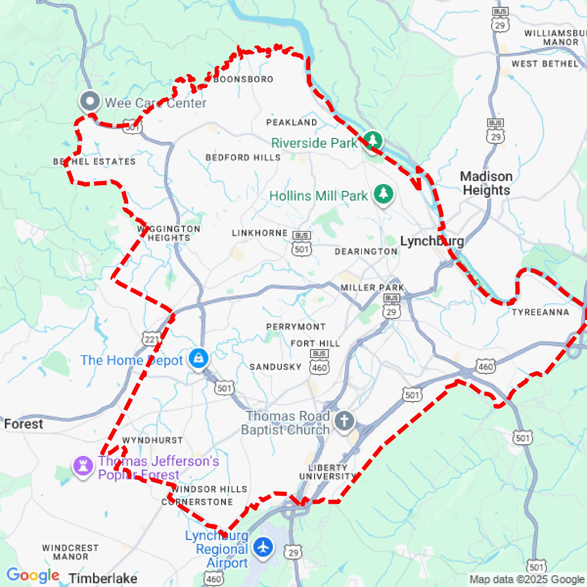

Data Available
Download GIS Data for Lynchburg city
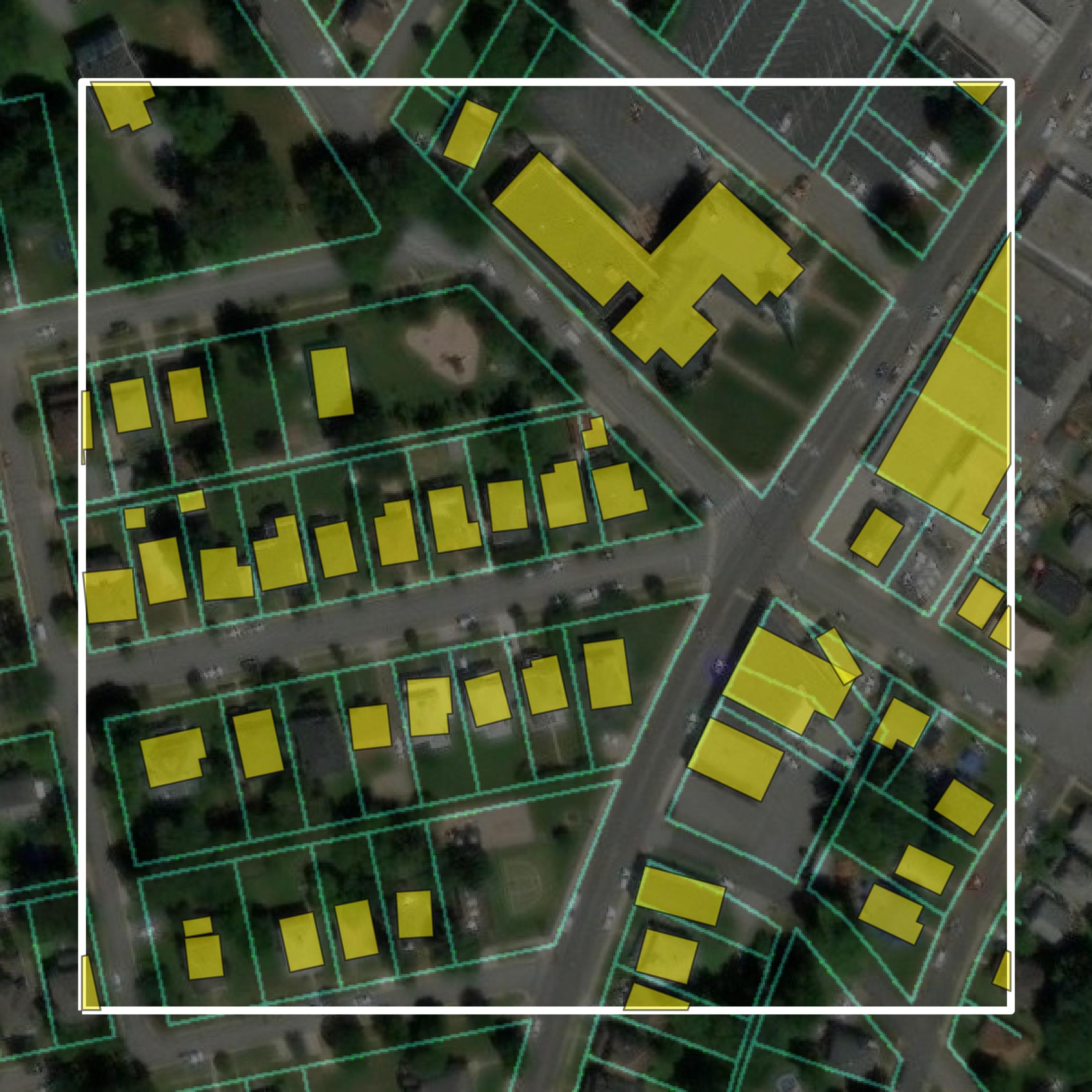
Parcels and Buildings
This image shows parcel and building data in Lynchburg city created using GIS data in Equator.
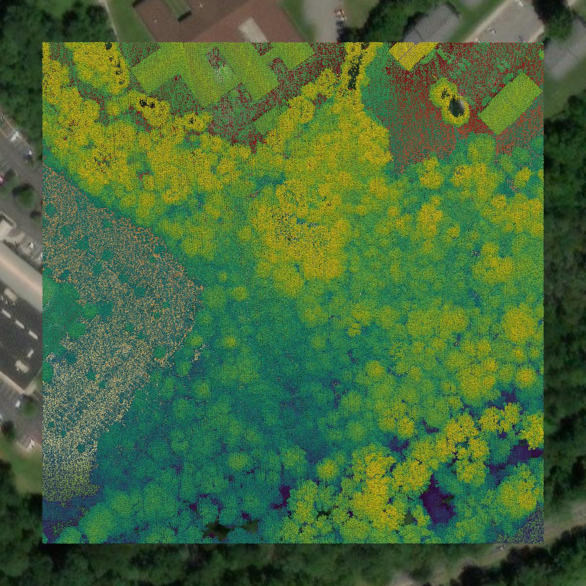
LiDAR
This image shows a LiDAR point cloud in Lynchburg city created using GIS data in Equator.
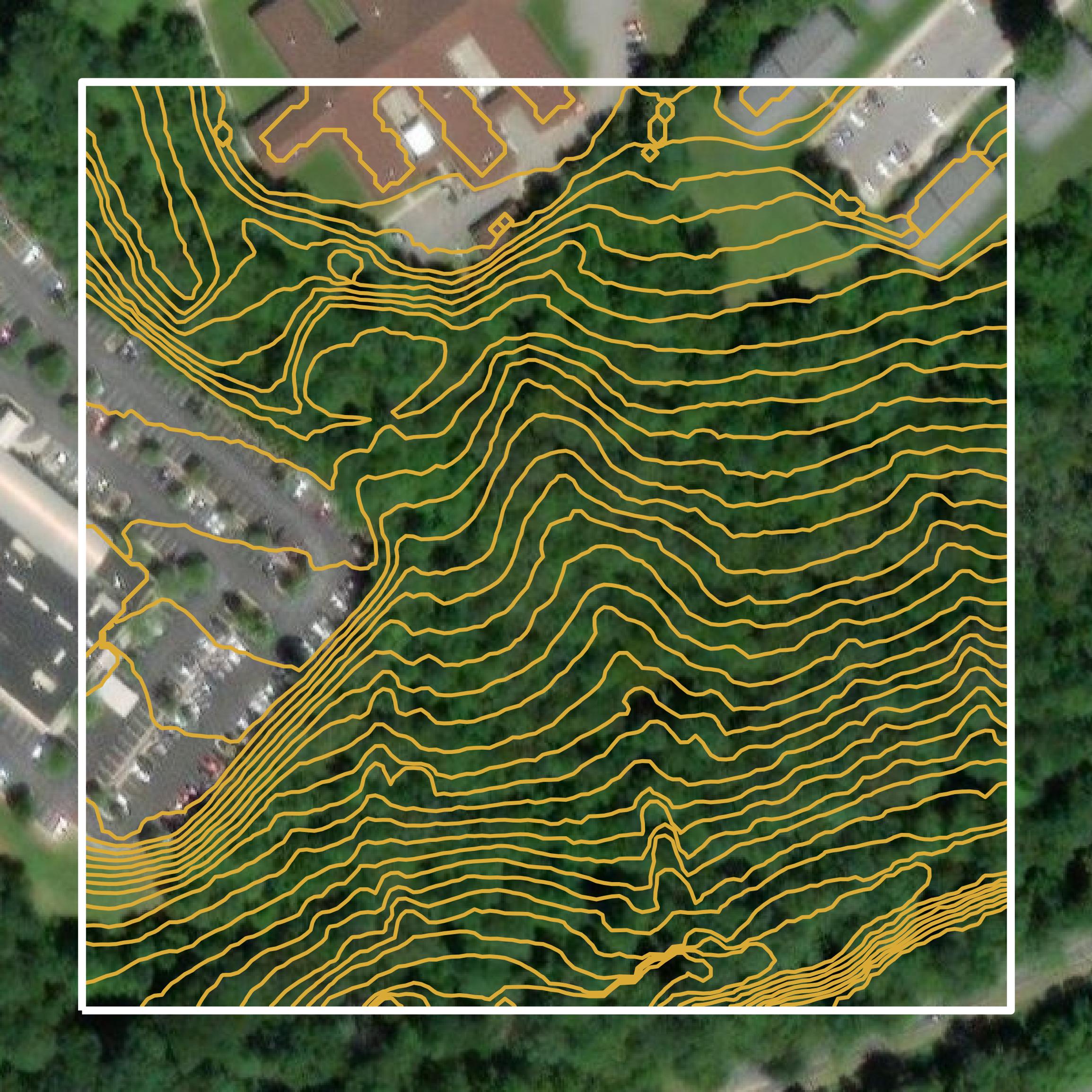
Contours
This image shows a contour map in Lynchburg city created using GIS data in Equator.
Formats Available
Export Your Data Ready to Use in Multiple Formats
DWG
AutoCAD Drawing - Industry-standard CAD format
Supported Data:
Contour, Parcel, Building Outline
SHP
Shapefile - Standard GIS vector format
Supported Data:
Contour, Parcel, Building Outline
DXF
Drawing Exchange Format - Universal CAD interchange
Supported Data:
Contour, Building Outline
GeoJSON
Geographic JSON - Web-friendly spatial data format
Supported Data:
Contour, Parcel, Building Outline
LAZ
Compressed LAS - Efficient LiDAR point cloud format
Supported Data:
Point Cloud
SVG
Scalable Vector Graphics - Web vector format
Supported Data:
Contour, Building Outline
GPKG
GeoPackage - Modern OGC spatial database format
Supported Data:
Contour, Parcel, Building Outline
LandXML (Coming Soon)
Land XML - Civil engineering data exchange format
Supported Data:
Point Cloud
TIN (Coming Soon)
Triangulated Irregular Network - 3D surface model
Supported Data:
Point Cloud
XYZ (Coming Soon)
XYZ Point Cloud - Simple ASCII point cloud format
Supported Data:
Point Cloud
Background
GIS Data for Lynchburg city
The webpage outlines the GIS data sharing and distribution policy for the City of Lynchburg, Virginia, emphasizing the importance of geographic information in reducing duplication of effort for local governments. It details the types of GIS datasets available, including parcel data, zoning information, aerial imagery, and other spatial data resources. Users can access various GIS data layers and tabular information through online applications, including a map gallery and an open data portal, where some datasets are available for download. The page also includes disclaimers regarding data accuracy and ownership, noting that certain confidential information is not publicly accessible. Additionally, it specifies the technical specifications and formats for the GIS data provided by the city.
Access Lynchburg city GIS Data in Equator →Lynchburg city Portal →Showcase
Sample GIS Data for Lynchburg city
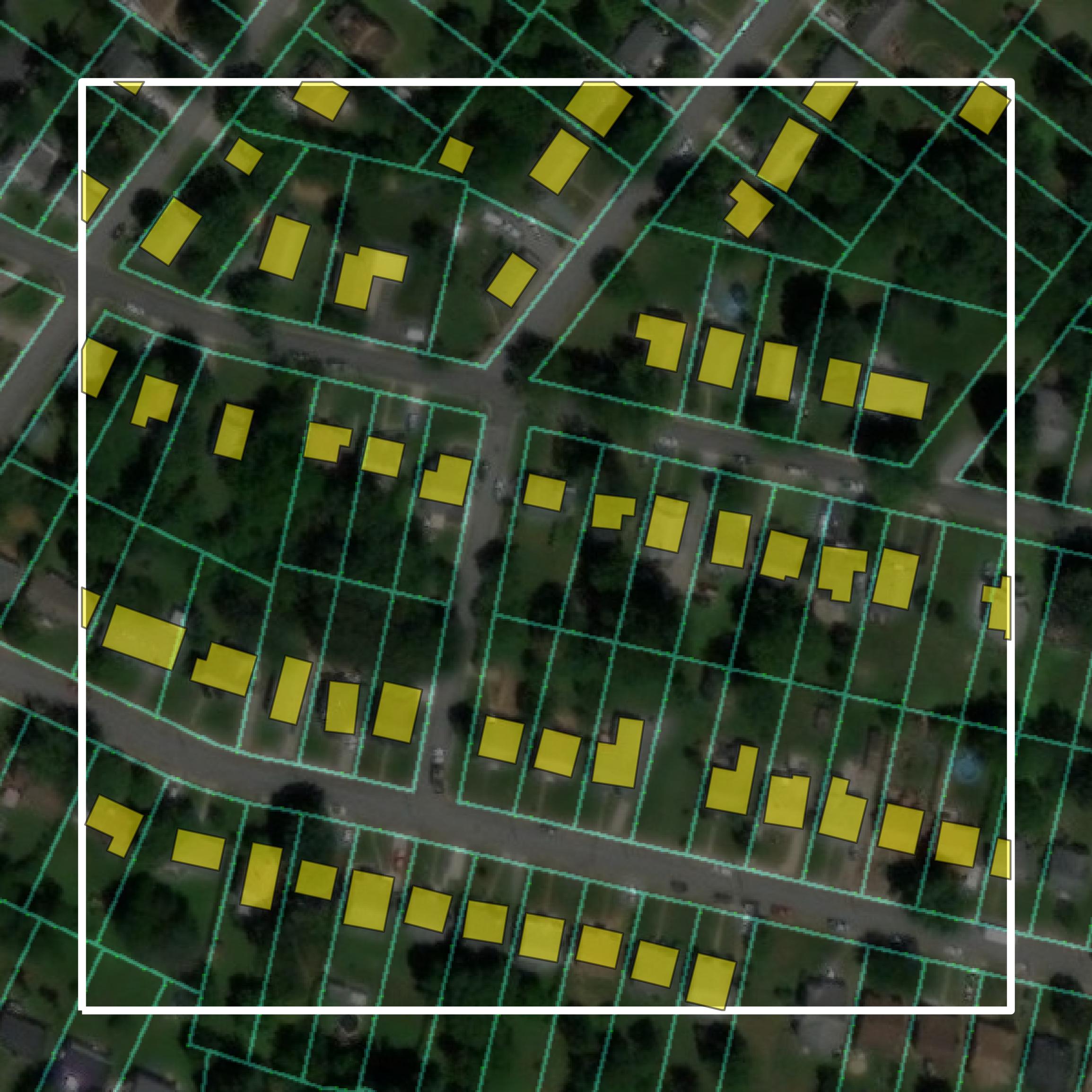
Parcels and Buildings
Parcel and building data in Lynchburg city are used in a variety of fields including architecture, real estate, and urban planning.
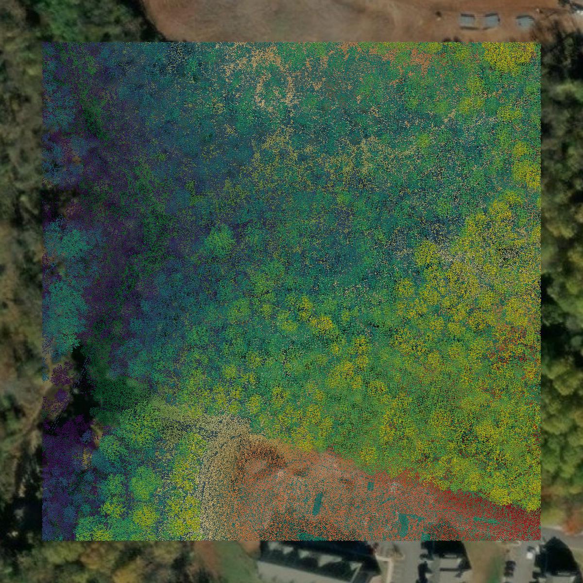
LiDAR
Point clouds (LiDAR) in Lynchburg city can produce highly accurate 3D models of terrain, structures, and vegetation.
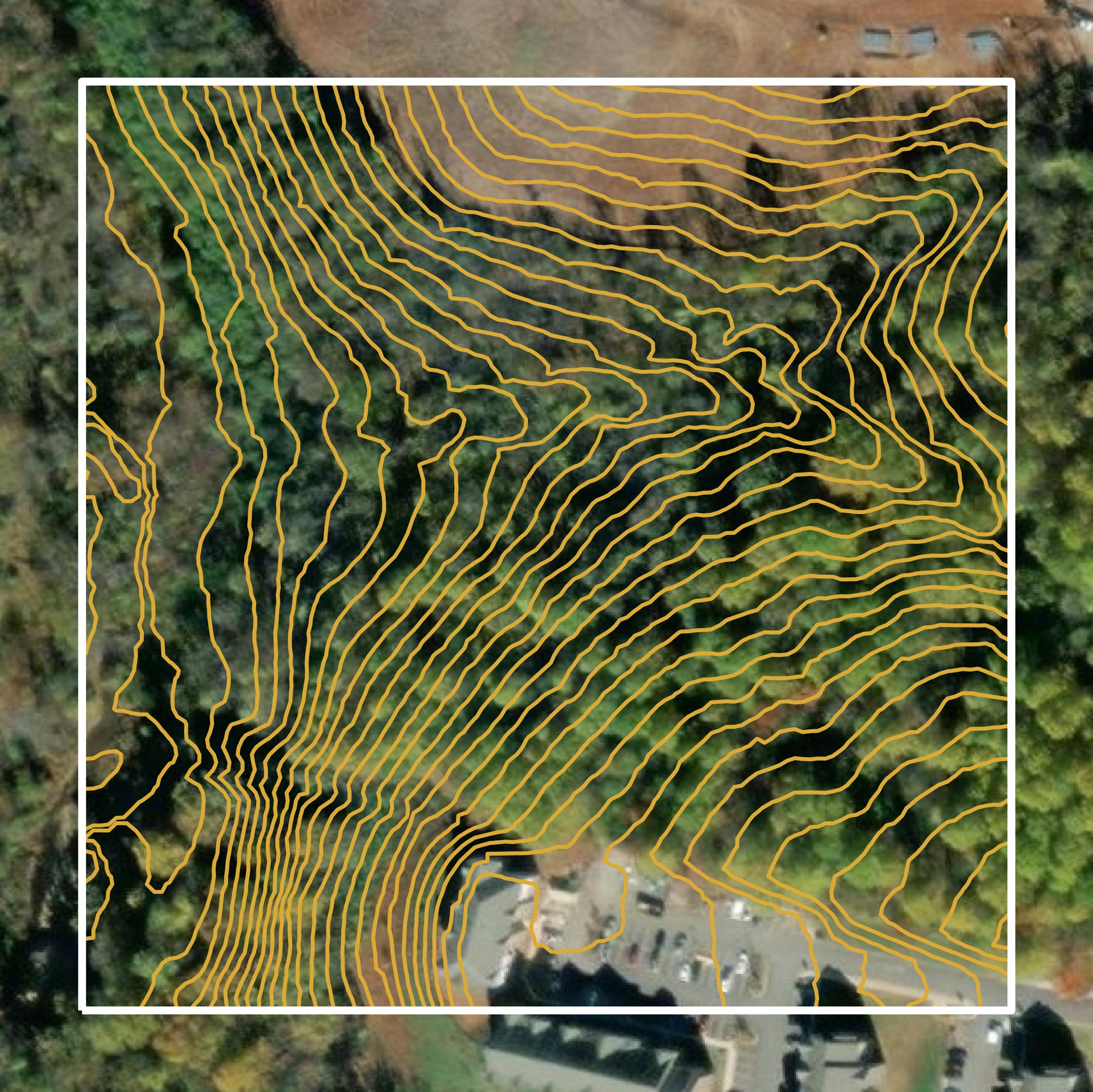
Contours
Contours in Lynchburg city visualize 3D elevations on a 2D surface allowing you to better understand your site.