Overview
Salem city GIS Data – For CAD
Equator helps civil engineering, architecture and consulting firms with the tools to instantly find, process and download accurate LiDAR, contours, parcel data, building footprints, DEMs, point clouds and other GIS data for Salem city in an online web mapping portal.
Salem city GIS Data →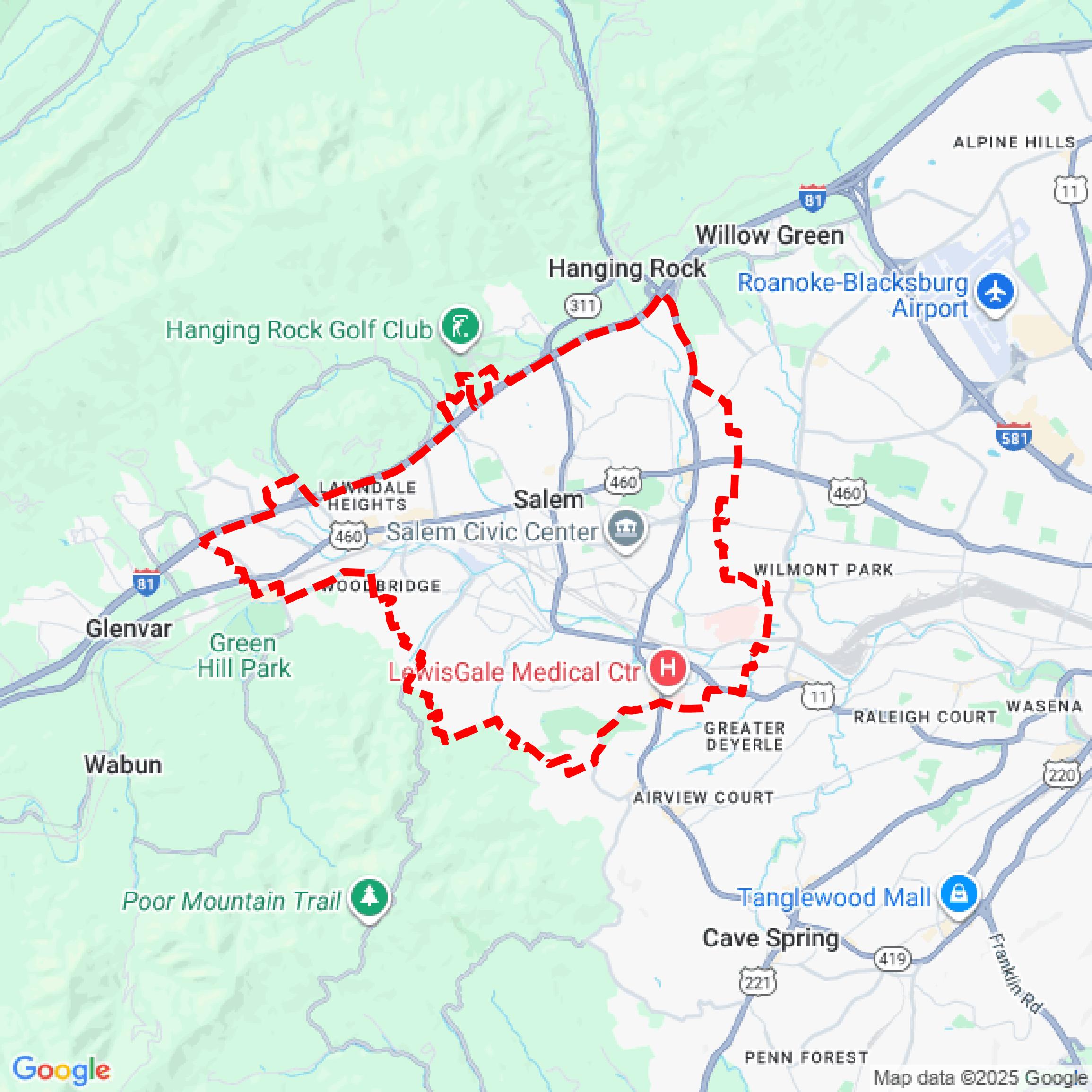

Data Available
Download GIS Data for Salem city
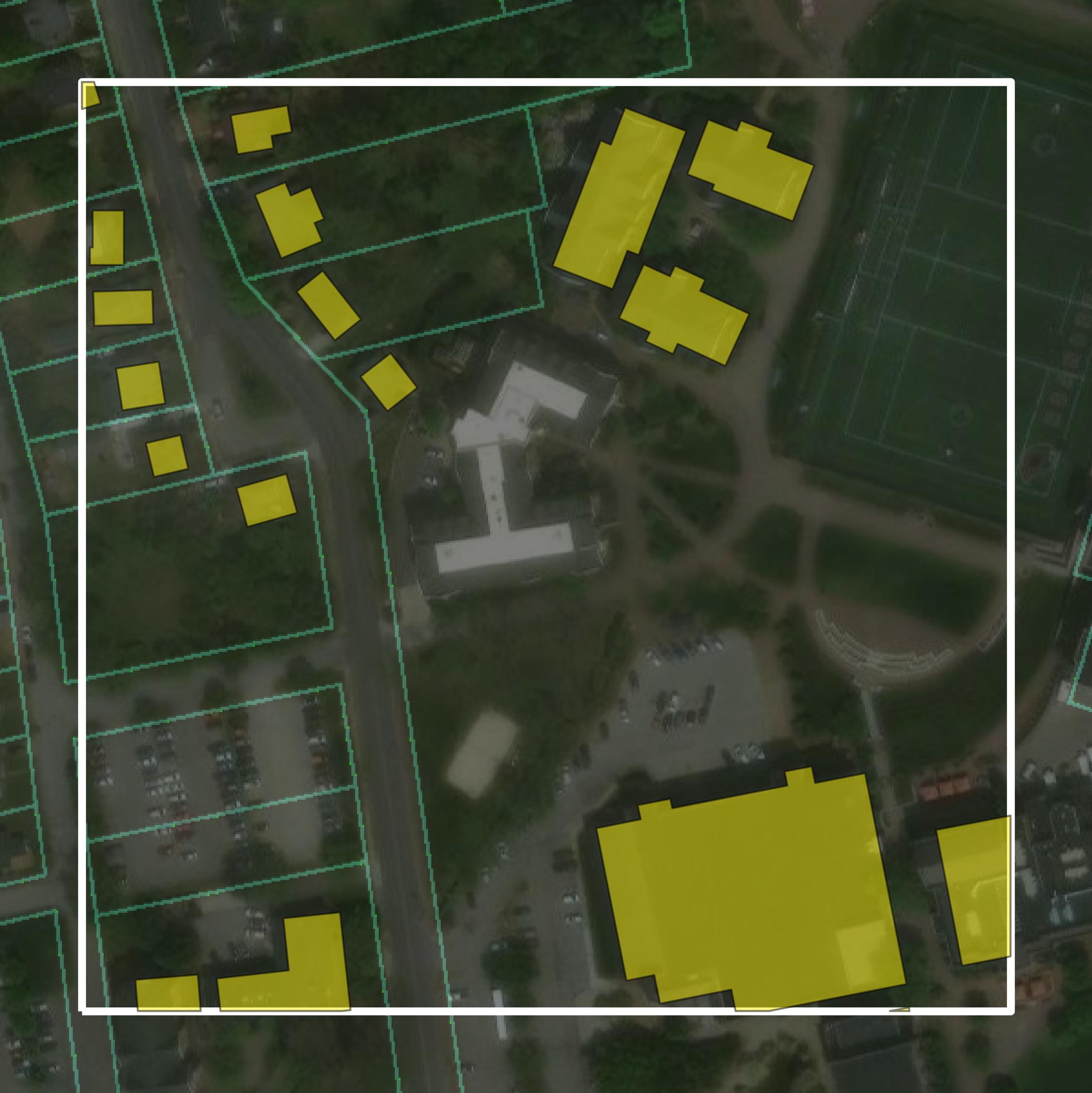
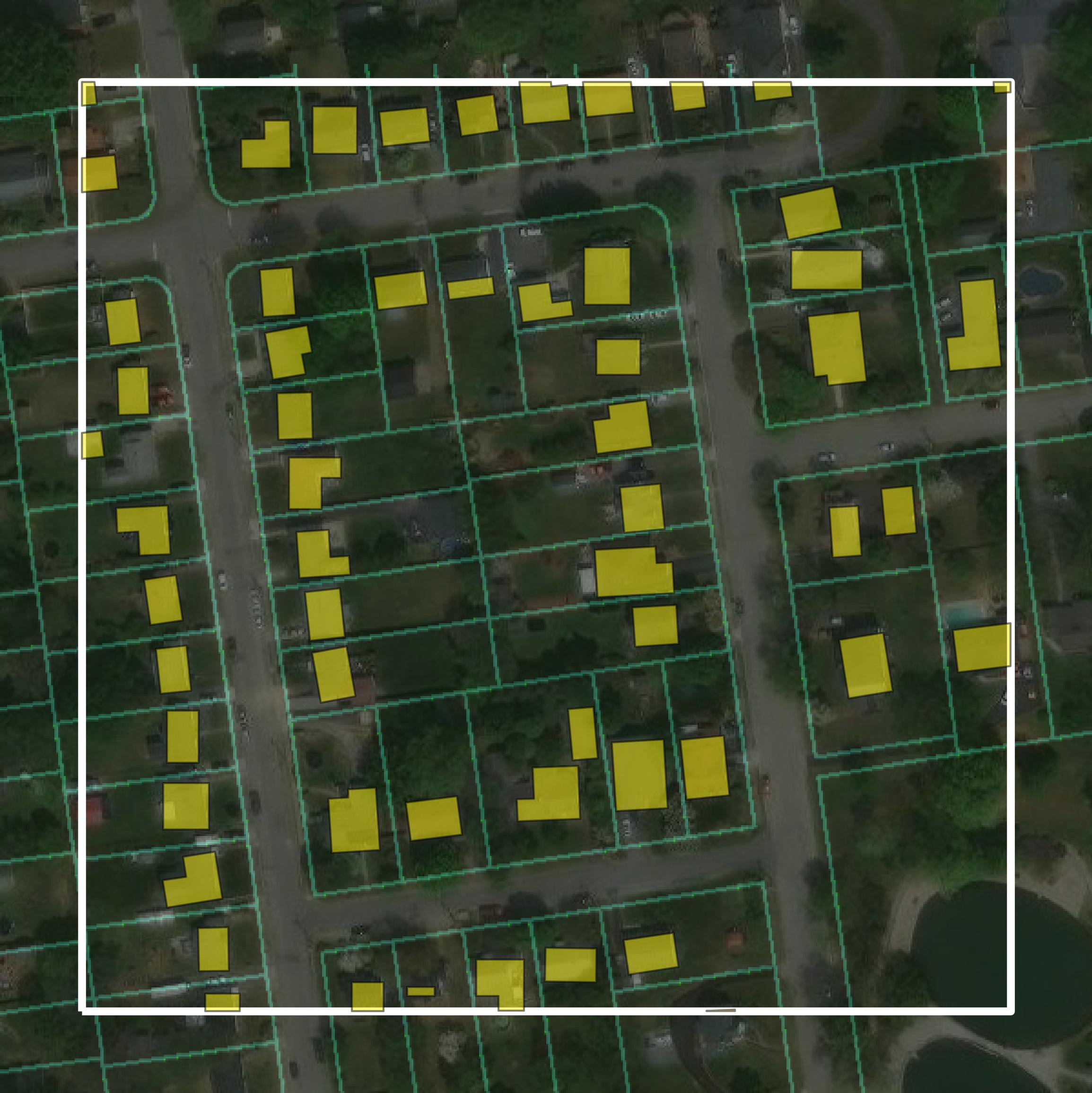
Parcels and Buildings
This image shows parcel and building data in Salem city created using GIS data in Equator.
Get Parcels and Buildings for Salem city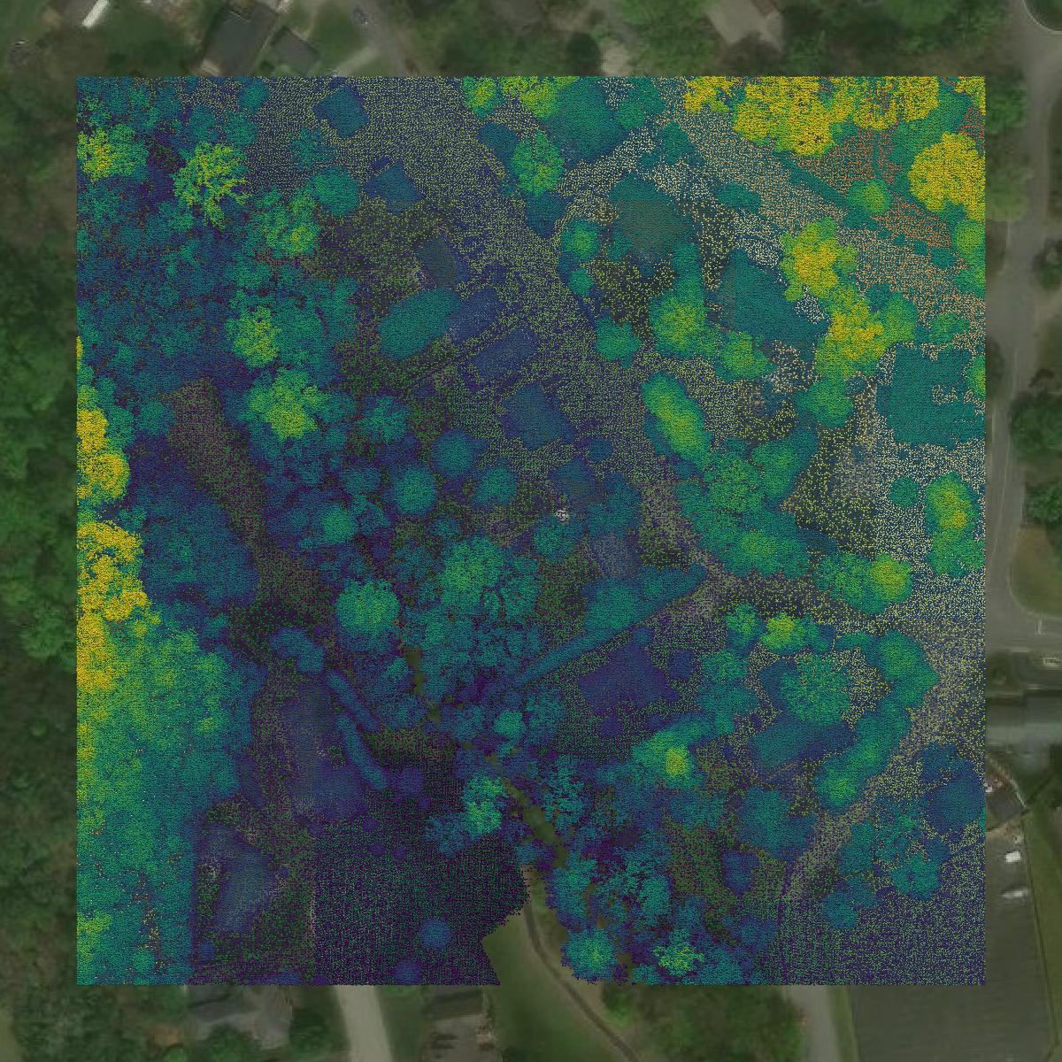
LiDAR
This image shows a LiDAR point cloud in Salem city created using GIS data in Equator.
Get LiDAR for Salem city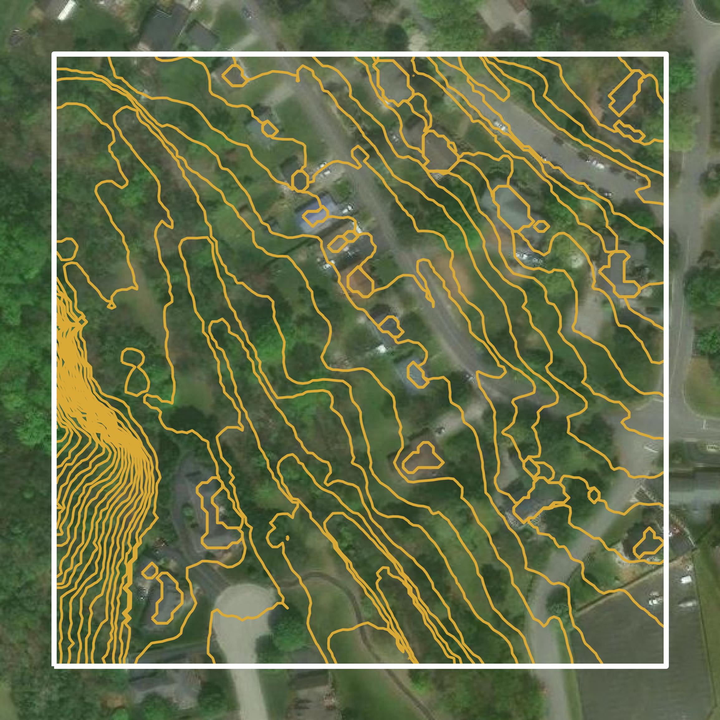
Contours
This image shows a contour map in Salem city created using GIS data in Equator.
Get Contours for Salem cityFormats Available
Export Your Data Ready to Use in Multiple Formats
DWG
AutoCAD Drawing - Industry-standard CAD format
Supported Data:
Contour, Parcel, Building Outline
SHP
Shapefile - Standard GIS vector format
Supported Data:
Contour, Parcel, Building Outline
DXF
Drawing Exchange Format - Universal CAD interchange
Supported Data:
Contour, Building Outline
GeoJSON
Geographic JSON - Web-friendly spatial data format
Supported Data:
Contour, Parcel, Building Outline
LAZ
Compressed LAS - Efficient LiDAR point cloud format
Supported Data:
Point Cloud
SVG
Scalable Vector Graphics - Web vector format
Supported Data:
Contour, Building Outline
GPKG (Coming Soon)
GeoPackage - Modern OGC spatial database format
Supported Data:
Contour, Parcel, Building Outline
LandXML (Coming Soon)
Land XML - Civil engineering data exchange format
Supported Data:
Point Cloud
TIN (Coming Soon)
Triangulated Irregular Network - 3D surface model
Supported Data:
Point Cloud
XYZ (Coming Soon)
XYZ Point Cloud - Simple ASCII point cloud format
Supported Data:
Point Cloud
Background
GIS Data for Salem city
The Geographic Information Systems (GIS) webpage for Salem, Virginia, serves as a comprehensive resource for accessing a variety of GIS datasets and spatial data resources. It includes interactive web applications and maps that feature parcel data, zoning information, aerial imagery, city facilities, recycling locations, polling places, flood zone details, and commercial property listings. Additional tools allow users to explore bike routes, historical maps, and park amenities. The GIS Open Data Portal facilitates the download of GIS layers and datasets, while links to external GIS resources are also provided. Overall, the site aims to enhance public communication and decision-making through geospatial analysis.
Access Salem city GIS Data in Equator →Salem city Portal →Showcase
Sample GIS Data for Salem city
Parcels and Buildings
Parcel and building data in Salem city are used in a variety of fields including architecture, real estate, and urban planning.
Get Parcels and Buildings for Salem city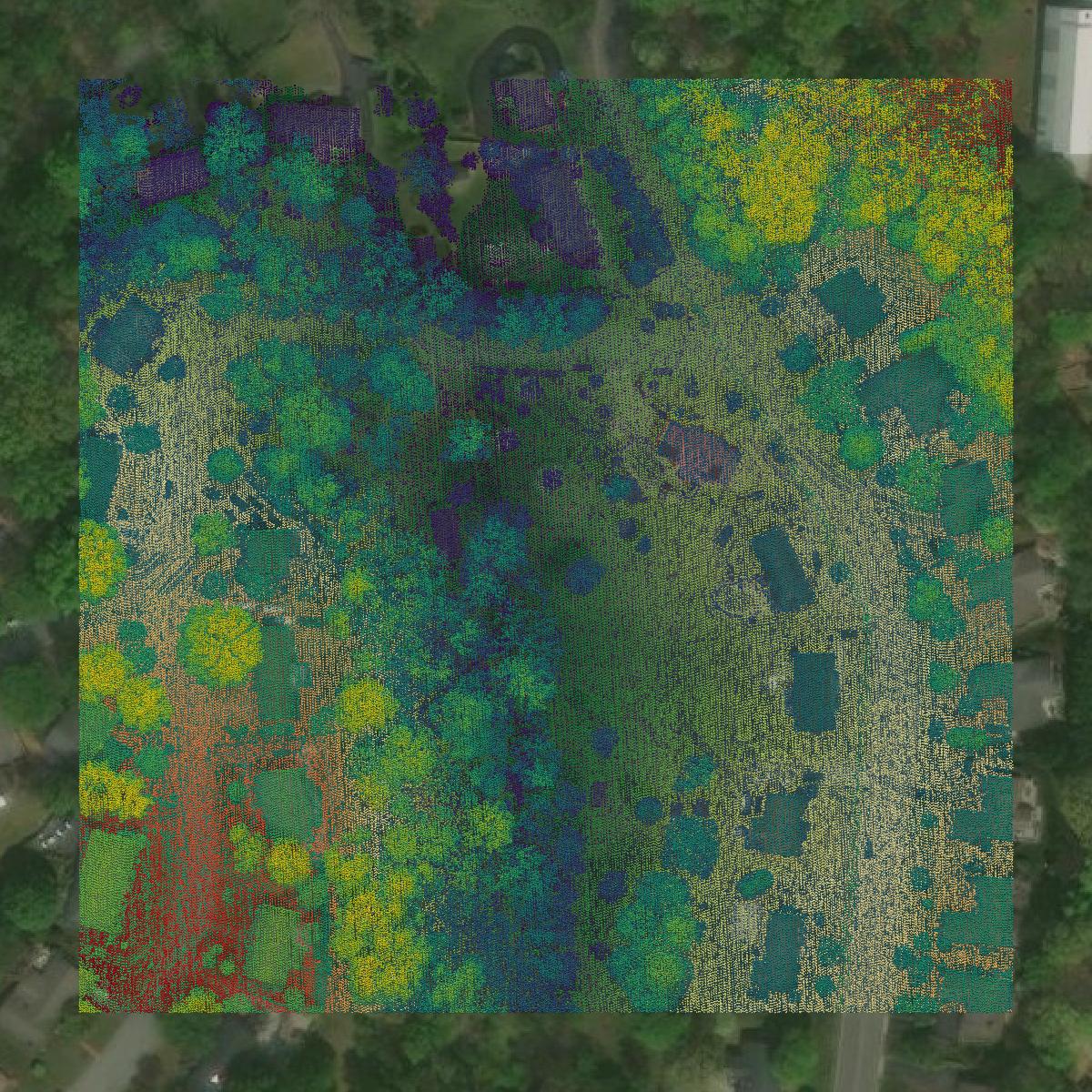
LiDAR
Point clouds (LiDAR) in Salem city can produce highly accurate 3D models of terrain, structures, and vegetation.
Get LiDAR for Salem city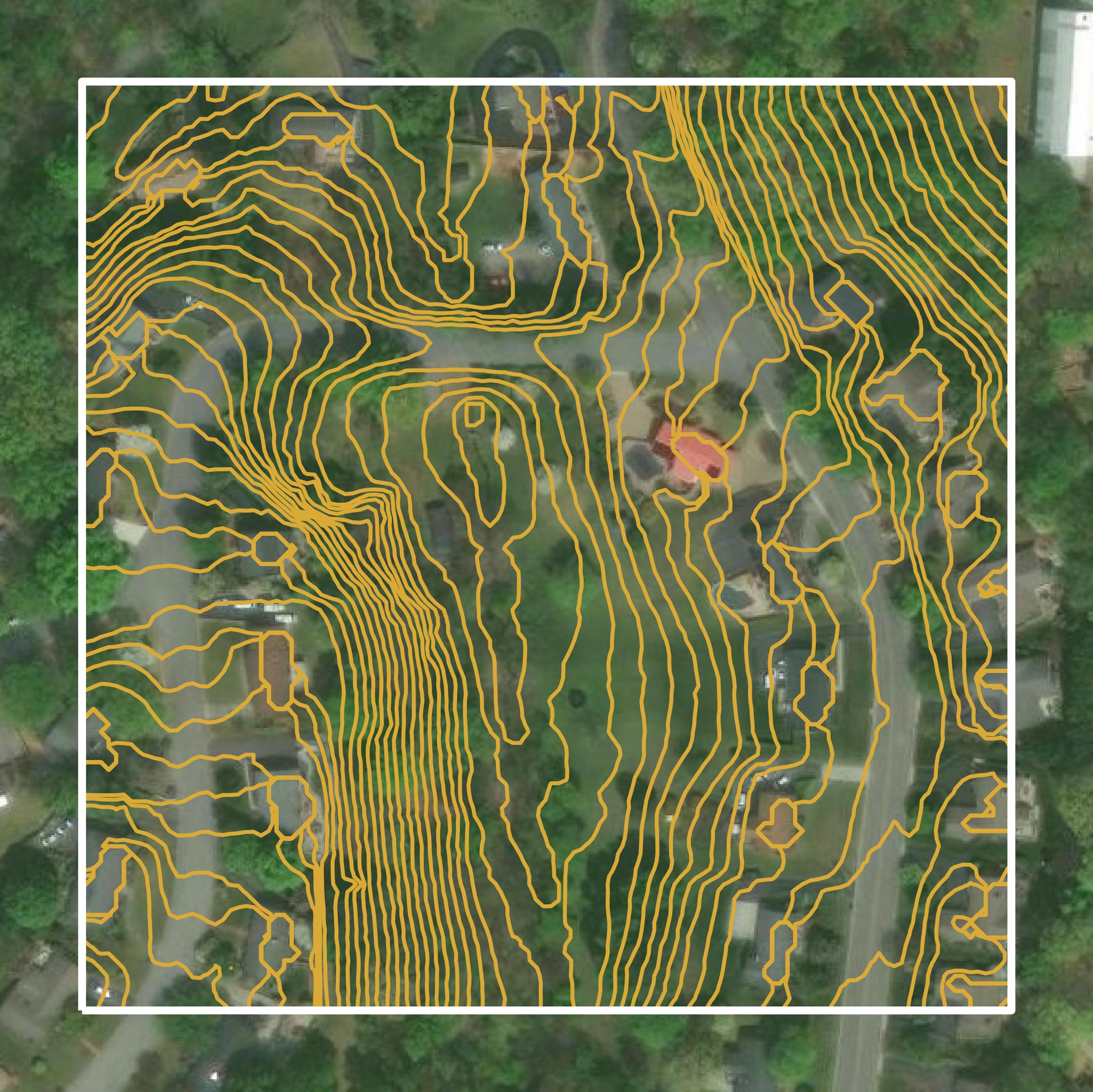
Contours
Contours in Salem city visualize 3D elevations on a 2D surface allowing you to better understand your site.
Get Contours for Salem city