Overview
Pocahontas County GIS Data - For CAD
Equator helps civil engineering, architecture and consulting firms with the tools to instantly find, process and download accurate LiDAR, contours, parcel data, building footprints, DEMs, point clouds and other GIS data for Pocahontas County in an online web mapping portal.
Pocahontas County GIS Data ->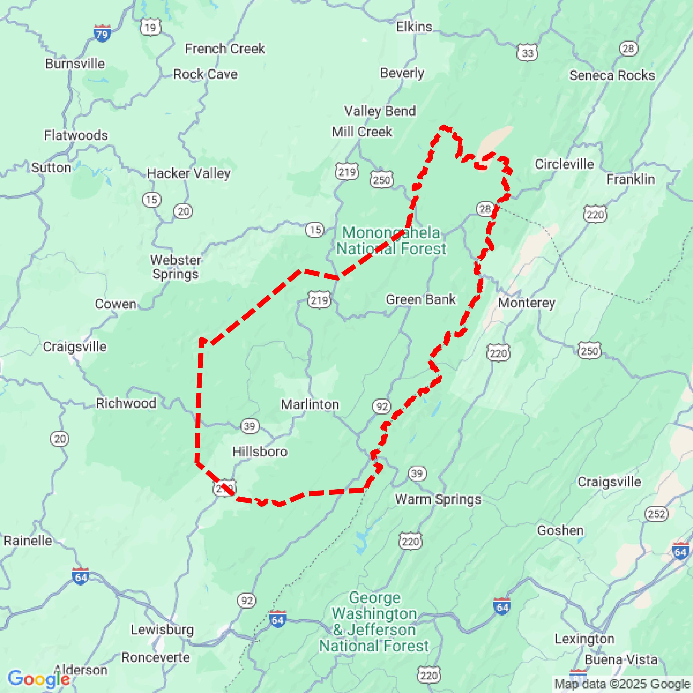

Data Available
Download GIS Data for Pocahontas County

Parcels and Buildings
This image shows parcel and building data in Pocahontas County created using GIS data in Equator.
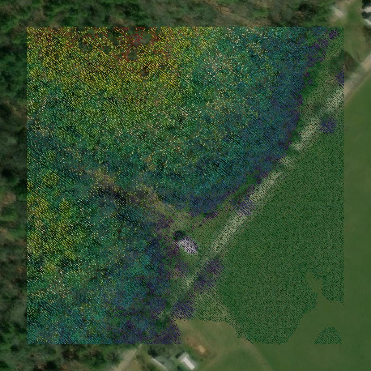
LiDAR
This image shows a LiDAR point cloud in Pocahontas County created using GIS data in Equator.
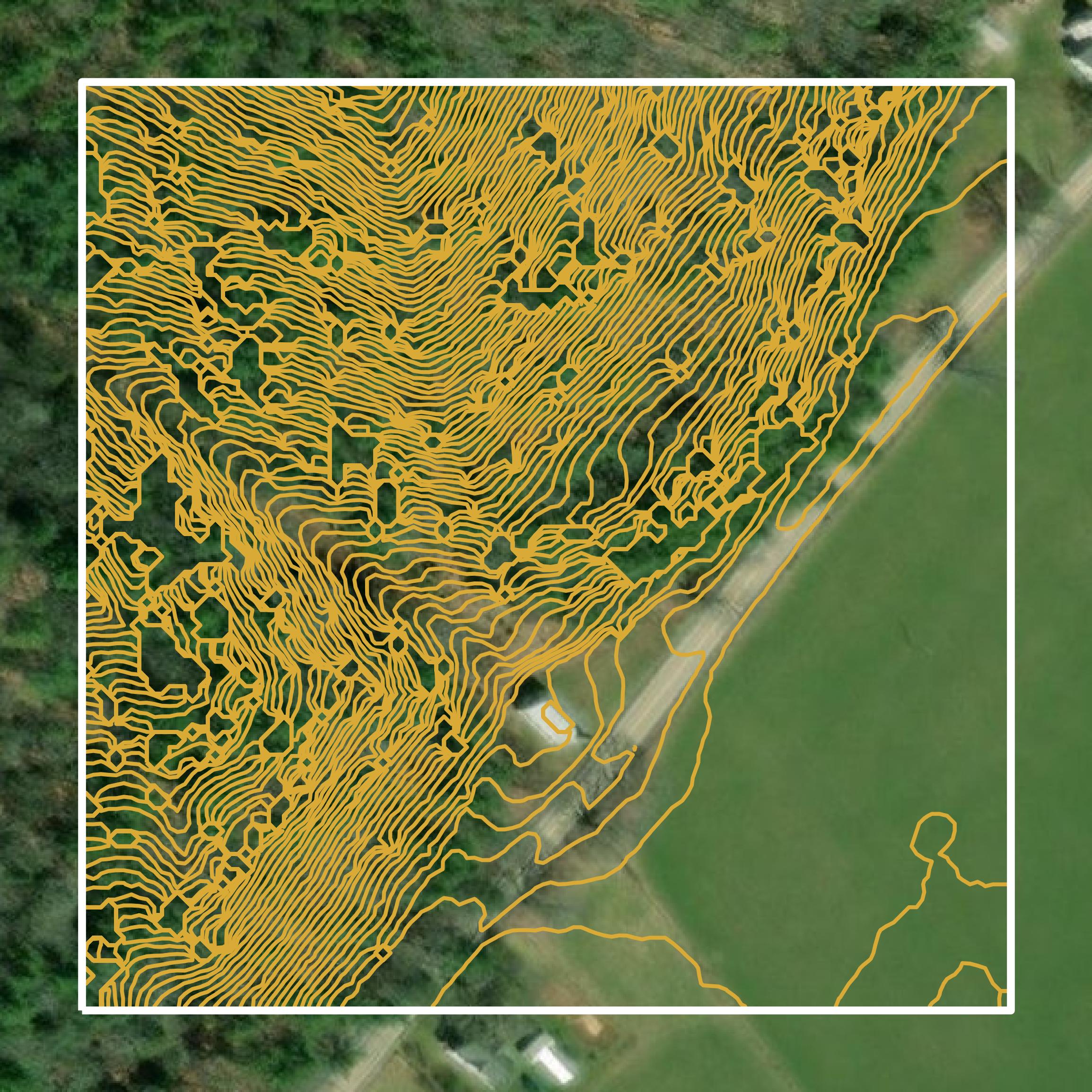
Contours
This image shows a contour map in Pocahontas County created using GIS data in Equator.
Formats Available
Export Your Data Ready to Use in Multiple Formats
DWG
AutoCAD Drawing - Industry-standard CAD format
Supported Data:
Contour, Parcel, Building Outline
SHP
Shapefile - Standard GIS vector format
Supported Data:
Contour, Parcel, Building Outline
DXF
Drawing Exchange Format - Universal CAD interchange
Supported Data:
Contour, Building Outline
GeoJSON
Geographic JSON - Web-friendly spatial data format
Supported Data:
Contour, Parcel, Building Outline
LAZ
Compressed LAS - Efficient LiDAR point cloud format
Supported Data:
Point Cloud
SVG
Scalable Vector Graphics - Web vector format
Supported Data:
Contour, Building Outline
GPKG
GeoPackage - Modern OGC spatial database format
Supported Data:
Contour, Parcel, Building Outline
LandXML (Coming Soon)
Land XML - Civil engineering data exchange format
Supported Data:
Point Cloud
TIN (Coming Soon)
Triangulated Irregular Network - 3D surface model
Supported Data:
Point Cloud
XYZ (Coming Soon)
XYZ Point Cloud - Simple ASCII point cloud format
Supported Data:
Point Cloud
Background
GIS Data for Pocahontas County
The webpage for Pocahontas County, West Virginia, provides essential information regarding maps and directions for accessing the area. It highlights the challenges of limited GPS and cell phone service due to the county's location within the National Radio Quiet Zone. The site offers resources for travelers, including suggested routes and locations where WiFi and cell service can be accessed, such as visitor centers and public libraries. Additionally, it outlines various modes of transportation to the county, including driving directions from major highways, air travel options via Greenbrier Valley Airport, and rail service through Amtrak. The page emphasizes the importance of preparation for a smooth travel experience in this scenic region.
Access Pocahontas County GIS Data in Equator →Pocahontas County Portal →Showcase
Sample GIS Data for Pocahontas County
Parcels and Buildings
Parcel and building data in Pocahontas County are used in a variety of fields including architecture, real estate, and urban planning.
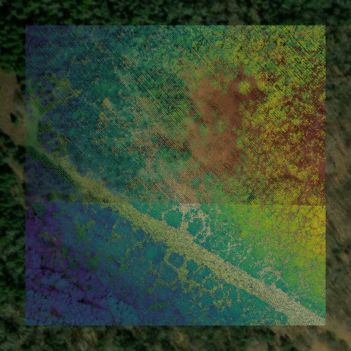
LiDAR
Point clouds (LiDAR) in Pocahontas County can produce highly accurate 3D models of terrain, structures, and vegetation.
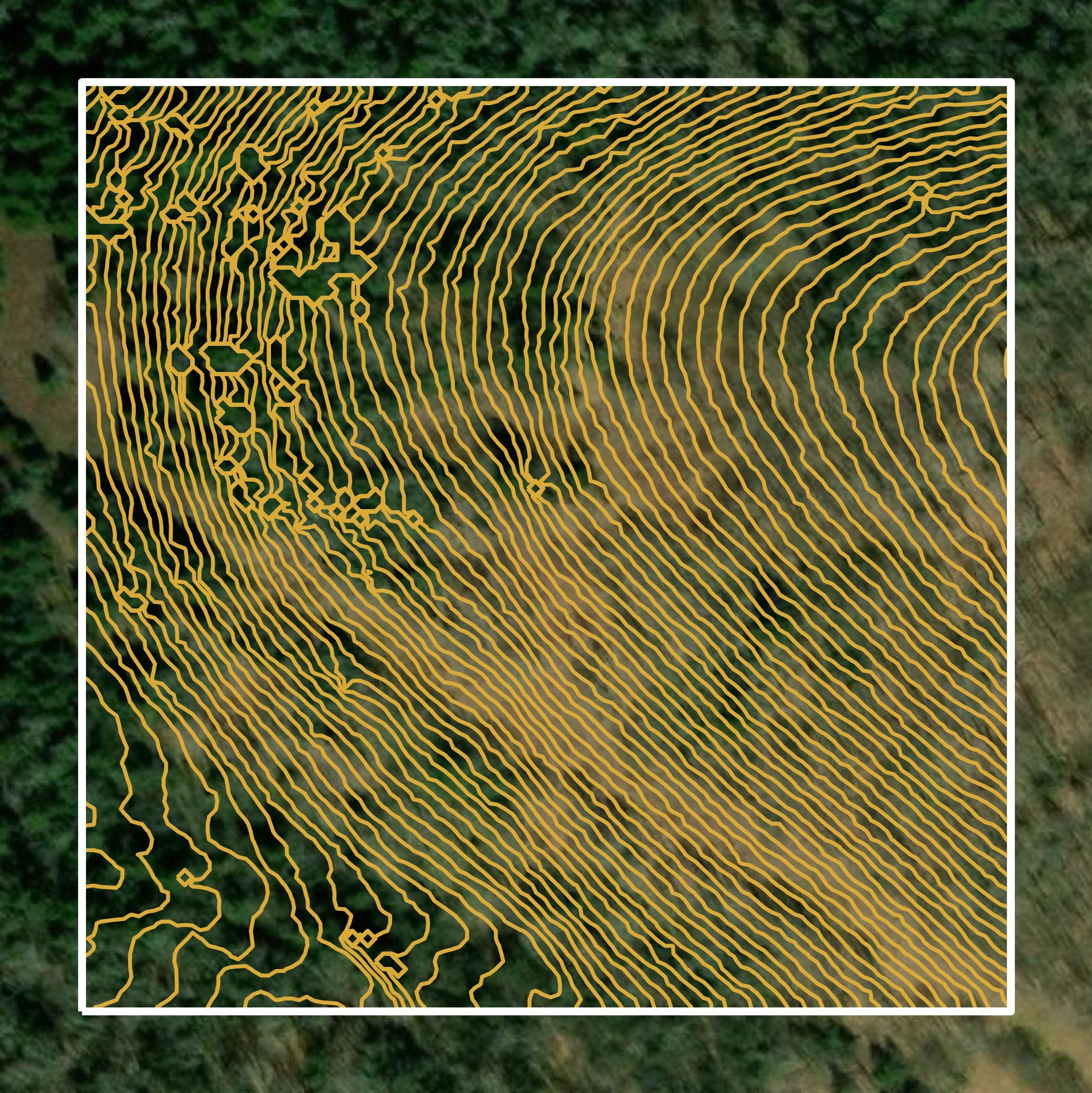
Contours
Contours in Pocahontas County visualize 3D elevations on a 2D surface allowing you to better understand your site.