Overview
Milwaukee County GIS Data – For CAD
Equator helps civil engineering, architecture and consulting firms with the tools to instantly find, process and download accurate LiDAR, contours, parcel data, building footprints, DEMs, point clouds and other GIS data for Milwaukee County in an online web mapping portal.
Milwaukee County GIS Data →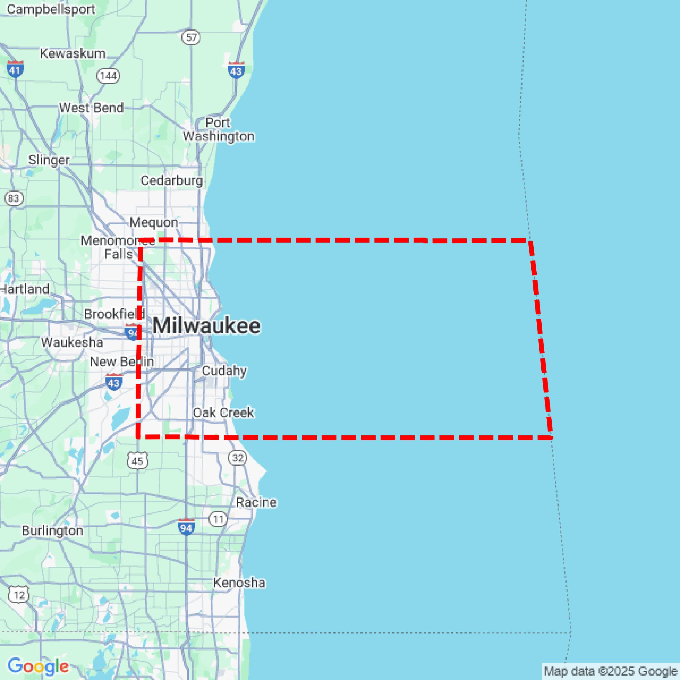

Data Available
Download GIS Data for Milwaukee County
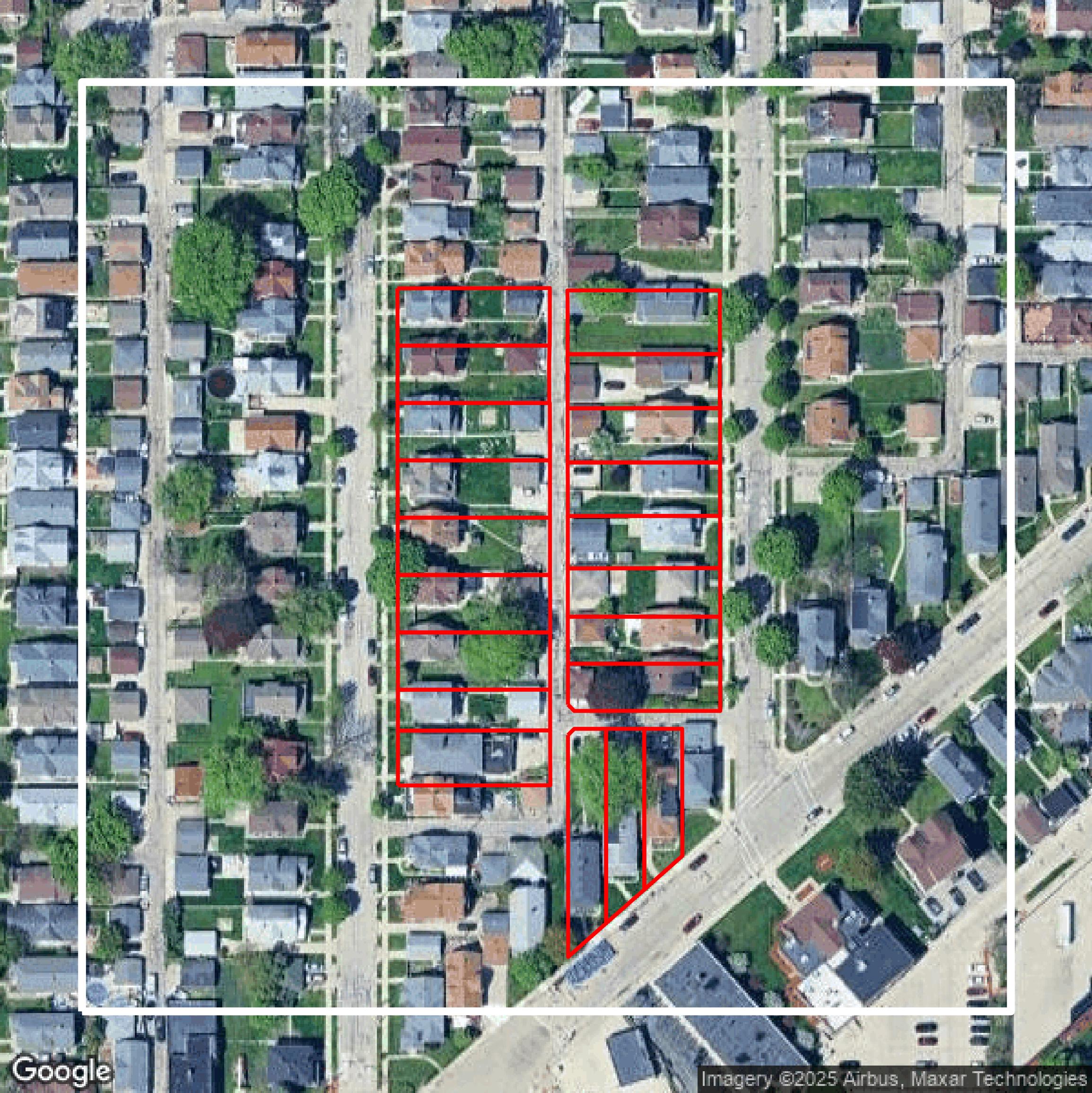
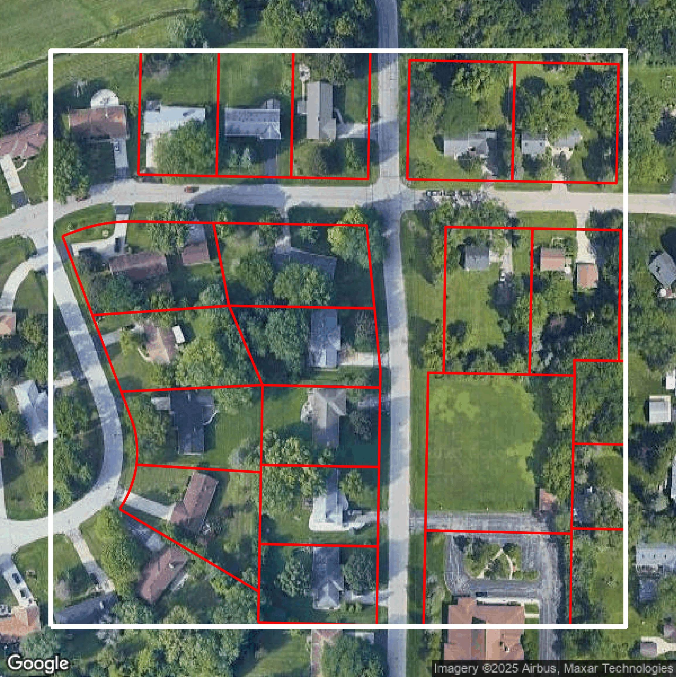
Parcels and Buildings
This image shows parcel and building data in Milwaukee County created using GIS data in Equator.
Get Parcels and Buildings for Milwaukee County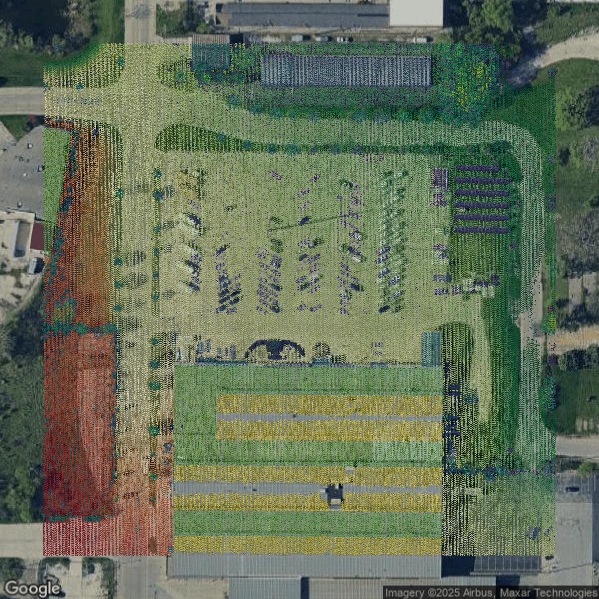
LiDAR
This image shows a LiDAR point cloud in Milwaukee County created using GIS data in Equator.
Get LiDAR for Milwaukee County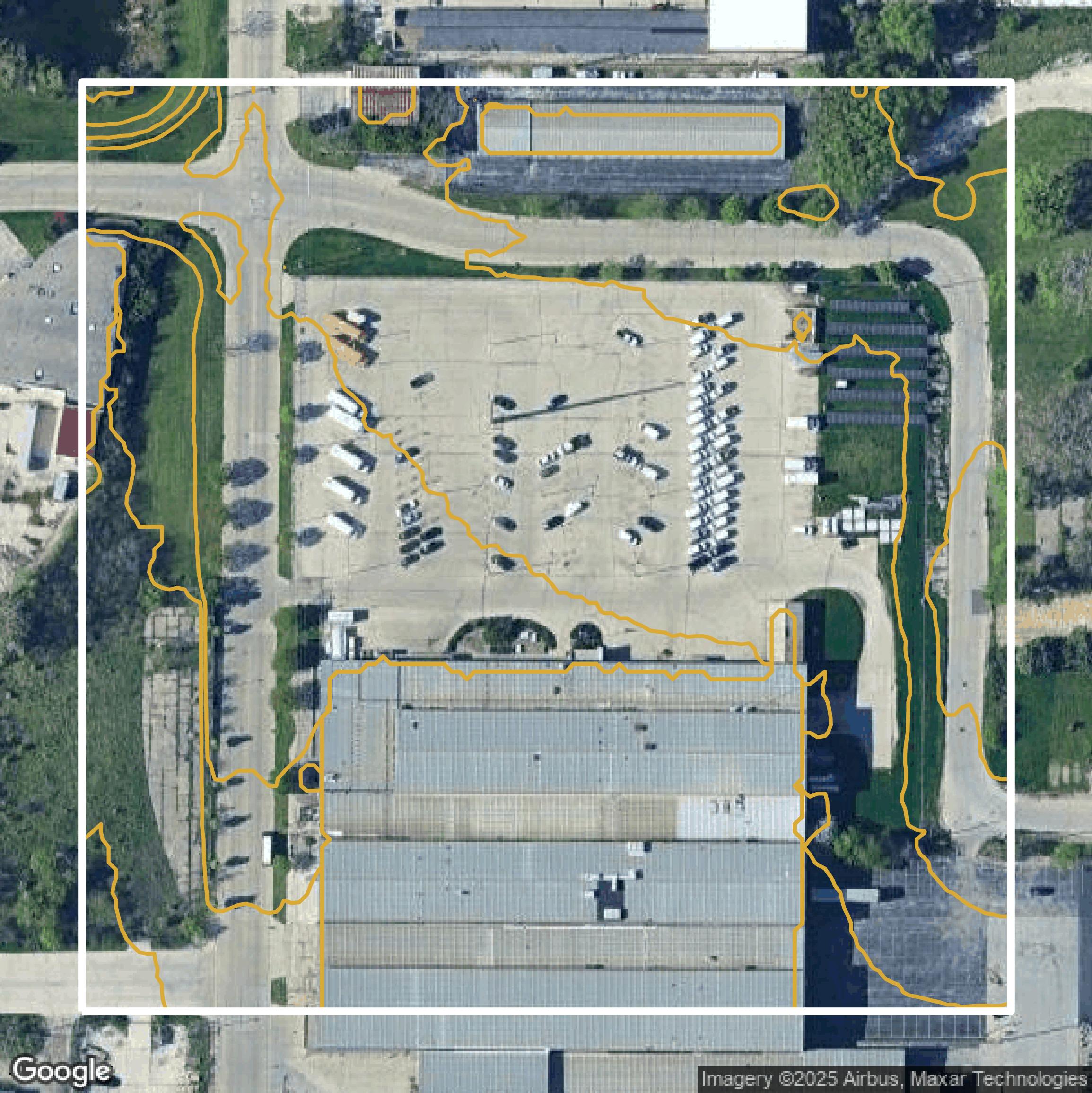
Contours
This image shows a contour map in Milwaukee County created using GIS data in Equator.
Get Contours for Milwaukee CountyFormats Available
Export Your Data Ready to Use in Multiple Formats
DWG
AutoCAD Drawing - Industry-standard CAD format
Supported Data:
Contour, Parcel, Building Outline
SHP
Shapefile - Standard GIS vector format
Supported Data:
Contour, Parcel, Building Outline
DXF
Drawing Exchange Format - Universal CAD interchange
Supported Data:
Contour, Building Outline
GeoJSON
Geographic JSON - Web-friendly spatial data format
Supported Data:
Contour, Parcel, Building Outline
LAZ
Compressed LAS - Efficient LiDAR point cloud format
Supported Data:
Point Cloud
SVG
Scalable Vector Graphics - Web vector format
Supported Data:
Contour, Building Outline
GPKG (Coming Soon)
GeoPackage - Modern OGC spatial database format
Supported Data:
Contour, Parcel, Building Outline
LandXML (Coming Soon)
Land XML - Civil engineering data exchange format
Supported Data:
Point Cloud
TIN (Coming Soon)
Triangulated Irregular Network - 3D surface model
Supported Data:
Point Cloud
XYZ (Coming Soon)
XYZ Point Cloud - Simple ASCII point cloud format
Supported Data:
Point Cloud
Background
GIS Data for Milwaukee County
The Milwaukee County Land Information Applications website offers a comprehensive suite of interactive tools and datasets designed to provide detailed property and geographic information. Visitors can explore the “Interactive Map” to access various GIS datasets and parcel information, supported by a user guide for easy navigation. The “Property Information Search” application allows users to quickly obtain text-based details about any property of interest, while the “Plat of Survey Search” tool helps determine if a specific property has a plat of survey on file. Additionally, the site features an Application Gallery with data download applications available through the GIS Data Downloads hub. For further assistance, users can access detailed Data User Guides and contact Milwaukee County Land Information services directly. This site is ideal for anyone needing accurate, official land and property information within Milwaukee County.
Access Milwaukee County GIS Data in Equator →Milwaukee County Portal →Showcase
Sample GIS Data for Milwaukee County
Parcels and Buildings
Parcel and building data in Milwaukee County are used in a variety of fields including architecture, real estate, and urban planning.
Get Parcels and Buildings for Milwaukee County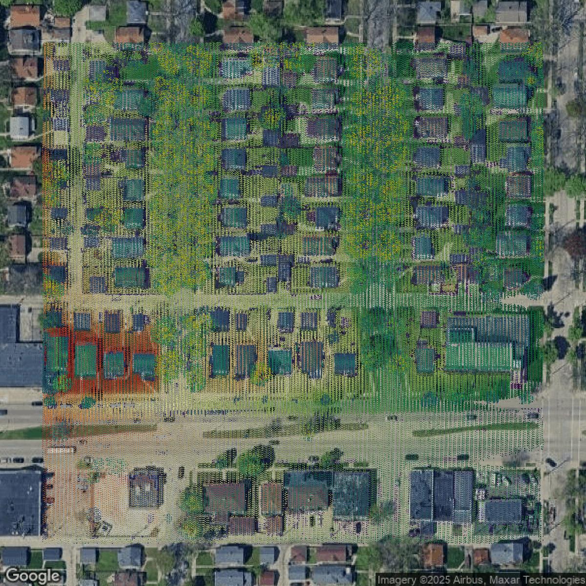
LiDAR
Point clouds (LiDAR) in Milwaukee County can produce highly accurate 3D models of terrain, structures, and vegetation.
Get LiDAR for Milwaukee County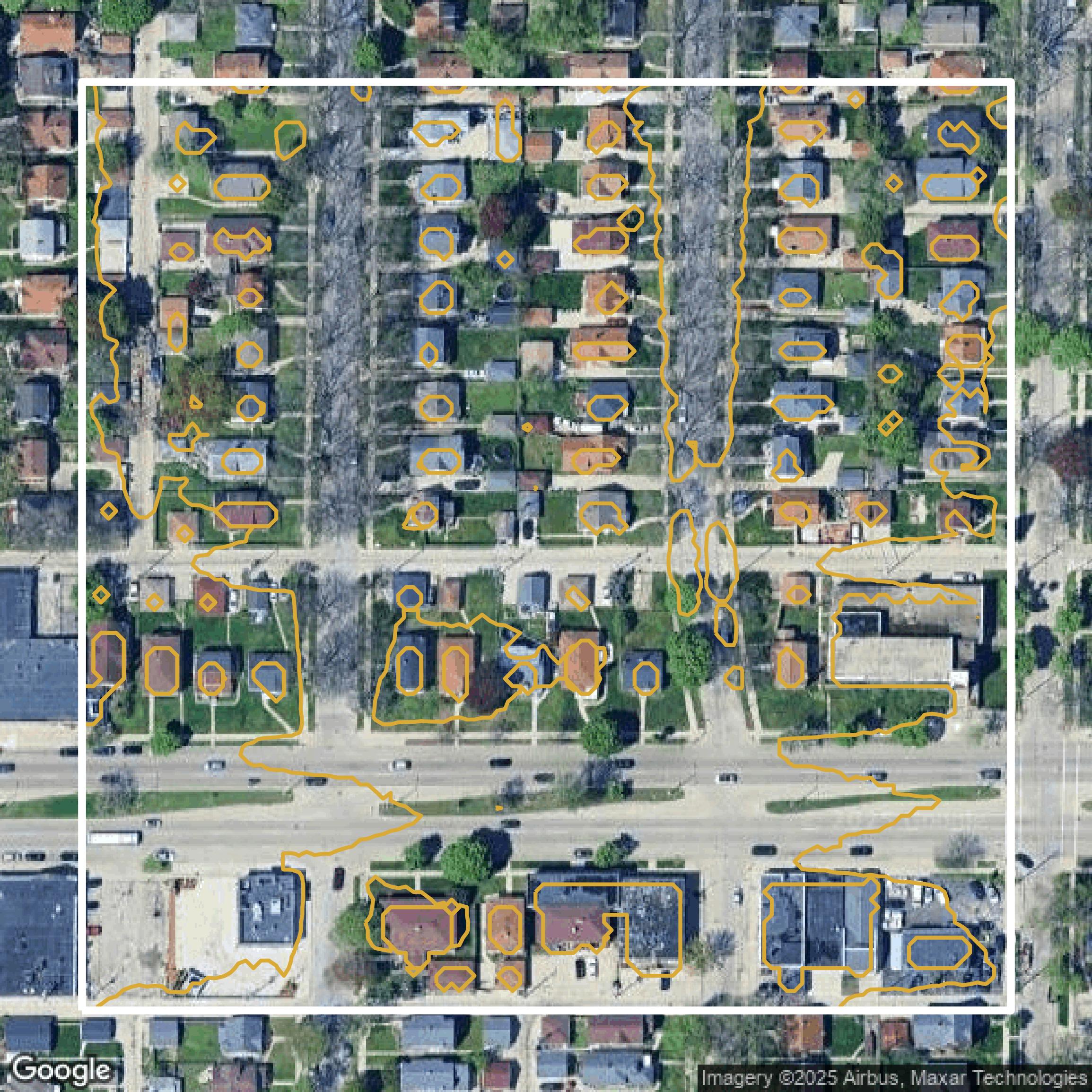
Contours
Contours in Milwaukee County visualize 3D elevations on a 2D surface allowing you to better understand your site.
Get Contours for Milwaukee County
Parcels and Buildings
Accessing Milwaukee County parcel and building data on Equator gives you access to coverage across the US.
Get Parcels and Buildings for Milwaukee County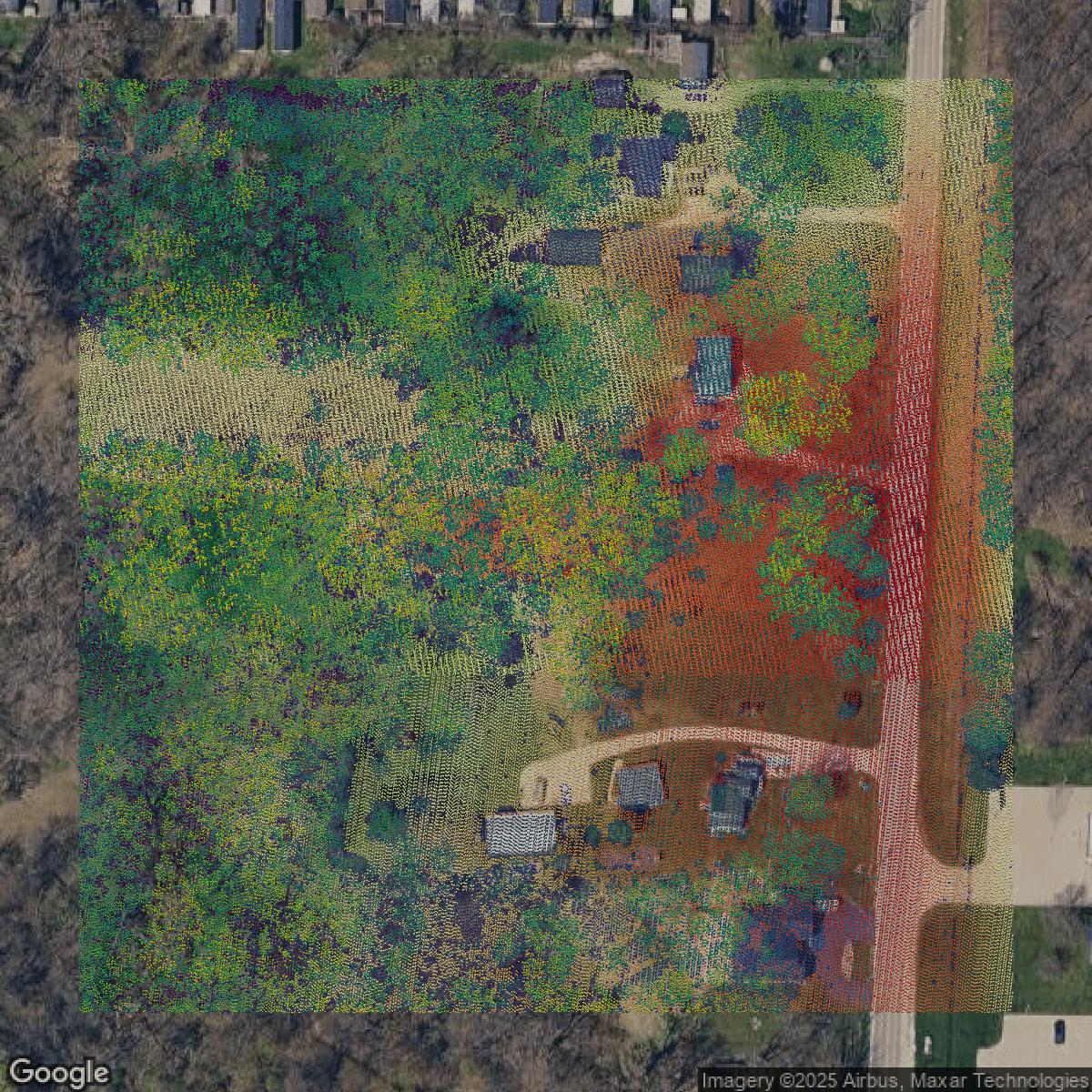
LiDAR
Milwaukee County LiDAR uses include land surveying, analyzing crop health, or even archaeological studies.
Get LiDAR for Milwaukee County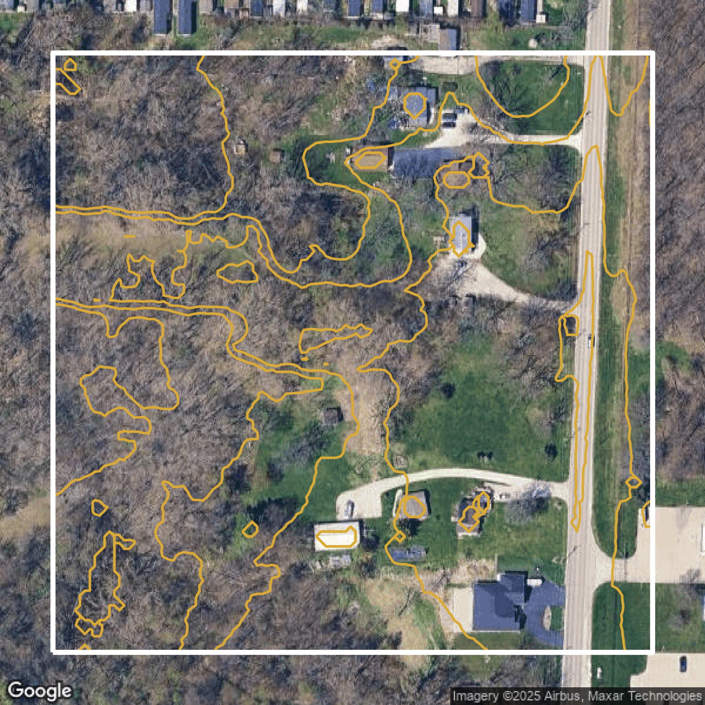
Contours
Milwaukee County contours can be used for construction & engineering, environmental science, and more.
Get Contours for Milwaukee County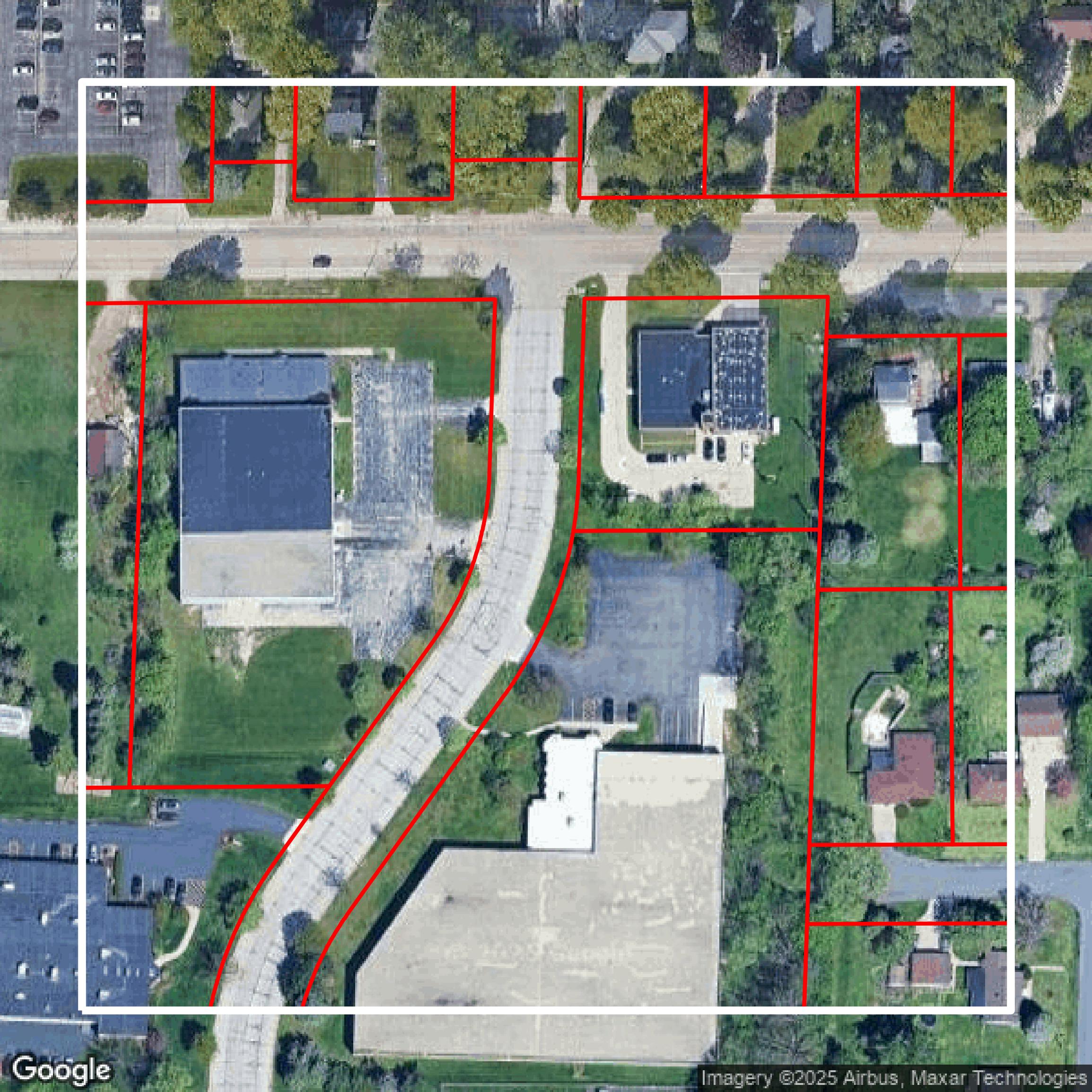
Parcels and Buildings
Dozens of fields are contained within each Milwaukee County parcel and building data, including zoning, owners, and year built.
Get Parcels and Buildings for Milwaukee County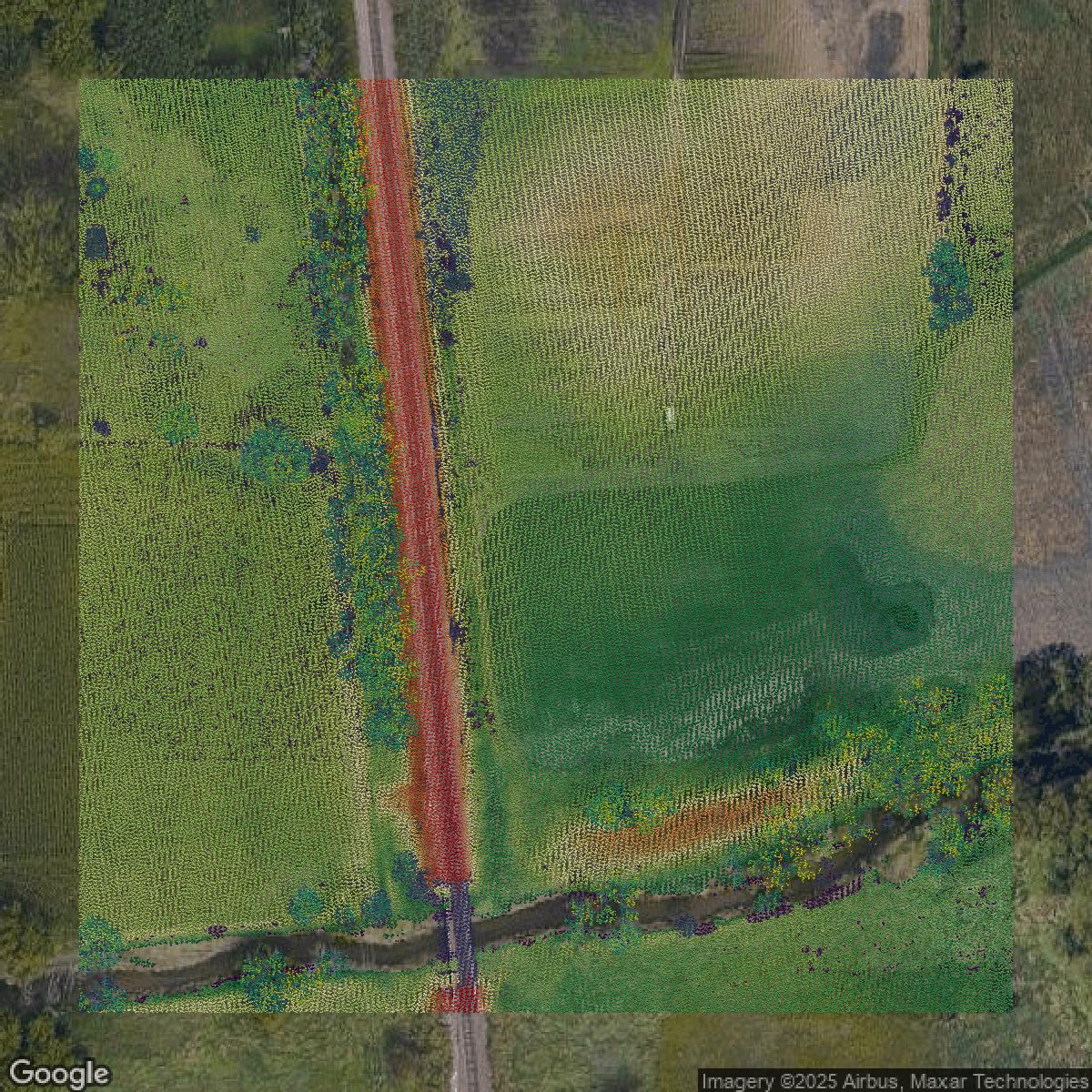
LiDAR
Equator turns Milwaukee County LiDAR point clouds into various lidar-derived data sets, including DEMs.
Get LiDAR for Milwaukee County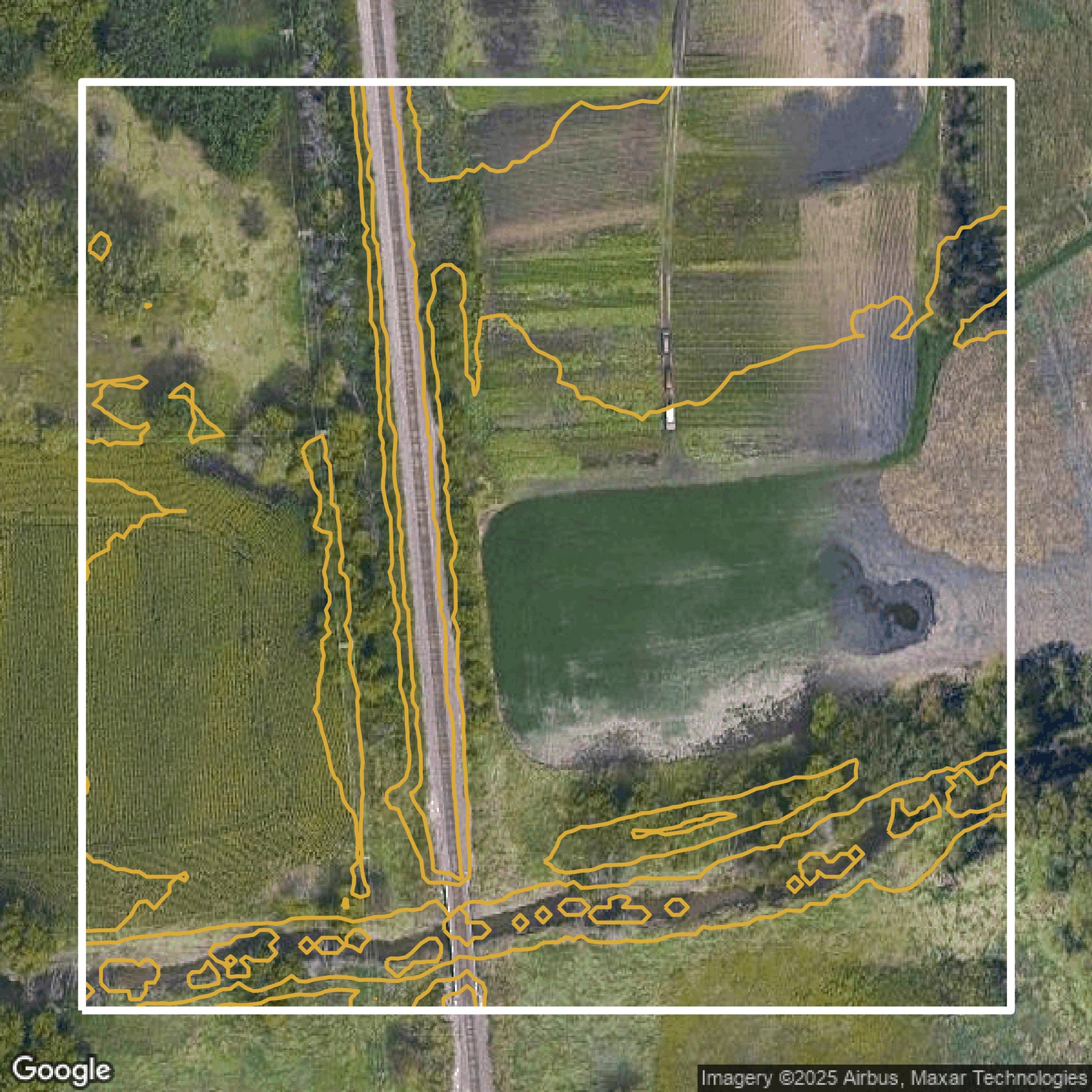
Contours
Milwaukee County contours on Equator are produced from LiDAR coverage, allowing for high precision
Get Contours for Milwaukee County