Overview
Maricopa County GIS Data – For CAD
Equator helps civil engineering, architecture and consulting firms with the tools to instantly find, process and download accurate LiDAR, contours, parcel data, building footprints, DEMs, point clouds and other GIS data for Maricopa County in an online web mapping portal.
Maricopa County GIS Data →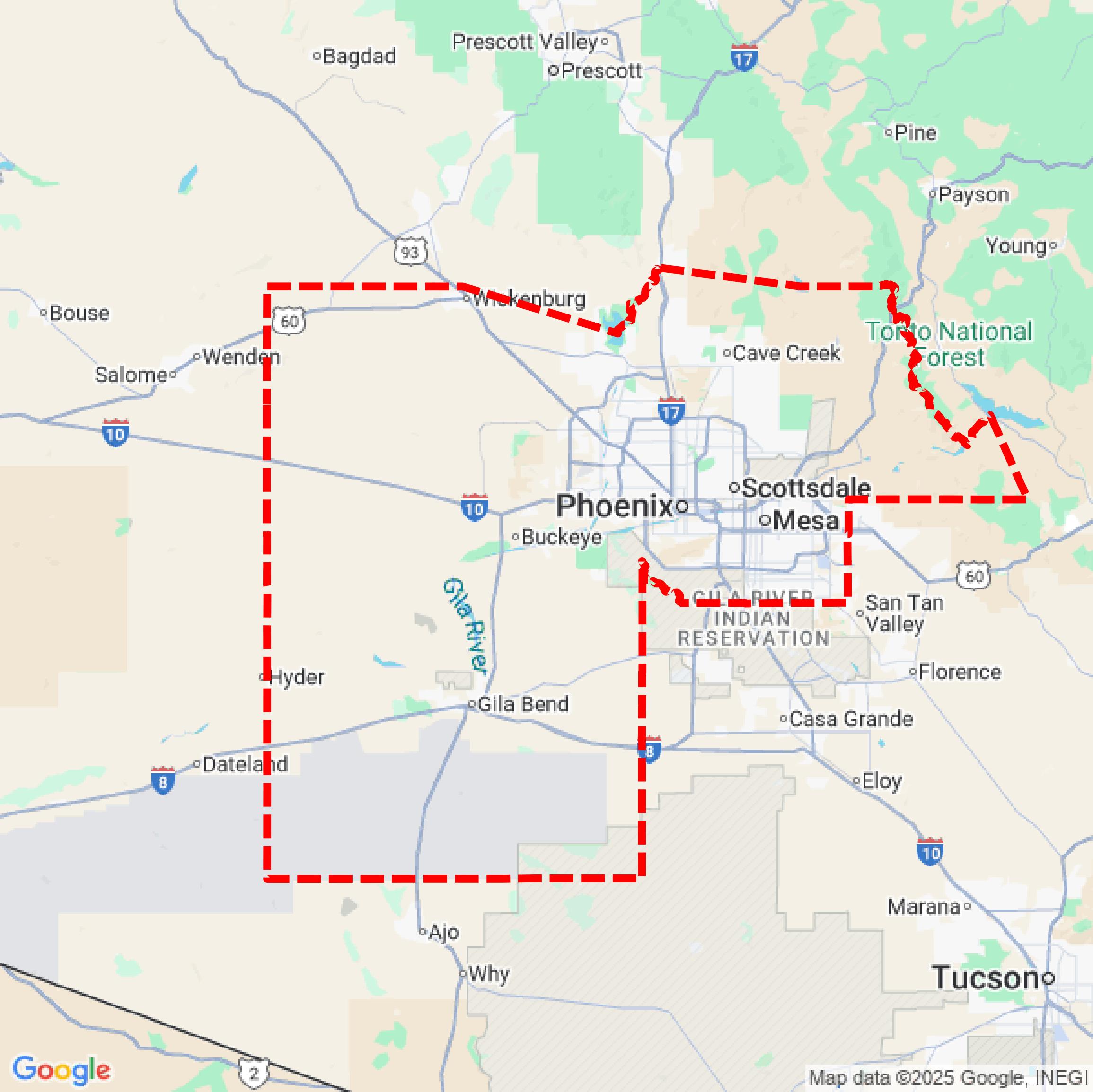

Data Available
Download GIS Data for Maricopa County
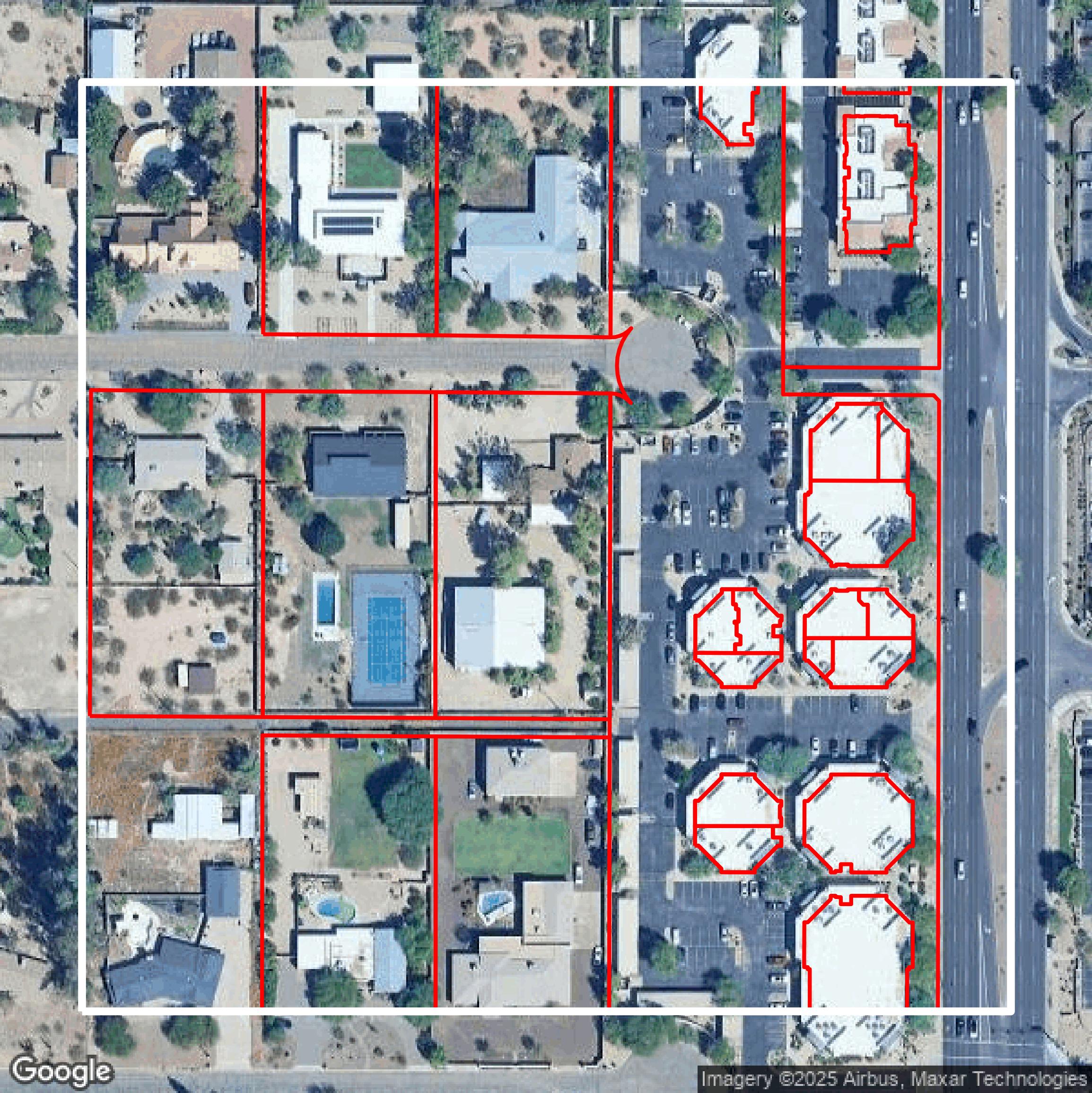
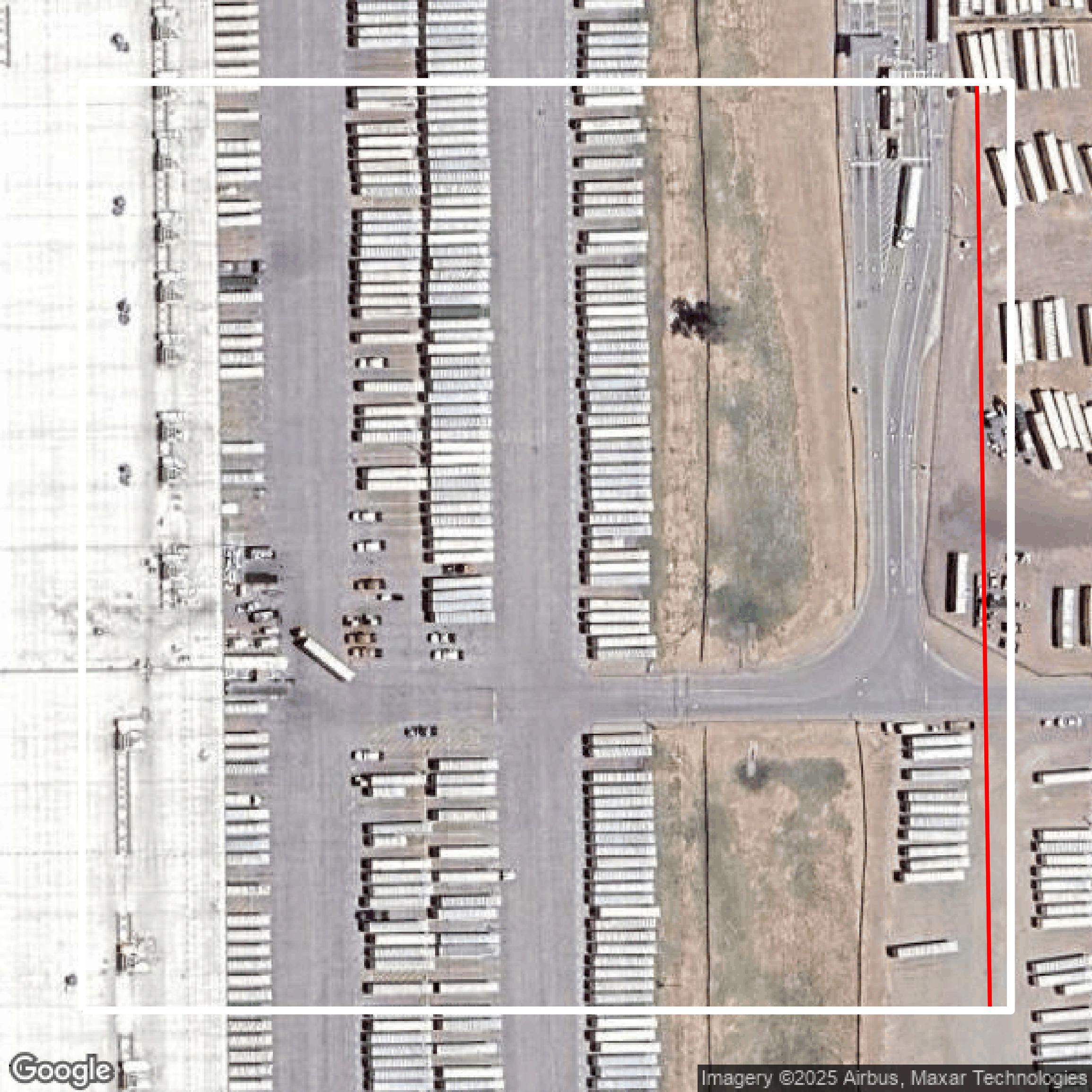
Parcels and Buildings
This image shows parcel and building data in Maricopa County created using GIS data in Equator.
Get Parcels and Buildings for Maricopa County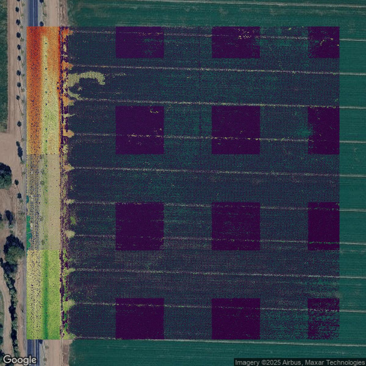
LiDAR
This image shows a LiDAR point cloud in Maricopa County created using GIS data in Equator.
Get LiDAR for Maricopa County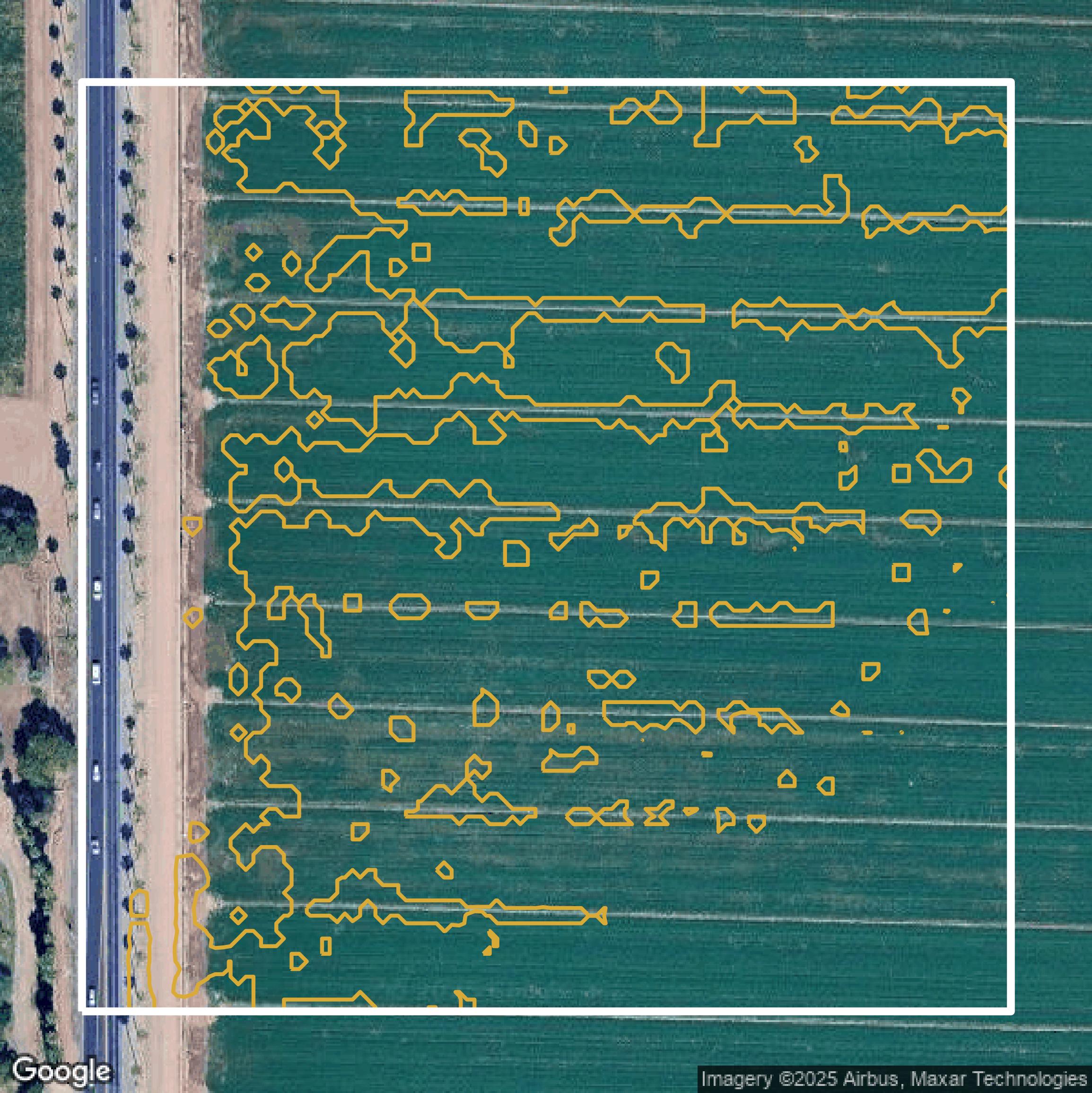
Contours
This image shows a contour map in Maricopa County created using GIS data in Equator.
Get Contours for Maricopa CountyFormats Available
Export Your Data Ready to Use in Multiple Formats
DWG
AutoCAD Drawing - Industry-standard CAD format
Supported Data:
Contour, Parcel, Building Outline
SHP
Shapefile - Standard GIS vector format
Supported Data:
Contour, Parcel, Building Outline
DXF
Drawing Exchange Format - Universal CAD interchange
Supported Data:
Contour, Building Outline
GeoJSON
Geographic JSON - Web-friendly spatial data format
Supported Data:
Contour, Parcel, Building Outline
LAZ
Compressed LAS - Efficient LiDAR point cloud format
Supported Data:
Point Cloud
SVG
Scalable Vector Graphics - Web vector format
Supported Data:
Contour, Building Outline
GPKG (Coming Soon)
GeoPackage - Modern OGC spatial database format
Supported Data:
Contour, Parcel, Building Outline
LandXML (Coming Soon)
Land XML - Civil engineering data exchange format
Supported Data:
Point Cloud
TIN (Coming Soon)
Triangulated Irregular Network - 3D surface model
Supported Data:
Point Cloud
XYZ (Coming Soon)
XYZ Point Cloud - Simple ASCII point cloud format
Supported Data:
Point Cloud
Background
GIS Data for Maricopa County
The Maricopa County GIS Mapping Applications website offers a comprehensive suite of interactive tools and data sets designed to provide detailed geographic and environmental information for the region. Visitors can explore parcel information through the "Parcels" tool and check property tax status via "Overdue Property Taxes." Historical insights are available with "Historical Aerials," while planning professionals will benefit from "Planning & Zoning (PlanNet)" and "Survey Points" for land survey data. Residents can find voting locations with "Where to Vote," discover recreational options through "PARKS, TRAILS & AMENITIES," and verify property boundaries with "No Fence Districts." Water level changes are tracked in "Lake Pleasant Water Levels," and waste management sites are mapped in "Waste & Recycling Facilities." Flood-related data includes FEMA "FLOODPLAINS & ELEVATION CERTIFICATES," recent updates in "FEBRUARY 8, 2024 LOWER GILA RIVER FLOODPLAIN UPDATE," and rainfall info via "RAINFALL & WEATHER DATA." Advanced flood modeling is accessible with the "FLO-2D WEB ACCESS TOOL," complemented by ongoing "FLOOD PROJECTS." Transportation resources cover road conditions and closures ("ROAD INFORMATION TOOL," "ROAD CLOSURES"), community road adoption ("ADOPT A ROAD"), and future planning with the "TRANSPORTATION SYSTEM PLAN" and "ACTIVE TRANSPORTATION PLAN." Environmental health and safety are addressed through tools like "MOSQUITO MANAGEMENT," "ENVIRONMENTAL HEALTH PLAN REVIEW DISTRICTS," "RESTAURANT INSPECTION RATINGS," air quality monitoring ("AIR QUALITY"), and mapping of "ENVIRONMENTAL HEALTH DISTRICTS." All these resources provide a user-friendly gateway for the public, planners, and professionals to access vital spatial information about Maricopa County.
Access Maricopa County GIS Data in Equator →Maricopa County Portal →Showcase
Sample GIS Data for Maricopa County
Parcels and Buildings
Parcel and building data in Maricopa County are used in a variety of fields including architecture, real estate, and urban planning.
Get Parcels and Buildings for Maricopa County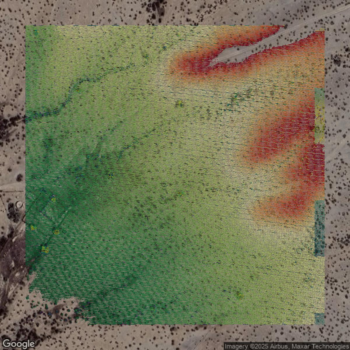
LiDAR
Point clouds (LiDAR) in Maricopa County can produce highly accurate 3D models of terrain, structures, and vegetation.
Get LiDAR for Maricopa County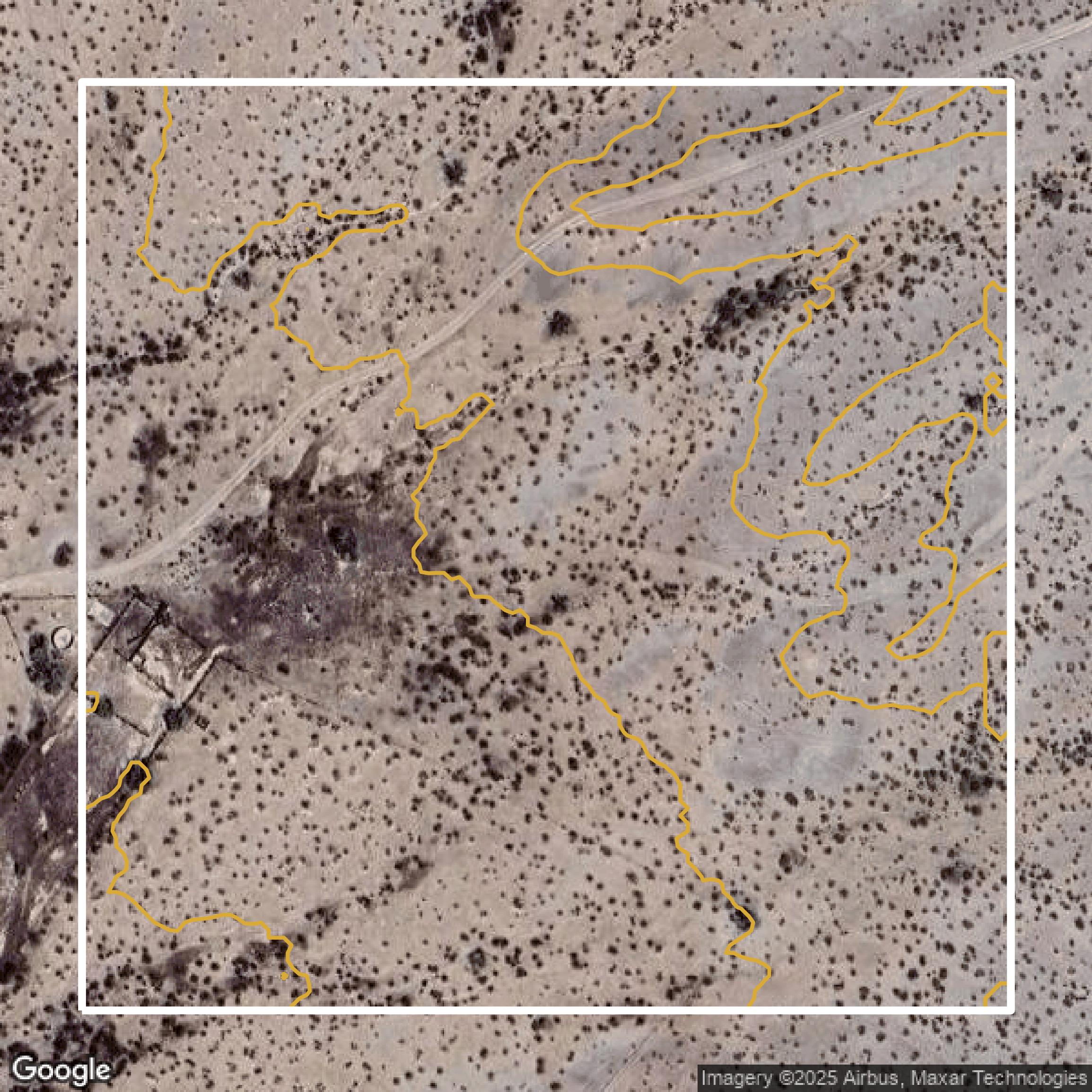
Contours
Contours in Maricopa County visualize 3D elevations on a 2D surface allowing you to better understand your site.
Get Contours for Maricopa County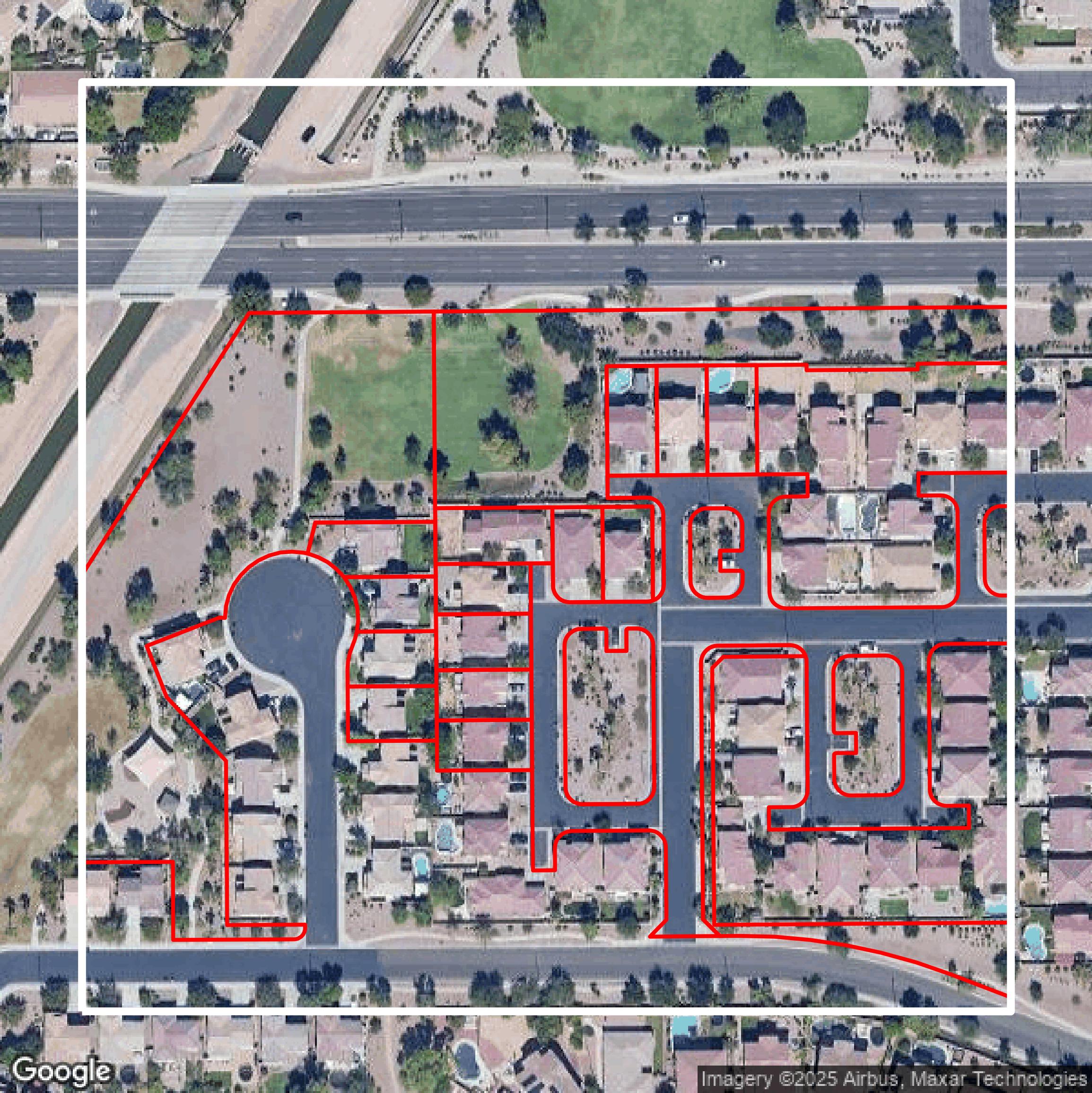
Parcels and Buildings
Accessing Maricopa County parcel and building data on Equator gives you access to coverage across the US.
Get Parcels and Buildings for Maricopa County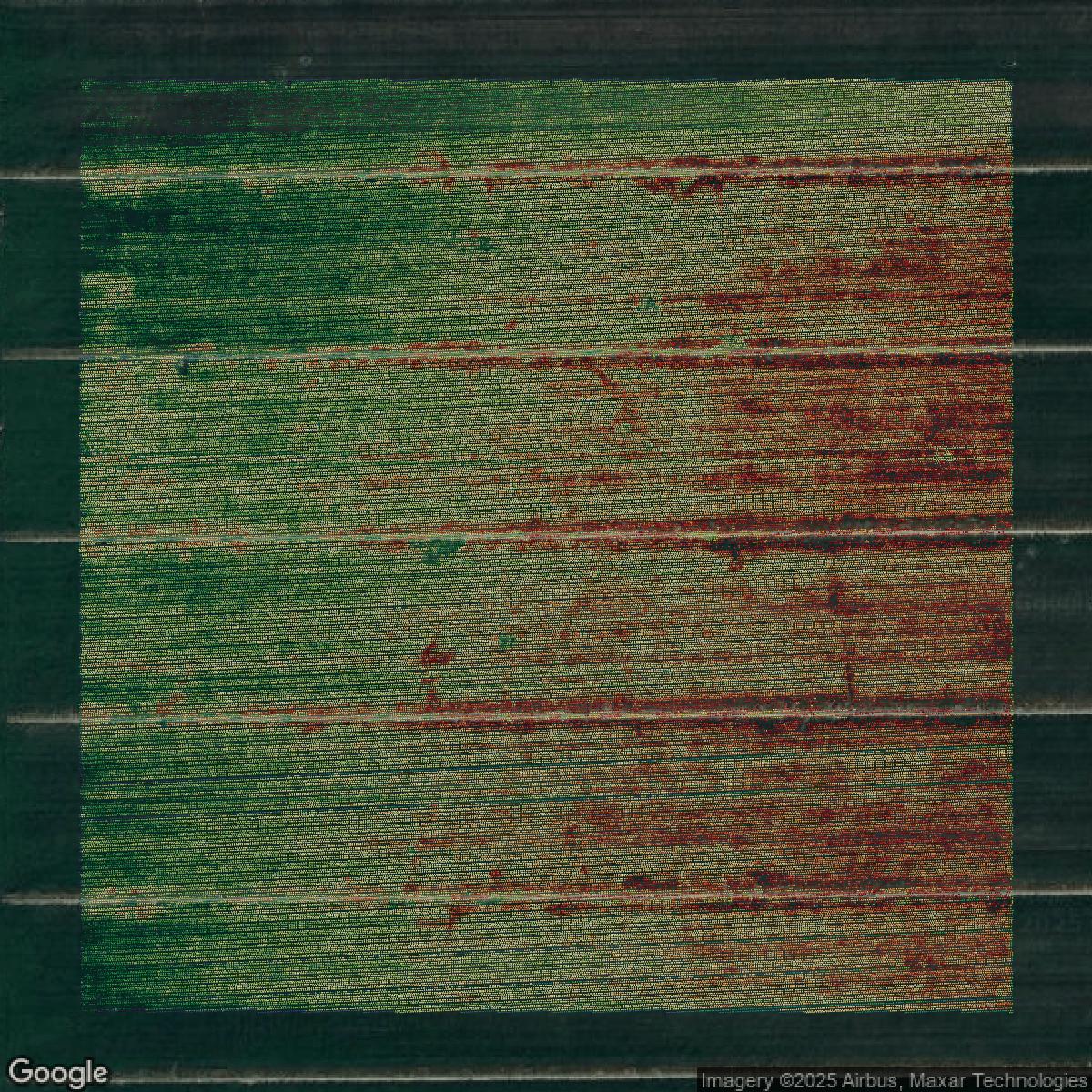
LiDAR
Maricopa County LiDAR uses include land surveying, analyzing crop health, or even archaeological studies.
Get LiDAR for Maricopa County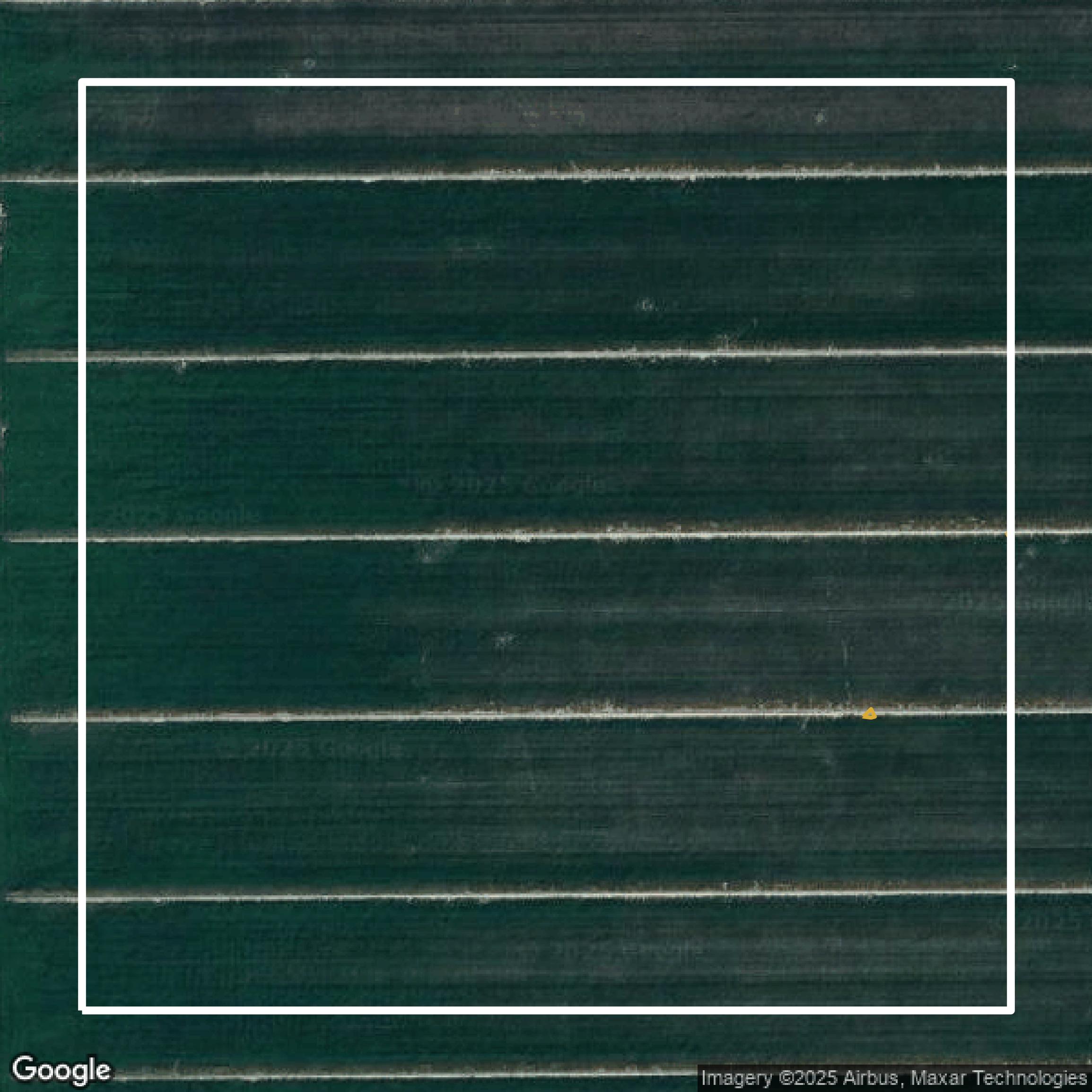
Contours
Maricopa County contours can be used for construction & engineering, environmental science, and more.
Get Contours for Maricopa County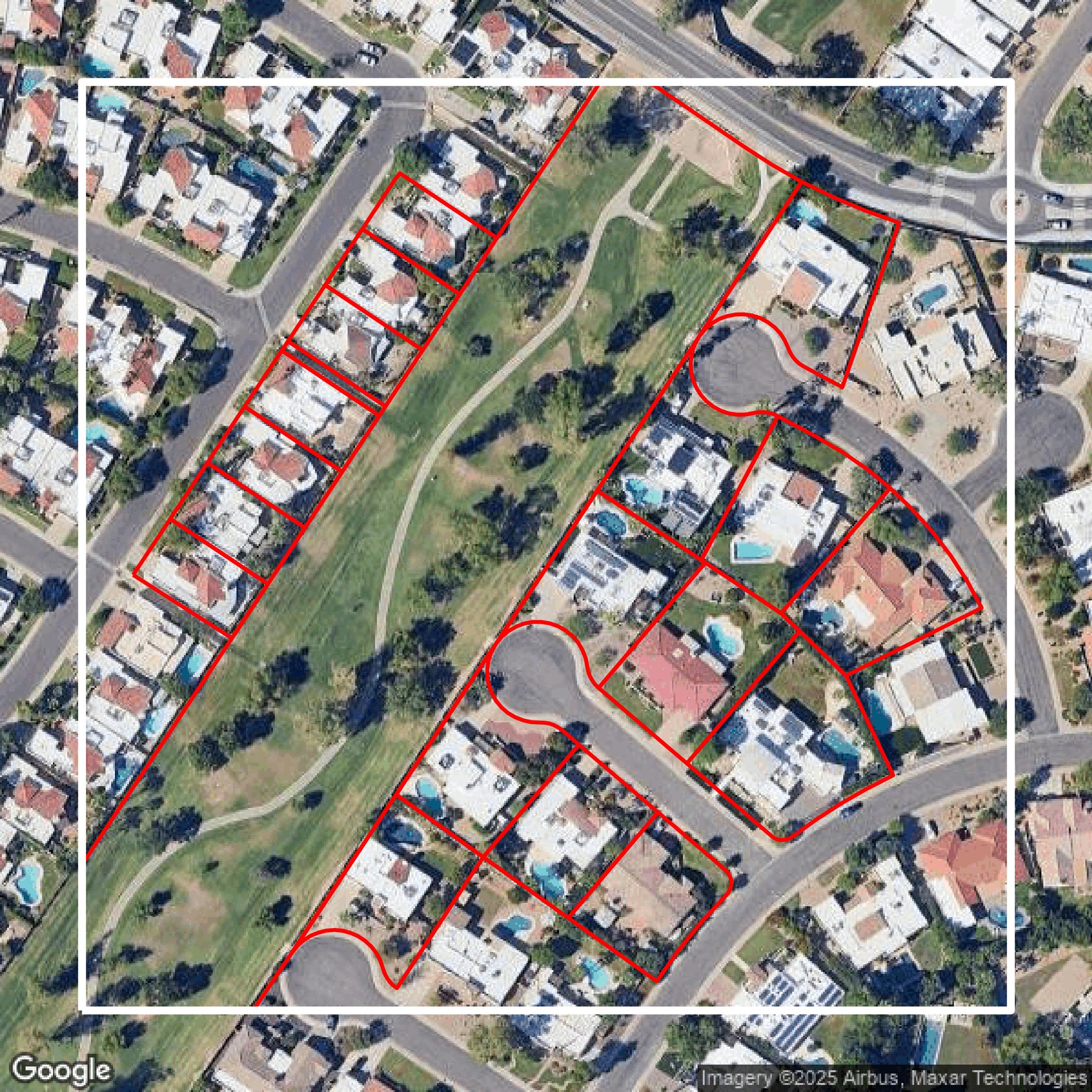
Parcels and Buildings
Dozens of fields are contained within each Maricopa County parcel and building data, including zoning, owners, and year built.
Get Parcels and Buildings for Maricopa County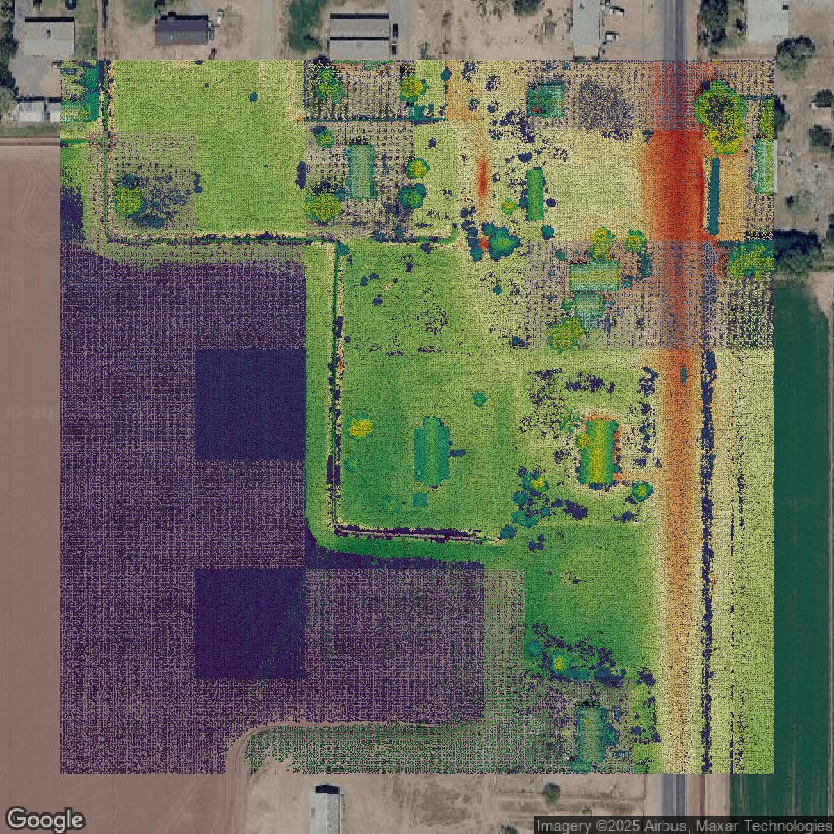
LiDAR
Equator turns Maricopa County LiDAR point clouds into various lidar-derived data sets, including DEMs.
Get LiDAR for Maricopa County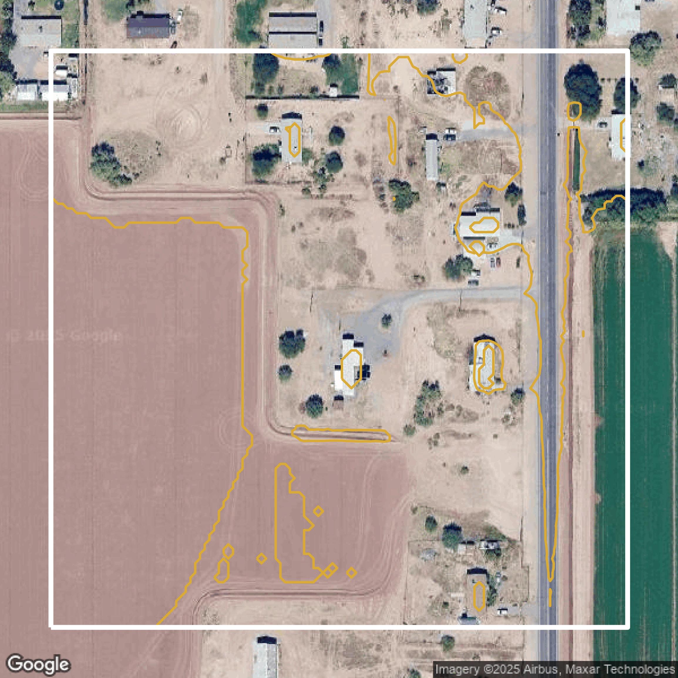
Contours
Maricopa County contours on Equator are produced from LiDAR coverage, allowing for high precision
Get Contours for Maricopa County