Overview
San Diego County GIS Data - For CAD
Equator helps civil engineering, architecture and consulting firms with the tools to instantly find, process and download accurate LiDAR, contours, parcel data, building footprints, DEMs, point clouds and other GIS data for San Diego County in an online web mapping portal.
San Diego County GIS Data ->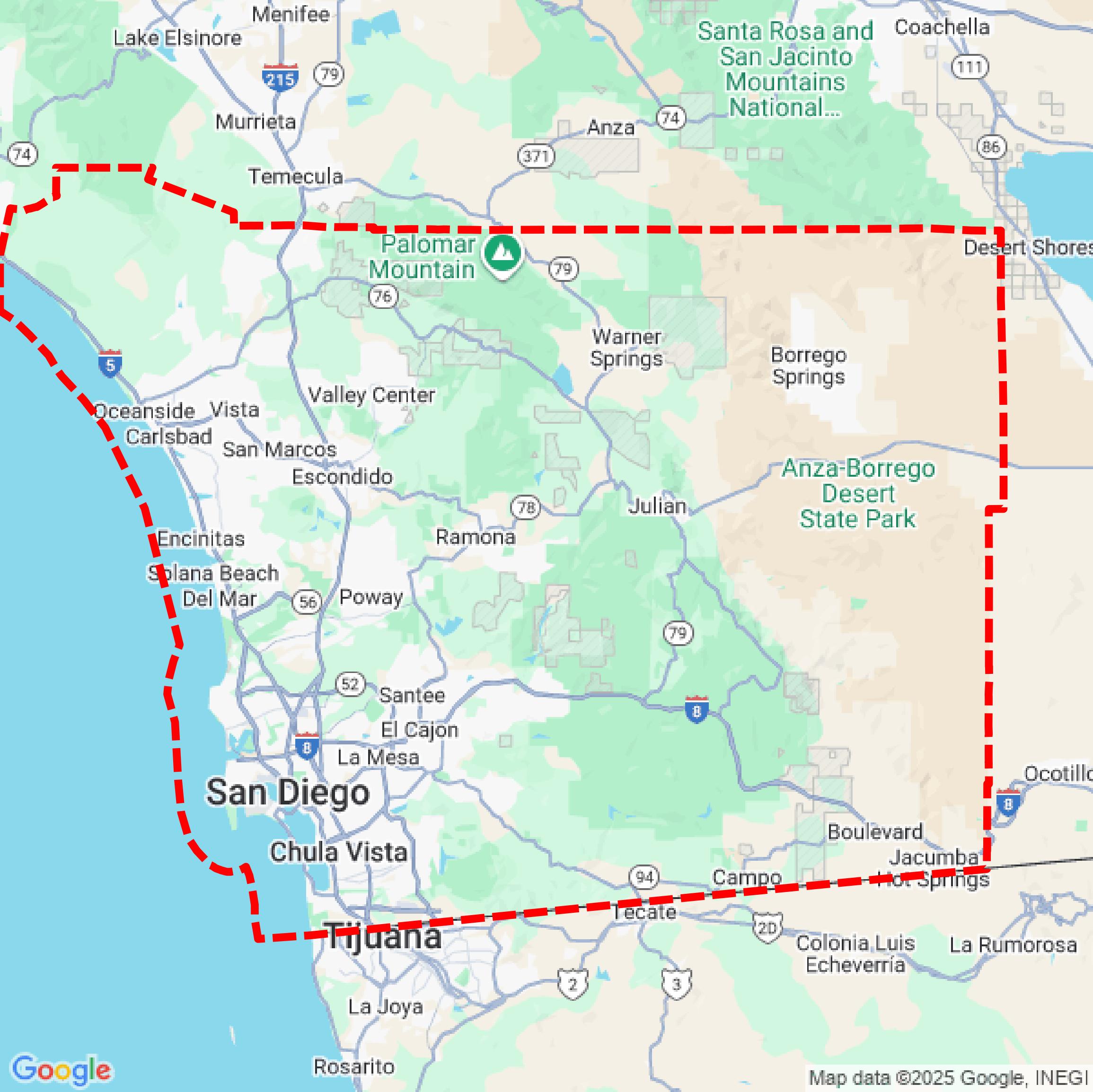

Data Available
Download GIS Data for San Diego County
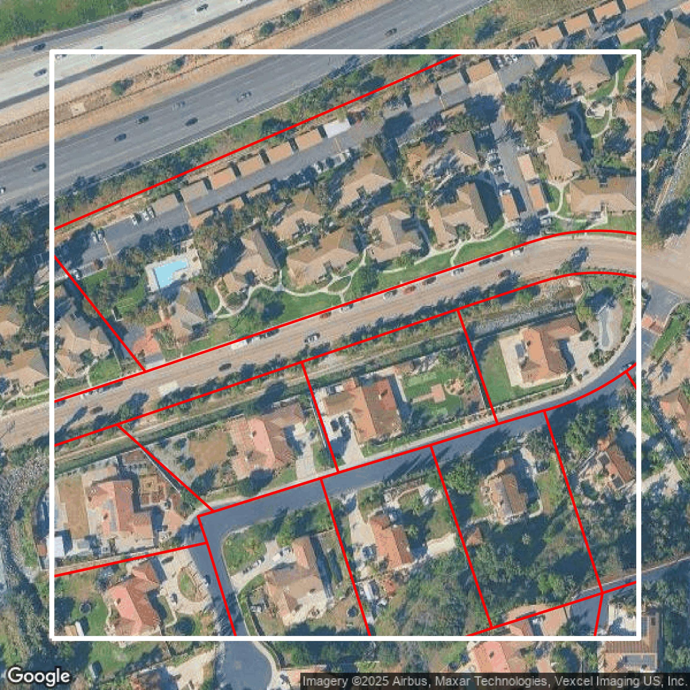
Parcels and Buildings
This image shows parcel and building data in San Diego County created using GIS data in Equator.
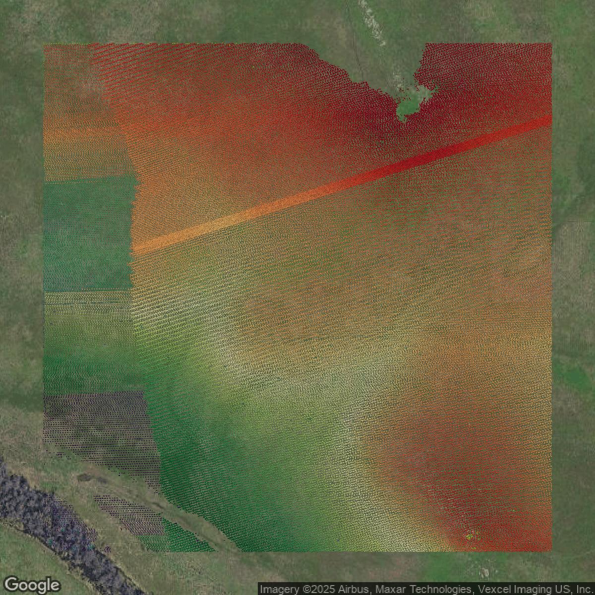
LiDAR
This image shows a LiDAR point cloud in San Diego County created using GIS data in Equator.
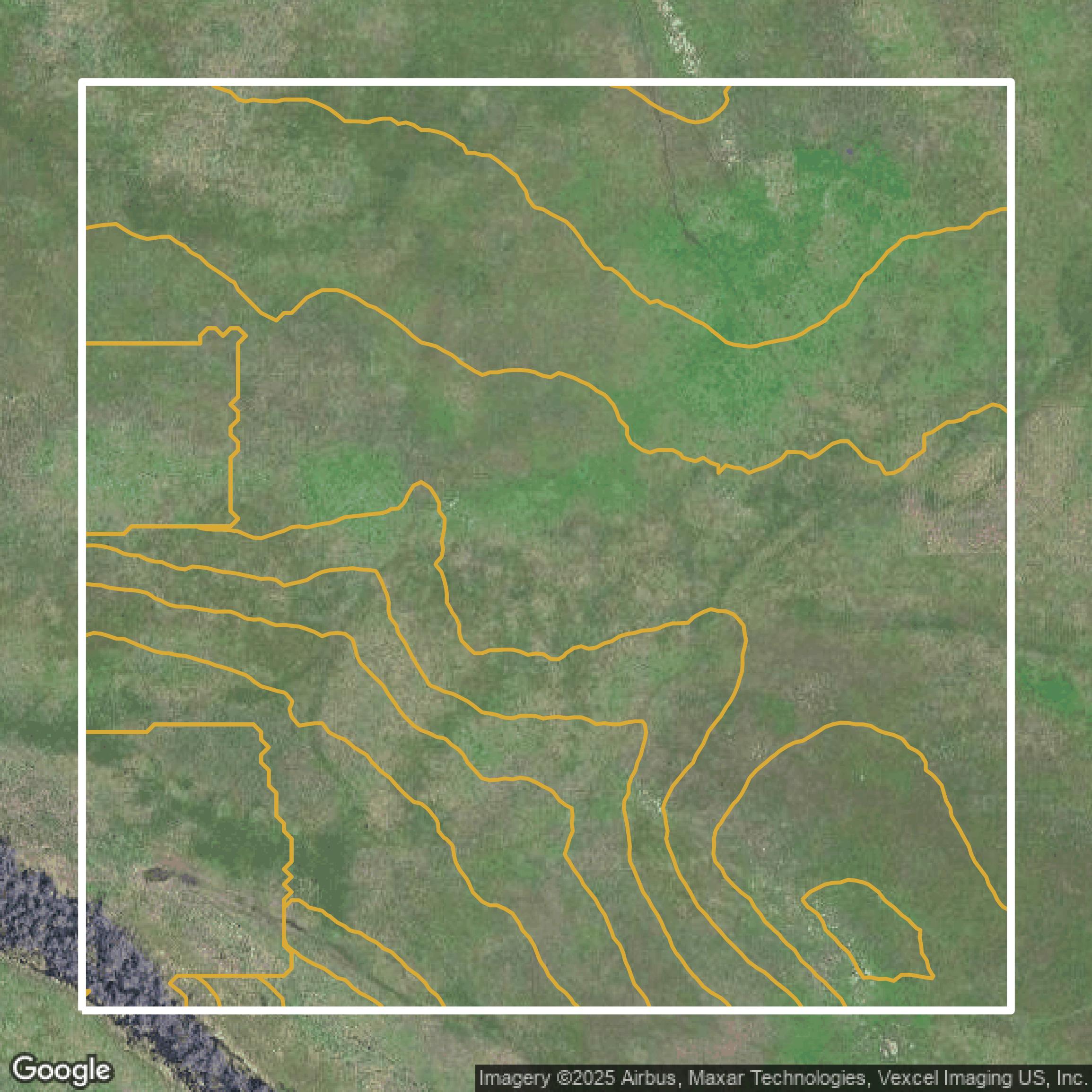
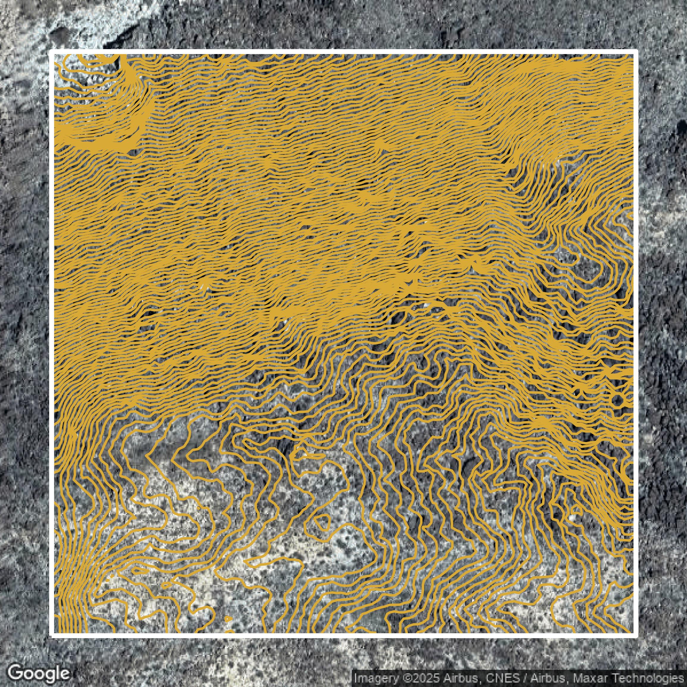
Contours
This image shows a contour map in San Diego County created using GIS data in Equator.
Formats Available
Export Your Data Ready to Use in Multiple Formats
DWG
AutoCAD Drawing - Industry-standard CAD format
Supported Data:
Contour, Parcel, Building Outline
SHP
Shapefile - Standard GIS vector format
Supported Data:
Contour, Parcel, Building Outline
DXF
Drawing Exchange Format - Universal CAD interchange
Supported Data:
Contour, Building Outline
GeoJSON
Geographic JSON - Web-friendly spatial data format
Supported Data:
Contour, Parcel, Building Outline
LAZ
Compressed LAS - Efficient LiDAR point cloud format
Supported Data:
Point Cloud
SVG
Scalable Vector Graphics - Web vector format
Supported Data:
Contour, Building Outline
GPKG
GeoPackage - Modern OGC spatial database format
Supported Data:
Contour, Parcel, Building Outline
LandXML (Coming Soon)
Land XML - Civil engineering data exchange format
Supported Data:
Point Cloud
TIN (Coming Soon)
Triangulated Irregular Network - 3D surface model
Supported Data:
Point Cloud
XYZ (Coming Soon)
XYZ Point Cloud - Simple ASCII point cloud format
Supported Data:
Point Cloud
Background
GIS Data for San Diego County
The County of San Diego GIS Portal is a comprehensive ArcGIS Enterprise platform that provides public access to a rich collection of high-quality, up-to-date geospatial data and advanced GIS tools designed to support government functions and community needs. Visitors can explore diverse data sets including “Esri Boundary Layers,” “Esri Demographic Layers,” and “ArcGIS Online Basemaps,” as well as specialized groups such as “Featured Maps and Apps,” “Gallery Templates,” and “Web Application Templates.” The portal supports powerful spatial analysis and geoprocessing services such as “Closest Facility,” “Route,” “ServiceArea,” “VehicleRoutingProblem,” and “OriginDestinationCostMatrix,” alongside geocoding services like “Composite_Super_Locator” and parcel data via “ADD RAPN.” Users benefit from a modern Map Viewer with customizable basemaps including “Topographic,” “World Hillshade,” and vector basemaps, as well as robust printing options with multiple layout templates. The portal emphasizes sharing and accessibility by supporting metadata editing, various export formats (PNG, PDF), batch geocoding, and direct contact for support. Overall, visitors can expect a powerful, user-friendly portal to visualize, analyze, and integrate geospatial information for San Diego County planning, emergency response, and public engagement.
Access San Diego County GIS Data in Equator →San Diego County Portal →Showcase
Sample GIS Data for San Diego County
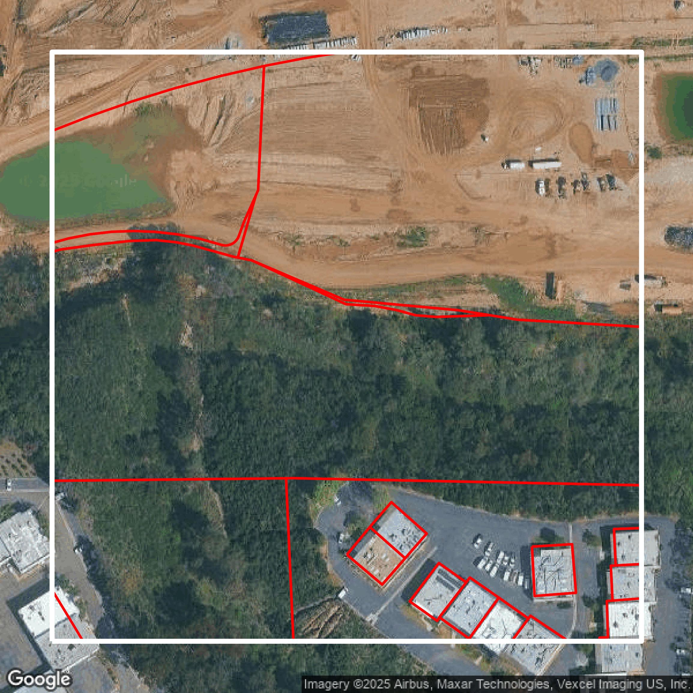
Parcels and Buildings
Parcel and building data in San Diego County are used in a variety of fields including architecture, real estate, and urban planning.
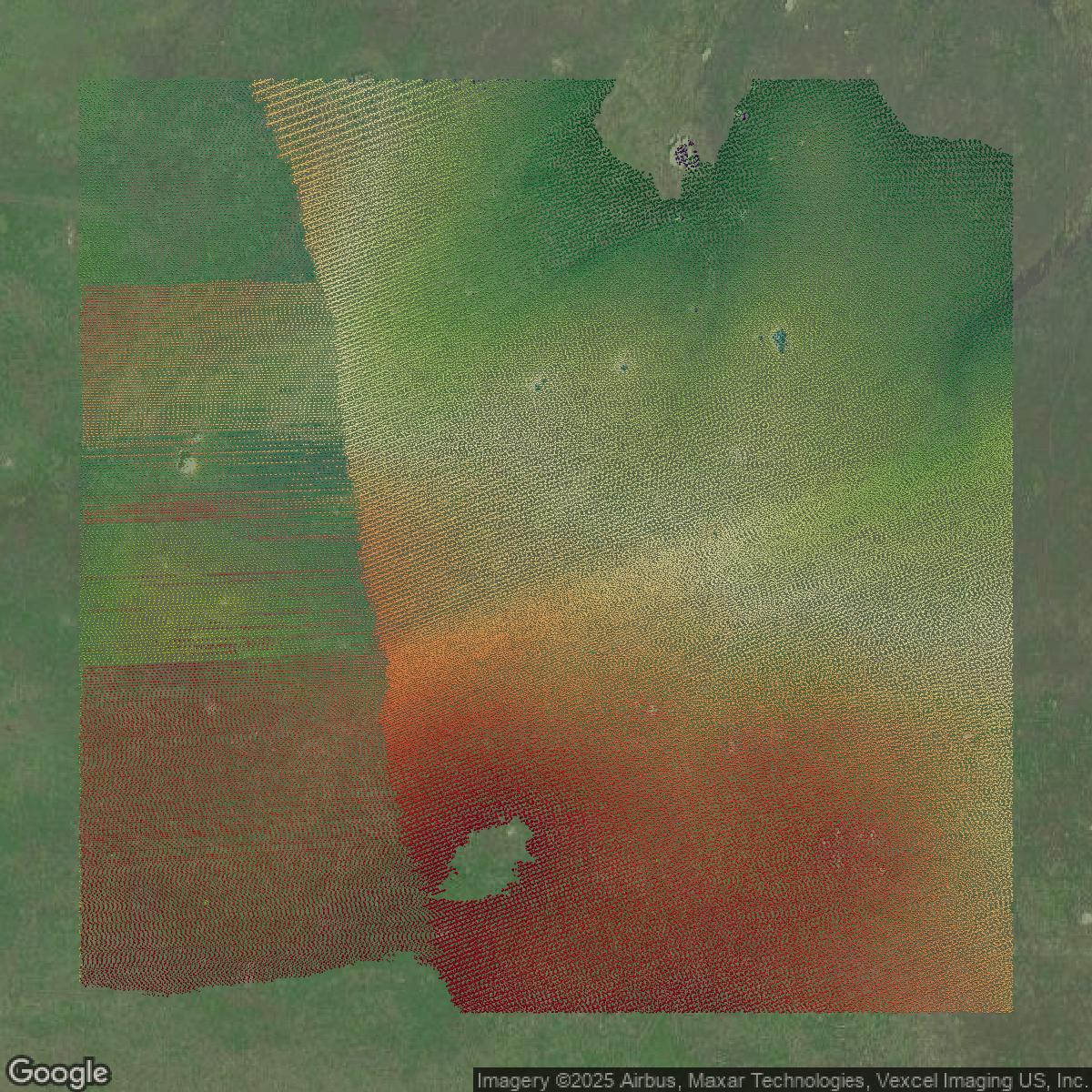
LiDAR
Point clouds (LiDAR) in San Diego County can produce highly accurate 3D models of terrain, structures, and vegetation.
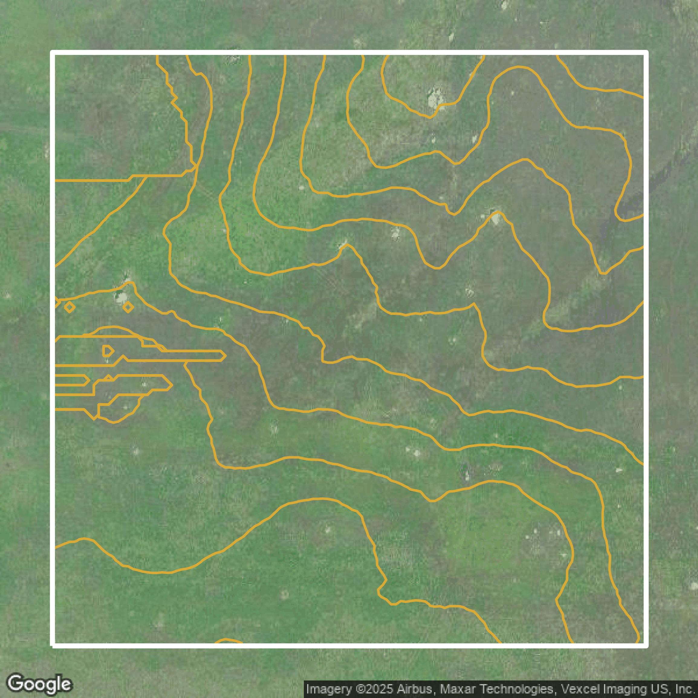
Contours
Contours in San Diego County visualize 3D elevations on a 2D surface allowing you to better understand your site.
Showcase
Sample GIS Data for San Diego County
Parcels and Buildings
Accessing San Diego County parcel and building data on Equator gives you access to coverage across the US.
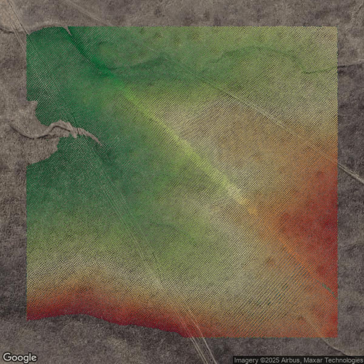
LiDAR
San Diego County LiDAR uses include land surveying, analyzing crop health, or even archaeological studies.
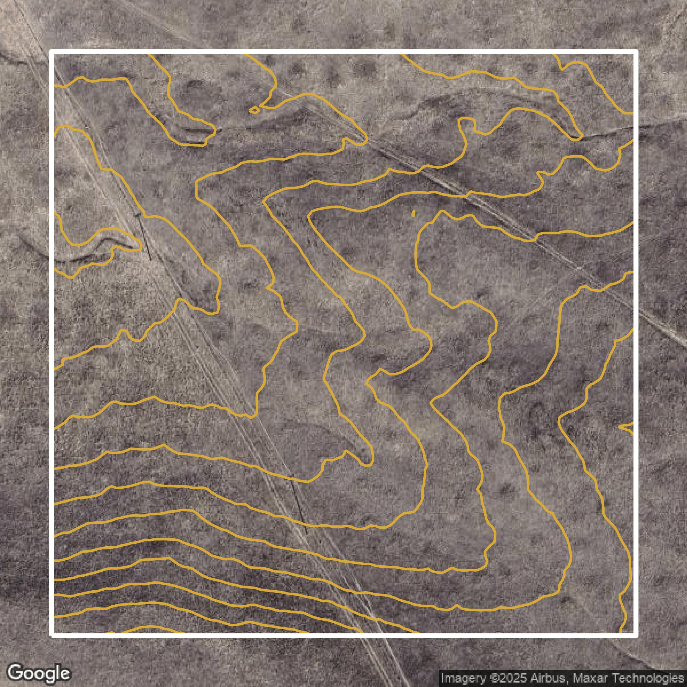
Contours
San Diego County contours can be used for construction & engineering, environmental science, and more.
Showcase
Sample GIS Data for San Diego County
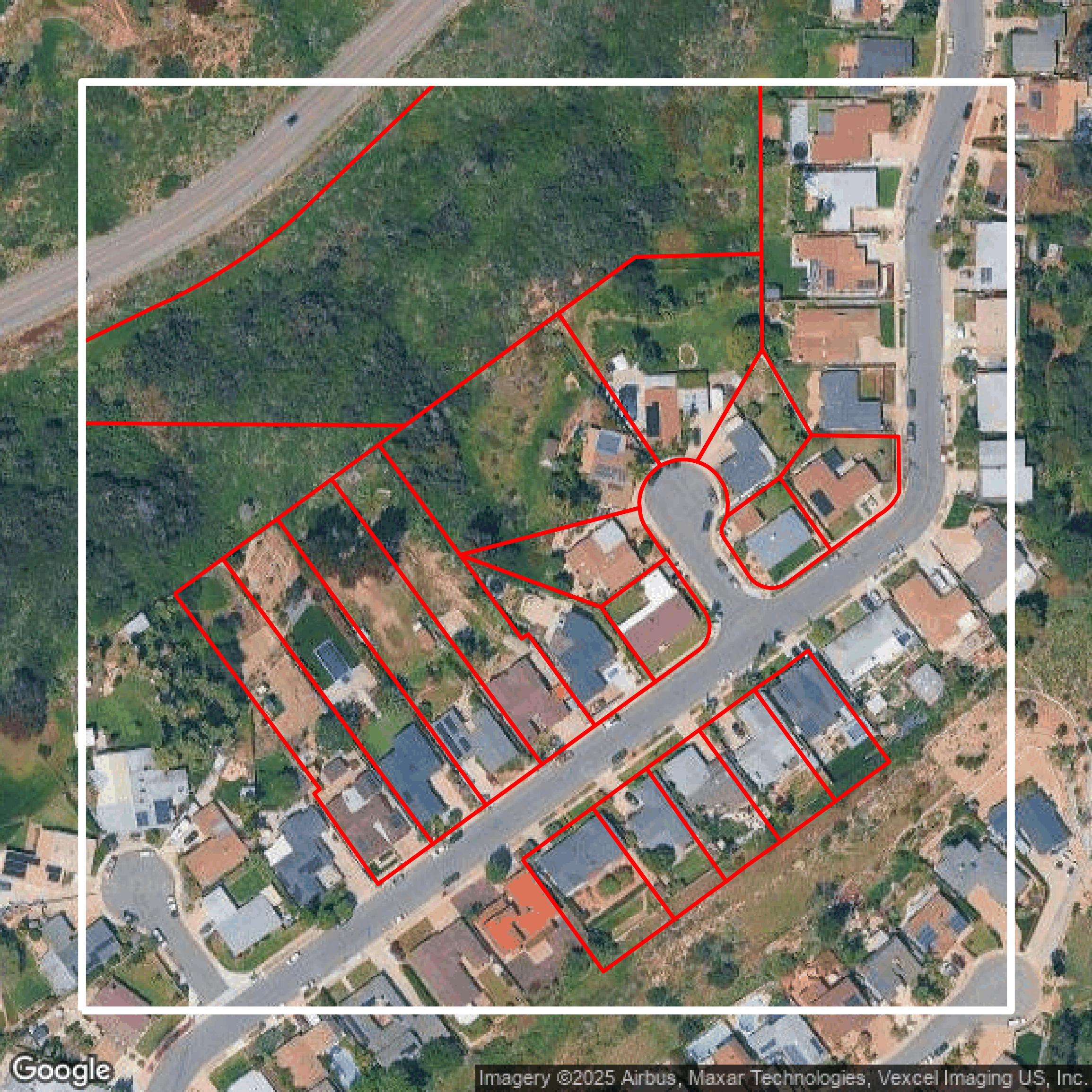
Parcels and Buildings
Dozens of fields are contained within each San Diego County parcel and building data, including zoning, owners, and year built.
LiDAR
Equator turns San Diego County LiDAR point clouds into various lidar-derived data sets, including DEMs.
Contours
San Diego County contours on Equator are produced from LiDAR coverage, allowing for high precision