Overview
Denver County GIS Data – For CAD
Equator helps civil engineering, architecture and consulting firms with the tools to instantly find, process and download accurate LiDAR, contours, parcel data, building footprints, DEMs, point clouds and other GIS data for Denver County in an online web mapping portal.
Denver County GIS Data →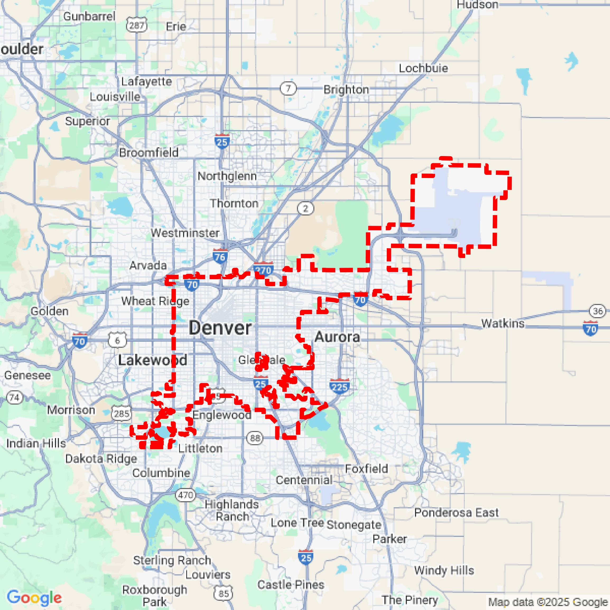

Data Available
Download GIS Data for Denver County
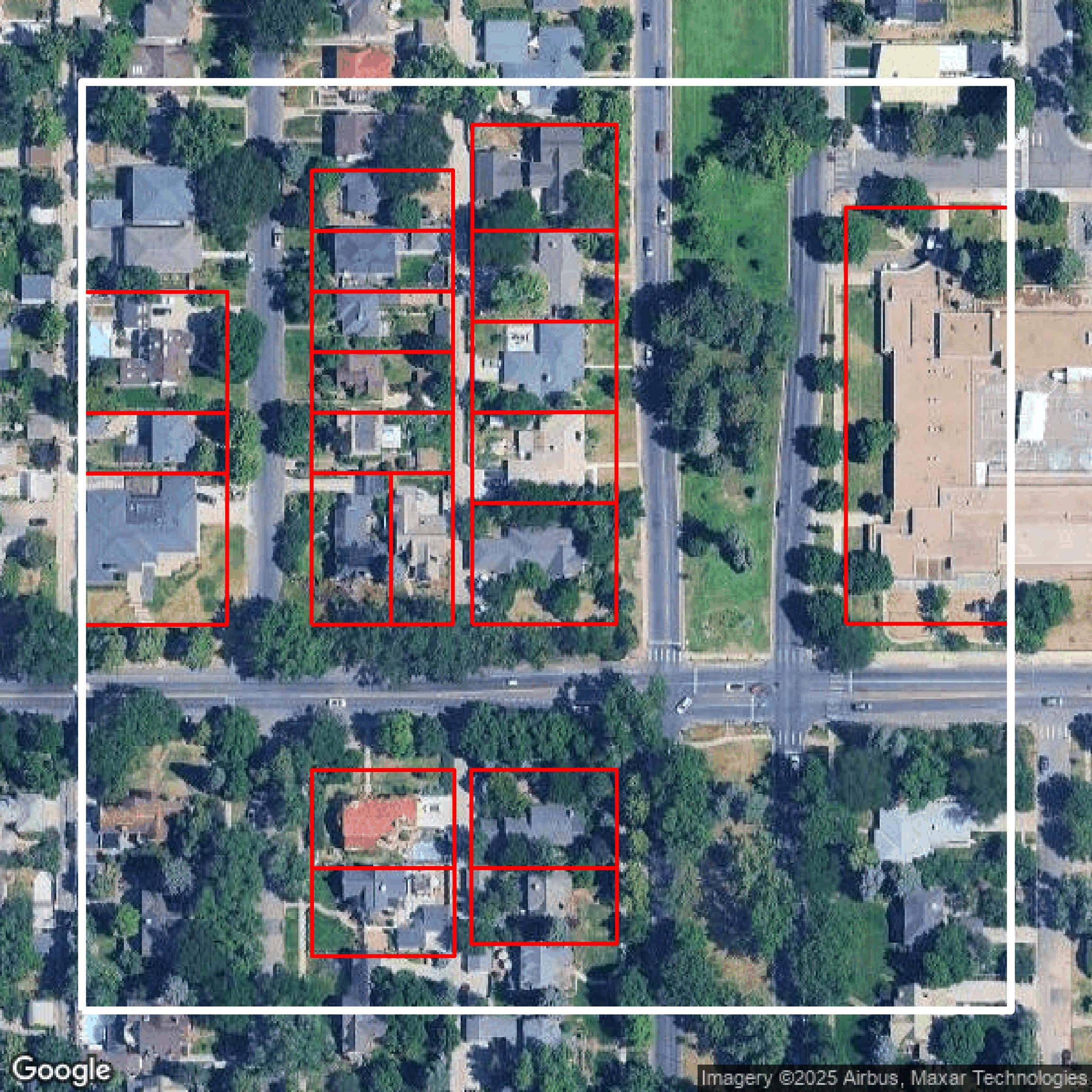
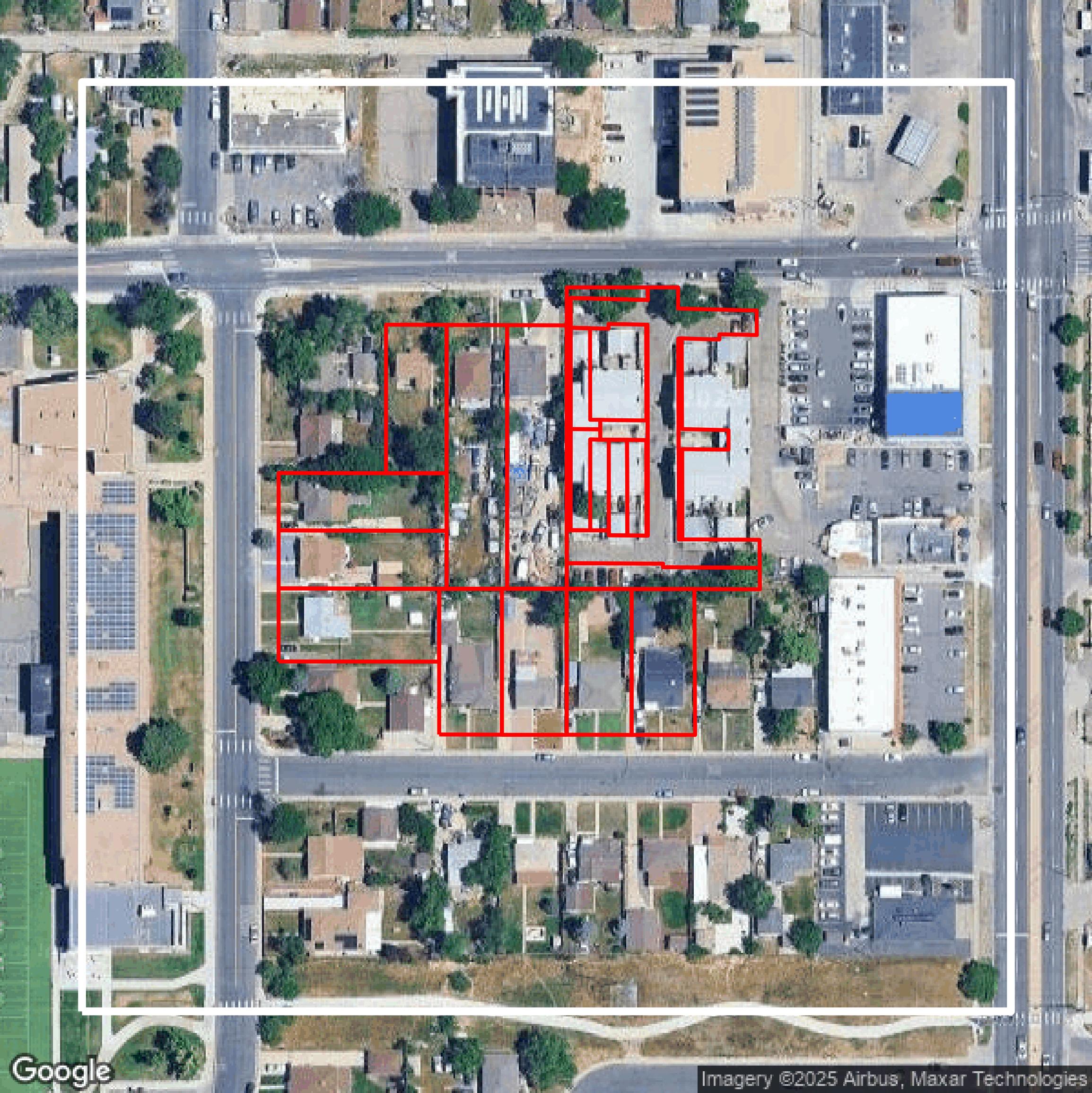
Parcels and Buildings
This image shows parcel and building data in Denver County created using GIS data in Equator.
Get Parcels and Buildings for Denver County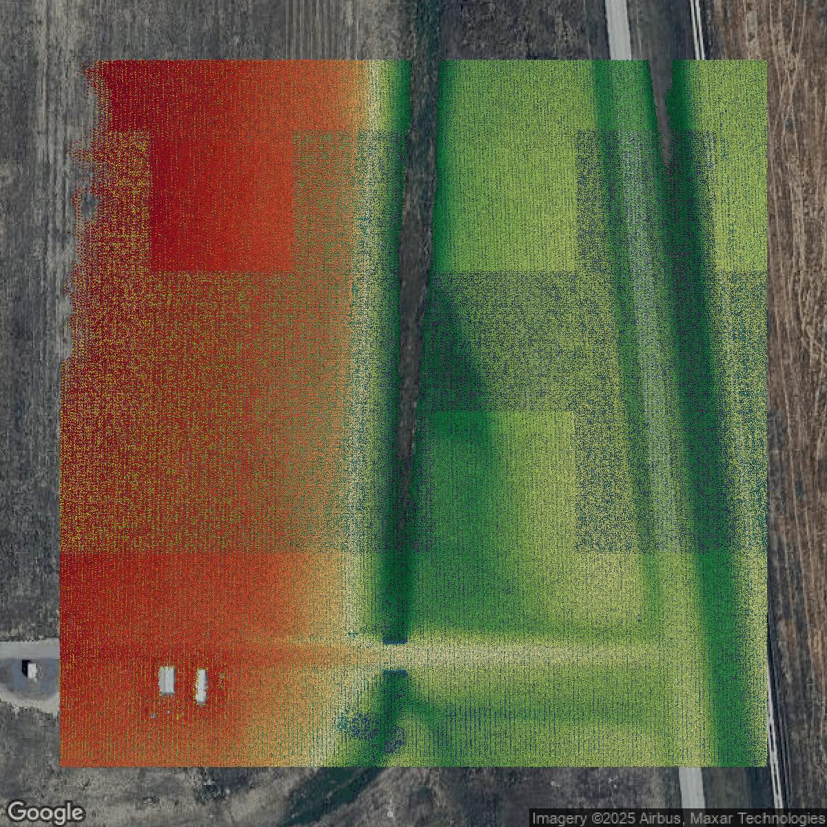
LiDAR
This image shows a LiDAR point cloud in Denver County created using GIS data in Equator.
Get LiDAR for Denver County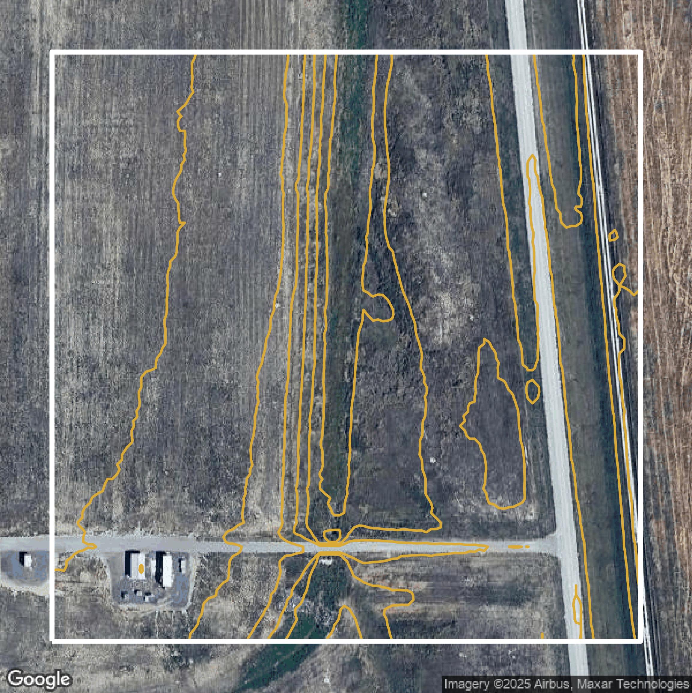
Contours
This image shows a contour map in Denver County created using GIS data in Equator.
Get Contours for Denver CountyFormats Available
Export Your Data Ready to Use in Multiple Formats
DWG
AutoCAD Drawing - Industry-standard CAD format
Supported Data:
Contour, Parcel, Building Outline
SHP
Shapefile - Standard GIS vector format
Supported Data:
Contour, Parcel, Building Outline
DXF
Drawing Exchange Format - Universal CAD interchange
Supported Data:
Contour, Building Outline
GeoJSON
Geographic JSON - Web-friendly spatial data format
Supported Data:
Contour, Parcel, Building Outline
LAZ
Compressed LAS - Efficient LiDAR point cloud format
Supported Data:
Point Cloud
SVG
Scalable Vector Graphics - Web vector format
Supported Data:
Contour, Building Outline
GPKG (Coming Soon)
GeoPackage - Modern OGC spatial database format
Supported Data:
Contour, Parcel, Building Outline
LandXML (Coming Soon)
Land XML - Civil engineering data exchange format
Supported Data:
Point Cloud
TIN (Coming Soon)
Triangulated Irregular Network - 3D surface model
Supported Data:
Point Cloud
XYZ (Coming Soon)
XYZ Point Cloud - Simple ASCII point cloud format
Supported Data:
Point Cloud
Background
GIS Data for Denver County
The Denver Maps website offers comprehensive access to a variety of interactive maps and data sets designed to assist residents, businesses, and visitors in navigating and understanding the City and County of Denver. Visitors can explore featured maps including “Real Property” for detailed property information, “Recreation Centers” to locate facilities and amenities, “Denver Marijuana Licenses” for license information, “Zoning” to identify zoning classifications and codes, and “Development Services” to track development project locations. Additional resources include “Registered Neighborhood Organizations” to engage with community groups, “Assessor Maps,” and a “Where To Vote – 2024 General Election” map to find voting centers, drive-through locations, and ballot drop-off boxes. The site also provides access to the Denver Open Data Catalog for downloading map data and offers numerous categorized tags such as “Address,” “Floodplain,” “Housing,” “Transportation,” and “Voting” to help users quickly find relevant geographic data and city services. Overall, Denver Maps is a robust GIS portal that empowers users with precise, official spatial information and practical interactive tools directly from the local government.
Access Denver County GIS Data in Equator →Denver County Portal →Showcase
Sample GIS Data for Denver County
Parcels and Buildings
Parcel and building data in Denver County are used in a variety of fields including architecture, real estate, and urban planning.
Get Parcels and Buildings for Denver County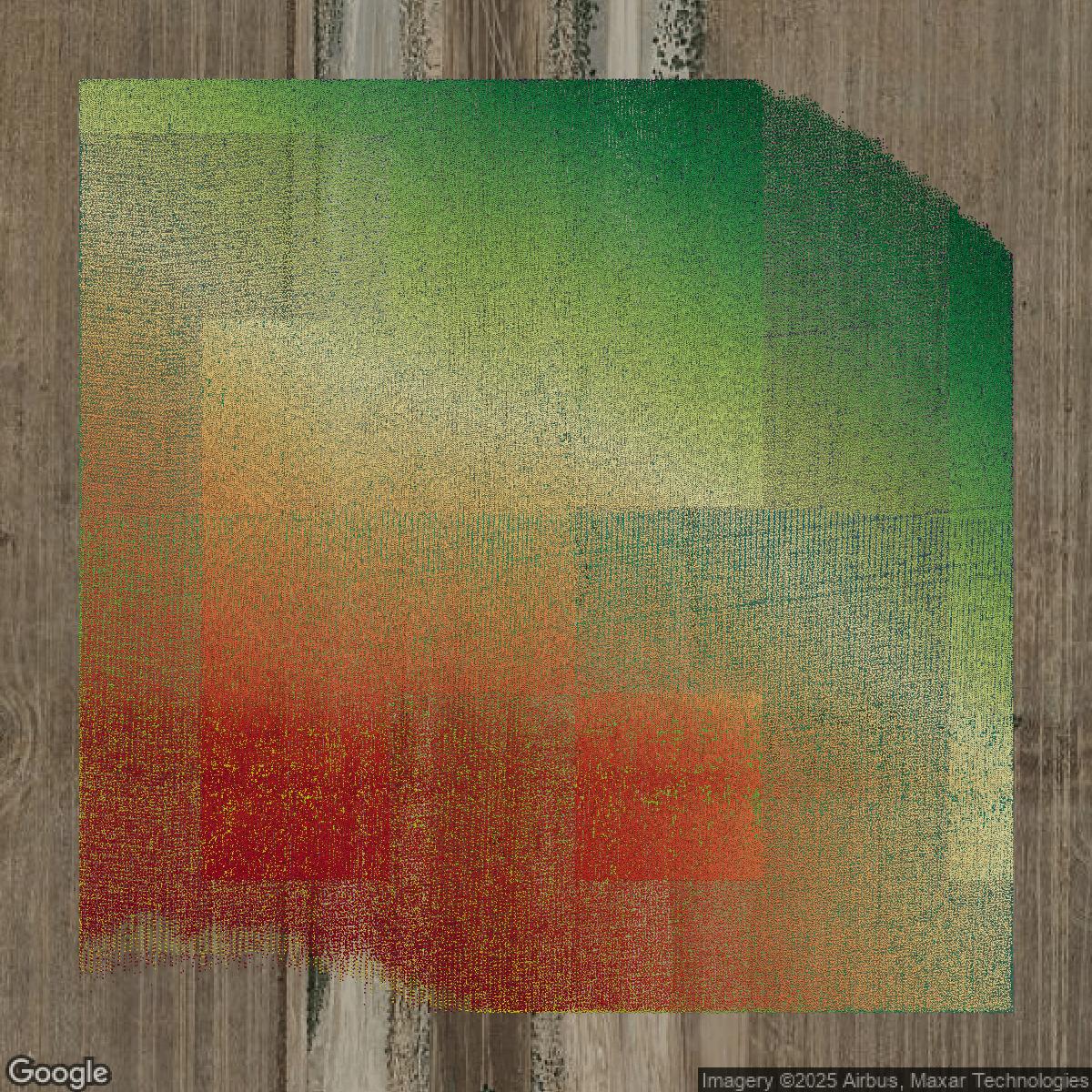
LiDAR
Point clouds (LiDAR) in Denver County can produce highly accurate 3D models of terrain, structures, and vegetation.
Get LiDAR for Denver County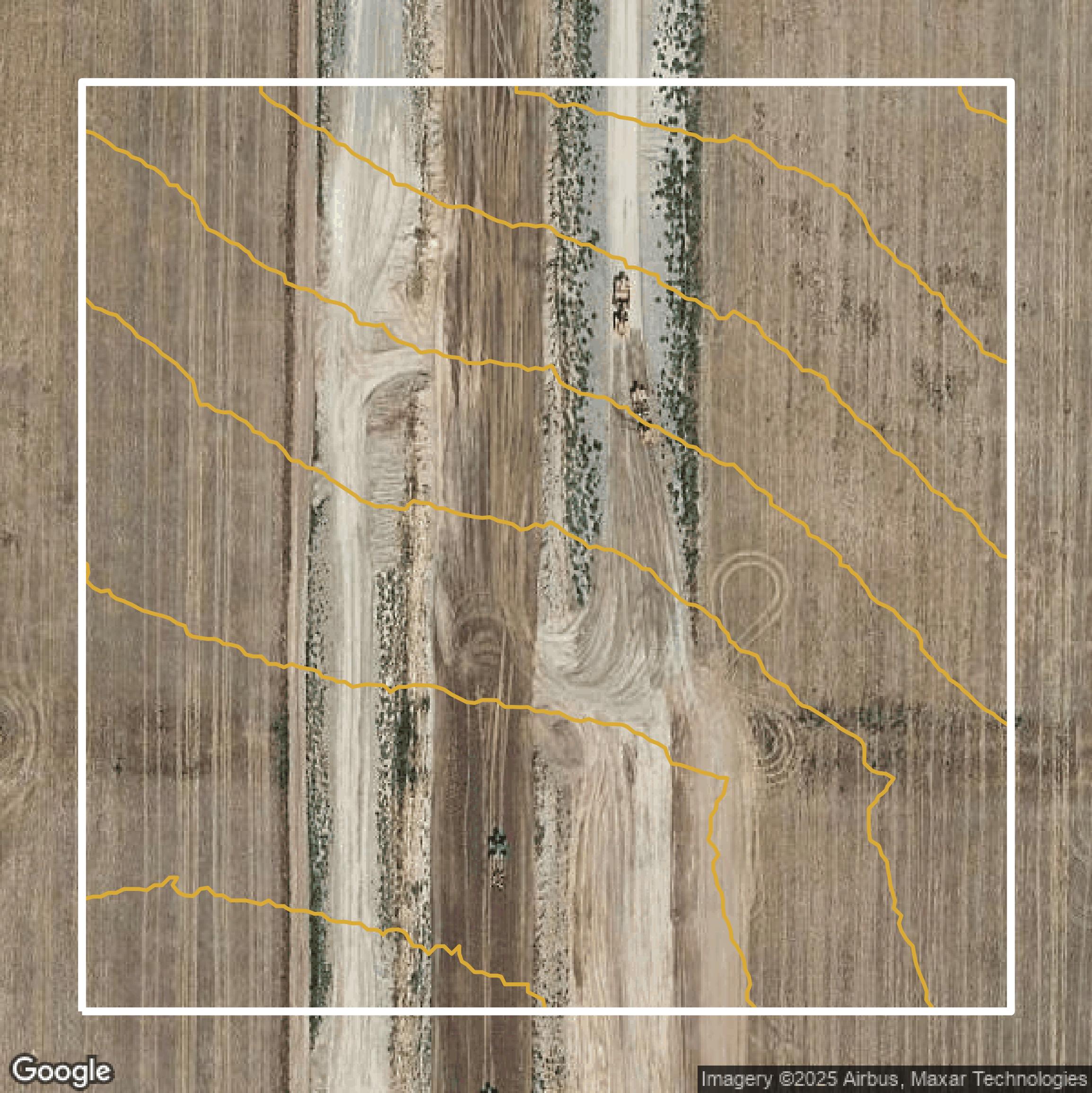
Contours
Contours in Denver County visualize 3D elevations on a 2D surface allowing you to better understand your site.
Get Contours for Denver County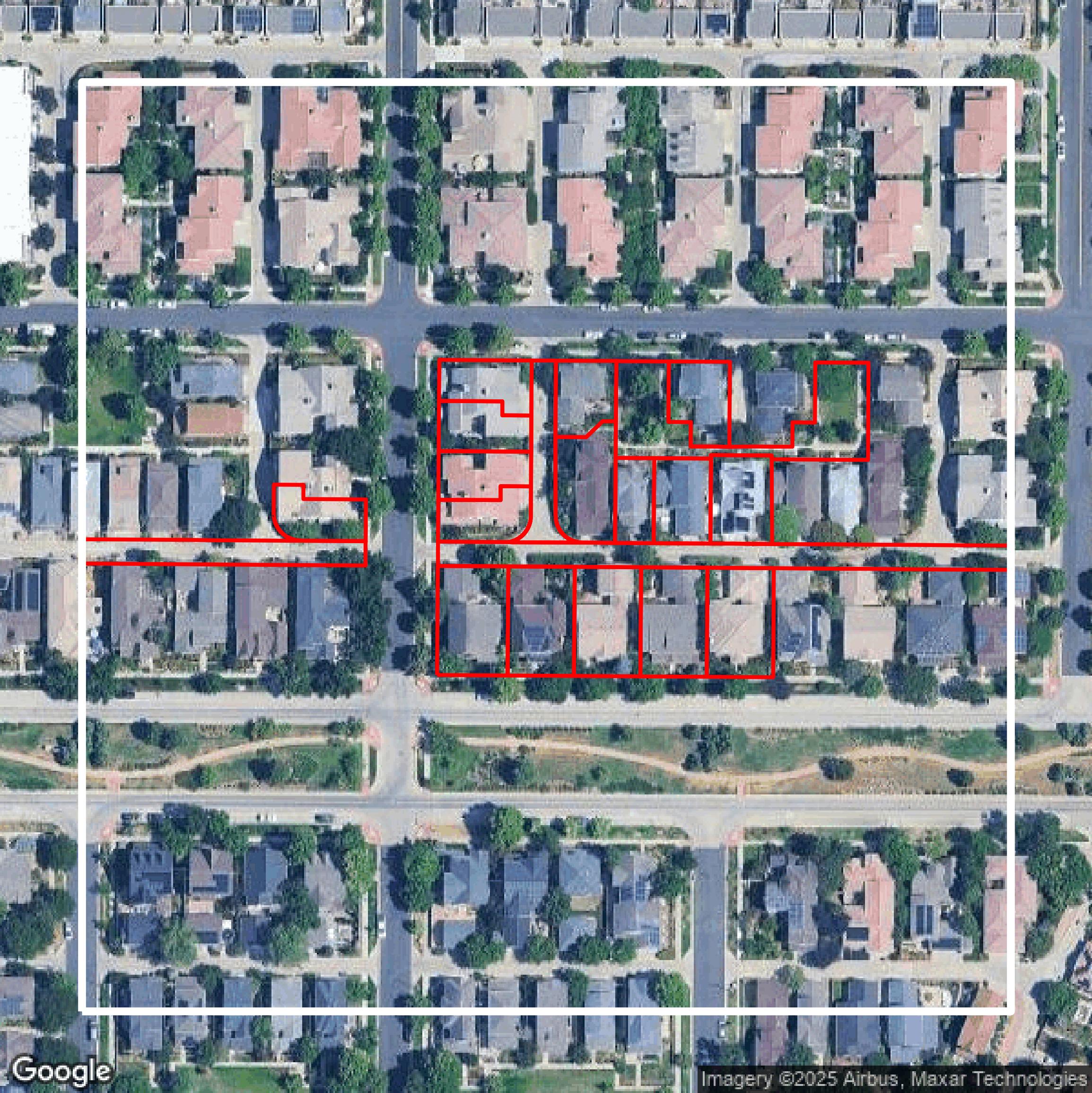
Parcels and Buildings
Accessing Denver County parcel and building data on Equator gives you access to coverage across the US.
Get Parcels and Buildings for Denver County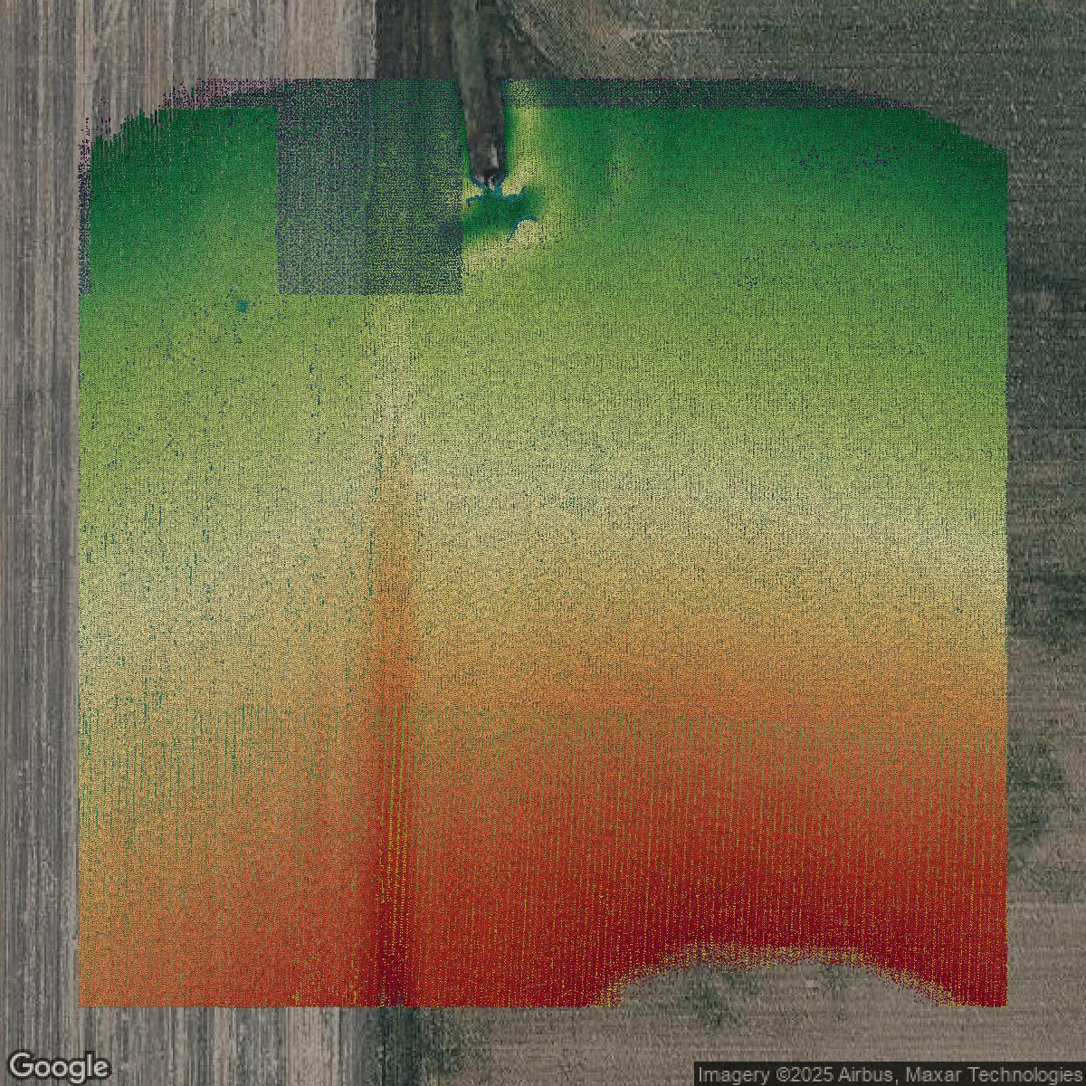
LiDAR
Denver County LiDAR uses include land surveying, analyzing crop health, or even archaeological studies.
Get LiDAR for Denver County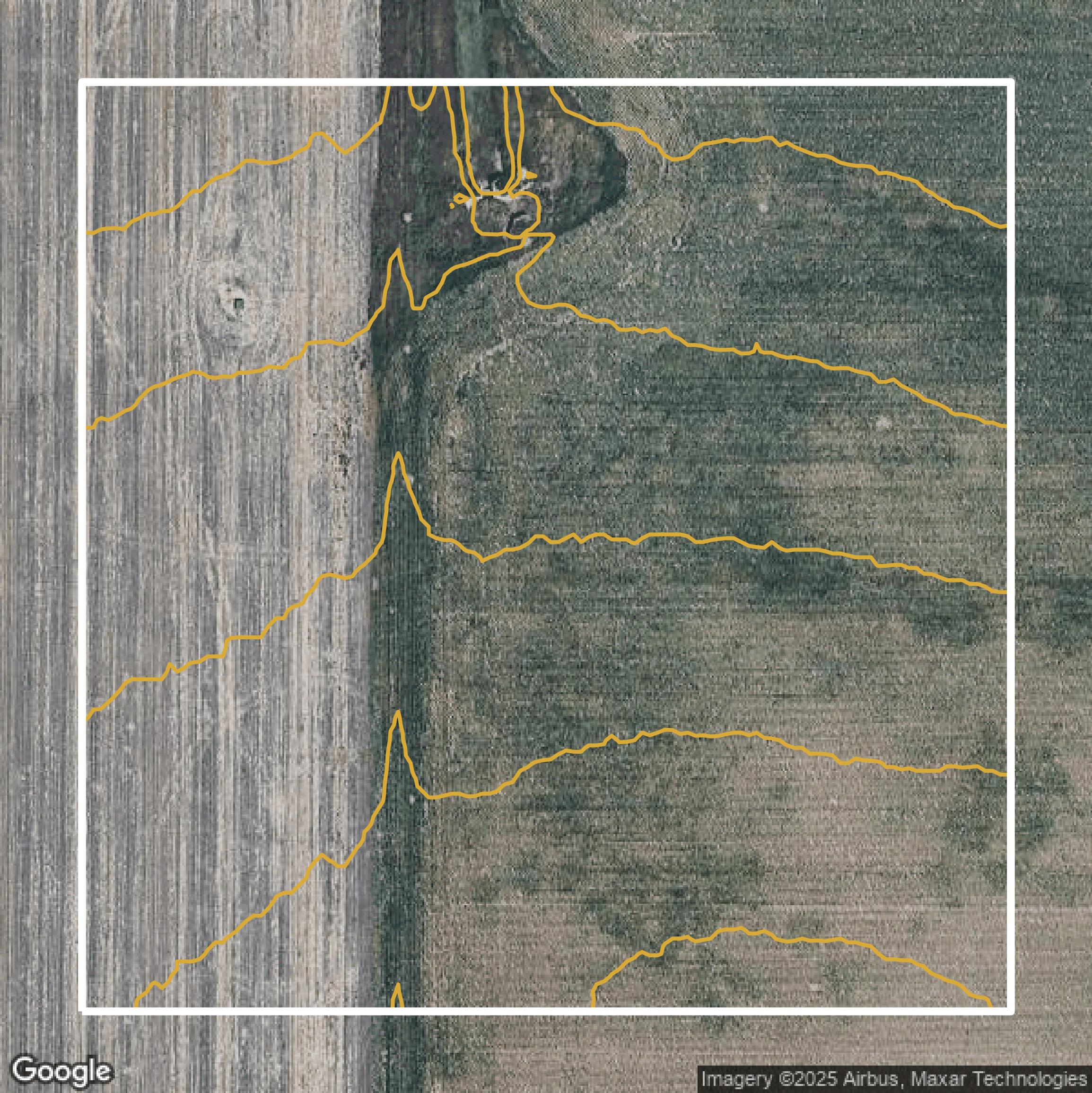
Contours
Denver County contours can be used for construction & engineering, environmental science, and more.
Get Contours for Denver County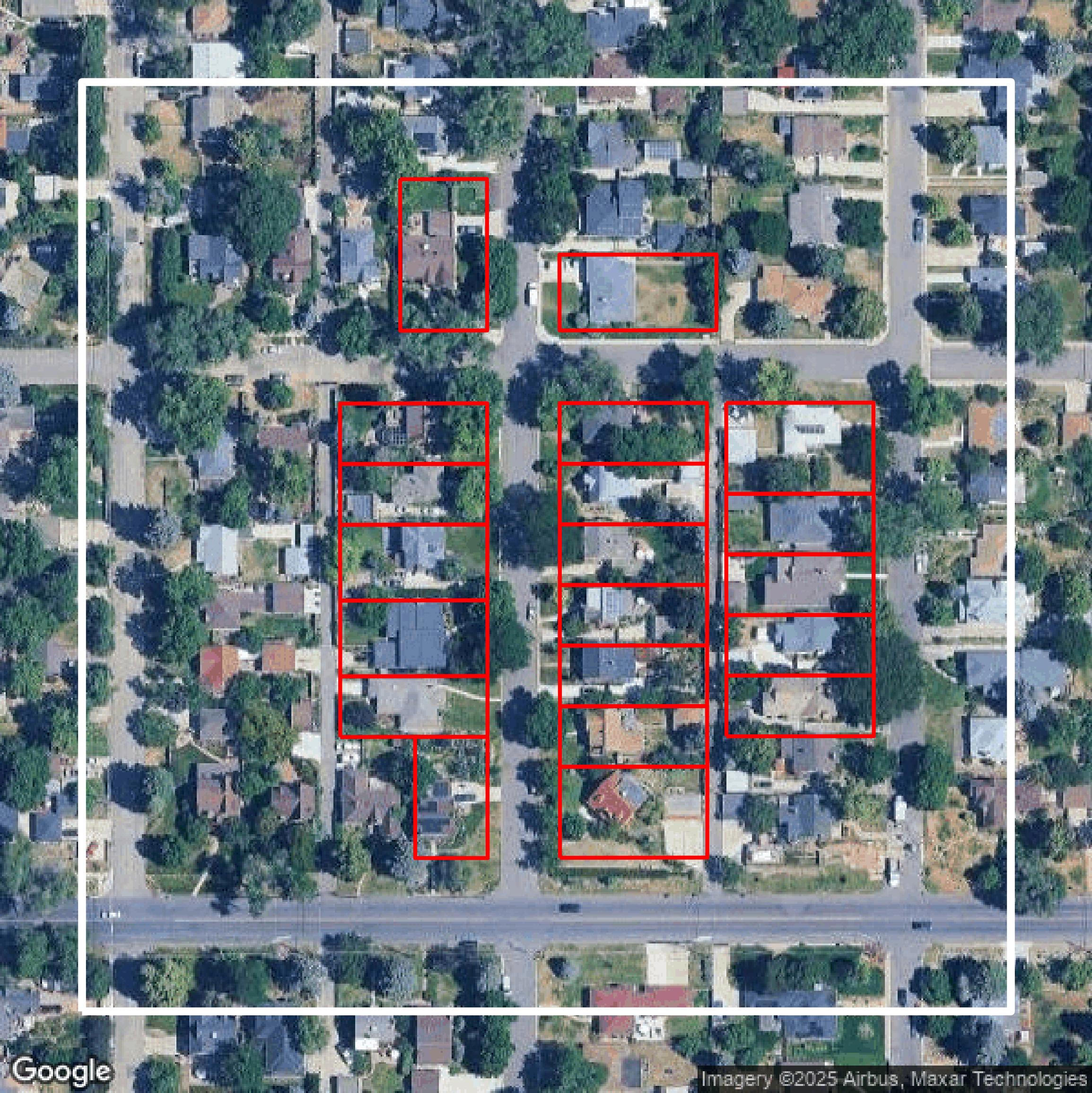
Parcels and Buildings
Dozens of fields are contained within each Denver County parcel and building data, including zoning, owners, and year built.
Get Parcels and Buildings for Denver County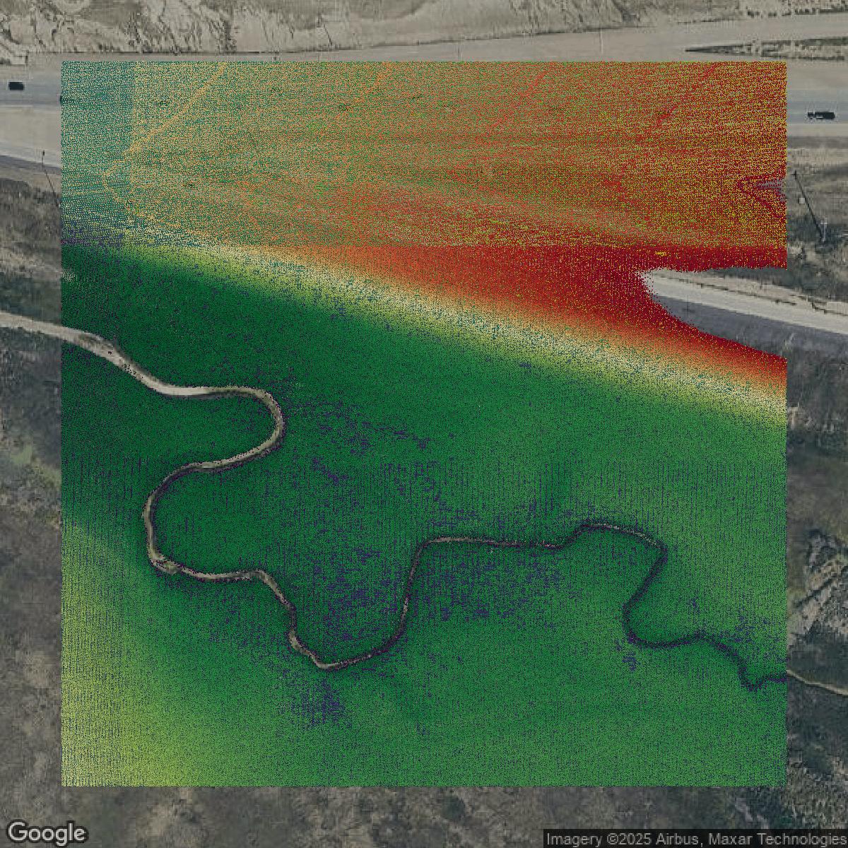
LiDAR
Equator turns Denver County LiDAR point clouds into various lidar-derived data sets, including DEMs.
Get LiDAR for Denver County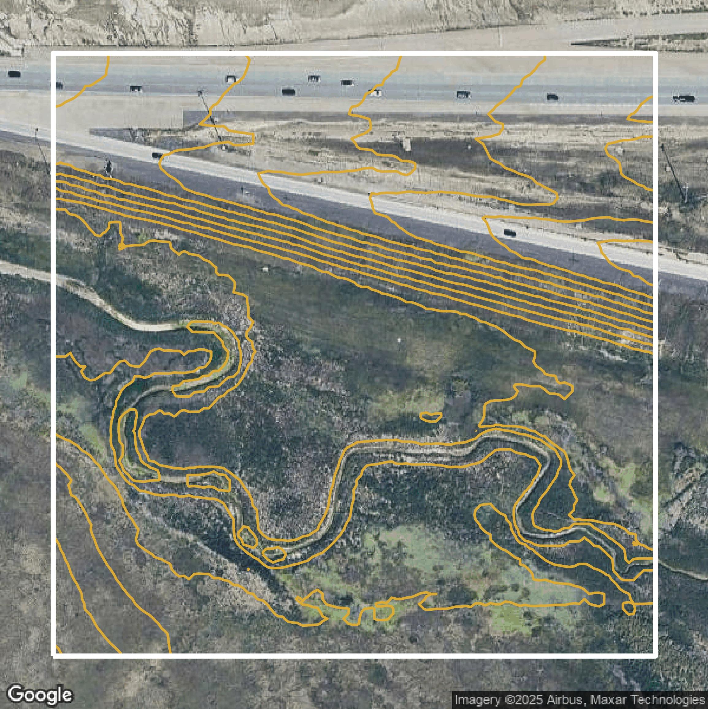
Contours
Denver County contours on Equator are produced from LiDAR coverage, allowing for high precision
Get Contours for Denver County