Overview
Capitol Planning Region GIS Data – For CAD
Equator helps civil engineering, architecture and consulting firms with the tools to instantly find, process and download accurate LiDAR, contours, parcel data, building footprints, DEMs, point clouds and other GIS data for Capitol Planning Region in an online web mapping portal.
Capitol Planning Region GIS Data →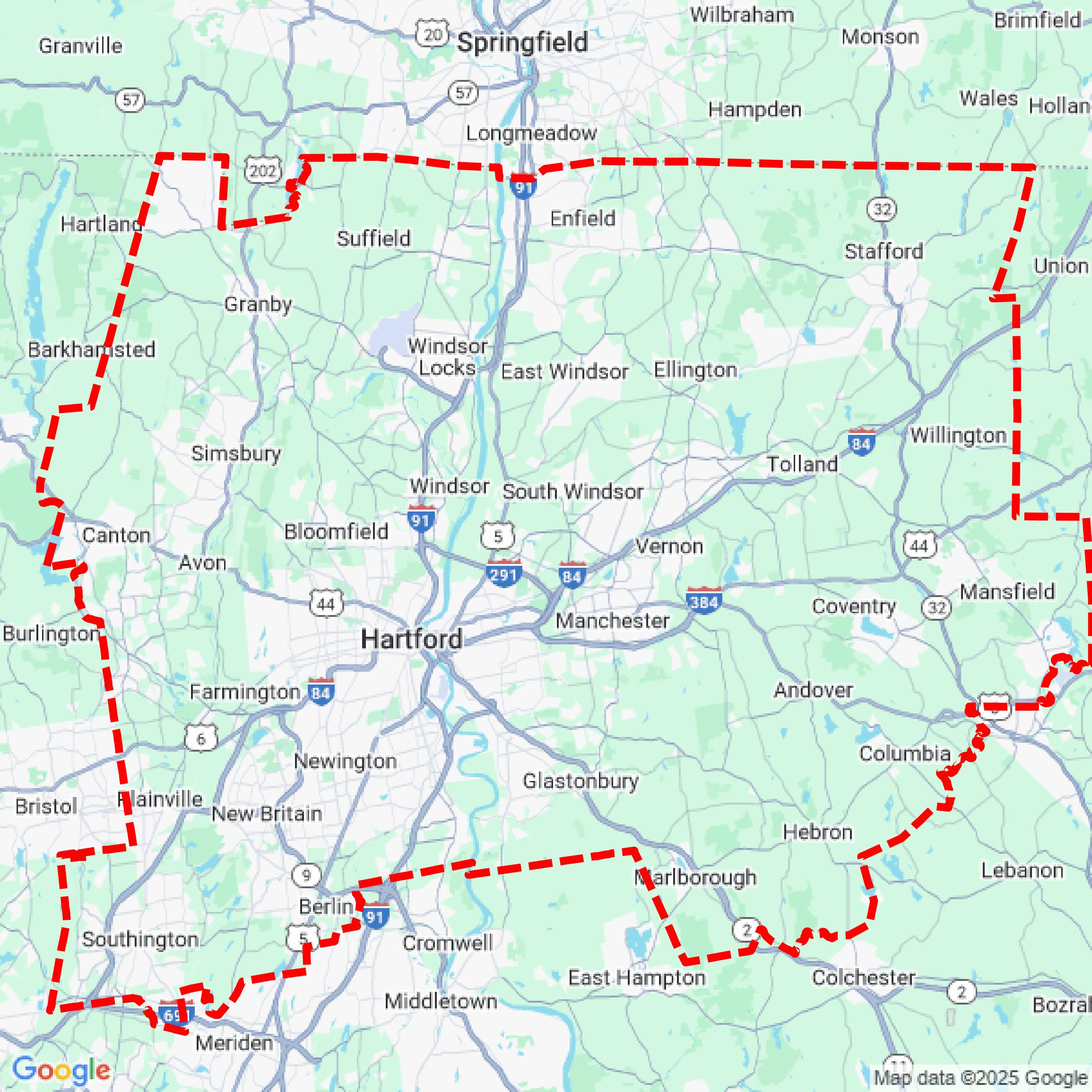

Data Available
Download GIS Data for Capitol Planning Region
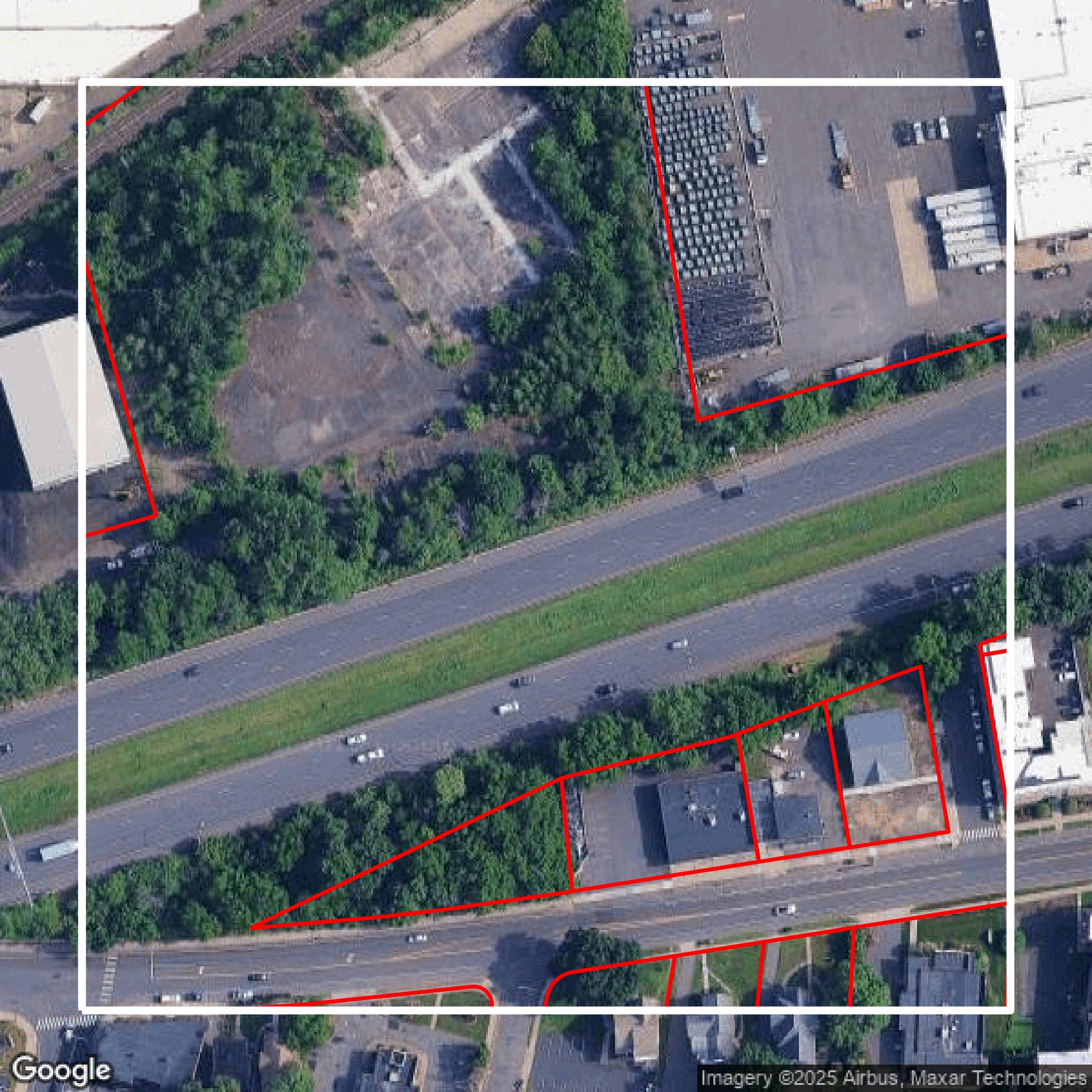
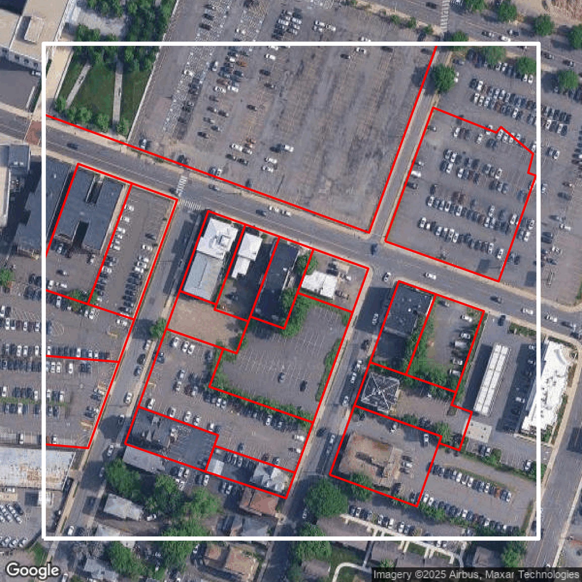
Parcels and Buildings
This image shows parcel and building data in Capitol Planning Region created using GIS data in Equator.
Get Parcels and Buildings for Capitol Planning Region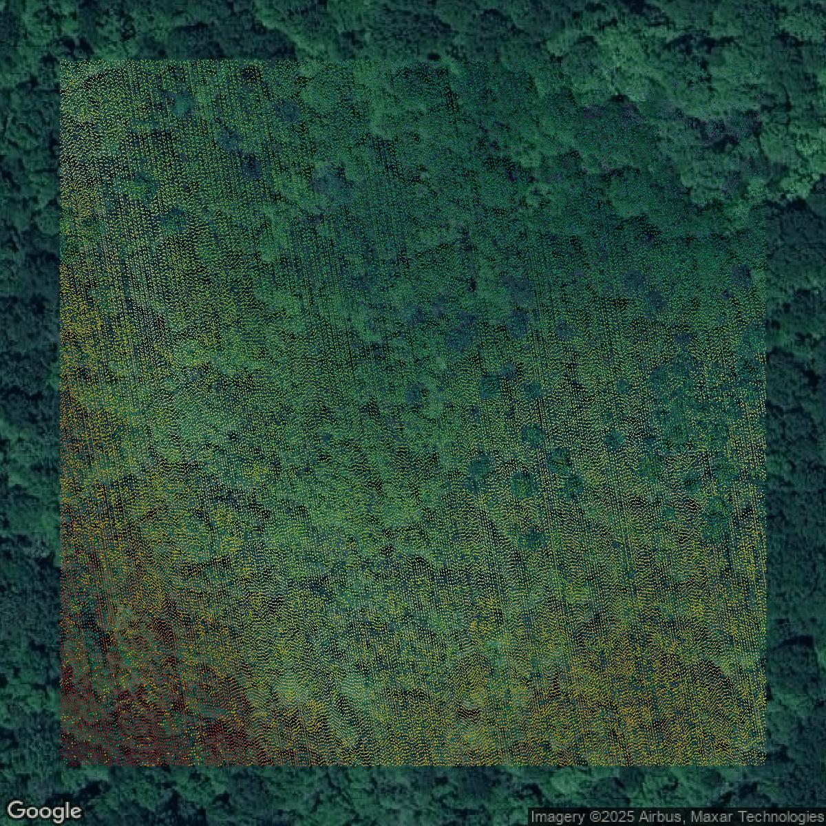
LiDAR
This image shows a LiDAR point cloud in Capitol Planning Region created using GIS data in Equator.
Get LiDAR for Capitol Planning Region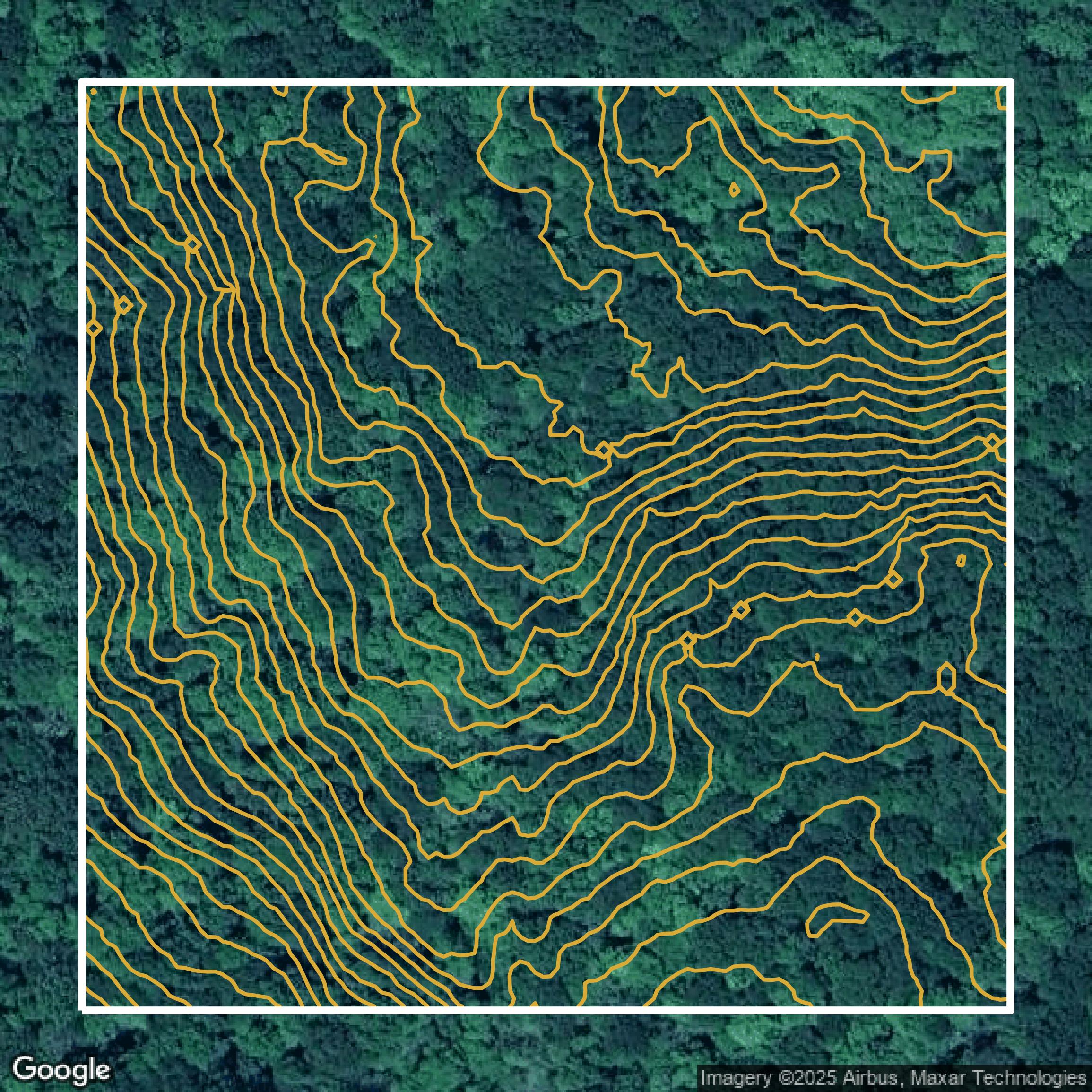
Contours
This image shows a contour map in Capitol Planning Region created using GIS data in Equator.
Get Contours for Capitol Planning RegionFormats Available
Export Your Data Ready to Use in Multiple Formats
DWG
AutoCAD Drawing - Industry-standard CAD format
Supported Data:
Contour, Parcel, Building Outline
SHP
Shapefile - Standard GIS vector format
Supported Data:
Contour, Parcel, Building Outline
DXF
Drawing Exchange Format - Universal CAD interchange
Supported Data:
Contour, Building Outline
GeoJSON
Geographic JSON - Web-friendly spatial data format
Supported Data:
Contour, Parcel, Building Outline
LAZ
Compressed LAS - Efficient LiDAR point cloud format
Supported Data:
Point Cloud
SVG
Scalable Vector Graphics - Web vector format
Supported Data:
Contour, Building Outline
GPKG (Coming Soon)
GeoPackage - Modern OGC spatial database format
Supported Data:
Contour, Parcel, Building Outline
LandXML (Coming Soon)
Land XML - Civil engineering data exchange format
Supported Data:
Point Cloud
TIN (Coming Soon)
Triangulated Irregular Network - 3D surface model
Supported Data:
Point Cloud
XYZ (Coming Soon)
XYZ Point Cloud - Simple ASCII point cloud format
Supported Data:
Point Cloud
Background
GIS Data for Capitol Planning Region
On the GIS DATA webpage of the Connecticut Department of Energy & Environmental Protection (DEEP), visitors can expect to find comprehensive geographic information system data available for download in multiple formats including Shapefile, File Geodatabase, KML, and CSV. Each dataset is accompanied by detailed FGDC metadata and cartographic symbology defined in ArcGIS layers to facilitate immediate use in GIS software. Although the traditional GIS Data Download Page has been replaced as of October 1, 2020, users are directed to the DEEP GIS Open Data Website (https://deepmaps.ct.gov/) for access to all current data. Additionally, the site provides the ability to connect desktop GIS or CAD applications directly to ArcGIS and WMS map services through CT ECO, offering an alternative way to access and view metadata without downloading files. The site is a resource for a variety of mapping and GIS datasets tailored to environmental planning, conservation, and resource management in Connecticut, all supported by state privacy, accessibility, and usage policies.
Access Capitol Planning Region GIS Data in Equator →Capitol Planning Region Portal →Showcase
Sample GIS Data for Capitol Planning Region
Parcels and Buildings
Parcel and building data in Capitol Planning Region are used in a variety of fields including architecture, real estate, and urban planning.
Get Parcels and Buildings for Capitol Planning Region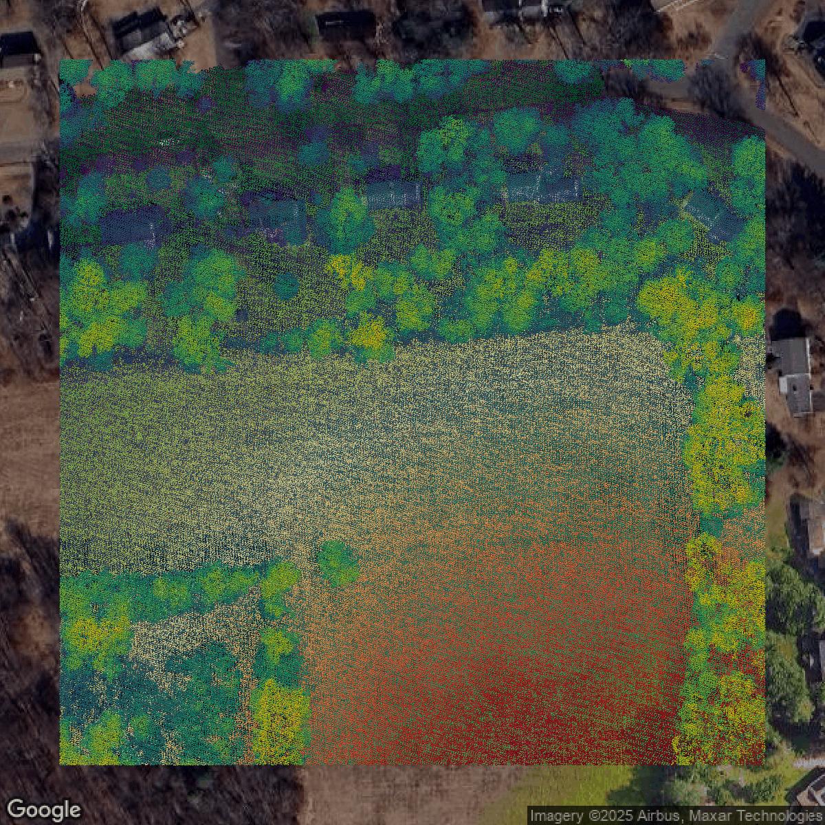
LiDAR
Point clouds (LiDAR) in Capitol Planning Region can produce highly accurate 3D models of terrain, structures, and vegetation.
Get LiDAR for Capitol Planning Region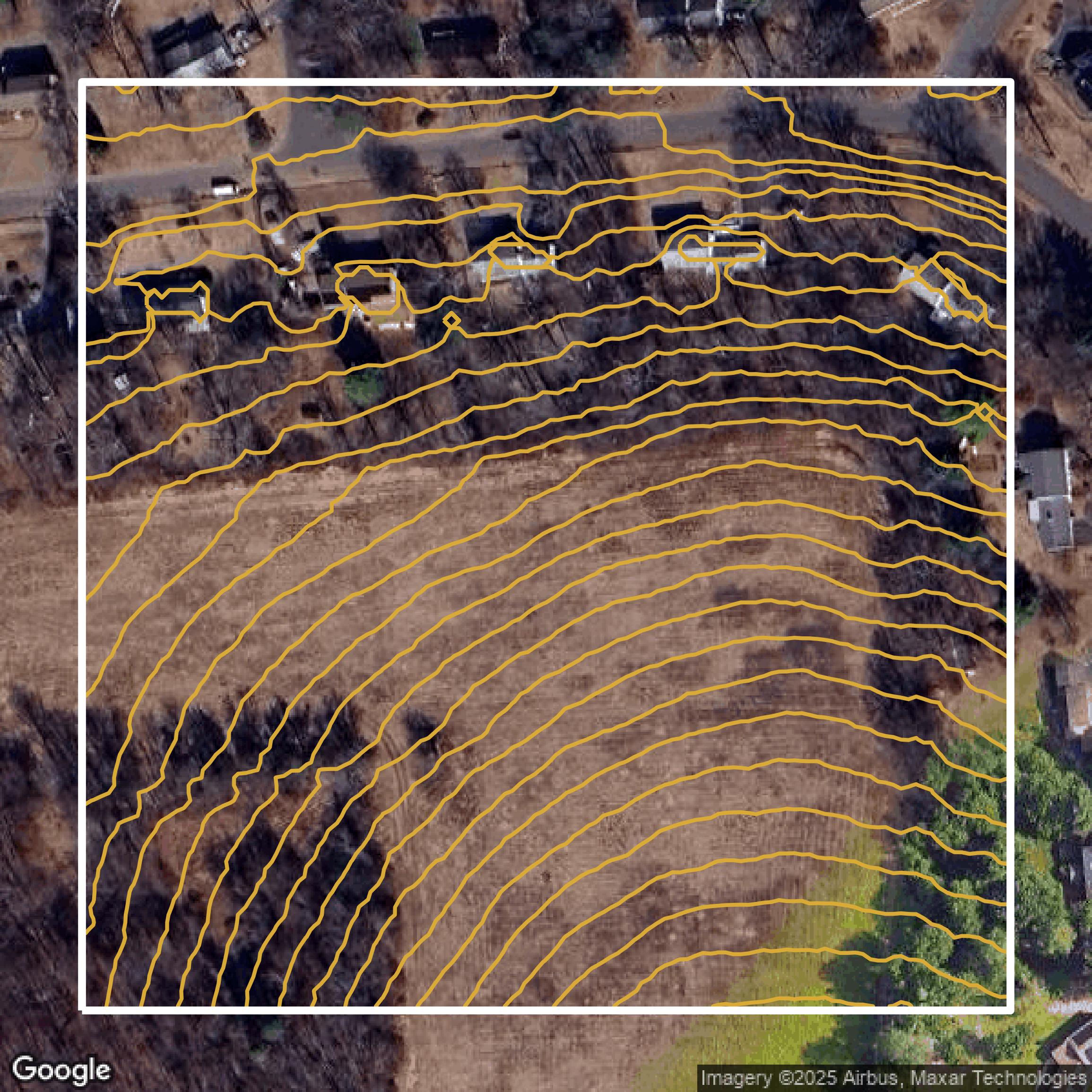
Contours
Contours in Capitol Planning Region visualize 3D elevations on a 2D surface allowing you to better understand your site.
Get Contours for Capitol Planning Region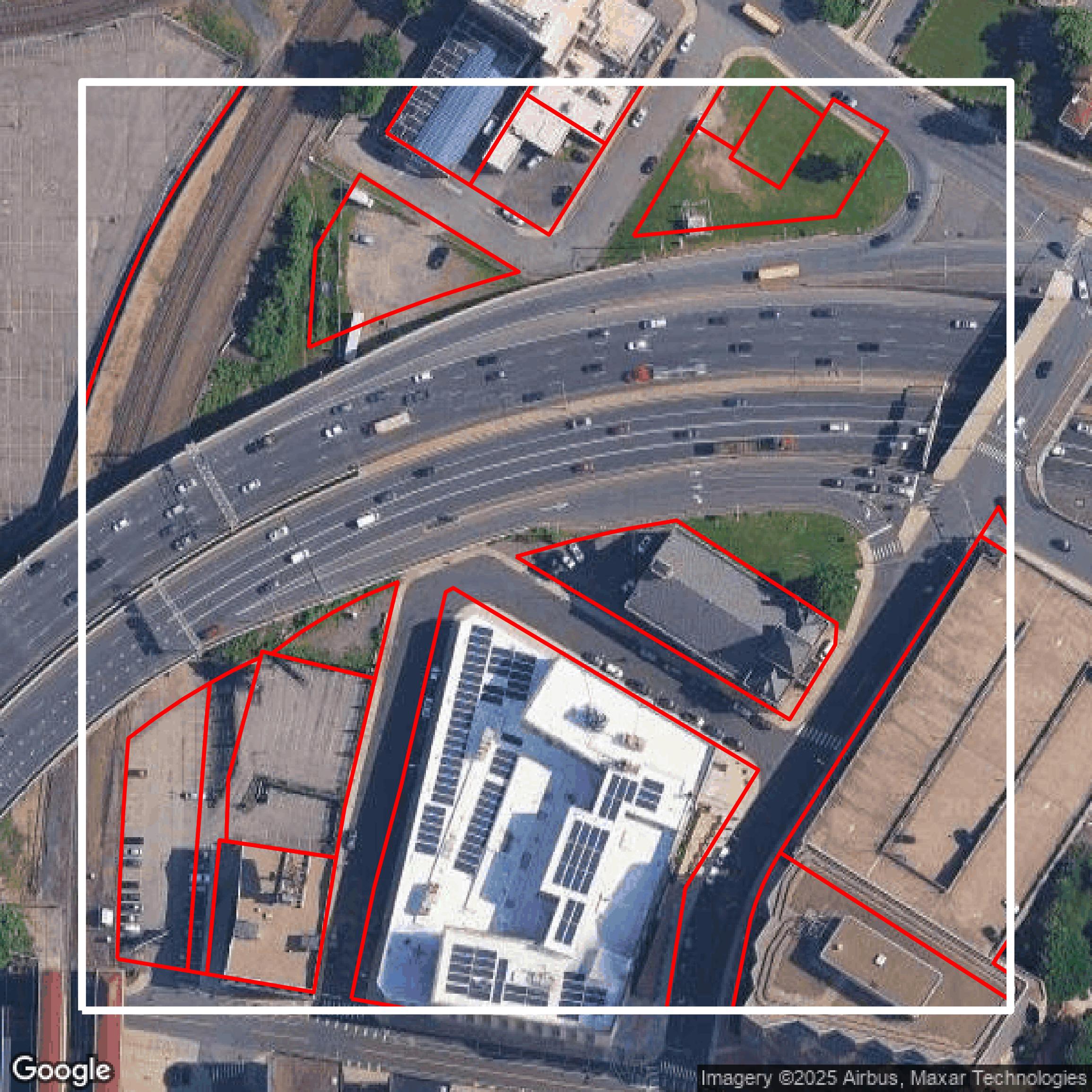
Parcels and Buildings
Accessing Capitol Planning Region parcel and building data on Equator gives you access to coverage across the US.
Get Parcels and Buildings for Capitol Planning Region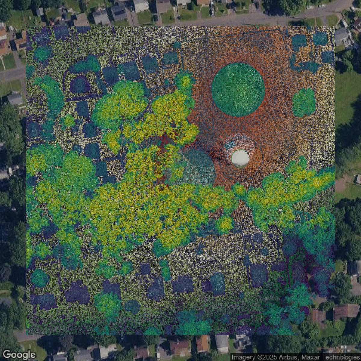
LiDAR
Capitol Planning Region LiDAR uses include land surveying, analyzing crop health, or even archaeological studies.
Get LiDAR for Capitol Planning Region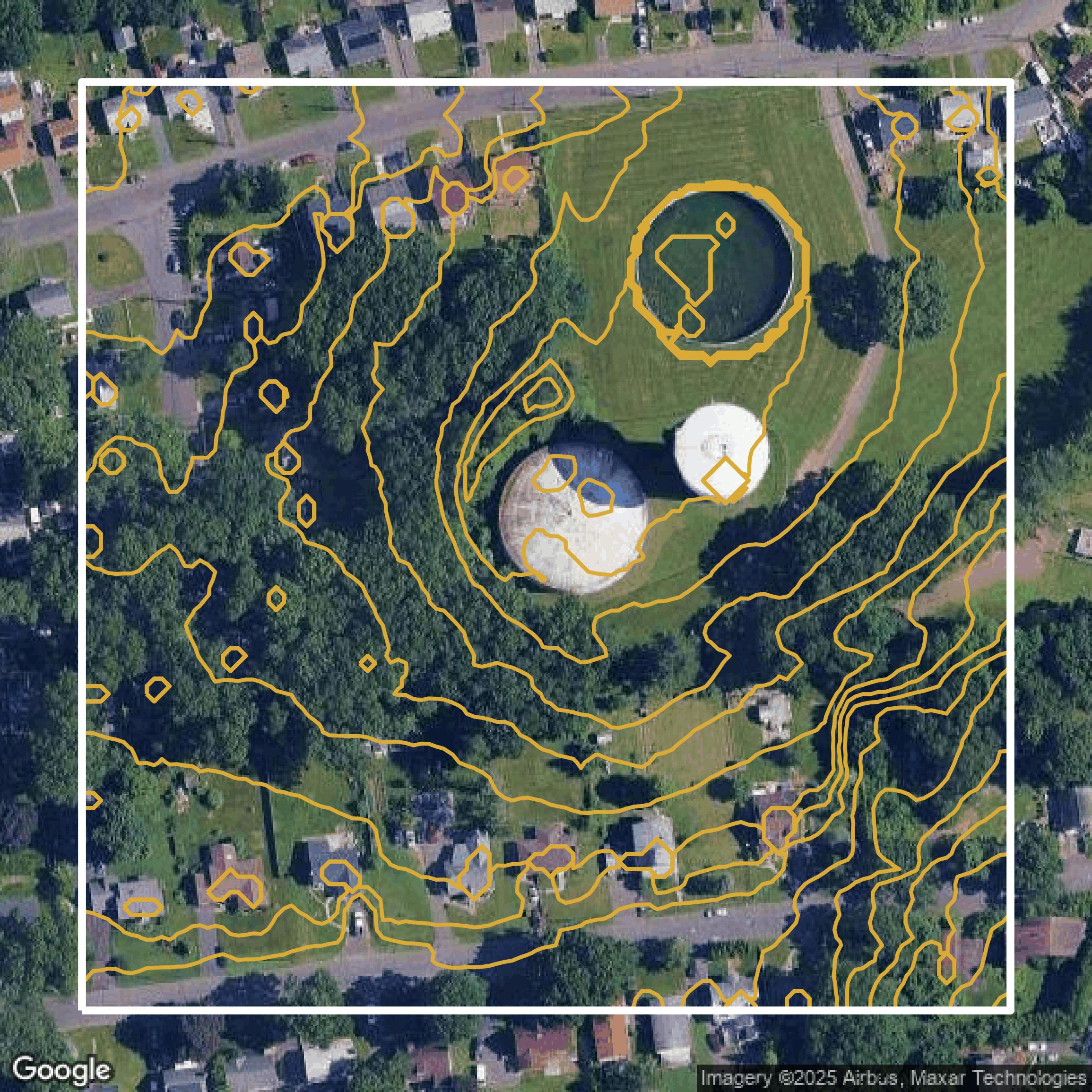
Contours
Capitol Planning Region contours can be used for construction & engineering, environmental science, and more.
Get Contours for Capitol Planning Region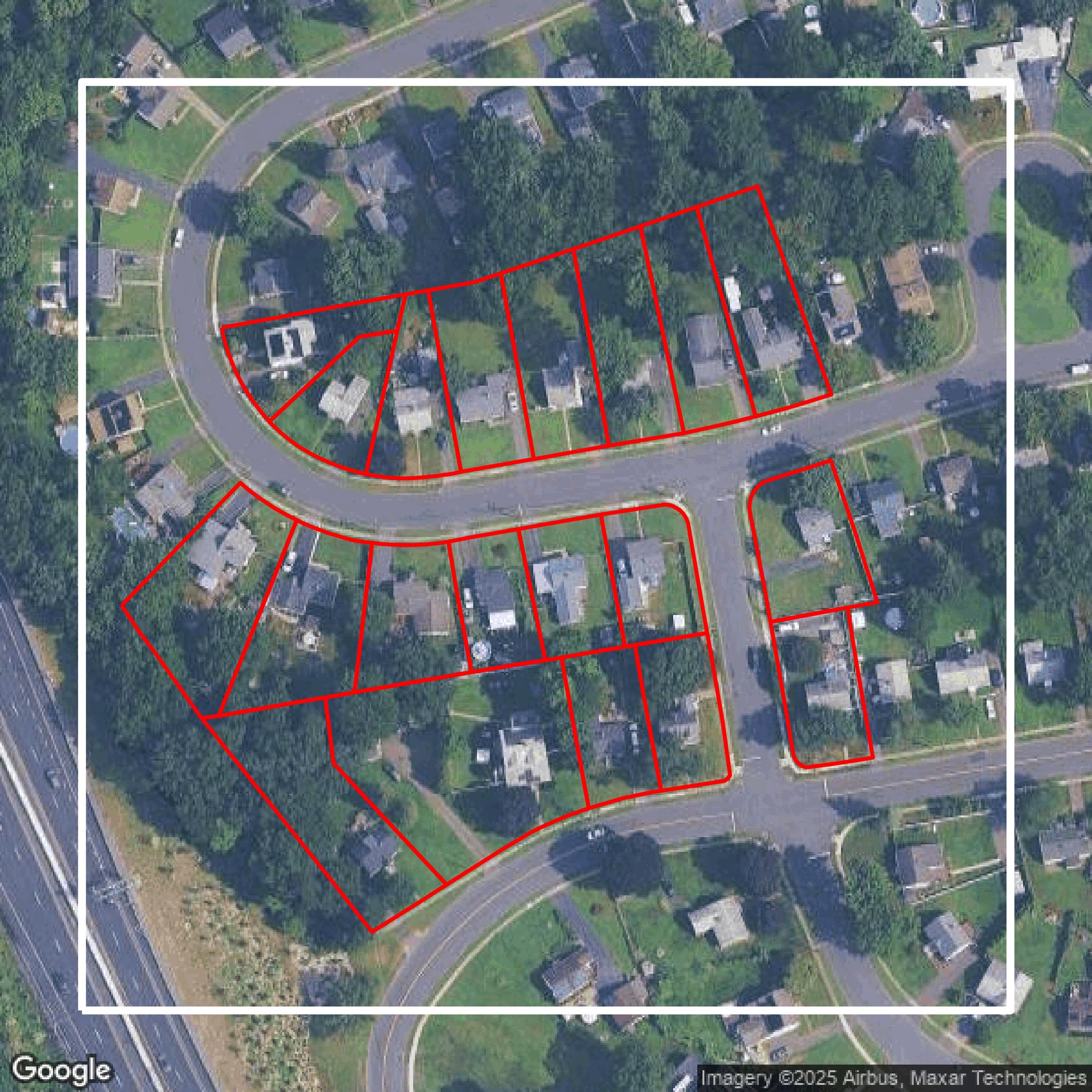
Parcels and Buildings
Dozens of fields are contained within each Capitol Planning Region parcel and building data, including zoning, owners, and year built.
Get Parcels and Buildings for Capitol Planning Region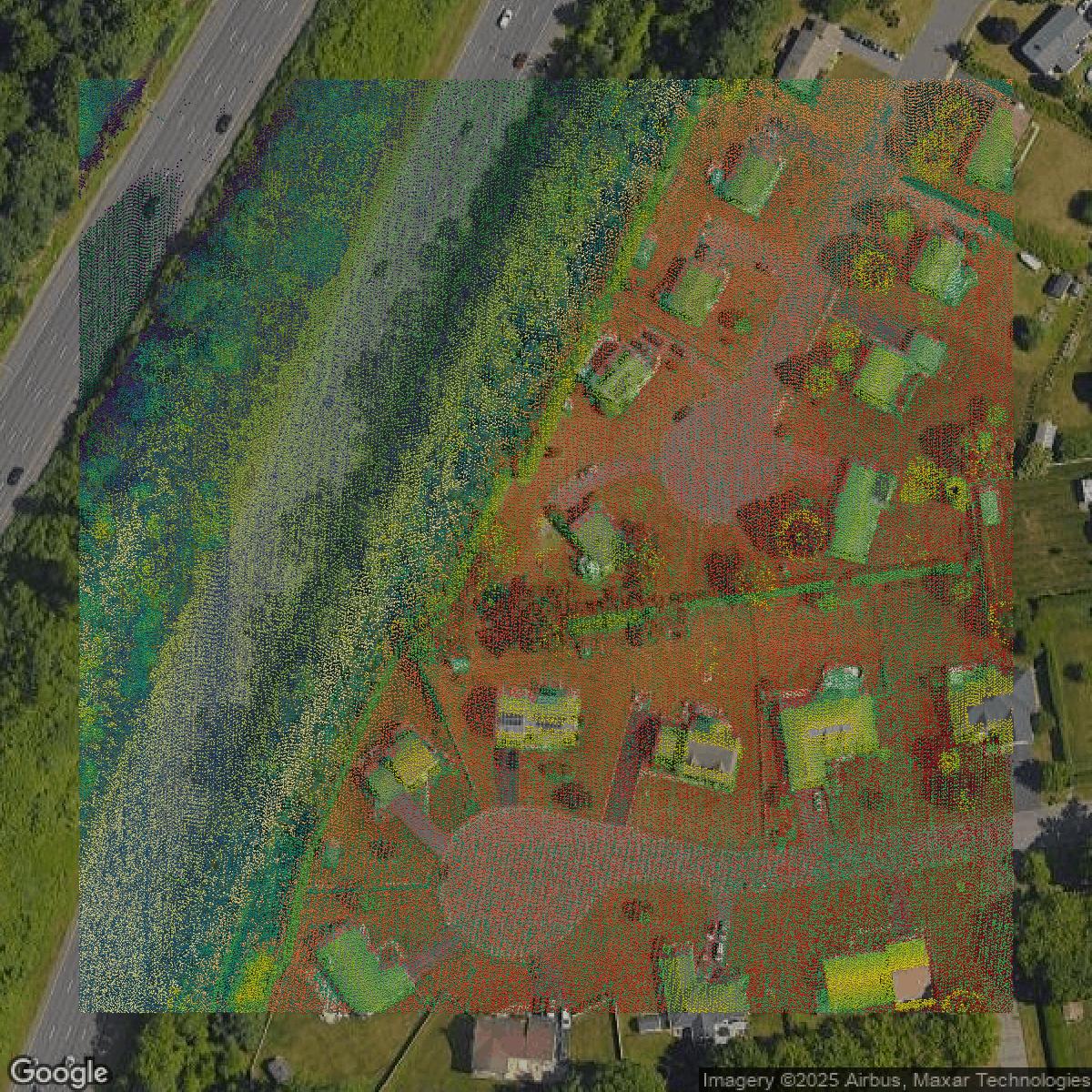
LiDAR
Equator turns Capitol Planning Region LiDAR point clouds into various lidar-derived data sets, including DEMs.
Get LiDAR for Capitol Planning Region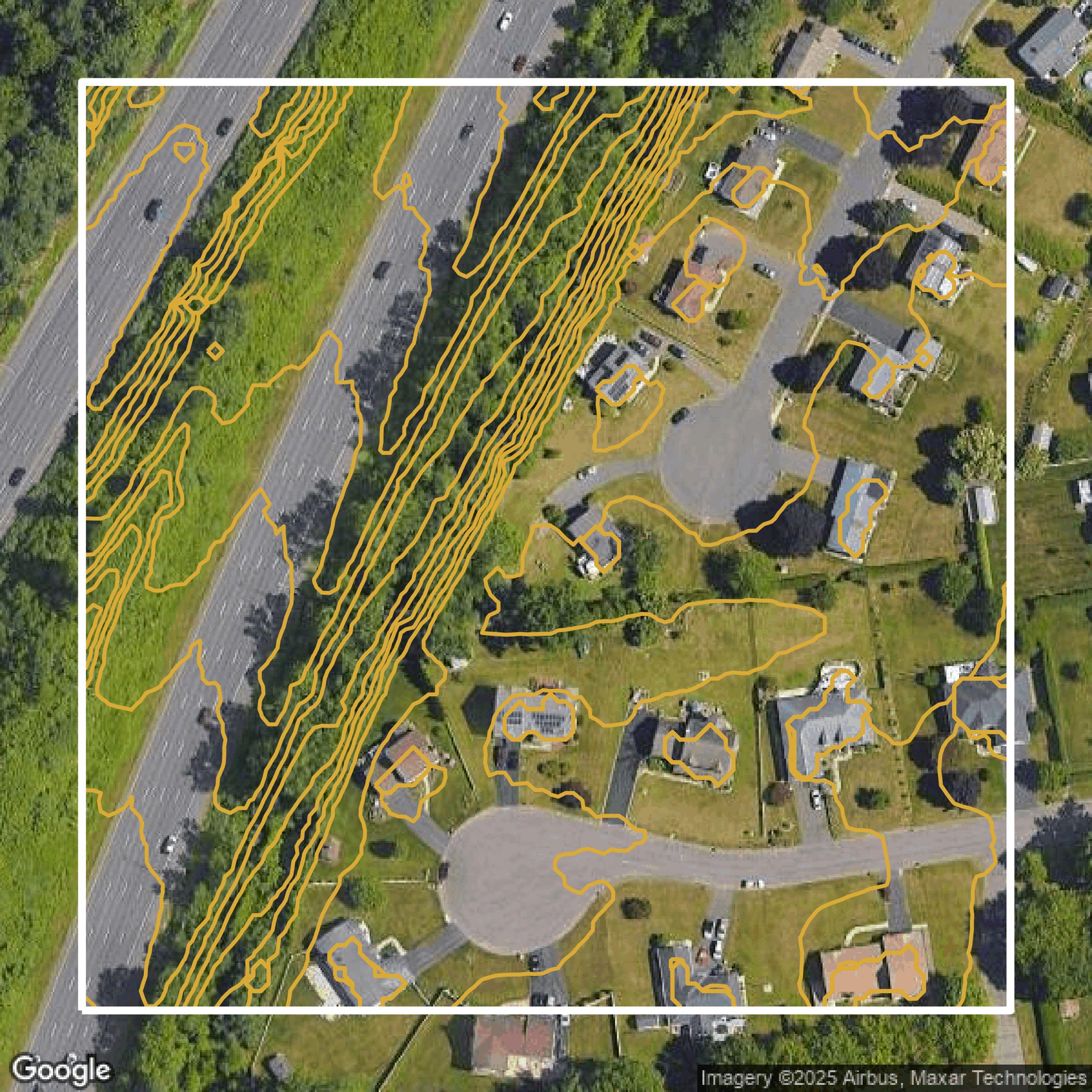
Contours
Capitol Planning Region contours on Equator are produced from LiDAR coverage, allowing for high precision
Get Contours for Capitol Planning Region