Overview
Norfolk County GIS Data – For CAD
Equator helps civil engineering, architecture and consulting firms with the tools to instantly find, process and download accurate LiDAR, contours, parcel data, building footprints, DEMs, point clouds and other GIS data for Norfolk County in an online web mapping portal.
Norfolk County GIS Data →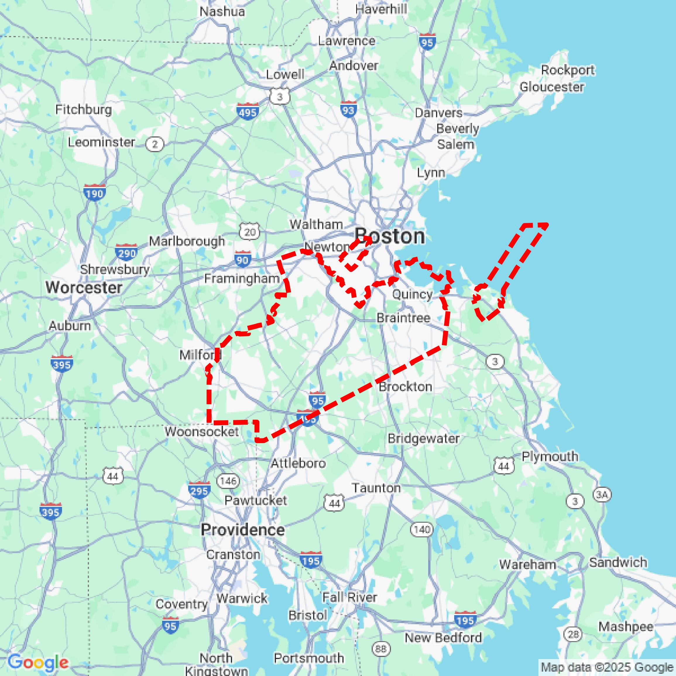

Data Available
Download GIS Data for Norfolk County
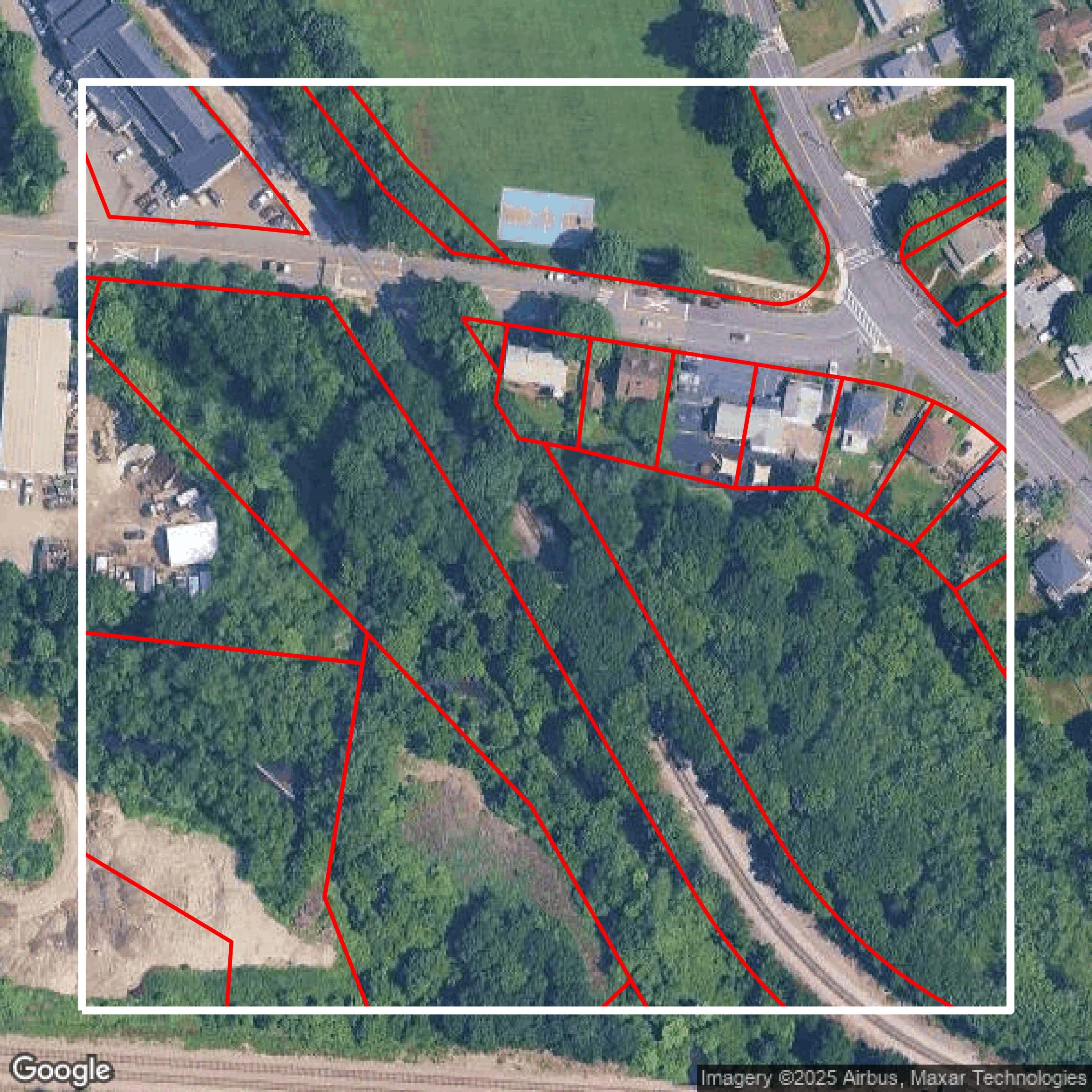
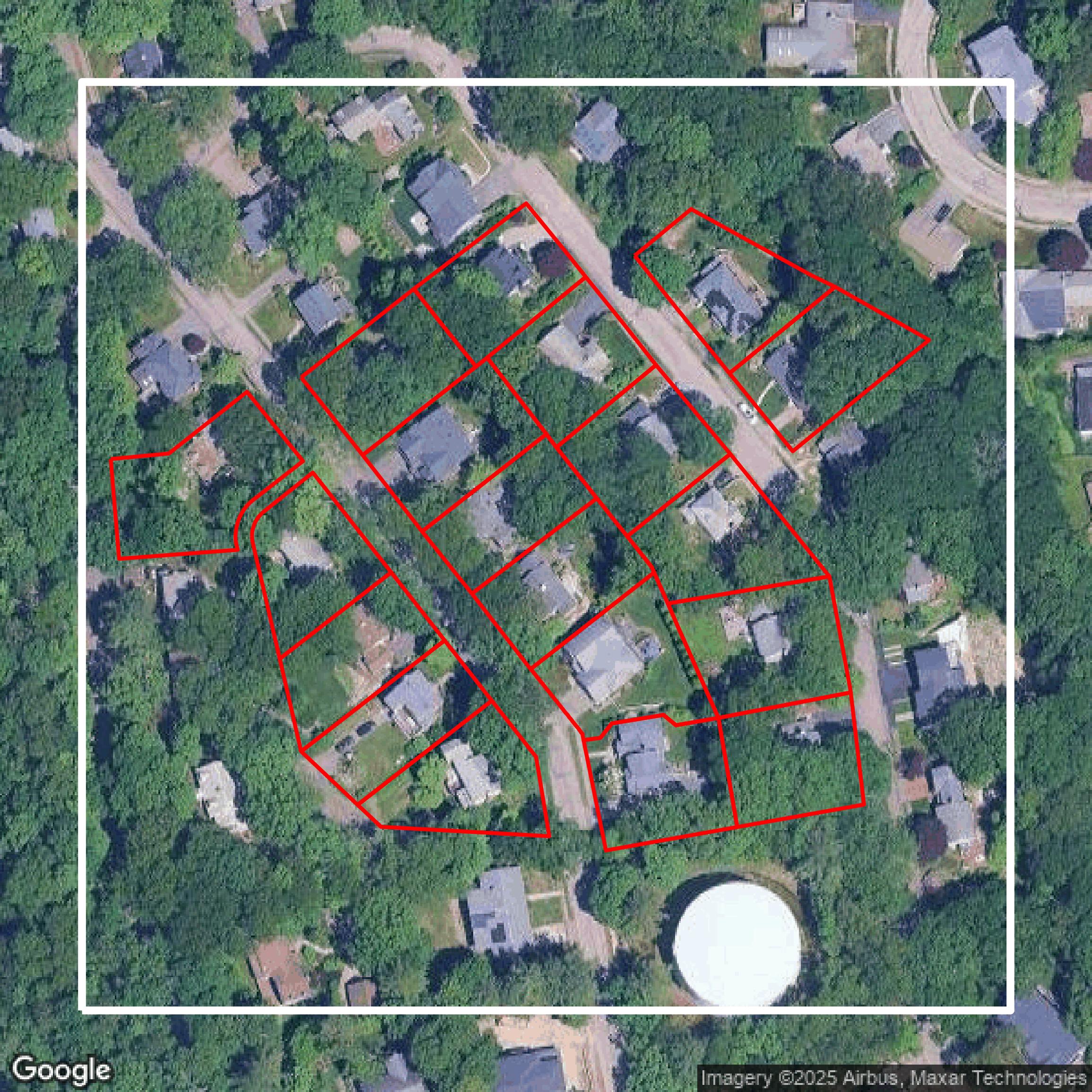
Parcels and Buildings
This image shows parcel and building data in Norfolk County created using GIS data in Equator.
Get Parcels and Buildings for Norfolk County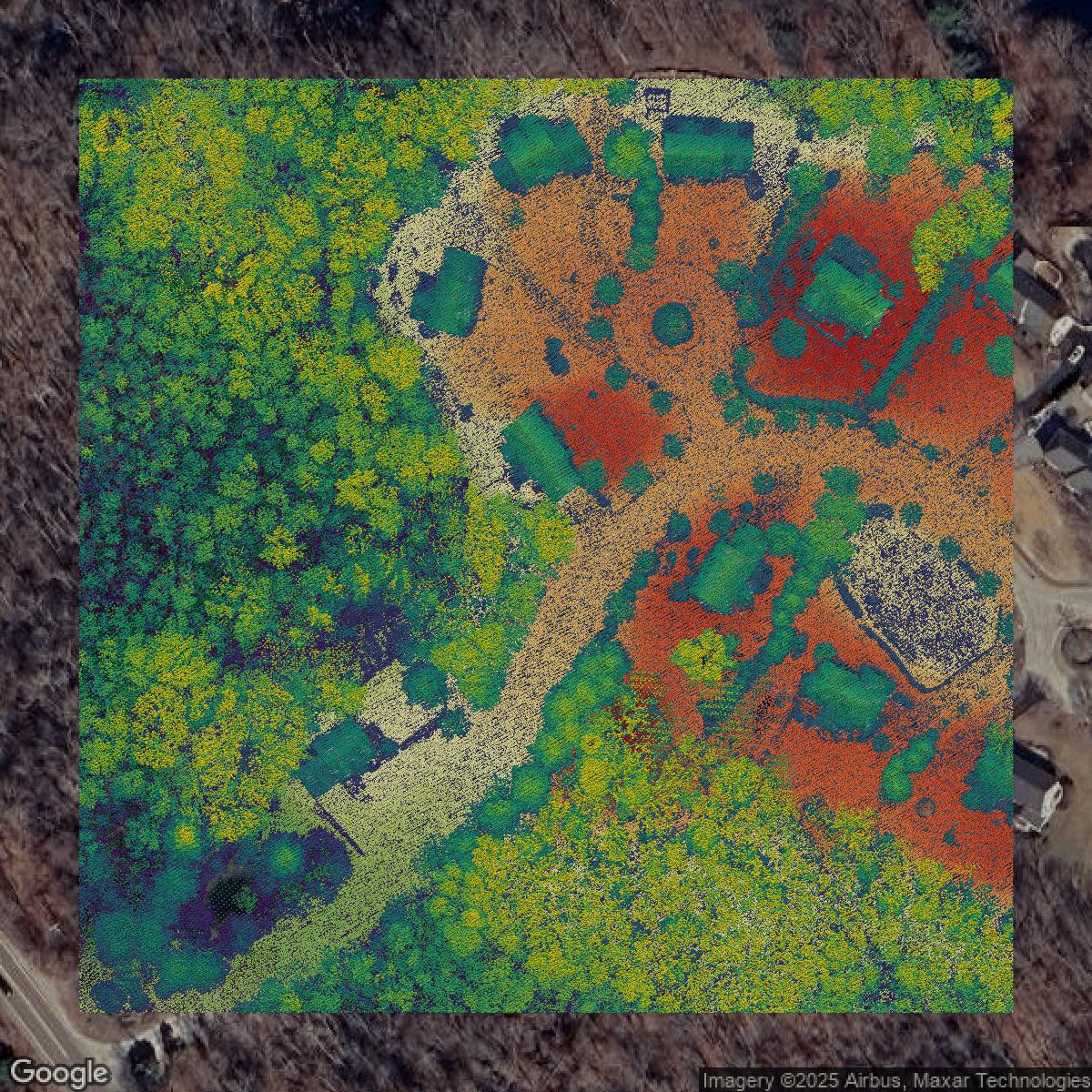
LiDAR
This image shows a LiDAR point cloud in Norfolk County created using GIS data in Equator.
Get LiDAR for Norfolk County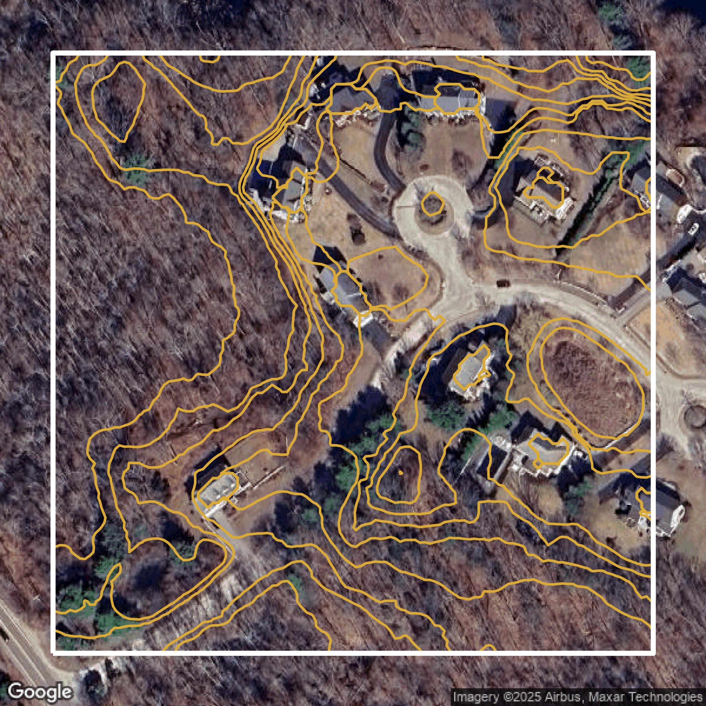
Contours
This image shows a contour map in Norfolk County created using GIS data in Equator.
Get Contours for Norfolk CountyFormats Available
Export Your Data Ready to Use in Multiple Formats
DWG
AutoCAD Drawing - Industry-standard CAD format
Supported Data:
Contour, Parcel, Building Outline
SHP
Shapefile - Standard GIS vector format
Supported Data:
Contour, Parcel, Building Outline
DXF
Drawing Exchange Format - Universal CAD interchange
Supported Data:
Contour, Building Outline
GeoJSON
Geographic JSON - Web-friendly spatial data format
Supported Data:
Contour, Parcel, Building Outline
LAZ
Compressed LAS - Efficient LiDAR point cloud format
Supported Data:
Point Cloud
SVG
Scalable Vector Graphics - Web vector format
Supported Data:
Contour, Building Outline
GPKG (Coming Soon)
GeoPackage - Modern OGC spatial database format
Supported Data:
Contour, Parcel, Building Outline
LandXML (Coming Soon)
Land XML - Civil engineering data exchange format
Supported Data:
Point Cloud
TIN (Coming Soon)
Triangulated Irregular Network - 3D surface model
Supported Data:
Point Cloud
XYZ (Coming Soon)
XYZ Point Cloud - Simple ASCII point cloud format
Supported Data:
Point Cloud
Background
GIS Data for Norfolk County
On the Norfolk County Assessors / GIS Links webpage of the Norfolk County Registry of Deeds website, visitors can access a comprehensive collection of Municipal Assessors and Geographic Information Systems (GIS) Links for all Norfolk County communities, including direct links to assessors’ offices and GIS property viewers such as "Dedham GIS" and "Brookline GIS." The site also provides access to statewide resources like the "Commonwealth of Massachusetts GIS" and "MassMapper, an interactive map for Massachusetts." In addition to GIS data, users will find detailed guidance and tools for land records research including "Begin Online Research," "Introduction to Research," the "Advanced Research Guide," and the ability to "Search for Your Deed." The website offers essential services like "Obtain a Copy of Your Deed," "Mortgage Discharge," and "Consumer Notification Service," alongside educational resources including a "Glossary of Terms," "Document Checklist," and "Registry Real Estate Statistics." This site is an invaluable resource for property owners, legal professionals, genealogists, and anyone seeking detailed, official property and land record data combined with helpful GIS mapping tools relevant to Norfolk County, Massachusetts.
Access Norfolk County GIS Data in Equator →Norfolk County Portal →Showcase
Sample GIS Data for Norfolk County
Parcels and Buildings
Parcel and building data in Norfolk County are used in a variety of fields including architecture, real estate, and urban planning.
Get Parcels and Buildings for Norfolk County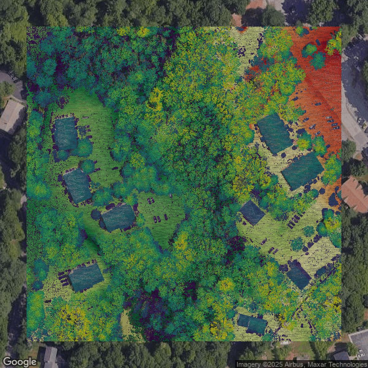
LiDAR
Point clouds (LiDAR) in Norfolk County can produce highly accurate 3D models of terrain, structures, and vegetation.
Get LiDAR for Norfolk County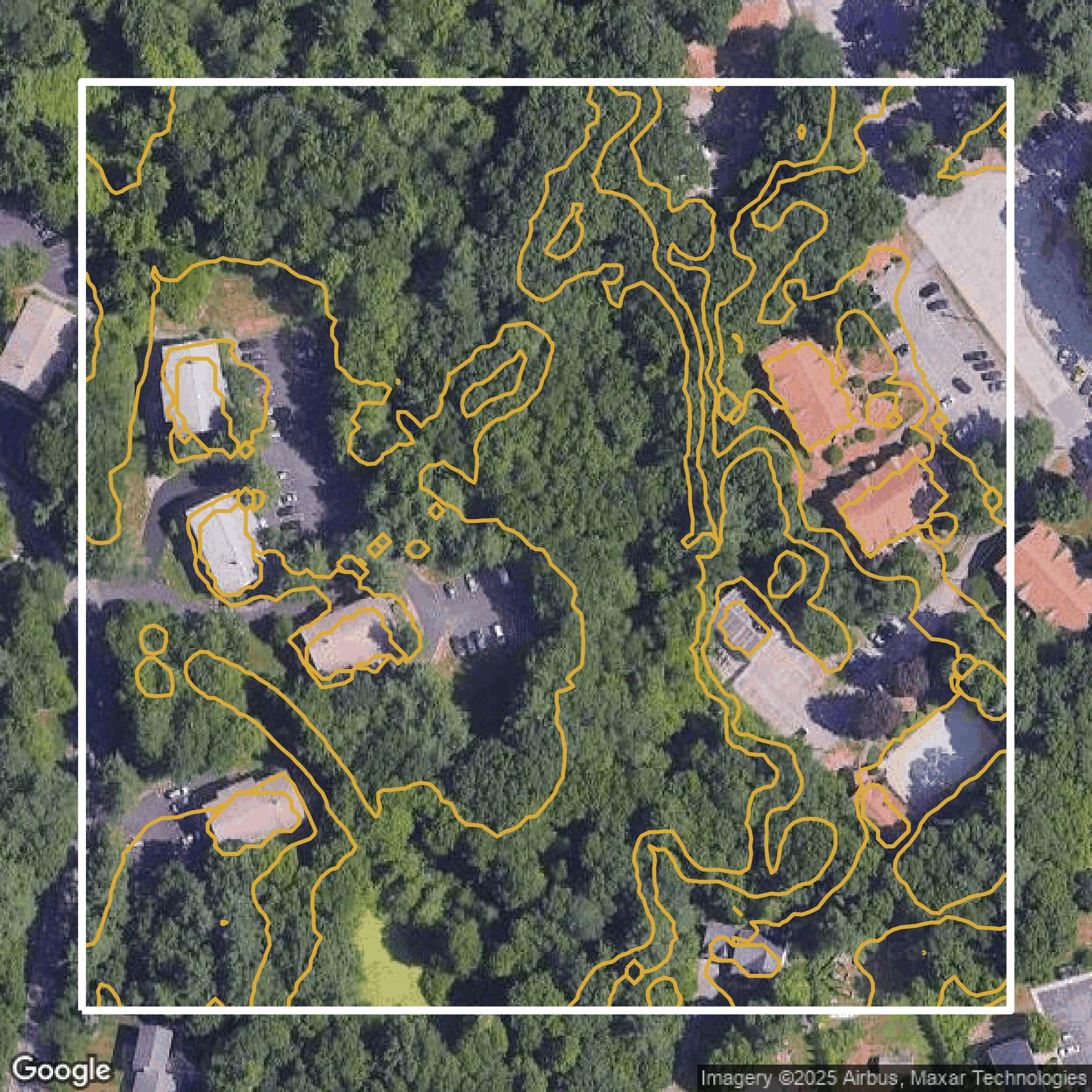
Contours
Contours in Norfolk County visualize 3D elevations on a 2D surface allowing you to better understand your site.
Get Contours for Norfolk County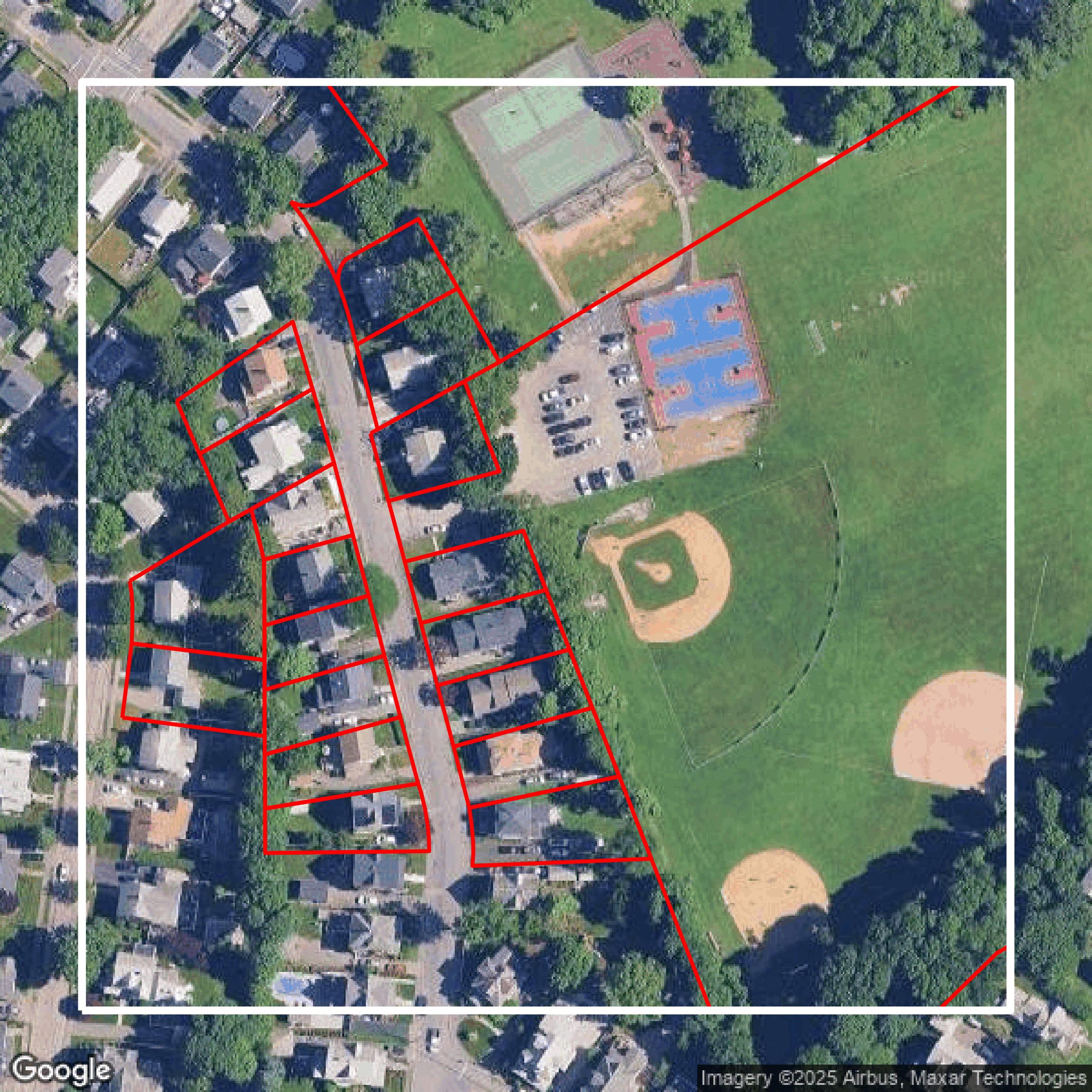
Parcels and Buildings
Accessing Norfolk County parcel and building data on Equator gives you access to coverage across the US.
Get Parcels and Buildings for Norfolk County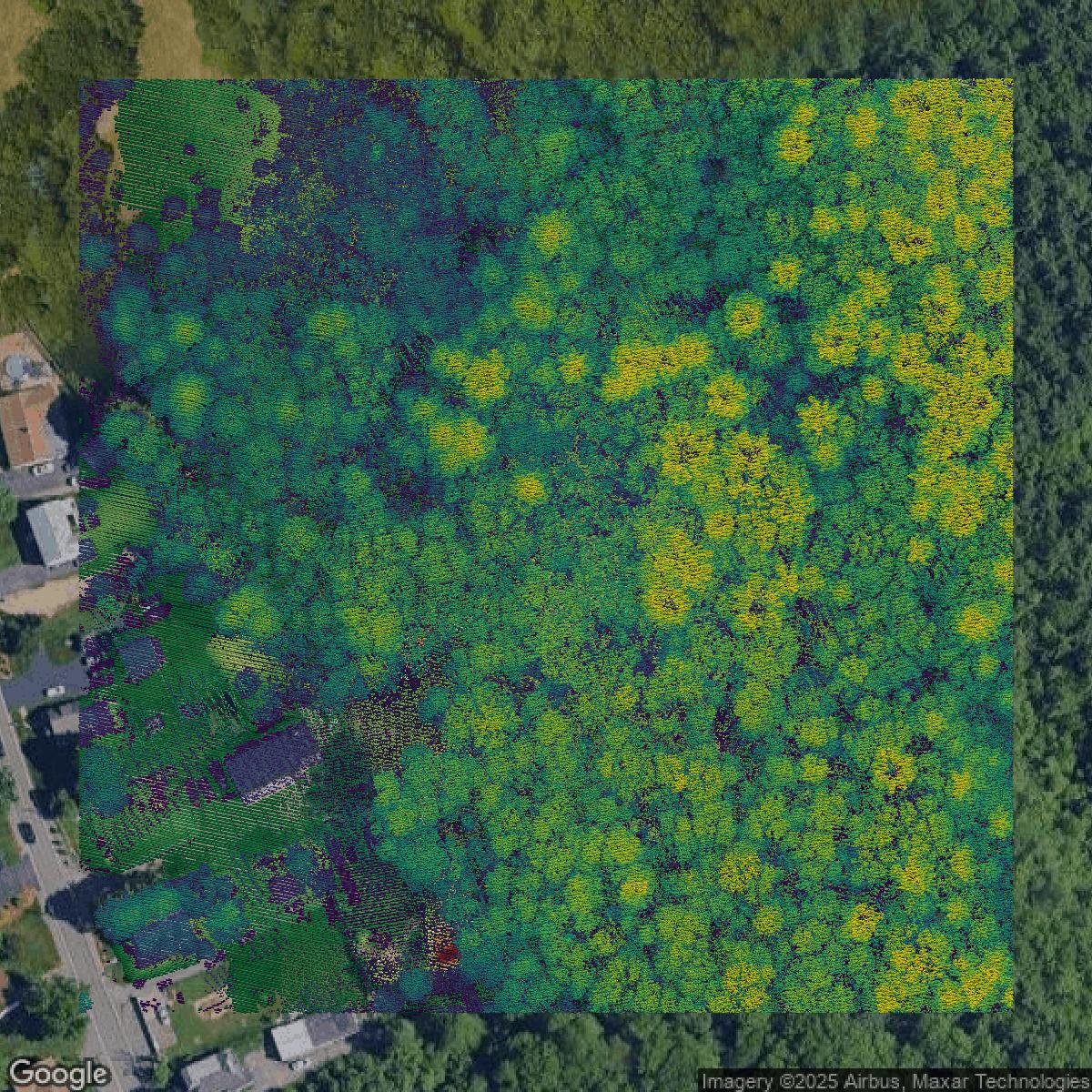
LiDAR
Norfolk County LiDAR uses include land surveying, analyzing crop health, or even archaeological studies.
Get LiDAR for Norfolk County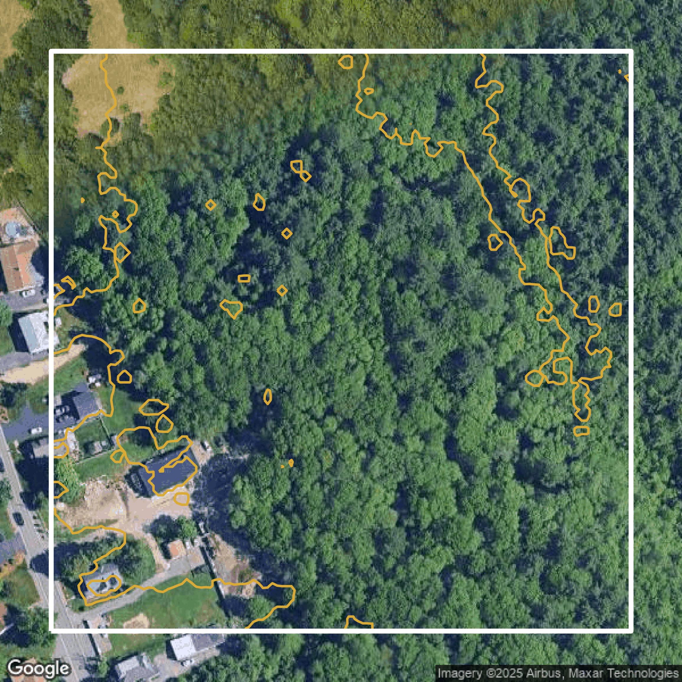
Contours
Norfolk County contours can be used for construction & engineering, environmental science, and more.
Get Contours for Norfolk County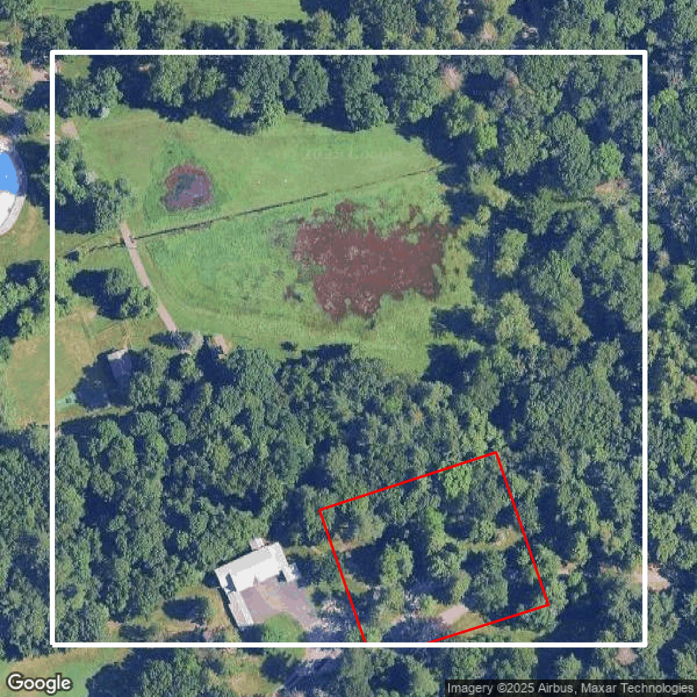
Parcels and Buildings
Dozens of fields are contained within each Norfolk County parcel and building data, including zoning, owners, and year built.
Get Parcels and Buildings for Norfolk County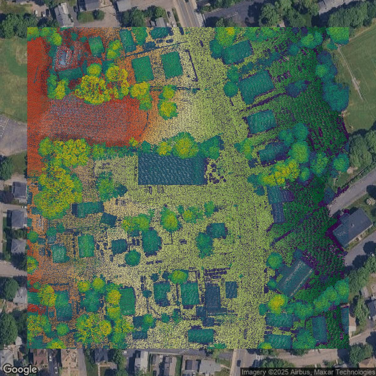
LiDAR
Equator turns Norfolk County LiDAR point clouds into various lidar-derived data sets, including DEMs.
Get LiDAR for Norfolk County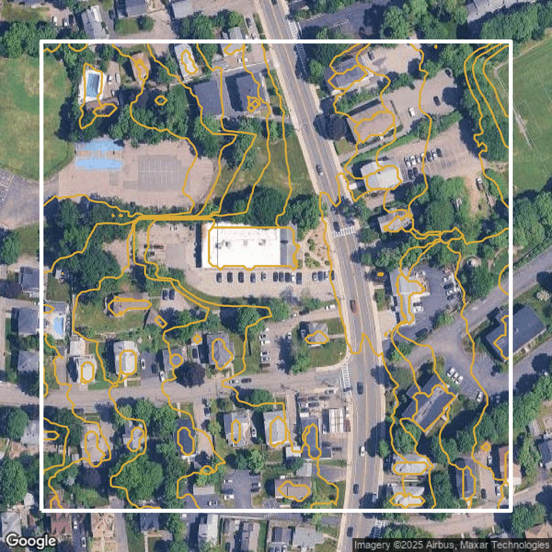
Contours
Norfolk County contours on Equator are produced from LiDAR coverage, allowing for high precision
Get Contours for Norfolk County