Overview
Honolulu County GIS Data – For CAD
Equator helps civil engineering, architecture and consulting firms with the tools to instantly find, process and download accurate LiDAR, contours, parcel data, building footprints, DEMs, point clouds and other GIS data for Honolulu County in an online web mapping portal.
Honolulu County GIS Data →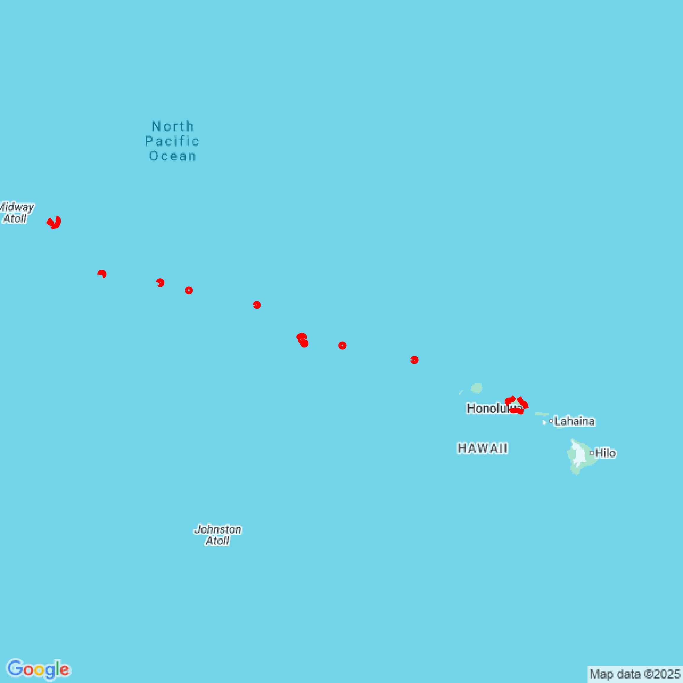

Data Available
Download GIS Data for Honolulu County
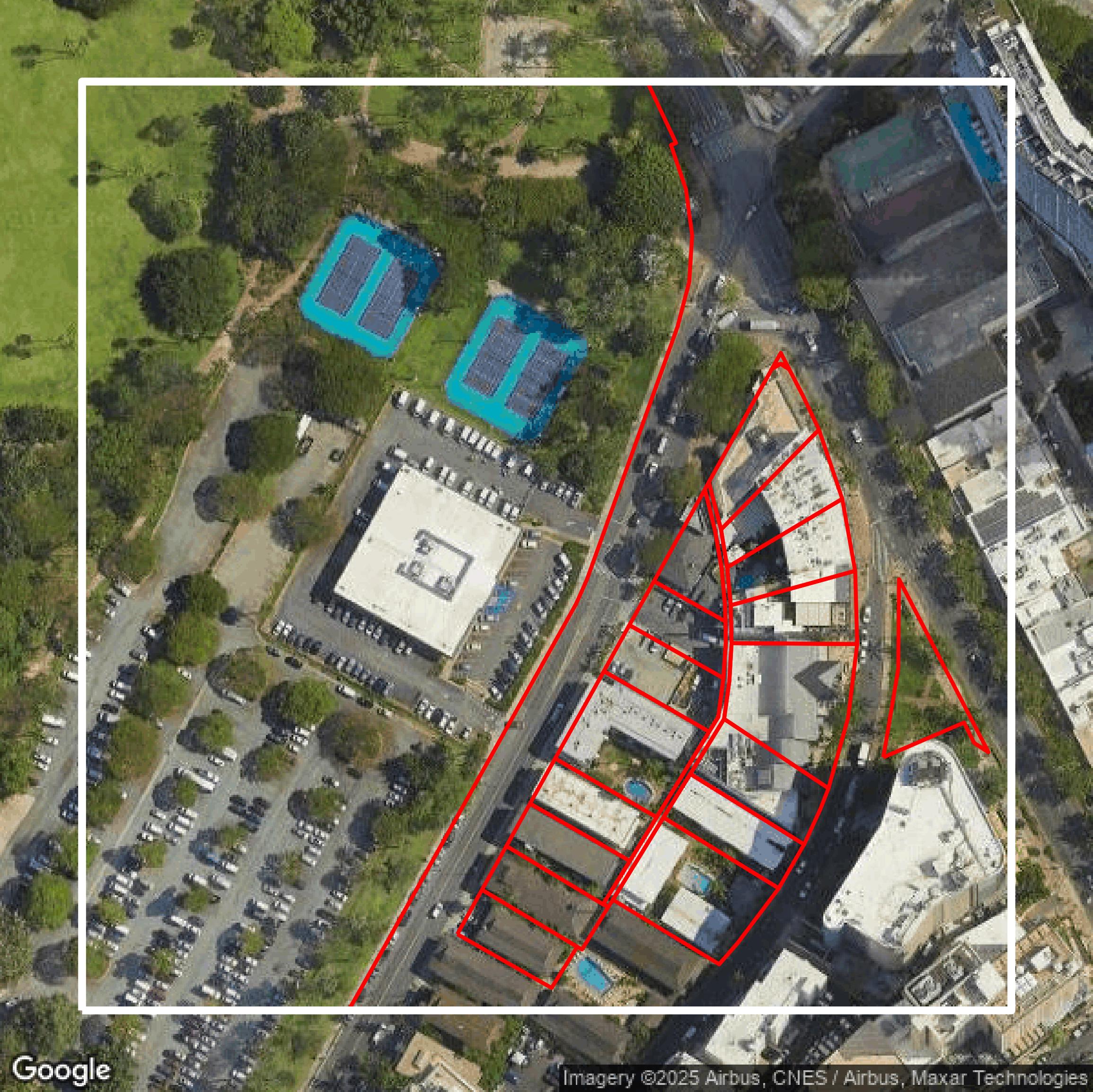
Parcels and Buildings
This image shows parcel and building data in Honolulu County created using GIS data in Equator.
Get Parcels and Buildings for Honolulu County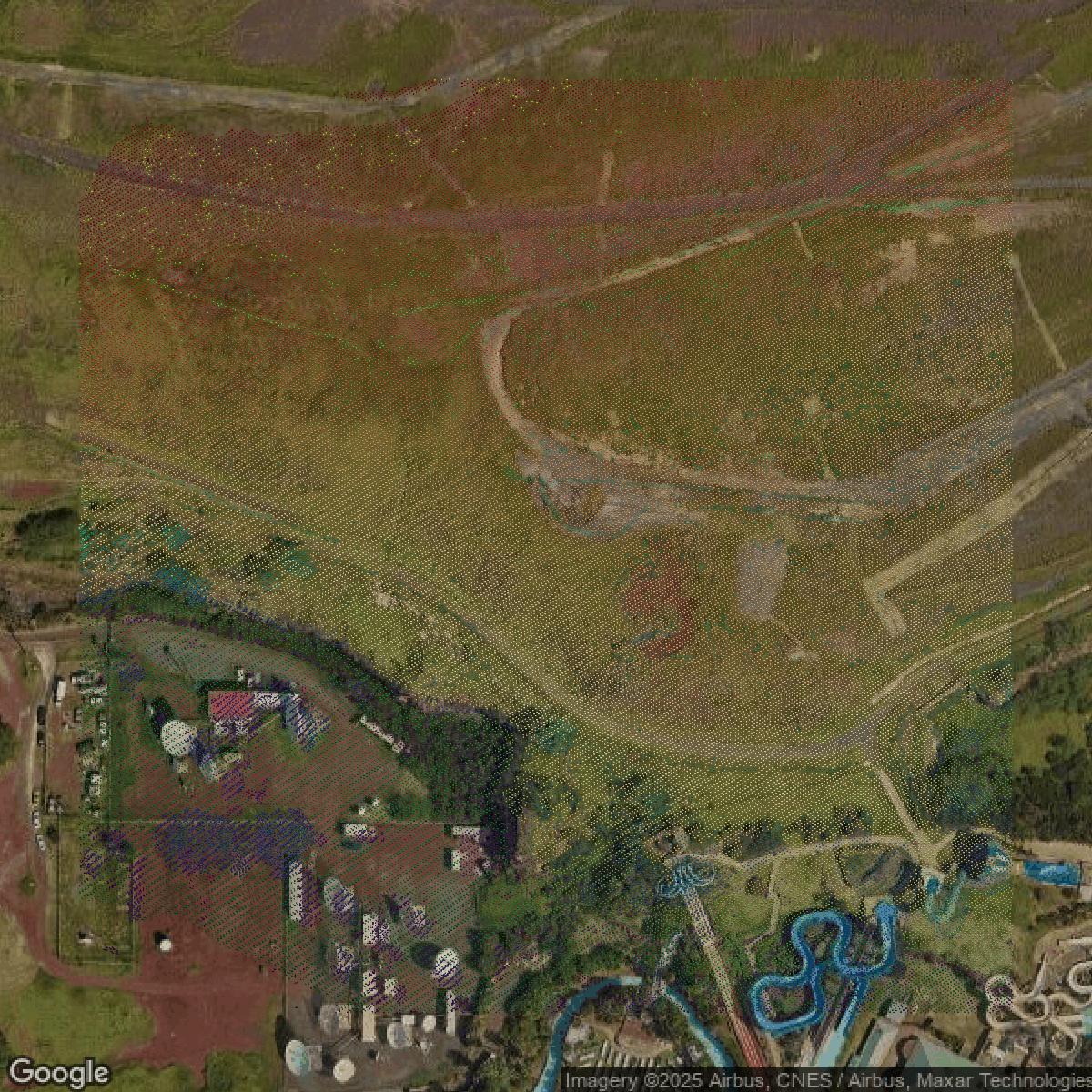
LiDAR
This image shows a LiDAR point cloud in Honolulu County created using GIS data in Equator.
Get LiDAR for Honolulu County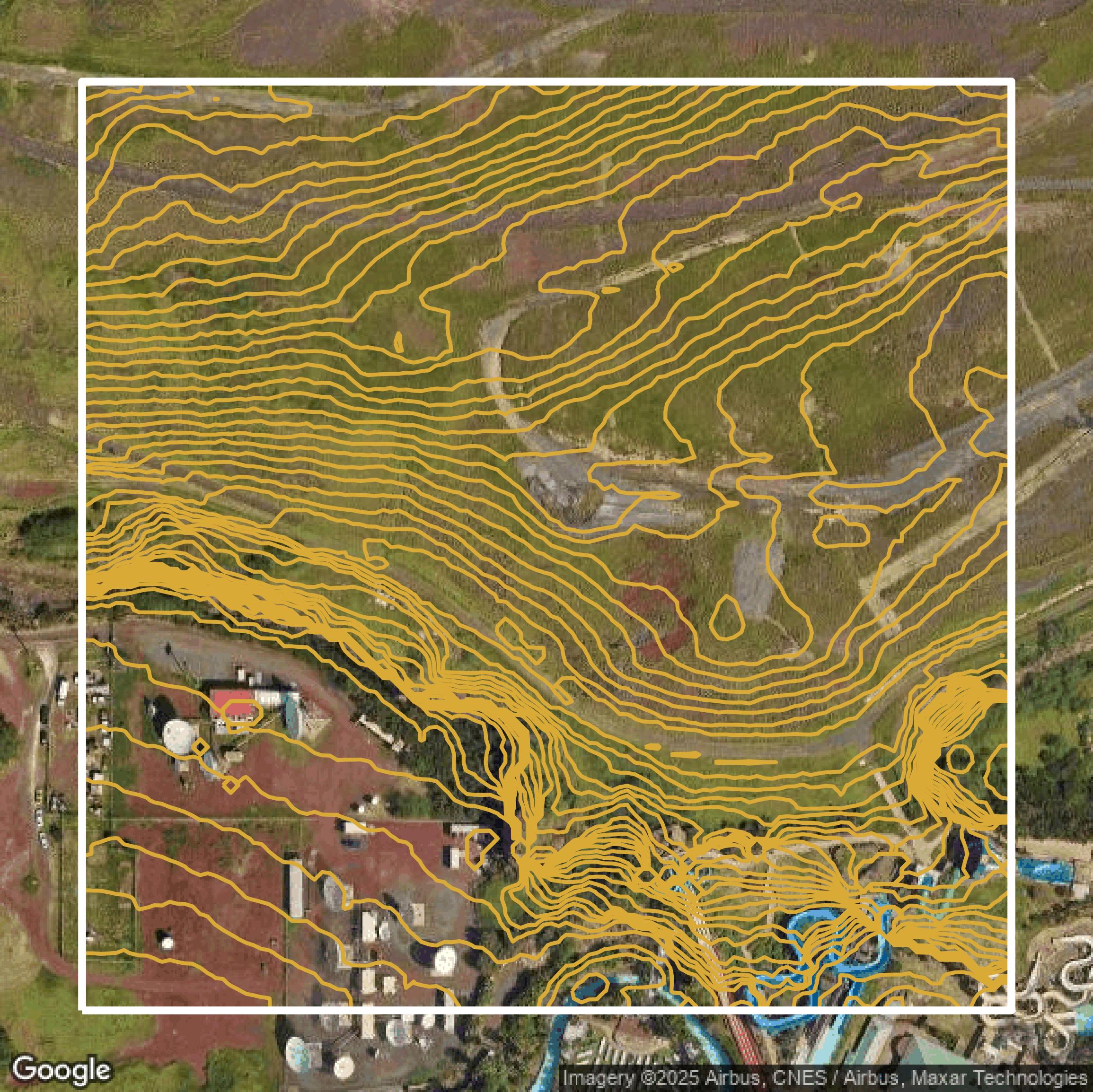
Contours
This image shows a contour map in Honolulu County created using GIS data in Equator.
Get Contours for Honolulu CountyFormats Available
Export Your Data Ready to Use in Multiple Formats
DWG
AutoCAD Drawing - Industry-standard CAD format
Supported Data:
Contour, Parcel, Building Outline
SHP
Shapefile - Standard GIS vector format
Supported Data:
Contour, Parcel, Building Outline
DXF
Drawing Exchange Format - Universal CAD interchange
Supported Data:
Contour, Building Outline
GeoJSON
Geographic JSON - Web-friendly spatial data format
Supported Data:
Contour, Parcel, Building Outline
LAZ
Compressed LAS - Efficient LiDAR point cloud format
Supported Data:
Point Cloud
SVG
Scalable Vector Graphics - Web vector format
Supported Data:
Contour, Building Outline
GPKG (Coming Soon)
GeoPackage - Modern OGC spatial database format
Supported Data:
Contour, Parcel, Building Outline
LandXML (Coming Soon)
Land XML - Civil engineering data exchange format
Supported Data:
Point Cloud
TIN (Coming Soon)
Triangulated Irregular Network - 3D surface model
Supported Data:
Point Cloud
XYZ (Coming Soon)
XYZ Point Cloud - Simple ASCII point cloud format
Supported Data:
Point Cloud
Background
GIS Data for Honolulu County
The Honolulu County Open Data Portal (https://data.honolulu.gov/) offers a rich collection of datasets and tools designed to provide transparency and valuable insights across various domains. Visitors can explore comprehensive categories such as **Public Safety**, featuring datasets like "Honolulu 311" reports covering broken streetlights, cracked sidewalks, and abandoned vehicles, as well as "Crime Incidents" and "Traffic Incidents" data from the Honolulu Police Department. For financial insights, the portal includes a **Finance** section with detailed budgets and spending data. Business users can access datasets under the **Business** category, including "Building Permits" issued by the Department of Planning and Permitting. Transportation-related data is available through the **Transportation** category, offering timely updates and trends. The **Location** category aids in finding geospatial data pertinent to the area. Users unsure where to start can browse the entire **Catalog** to search all available datasets. Overall, the portal empowers users with official, up-to-date, and detailed datasets to support public engagement, business planning, and city management initiatives.
Access Honolulu County GIS Data in Equator →Honolulu County Portal →Showcase
Sample GIS Data for Honolulu County
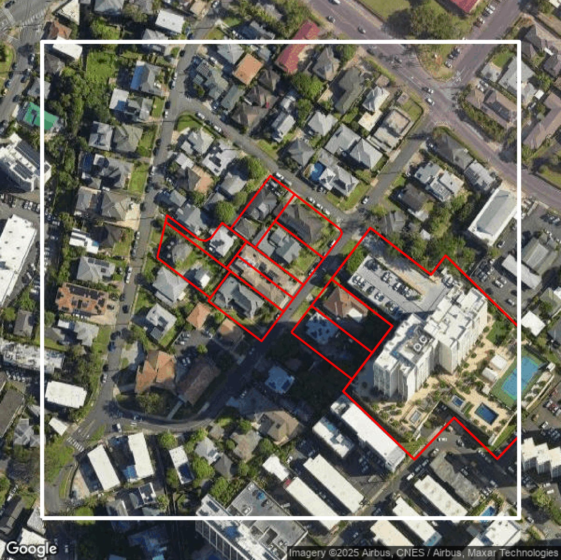
Parcels and Buildings
Parcel and building data in Honolulu County are used in a variety of fields including architecture, real estate, and urban planning.
Get Parcels and Buildings for Honolulu County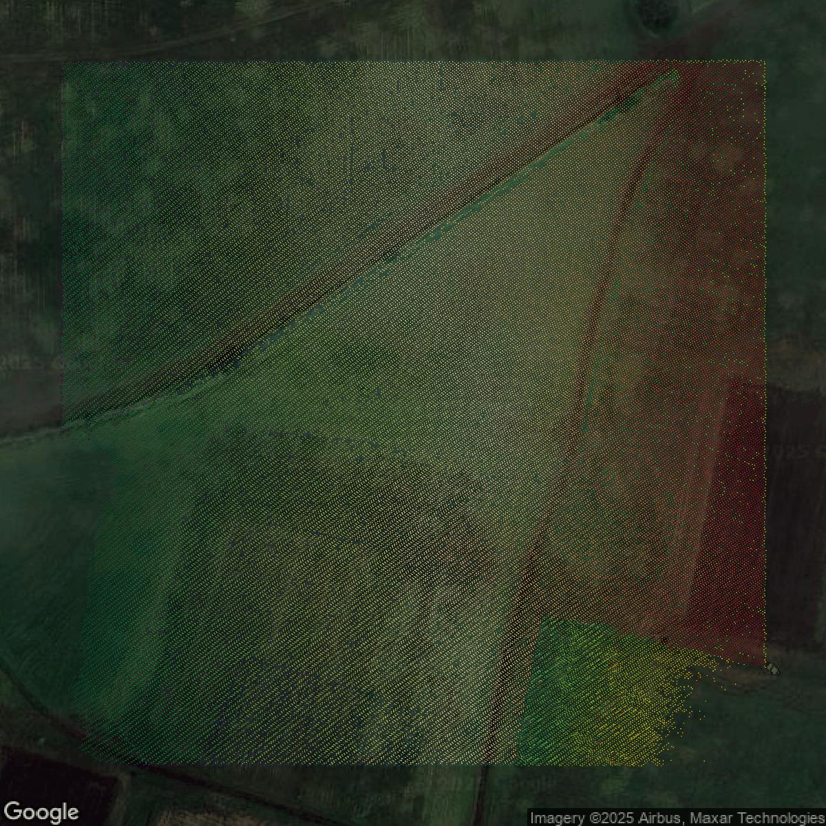
LiDAR
Point clouds (LiDAR) in Honolulu County can produce highly accurate 3D models of terrain, structures, and vegetation.
Get LiDAR for Honolulu County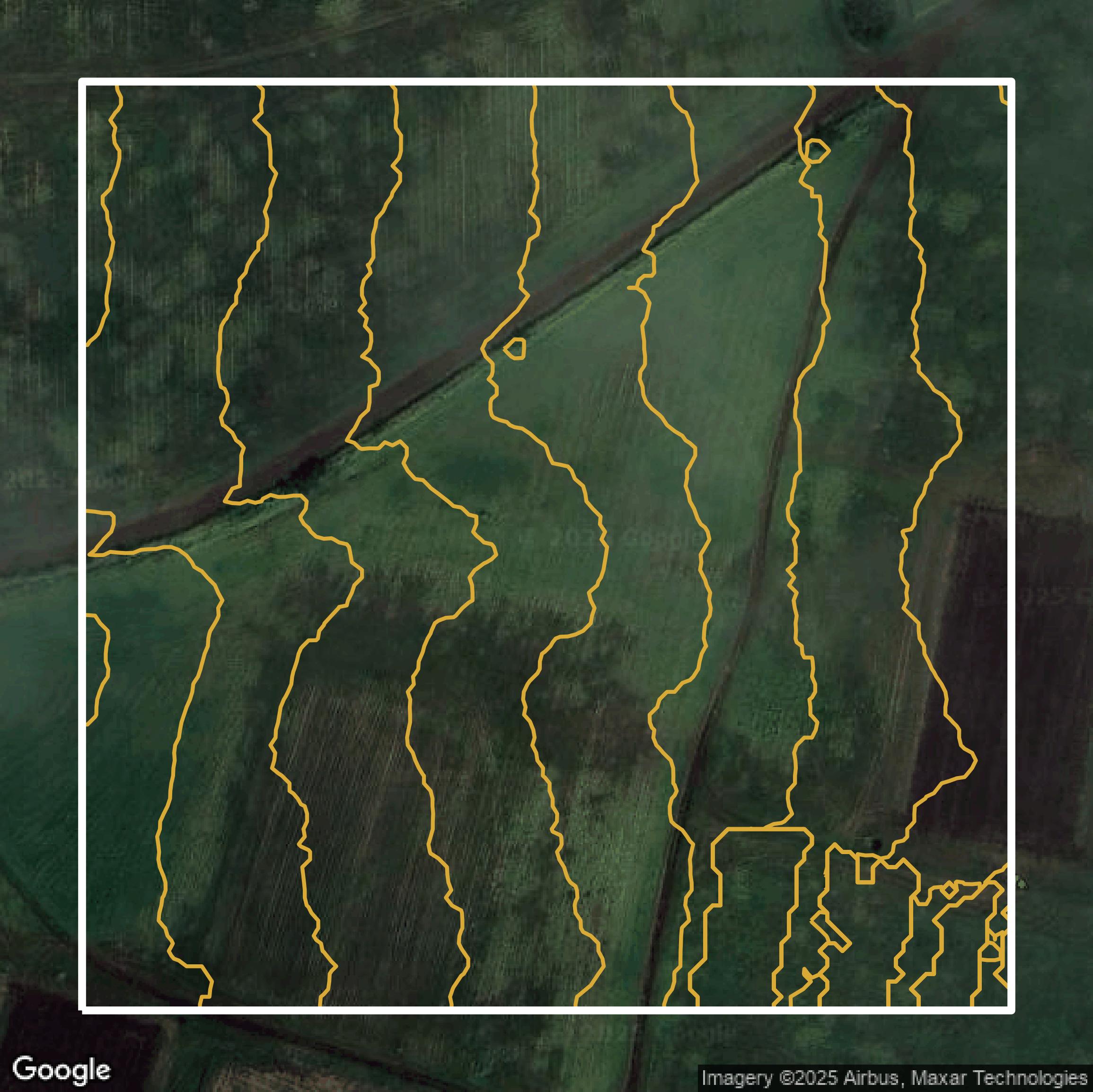
Contours
Contours in Honolulu County visualize 3D elevations on a 2D surface allowing you to better understand your site.
Get Contours for Honolulu CountyParcels and Buildings
Accessing Honolulu County parcel and building data on Equator gives you access to coverage across the US.
Get Parcels and Buildings for Honolulu County
LiDAR
Honolulu County LiDAR uses include land surveying, analyzing crop health, or even archaeological studies.
Get LiDAR for Honolulu County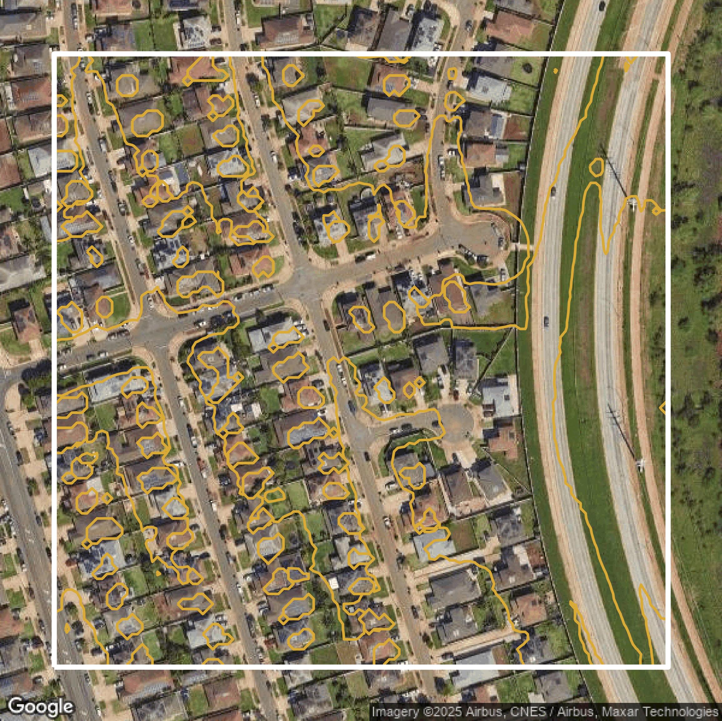
Contours
Honolulu County contours can be used for construction & engineering, environmental science, and more.
Get Contours for Honolulu CountyParcels and Buildings
Dozens of fields are contained within each Honolulu County parcel and building data, including zoning, owners, and year built.
Get Parcels and Buildings for Honolulu CountyLiDAR
Equator turns Honolulu County LiDAR point clouds into various lidar-derived data sets, including DEMs.
Get LiDAR for Honolulu CountyContours
Honolulu County contours on Equator are produced from LiDAR coverage, allowing for high precision
Get Contours for Honolulu County