Overview
Rock Island County GIS Data – For CAD
Equator helps civil engineering, architecture and consulting firms with the tools to instantly find, process and download accurate LiDAR, contours, parcel data, building footprints, DEMs, point clouds and other GIS data for Rock Island County in an online web mapping portal.
Rock Island County GIS Data →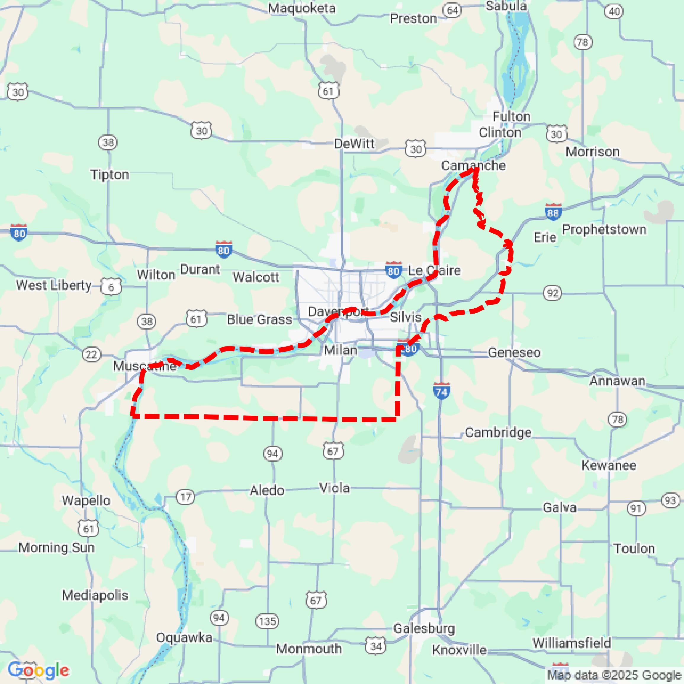

Data Available
Download GIS Data for Rock Island County
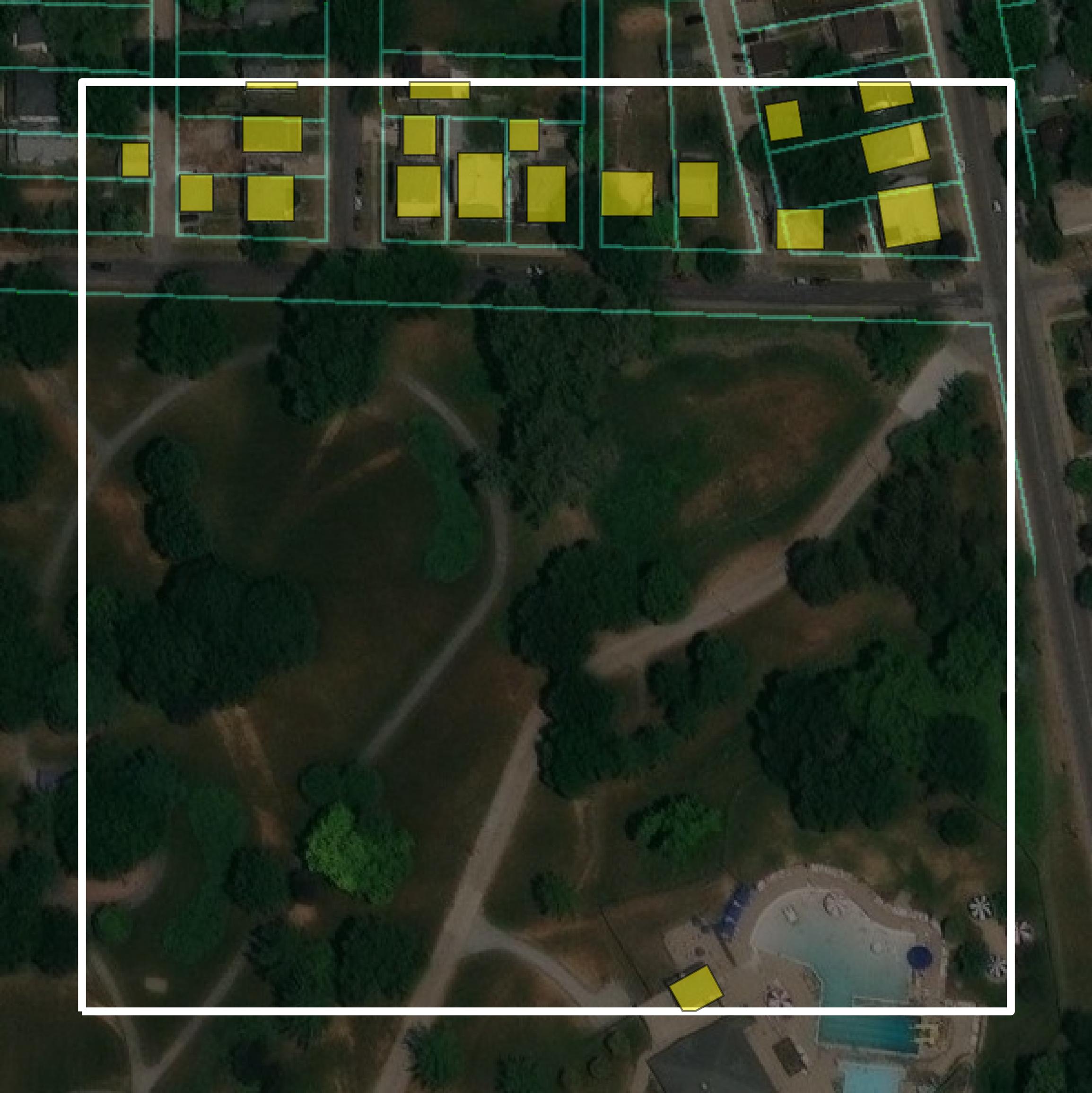
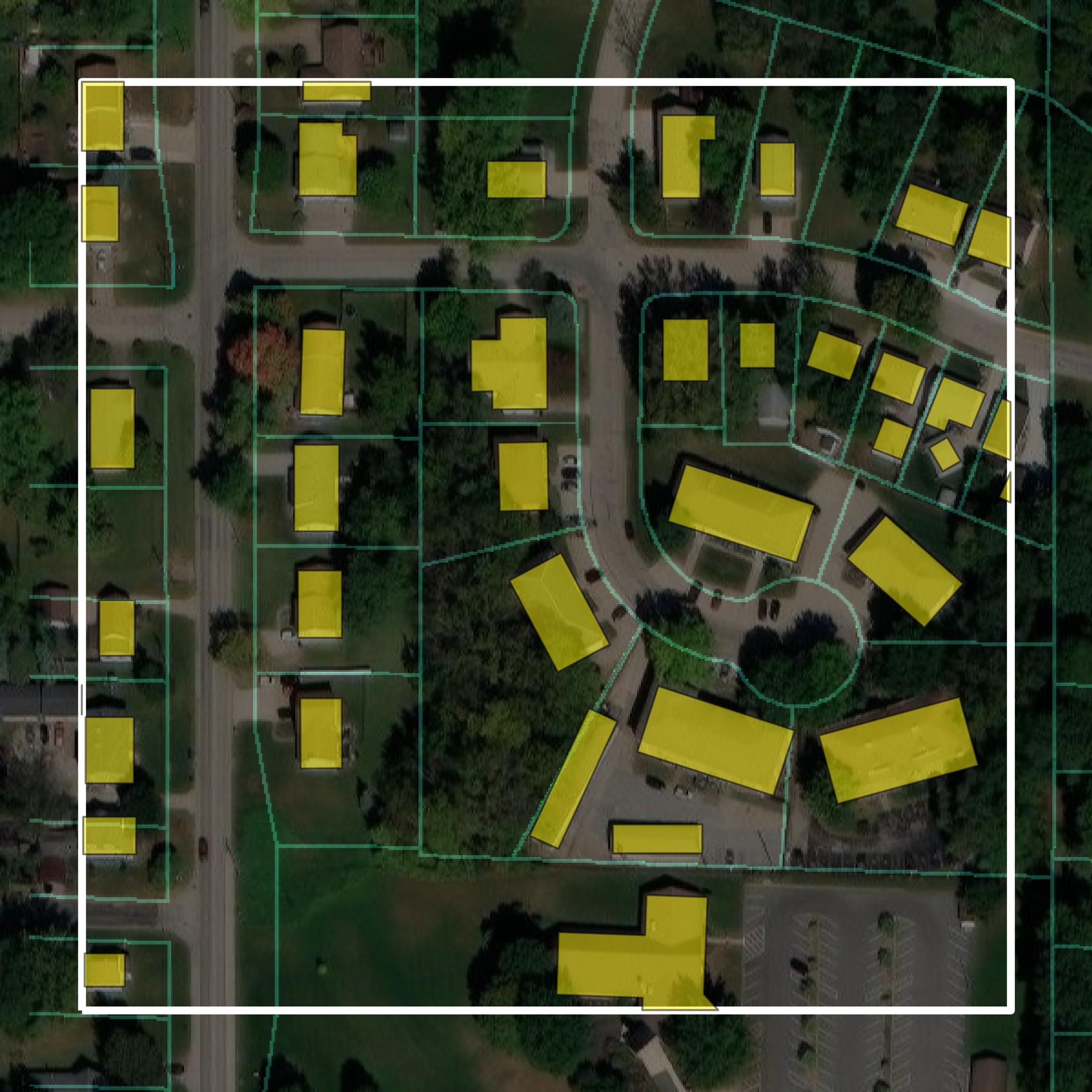
Parcels and Buildings
This image shows parcel and building data in Rock Island County created using GIS data in Equator.
Get Parcels and Buildings for Rock Island County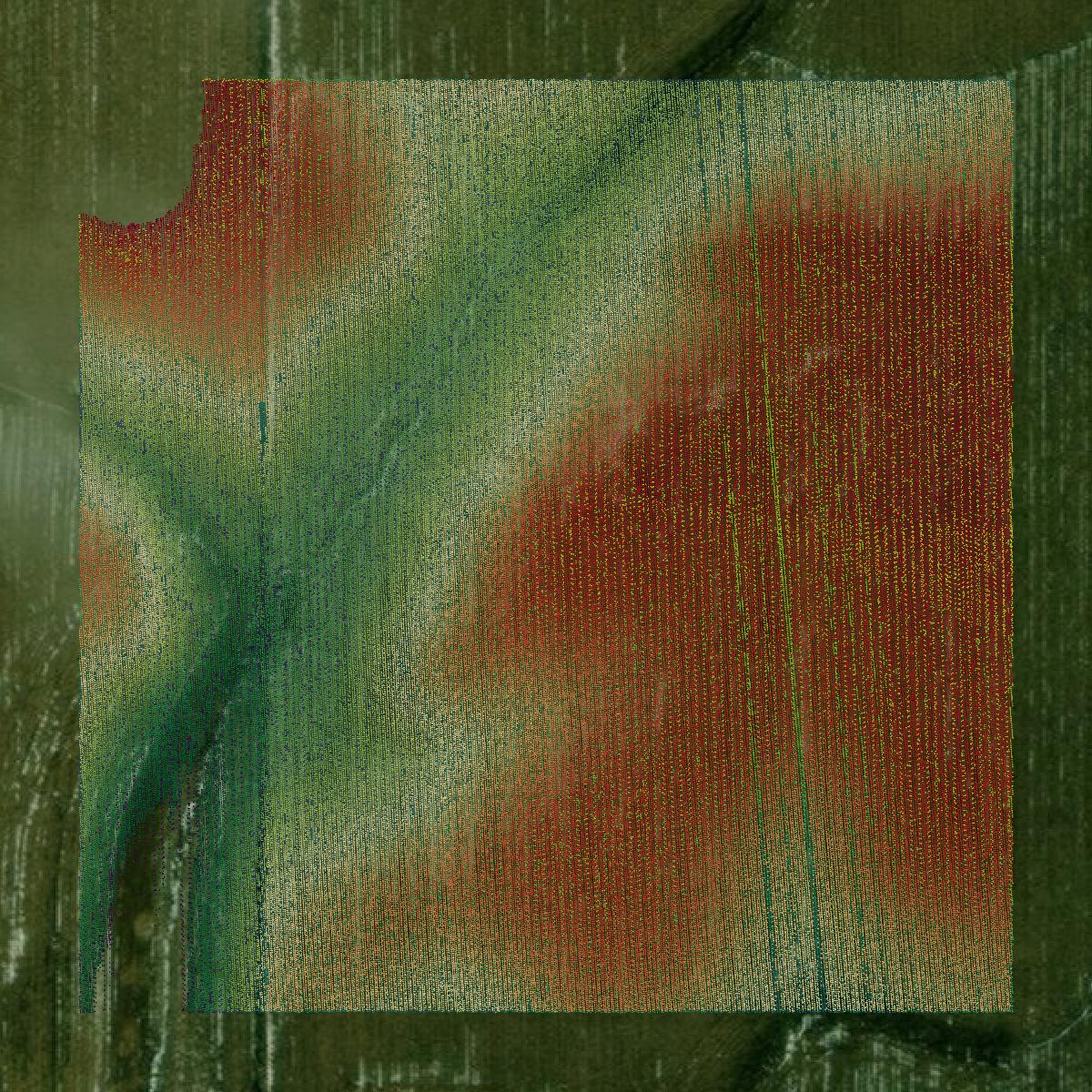
LiDAR
This image shows a LiDAR point cloud in Rock Island County created using GIS data in Equator.
Get LiDAR for Rock Island County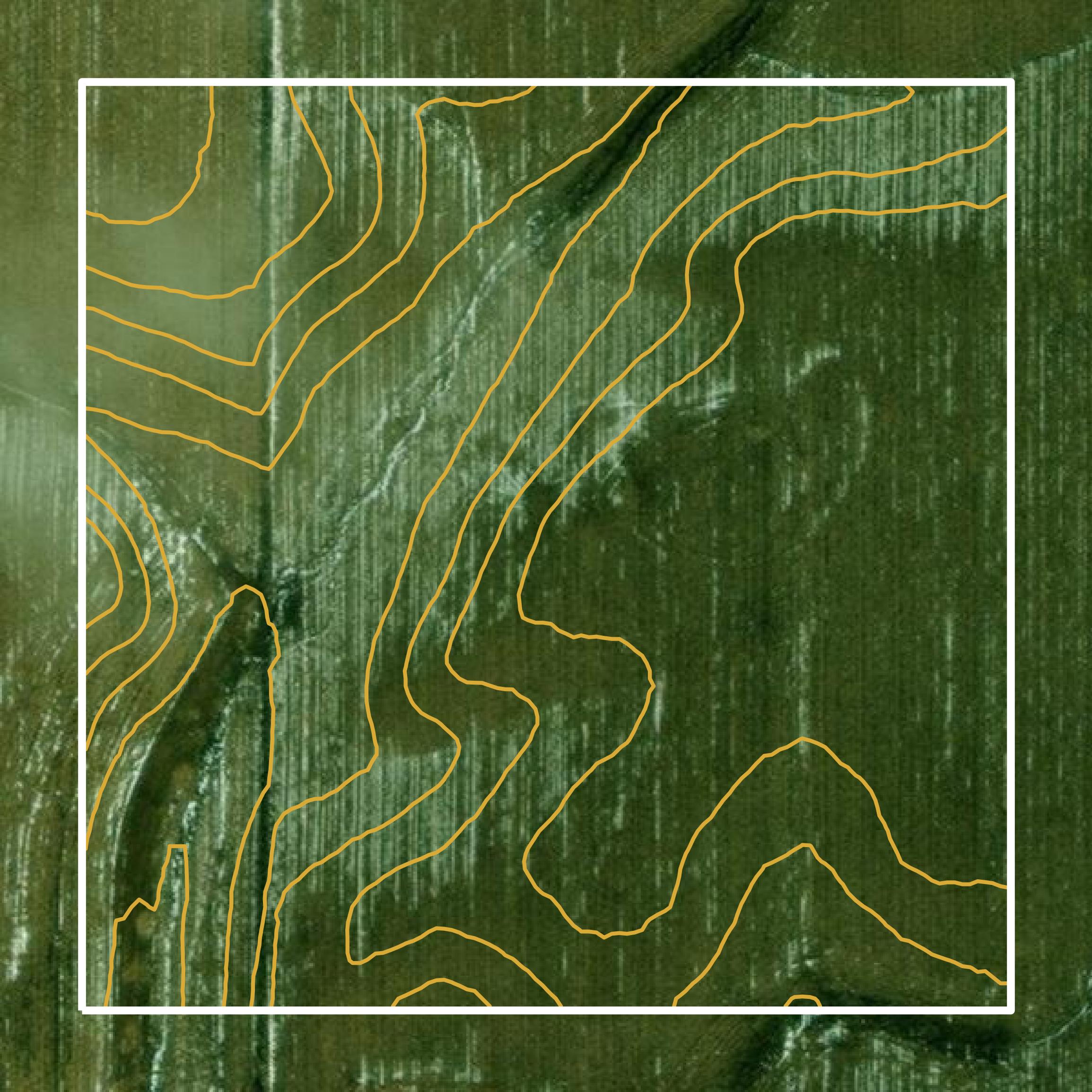
Contours
This image shows a contour map in Rock Island County created using GIS data in Equator.
Get Contours for Rock Island CountyFormats Available
Export Your Data Ready to Use in Multiple Formats
DWG
AutoCAD Drawing - Industry-standard CAD format
Supported Data:
Contour, Parcel, Building Outline
SHP
Shapefile - Standard GIS vector format
Supported Data:
Contour, Parcel, Building Outline
DXF
Drawing Exchange Format - Universal CAD interchange
Supported Data:
Contour, Building Outline
GeoJSON
Geographic JSON - Web-friendly spatial data format
Supported Data:
Contour, Parcel, Building Outline
LAZ
Compressed LAS - Efficient LiDAR point cloud format
Supported Data:
Point Cloud
SVG
Scalable Vector Graphics - Web vector format
Supported Data:
Contour, Building Outline
GPKG (Coming Soon)
GeoPackage - Modern OGC spatial database format
Supported Data:
Contour, Parcel, Building Outline
LandXML (Coming Soon)
Land XML - Civil engineering data exchange format
Supported Data:
Point Cloud
TIN (Coming Soon)
Triangulated Irregular Network - 3D surface model
Supported Data:
Point Cloud
XYZ (Coming Soon)
XYZ Point Cloud - Simple ASCII point cloud format
Supported Data:
Point Cloud
Background
GIS Data for Rock Island County
The Geographic Information System (GIS) Department of Rock Island County, Illinois, provides access to a variety of GIS datasets, maps, and spatial data resources. Available content includes over 65,000 parcel boundaries, street segments with address ranges, zoning codes, soil types, census data, and aerial photography dating back to 1995. The GIS Department also maintains data for taxing districts and emergency services, supporting functions such as parcel maintenance and high-end data analysis. Users can explore these resources through an online mapping application and request additional data or maps via email.
Access Rock Island County GIS Data in Equator →Rock Island County Portal →Showcase
Sample GIS Data for Rock Island County
Parcels and Buildings
Parcel and building data in Rock Island County are used in a variety of fields including architecture, real estate, and urban planning.
Get Parcels and Buildings for Rock Island County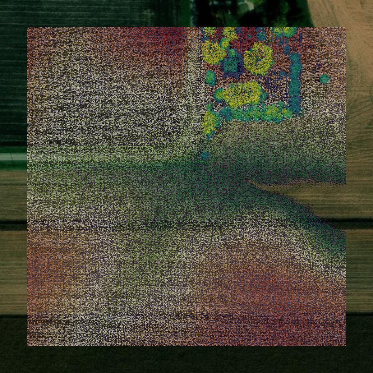
LiDAR
Point clouds (LiDAR) in Rock Island County can produce highly accurate 3D models of terrain, structures, and vegetation.
Get LiDAR for Rock Island County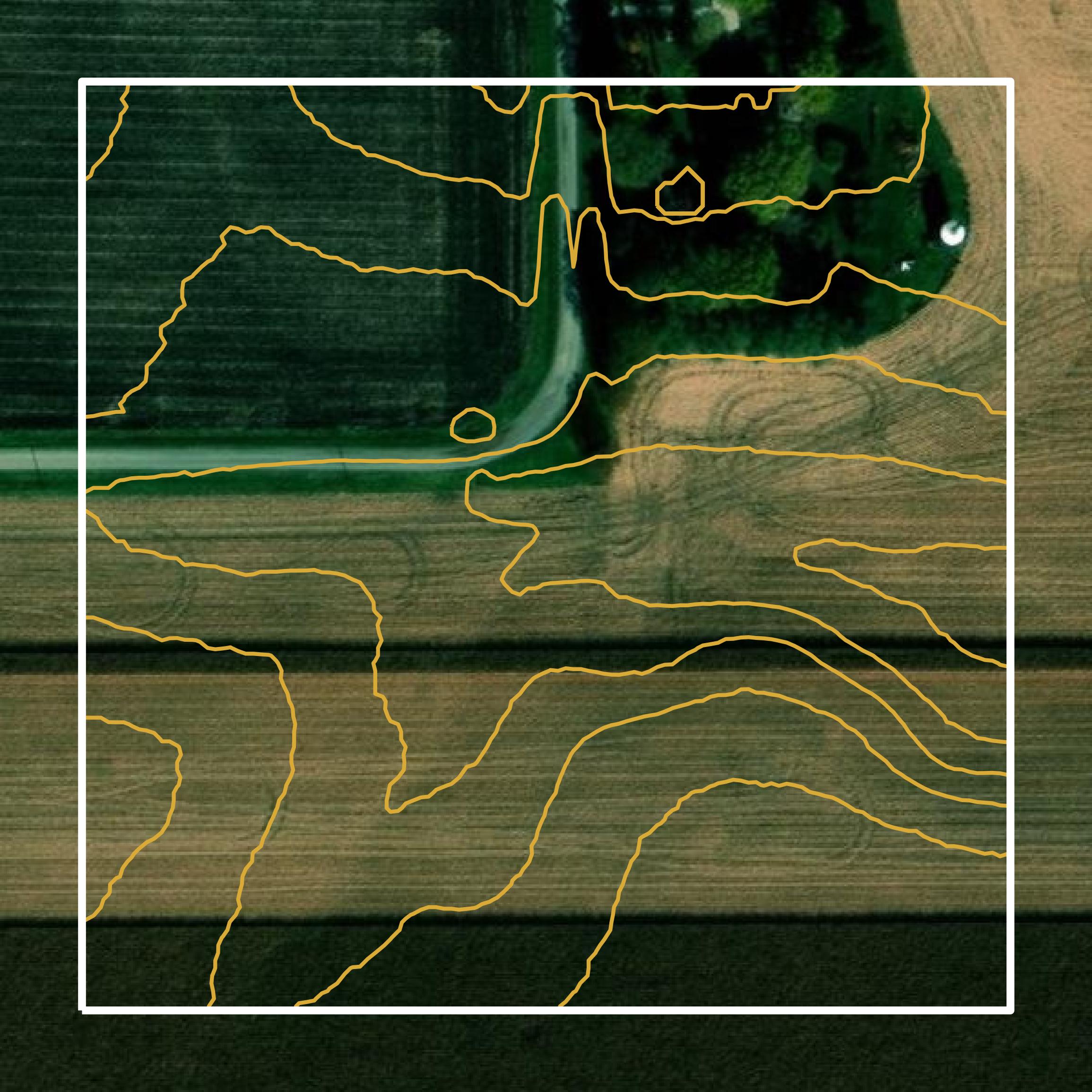
Contours
Contours in Rock Island County visualize 3D elevations on a 2D surface allowing you to better understand your site.
Get Contours for Rock Island County