Overview
Jackson County GIS Data – For CAD
Equator helps civil engineering, architecture and consulting firms with the tools to instantly find, process and download accurate LiDAR, contours, parcel data, building footprints, DEMs, point clouds and other GIS data for Jackson County in an online web mapping portal.
Jackson County GIS Data →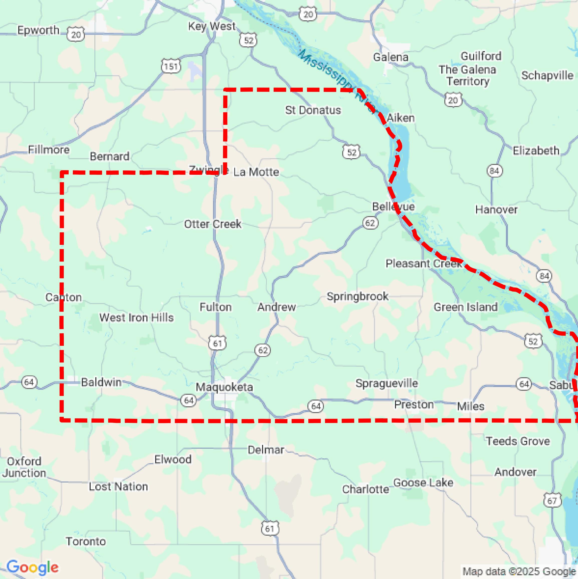

Data Available
Download GIS Data for Jackson County
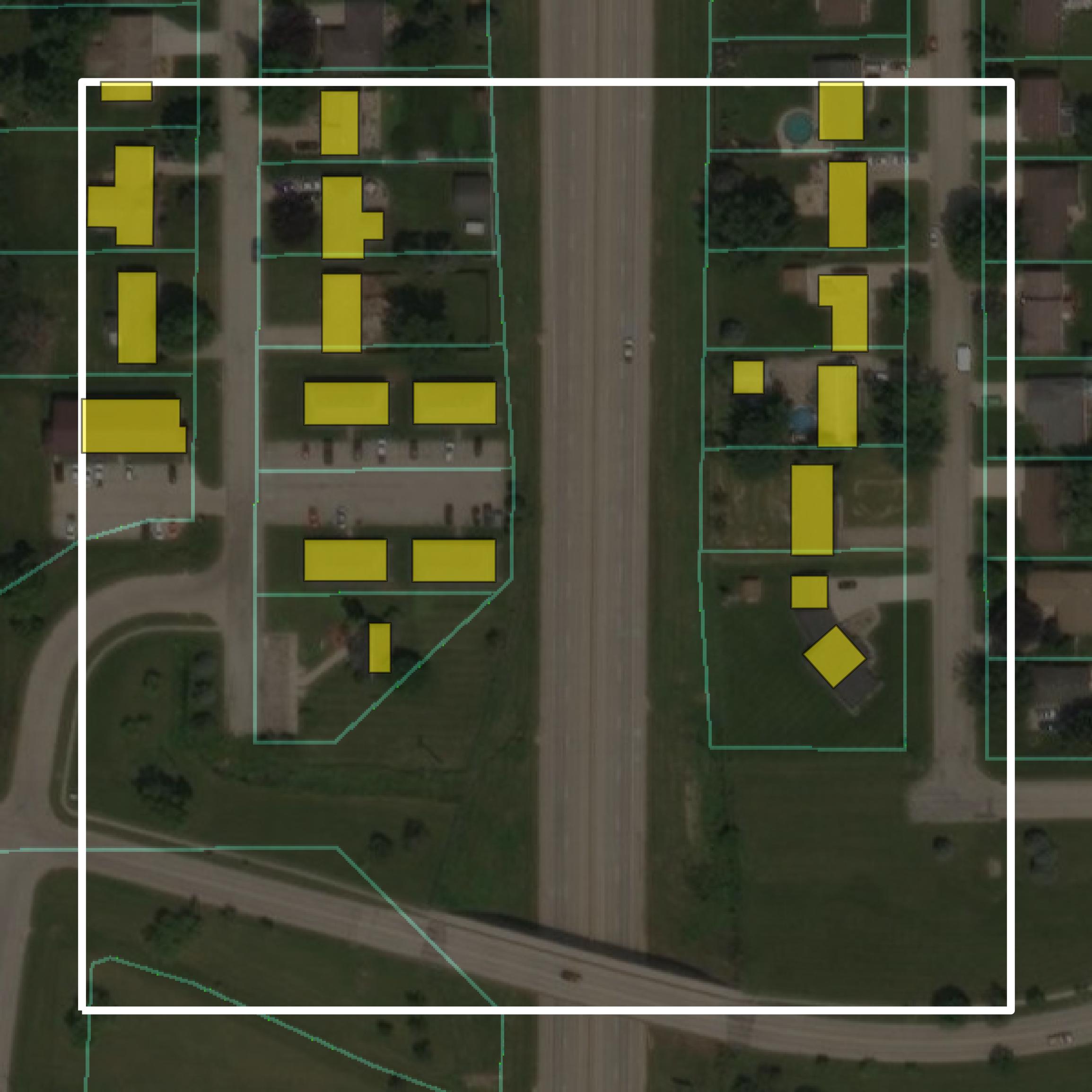
Parcels and Buildings
This image shows parcel and building data in Jackson County created using GIS data in Equator.
Get Parcels and Buildings for Jackson County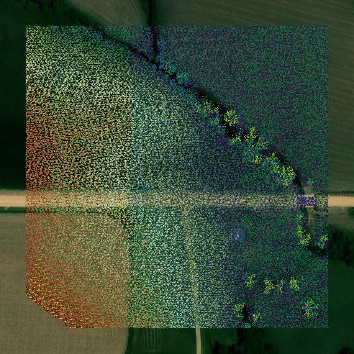
LiDAR
This image shows a LiDAR point cloud in Jackson County created using GIS data in Equator.
Get LiDAR for Jackson County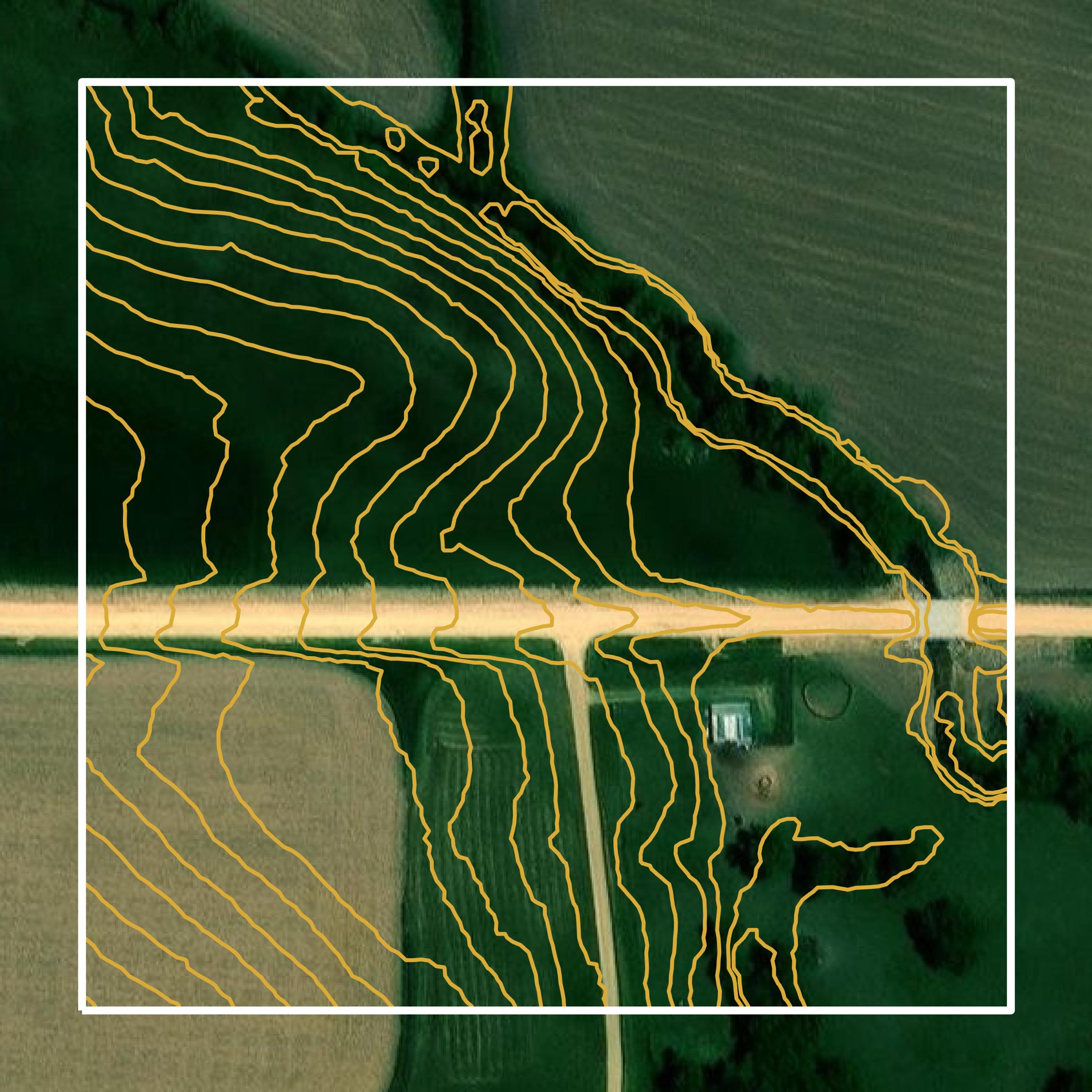
Contours
This image shows a contour map in Jackson County created using GIS data in Equator.
Get Contours for Jackson CountyFormats Available
Export Your Data Ready to Use in Multiple Formats
DWG
AutoCAD Drawing - Industry-standard CAD format
Supported Data:
Contour, Parcel, Building Outline
SHP
Shapefile - Standard GIS vector format
Supported Data:
Contour, Parcel, Building Outline
DXF
Drawing Exchange Format - Universal CAD interchange
Supported Data:
Contour, Building Outline
GeoJSON
Geographic JSON - Web-friendly spatial data format
Supported Data:
Contour, Parcel, Building Outline
LAZ
Compressed LAS - Efficient LiDAR point cloud format
Supported Data:
Point Cloud
SVG
Scalable Vector Graphics - Web vector format
Supported Data:
Contour, Building Outline
GPKG (Coming Soon)
GeoPackage - Modern OGC spatial database format
Supported Data:
Contour, Parcel, Building Outline
LandXML (Coming Soon)
Land XML - Civil engineering data exchange format
Supported Data:
Point Cloud
TIN (Coming Soon)
Triangulated Irregular Network - 3D surface model
Supported Data:
Point Cloud
XYZ (Coming Soon)
XYZ Point Cloud - Simple ASCII point cloud format
Supported Data:
Point Cloud
Background
GIS Data for Jackson County
The Jackson County, Iowa GIS webpage provides access to a variety of geographic information system (GIS) datasets and resources. Available content includes property records, parcel data, zoning information, and high-resolution aerial imagery. Users can interact with an online map viewer that is regularly updated and offers various data layers. The site also facilitates data requests via email and outlines the process for reporting discrepancies in the GIS data. Additionally, governmental and tax-supported entities can access ortho-imagery at no cost. Overall, the GIS department aims to keep the datasets current, though it advises users to consider the varying accuracy and update frequencies of the data sources.
Access Jackson County GIS Data in Equator →Jackson County Portal →Showcase
Sample GIS Data for Jackson County
Parcels and Buildings
Parcel and building data in Jackson County are used in a variety of fields including architecture, real estate, and urban planning.
Get Parcels and Buildings for Jackson County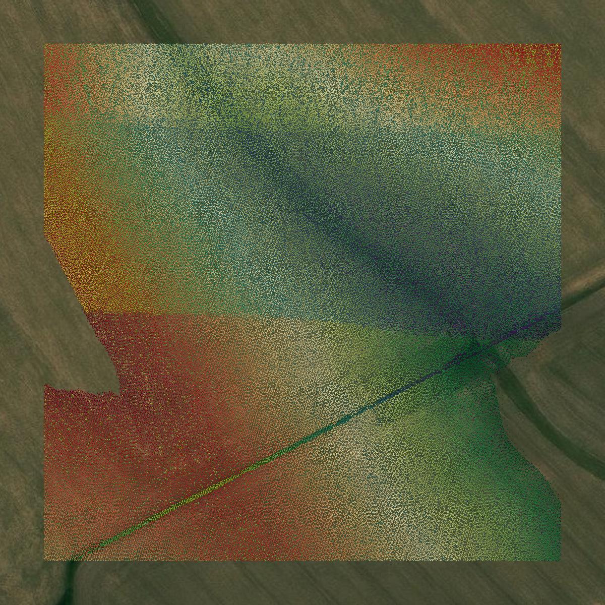
LiDAR
Point clouds (LiDAR) in Jackson County can produce highly accurate 3D models of terrain, structures, and vegetation.
Get LiDAR for Jackson County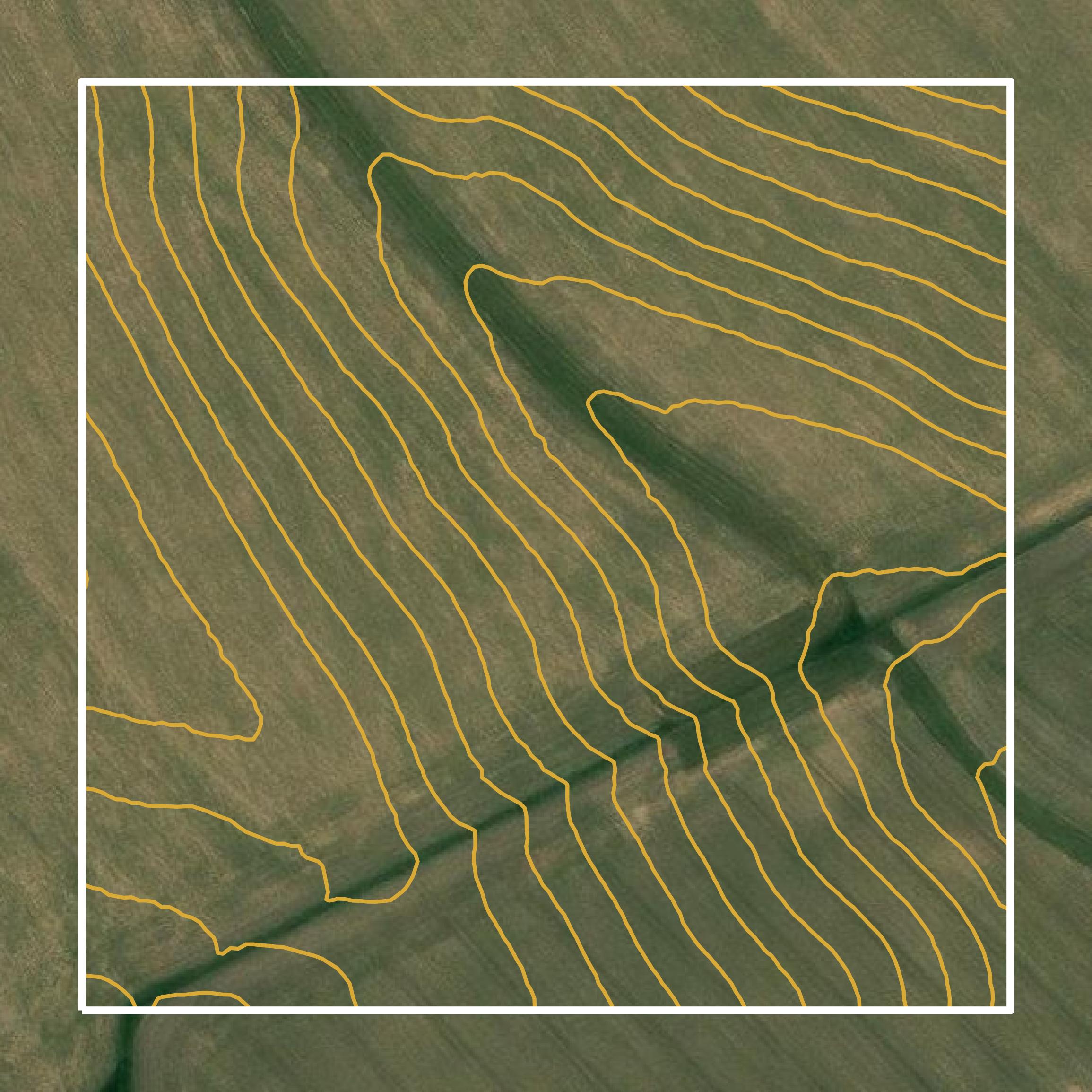
Contours
Contours in Jackson County visualize 3D elevations on a 2D surface allowing you to better understand your site.
Get Contours for Jackson County