Overview
New York County GIS Data - For CAD
Equator helps civil engineering, architecture and consulting firms with the tools to instantly find, process and download accurate LiDAR, contours, parcel data, building footprints, DEMs, point clouds and other GIS data for New York County in an online web mapping portal.
New York County GIS Data ->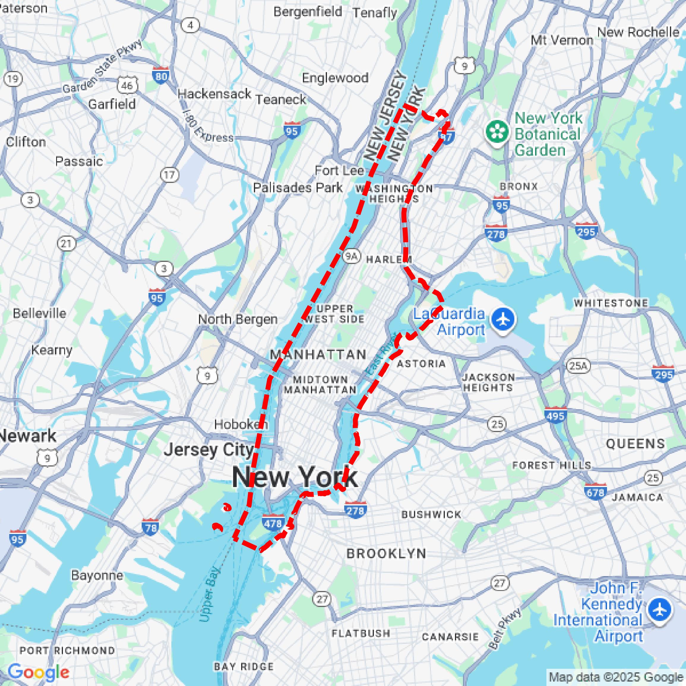

Data Available
Download GIS Data for New York County
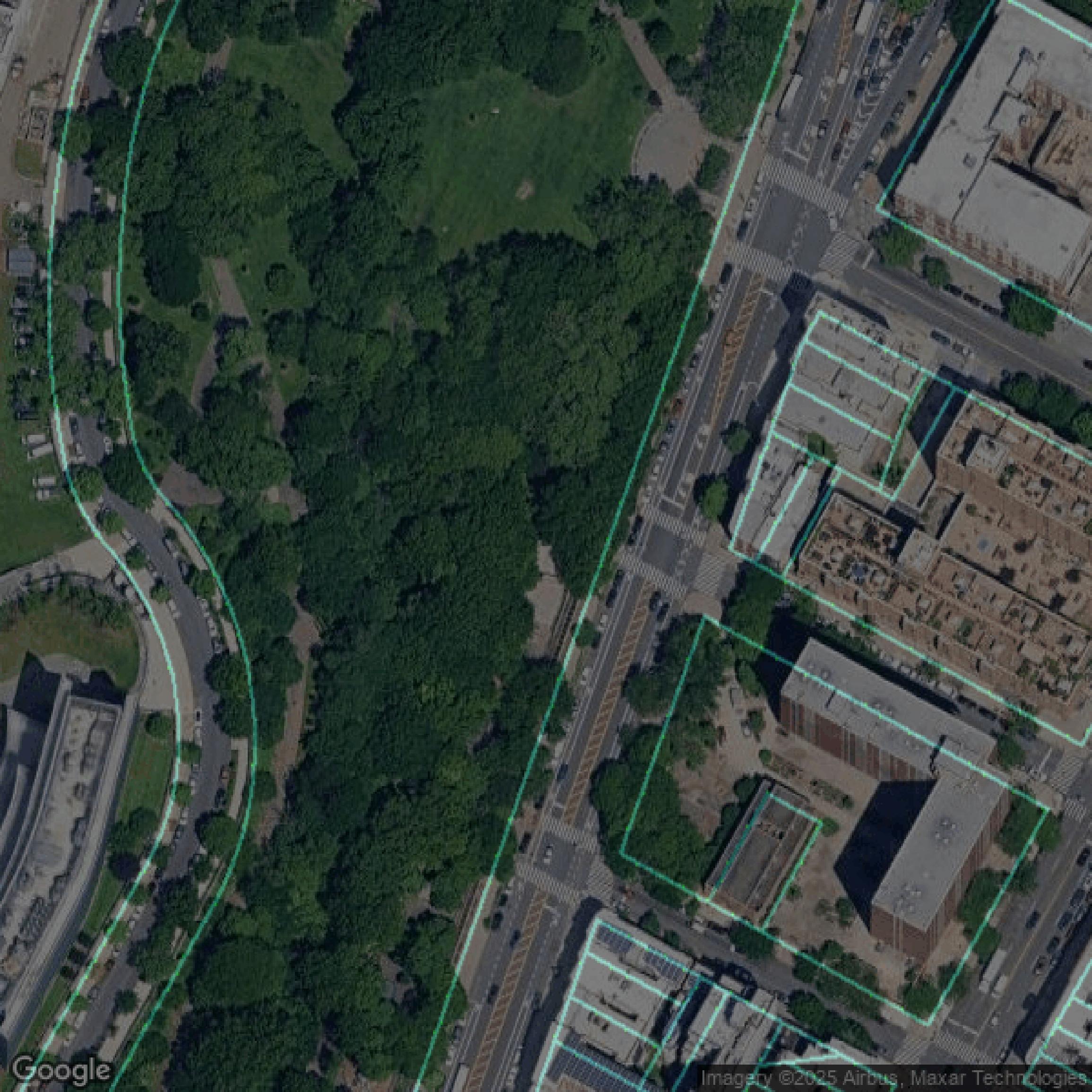
Parcels and Buildings
This image shows parcel and building data in New York County created using GIS data in Equator.
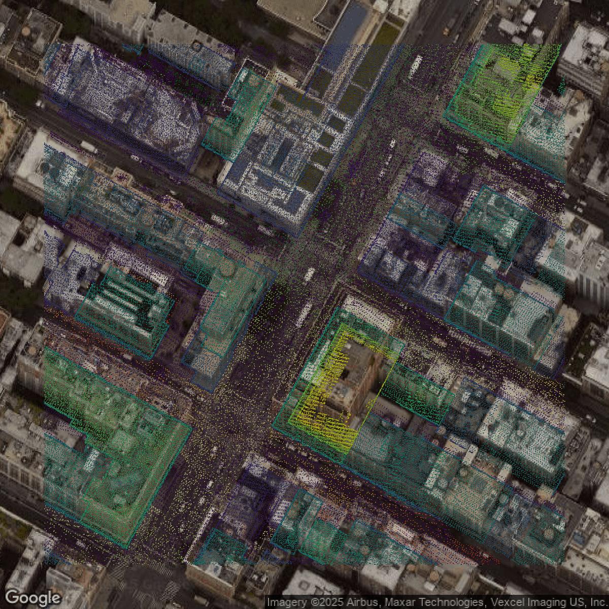
LiDAR
This image shows a LiDAR point cloud in New York County created using GIS data in Equator.
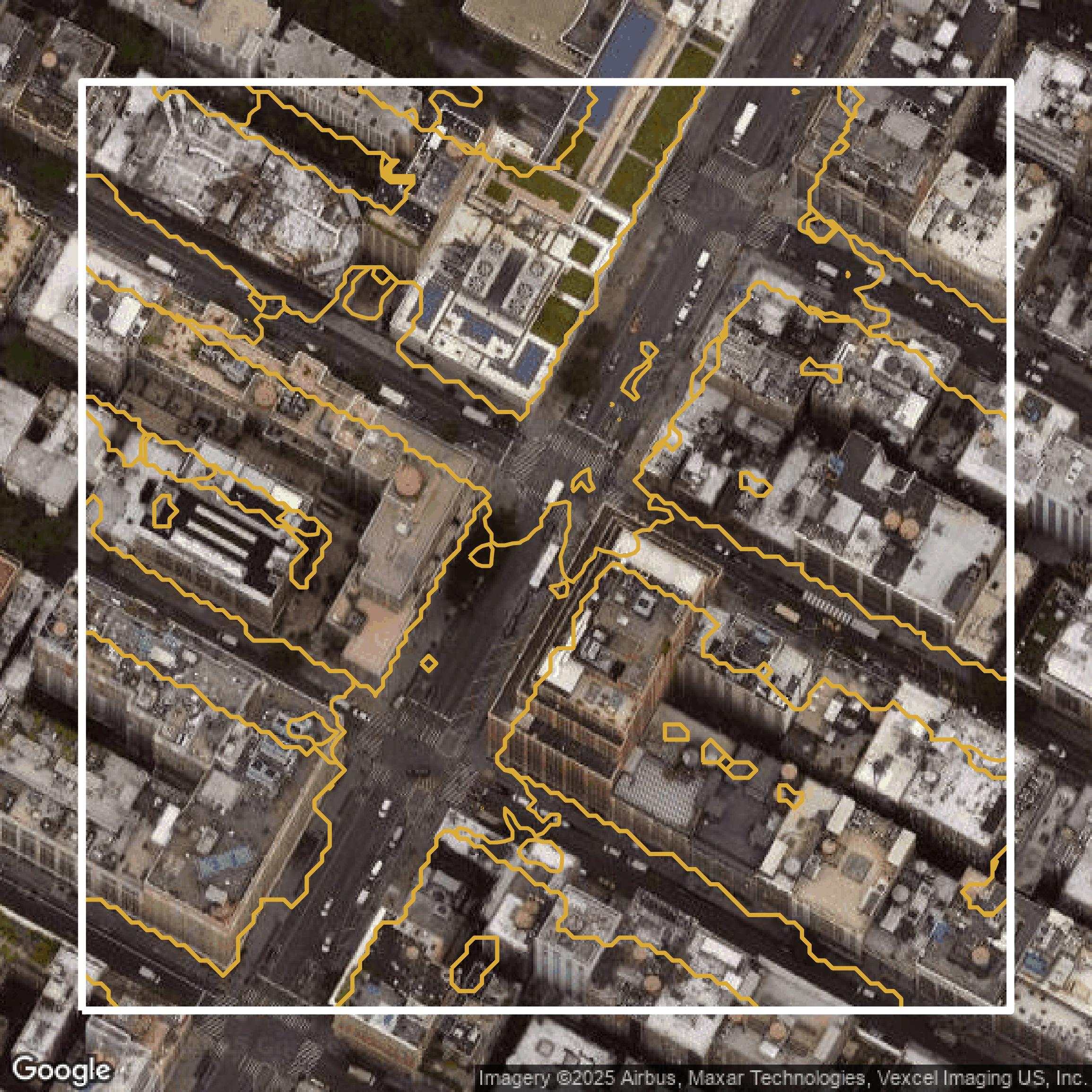
Contours
This image shows a contour map in New York County created using GIS data in Equator.
Formats Available
Export Your Data Ready to Use in Multiple Formats
DWG
AutoCAD Drawing - Industry-standard CAD format
Supported Data:
Contour, Parcel, Building Outline
SHP
Shapefile - Standard GIS vector format
Supported Data:
Contour, Parcel, Building Outline
DXF
Drawing Exchange Format - Universal CAD interchange
Supported Data:
Contour, Building Outline
GeoJSON
Geographic JSON - Web-friendly spatial data format
Supported Data:
Contour, Parcel, Building Outline
LAZ
Compressed LAS - Efficient LiDAR point cloud format
Supported Data:
Point Cloud
SVG
Scalable Vector Graphics - Web vector format
Supported Data:
Contour, Building Outline
GPKG
GeoPackage - Modern OGC spatial database format
Supported Data:
Contour, Parcel, Building Outline
LandXML (Coming Soon)
Land XML - Civil engineering data exchange format
Supported Data:
Point Cloud
TIN (Coming Soon)
Triangulated Irregular Network - 3D surface model
Supported Data:
Point Cloud
XYZ (Coming Soon)
XYZ Point Cloud - Simple ASCII point cloud format
Supported Data:
Point Cloud
Background
GIS Data for New York County
NYC Open Data provides comprehensive, free public data published by New York City agencies and partners, offering users a robust "data catalog" where they can explore datasets organized by agency or category, including Business, Education, and Environment. Visitors can access a variety of tools such as detailed "Open Data APIs," learn how to utilize the data through "How To" guides, and participate in community events like "Open Data Week." The site features popular and newly published datasets, a "Project Gallery" showcasing real-world data applications, and learning resources including training classes to help users at all levels. Whether you want to browse by "Datasets by Agency," explore "Popular Datasets," or dive into specific categories, NYC Open Data is designed to empower New Yorkers and data enthusiasts to discover actionable insights and engage with the city's rich data resources.
Access New York County GIS Data in Equator →New York County Portal →