Overview
Queens County GIS Data – For CAD
Equator helps civil engineering, architecture and consulting firms with the tools to instantly find, process and download accurate LiDAR, contours, parcel data, building footprints, DEMs, point clouds and other GIS data for Queens County in an online web mapping portal.
Queens County GIS Data →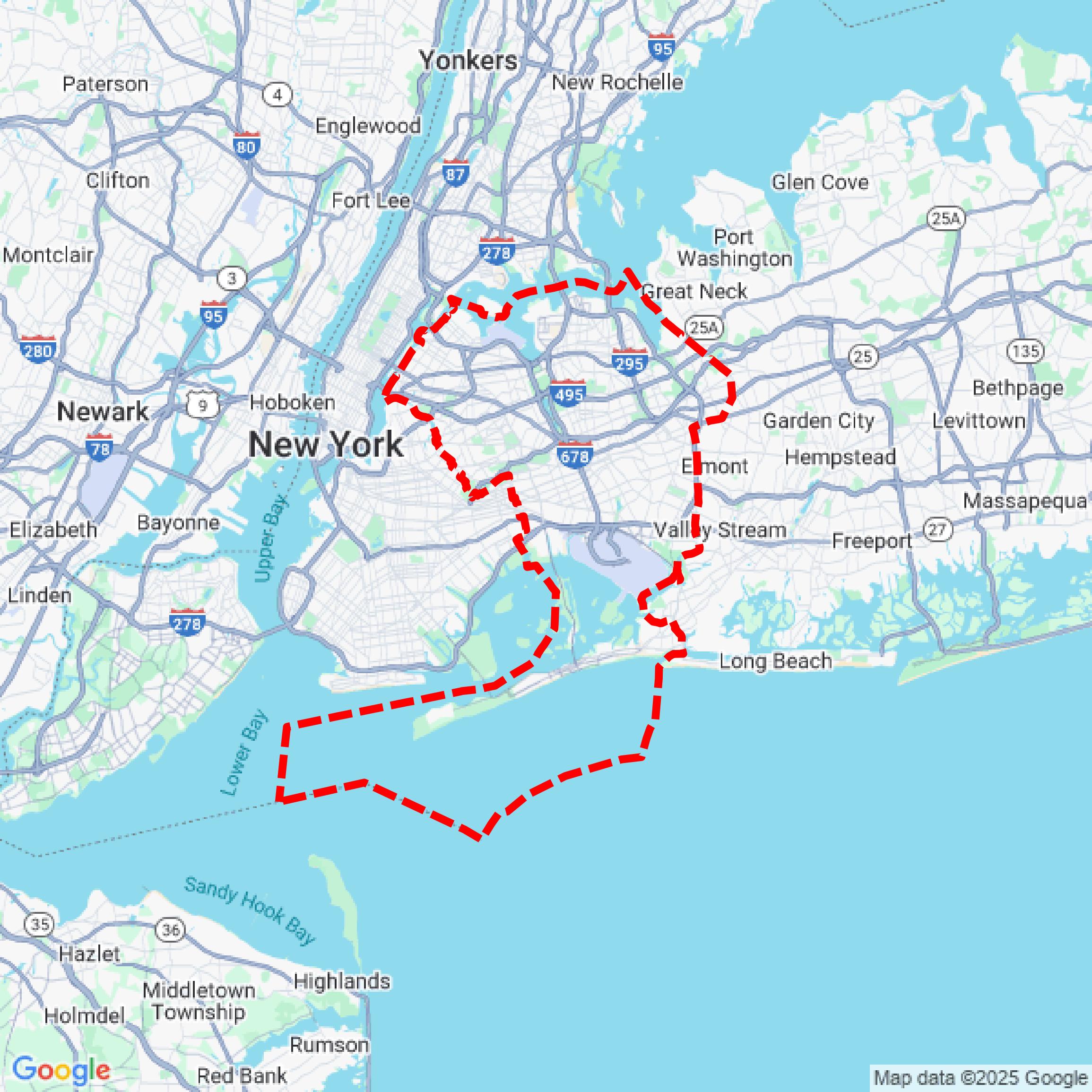

Data Available
Download GIS Data for Queens County
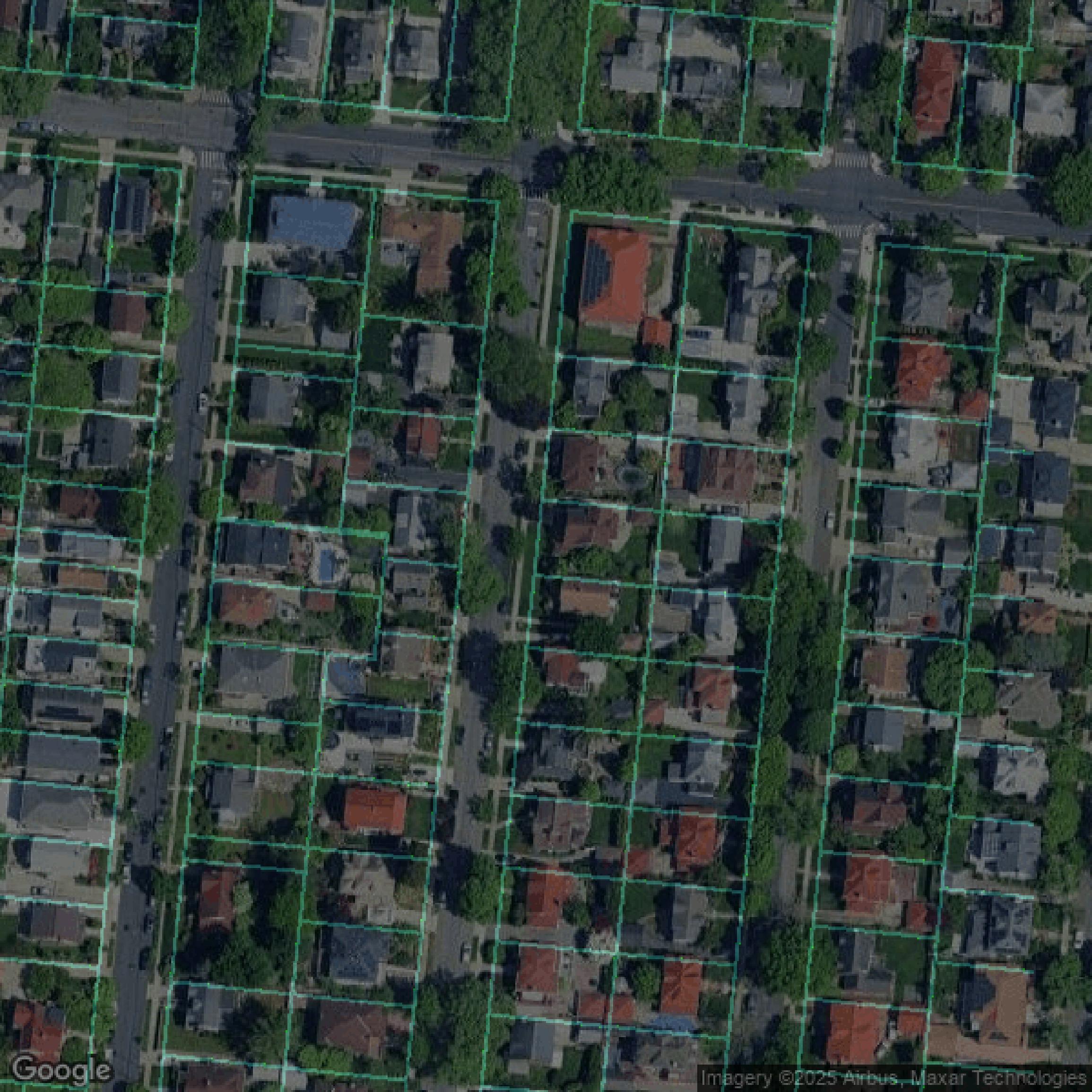
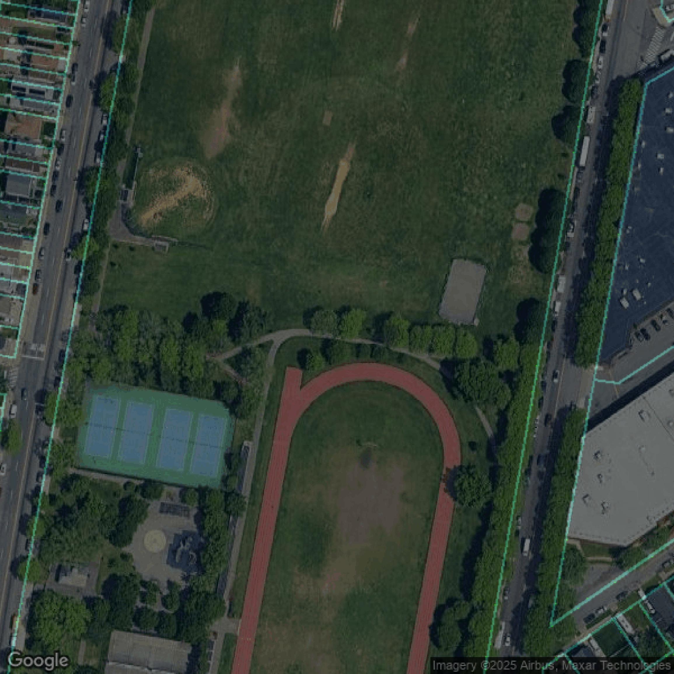
Parcels and Buildings
This image shows parcel and building data in Queens County created using GIS data in Equator.
Get Parcels and Buildings for Queens County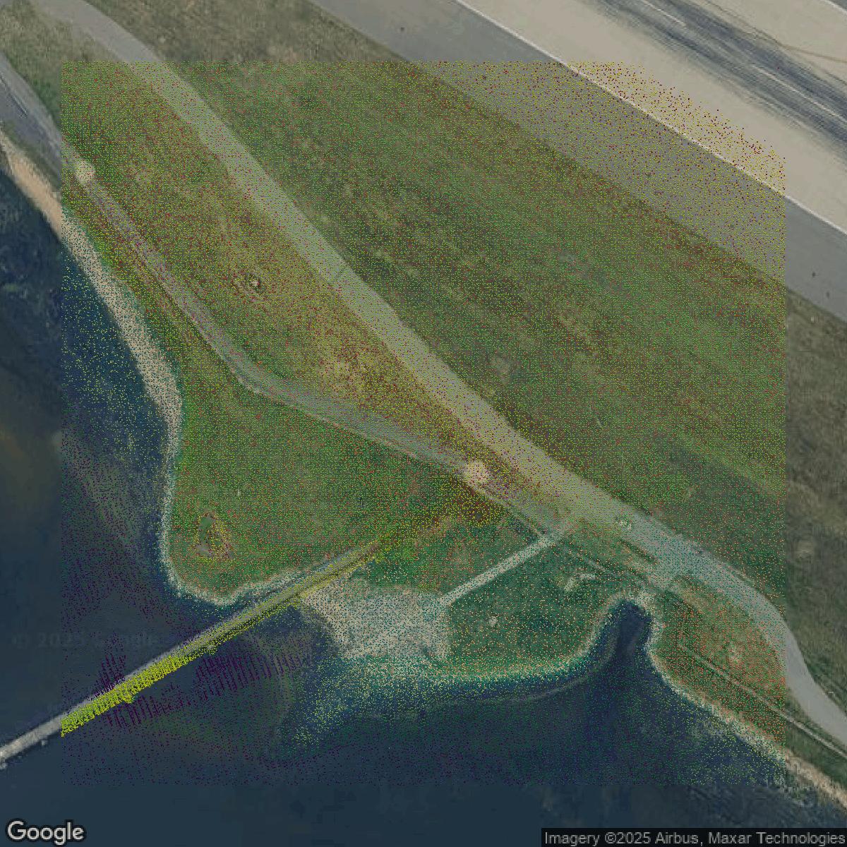
LiDAR
This image shows a LiDAR point cloud in Queens County created using GIS data in Equator.
Get LiDAR for Queens County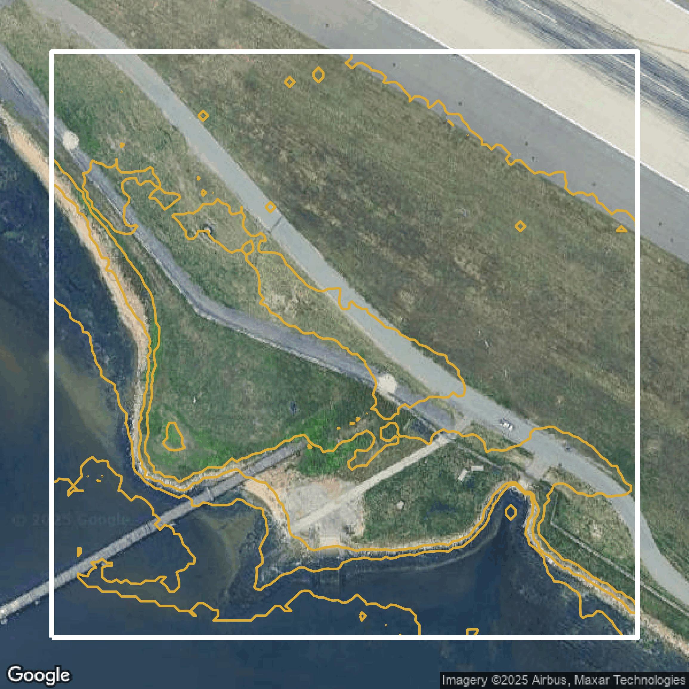
Contours
This image shows a contour map in Queens County created using GIS data in Equator.
Get Contours for Queens CountyFormats Available
Export Your Data Ready to Use in Multiple Formats
DWG
AutoCAD Drawing - Industry-standard CAD format
Supported Data:
Contour, Parcel, Building Outline
SHP
Shapefile - Standard GIS vector format
Supported Data:
Contour, Parcel, Building Outline
DXF
Drawing Exchange Format - Universal CAD interchange
Supported Data:
Contour, Building Outline
GeoJSON
Geographic JSON - Web-friendly spatial data format
Supported Data:
Contour, Parcel, Building Outline
LAZ
Compressed LAS - Efficient LiDAR point cloud format
Supported Data:
Point Cloud
SVG
Scalable Vector Graphics - Web vector format
Supported Data:
Contour, Building Outline
GPKG (Coming Soon)
GeoPackage - Modern OGC spatial database format
Supported Data:
Contour, Parcel, Building Outline
LandXML (Coming Soon)
Land XML - Civil engineering data exchange format
Supported Data:
Point Cloud
TIN (Coming Soon)
Triangulated Irregular Network - 3D surface model
Supported Data:
Point Cloud
XYZ (Coming Soon)
XYZ Point Cloud - Simple ASCII point cloud format
Supported Data:
Point Cloud
Background
GIS Data for Queens County
The NYS GIS Clearinghouse website is your comprehensive portal for accessing a wide range of New York State geographic information system (GIS) data and tools. Visitors can explore the "Data Discovery" site to find extensive GIS data sets including crucial data programs like "Parcels," "Streets & Addresses," "Orthoimagery," "Elevation," and "Civil Boundaries." The site also provides access to the latest "2024 orthoimagery" for multiple counties, updated "DEM image service," and USGS LiDAR data. Beyond data, the Clearinghouse offers resources for GIS coordination across the state, including information on the "Geospatial Advisory Council," "State Agency Advisory Group," and "Data Sharing Cooperative." For enterprise needs, the "ShareGIS" platform supports collaborative GIS efforts, while "GIS Resources for NYS Agencies" and specialized programs like "Public Safety GIS" cater to agency-specific requirements. Whether you need to capture, analyze, or visualize spatial data, this official NY State website delivers authoritative GIS data, tools, and support to meet a variety of professional and public needs.
Access Queens County GIS Data in Equator →Queens County Portal →Showcase
Sample GIS Data for Queens County
Parcels and Buildings
Parcel and building data in Queens County are used in a variety of fields including architecture, real estate, and urban planning.
Get Parcels and Buildings for Queens County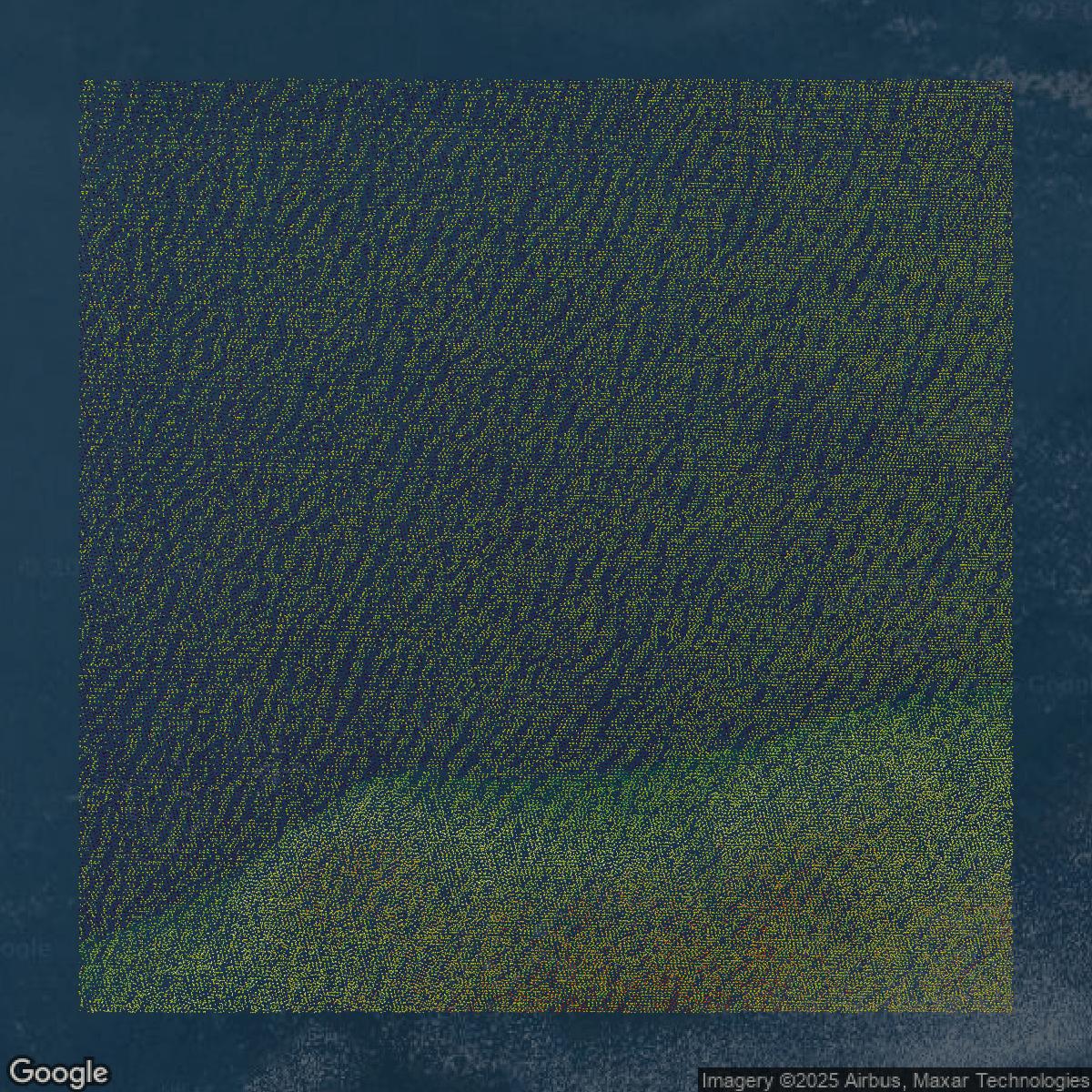
LiDAR
Point clouds (LiDAR) in Queens County can produce highly accurate 3D models of terrain, structures, and vegetation.
Get LiDAR for Queens County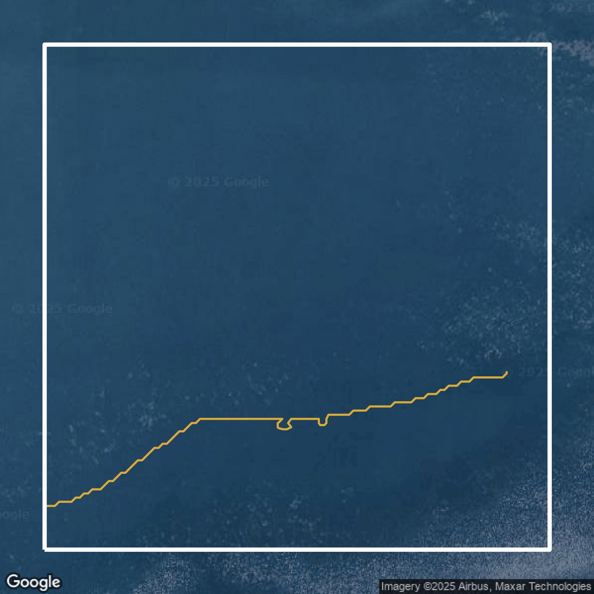
Contours
Contours in Queens County visualize 3D elevations on a 2D surface allowing you to better understand your site.
Get Contours for Queens County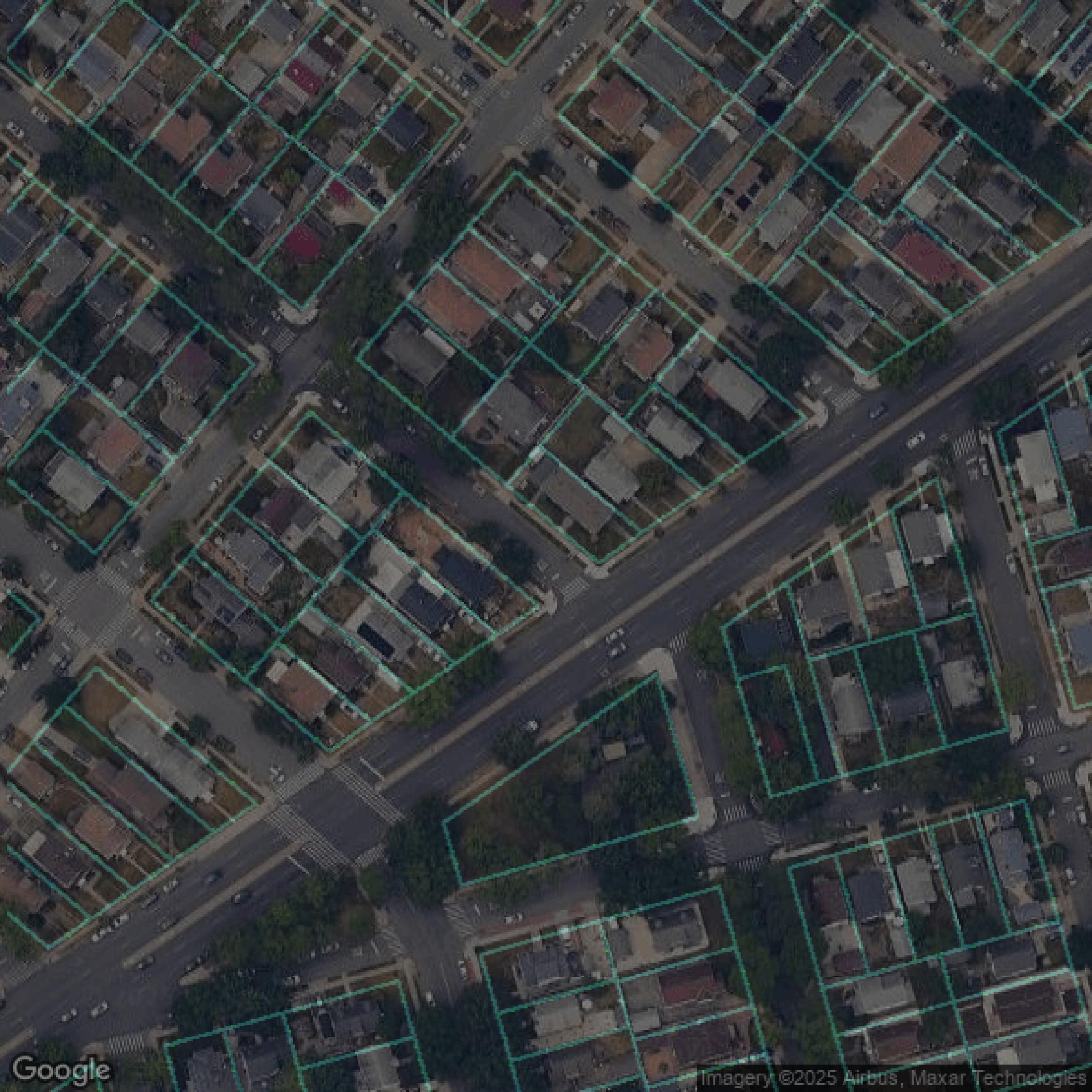
Parcels and Buildings
Accessing Queens County parcel and building data on Equator gives you access to coverage across the US.
Get Parcels and Buildings for Queens County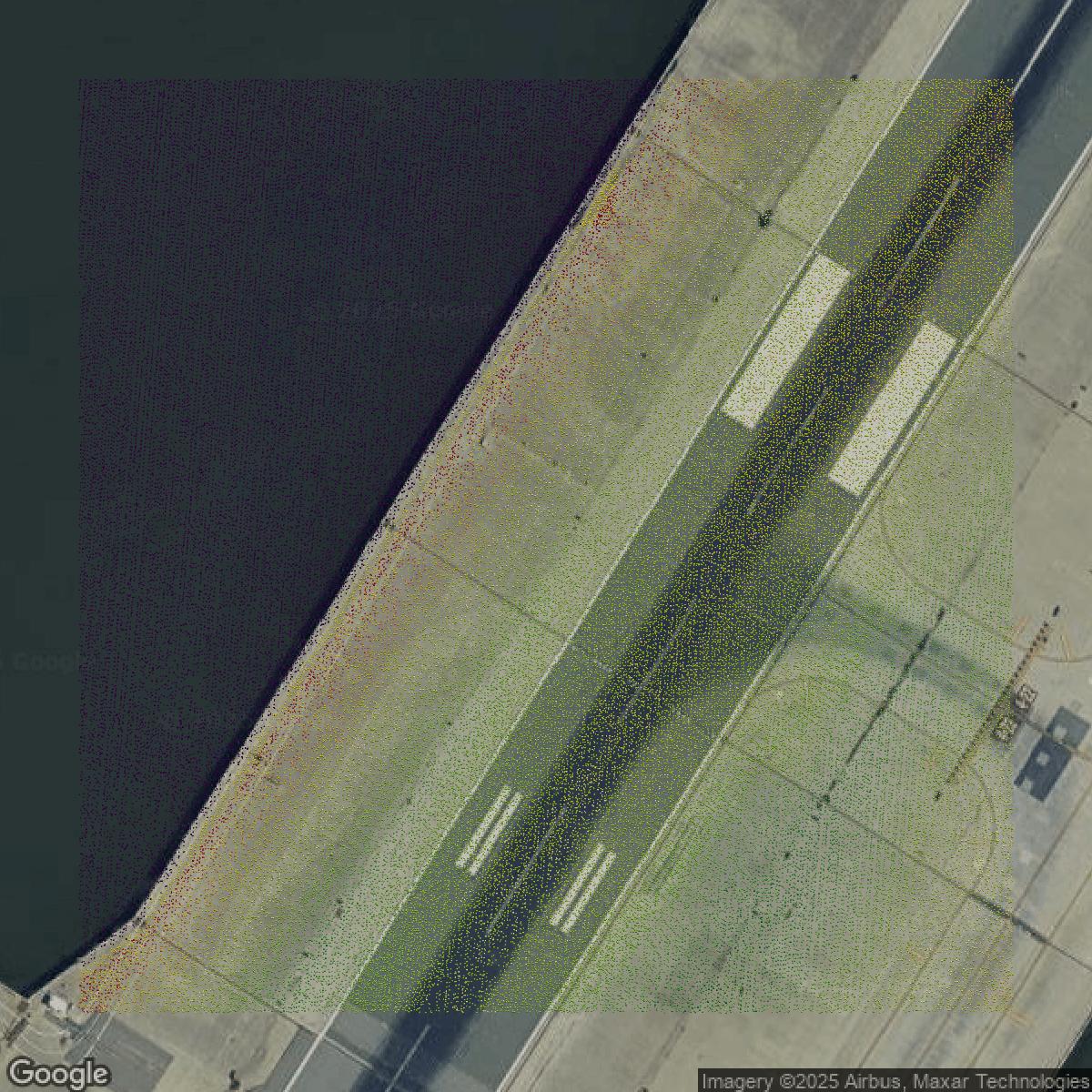
LiDAR
Queens County LiDAR uses include land surveying, analyzing crop health, or even archaeological studies.
Get LiDAR for Queens County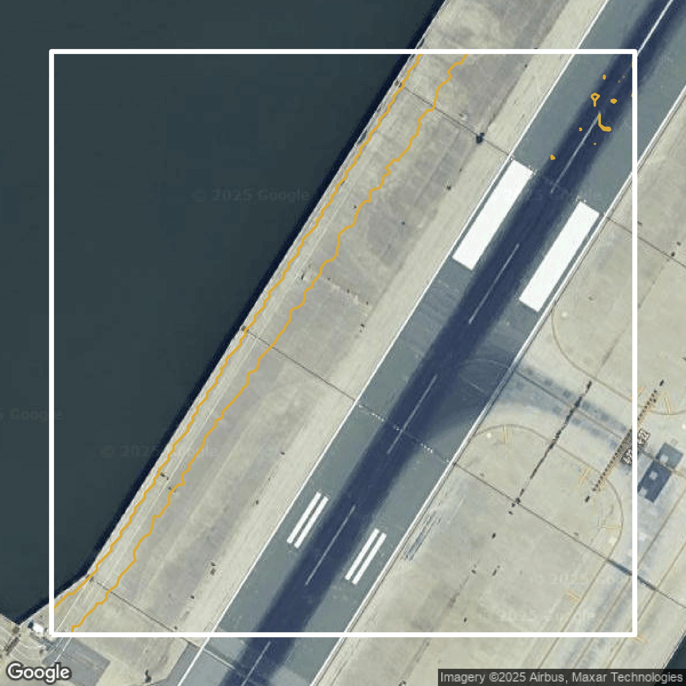
Contours
Queens County contours can be used for construction & engineering, environmental science, and more.
Get Contours for Queens County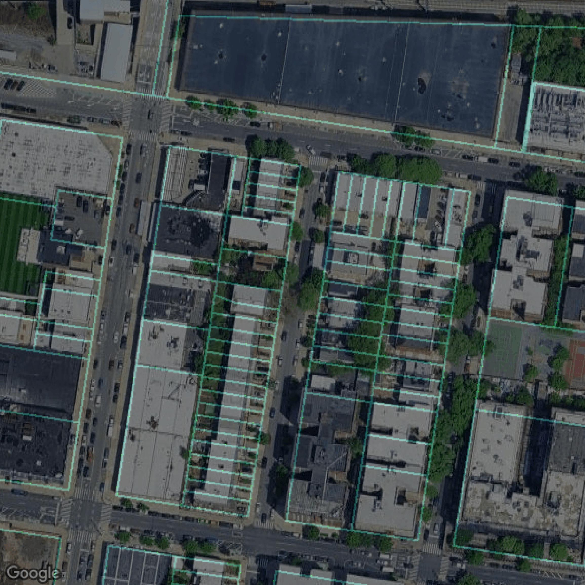
Parcels and Buildings
Dozens of fields are contained within each Queens County parcel and building data, including zoning, owners, and year built.
Get Parcels and Buildings for Queens County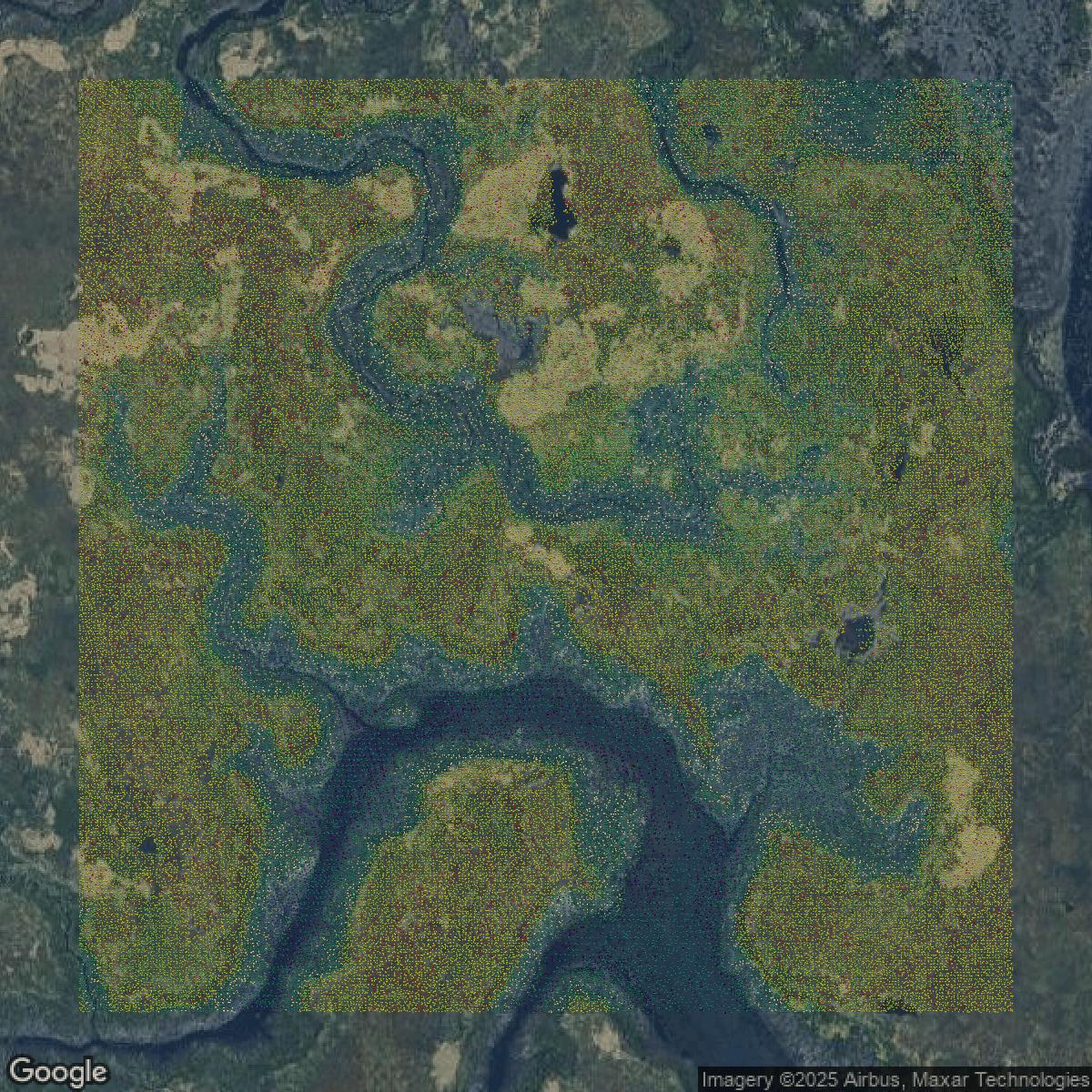
LiDAR
Equator turns Queens County LiDAR point clouds into various lidar-derived data sets, including DEMs.
Get LiDAR for Queens County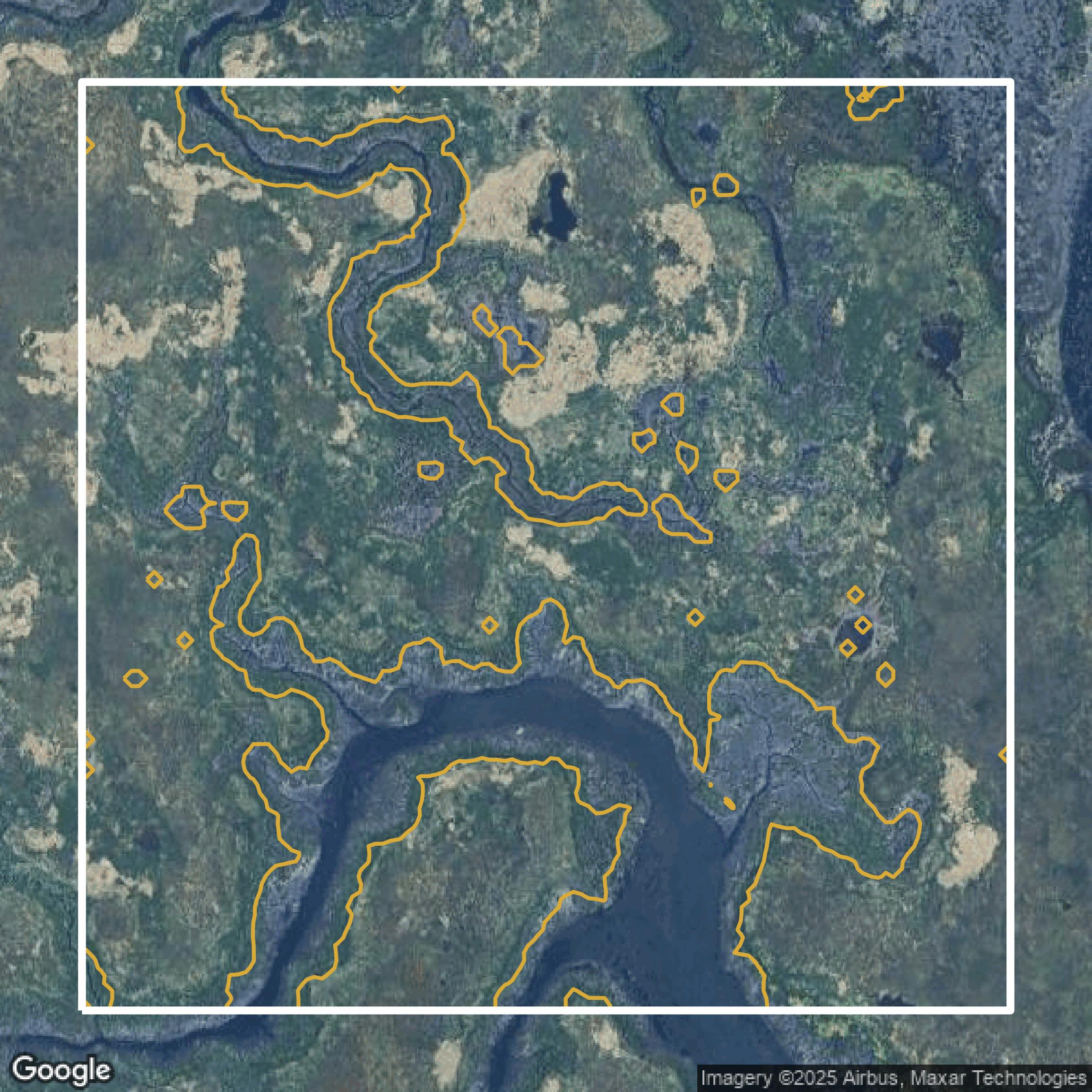
Contours
Queens County contours on Equator are produced from LiDAR coverage, allowing for high precision
Get Contours for Queens County