Overview
Cuyahoga County GIS Data – For CAD
Equator helps civil engineering, architecture and consulting firms with the tools to instantly find, process and download accurate LiDAR, contours, parcel data, building footprints, DEMs, point clouds and other GIS data for Cuyahoga County in an online web mapping portal.
Cuyahoga County GIS Data →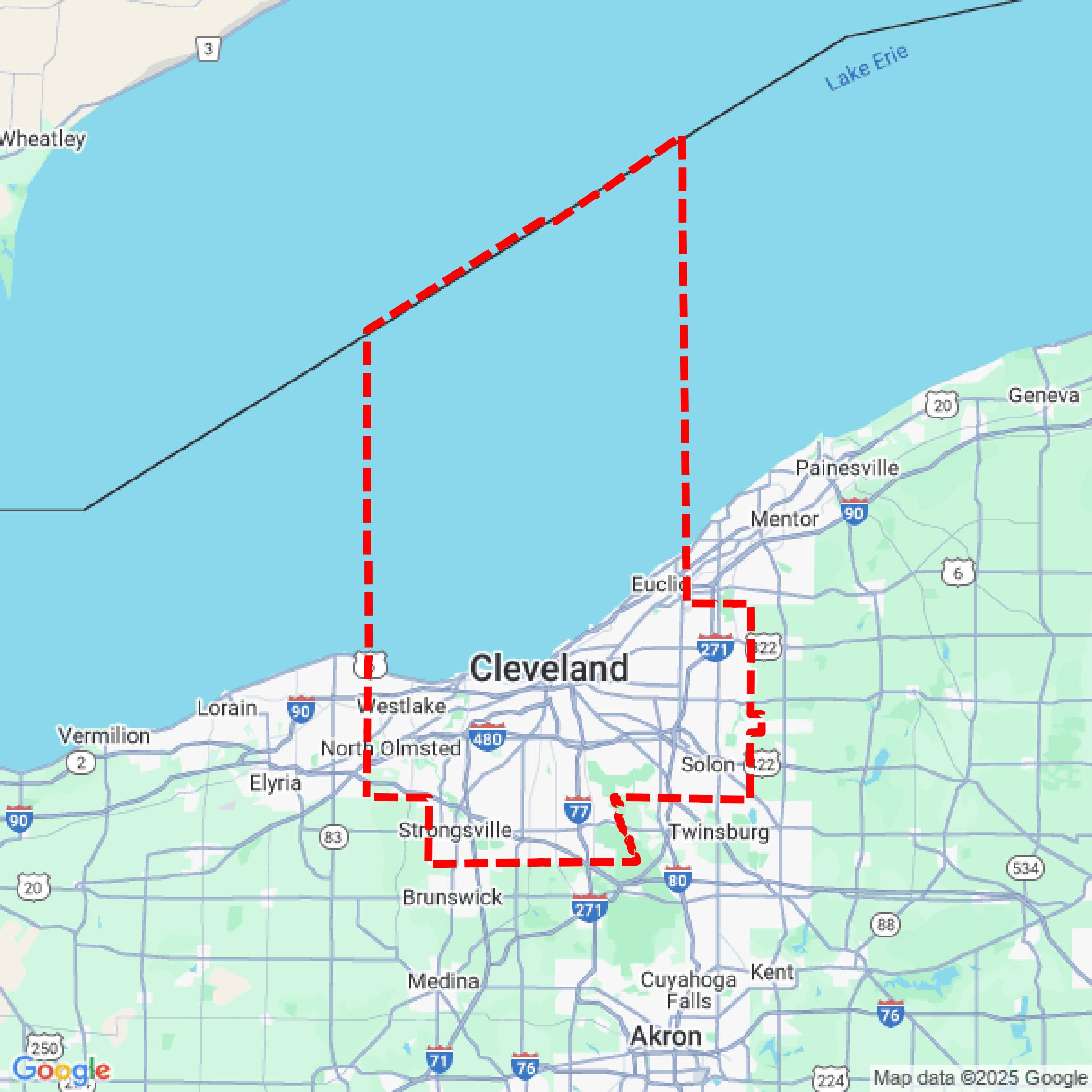

Data Available
Download GIS Data for Cuyahoga County
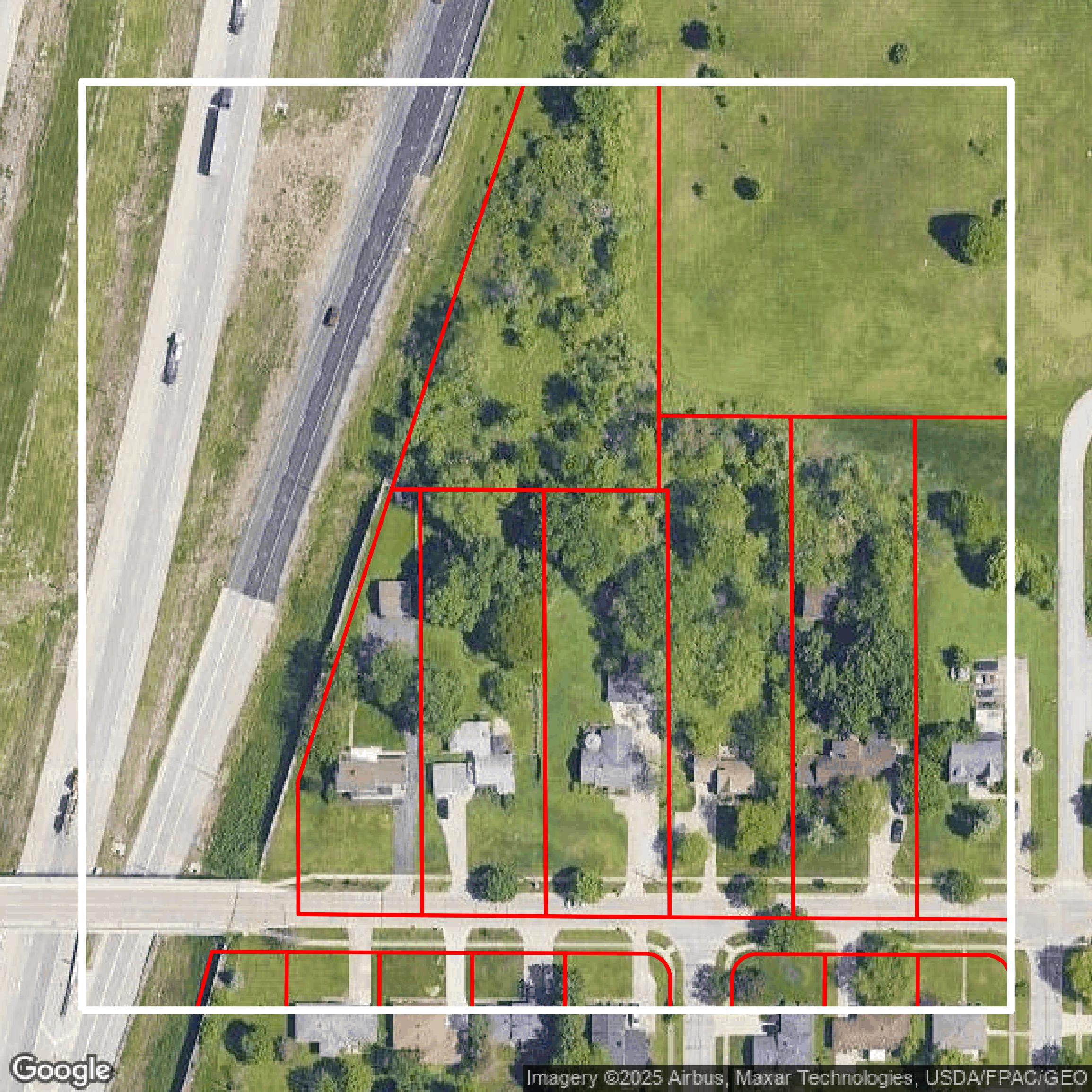
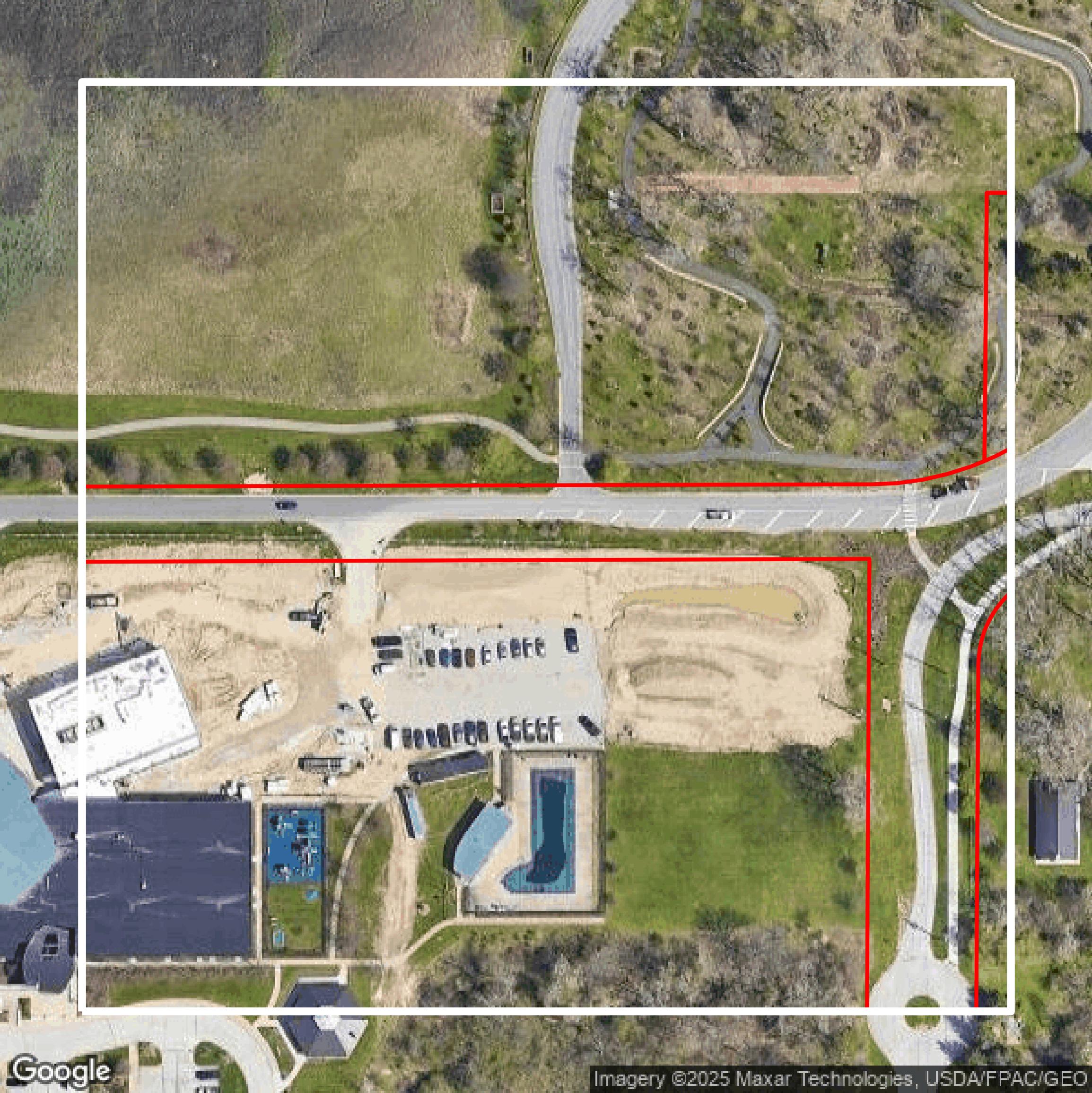
Parcels and Buildings
This image shows parcel and building data in Cuyahoga County created using GIS data in Equator.
Get Parcels and Buildings for Cuyahoga County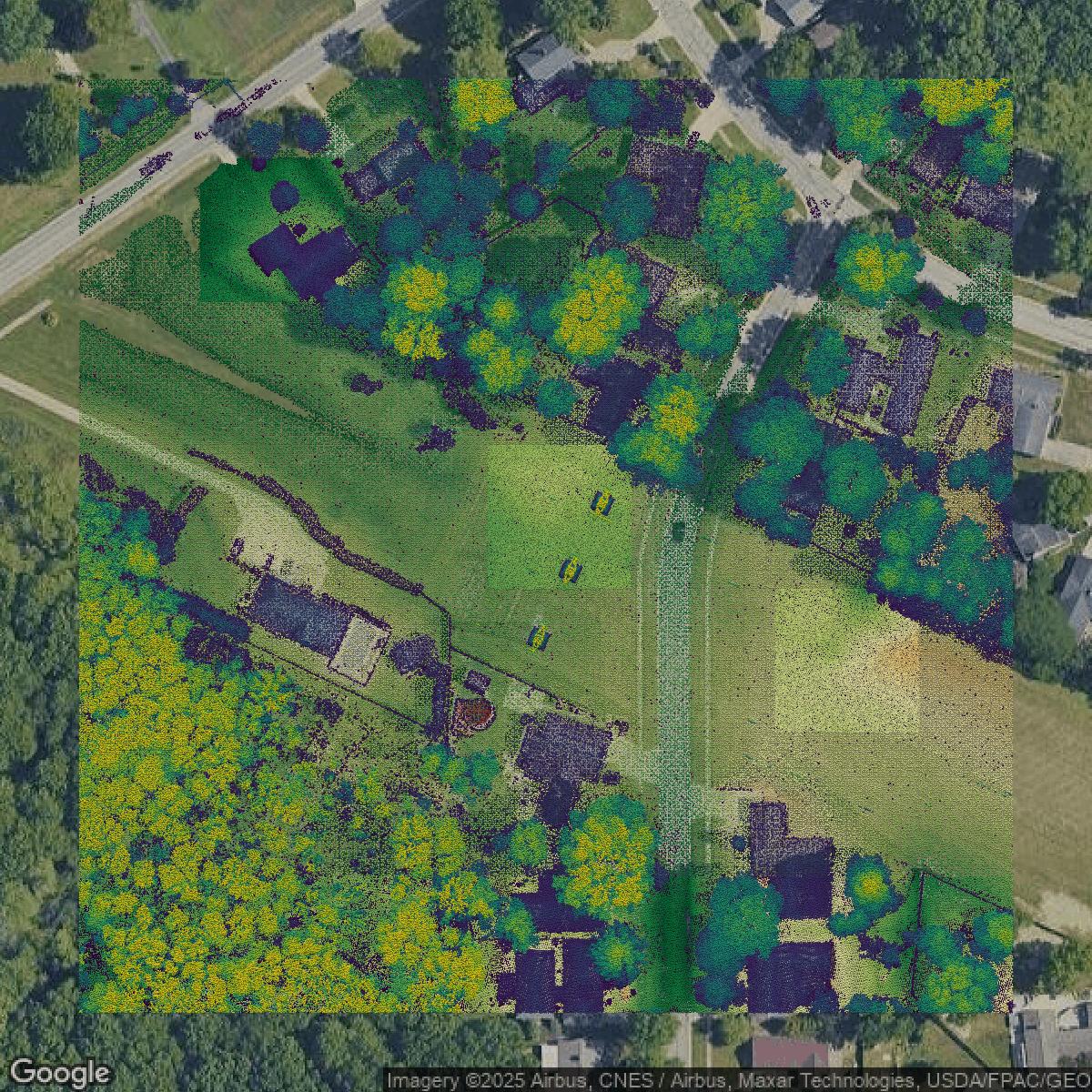
LiDAR
This image shows a LiDAR point cloud in Cuyahoga County created using GIS data in Equator.
Get LiDAR for Cuyahoga County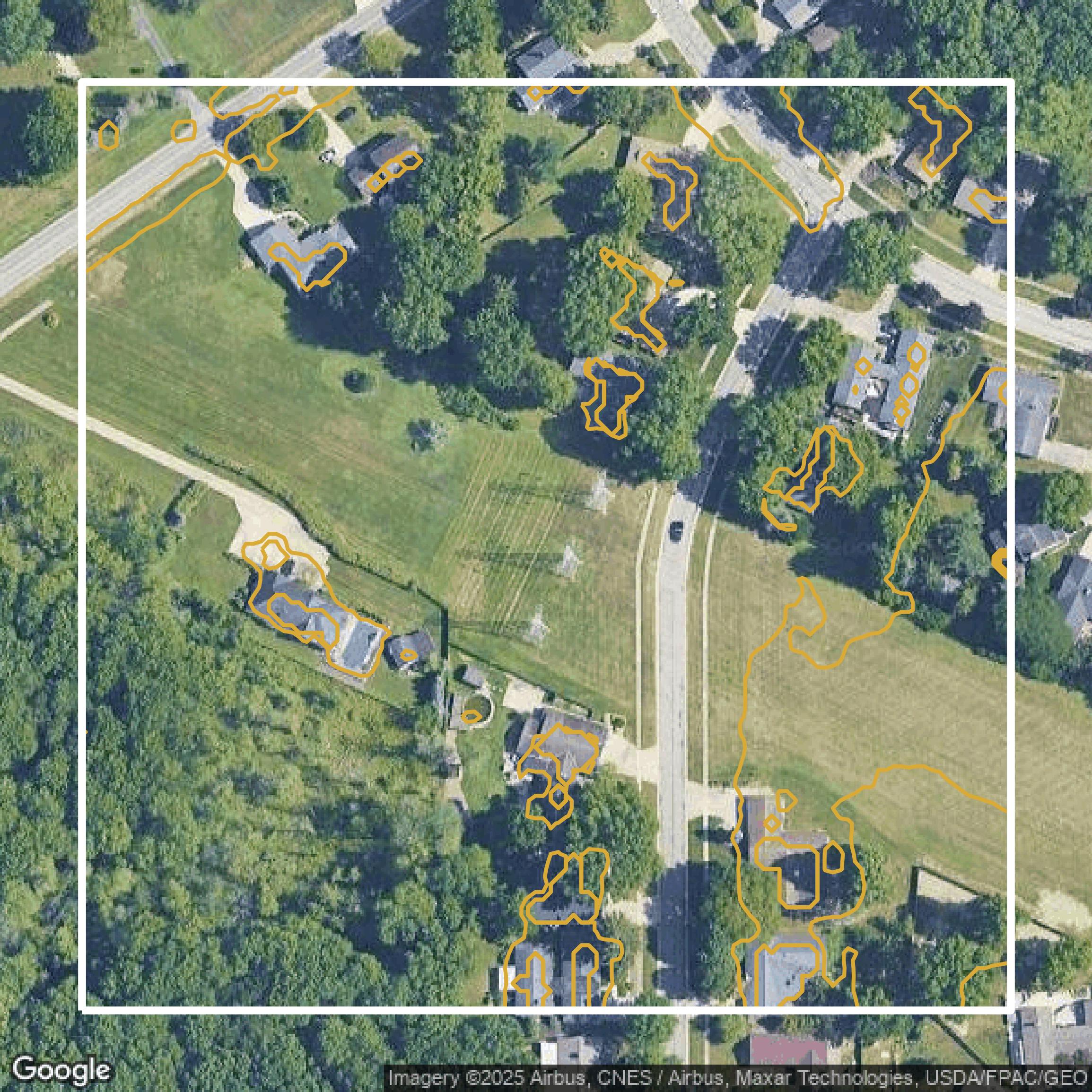
Contours
This image shows a contour map in Cuyahoga County created using GIS data in Equator.
Get Contours for Cuyahoga CountyFormats Available
Export Your Data Ready to Use in Multiple Formats
DWG
AutoCAD Drawing - Industry-standard CAD format
Supported Data:
Contour, Parcel, Building Outline
SHP
Shapefile - Standard GIS vector format
Supported Data:
Contour, Parcel, Building Outline
DXF
Drawing Exchange Format - Universal CAD interchange
Supported Data:
Contour, Building Outline
GeoJSON
Geographic JSON - Web-friendly spatial data format
Supported Data:
Contour, Parcel, Building Outline
LAZ
Compressed LAS - Efficient LiDAR point cloud format
Supported Data:
Point Cloud
SVG
Scalable Vector Graphics - Web vector format
Supported Data:
Contour, Building Outline
GPKG (Coming Soon)
GeoPackage - Modern OGC spatial database format
Supported Data:
Contour, Parcel, Building Outline
LandXML (Coming Soon)
Land XML - Civil engineering data exchange format
Supported Data:
Point Cloud
TIN (Coming Soon)
Triangulated Irregular Network - 3D surface model
Supported Data:
Point Cloud
XYZ (Coming Soon)
XYZ Point Cloud - Simple ASCII point cloud format
Supported Data:
Point Cloud
Background
GIS Data for Cuyahoga County
The Cuyahoga County Enterprise GIS Portal offers visitors comprehensive access to a wide range of geographic information system (GIS) data and analytical tools, provided as a free public service. On this site, users can explore multiple "GIS data" sets and related "analytical results" that cover various aspects of Cuyahoga County, all available on an "as is" basis. The portal includes an intuitive ArcGIS interface with sections such as "Home," "Gallery," and "Help" to facilitate user navigation and maximize ease of use. Visitors can expect to find access to valuable open data resources via the "Open Data" link, providing actionable geographic datasets useful for decision-making, planning, and research within the county. While the portal offers authoritative information, it is important to note that it does not serve as an "official public record," and the original records remain with the respective offices or agencies. Additional resources include direct contact options for GIS support and trust information through Esri, ensuring users can report concerns or seek assistance as needed.
Access Cuyahoga County GIS Data in Equator →Cuyahoga County Portal →Showcase
Sample GIS Data for Cuyahoga County
Parcels and Buildings
Parcel and building data in Cuyahoga County are used in a variety of fields including architecture, real estate, and urban planning.
Get Parcels and Buildings for Cuyahoga County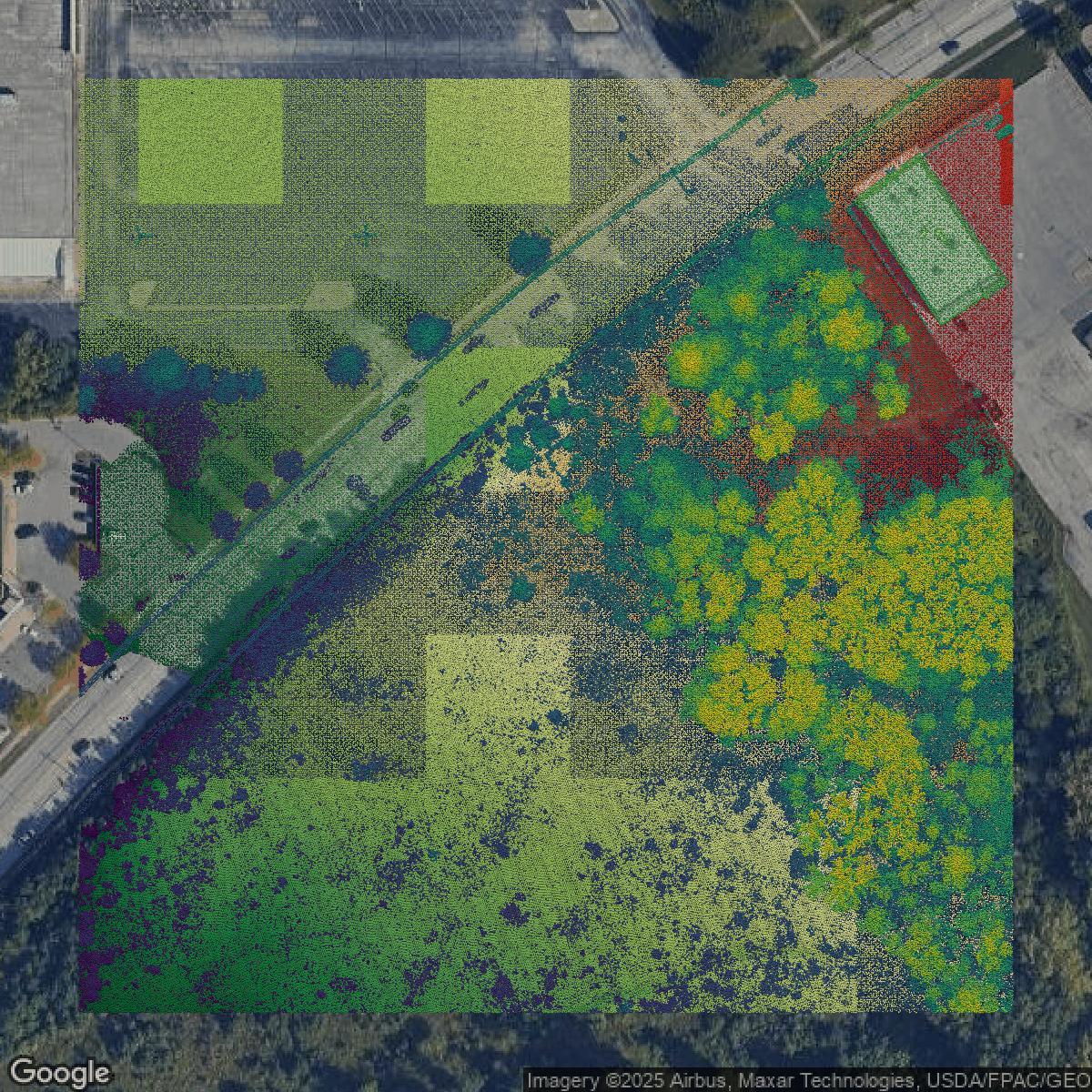
LiDAR
Point clouds (LiDAR) in Cuyahoga County can produce highly accurate 3D models of terrain, structures, and vegetation.
Get LiDAR for Cuyahoga County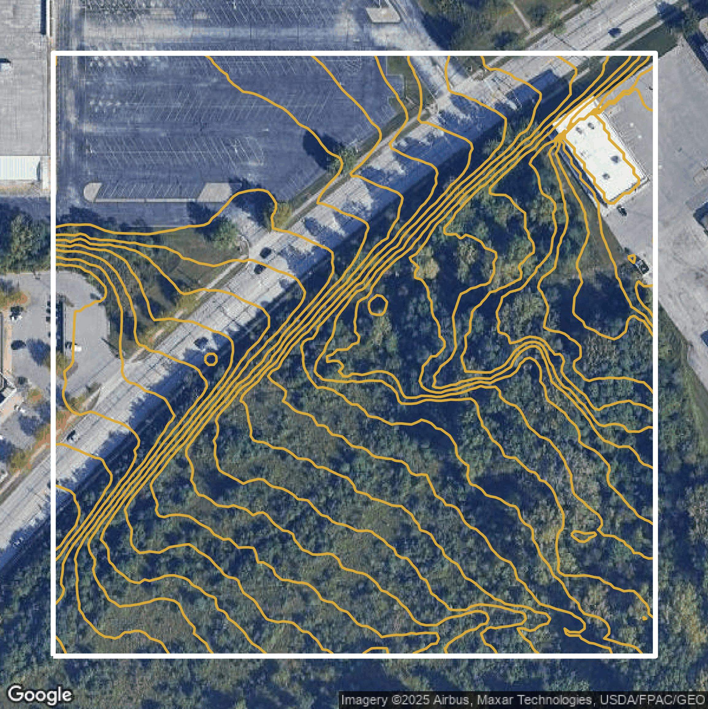
Contours
Contours in Cuyahoga County visualize 3D elevations on a 2D surface allowing you to better understand your site.
Get Contours for Cuyahoga County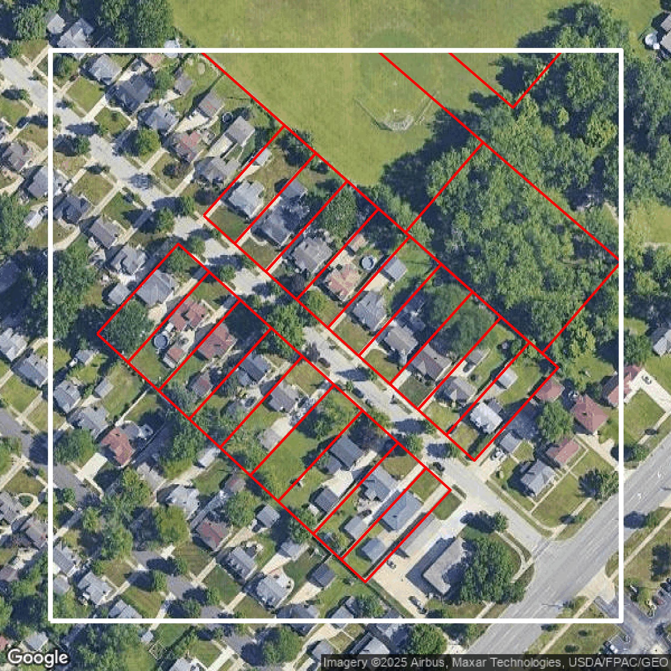
Parcels and Buildings
Accessing Cuyahoga County parcel and building data on Equator gives you access to coverage across the US.
Get Parcels and Buildings for Cuyahoga County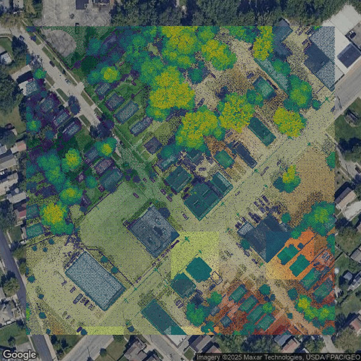
LiDAR
Cuyahoga County LiDAR uses include land surveying, analyzing crop health, or even archaeological studies.
Get LiDAR for Cuyahoga County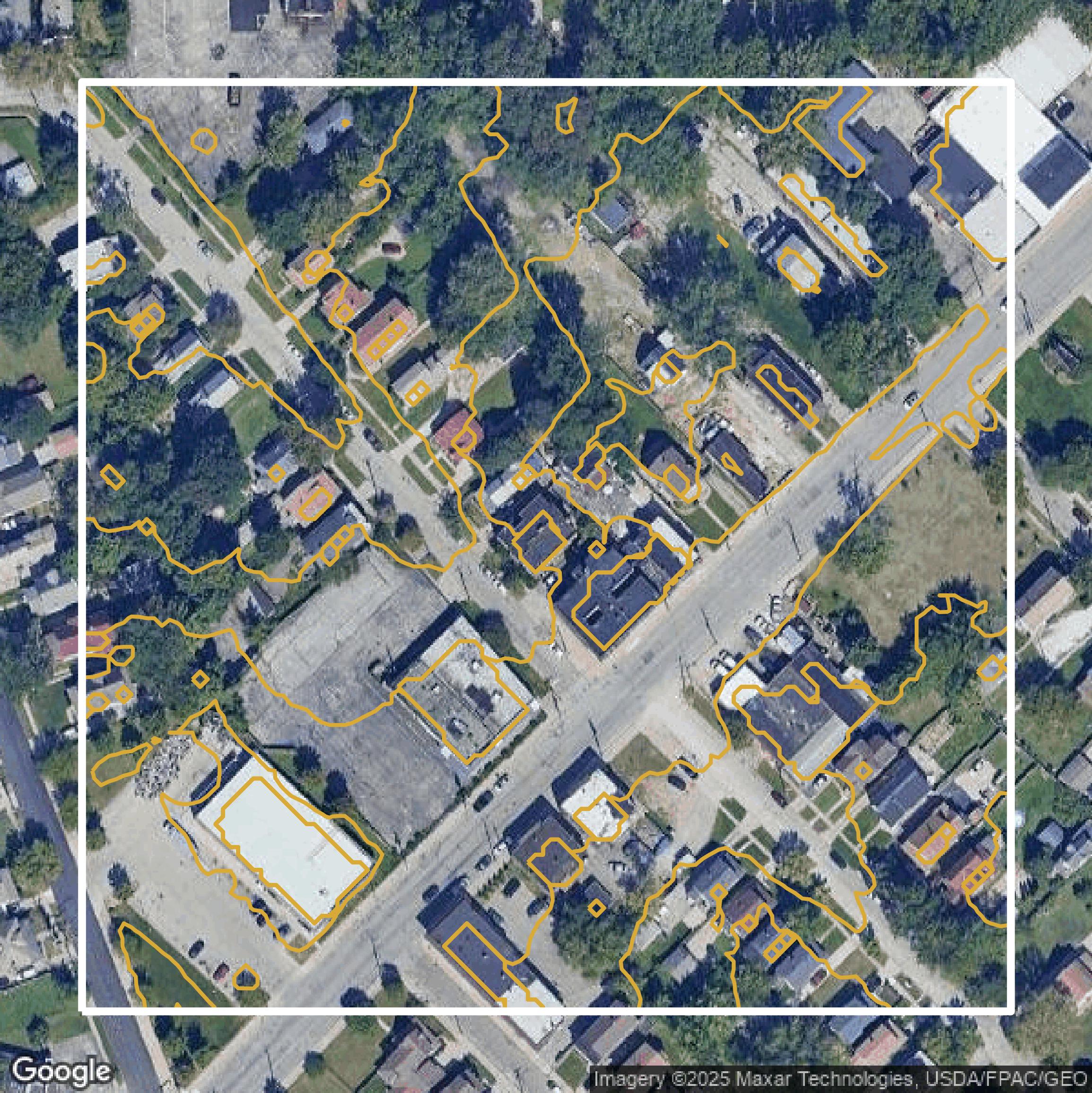
Contours
Cuyahoga County contours can be used for construction & engineering, environmental science, and more.
Get Contours for Cuyahoga County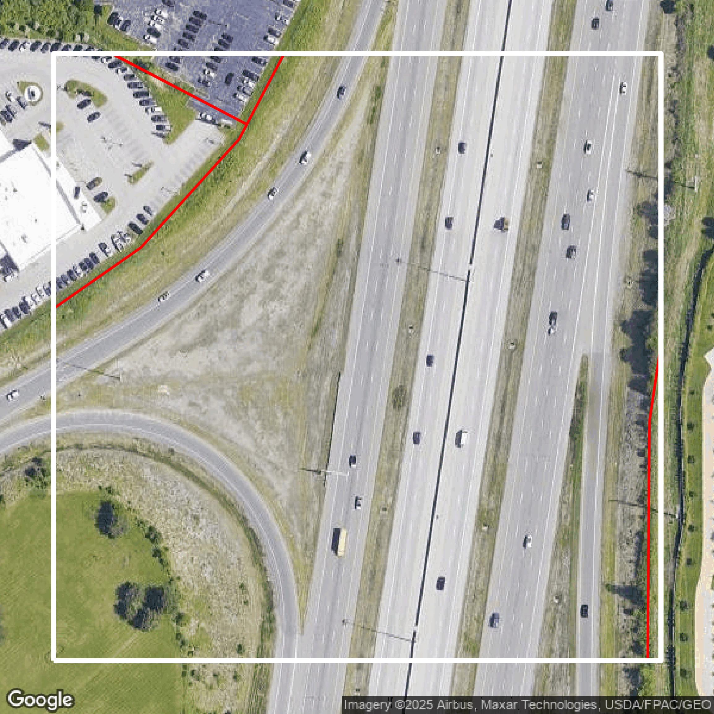
Parcels and Buildings
Dozens of fields are contained within each Cuyahoga County parcel and building data, including zoning, owners, and year built.
Get Parcels and Buildings for Cuyahoga CountyLiDAR
Equator turns Cuyahoga County LiDAR point clouds into various lidar-derived data sets, including DEMs.
Get LiDAR for Cuyahoga CountyContours
Cuyahoga County contours on Equator are produced from LiDAR coverage, allowing for high precision
Get Contours for Cuyahoga County