Overview
Fairfield County GIS Data - For CAD
Equator helps civil engineering, architecture and consulting firms with the tools to instantly find, process and download accurate LiDAR, contours, parcel data, building footprints, DEMs, point clouds and other GIS data for Fairfield County in an online web mapping portal.
Fairfield County GIS Data ->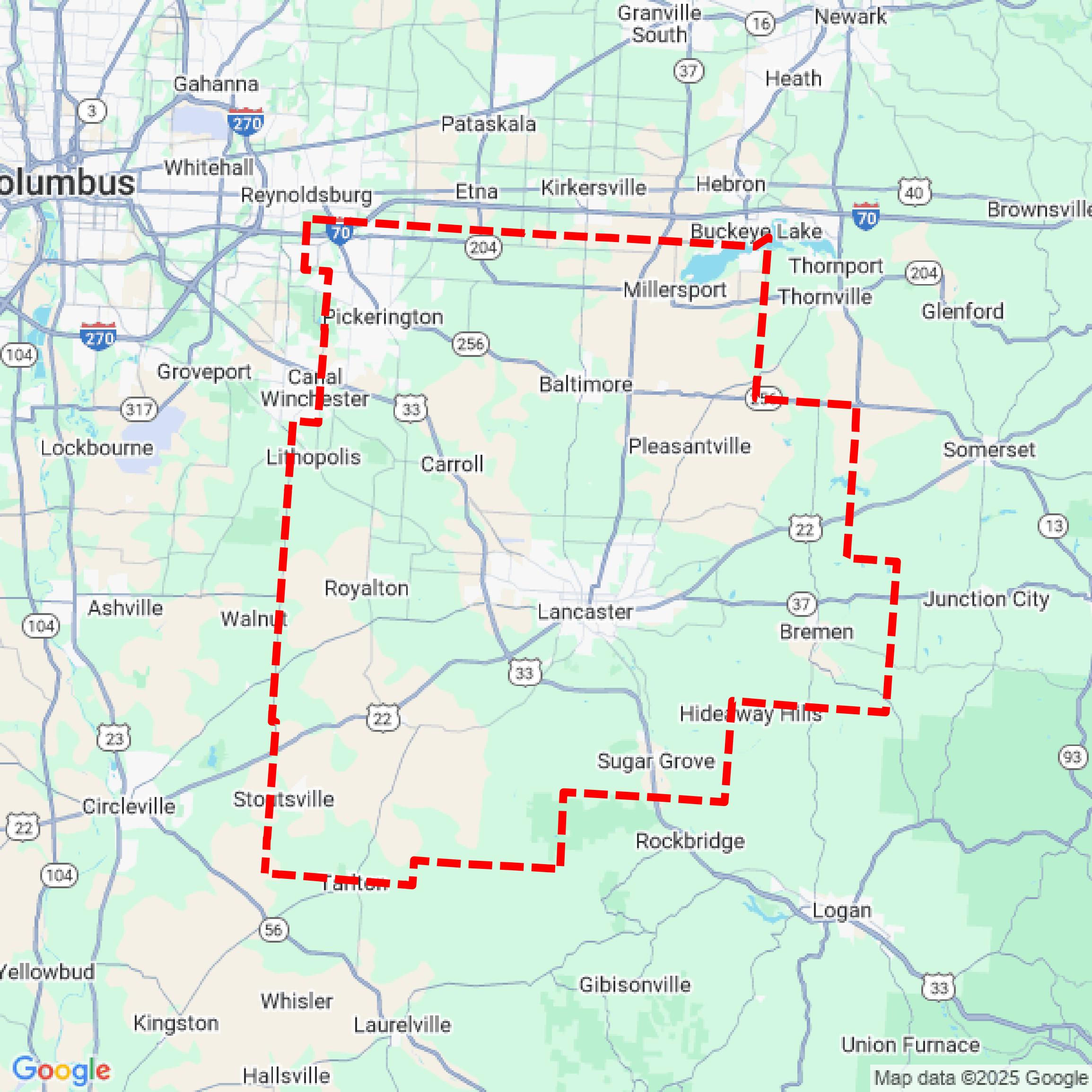

Data Available
Download GIS Data for Fairfield County
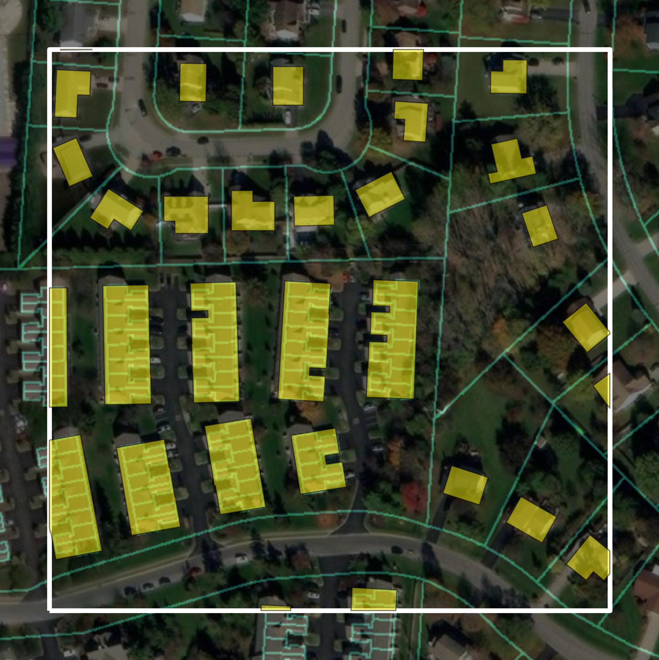
Parcels and Buildings
This image shows parcel and building data in Fairfield County created using GIS data in Equator.
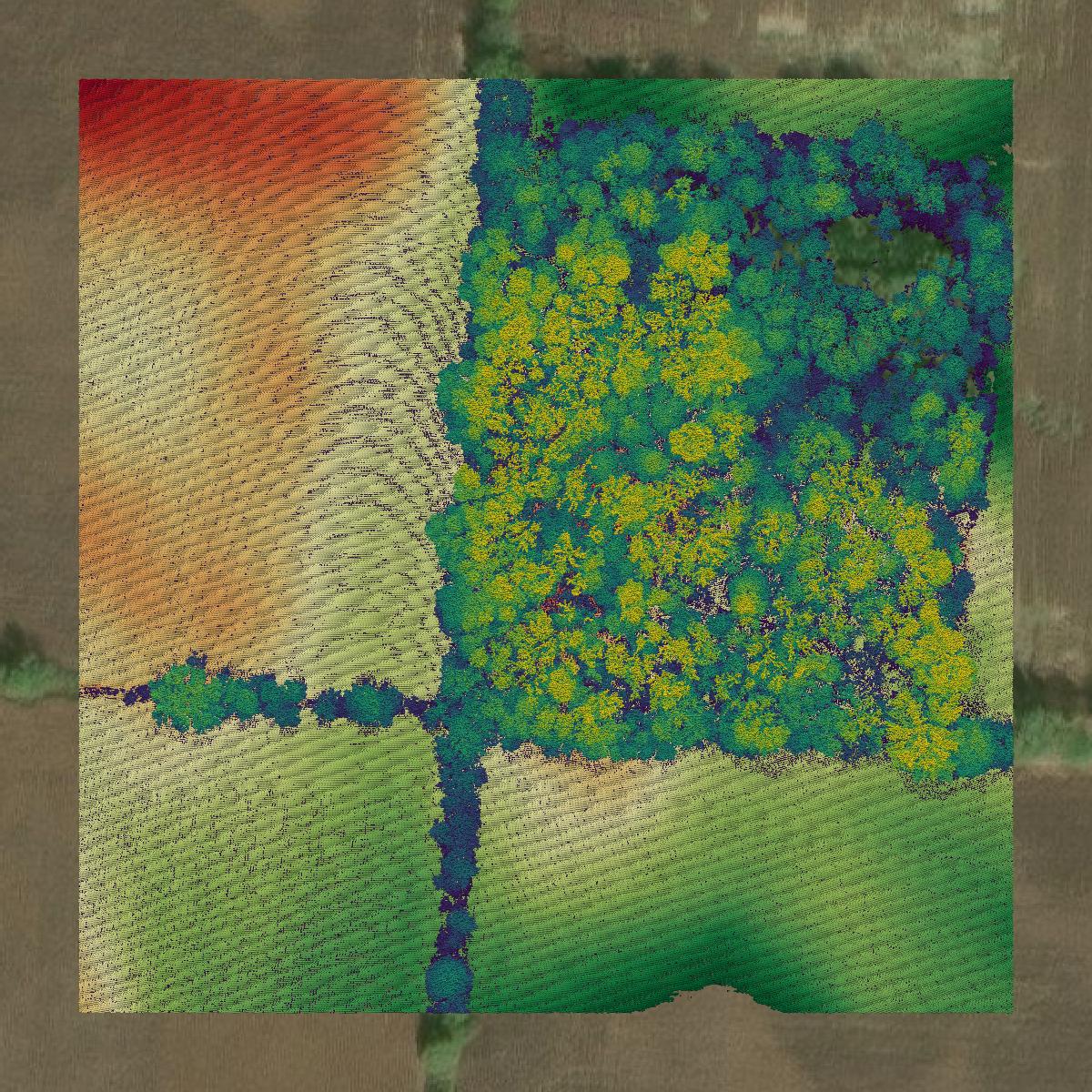
LiDAR
This image shows a LiDAR point cloud in Fairfield County created using GIS data in Equator.
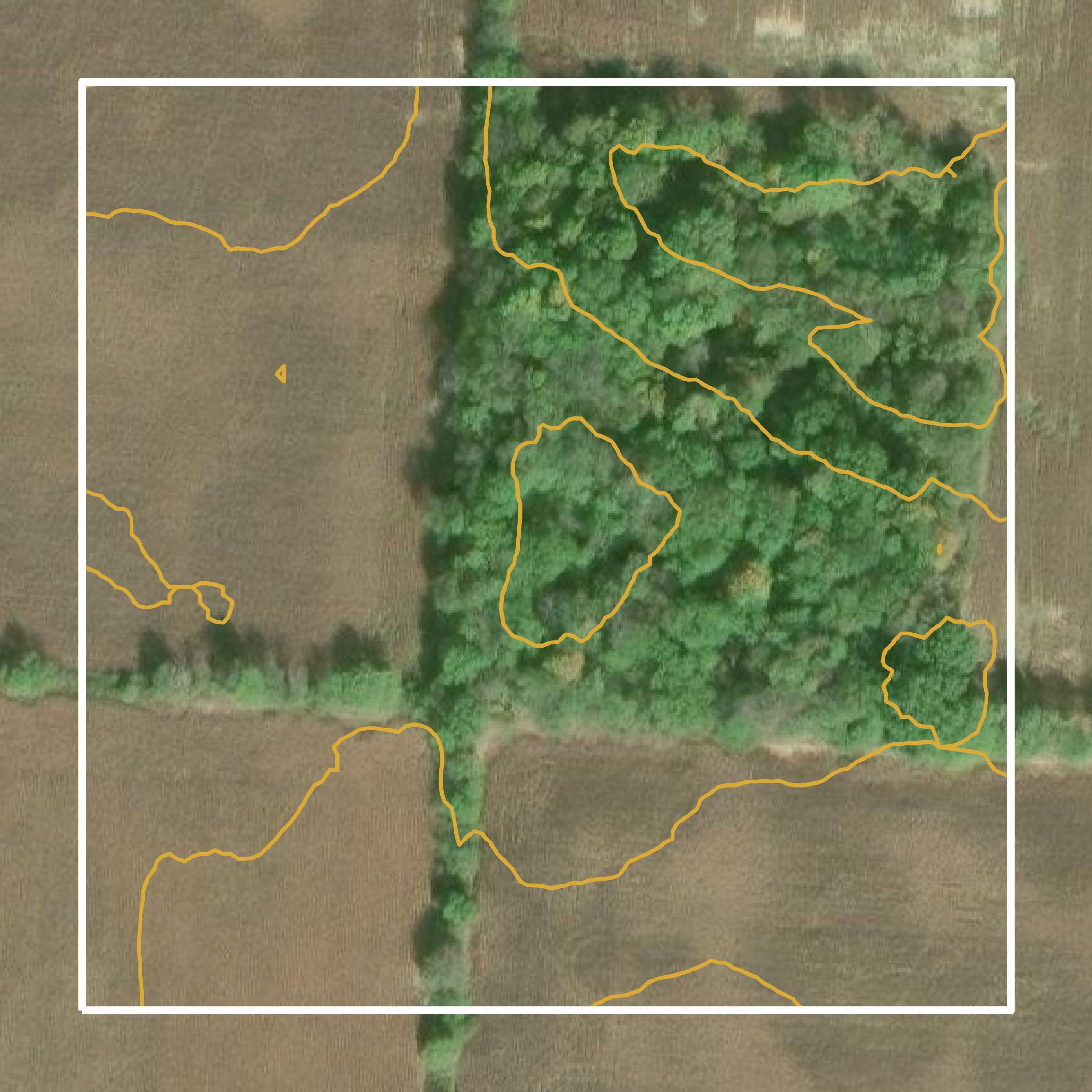
Contours
This image shows a contour map in Fairfield County created using GIS data in Equator.
Formats Available
Export Your Data Ready to Use in Multiple Formats
DWG
AutoCAD Drawing - Industry-standard CAD format
Supported Data:
Contour, Parcel, Building Outline
SHP
Shapefile - Standard GIS vector format
Supported Data:
Contour, Parcel, Building Outline
DXF
Drawing Exchange Format - Universal CAD interchange
Supported Data:
Contour, Building Outline
GeoJSON
Geographic JSON - Web-friendly spatial data format
Supported Data:
Contour, Parcel, Building Outline
LAZ
Compressed LAS - Efficient LiDAR point cloud format
Supported Data:
Point Cloud
SVG
Scalable Vector Graphics - Web vector format
Supported Data:
Contour, Building Outline
GPKG
GeoPackage - Modern OGC spatial database format
Supported Data:
Contour, Parcel, Building Outline
LandXML (Coming Soon)
Land XML - Civil engineering data exchange format
Supported Data:
Point Cloud
TIN (Coming Soon)
Triangulated Irregular Network - 3D surface model
Supported Data:
Point Cloud
XYZ (Coming Soon)
XYZ Point Cloud - Simple ASCII point cloud format
Supported Data:
Point Cloud
Background
GIS Data for Fairfield County
The "Map of the Month" webpage from the Fairfield County Auditor's Office features a series of monthly maps highlighting various geographic and historical aspects of Fairfield County, Ohio. Each month, a new thematic map is presented, showcasing topics such as local landmarks, events, and community resources. The content includes a variety of GIS datasets, such as parcel data, zoning information, and aerial imagery, which are accessible through downloadable PDFs. This initiative serves to demonstrate the mapping capabilities of the GIS Office while providing residents and visitors with valuable spatial data resources.
Access Fairfield County GIS Data in Equator →Fairfield County Portal →Showcase
Sample GIS Data for Fairfield County
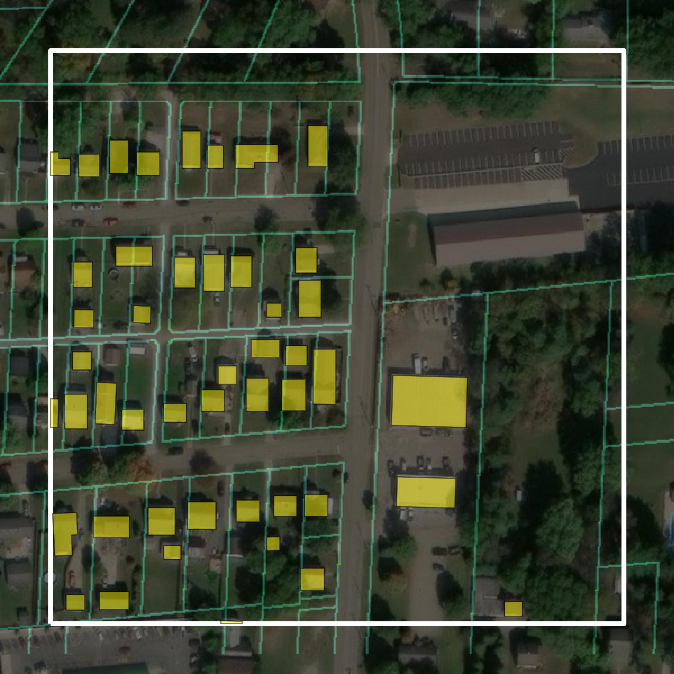
Parcels and Buildings
Parcel and building data in Fairfield County are used in a variety of fields including architecture, real estate, and urban planning.
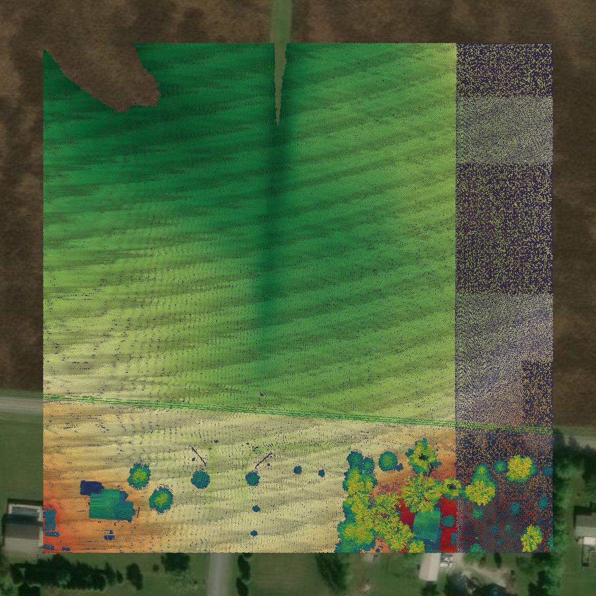
LiDAR
Point clouds (LiDAR) in Fairfield County can produce highly accurate 3D models of terrain, structures, and vegetation.
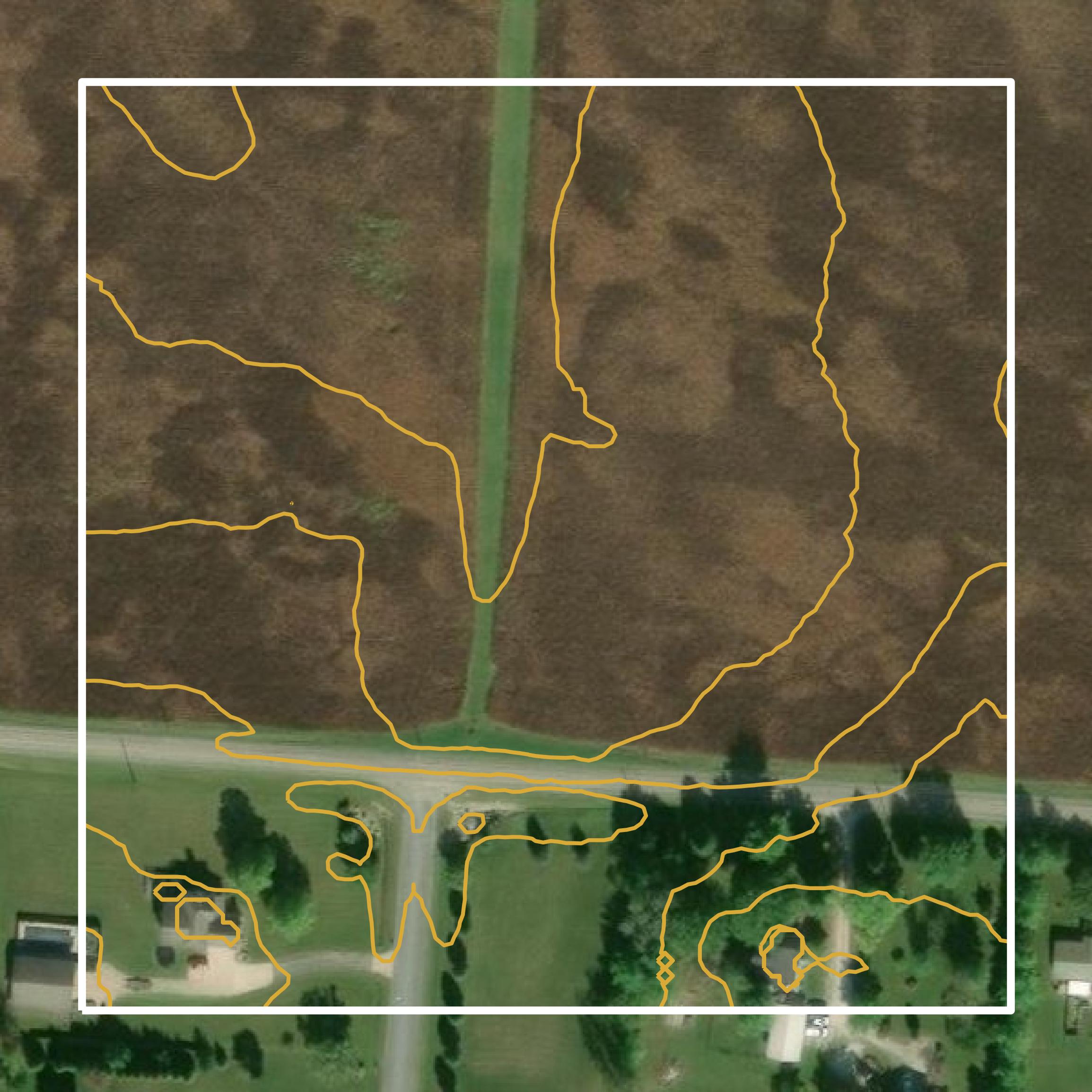
Contours
Contours in Fairfield County visualize 3D elevations on a 2D surface allowing you to better understand your site.