Overview
Ross County GIS Data - For CAD
Equator helps civil engineering, architecture and consulting firms with the tools to instantly find, process and download accurate LiDAR, contours, parcel data, building footprints, DEMs, point clouds and other GIS data for Ross County in an online web mapping portal.
Ross County GIS Data ->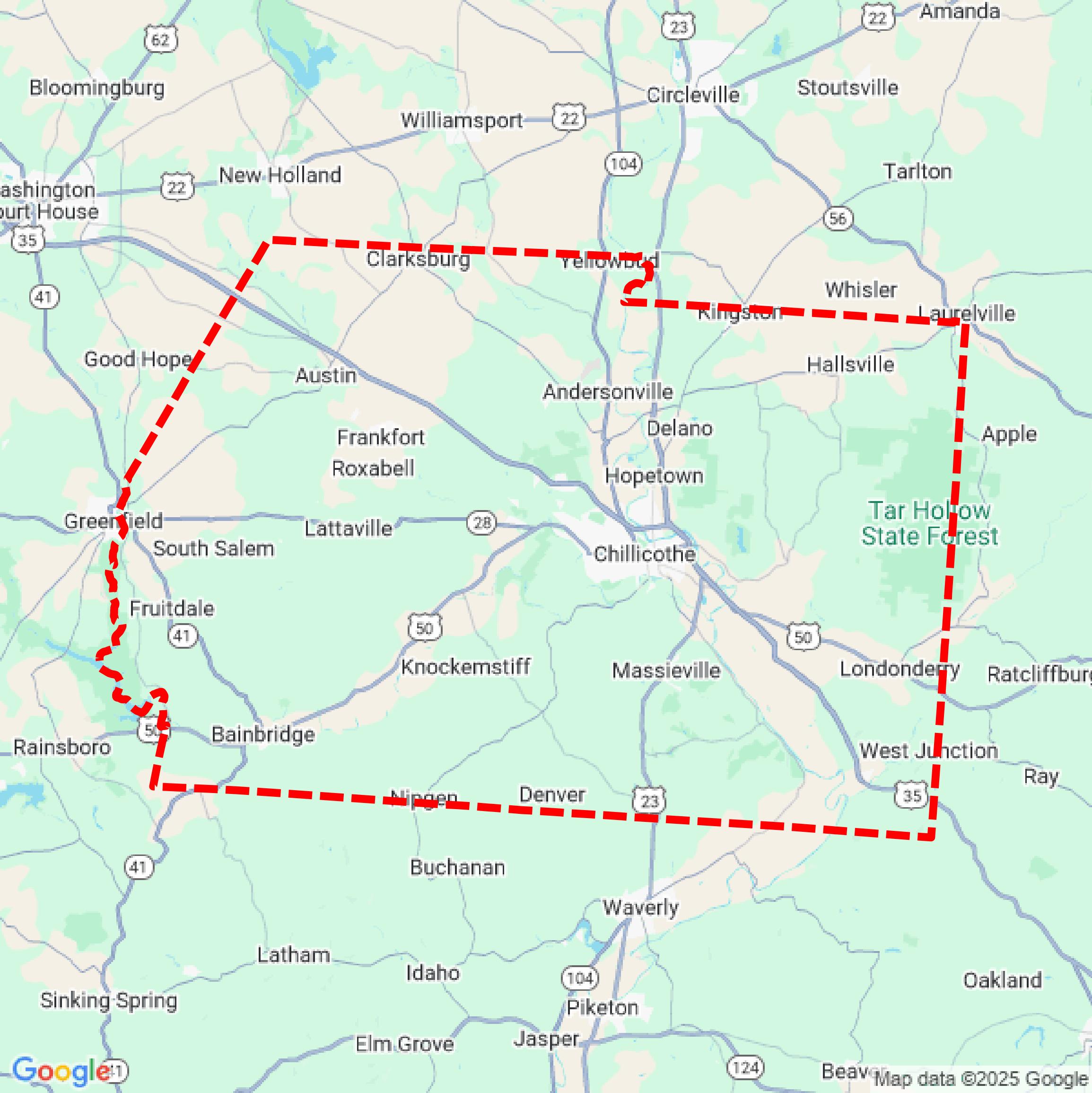

Data Available
Download GIS Data for Ross County
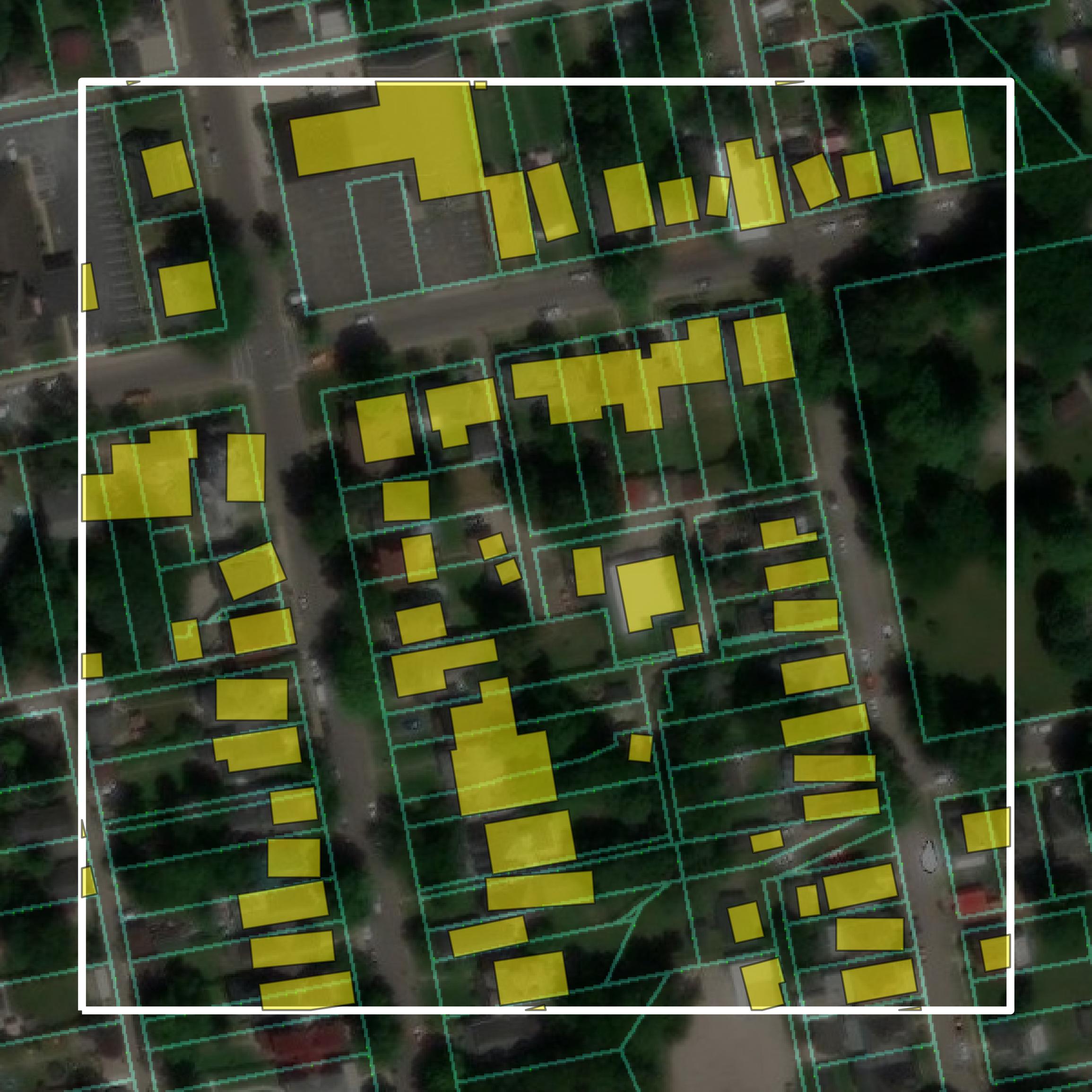
Parcels and Buildings
This image shows parcel and building data in Ross County created using GIS data in Equator.
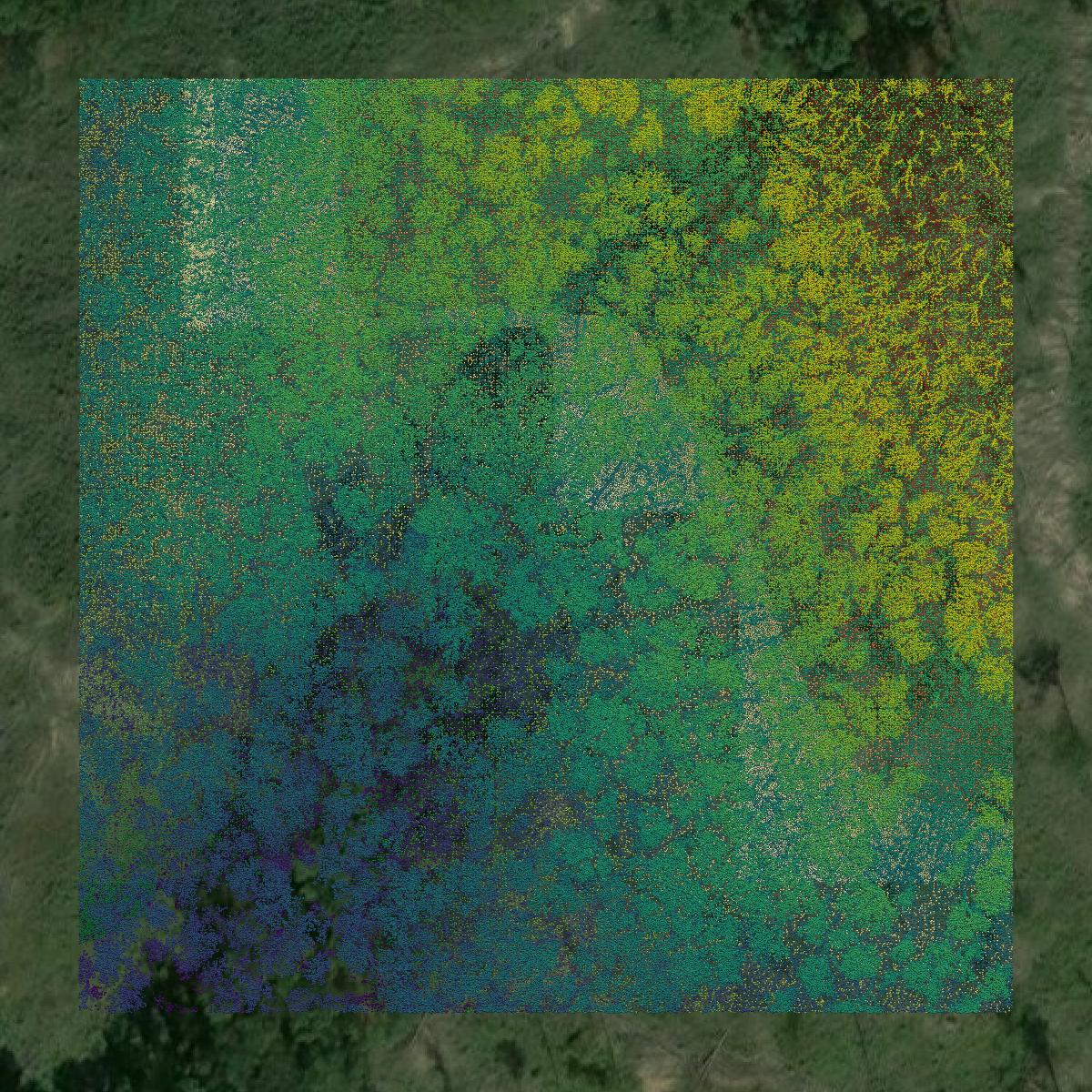
LiDAR
This image shows a LiDAR point cloud in Ross County created using GIS data in Equator.
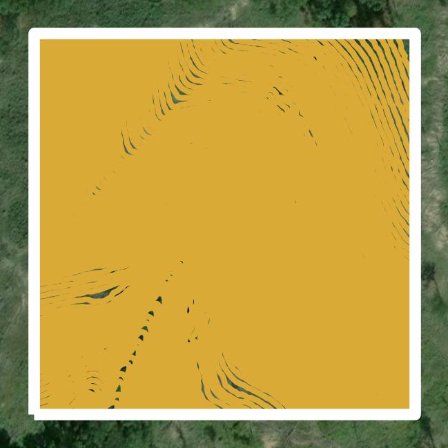
Contours
This image shows a contour map in Ross County created using GIS data in Equator.
Formats Available
Export Your Data Ready to Use in Multiple Formats
DWG
AutoCAD Drawing - Industry-standard CAD format
Supported Data:
Contour, Parcel, Building Outline
SHP
Shapefile - Standard GIS vector format
Supported Data:
Contour, Parcel, Building Outline
DXF
Drawing Exchange Format - Universal CAD interchange
Supported Data:
Contour, Building Outline
GeoJSON
Geographic JSON - Web-friendly spatial data format
Supported Data:
Contour, Parcel, Building Outline
LAZ
Compressed LAS - Efficient LiDAR point cloud format
Supported Data:
Point Cloud
SVG
Scalable Vector Graphics - Web vector format
Supported Data:
Contour, Building Outline
GPKG
GeoPackage - Modern OGC spatial database format
Supported Data:
Contour, Parcel, Building Outline
LandXML (Coming Soon)
Land XML - Civil engineering data exchange format
Supported Data:
Point Cloud
TIN (Coming Soon)
Triangulated Irregular Network - 3D surface model
Supported Data:
Point Cloud
XYZ (Coming Soon)
XYZ Point Cloud - Simple ASCII point cloud format
Supported Data:
Point Cloud
Background
GIS Data for Ross County
The Ross County Engineer's Map Room webpage provides access to a variety of geographic information system (GIS) datasets and spatial data resources pertinent to Ross County, Ohio. Available content includes property maps, plat maps, county aerial photographs, and historical records dating back to the county's founding in 1798. The site serves as a repository for essential mapping information and is staffed by experienced personnel who assist the public with inquiries related to these resources.
Access Ross County GIS Data in Equator →Ross County Portal →