Overview
Franklin County GIS Data – For CAD
Equator helps civil engineering, architecture and consulting firms with the tools to instantly find, process and download accurate LiDAR, contours, parcel data, building footprints, DEMs, point clouds and other GIS data for Franklin County in an online web mapping portal.
Franklin County GIS Data →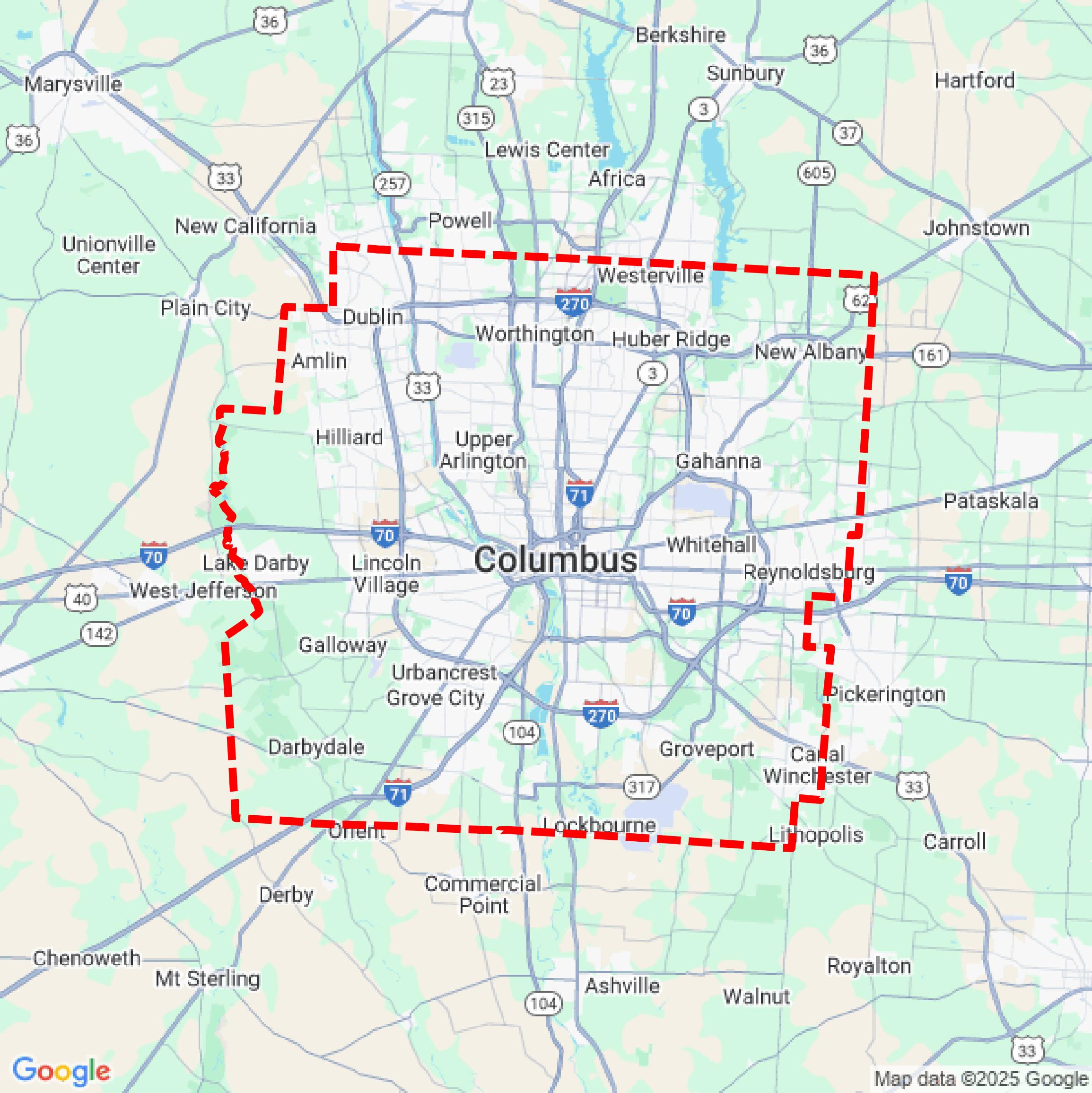

Data Available
Download GIS Data for Franklin County
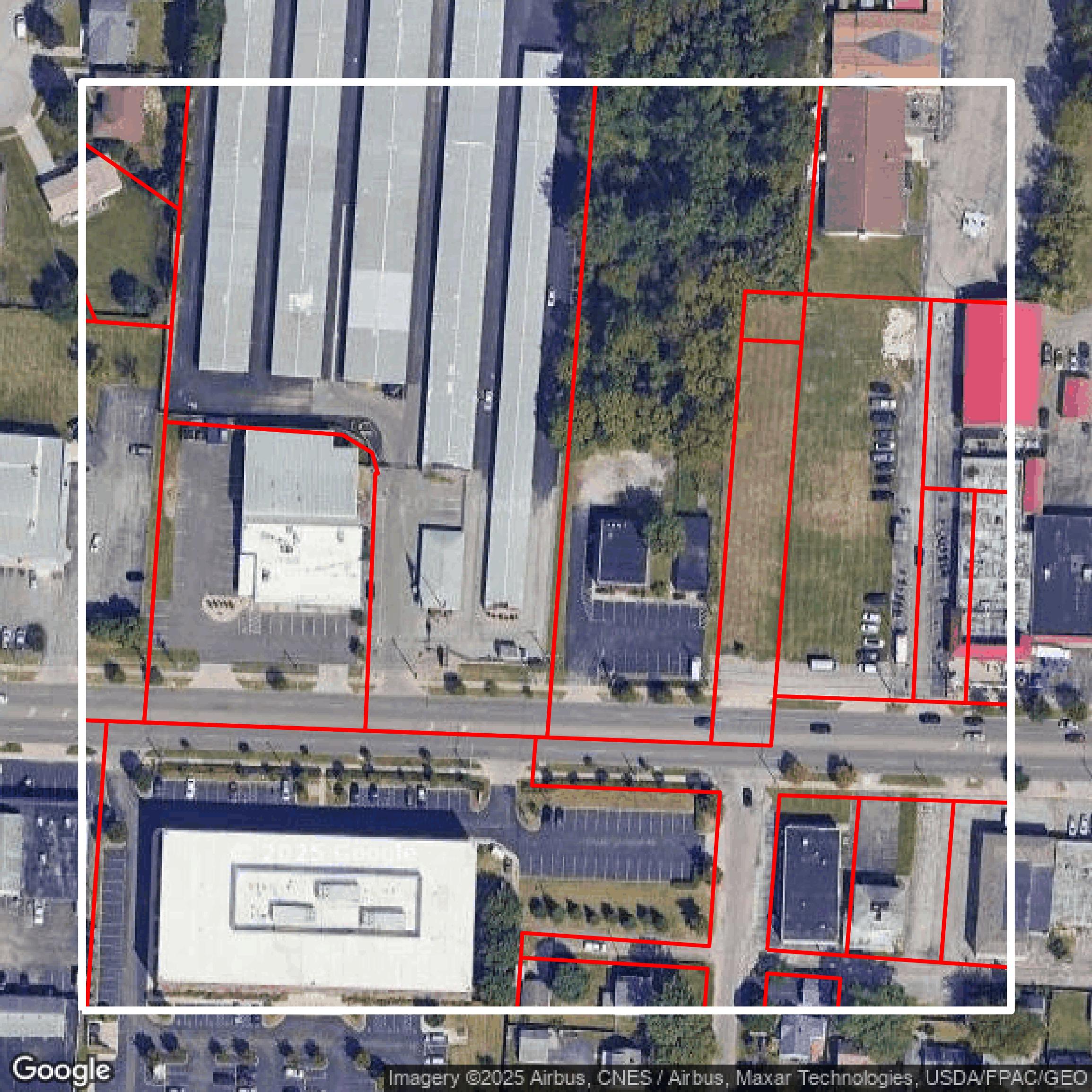
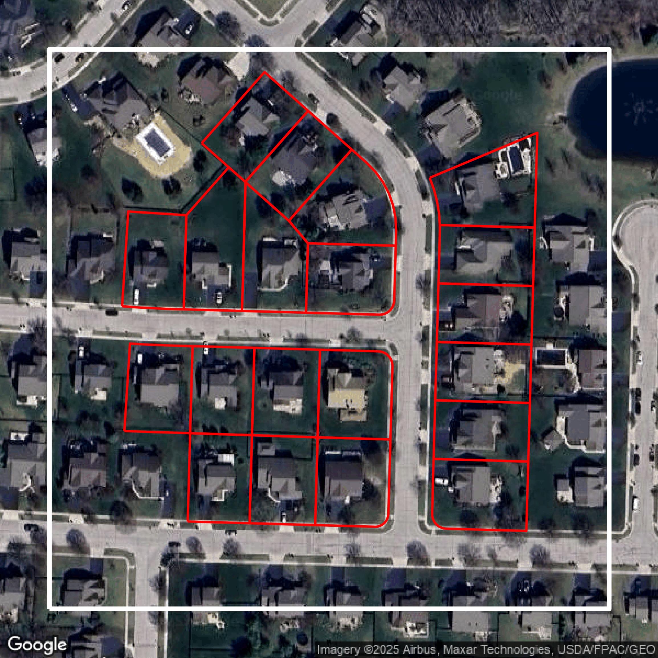
Parcels and Buildings
This image shows parcel and building data in Franklin County created using GIS data in Equator.
Get Parcels and Buildings for Franklin County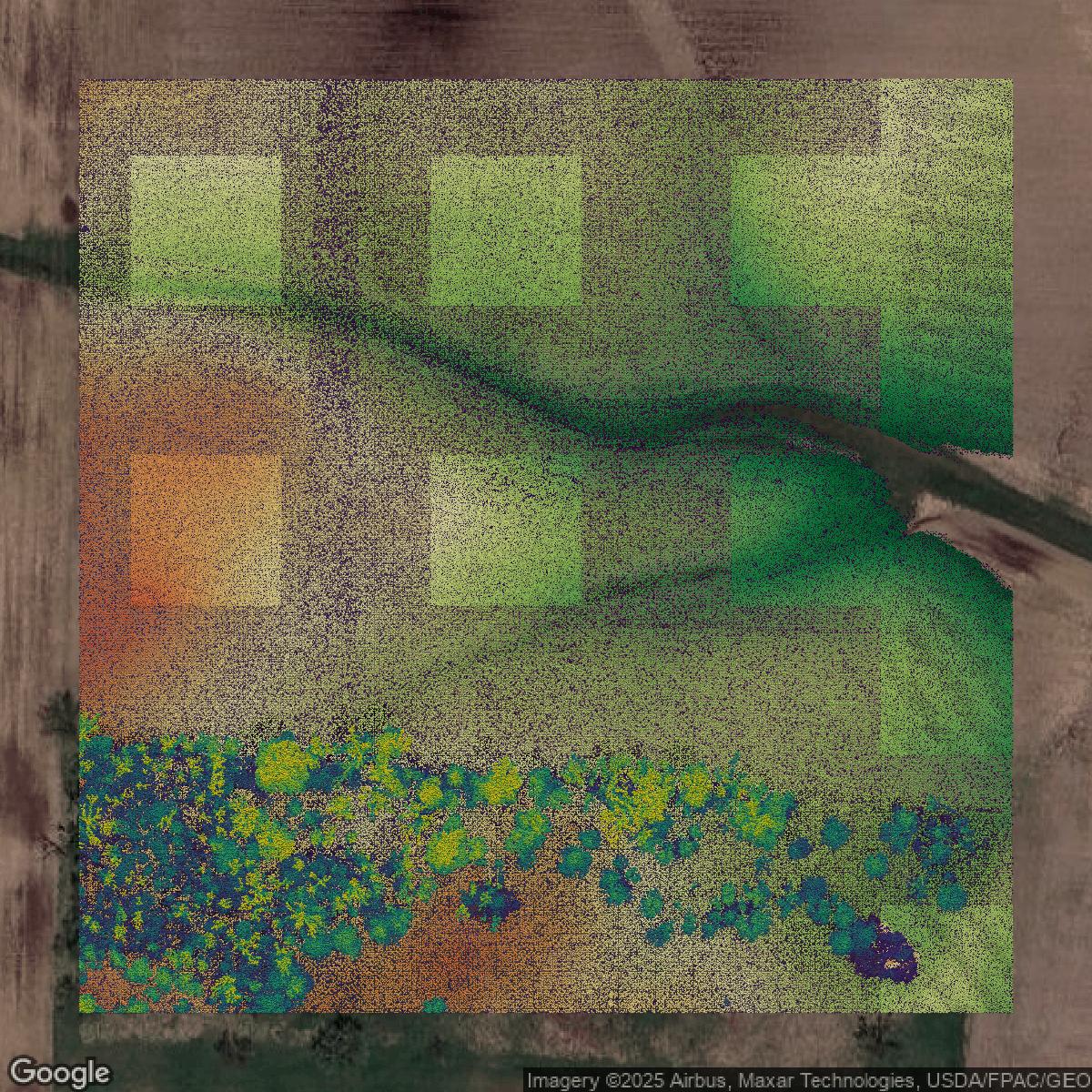
LiDAR
This image shows a LiDAR point cloud in Franklin County created using GIS data in Equator.
Get LiDAR for Franklin County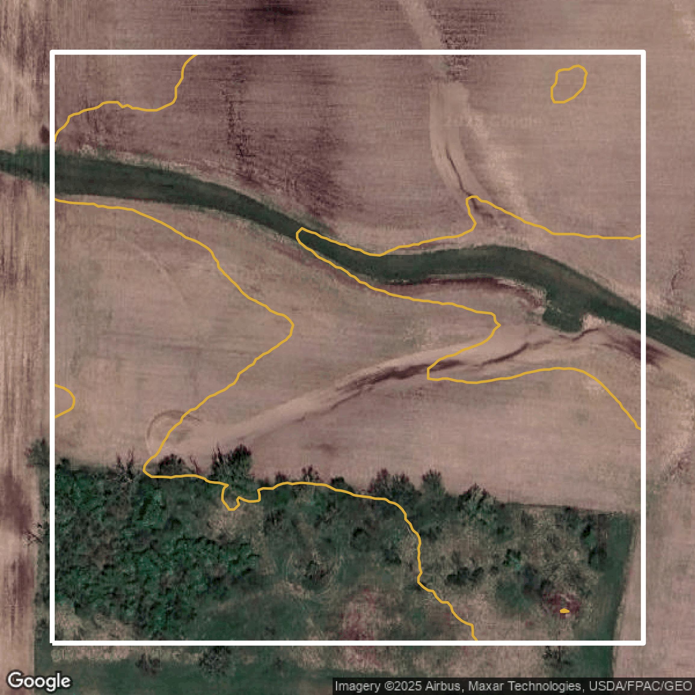
Contours
This image shows a contour map in Franklin County created using GIS data in Equator.
Get Contours for Franklin CountyFormats Available
Export Your Data Ready to Use in Multiple Formats
DWG
AutoCAD Drawing - Industry-standard CAD format
Supported Data:
Contour, Parcel, Building Outline
SHP
Shapefile - Standard GIS vector format
Supported Data:
Contour, Parcel, Building Outline
DXF
Drawing Exchange Format - Universal CAD interchange
Supported Data:
Contour, Building Outline
GeoJSON
Geographic JSON - Web-friendly spatial data format
Supported Data:
Contour, Parcel, Building Outline
LAZ
Compressed LAS - Efficient LiDAR point cloud format
Supported Data:
Point Cloud
SVG
Scalable Vector Graphics - Web vector format
Supported Data:
Contour, Building Outline
GPKG (Coming Soon)
GeoPackage - Modern OGC spatial database format
Supported Data:
Contour, Parcel, Building Outline
LandXML (Coming Soon)
Land XML - Civil engineering data exchange format
Supported Data:
Point Cloud
TIN (Coming Soon)
Triangulated Irregular Network - 3D surface model
Supported Data:
Point Cloud
XYZ (Coming Soon)
XYZ Point Cloud - Simple ASCII point cloud format
Supported Data:
Point Cloud
Background
GIS Data for Franklin County
The Franklin County Auditor’s website offers a comprehensive suite of data and tools designed to support residents, property owners, and professionals with accurate and accessible geospatial and fiscal information. Visitors can explore the “Real Estate” section featuring tools such as “Property Search,” “Property eAlerts,” “Appraisal,” “Agricultural Use (CAUV),” “Tax Incentives,” and services for “Board of Revision” including “BOR Case Document Search” and “Hearing Schedules.” The “Geospatial Technologies (GIS)” page provides access to specialized “Products and Services” and detailed “Data Organization.” For fiscal matters, users can navigate resources under “Financial Reporting,” “County Finances,” and “Unclaimed Funds Search.” The site also supports consumers through licensing services including “Dog Licensing,” “Kennel License,” and “Weights and Measures” information, alongside various “Form Centers” that streamline processes like “Transfer & Conveyance” and tax-related applications. Comprehensive FAQs, contact options, and community relations content further enhance the user experience, making it a valuable portal for detailed geographic, property, licensing, and fiscal data in Franklin County.
Access Franklin County GIS Data in Equator →Franklin County Portal →Showcase
Sample GIS Data for Franklin County
Parcels and Buildings
Parcel and building data in Franklin County are used in a variety of fields including architecture, real estate, and urban planning.
Get Parcels and Buildings for Franklin County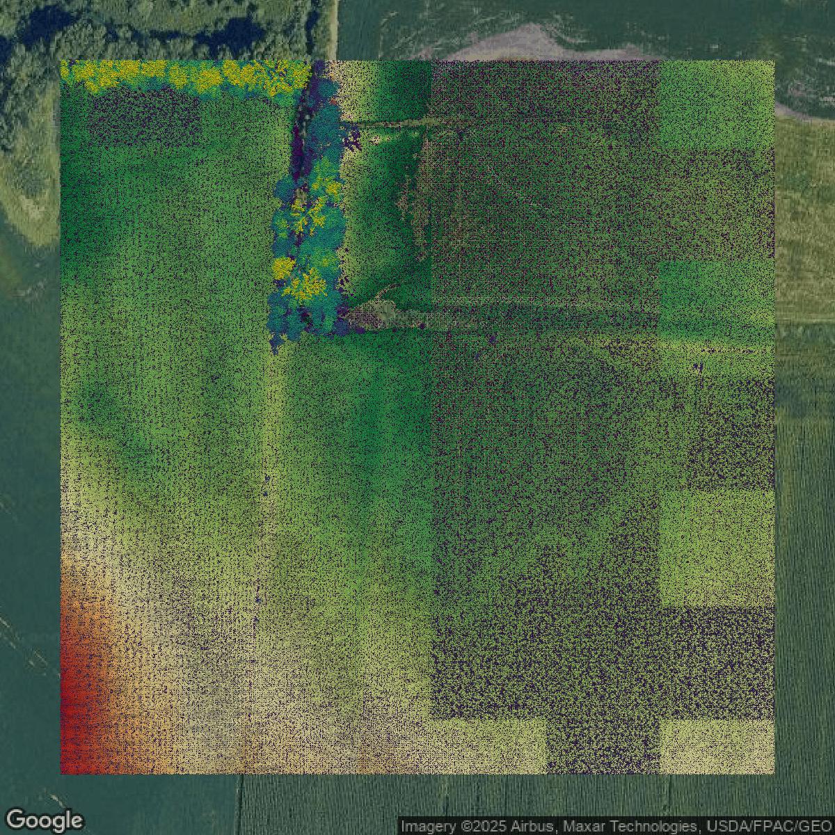
LiDAR
Point clouds (LiDAR) in Franklin County can produce highly accurate 3D models of terrain, structures, and vegetation.
Get LiDAR for Franklin County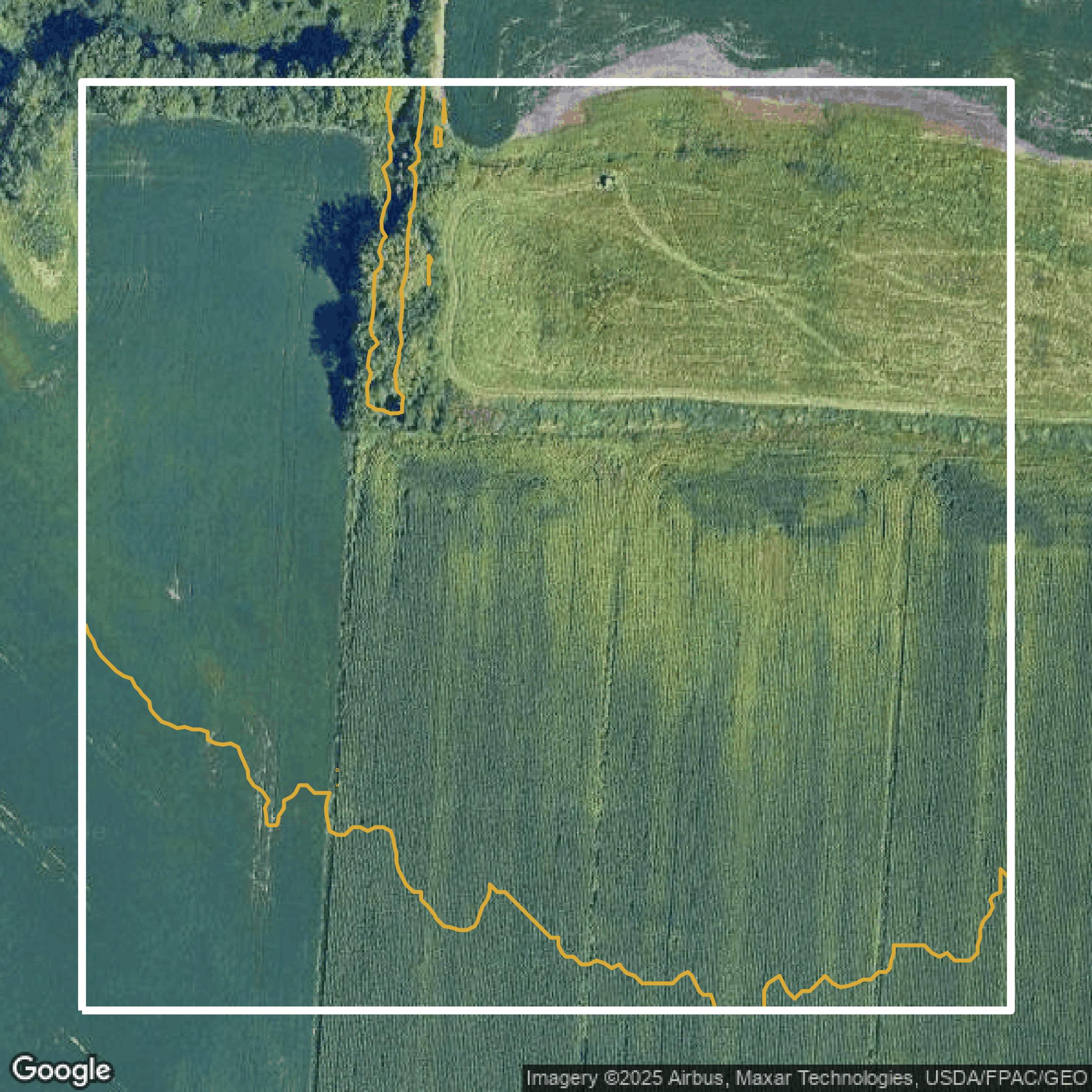
Contours
Contours in Franklin County visualize 3D elevations on a 2D surface allowing you to better understand your site.
Get Contours for Franklin County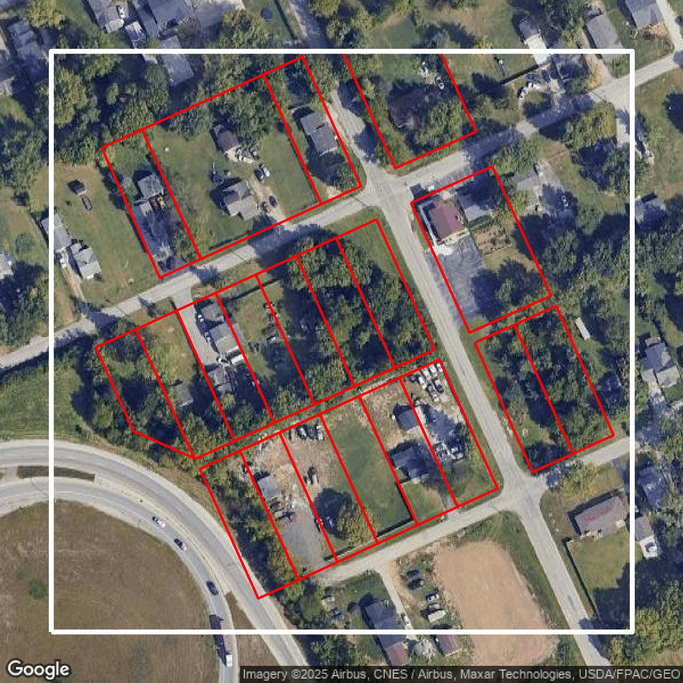
Parcels and Buildings
Accessing Franklin County parcel and building data on Equator gives you access to coverage across the US.
Get Parcels and Buildings for Franklin County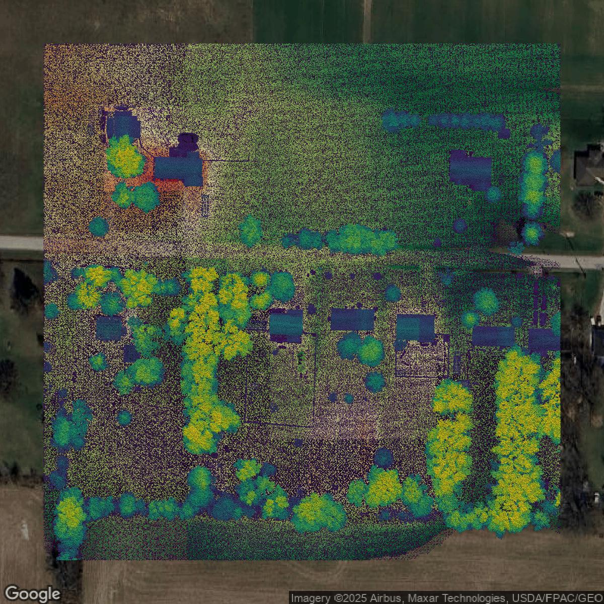
LiDAR
Franklin County LiDAR uses include land surveying, analyzing crop health, or even archaeological studies.
Get LiDAR for Franklin County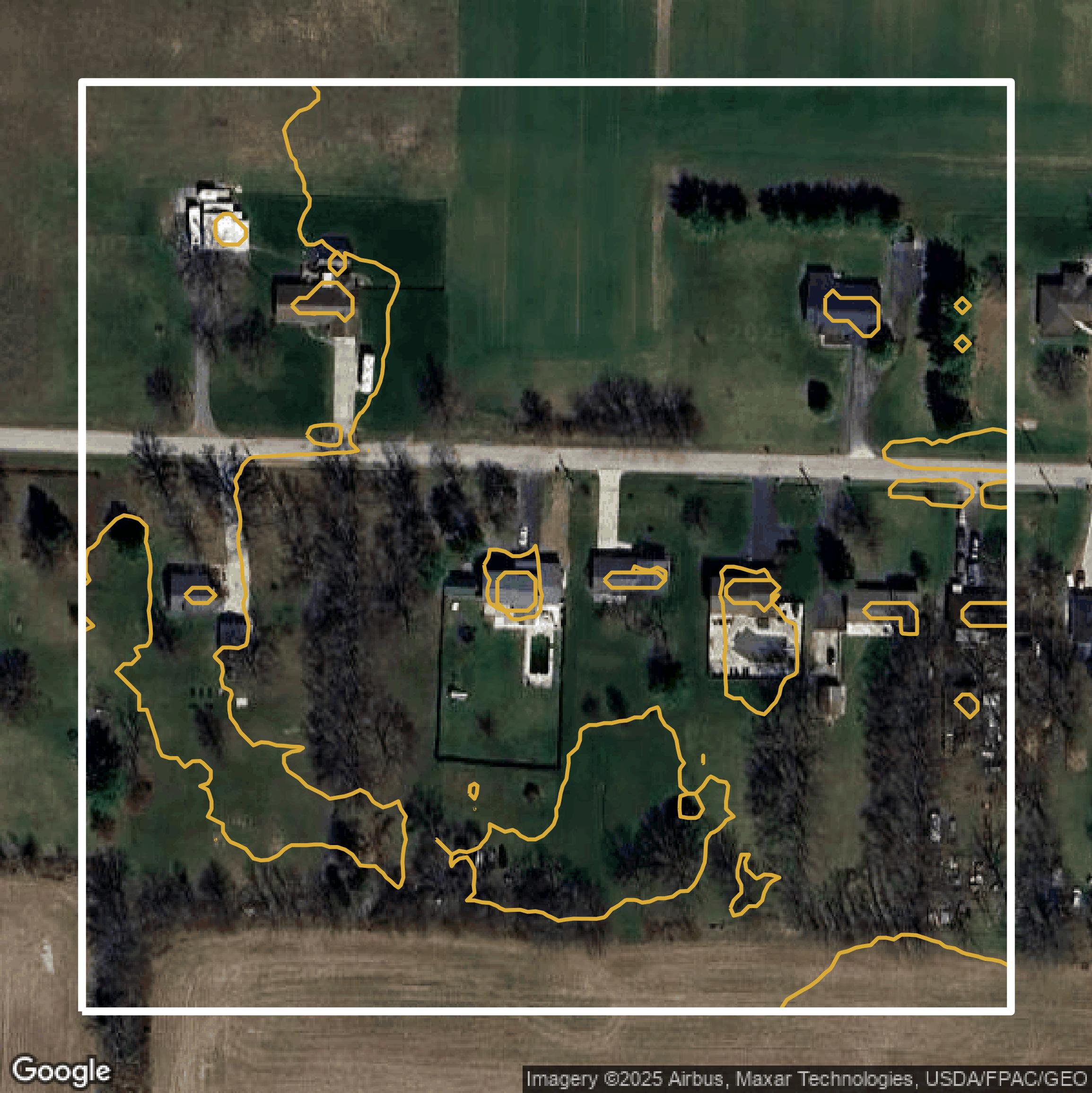
Contours
Franklin County contours can be used for construction & engineering, environmental science, and more.
Get Contours for Franklin County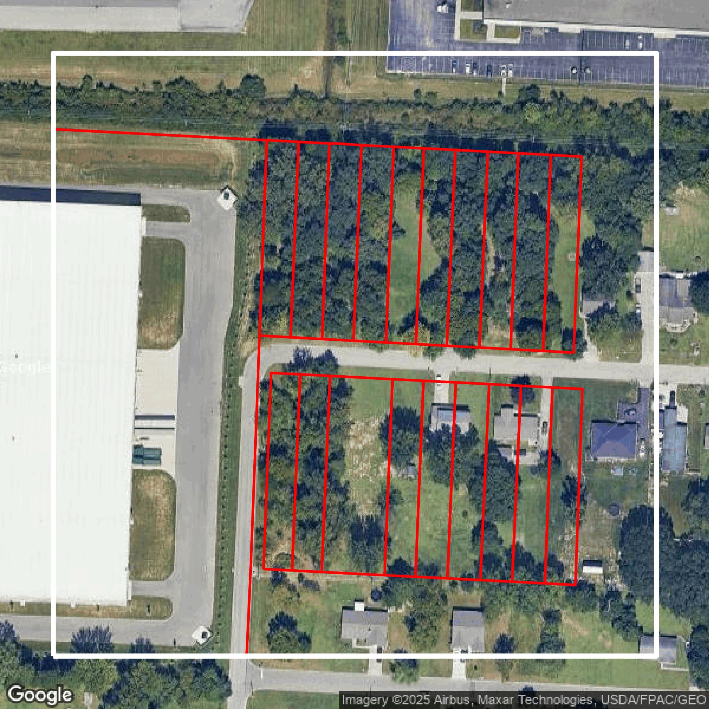
Parcels and Buildings
Dozens of fields are contained within each Franklin County parcel and building data, including zoning, owners, and year built.
Get Parcels and Buildings for Franklin County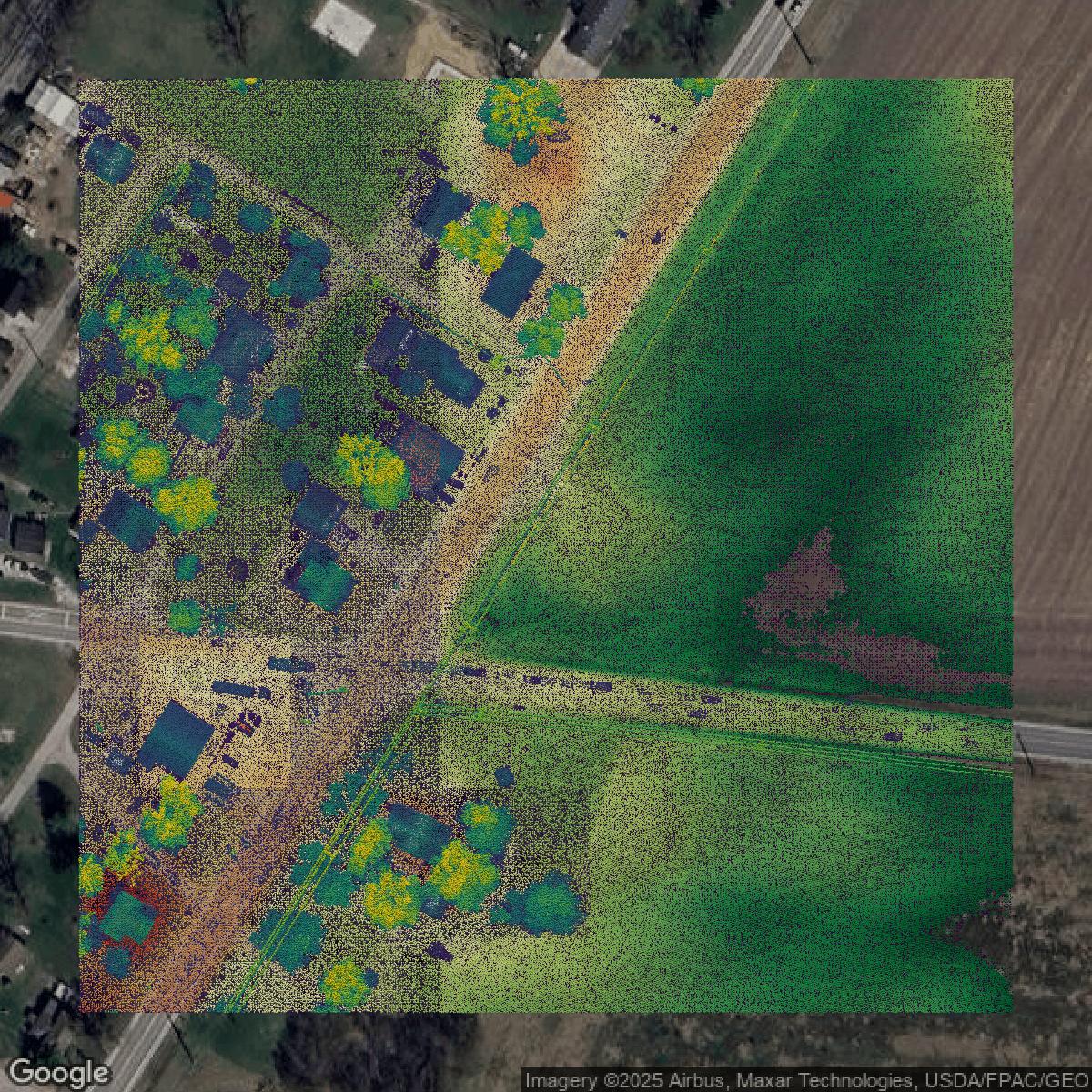
LiDAR
Equator turns Franklin County LiDAR point clouds into various lidar-derived data sets, including DEMs.
Get LiDAR for Franklin County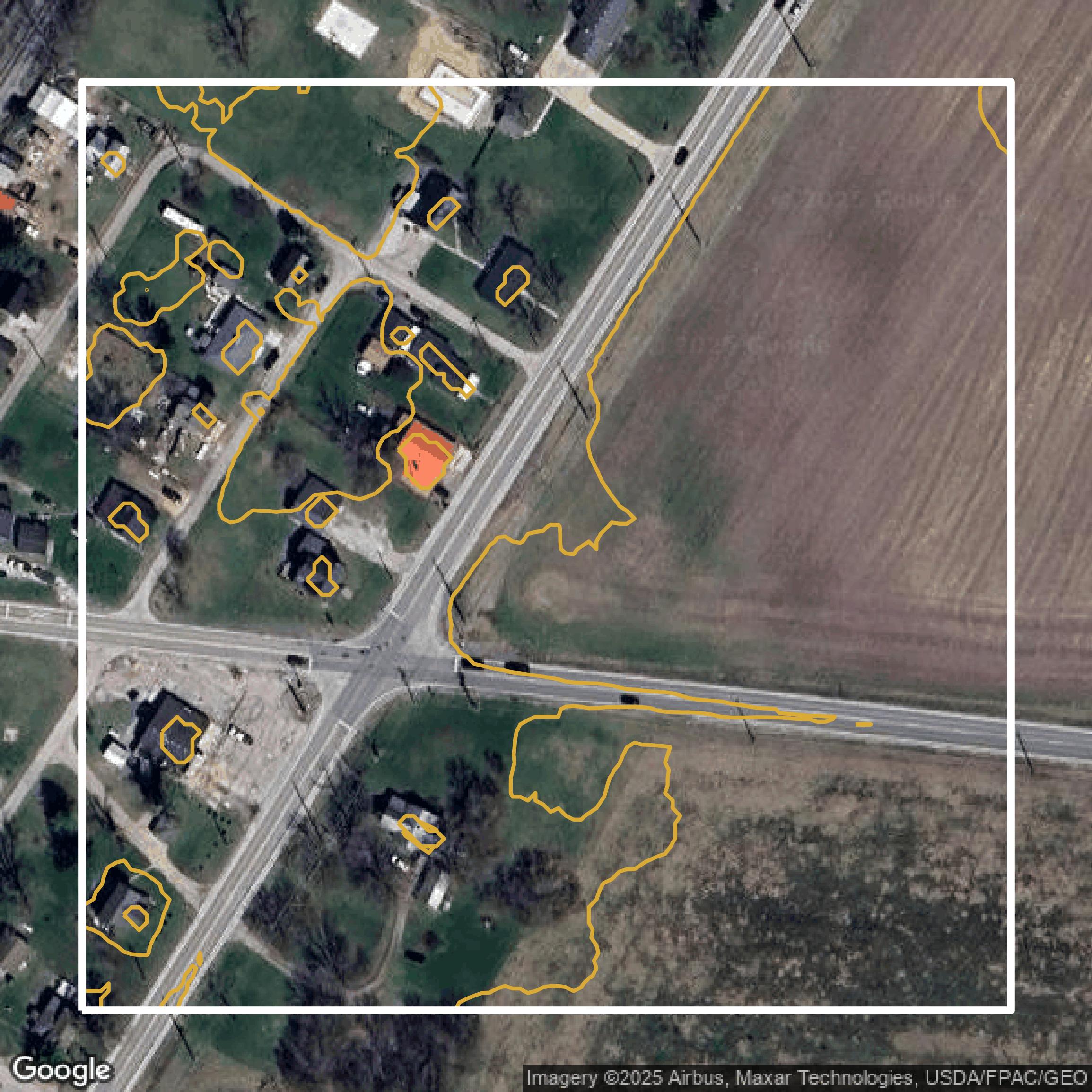
Contours
Franklin County contours on Equator are produced from LiDAR coverage, allowing for high precision
Get Contours for Franklin County