Overview
Licking County GIS Data – For CAD
Equator helps civil engineering, architecture and consulting firms with the tools to instantly find, process and download accurate LiDAR, contours, parcel data, building footprints, DEMs, point clouds and other GIS data for Licking County in an online web mapping portal.
Licking County GIS Data →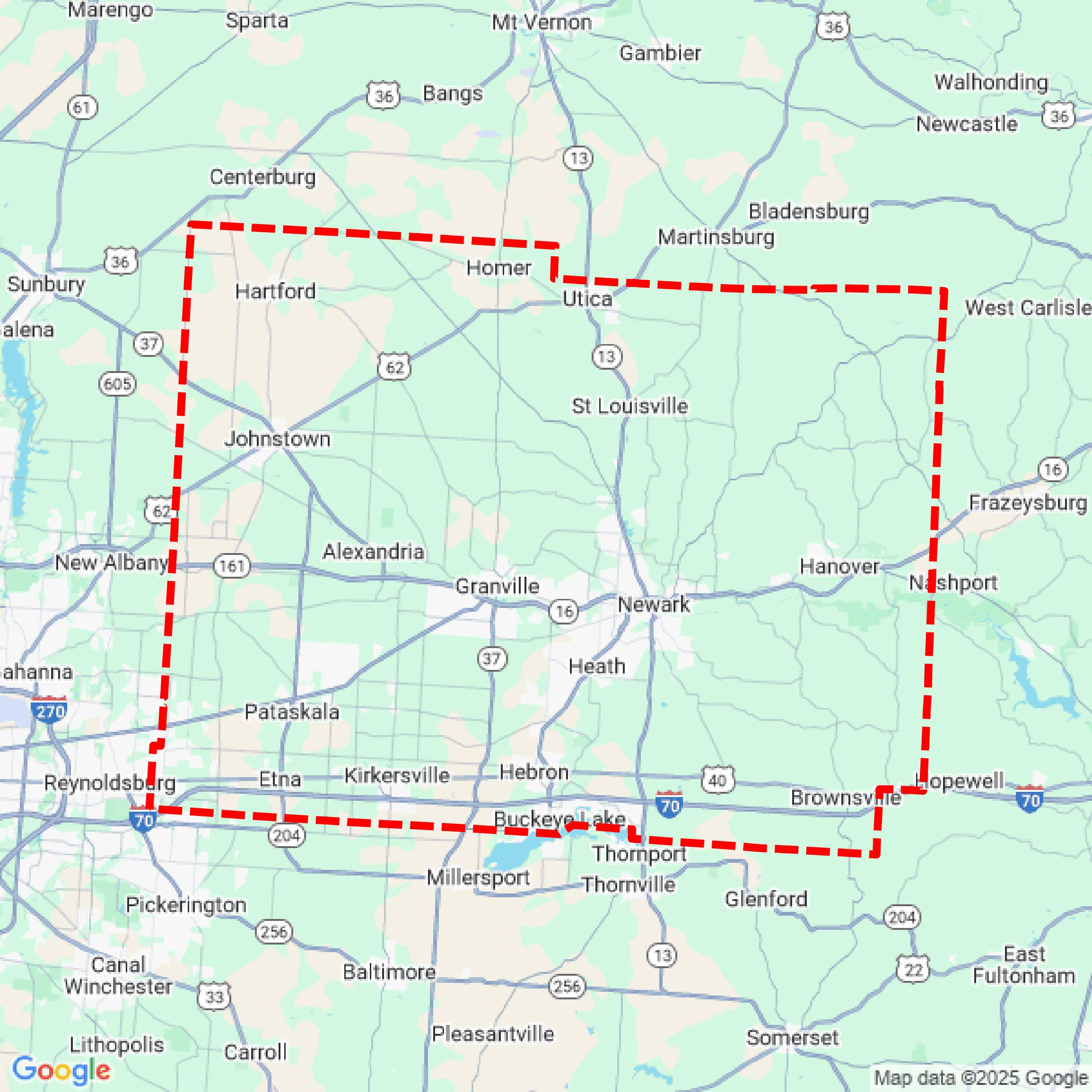

Data Available
Download GIS Data for Licking County
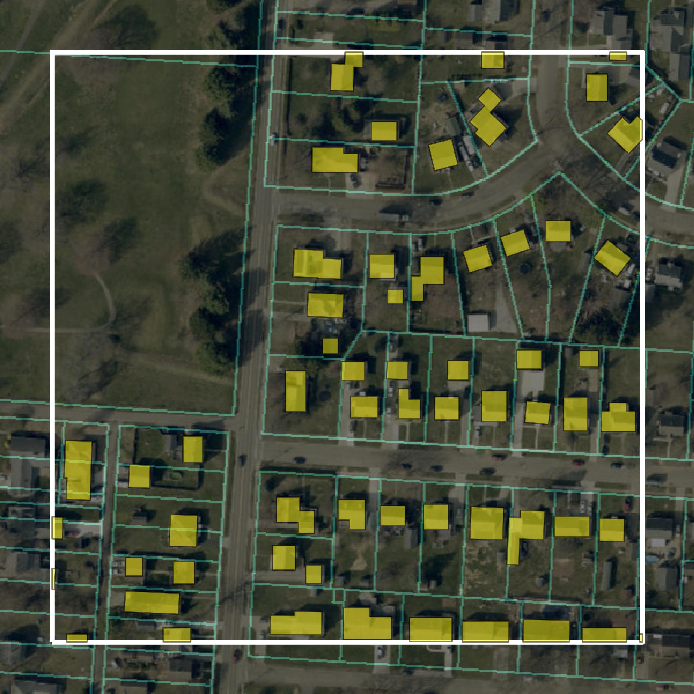
Parcels and Buildings
This image shows parcel and building data in Licking County created using GIS data in Equator.
Get Parcels and Buildings for Licking County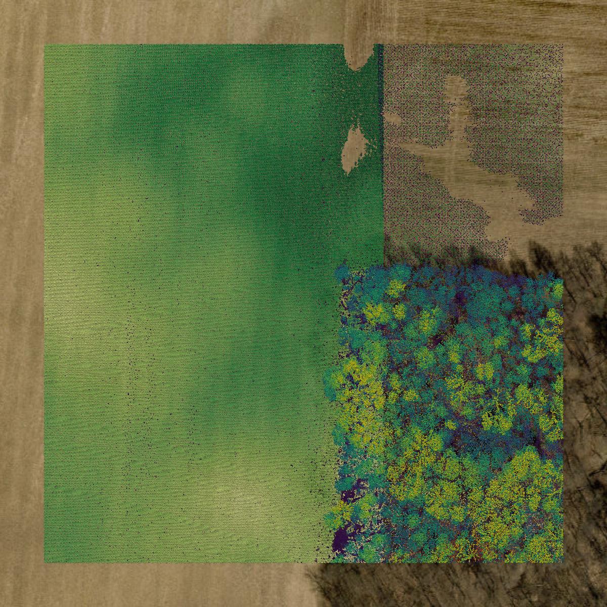
LiDAR
This image shows a LiDAR point cloud in Licking County created using GIS data in Equator.
Get LiDAR for Licking County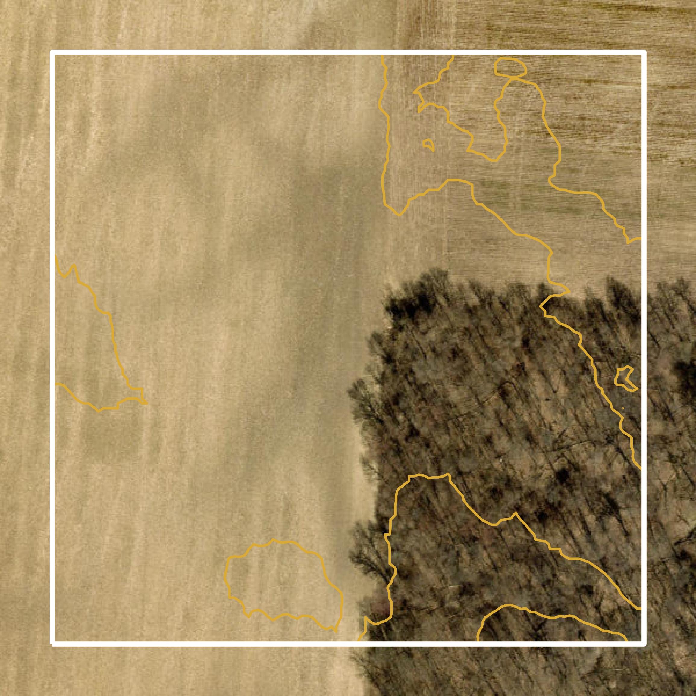
Contours
This image shows a contour map in Licking County created using GIS data in Equator.
Get Contours for Licking CountyFormats Available
Export Your Data Ready to Use in Multiple Formats
DWG
AutoCAD Drawing - Industry-standard CAD format
Supported Data:
Contour, Parcel, Building Outline
SHP
Shapefile - Standard GIS vector format
Supported Data:
Contour, Parcel, Building Outline
DXF
Drawing Exchange Format - Universal CAD interchange
Supported Data:
Contour, Building Outline
GeoJSON
Geographic JSON - Web-friendly spatial data format
Supported Data:
Contour, Parcel, Building Outline
LAZ
Compressed LAS - Efficient LiDAR point cloud format
Supported Data:
Point Cloud
SVG
Scalable Vector Graphics - Web vector format
Supported Data:
Contour, Building Outline
GPKG (Coming Soon)
GeoPackage - Modern OGC spatial database format
Supported Data:
Contour, Parcel, Building Outline
LandXML (Coming Soon)
Land XML - Civil engineering data exchange format
Supported Data:
Point Cloud
TIN (Coming Soon)
Triangulated Irregular Network - 3D surface model
Supported Data:
Point Cloud
XYZ (Coming Soon)
XYZ Point Cloud - Simple ASCII point cloud format
Supported Data:
Point Cloud
Background
GIS Data for Licking County
The Licking County GIS Downloads webpage provides access to various geographic information system (GIS) datasets and spatial data resources relevant to the county. Available content includes municipal boundaries, parcel data, road centerlines, road right-of-way information, and township area data. All datasets are projected to the Ohio State Plane South Zone Coordinate System (NAD 83) and are available for download, often in ZIP compressed format to optimize download times. The data is subject to continuous updates and improvements, and users are advised that the information is for reference purposes only and not intended as official land survey data.
Access Licking County GIS Data in Equator →Licking County Portal →Showcase
Sample GIS Data for Licking County
Parcels and Buildings
Parcel and building data in Licking County are used in a variety of fields including architecture, real estate, and urban planning.
Get Parcels and Buildings for Licking County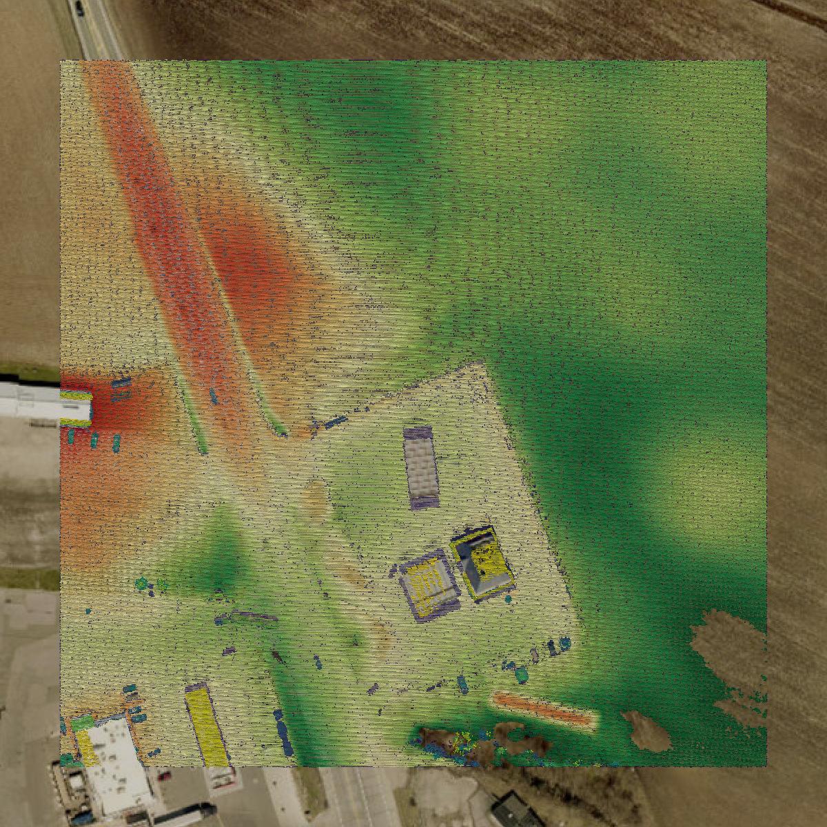
LiDAR
Point clouds (LiDAR) in Licking County can produce highly accurate 3D models of terrain, structures, and vegetation.
Get LiDAR for Licking County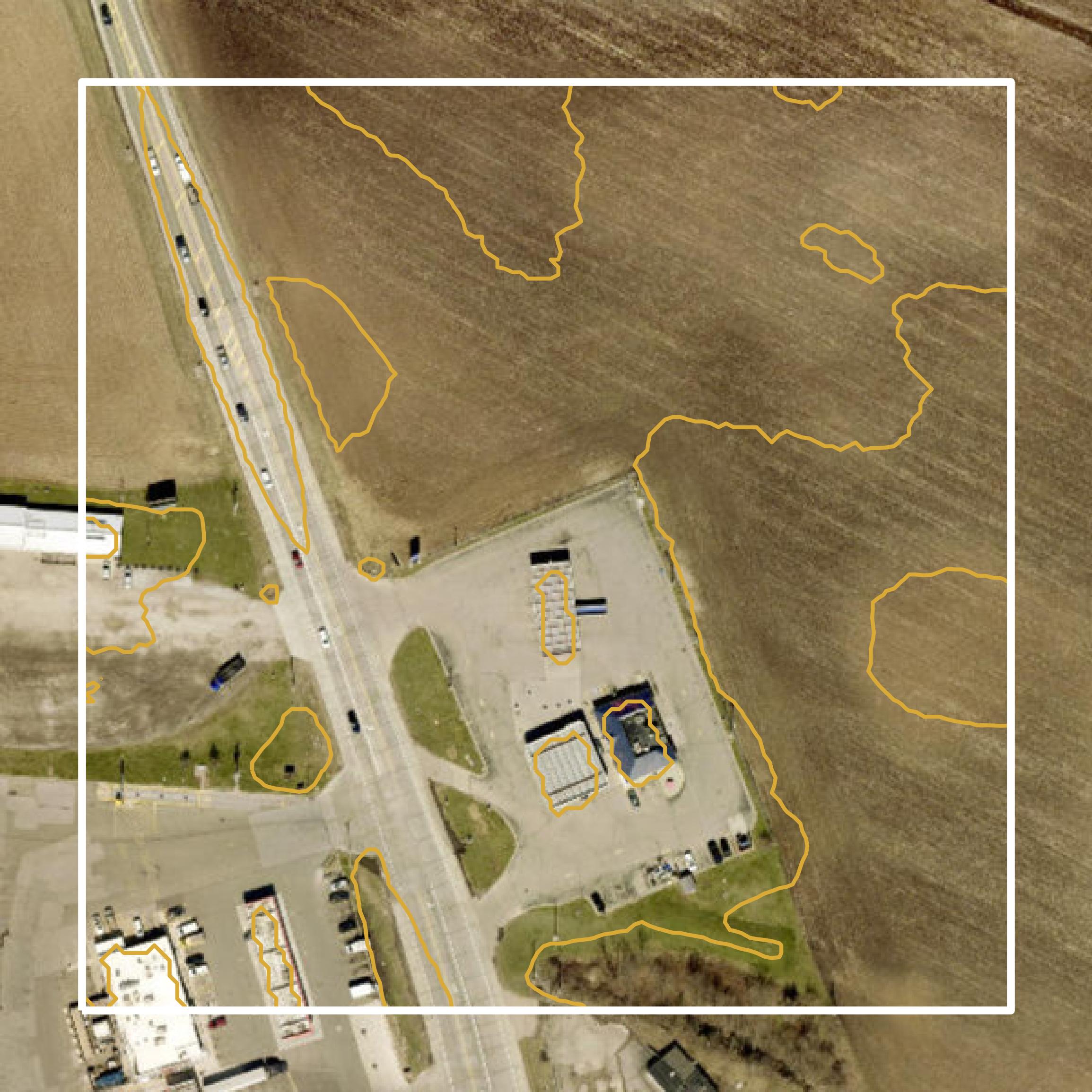
Contours
Contours in Licking County visualize 3D elevations on a 2D surface allowing you to better understand your site.
Get Contours for Licking County