Overview
Multnomah County GIS Data – For CAD
Equator helps civil engineering, architecture and consulting firms with the tools to instantly find, process and download accurate LiDAR, contours, parcel data, building footprints, DEMs, point clouds and other GIS data for Multnomah County in an online web mapping portal.
Multnomah County GIS Data →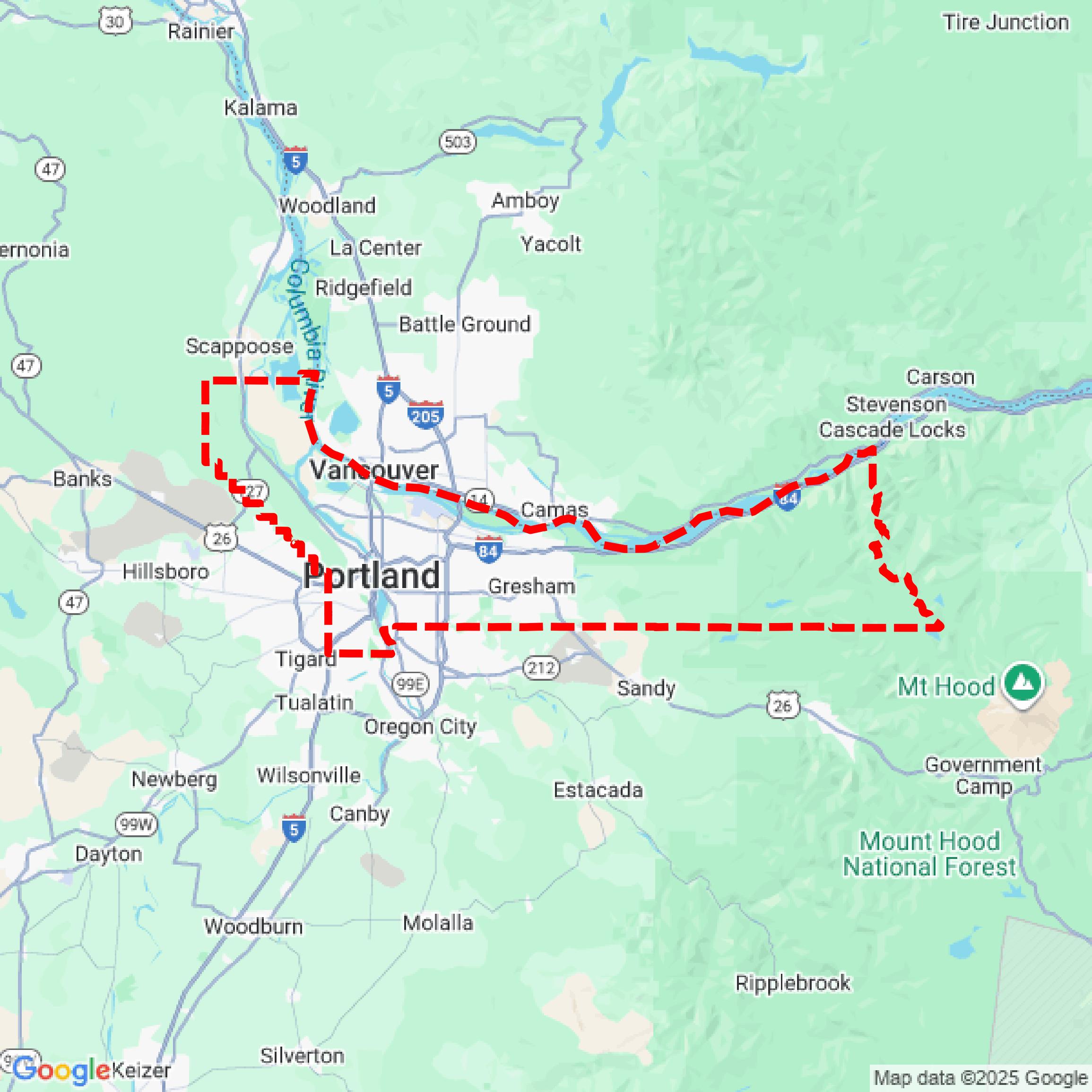

Data Available
Download GIS Data for Multnomah County
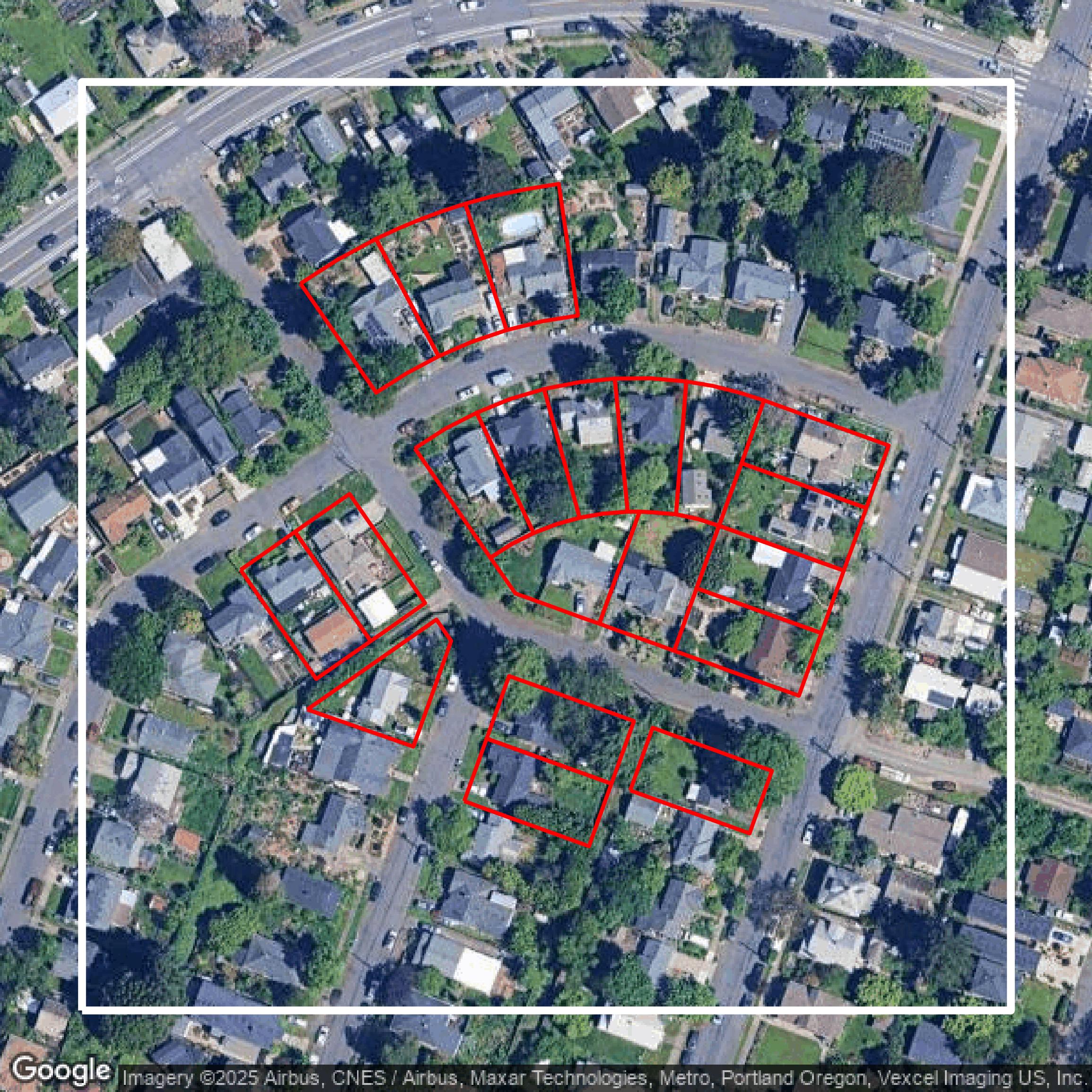
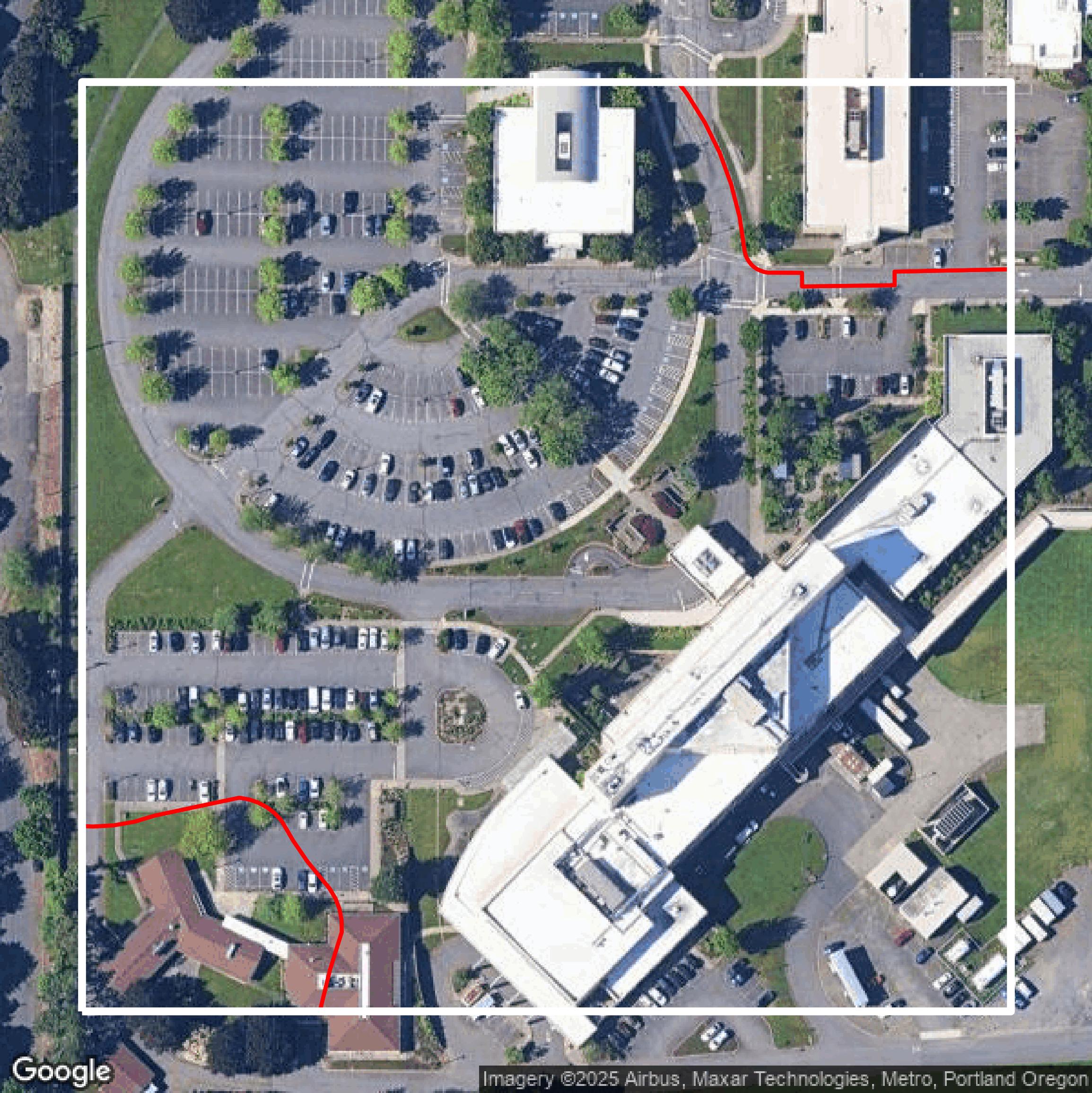
Parcels and Buildings
This image shows parcel and building data in Multnomah County created using GIS data in Equator.
Get Parcels and Buildings for Multnomah County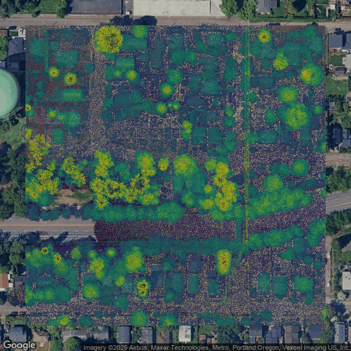
LiDAR
This image shows a LiDAR point cloud in Multnomah County created using GIS data in Equator.
Get LiDAR for Multnomah County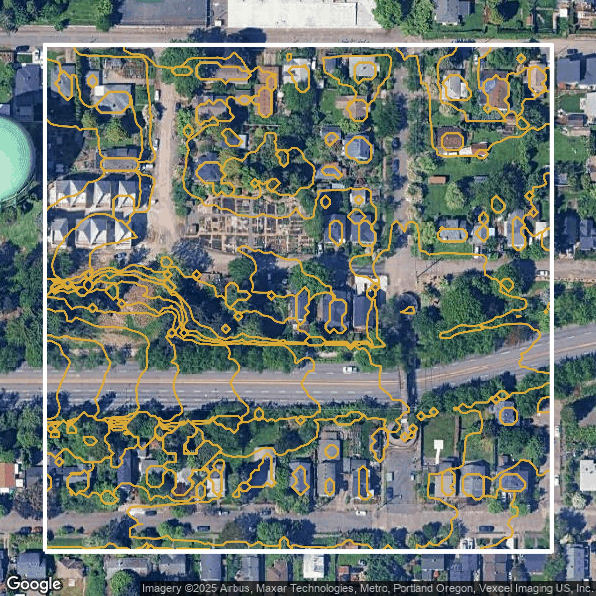
Contours
This image shows a contour map in Multnomah County created using GIS data in Equator.
Get Contours for Multnomah CountyFormats Available
Export Your Data Ready to Use in Multiple Formats
DWG
AutoCAD Drawing - Industry-standard CAD format
Supported Data:
Contour, Parcel, Building Outline
SHP
Shapefile - Standard GIS vector format
Supported Data:
Contour, Parcel, Building Outline
DXF
Drawing Exchange Format - Universal CAD interchange
Supported Data:
Contour, Building Outline
GeoJSON
Geographic JSON - Web-friendly spatial data format
Supported Data:
Contour, Parcel, Building Outline
LAZ
Compressed LAS - Efficient LiDAR point cloud format
Supported Data:
Point Cloud
SVG
Scalable Vector Graphics - Web vector format
Supported Data:
Contour, Building Outline
GPKG (Coming Soon)
GeoPackage - Modern OGC spatial database format
Supported Data:
Contour, Parcel, Building Outline
LandXML (Coming Soon)
Land XML - Civil engineering data exchange format
Supported Data:
Point Cloud
TIN (Coming Soon)
Triangulated Irregular Network - 3D surface model
Supported Data:
Point Cloud
XYZ (Coming Soon)
XYZ Point Cloud - Simple ASCII point cloud format
Supported Data:
Point Cloud
Background
GIS Data for Multnomah County
The Multnomah County Property Search Tools and Maps website offers a comprehensive suite of resources for accessing detailed property information and interactive mapping data. Visitors can use free tools such as MultcoPropTax.com to search property ownership, land and building details, values, tax amounts, payment history, and tax bills by Property ID or address, with additional subscription features available. MultcoRecords.com provides access to recorded documents since 2002, searchable by name, date, and document type, with options to download or order certified copies. The TaxGraph tool visually displays how property values have changed over the last five years. For mapping, the Multnomah County Survey and Assessment Image Locator (SAIL) offers an interactive site featuring surveys, recorded plats, assessment (cadastral) maps, and ownership information, searchable by address, tax lot, map number, or plat name. The Tax District and Map Image Viewer enables users to explore detailed parcel data, tax and transportation districts, school and neighborhood boundaries, renewal agency plans, utility districts, zoning, and plat details, with links to further resources, and can be searched by owner name, Property ID, address, map page, or section. Additional external resources include Portland Maps, GreshamView, Metro, and ORMAP for aerial photos, zoning, and regional assessment data. For older Levy Code Area shape files, customer service assistance is available. This robust platform is ideal for residents, professionals, and researchers seeking accurate, multifaceted property and geographic information in Multnomah County.
Access Multnomah County GIS Data in Equator →Multnomah County Portal →Showcase
Sample GIS Data for Multnomah County
Parcels and Buildings
Parcel and building data in Multnomah County are used in a variety of fields including architecture, real estate, and urban planning.
Get Parcels and Buildings for Multnomah CountyLiDAR
Point clouds (LiDAR) in Multnomah County can produce highly accurate 3D models of terrain, structures, and vegetation.
Get LiDAR for Multnomah CountyContours
Contours in Multnomah County visualize 3D elevations on a 2D surface allowing you to better understand your site.
Get Contours for Multnomah CountyParcels and Buildings
Accessing Multnomah County parcel and building data on Equator gives you access to coverage across the US.
Get Parcels and Buildings for Multnomah CountyLiDAR
Multnomah County LiDAR uses include land surveying, analyzing crop health, or even archaeological studies.
Get LiDAR for Multnomah CountyContours
Multnomah County contours can be used for construction & engineering, environmental science, and more.
Get Contours for Multnomah CountyParcels and Buildings
Dozens of fields are contained within each Multnomah County parcel and building data, including zoning, owners, and year built.
Get Parcels and Buildings for Multnomah CountyLiDAR
Equator turns Multnomah County LiDAR point clouds into various lidar-derived data sets, including DEMs.
Get LiDAR for Multnomah CountyContours
Multnomah County contours on Equator are produced from LiDAR coverage, allowing for high precision
Get Contours for Multnomah County