Overview
Pierce County GIS Data – For CAD
Equator helps civil engineering, architecture and consulting firms with the tools to instantly find, process and download accurate LiDAR, contours, parcel data, building footprints, DEMs, point clouds and other GIS data for Pierce County in an online web mapping portal.
Pierce County GIS Data →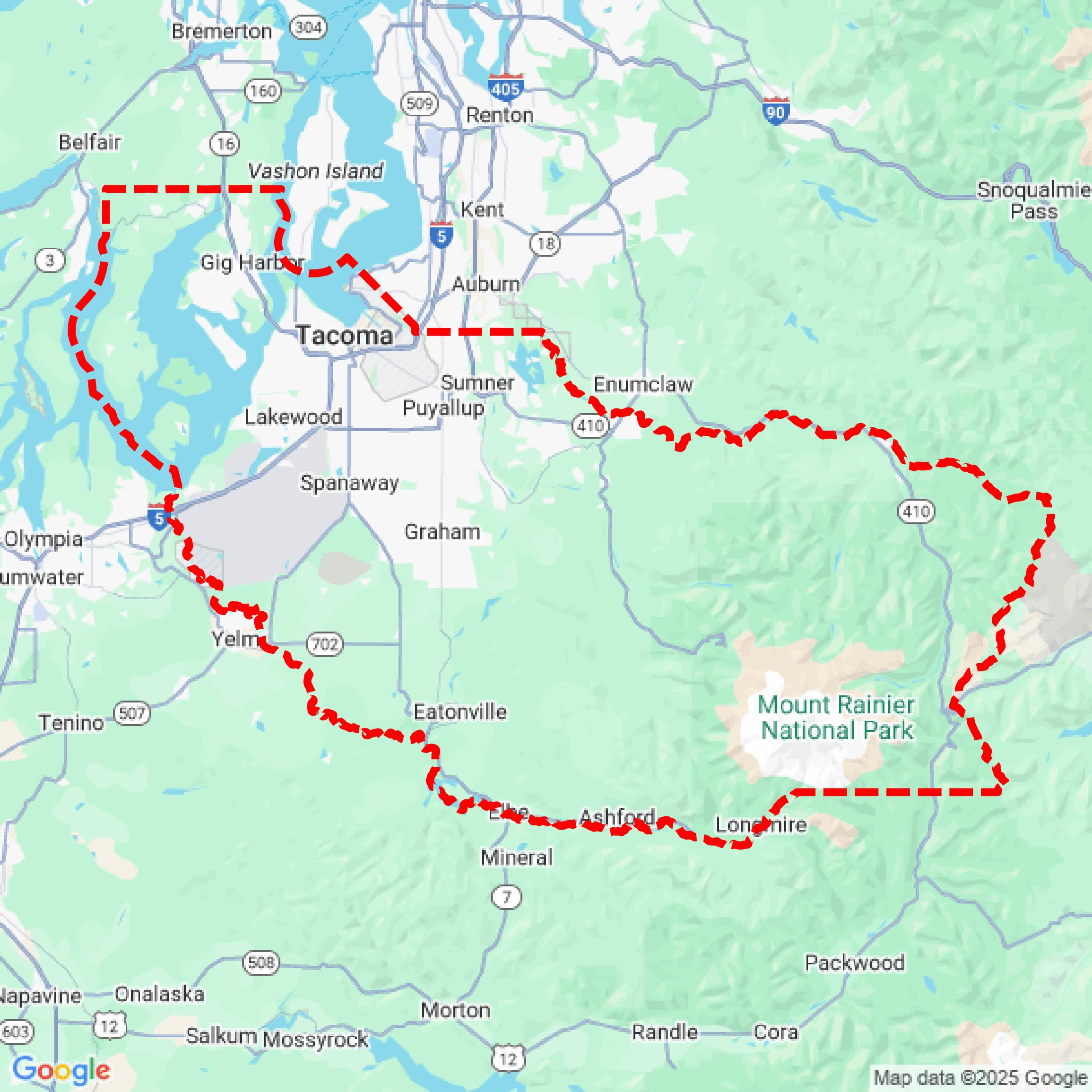

Data Available
Download GIS Data for Pierce County
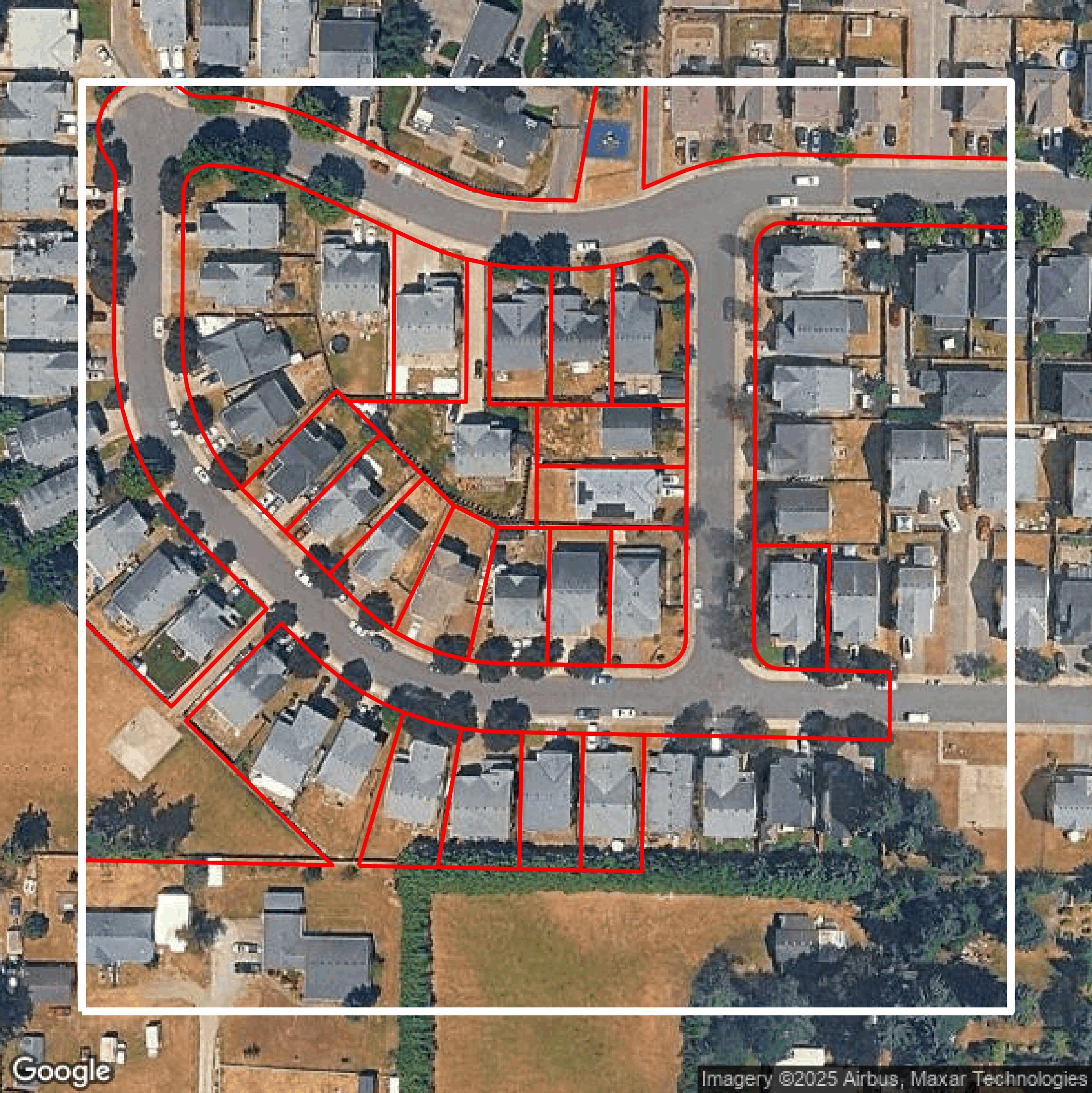
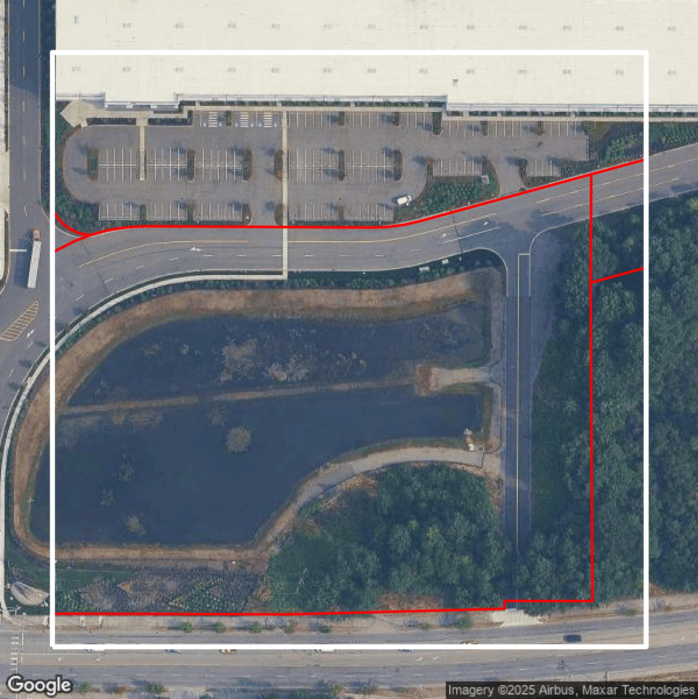
Parcels and Buildings
This image shows parcel and building data in Pierce County created using GIS data in Equator.
Get Parcels and Buildings for Pierce County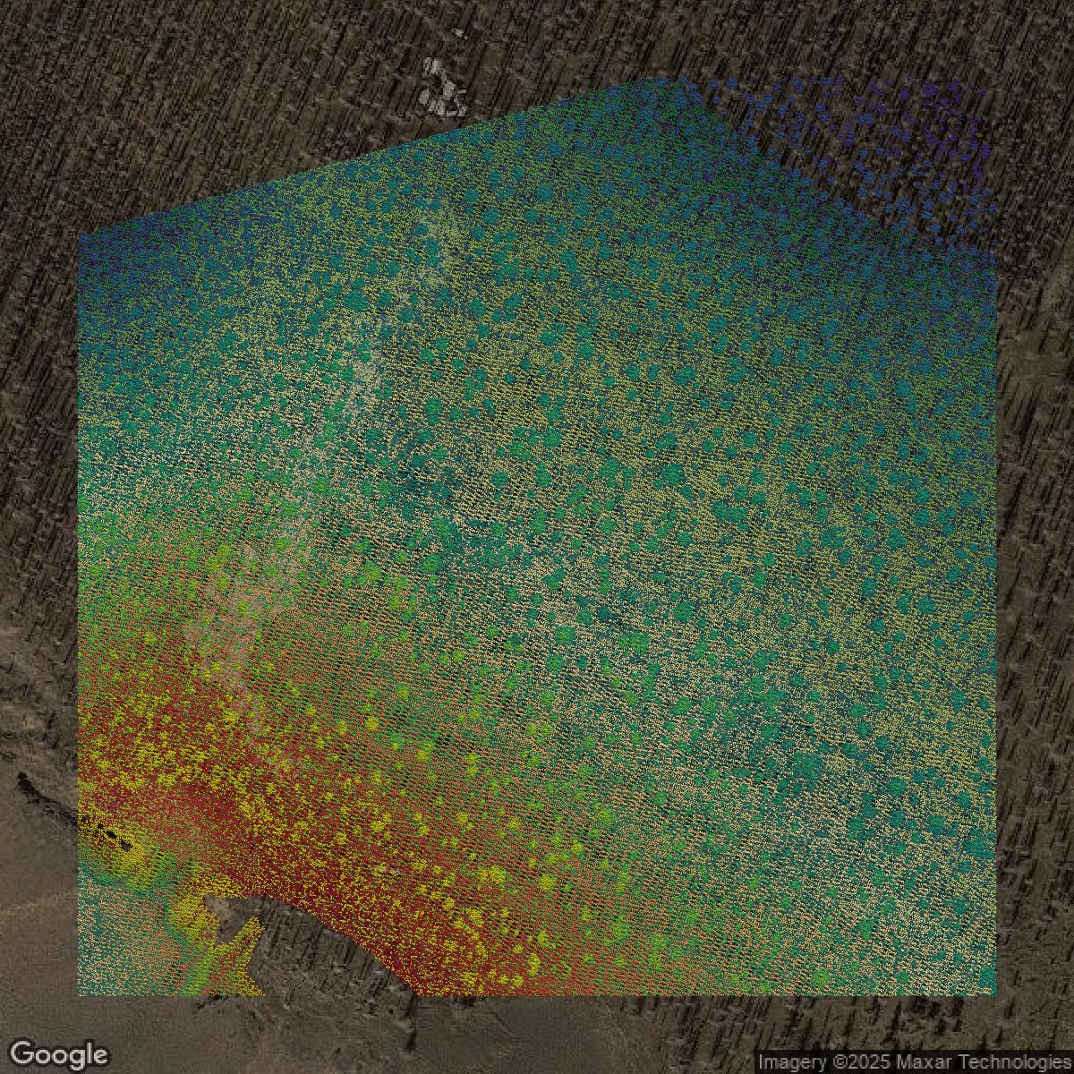
LiDAR
This image shows a LiDAR point cloud in Pierce County created using GIS data in Equator.
Get LiDAR for Pierce County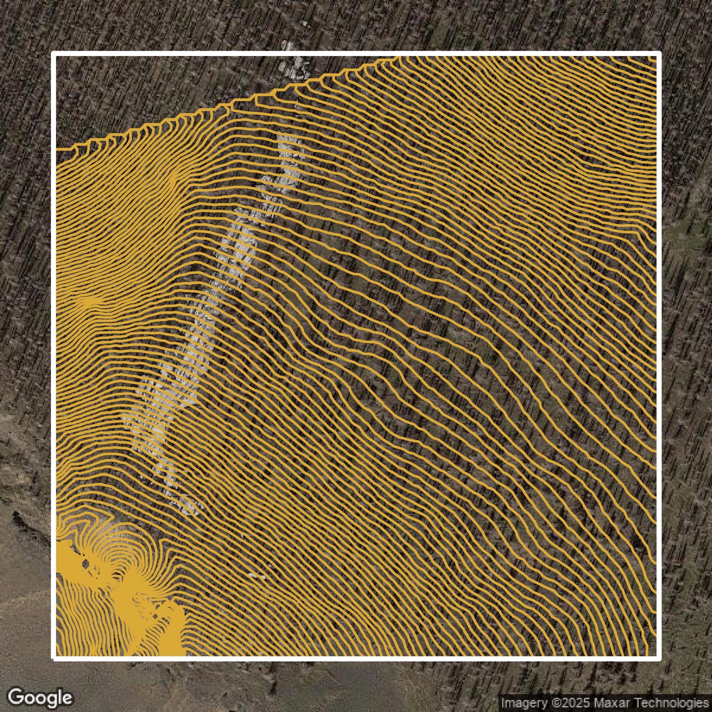
Contours
This image shows a contour map in Pierce County created using GIS data in Equator.
Get Contours for Pierce CountyFormats Available
Export Your Data Ready to Use in Multiple Formats
DWG
AutoCAD Drawing - Industry-standard CAD format
Supported Data:
Contour, Parcel, Building Outline
SHP
Shapefile - Standard GIS vector format
Supported Data:
Contour, Parcel, Building Outline
DXF
Drawing Exchange Format - Universal CAD interchange
Supported Data:
Contour, Building Outline
GeoJSON
Geographic JSON - Web-friendly spatial data format
Supported Data:
Contour, Parcel, Building Outline
LAZ
Compressed LAS - Efficient LiDAR point cloud format
Supported Data:
Point Cloud
SVG
Scalable Vector Graphics - Web vector format
Supported Data:
Contour, Building Outline
GPKG (Coming Soon)
GeoPackage - Modern OGC spatial database format
Supported Data:
Contour, Parcel, Building Outline
LandXML (Coming Soon)
Land XML - Civil engineering data exchange format
Supported Data:
Point Cloud
TIN (Coming Soon)
Triangulated Irregular Network - 3D surface model
Supported Data:
Point Cloud
XYZ (Coming Soon)
XYZ Point Cloud - Simple ASCII point cloud format
Supported Data:
Point Cloud
Background
GIS Data for Pierce County
The Pierce County WA Open GeoSpatial Data Portal (v2.1) offers free public access to a comprehensive collection of GIS data sets and mapping resources maintained by Pierce County. Visitors can expect to find detailed “Data” covering geographic, land use, environmental, and infrastructure themes available for download or direct use, all provided on an “AS IS” basis without warranty of accuracy or fitness for a particular purpose. The portal enables users to explore spatial data using interactive mapping tools hosted by Esri, but users must independently verify data quality and accept terms that prohibit representing the data as official County business or agency work. While the site facilitates easy access to updated geospatial information, it explicitly disclaims liability for data errors or service interruptions and restricts unauthorized reproduction or branding of Pierce County materials. In sum, this trusted portal is ideal for professionals, researchers, and the public seeking up-to-date, government-sourced GIS data to support planning, analysis, and decision-making in Pierce County, Washington.
Access Pierce County GIS Data in Equator →Pierce County Portal →Showcase
Sample GIS Data for Pierce County
Parcels and Buildings
Parcel and building data in Pierce County are used in a variety of fields including architecture, real estate, and urban planning.
Get Parcels and Buildings for Pierce County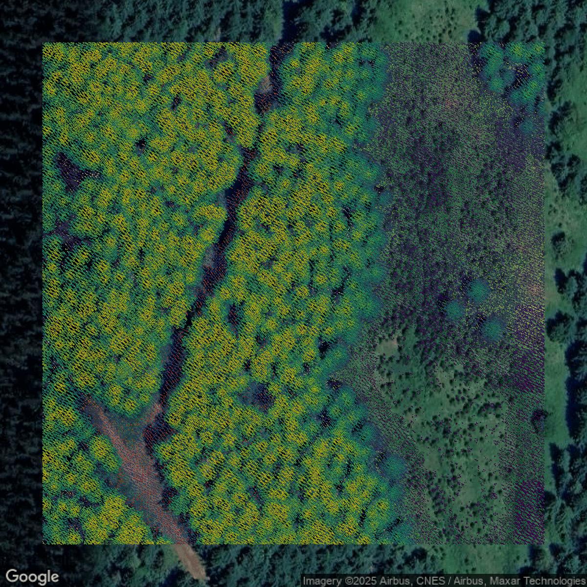
LiDAR
Point clouds (LiDAR) in Pierce County can produce highly accurate 3D models of terrain, structures, and vegetation.
Get LiDAR for Pierce County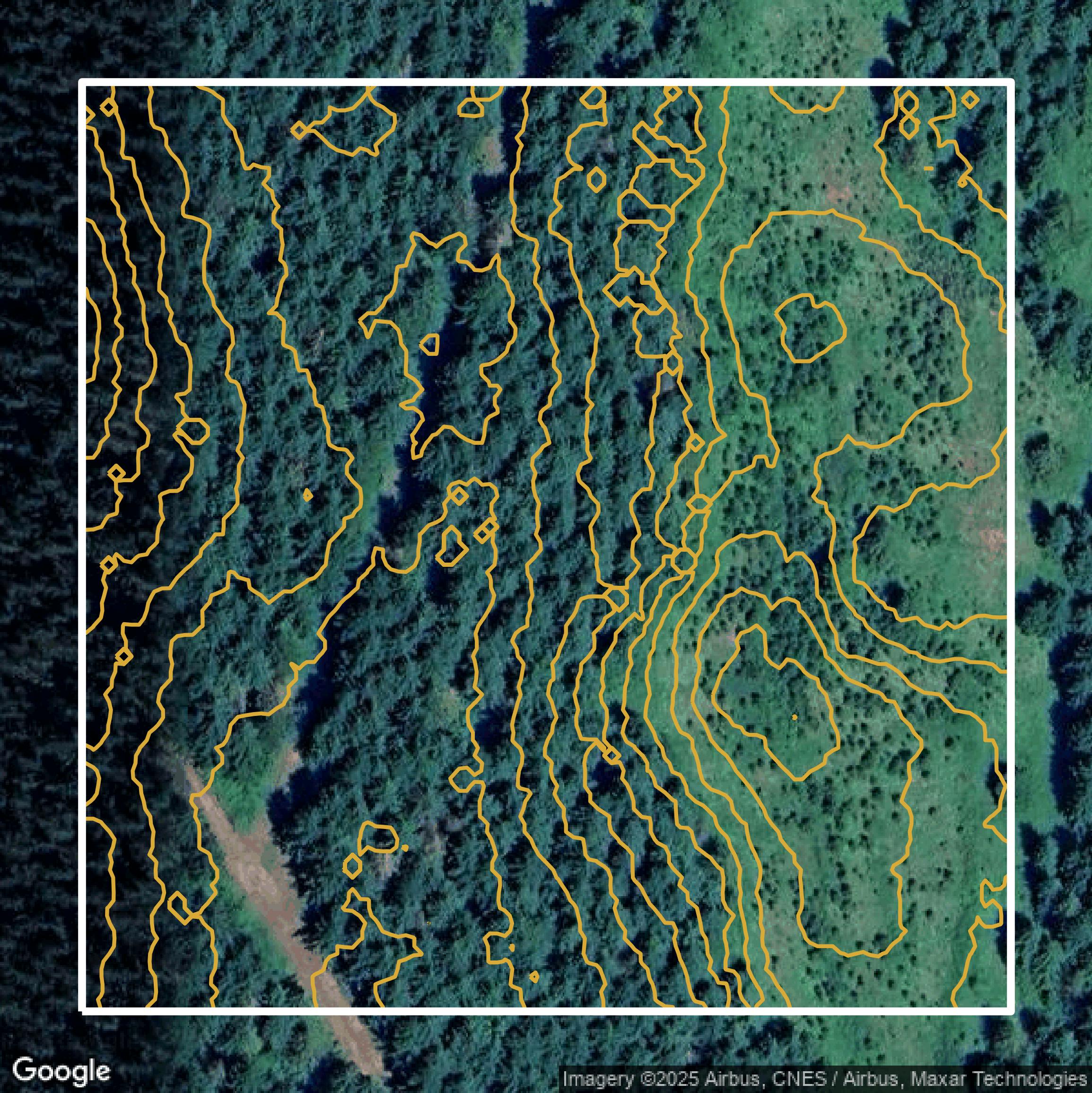
Contours
Contours in Pierce County visualize 3D elevations on a 2D surface allowing you to better understand your site.
Get Contours for Pierce County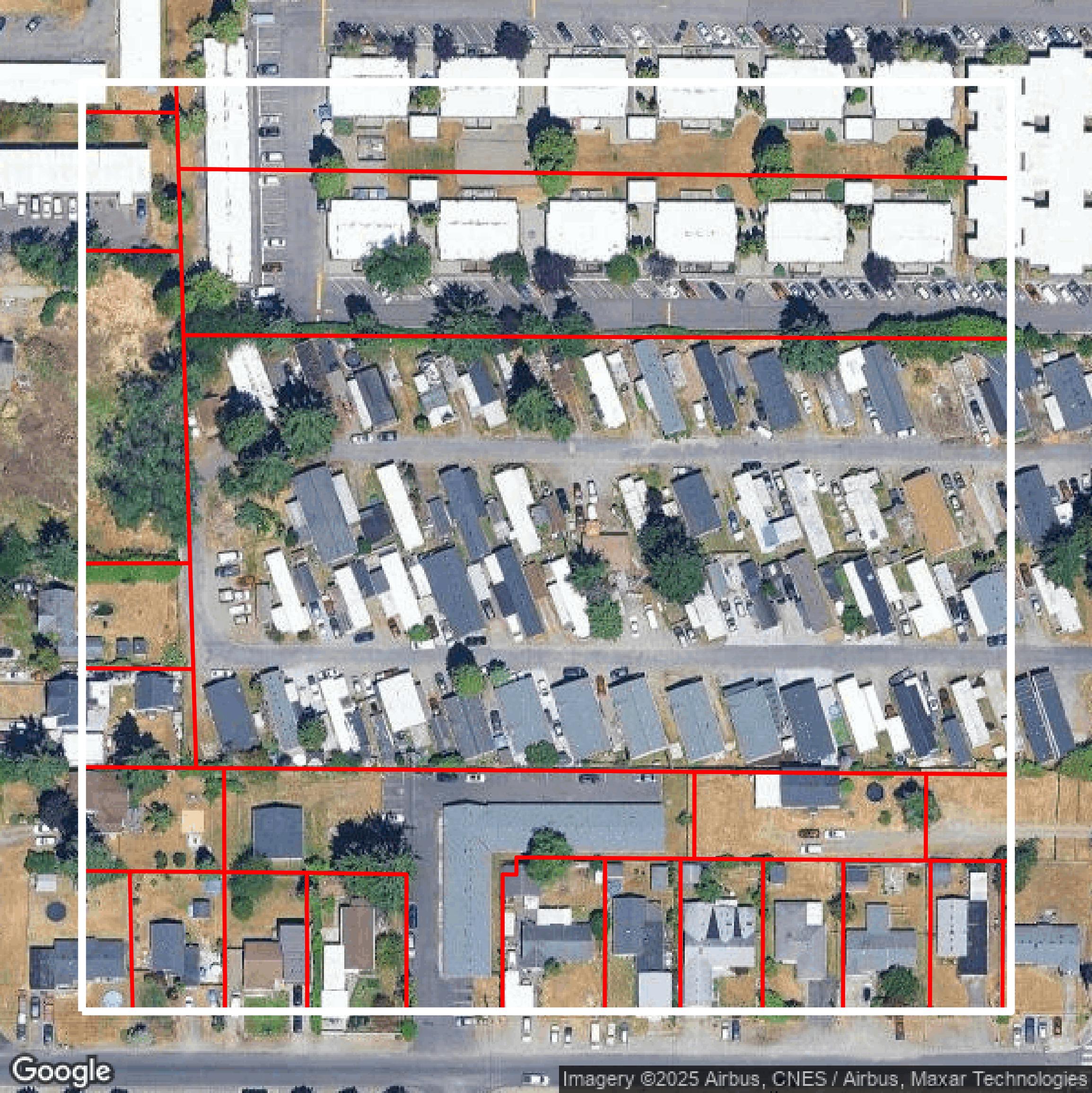
Parcels and Buildings
Accessing Pierce County parcel and building data on Equator gives you access to coverage across the US.
Get Parcels and Buildings for Pierce County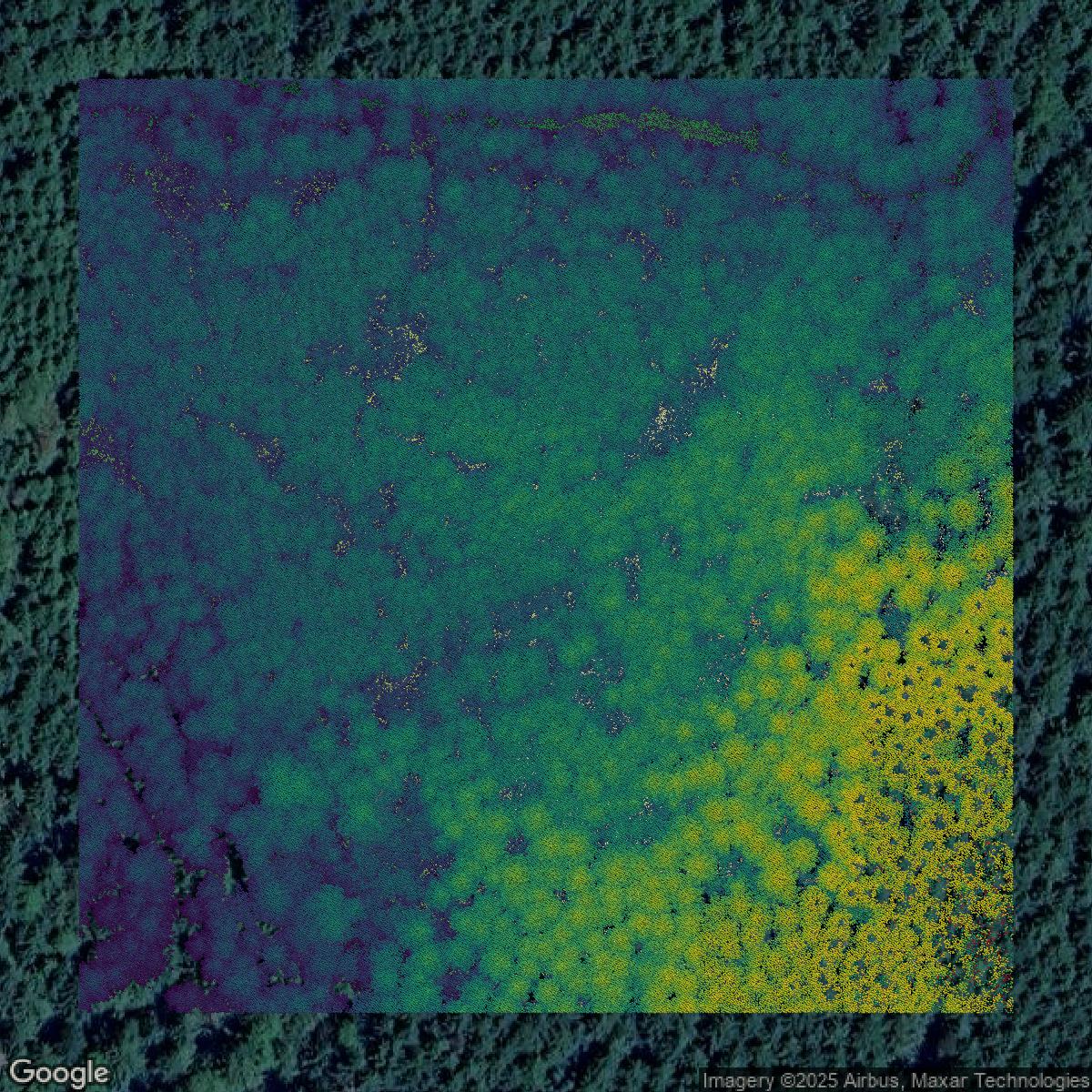
LiDAR
Pierce County LiDAR uses include land surveying, analyzing crop health, or even archaeological studies.
Get LiDAR for Pierce County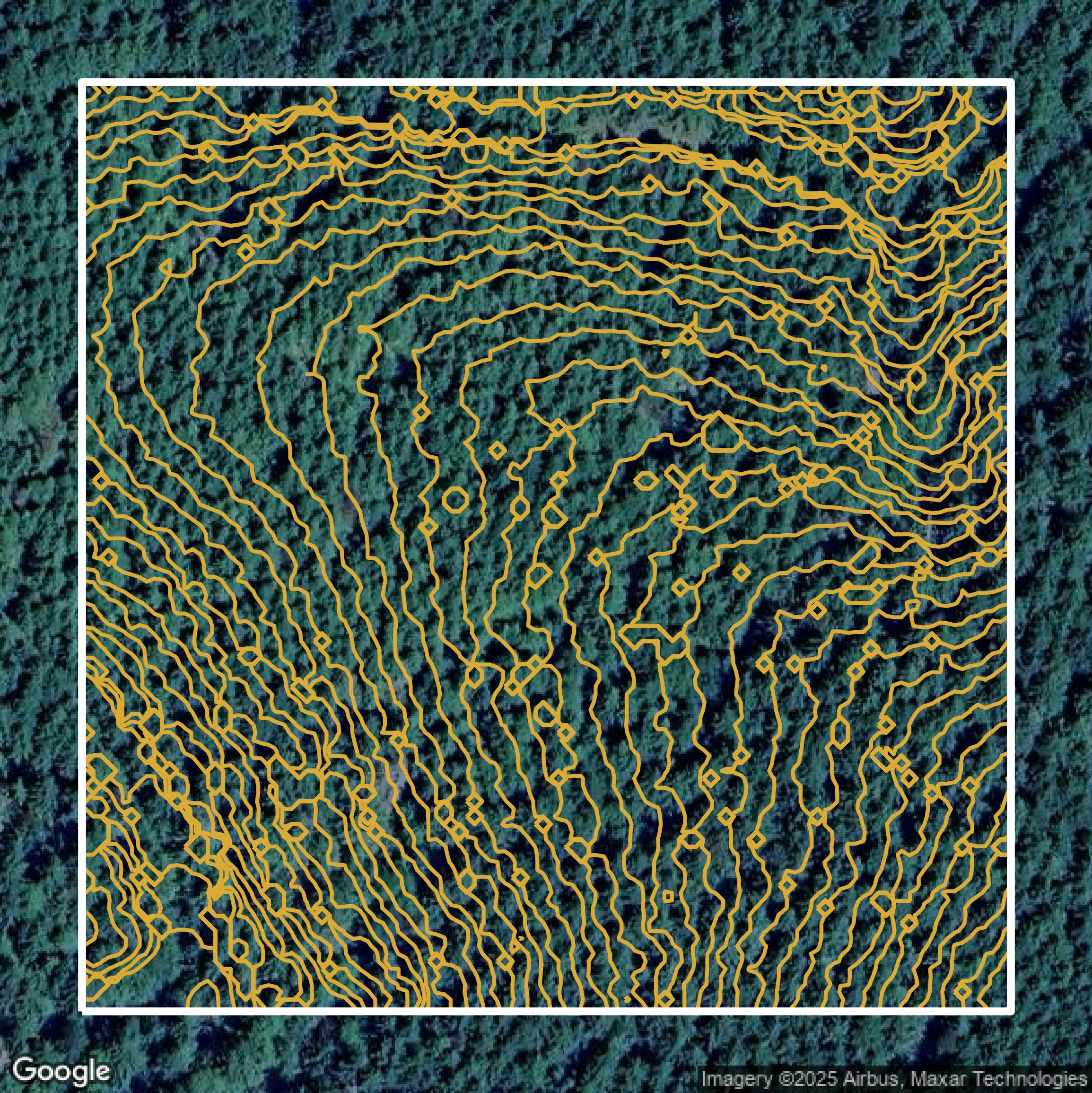
Contours
Pierce County contours can be used for construction & engineering, environmental science, and more.
Get Contours for Pierce County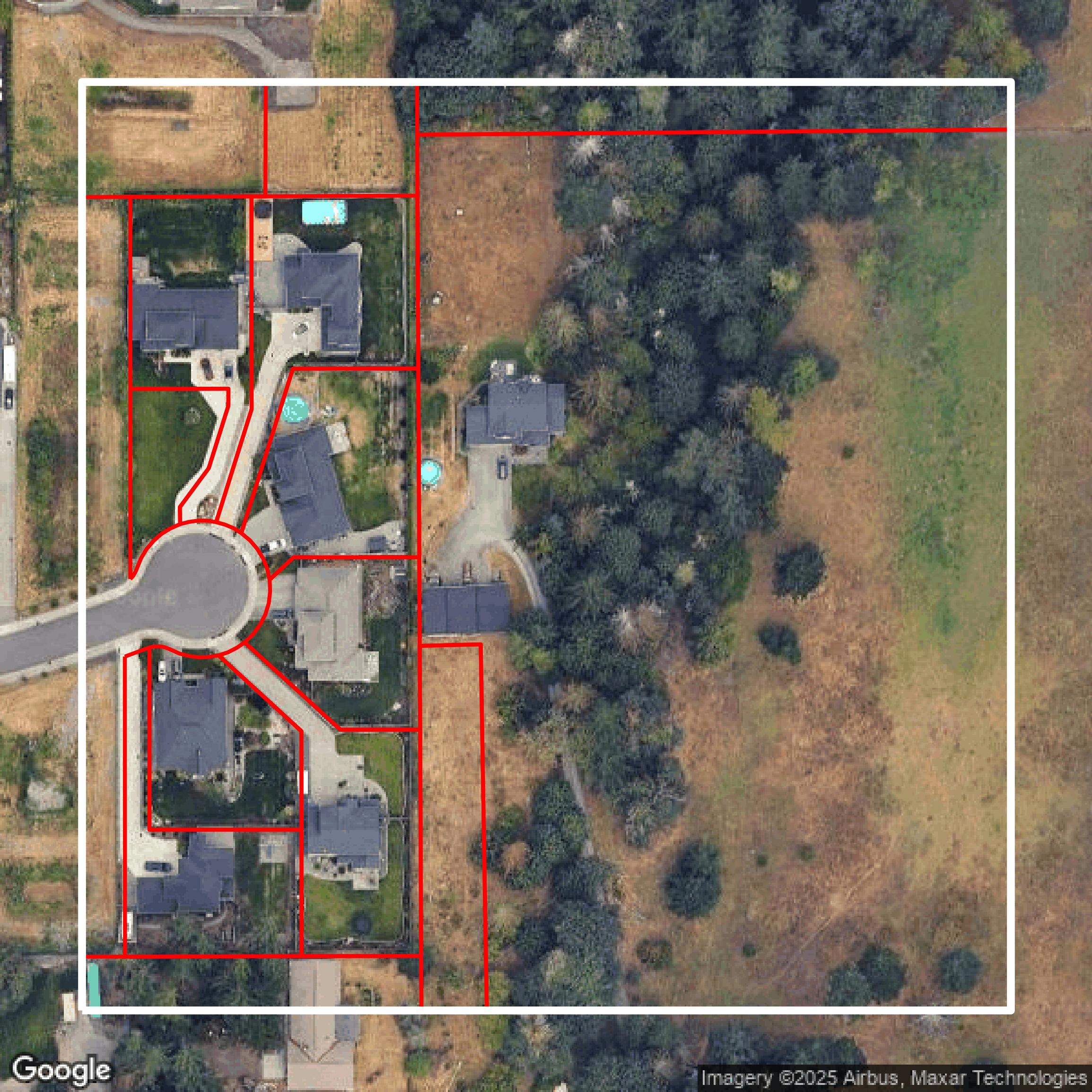
Parcels and Buildings
Dozens of fields are contained within each Pierce County parcel and building data, including zoning, owners, and year built.
Get Parcels and Buildings for Pierce County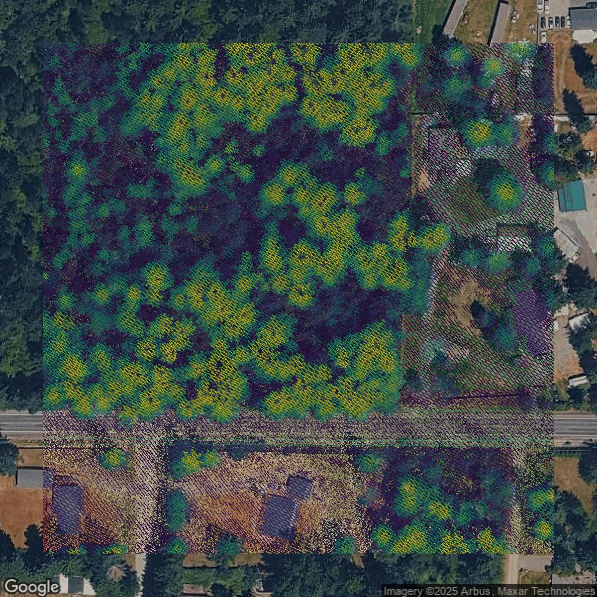
LiDAR
Equator turns Pierce County LiDAR point clouds into various lidar-derived data sets, including DEMs.
Get LiDAR for Pierce County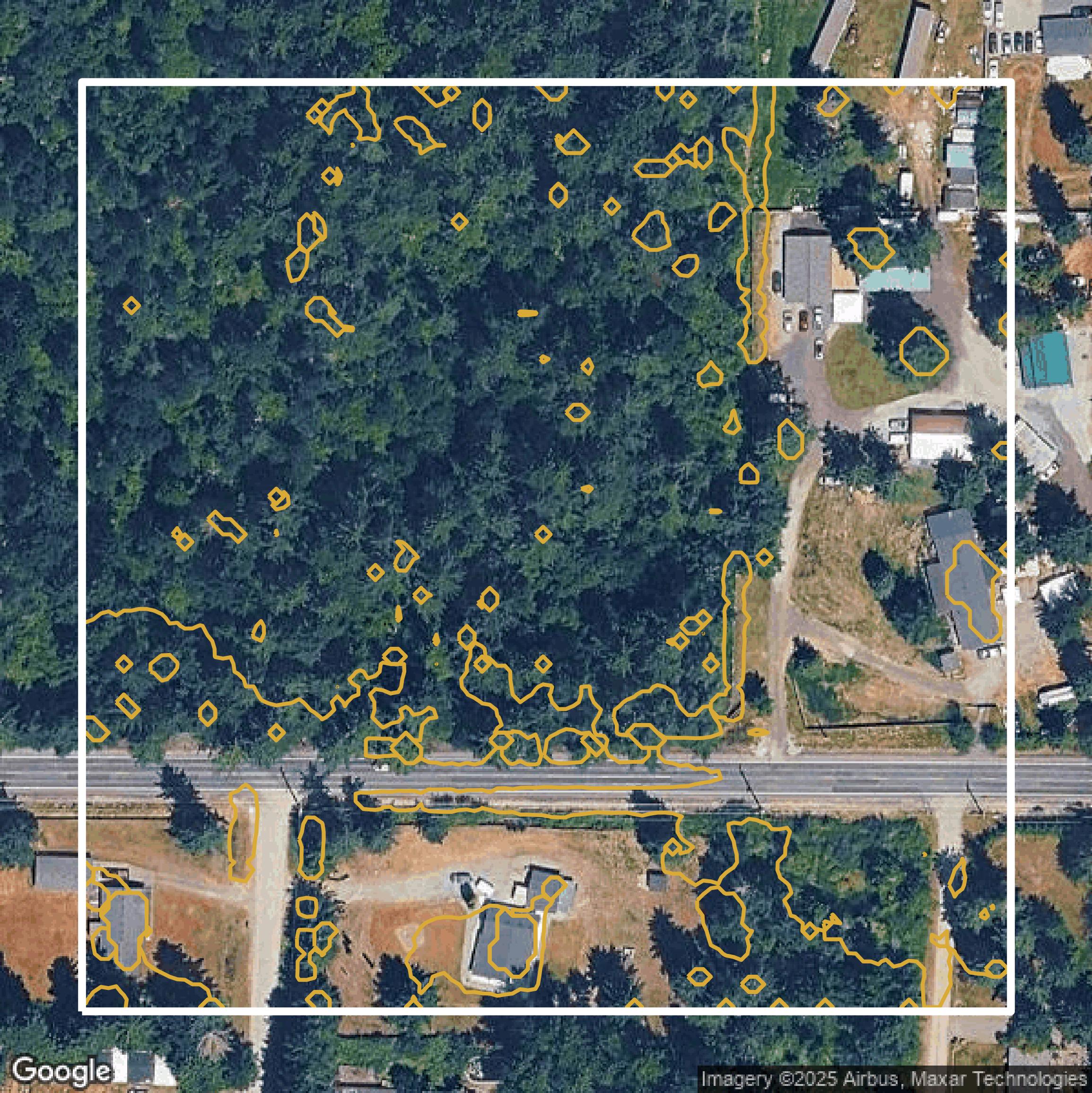
Contours
Pierce County contours on Equator are produced from LiDAR coverage, allowing for high precision
Get Contours for Pierce County