Overview
Hidalgo County GIS Data – For CAD
Equator helps civil engineering, architecture and consulting firms with the tools to instantly find, process and download accurate LiDAR, contours, parcel data, building footprints, DEMs, point clouds and other GIS data for Hidalgo County in an online web mapping portal.
Hidalgo County GIS Data →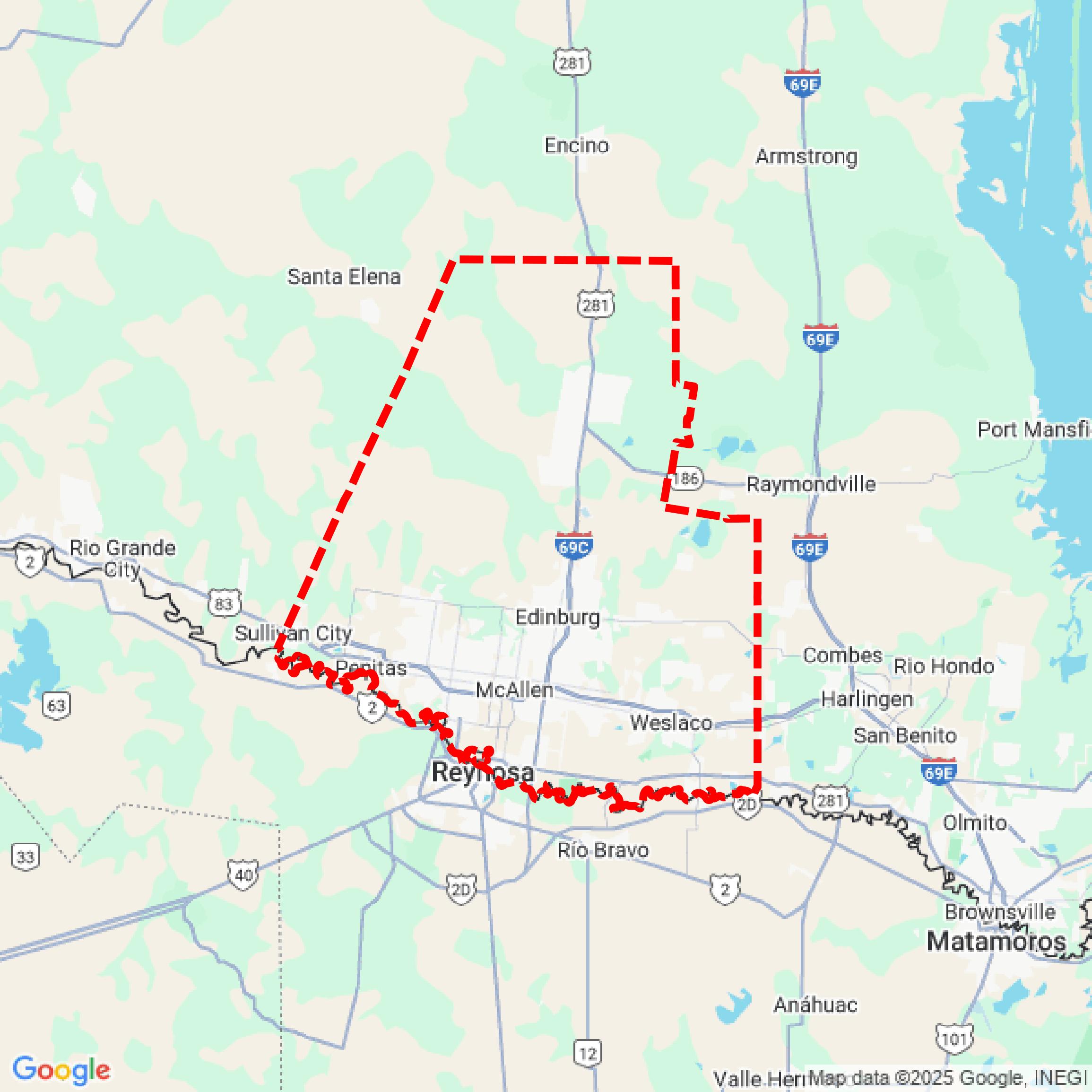

Data Available
Download GIS Data for Hidalgo County
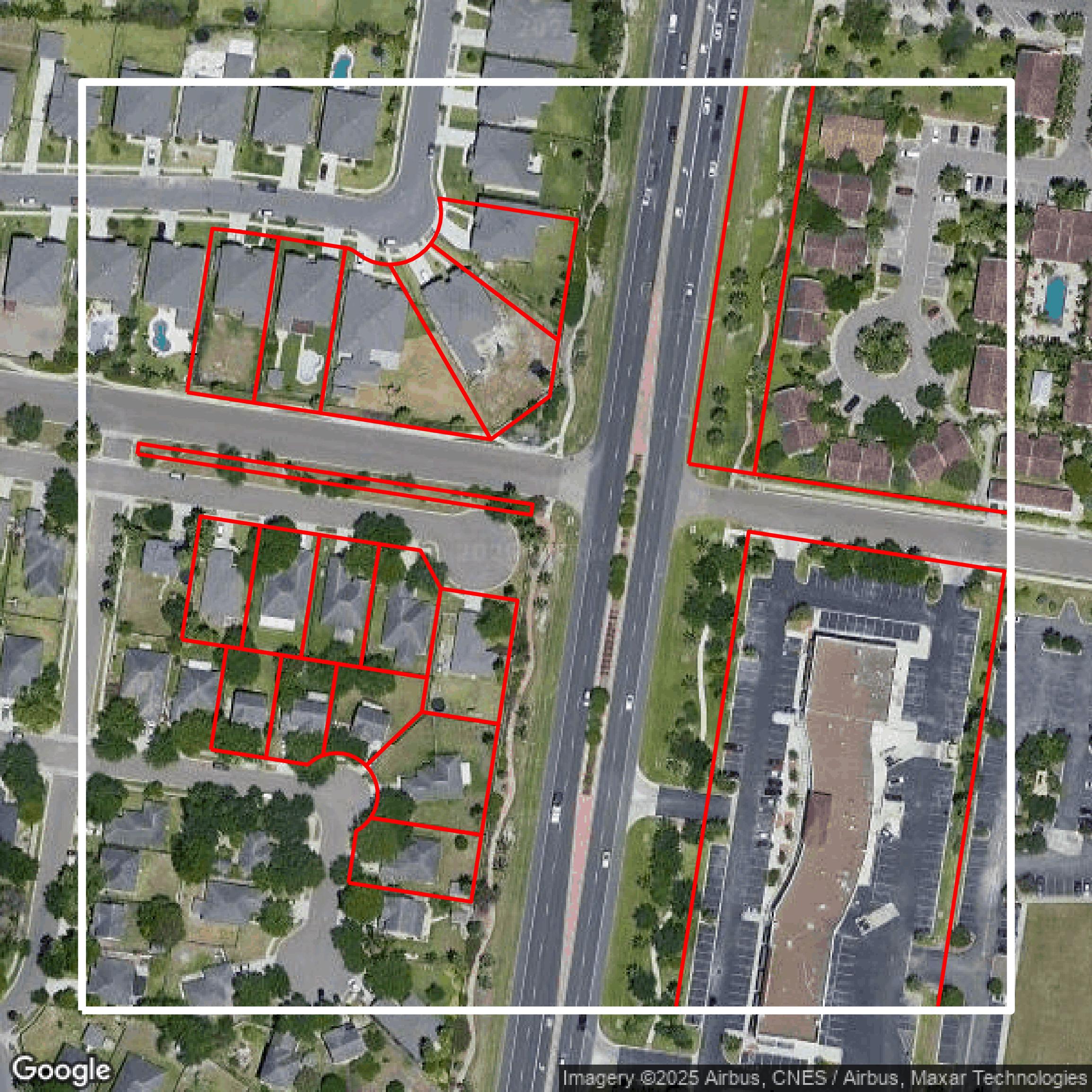
Parcels and Buildings
This image shows parcel and building data in Hidalgo County created using GIS data in Equator.
Get Parcels and Buildings for Hidalgo County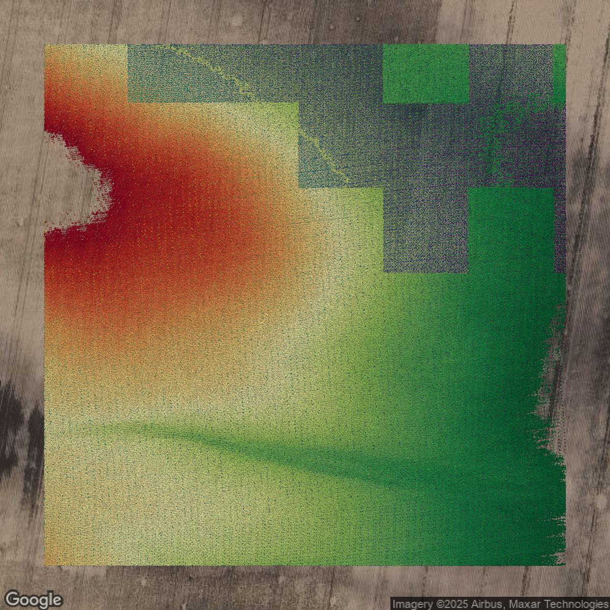
LiDAR
This image shows a LiDAR point cloud in Hidalgo County created using GIS data in Equator.
Get LiDAR for Hidalgo County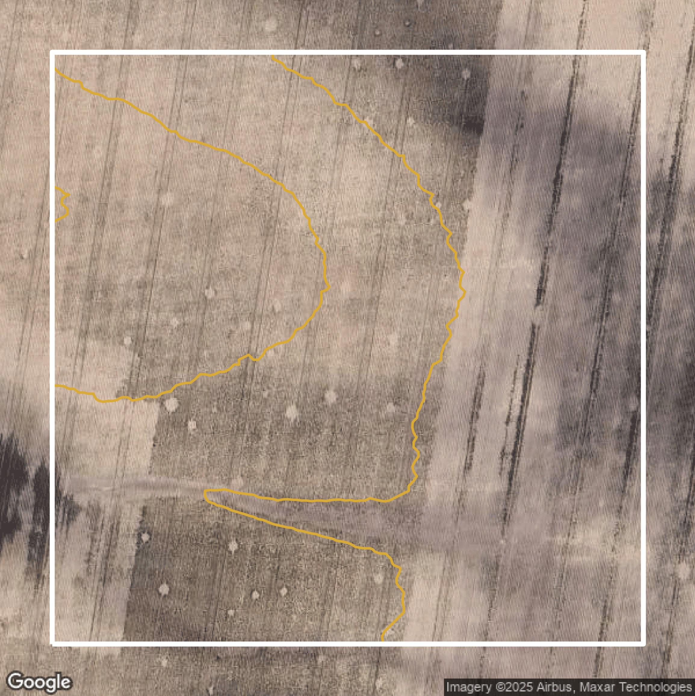
Contours
This image shows a contour map in Hidalgo County created using GIS data in Equator.
Get Contours for Hidalgo CountyFormats Available
Export Your Data Ready to Use in Multiple Formats
DWG
AutoCAD Drawing - Industry-standard CAD format
Supported Data:
Contour, Parcel, Building Outline
SHP
Shapefile - Standard GIS vector format
Supported Data:
Contour, Parcel, Building Outline
DXF
Drawing Exchange Format - Universal CAD interchange
Supported Data:
Contour, Building Outline
GeoJSON
Geographic JSON - Web-friendly spatial data format
Supported Data:
Contour, Parcel, Building Outline
LAZ
Compressed LAS - Efficient LiDAR point cloud format
Supported Data:
Point Cloud
SVG
Scalable Vector Graphics - Web vector format
Supported Data:
Contour, Building Outline
GPKG (Coming Soon)
GeoPackage - Modern OGC spatial database format
Supported Data:
Contour, Parcel, Building Outline
LandXML (Coming Soon)
Land XML - Civil engineering data exchange format
Supported Data:
Point Cloud
TIN (Coming Soon)
Triangulated Irregular Network - 3D surface model
Supported Data:
Point Cloud
XYZ (Coming Soon)
XYZ Point Cloud - Simple ASCII point cloud format
Supported Data:
Point Cloud
Background
GIS Data for Hidalgo County
The Hidalgo County GIS website offers a comprehensive suite of interactive mapping tools and detailed geographic data designed to serve the approximately 900,000 residents of one of the fastest growing regions in the nation. Visitors can access official "Hidalgo County Map" and precinct-specific maps ("Precinct No. 1," "Precinct No. 2," "Precinct No. 3," and "Precinct No. 4") that provide precise boundary overlays and geographic details for each of the county’s four precincts. The site features valuable data sets and resources from the "Geographic Information Systems" division, supporting public services, permitting, subdivision plat review, and county planning. Users can expect tools that facilitate property location, jurisdictional boundary understanding, and connectivity to services managed by county officials including precinct commissioners and the County Judge. The GIS portal integrates with county initiatives promoting leadership, transparency, collaboration, and fiscal responsibility, making it an essential resource for residents, developers, government officials, and businesses seeking accurate, up-to-date maps and geographic data for Hidalgo County, Texas.
Access Hidalgo County GIS Data in Equator →Hidalgo County Portal →Showcase
Sample GIS Data for Hidalgo County

Parcels and Buildings
Parcel and building data in Hidalgo County are used in a variety of fields including architecture, real estate, and urban planning.
Get Parcels and Buildings for Hidalgo County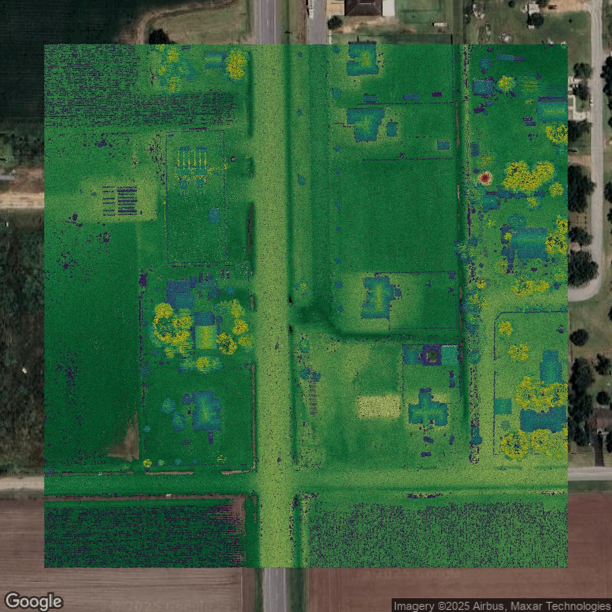
LiDAR
Point clouds (LiDAR) in Hidalgo County can produce highly accurate 3D models of terrain, structures, and vegetation.
Get LiDAR for Hidalgo County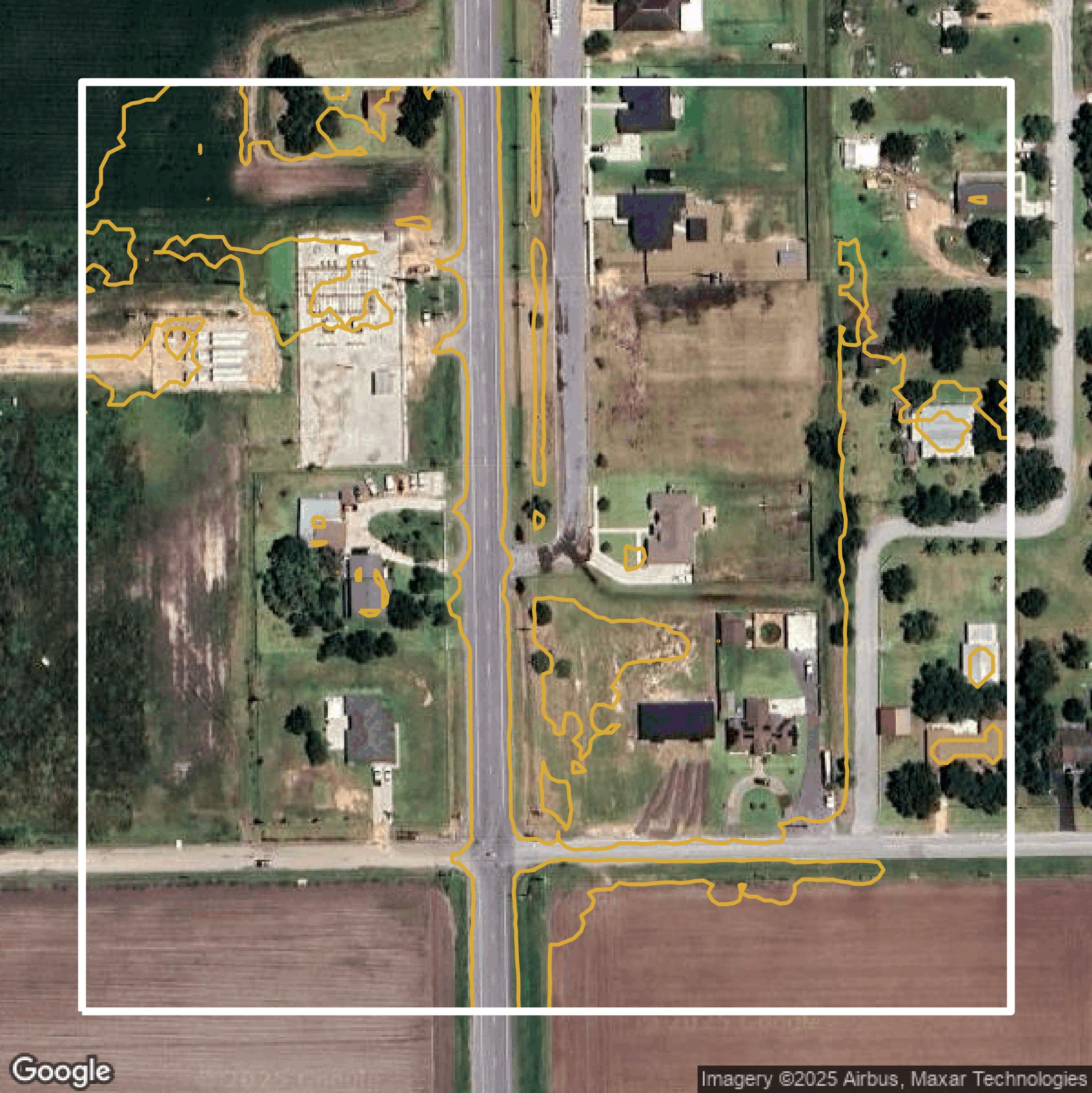
Contours
Contours in Hidalgo County visualize 3D elevations on a 2D surface allowing you to better understand your site.
Get Contours for Hidalgo County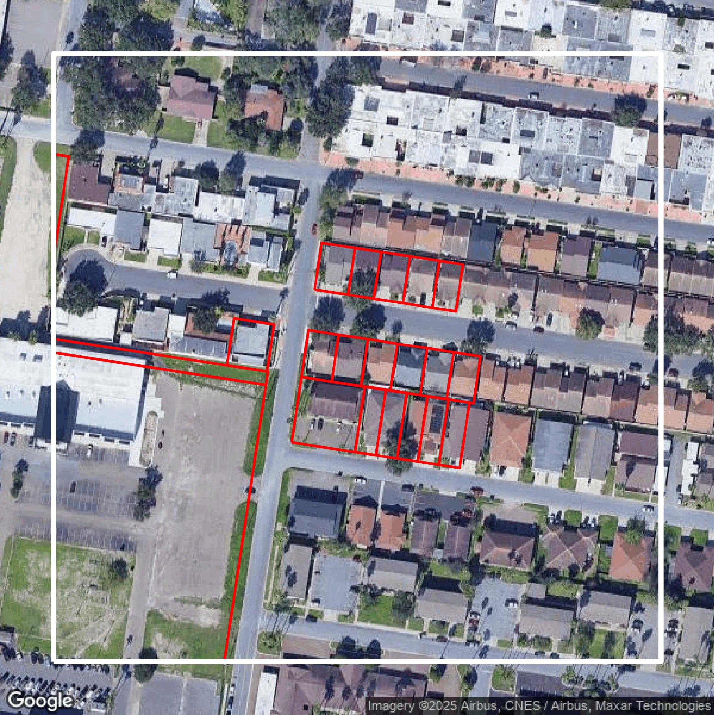
Parcels and Buildings
Accessing Hidalgo County parcel and building data on Equator gives you access to coverage across the US.
Get Parcels and Buildings for Hidalgo County
LiDAR
Hidalgo County LiDAR uses include land surveying, analyzing crop health, or even archaeological studies.
Get LiDAR for Hidalgo County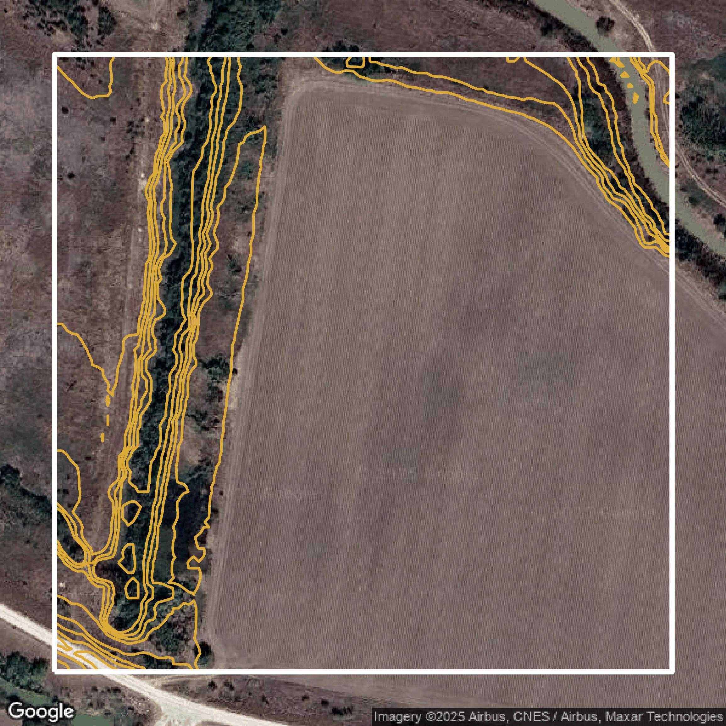
Contours
Hidalgo County contours can be used for construction & engineering, environmental science, and more.
Get Contours for Hidalgo County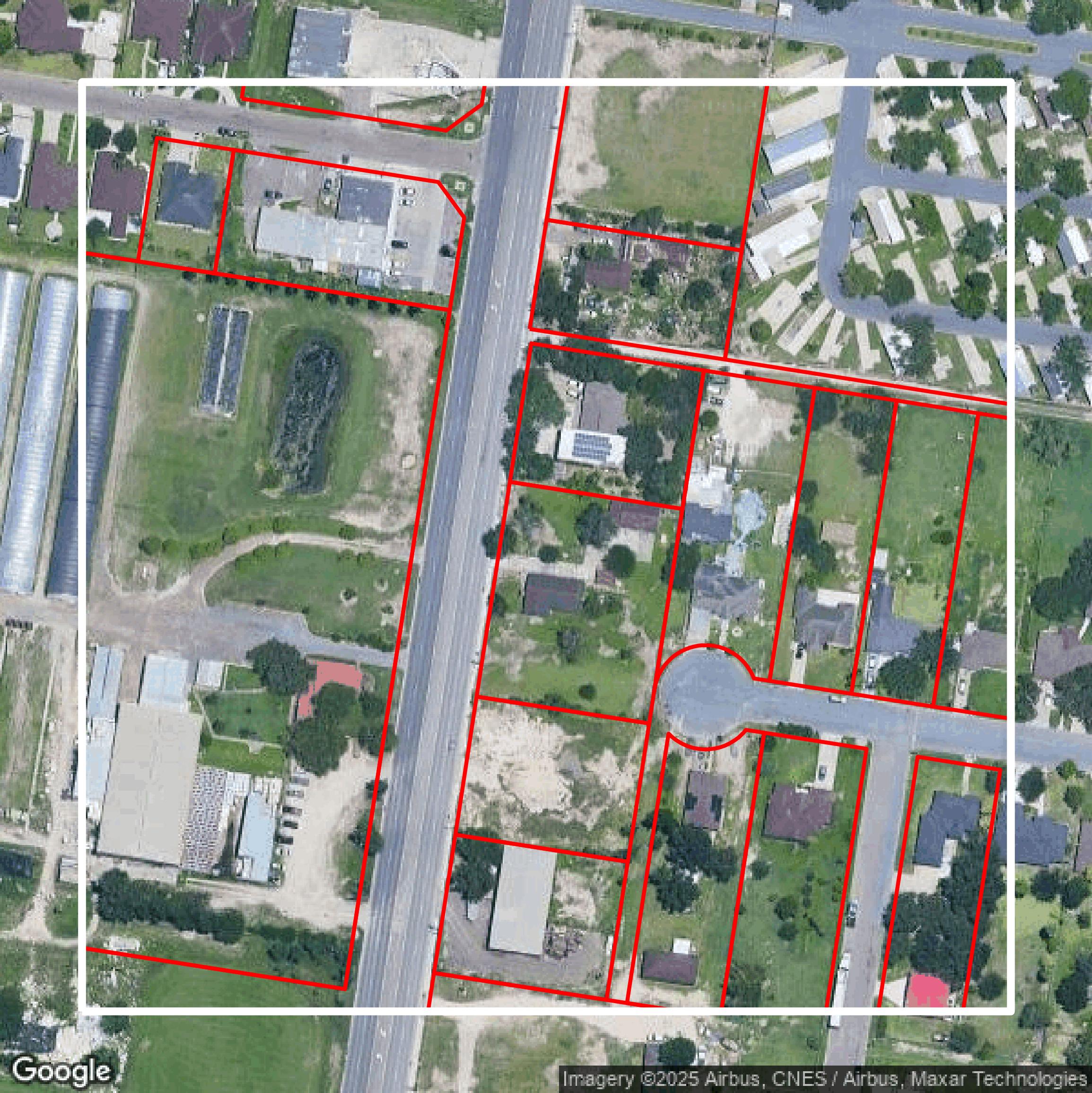
Parcels and Buildings
Dozens of fields are contained within each Hidalgo County parcel and building data, including zoning, owners, and year built.
Get Parcels and Buildings for Hidalgo County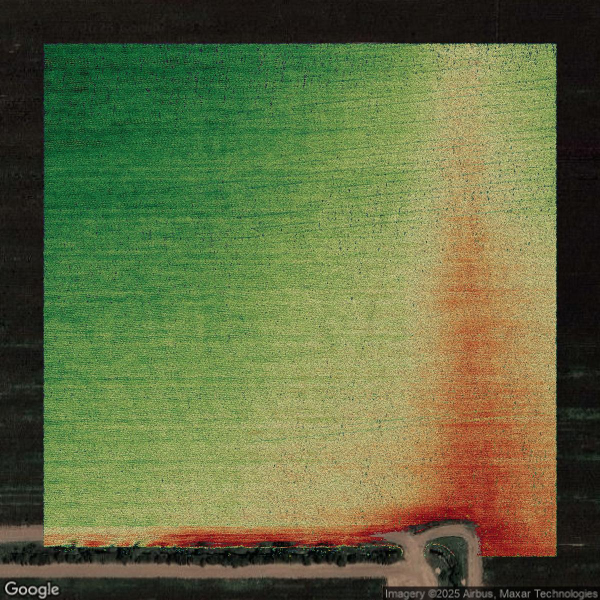
LiDAR
Equator turns Hidalgo County LiDAR point clouds into various lidar-derived data sets, including DEMs.
Get LiDAR for Hidalgo County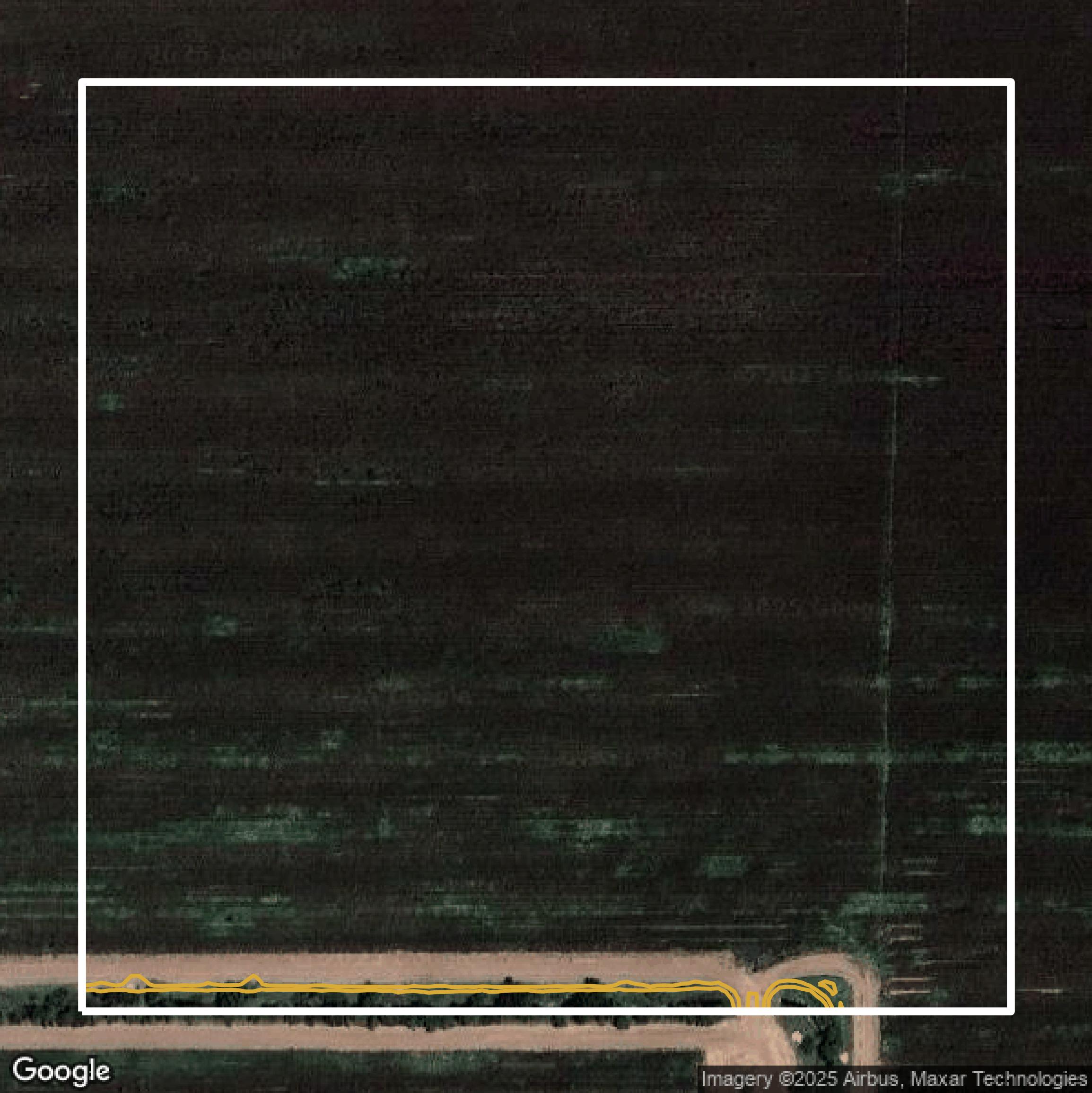
Contours
Hidalgo County contours on Equator are produced from LiDAR coverage, allowing for high precision
Get Contours for Hidalgo County