Overview
Green County GIS Data – For CAD
Equator helps civil engineering, architecture and consulting firms with the tools to instantly find, process and download accurate LiDAR, contours, parcel data, building footprints, DEMs, point clouds and other GIS data for Green County in an online web mapping portal.
Green County GIS Data →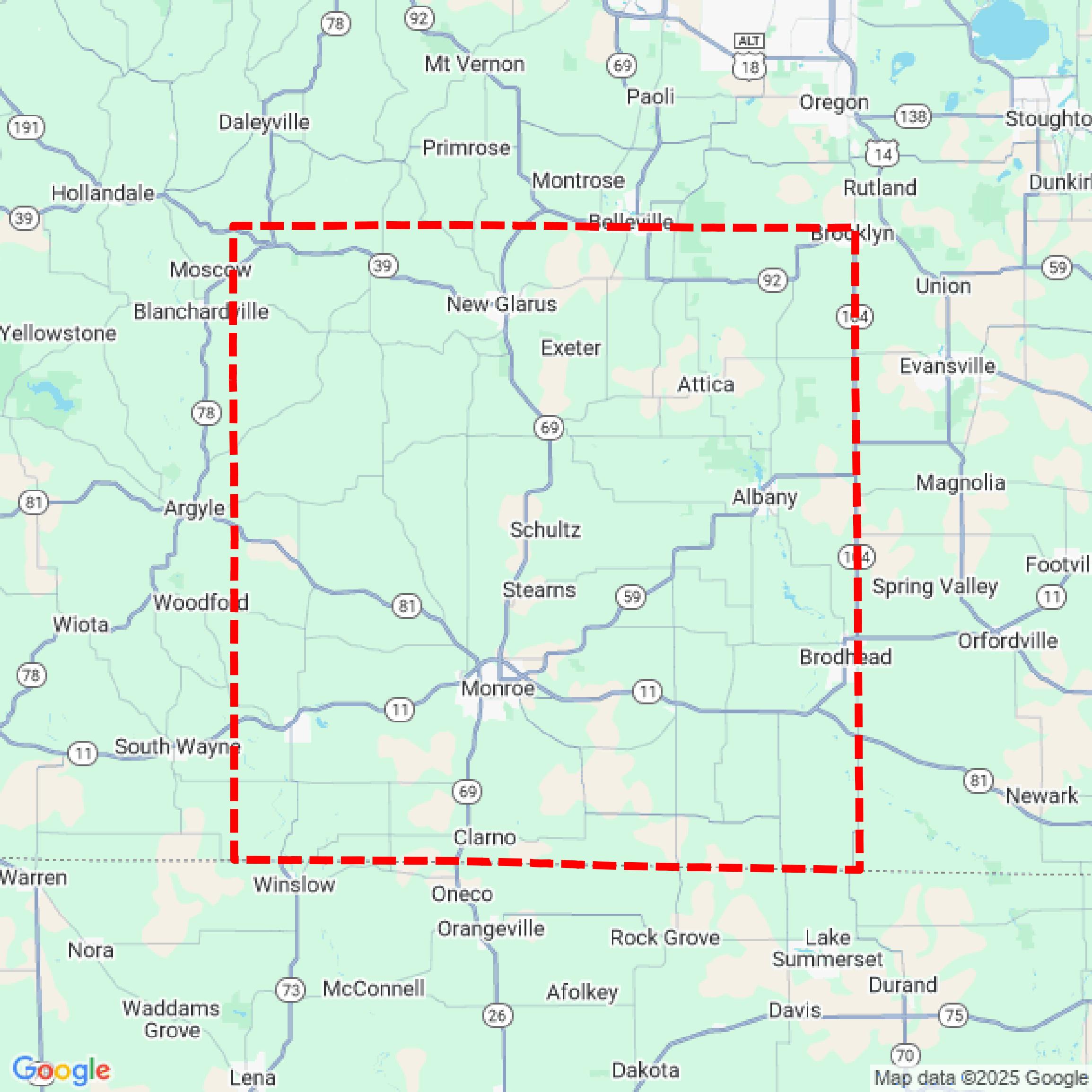

Data Available
Download GIS Data for Green County
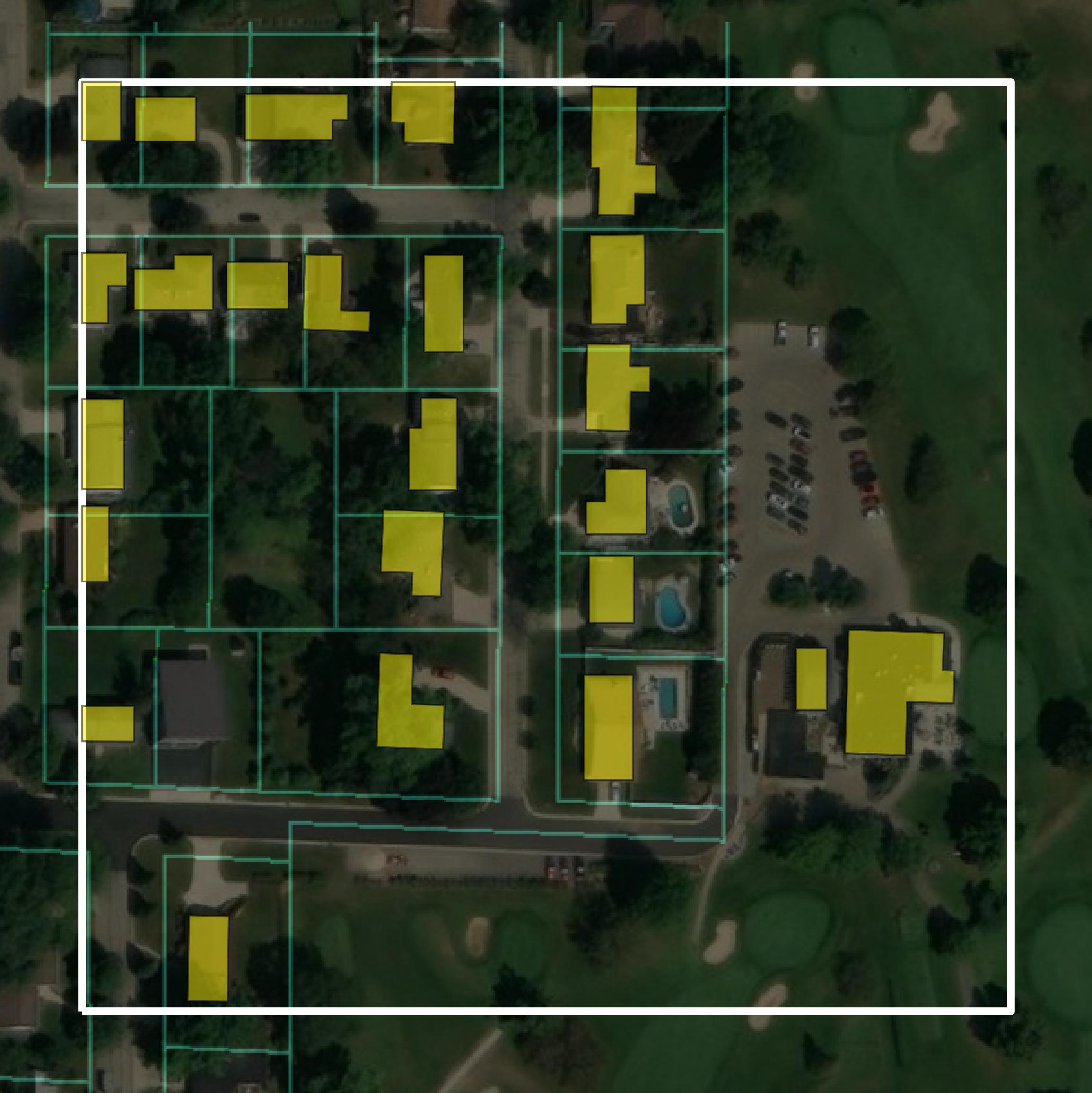
Parcels and Buildings
This image shows parcel and building data in Green County created using GIS data in Equator.
Get Parcels and Buildings for Green County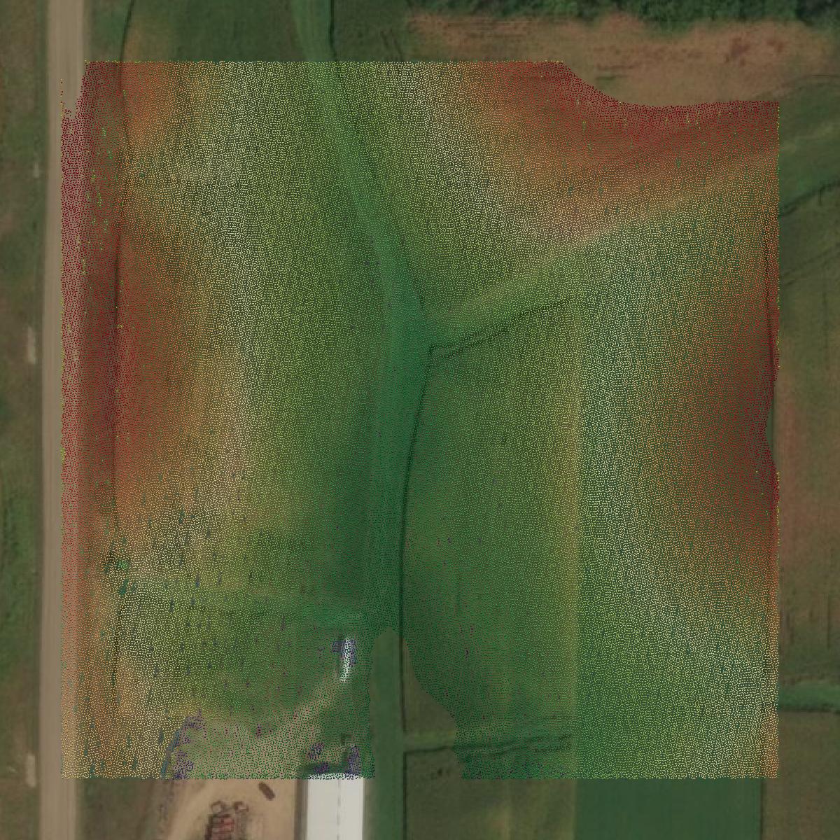
LiDAR
This image shows a LiDAR point cloud in Green County created using GIS data in Equator.
Get LiDAR for Green County
Contours
This image shows a contour map in Green County created using GIS data in Equator.
Get Contours for Green CountyFormats Available
Export Your Data Ready to Use in Multiple Formats
DWG
AutoCAD Drawing - Industry-standard CAD format
Supported Data:
Contour, Parcel, Building Outline
SHP
Shapefile - Standard GIS vector format
Supported Data:
Contour, Parcel, Building Outline
DXF
Drawing Exchange Format - Universal CAD interchange
Supported Data:
Contour, Building Outline
GeoJSON
Geographic JSON - Web-friendly spatial data format
Supported Data:
Contour, Parcel, Building Outline
LAZ
Compressed LAS - Efficient LiDAR point cloud format
Supported Data:
Point Cloud
SVG
Scalable Vector Graphics - Web vector format
Supported Data:
Contour, Building Outline
GPKG (Coming Soon)
GeoPackage - Modern OGC spatial database format
Supported Data:
Contour, Parcel, Building Outline
LandXML (Coming Soon)
Land XML - Civil engineering data exchange format
Supported Data:
Point Cloud
TIN (Coming Soon)
Triangulated Irregular Network - 3D surface model
Supported Data:
Point Cloud
XYZ (Coming Soon)
XYZ Point Cloud - Simple ASCII point cloud format
Supported Data:
Point Cloud
Background
GIS Data for Green County
The webpage for Green County, Wisconsin, provides access to a variety of downloadable GIS datasets and forms. It features a zipped ESRI File Geodatabase, which includes data on address points, parcels, lakes, rivers, road centerlines, and more. Additionally, users can request custom GIS data or maps through a designated form, which includes a fee schedule. The site also offers plat books for sale and provides digital access to Plats of Survey, organized by volume and page number, with an index for owner lookup.
Access Green County GIS Data in Equator →Green County Portal →Showcase
Sample GIS Data for Green County
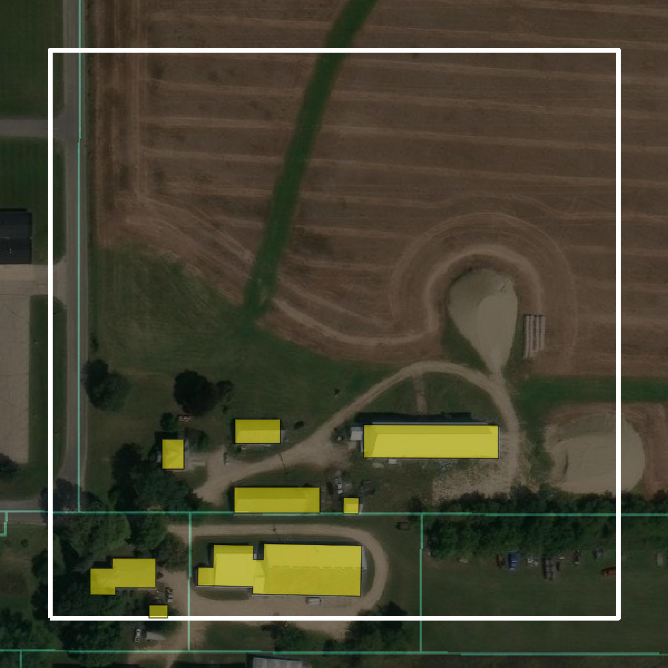
Parcels and Buildings
Parcel and building data in Green County are used in a variety of fields including architecture, real estate, and urban planning.
Get Parcels and Buildings for Green County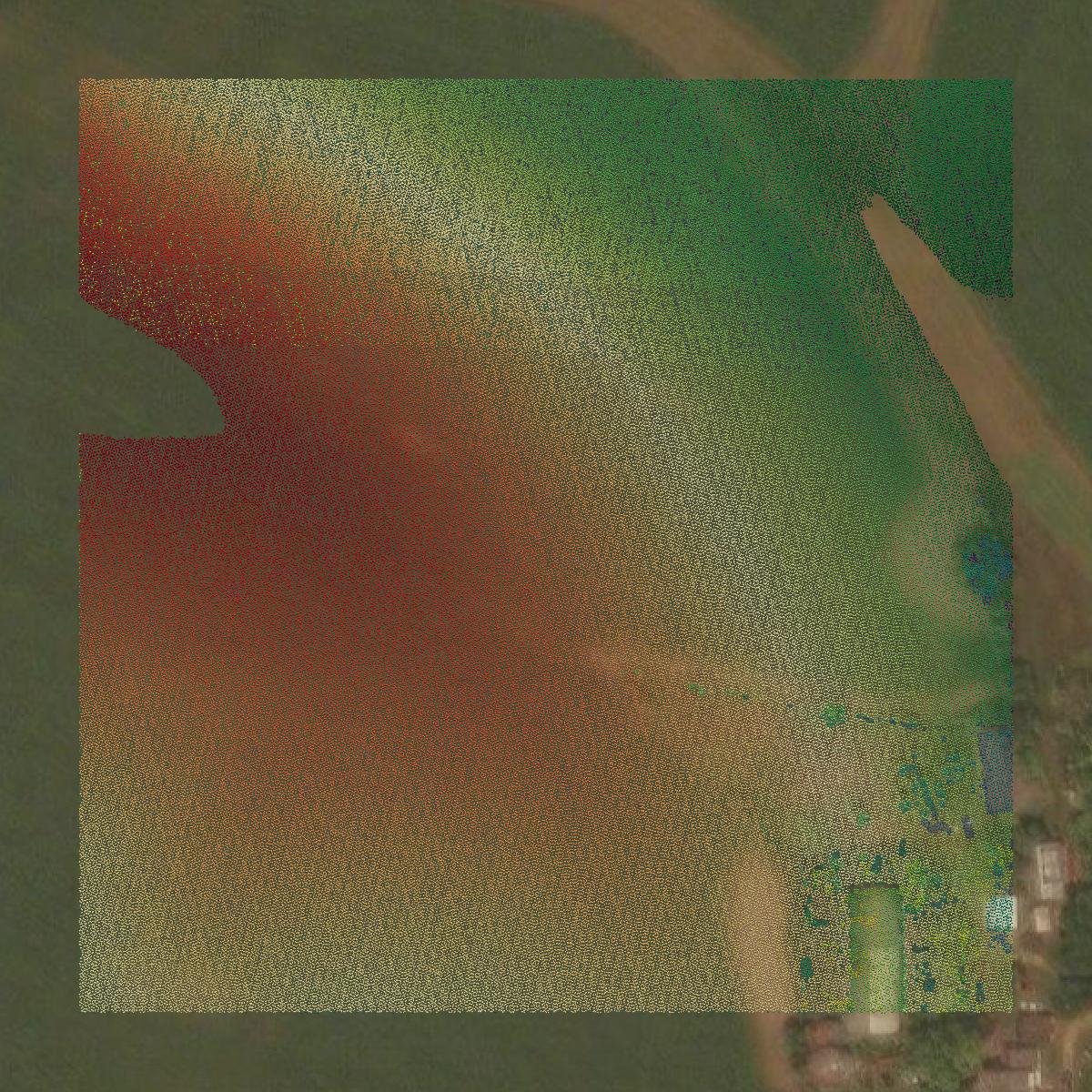
LiDAR
Point clouds (LiDAR) in Green County can produce highly accurate 3D models of terrain, structures, and vegetation.
Get LiDAR for Green County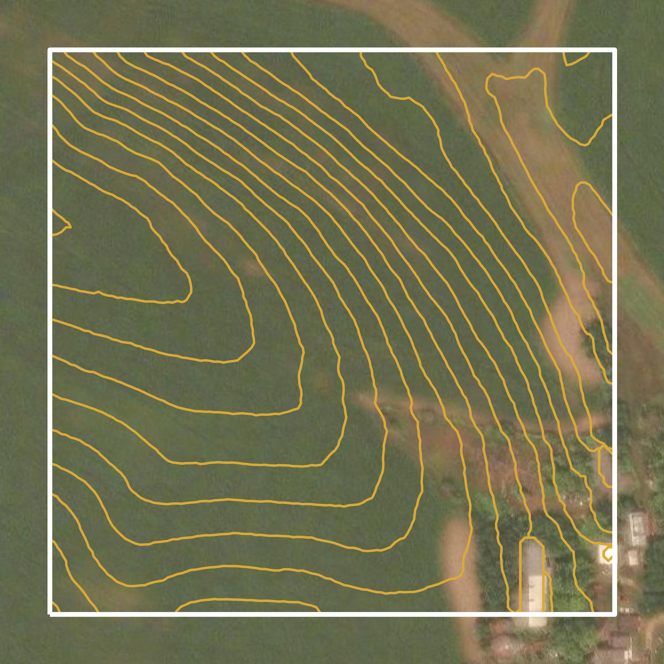
Contours
Contours in Green County visualize 3D elevations on a 2D surface allowing you to better understand your site.
Get Contours for Green County