Overview
Fairbanks North Star Borough GIS Data - For CAD
Equator helps civil engineering, architecture and consulting firms with the tools to instantly find, process and download accurate LiDAR, contours, parcel data, building footprints, DEMs, point clouds and other GIS data for Fairbanks North Star Borough in an online web mapping portal.
Fairbanks North Star Borough GIS Data ->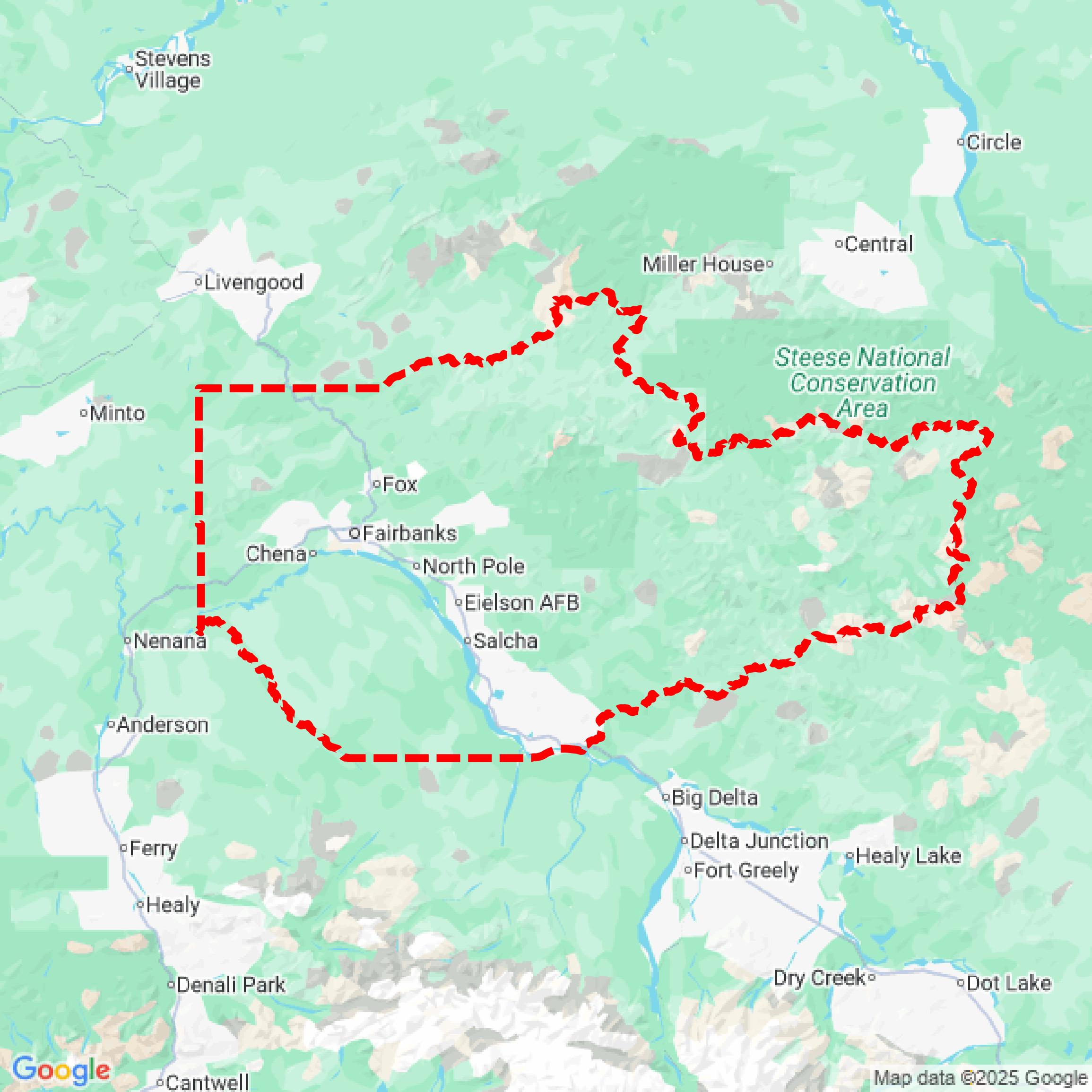

Data Available
Download GIS Data for Fairbanks North Star Borough

Parcels and Buildings
This image shows parcel and building data in Fairbanks North Star Borough created using GIS data in Equator.
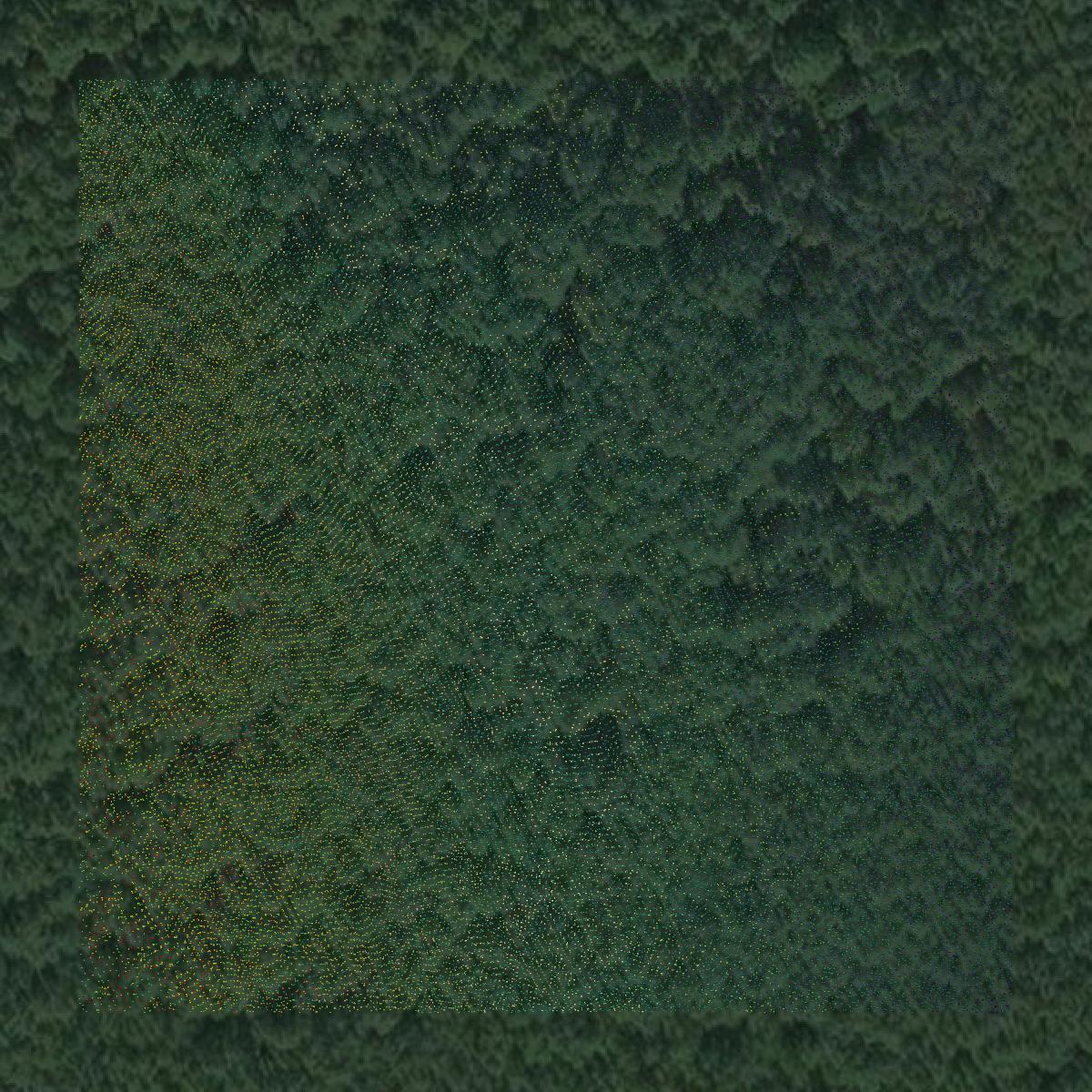
LiDAR
This image shows a LiDAR point cloud in Fairbanks North Star Borough created using GIS data in Equator.
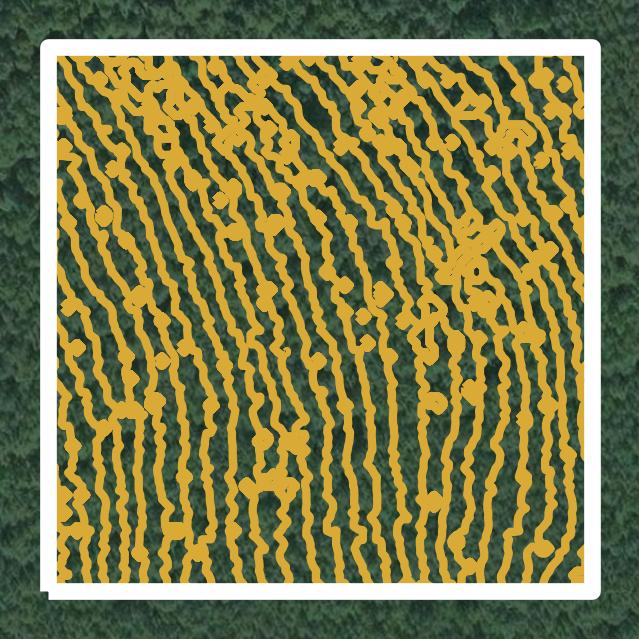
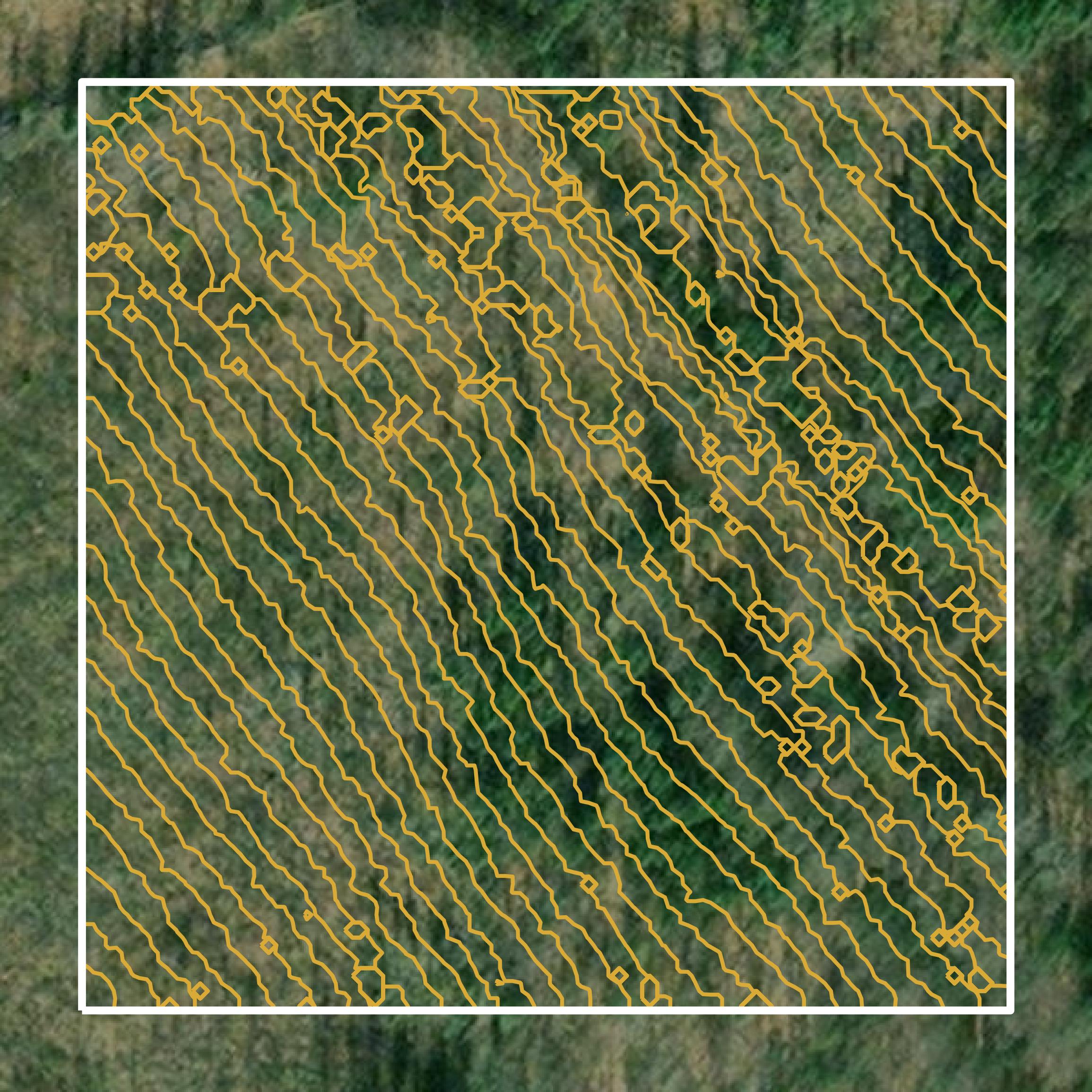
Contours
This image shows a contour map in Fairbanks North Star Borough created using GIS data in Equator.
Formats Available
Export Your Data Ready to Use in Multiple Formats
DWG
AutoCAD Drawing - Industry-standard CAD format
Supported Data:
Contour, Parcel, Building Outline
SHP
Shapefile - Standard GIS vector format
Supported Data:
Contour, Parcel, Building Outline
DXF
Drawing Exchange Format - Universal CAD interchange
Supported Data:
Contour, Building Outline
GeoJSON
Geographic JSON - Web-friendly spatial data format
Supported Data:
Contour, Parcel, Building Outline
LAZ
Compressed LAS - Efficient LiDAR point cloud format
Supported Data:
Point Cloud
SVG
Scalable Vector Graphics - Web vector format
Supported Data:
Contour, Building Outline
GPKG
GeoPackage - Modern OGC spatial database format
Supported Data:
Contour, Parcel, Building Outline
LandXML (Coming Soon)
Land XML - Civil engineering data exchange format
Supported Data:
Point Cloud
TIN (Coming Soon)
Triangulated Irregular Network - 3D surface model
Supported Data:
Point Cloud
XYZ (Coming Soon)
XYZ Point Cloud - Simple ASCII point cloud format
Supported Data:
Point Cloud
Background
GIS Data for Fairbanks North Star Borough
The Fairbanks North Star Borough GIS data portal provides access to a variety of geographic information system (GIS) datasets and spatial data resources. Available content includes parcel data, zoning information, aerial imagery, and LiDAR datasets, with specific offerings such as Pictometry mosaics from various years. Users can acquire data through Dropbox downloads or in-person USB pickups, with fees varying based on user type—general public, non-profit, journalist, or public agency/education. Additionally, the site outlines requirements for customer-provided storage devices for larger datasets, ensuring efficient data distribution.
Access Fairbanks North Star Borough GIS Data in Equator →Fairbanks North Star Borough Portal →Showcase
Sample GIS Data for Fairbanks North Star Borough

Parcels and Buildings
Parcel and building data in Fairbanks North Star Borough are used in a variety of fields including architecture, real estate, and urban planning.
LiDAR
Point clouds (LiDAR) in Fairbanks North Star Borough can produce highly accurate 3D models of terrain, structures, and vegetation.
Contours
Contours in Fairbanks North Star Borough visualize 3D elevations on a 2D surface allowing you to better understand your site.