Overview
Contra Costa County GIS Data – For CAD
Equator helps civil engineering, architecture and consulting firms with the tools to instantly find, process and download accurate LiDAR, contours, parcel data, building footprints, DEMs, point clouds and other GIS data for Contra Costa County in an online web mapping portal.
Contra Costa County GIS Data →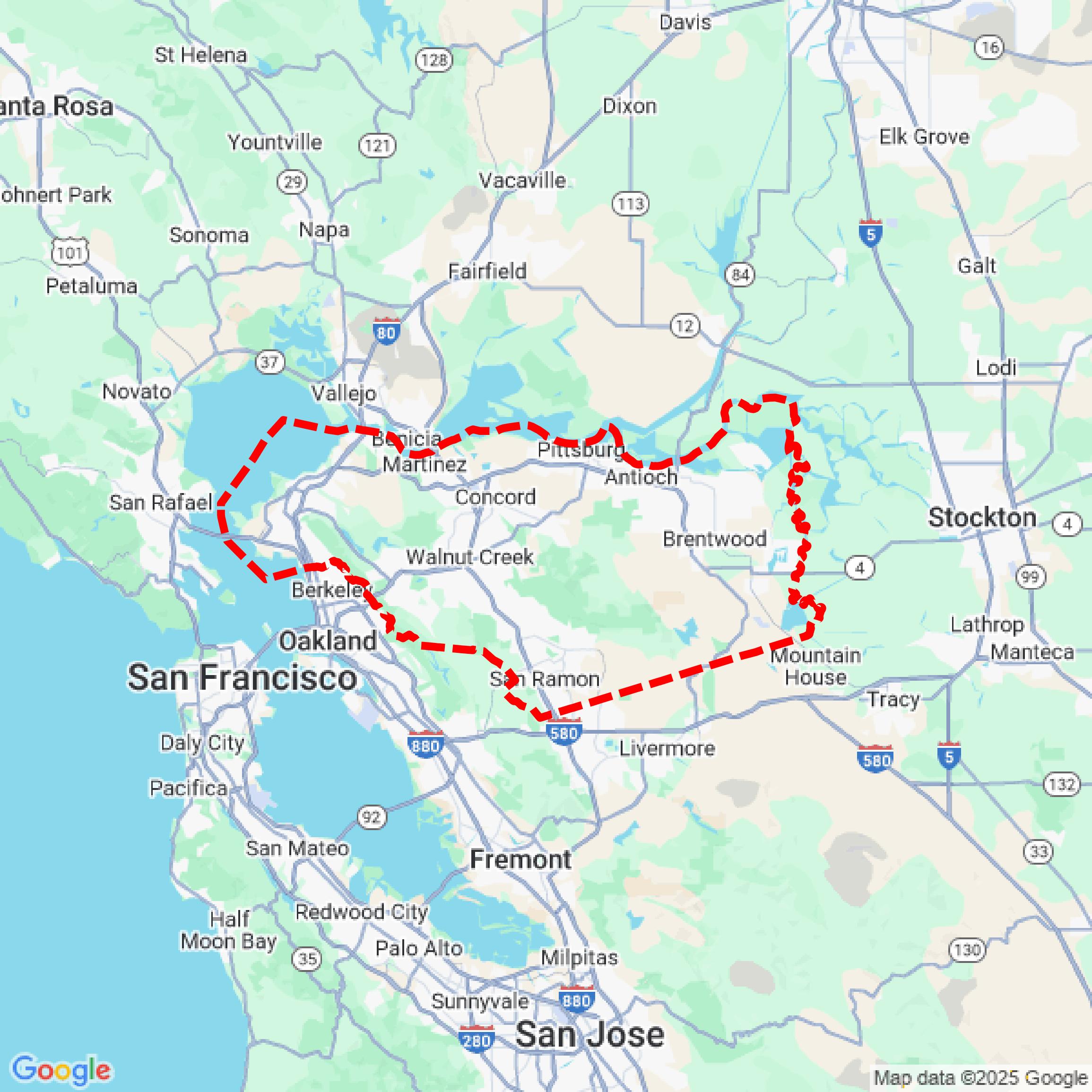

Data Available
Download GIS Data for Contra Costa County
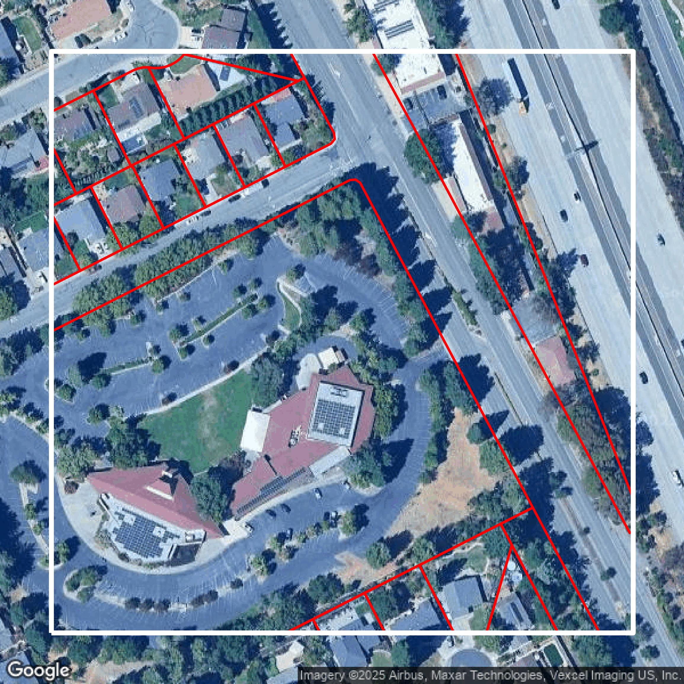
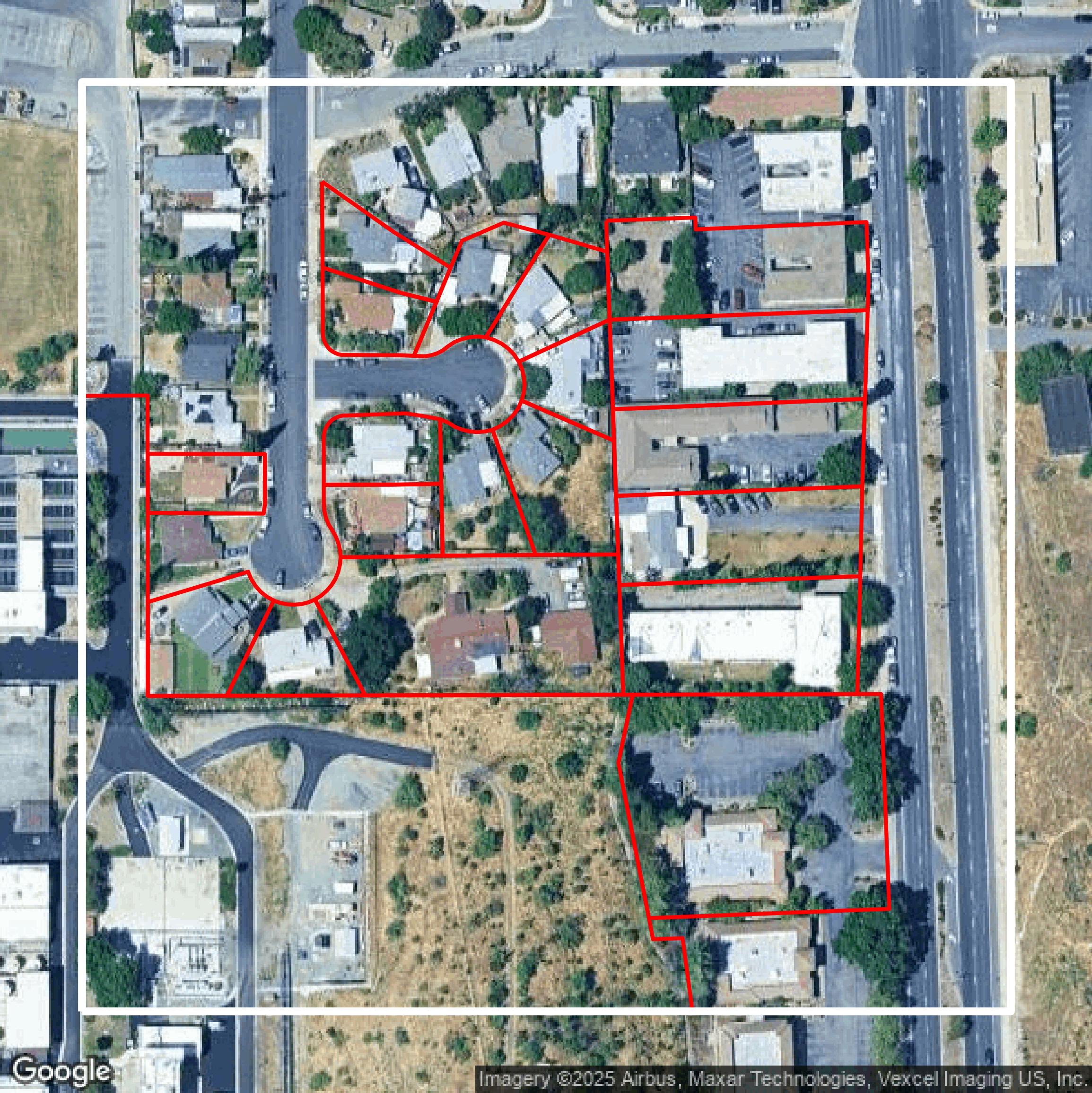
Parcels and Buildings
This image shows parcel and building data in Contra Costa County created using GIS data in Equator.
Get Parcels and Buildings for Contra Costa County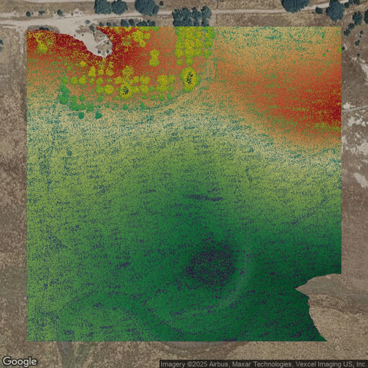
LiDAR
This image shows a LiDAR point cloud in Contra Costa County created using GIS data in Equator.
Get LiDAR for Contra Costa County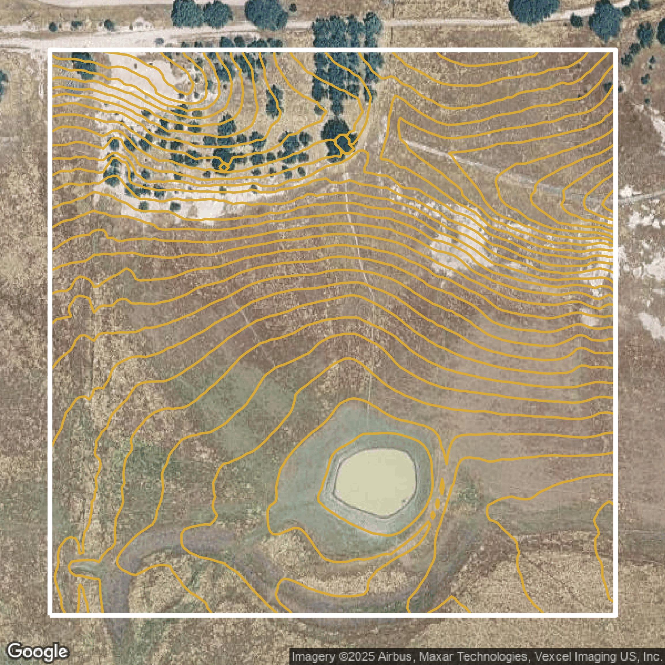
Contours
This image shows a contour map in Contra Costa County created using GIS data in Equator.
Get Contours for Contra Costa CountyFormats Available
Export Your Data Ready to Use in Multiple Formats
DWG
AutoCAD Drawing - Industry-standard CAD format
Supported Data:
Contour, Parcel, Building Outline
SHP
Shapefile - Standard GIS vector format
Supported Data:
Contour, Parcel, Building Outline
DXF
Drawing Exchange Format - Universal CAD interchange
Supported Data:
Contour, Building Outline
GeoJSON
Geographic JSON - Web-friendly spatial data format
Supported Data:
Contour, Parcel, Building Outline
LAZ
Compressed LAS - Efficient LiDAR point cloud format
Supported Data:
Point Cloud
SVG
Scalable Vector Graphics - Web vector format
Supported Data:
Contour, Building Outline
GPKG (Coming Soon)
GeoPackage - Modern OGC spatial database format
Supported Data:
Contour, Parcel, Building Outline
LandXML (Coming Soon)
Land XML - Civil engineering data exchange format
Supported Data:
Point Cloud
TIN (Coming Soon)
Triangulated Irregular Network - 3D surface model
Supported Data:
Point Cloud
XYZ (Coming Soon)
XYZ Point Cloud - Simple ASCII point cloud format
Supported Data:
Point Cloud
Background
GIS Data for Contra Costa County
The Contra Costa County GIS website offers a robust collection of "Online Mapping Resources" and interactive data tools designed to support community planning, economic development, environmental analysis, and public safety. Visitors can explore specialized datasets such as the "Bay Area Equity Atlas" for regional equity tracking, the "California Community & Place Based Data Tool" for demographic, business, and education data, and "Census Business Builder" for key economic demographics tailored to business owners. The site also provides access to authoritative maps like "Cal Fire - Fire Hazard Severity Zones" for wildfire risk assessment, the "California Highway System" for comprehensive road network information, and environmental justice mapping through tools like "SB535 Disadvantaged Communities" and the "Department of Water Resources Disadvantaged Communities Mapping Tool." Additional resources include historical aerial imagery via "FrameFinder," workforce patterns with "OnTheMap," and public health and service data through "Healthy City." These datasets and applications empower users with detailed, actionable geographic information for informed decision-making across a range of county-related issues.
Access Contra Costa County GIS Data in Equator →Contra Costa County Portal →Showcase
Sample GIS Data for Contra Costa County
Parcels and Buildings
Parcel and building data in Contra Costa County are used in a variety of fields including architecture, real estate, and urban planning.
Get Parcels and Buildings for Contra Costa County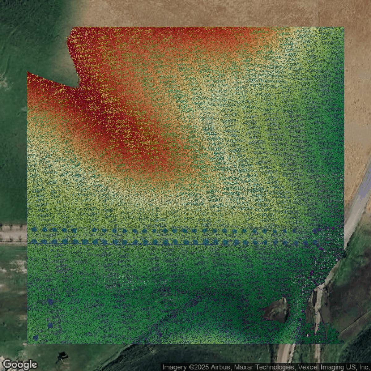
LiDAR
Point clouds (LiDAR) in Contra Costa County can produce highly accurate 3D models of terrain, structures, and vegetation.
Get LiDAR for Contra Costa County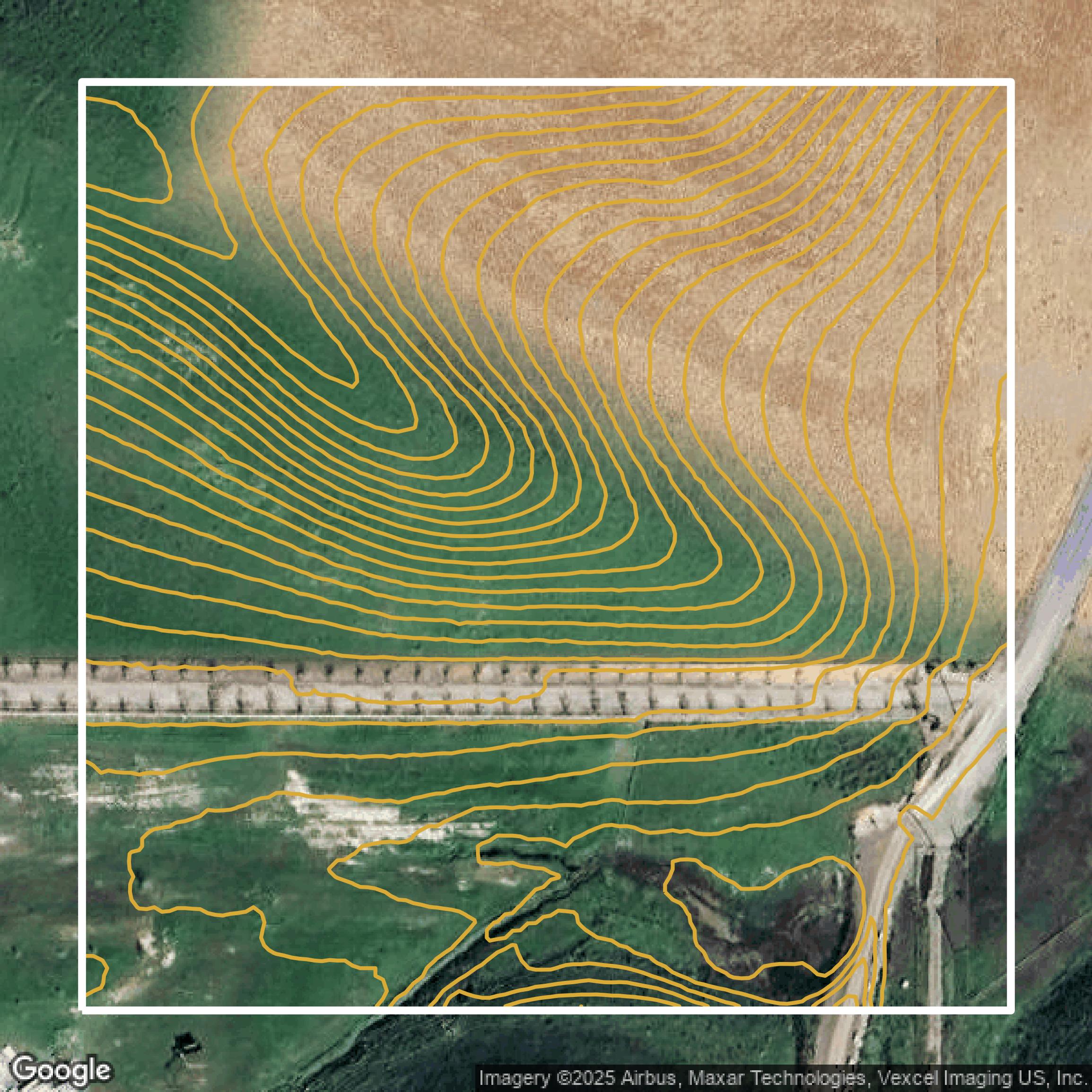
Contours
Contours in Contra Costa County visualize 3D elevations on a 2D surface allowing you to better understand your site.
Get Contours for Contra Costa County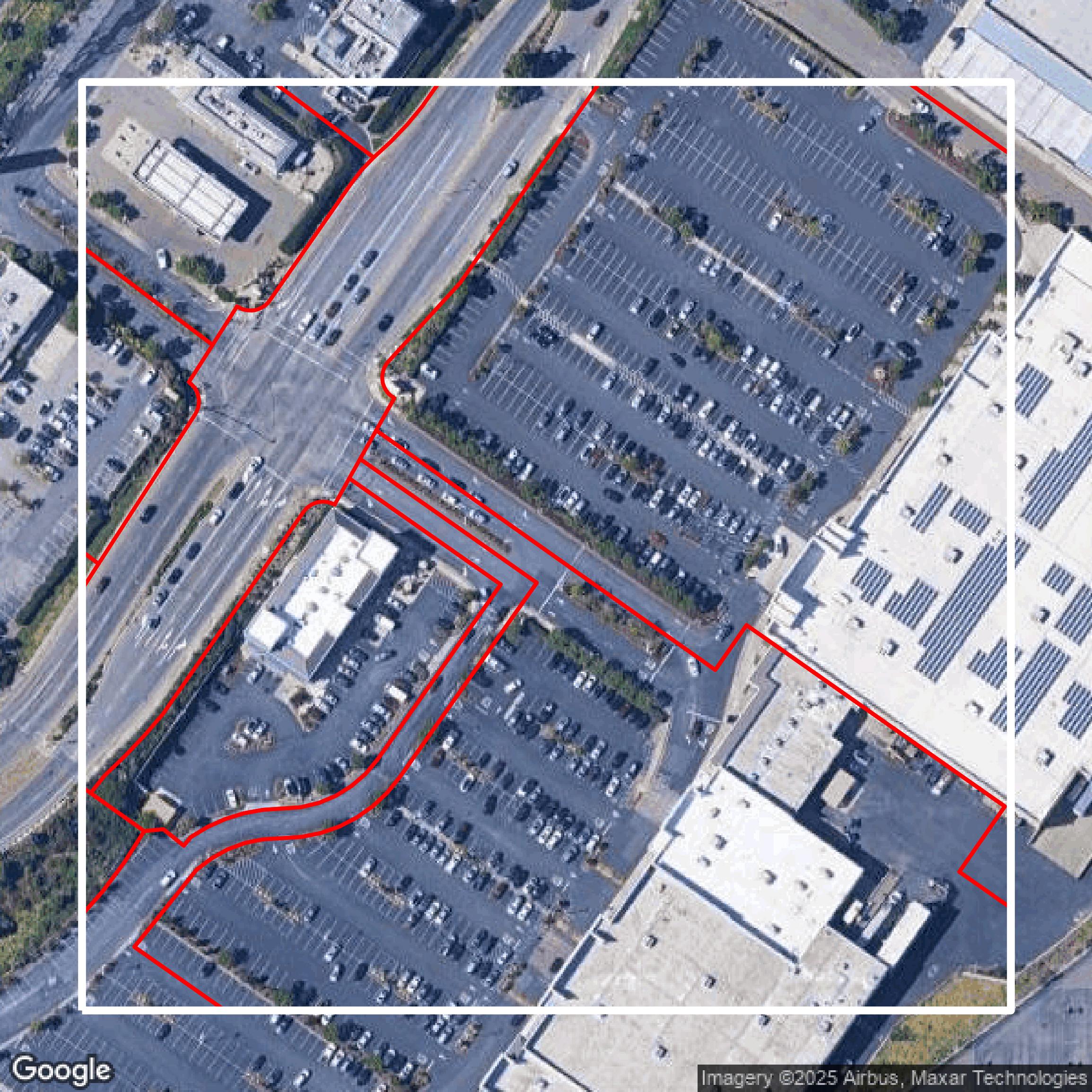
Parcels and Buildings
Accessing Contra Costa County parcel and building data on Equator gives you access to coverage across the US.
Get Parcels and Buildings for Contra Costa County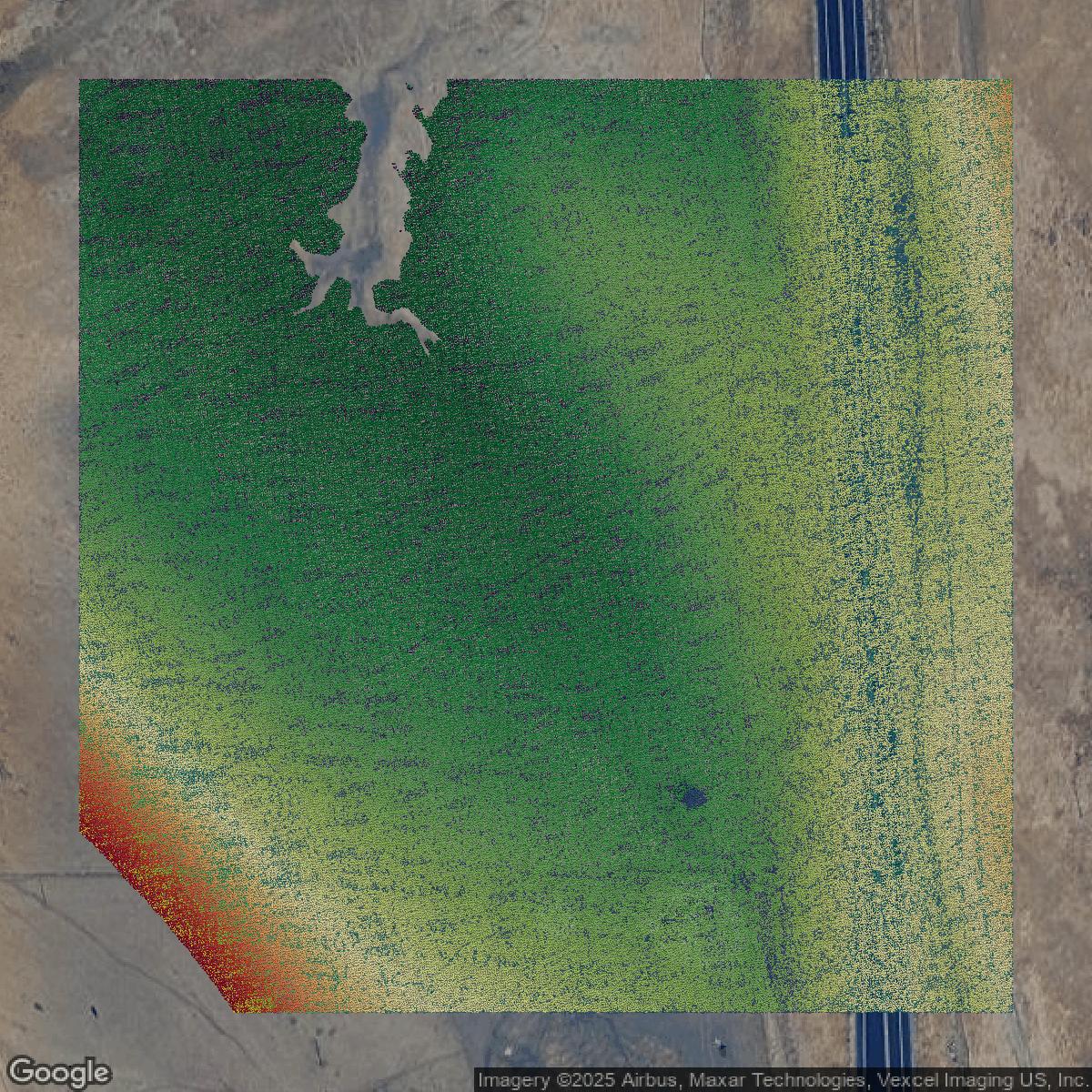
LiDAR
Contra Costa County LiDAR uses include land surveying, analyzing crop health, or even archaeological studies.
Get LiDAR for Contra Costa County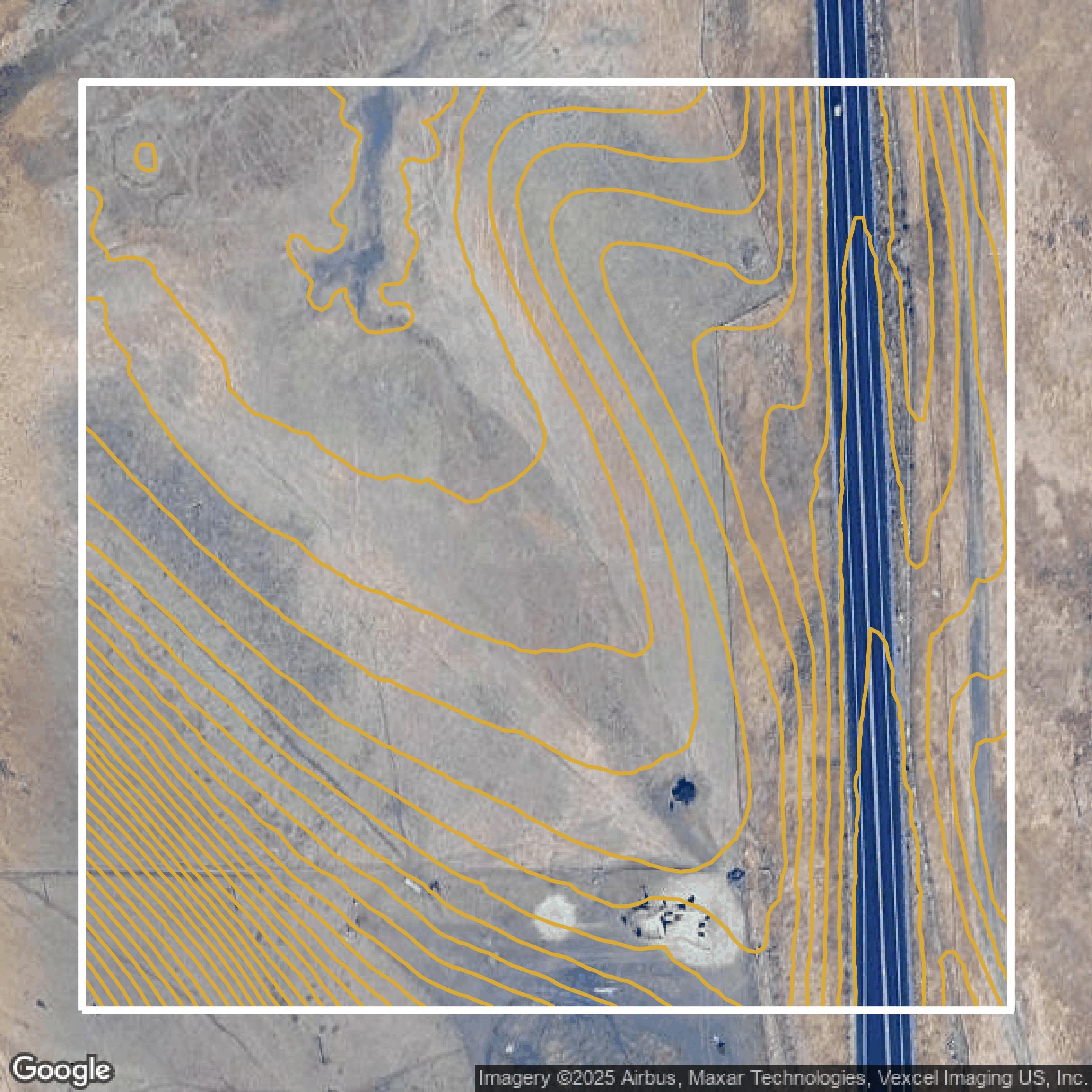
Contours
Contra Costa County contours can be used for construction & engineering, environmental science, and more.
Get Contours for Contra Costa County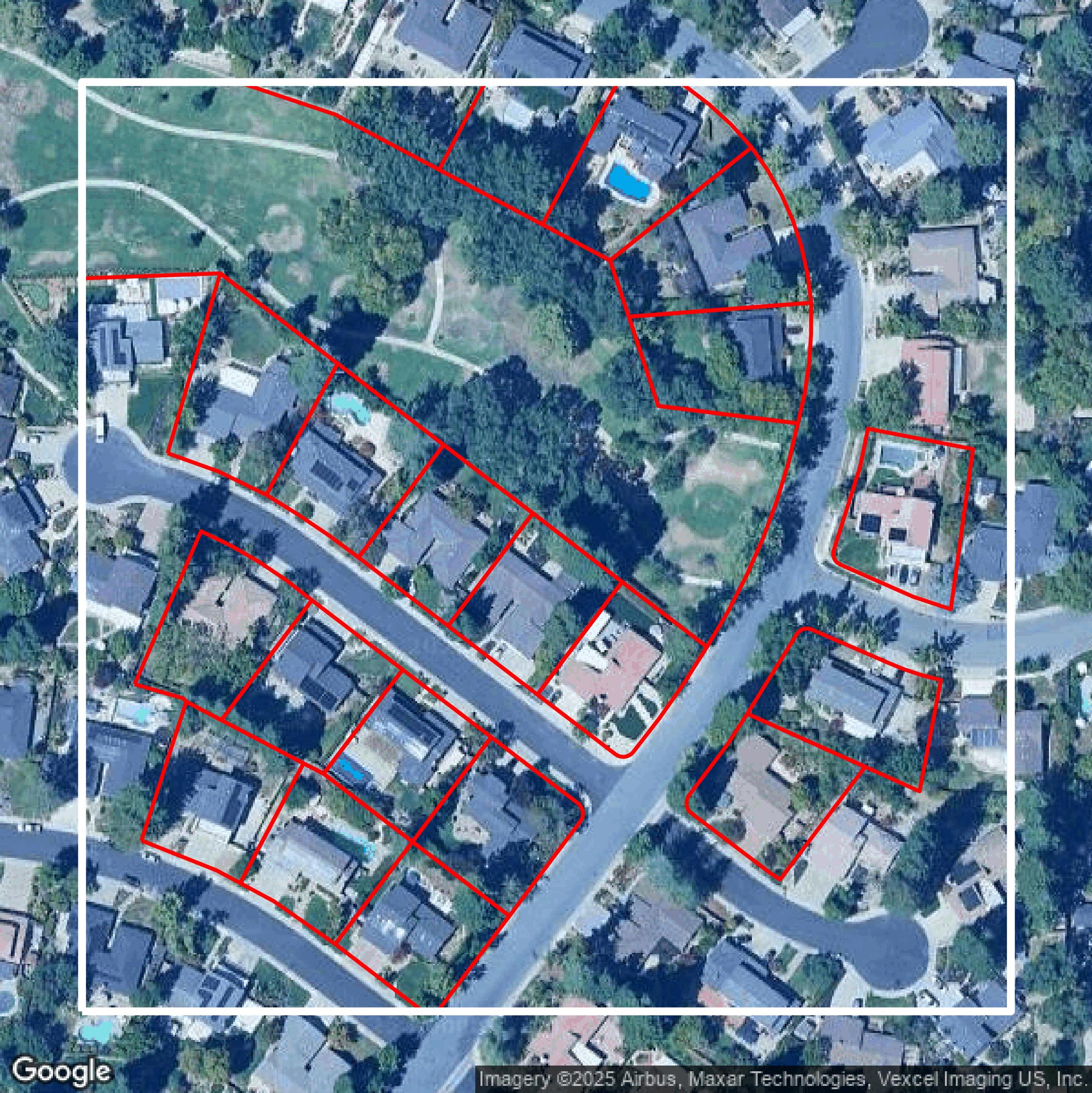
Parcels and Buildings
Dozens of fields are contained within each Contra Costa County parcel and building data, including zoning, owners, and year built.
Get Parcels and Buildings for Contra Costa County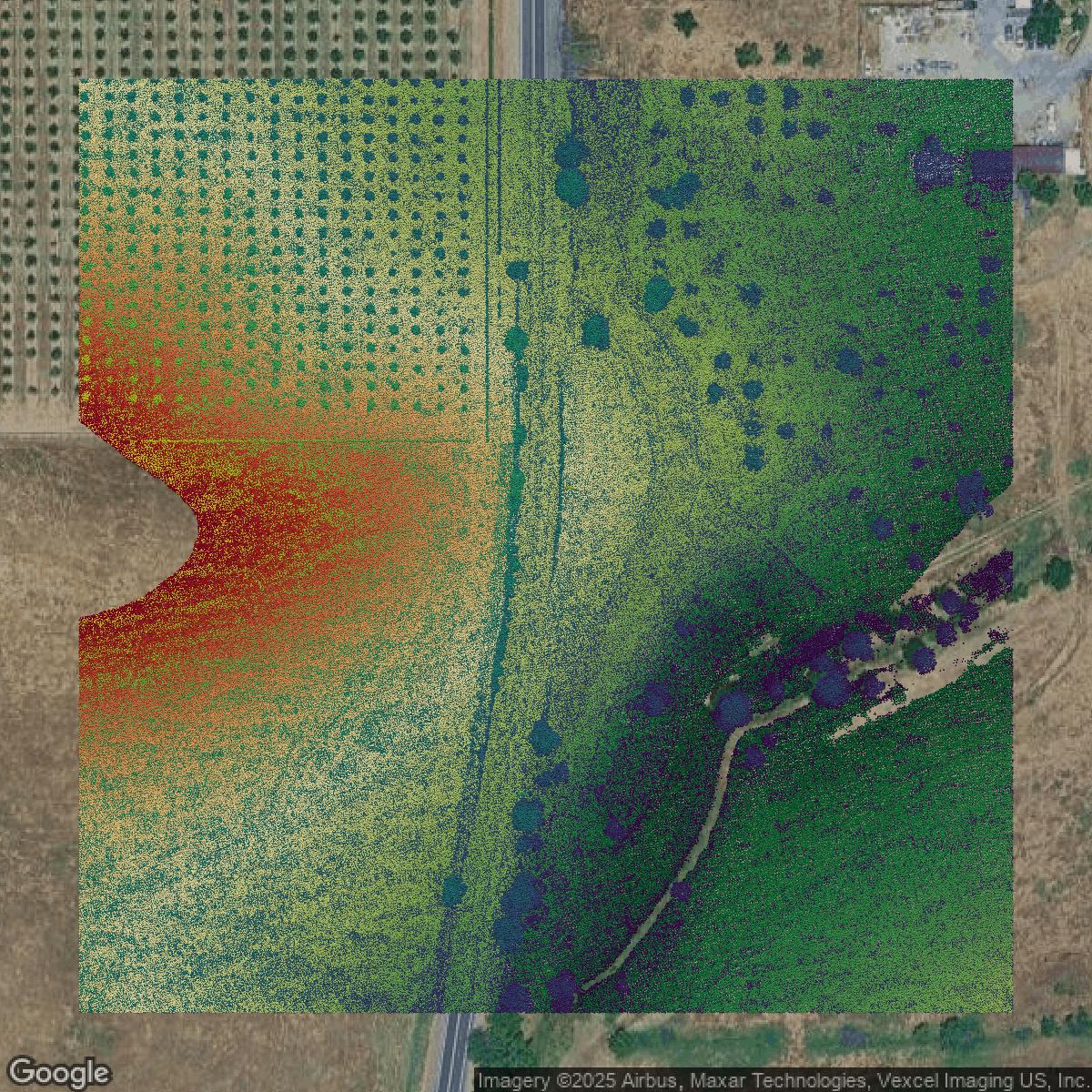
LiDAR
Equator turns Contra Costa County LiDAR point clouds into various lidar-derived data sets, including DEMs.
Get LiDAR for Contra Costa County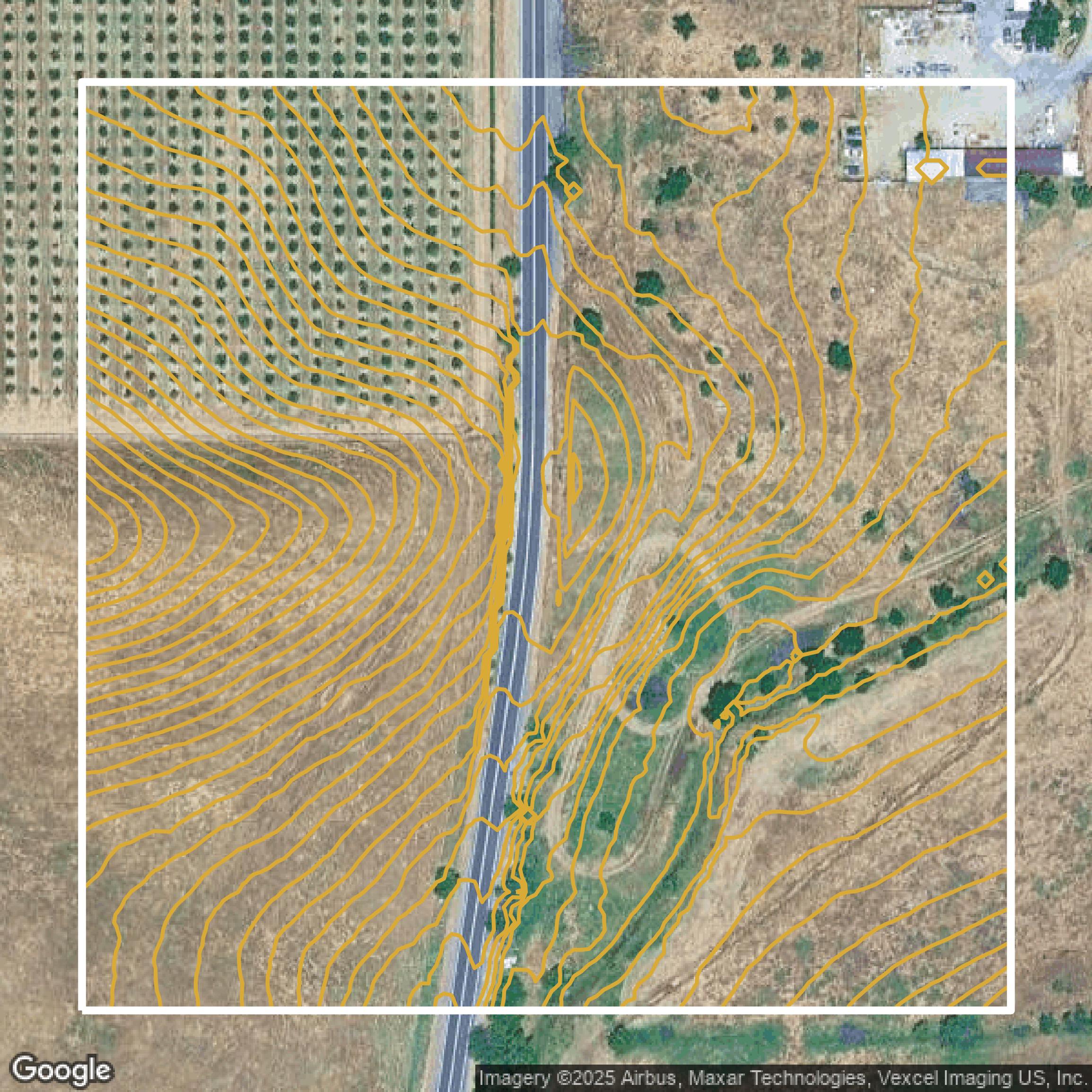
Contours
Contra Costa County contours on Equator are produced from LiDAR coverage, allowing for high precision
Get Contours for Contra Costa County