Overview
San Joaquin County GIS Data – For CAD
Equator helps civil engineering, architecture and consulting firms with the tools to instantly find, process and download accurate LiDAR, contours, parcel data, building footprints, DEMs, point clouds and other GIS data for San Joaquin County in an online web mapping portal.
San Joaquin County GIS Data →

Data Available
Download GIS Data for San Joaquin County
Parcels and Buildings
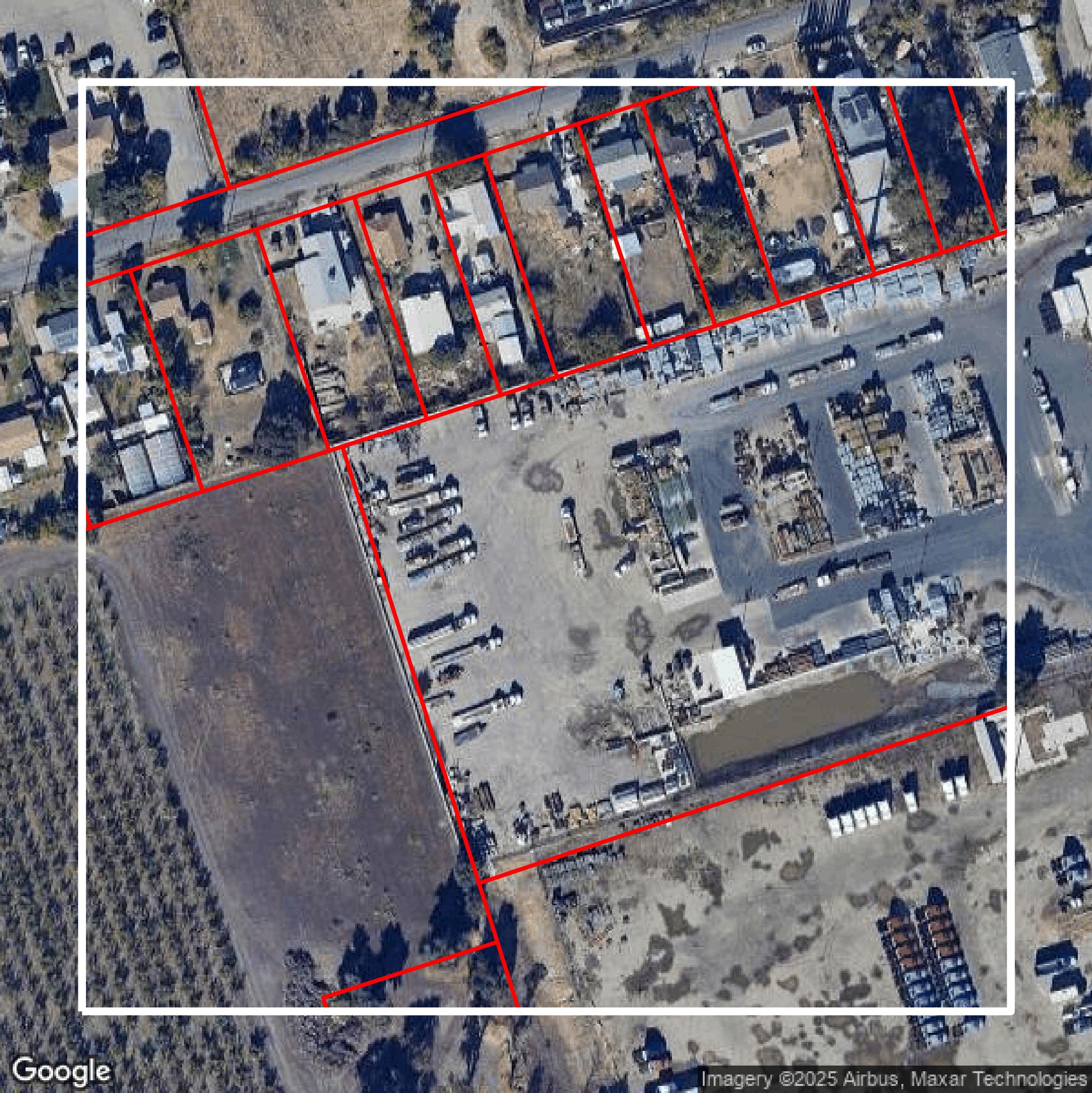
This image shows parcel and building data in San Joaquin County created using GIS data in Equator.
Get Parcels and Buildings for San Joaquin County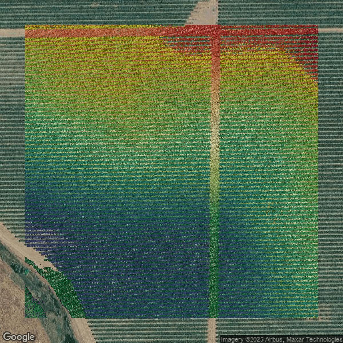
LiDAR
This image shows a LiDAR point cloud in San Joaquin County created using GIS data in Equator.
Get LiDAR for San Joaquin County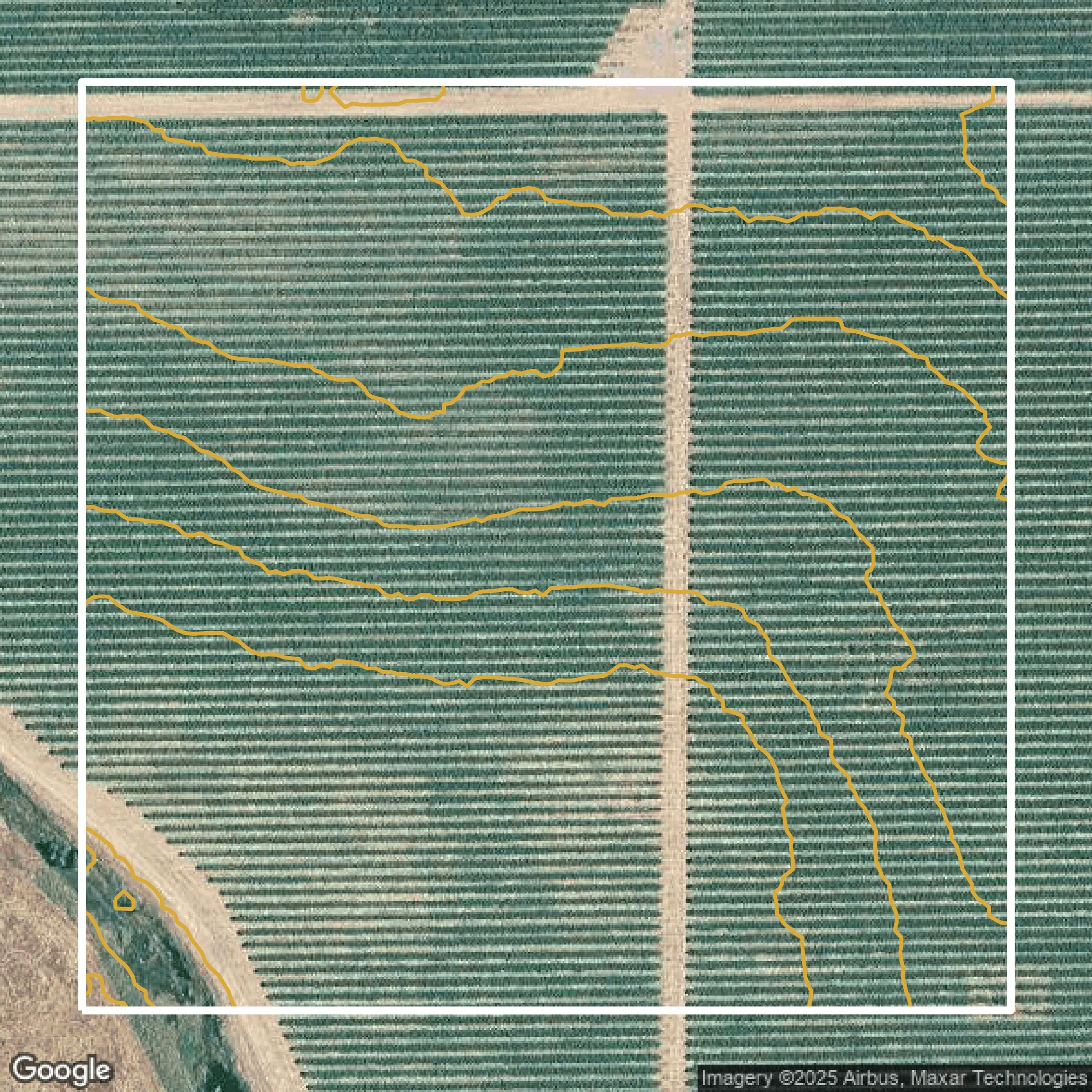
Contours
This image shows a contour map in San Joaquin County created using GIS data in Equator.
Get Contours for San Joaquin CountyFormats Available
Export Your Data Ready to Use in Multiple Formats
DWG
AutoCAD Drawing - Industry-standard CAD format
Supported Data:
Contour, Parcel, Building Outline
SHP
Shapefile - Standard GIS vector format
Supported Data:
Contour, Parcel, Building Outline
DXF
Drawing Exchange Format - Universal CAD interchange
Supported Data:
Contour, Building Outline
GeoJSON
Geographic JSON - Web-friendly spatial data format
Supported Data:
Contour, Parcel, Building Outline
LAZ
Compressed LAS - Efficient LiDAR point cloud format
Supported Data:
Point Cloud
SVG
Scalable Vector Graphics - Web vector format
Supported Data:
Contour, Building Outline
GPKG (Coming Soon)
GeoPackage - Modern OGC spatial database format
Supported Data:
Contour, Parcel, Building Outline
LandXML (Coming Soon)
Land XML - Civil engineering data exchange format
Supported Data:
Point Cloud
TIN (Coming Soon)
Triangulated Irregular Network - 3D surface model
Supported Data:
Point Cloud
XYZ (Coming Soon)
XYZ Point Cloud - Simple ASCII point cloud format
Supported Data:
Point Cloud
Background
GIS Data for San Joaquin County
The San Joaquin County GIS Map Server website offers a comprehensive collection of downloadable digital GIS data provided as ESRI shapefiles in Zip archives, updated biannually (most recently on January 6, 2025). Visitors can access a wide range of technical datasets categorized into key areas including **Administrative** (e.g., County Limit, City Limits, School Districts), **Cadastral** (Parcels, APN Book Index), **Transportation** (Streets, Railroads, Highway Exits), **Addressing** (Address Grid regions and sections), **Political** districts, **Hydrology** (Lakes & Rivers, Ponds, Delta zones), **Planning** (Zoning, General Plan, Agricultural Preserves, Airport Influence Areas), **Locations** (Airports, Hospitals, Parks), **Safety** (Fire Districts, Sheriff Beats, Ambulance Zones), **Services** (Water, Sewer, Irrigation Districts), **Hazards** (Fire Hazard Severity Zones, Earthquake Zones, Flood Zones), **Topography** (Elevation Contours), and **US Census 2020** spatial units. The site also provides standard reference data such as PLSS Sections and USGS 7.5' Quads. All datasets are projected to CCS83 NAD83 Zone 3 in US Survey Feet and require specialized GIS software and skills for effective use. For users needing more current or customized data extracts, a dedicated [GIS Data Request](https://sjmap.org/GISDataRequest.htm) page is available. Note that use of this data is subject to specific terms, disclaimers, and no technical support is provided outside normal County operations.
Access San Joaquin County GIS Data in Equator →San Joaquin County Portal →Showcase
Sample GIS Data for San Joaquin County
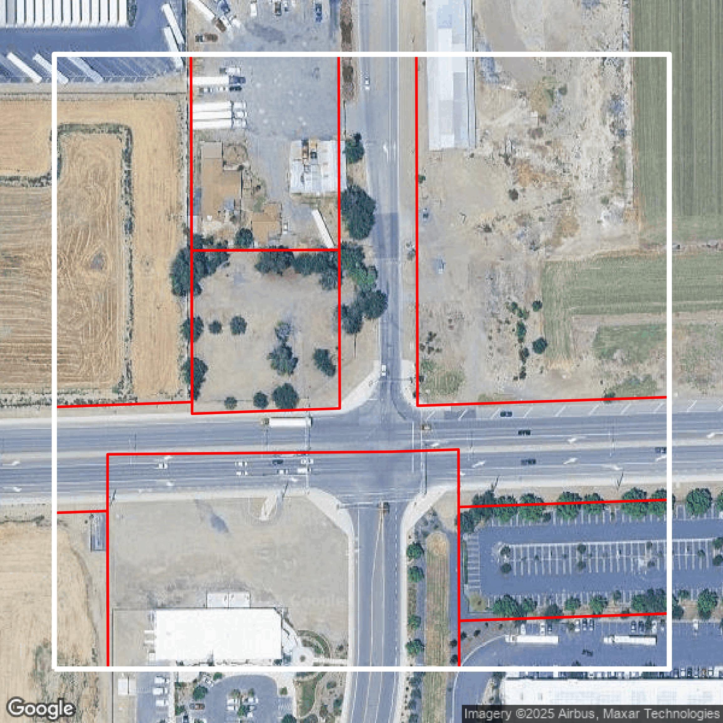
Parcels and Buildings
Parcel and building data in San Joaquin County are used in a variety of fields including architecture, real estate, and urban planning.
Get Parcels and Buildings for San Joaquin County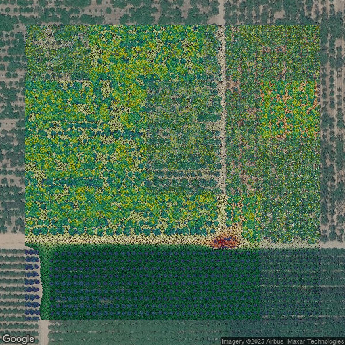
LiDAR
Point clouds (LiDAR) in San Joaquin County can produce highly accurate 3D models of terrain, structures, and vegetation.
Get LiDAR for San Joaquin County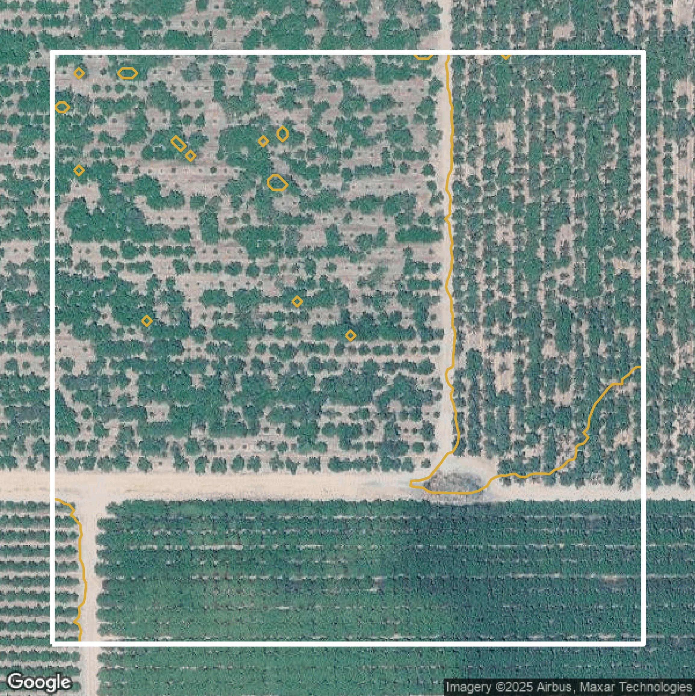
Contours
Contours in San Joaquin County visualize 3D elevations on a 2D surface allowing you to better understand your site.
Get Contours for San Joaquin County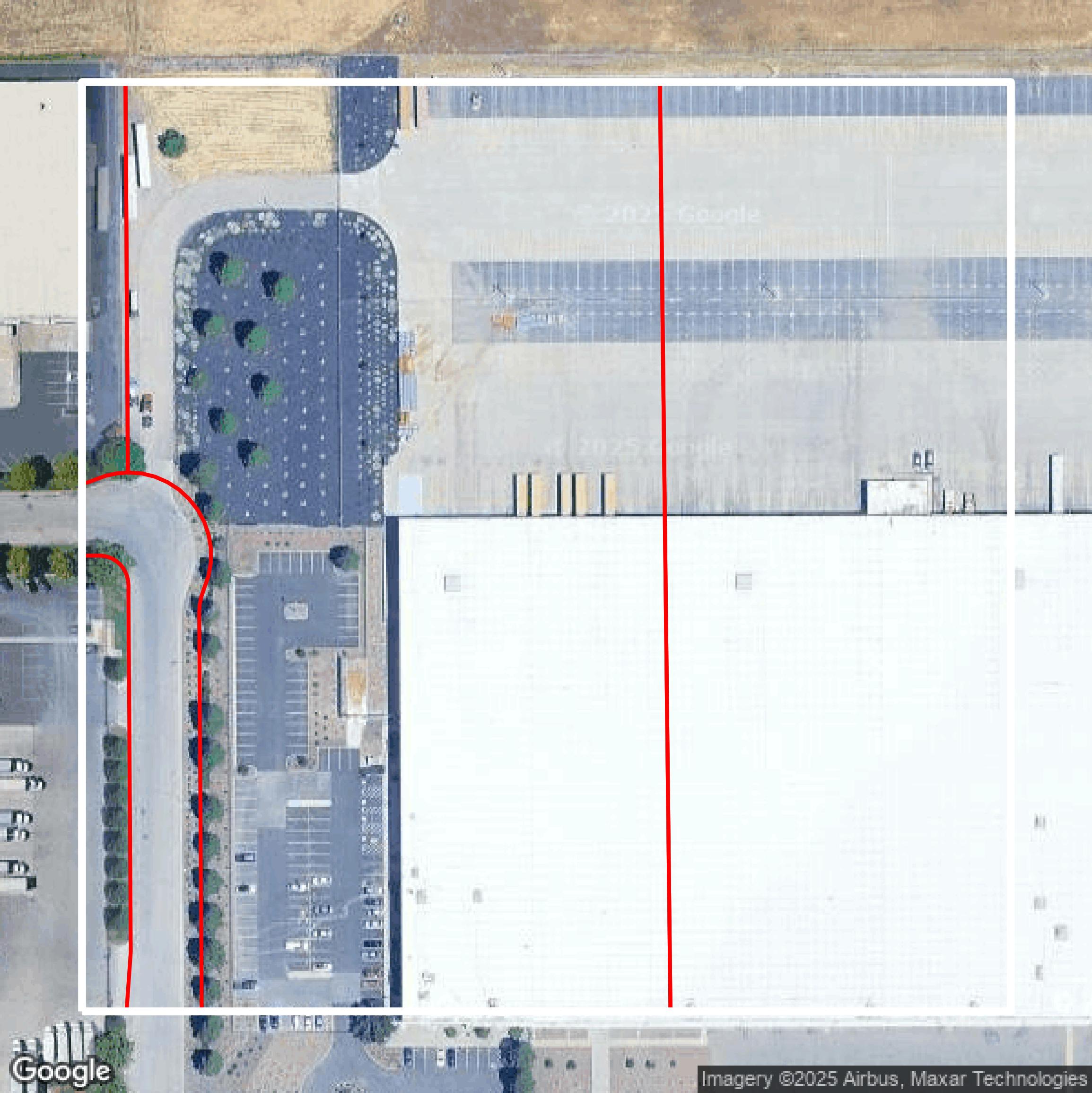
Parcels and Buildings
Accessing San Joaquin County parcel and building data on Equator gives you access to coverage across the US.
Get Parcels and Buildings for San Joaquin CountyLiDAR
San Joaquin County LiDAR uses include land surveying, analyzing crop health, or even archaeological studies.
Get LiDAR for San Joaquin CountyContours
San Joaquin County contours can be used for construction & engineering, environmental science, and more.
Get Contours for San Joaquin CountyParcels and Buildings
Dozens of fields are contained within each San Joaquin County parcel and building data, including zoning, owners, and year built.
Get Parcels and Buildings for San Joaquin CountyLiDAR
Equator turns San Joaquin County LiDAR point clouds into various lidar-derived data sets, including DEMs.
Get LiDAR for San Joaquin CountyContours
San Joaquin County contours on Equator are produced from LiDAR coverage, allowing for high precision
Get Contours for San Joaquin County