Overview
Sacramento County GIS Data – For CAD
Equator helps civil engineering, architecture and consulting firms with the tools to instantly find, process and download accurate LiDAR, contours, parcel data, building footprints, DEMs, point clouds and other GIS data for Sacramento County in an online web mapping portal.
Sacramento County GIS Data →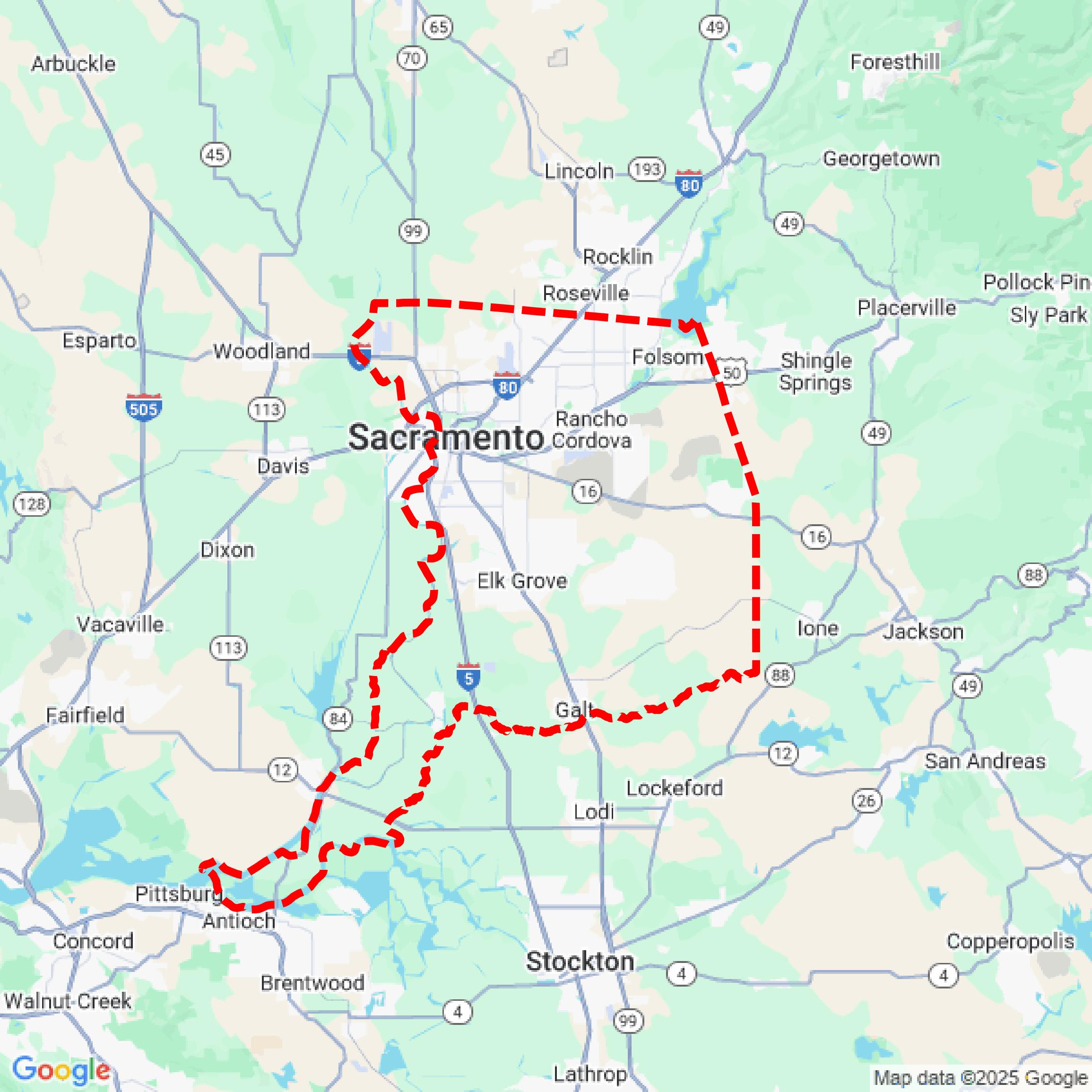

Data Available
Download GIS Data for Sacramento County
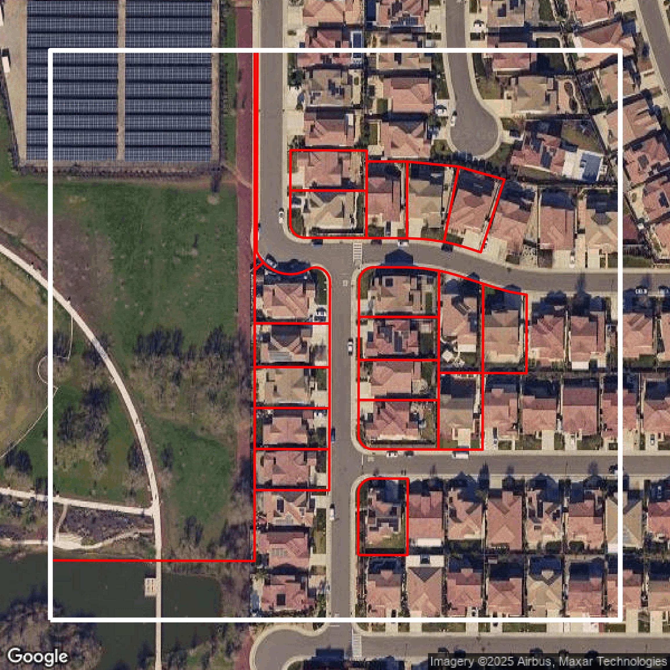
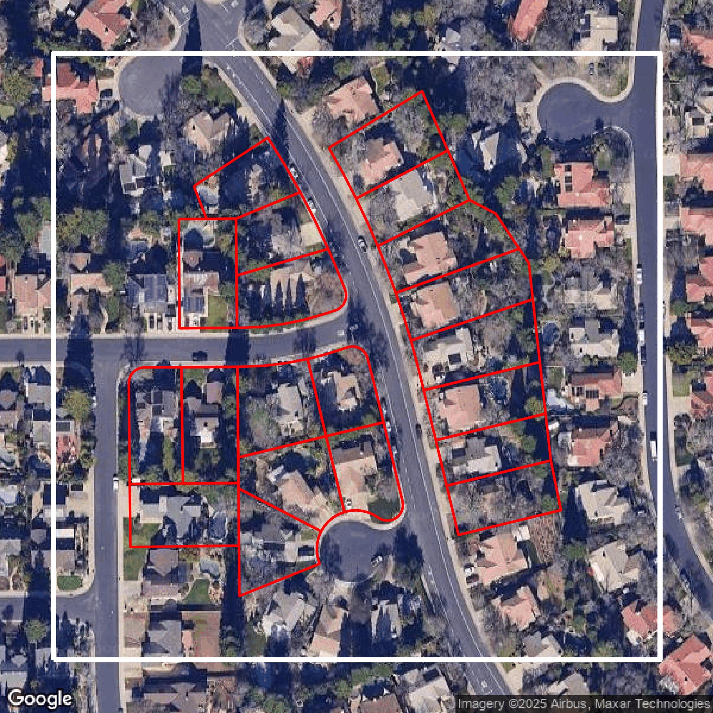
Parcels and Buildings
This image shows parcel and building data in Sacramento County created using GIS data in Equator.
Get Parcels and Buildings for Sacramento County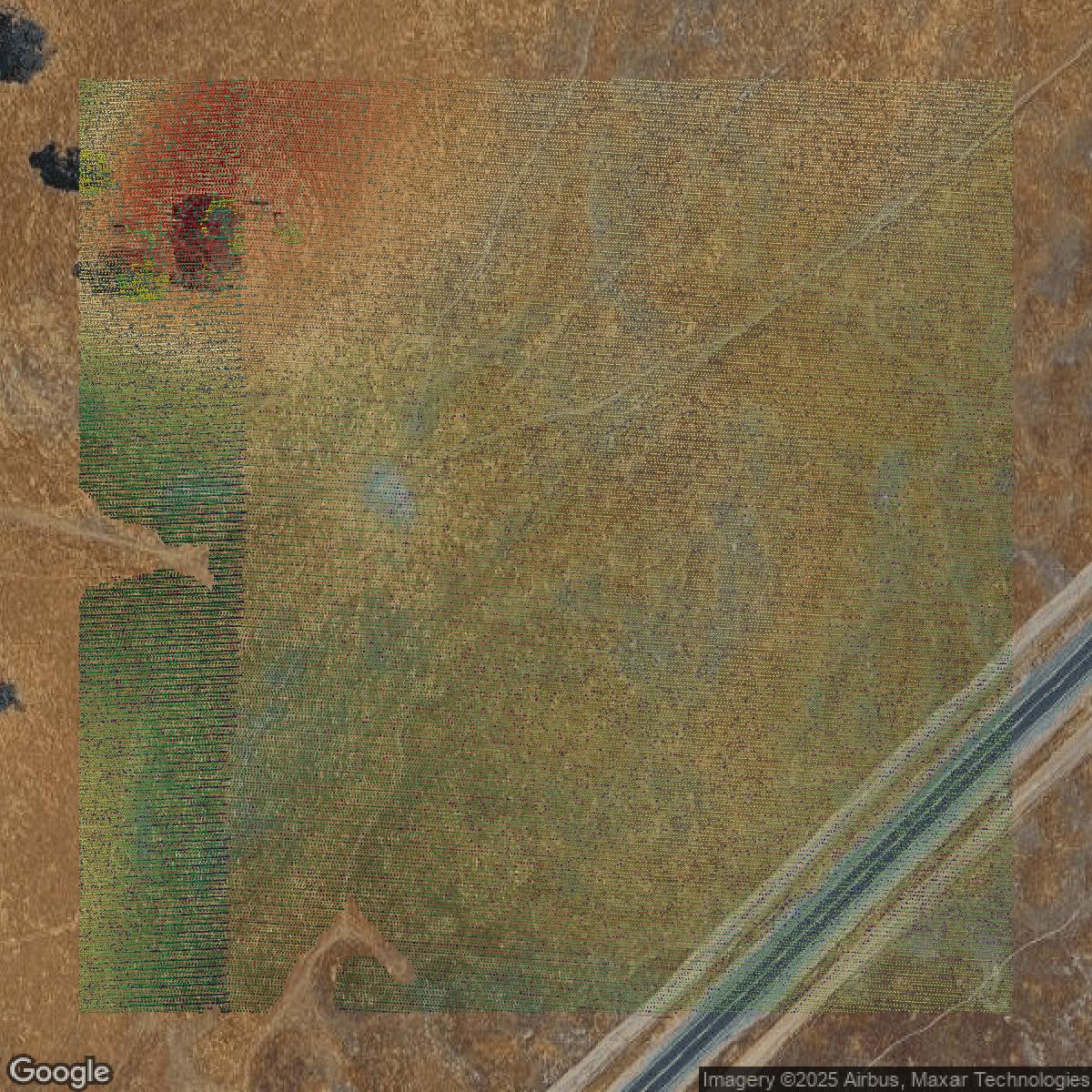
LiDAR
This image shows a LiDAR point cloud in Sacramento County created using GIS data in Equator.
Get LiDAR for Sacramento County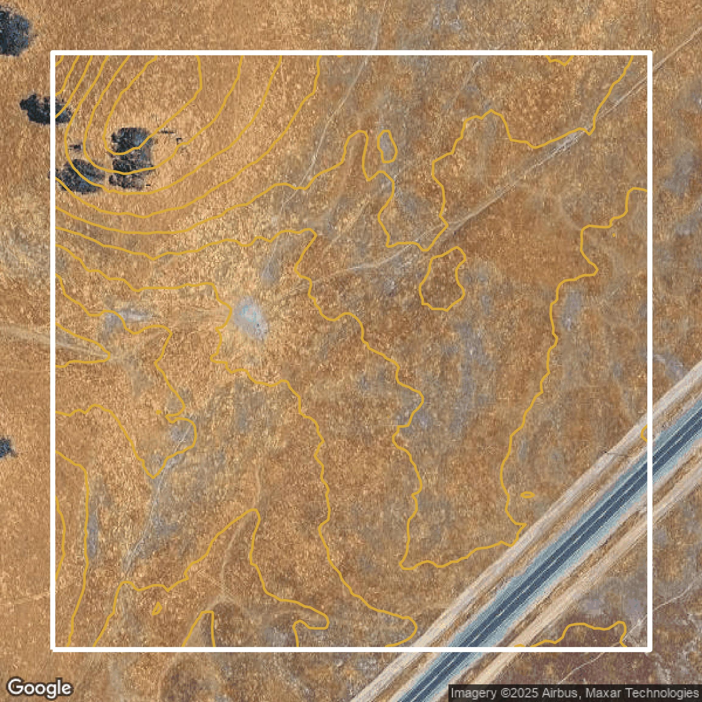
Contours
This image shows a contour map in Sacramento County created using GIS data in Equator.
Get Contours for Sacramento CountyFormats Available
Export Your Data Ready to Use in Multiple Formats
DWG
AutoCAD Drawing - Industry-standard CAD format
Supported Data:
Contour, Parcel, Building Outline
SHP
Shapefile - Standard GIS vector format
Supported Data:
Contour, Parcel, Building Outline
DXF
Drawing Exchange Format - Universal CAD interchange
Supported Data:
Contour, Building Outline
GeoJSON
Geographic JSON - Web-friendly spatial data format
Supported Data:
Contour, Parcel, Building Outline
LAZ
Compressed LAS - Efficient LiDAR point cloud format
Supported Data:
Point Cloud
SVG
Scalable Vector Graphics - Web vector format
Supported Data:
Contour, Building Outline
GPKG (Coming Soon)
GeoPackage - Modern OGC spatial database format
Supported Data:
Contour, Parcel, Building Outline
LandXML (Coming Soon)
Land XML - Civil engineering data exchange format
Supported Data:
Point Cloud
TIN (Coming Soon)
Triangulated Irregular Network - 3D surface model
Supported Data:
Point Cloud
XYZ (Coming Soon)
XYZ Point Cloud - Simple ASCII point cloud format
Supported Data:
Point Cloud
Background
GIS Data for Sacramento County
The Sacramento County Planning and Community Maps website offers a comprehensive suite of geographic and planning data tools designed to support residents, applicants, consultants, and community planners. Visitors can explore the **General Map Viewer**, which provides parcel-specific information including **General Plan designations, Zoning,** and **Williamson Act status**. The site also features downloadable **GIS Data** from the Sacramento County GIS Department and includes detailed **Hearing Body Jurisdiction Maps** such as **Board of Supervisors Districts** and **CPAC Boundaries Maps**. Community members can access **Community Boundary Maps** and **Utility District Boundary Maps** covering **Fire, Park, and Water Districts**. For those involved in development and planning, the website offers resources on **Specific Plans, Community Plans and Special Projects** with related maps, as well as access to **General Plan Maps** and **Urban Policy Area/Urban Services Boundary** information. Additional support includes links to **Planning Projects Viewer**, environmental and land use regulations, and permit programs. The site facilitates public awareness and participation by providing meeting schedules for various advisory councils and committees. Overall, the website serves as a vital planning resource featuring comprehensive maps, data sets, and tools to help users navigate Sacramento County’s land use, development, and community planning landscape.
Access Sacramento County GIS Data in Equator →Sacramento County Portal →Showcase
Sample GIS Data for Sacramento County
Parcels and Buildings
Parcel and building data in Sacramento County are used in a variety of fields including architecture, real estate, and urban planning.
Get Parcels and Buildings for Sacramento County
LiDAR
Point clouds (LiDAR) in Sacramento County can produce highly accurate 3D models of terrain, structures, and vegetation.
Get LiDAR for Sacramento County
Contours
Contours in Sacramento County visualize 3D elevations on a 2D surface allowing you to better understand your site.
Get Contours for Sacramento County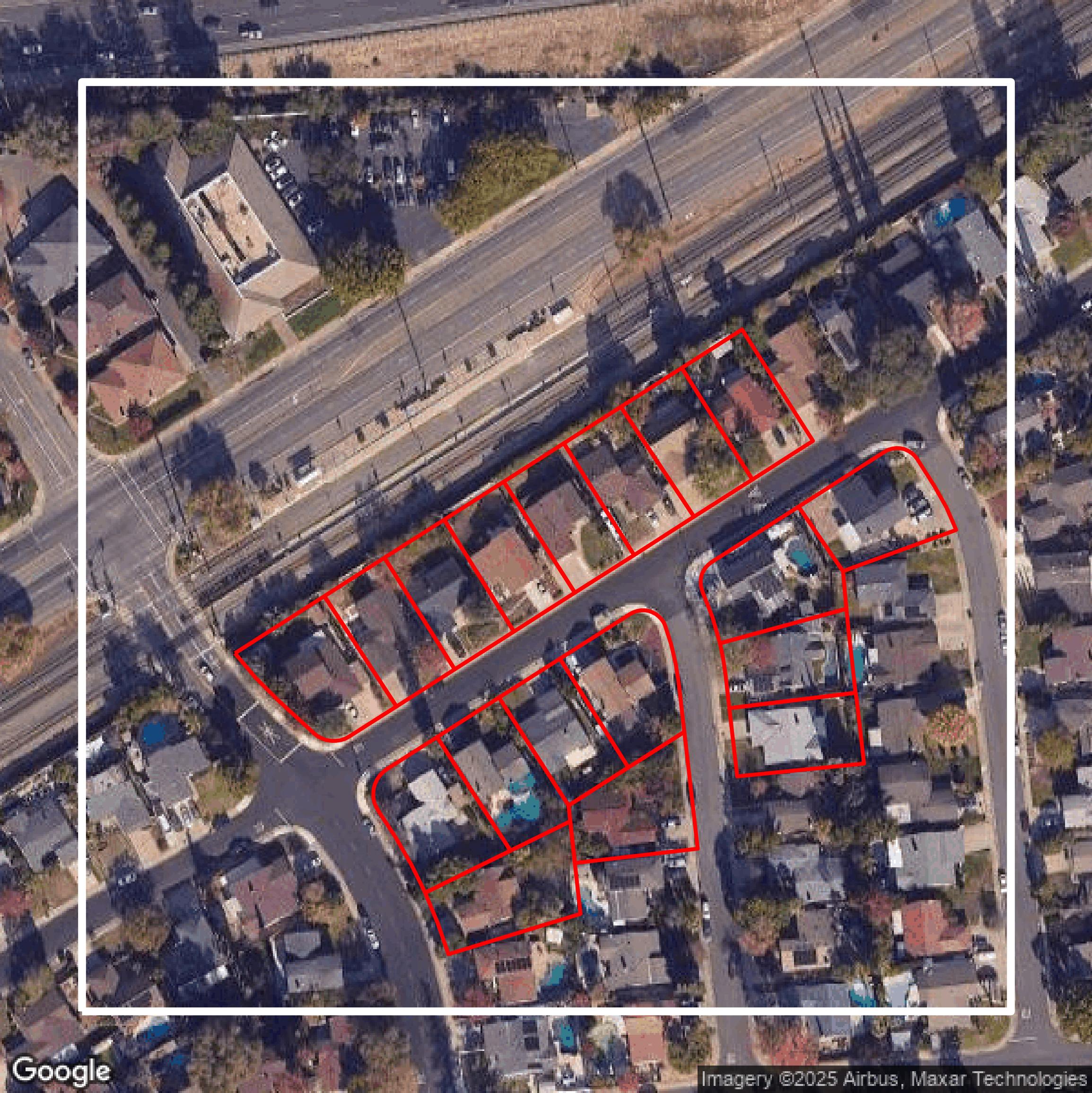
Parcels and Buildings
Accessing Sacramento County parcel and building data on Equator gives you access to coverage across the US.
Get Parcels and Buildings for Sacramento County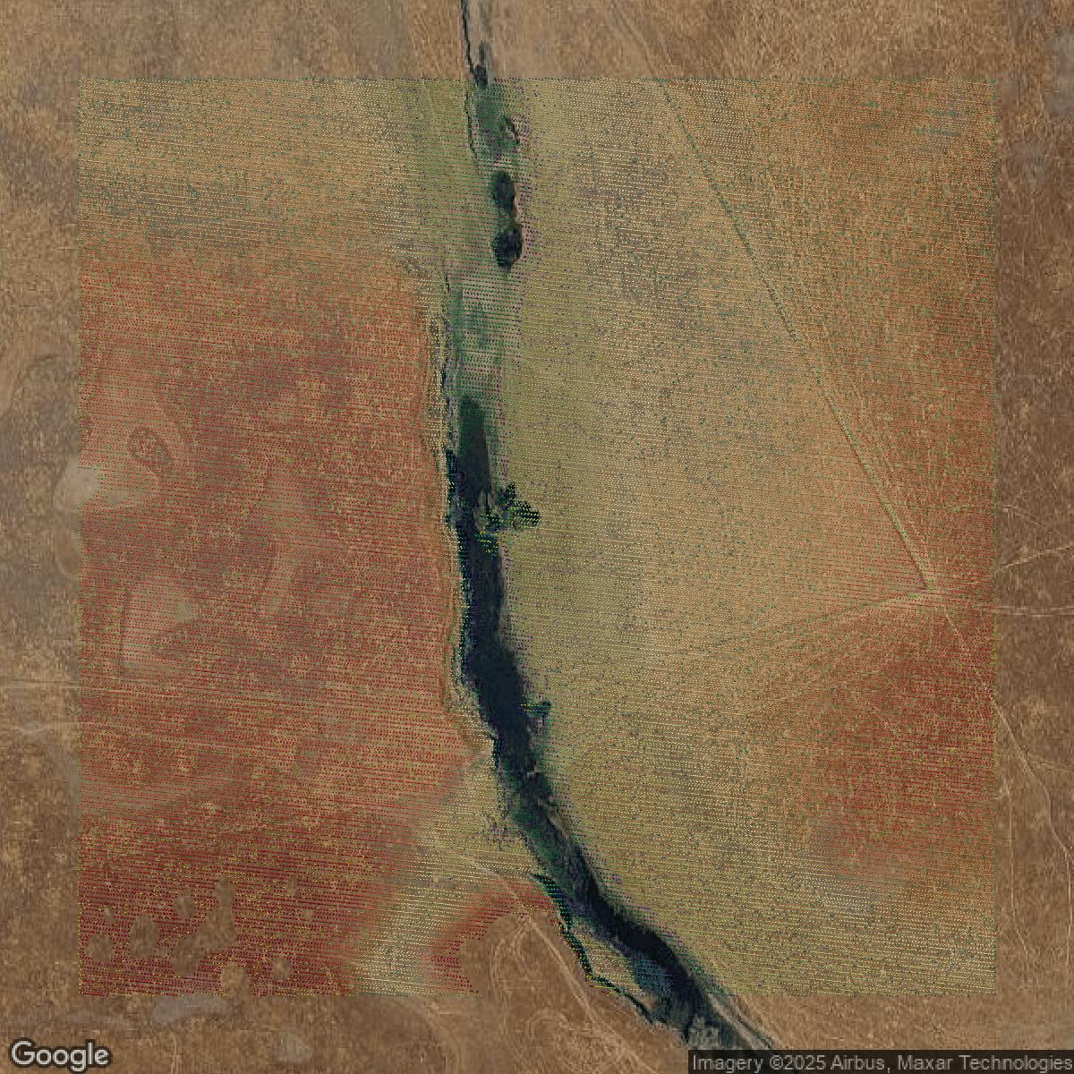
LiDAR
Sacramento County LiDAR uses include land surveying, analyzing crop health, or even archaeological studies.
Get LiDAR for Sacramento County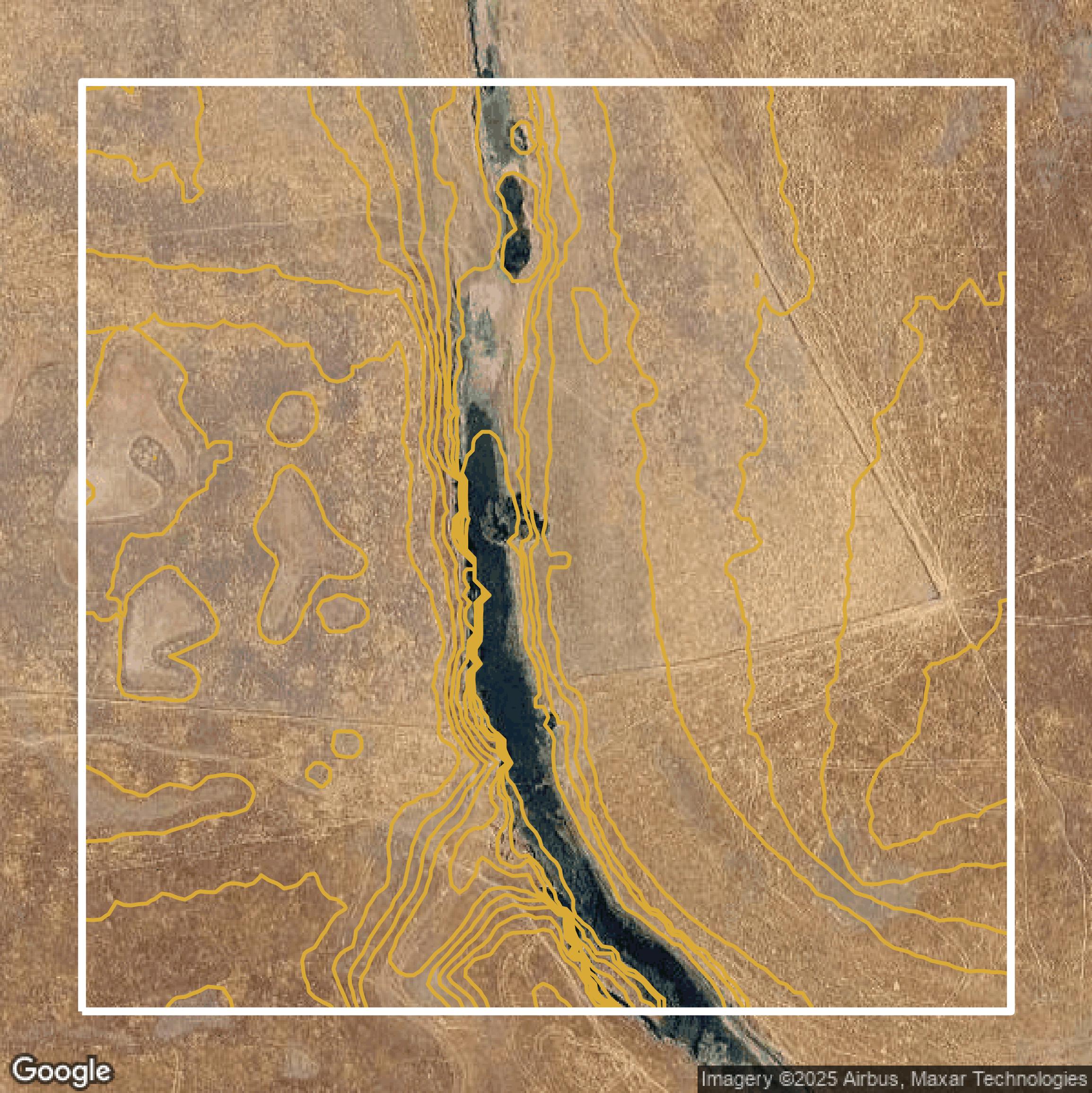
Contours
Sacramento County contours can be used for construction & engineering, environmental science, and more.
Get Contours for Sacramento County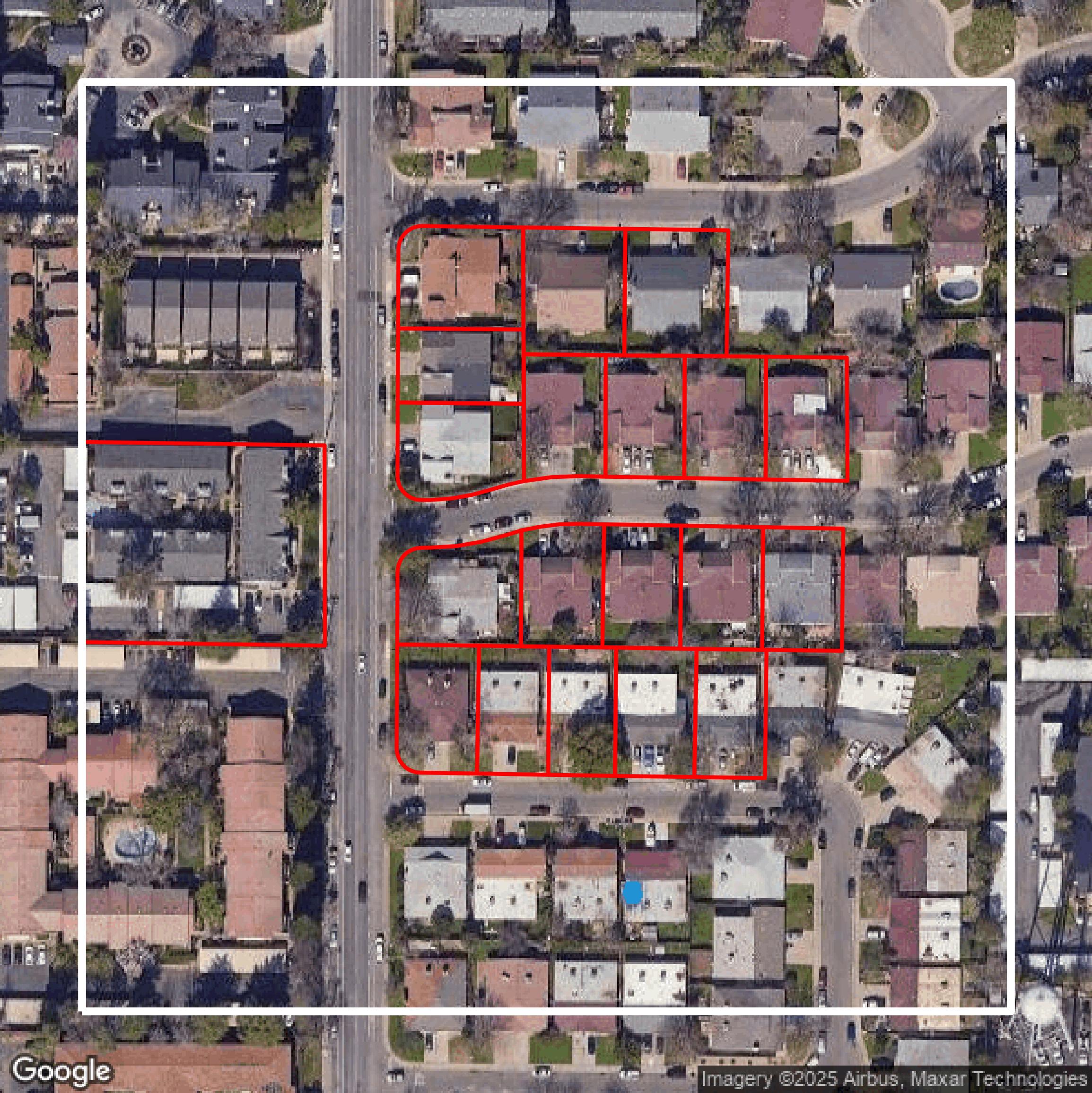
Parcels and Buildings
Dozens of fields are contained within each Sacramento County parcel and building data, including zoning, owners, and year built.
Get Parcels and Buildings for Sacramento County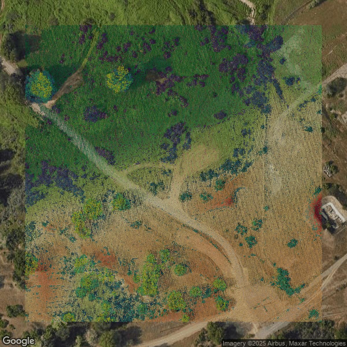
LiDAR
Equator turns Sacramento County LiDAR point clouds into various lidar-derived data sets, including DEMs.
Get LiDAR for Sacramento County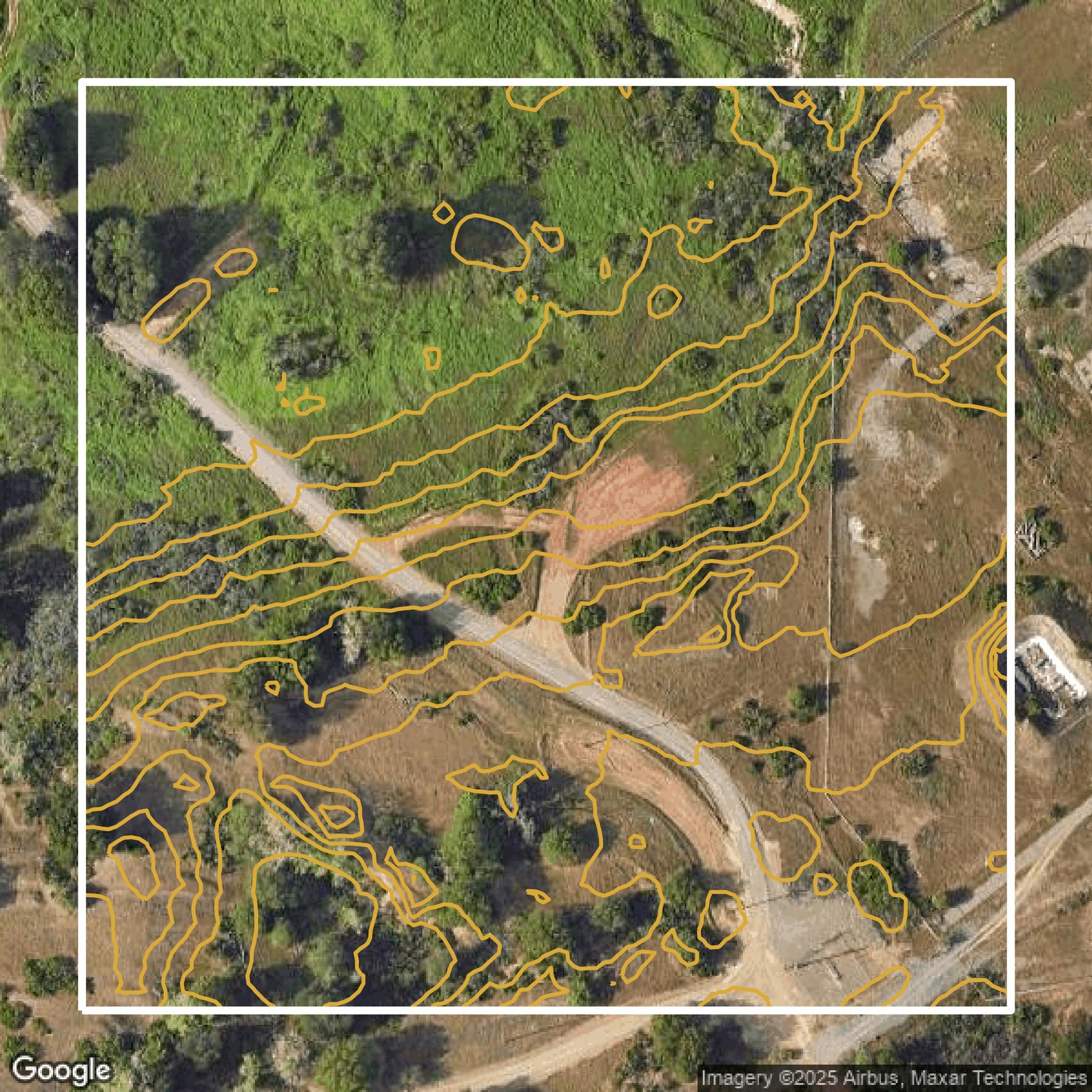
Contours
Sacramento County contours on Equator are produced from LiDAR coverage, allowing for high precision
Get Contours for Sacramento County