Overview
Broward County GIS Data – For CAD
Equator helps civil engineering, architecture and consulting firms with the tools to instantly find, process and download accurate LiDAR, contours, parcel data, building footprints, DEMs, point clouds and other GIS data for Broward County in an online web mapping portal.
Broward County GIS Data →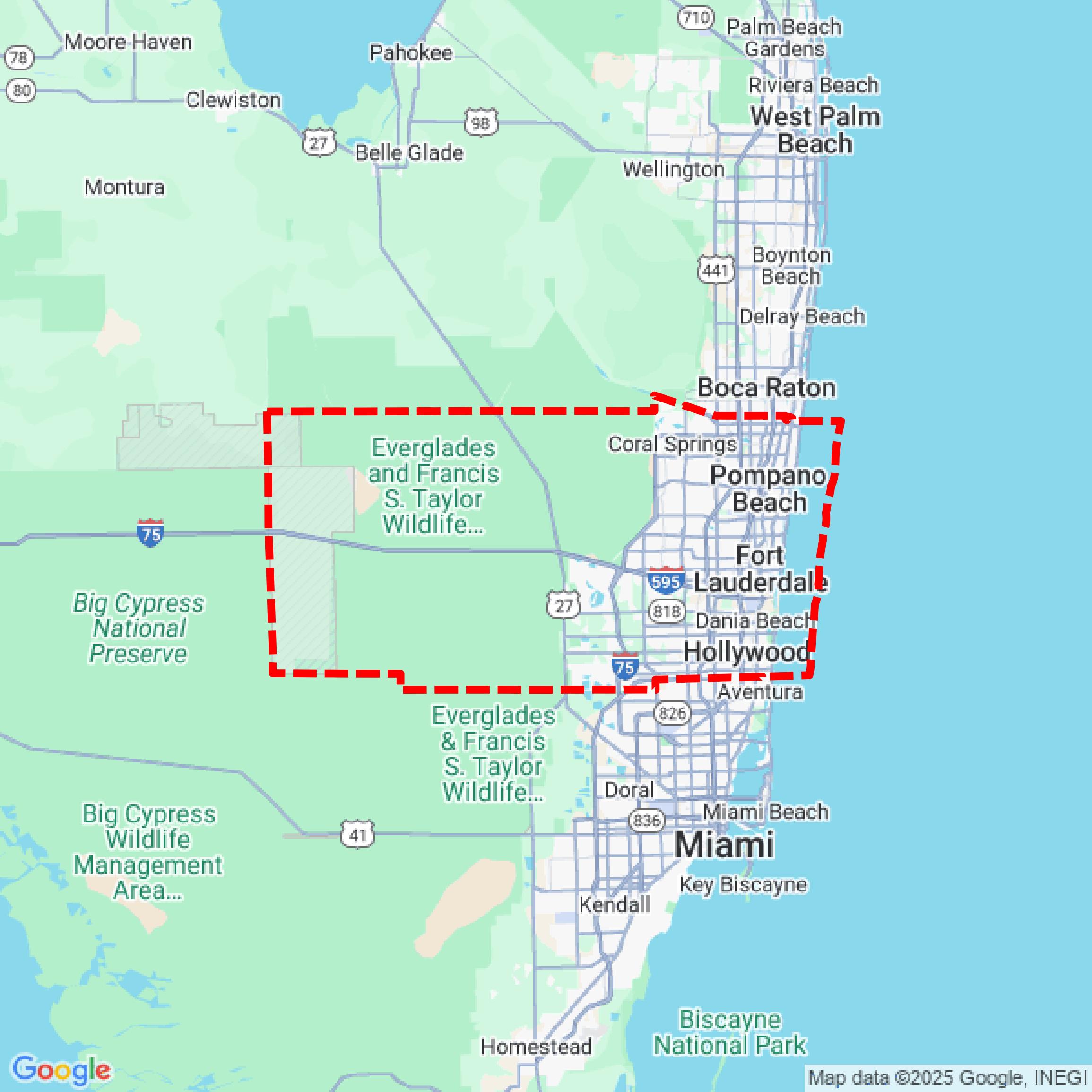

Data Available
Download GIS Data for Broward County
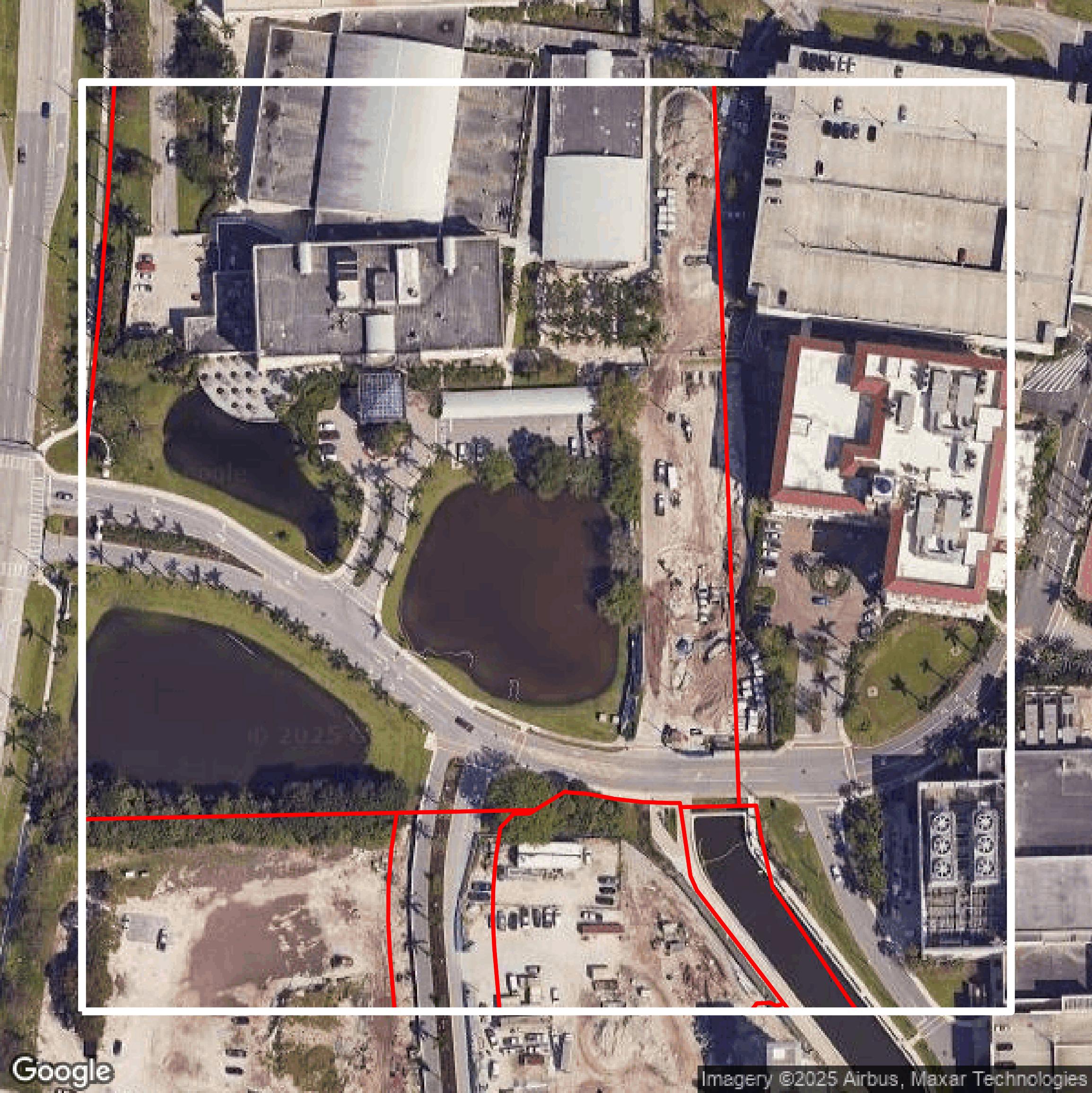
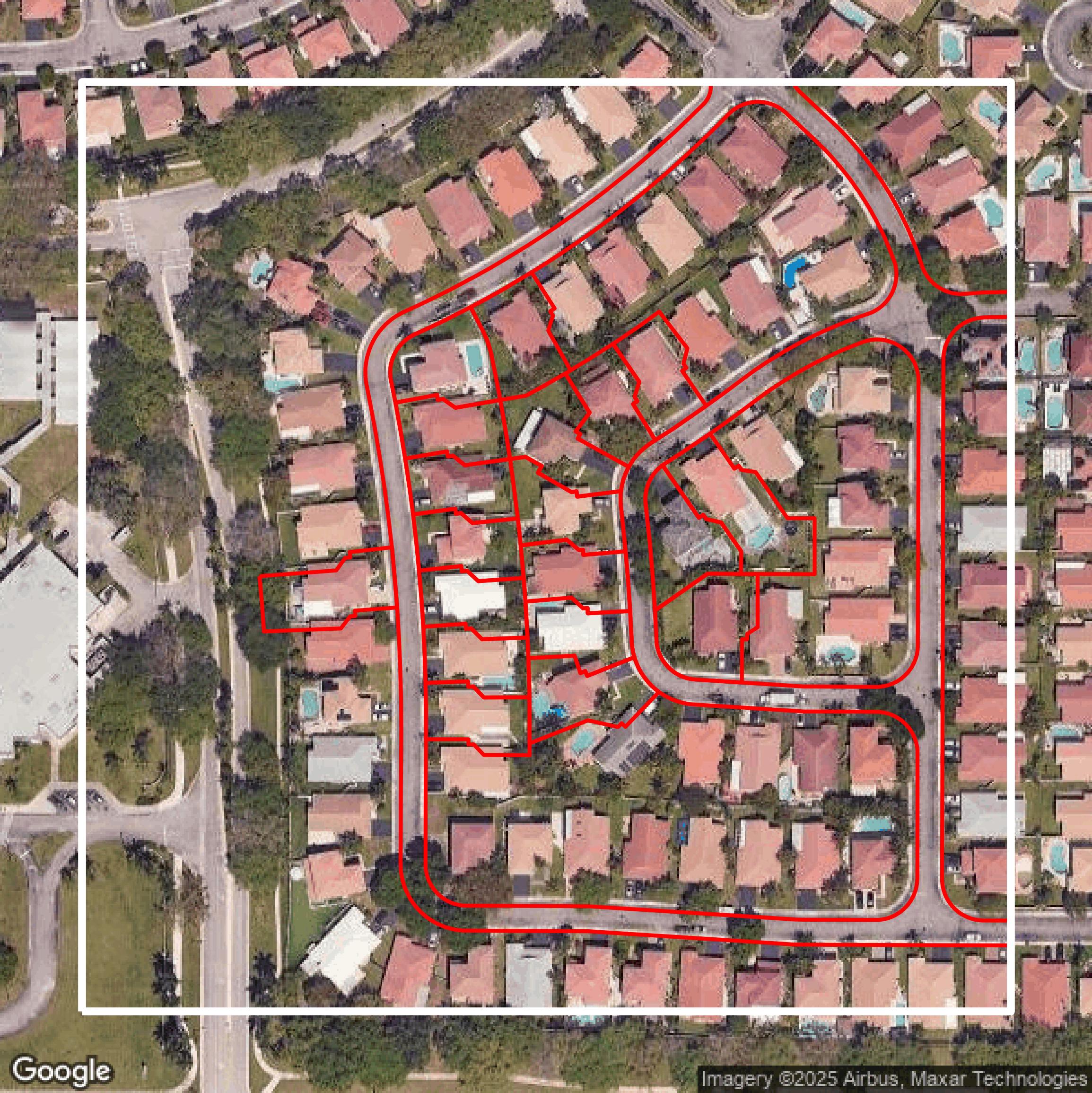
Parcels and Buildings
This image shows parcel and building data in Broward County created using GIS data in Equator.
Get Parcels and Buildings for Broward County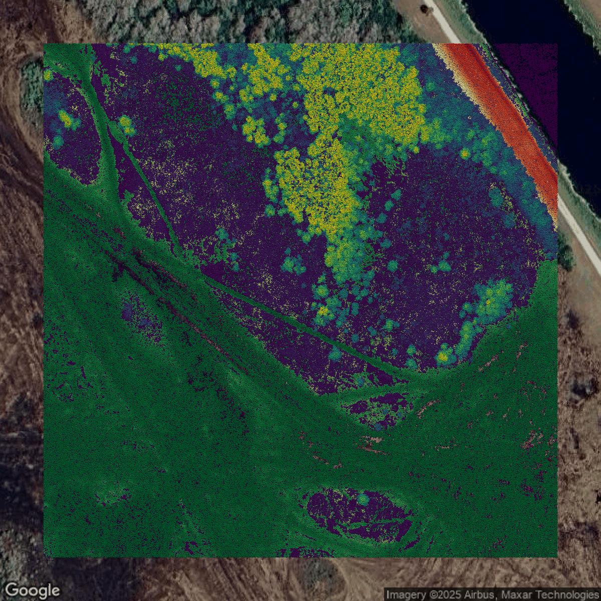
LiDAR
This image shows a LiDAR point cloud in Broward County created using GIS data in Equator.
Get LiDAR for Broward County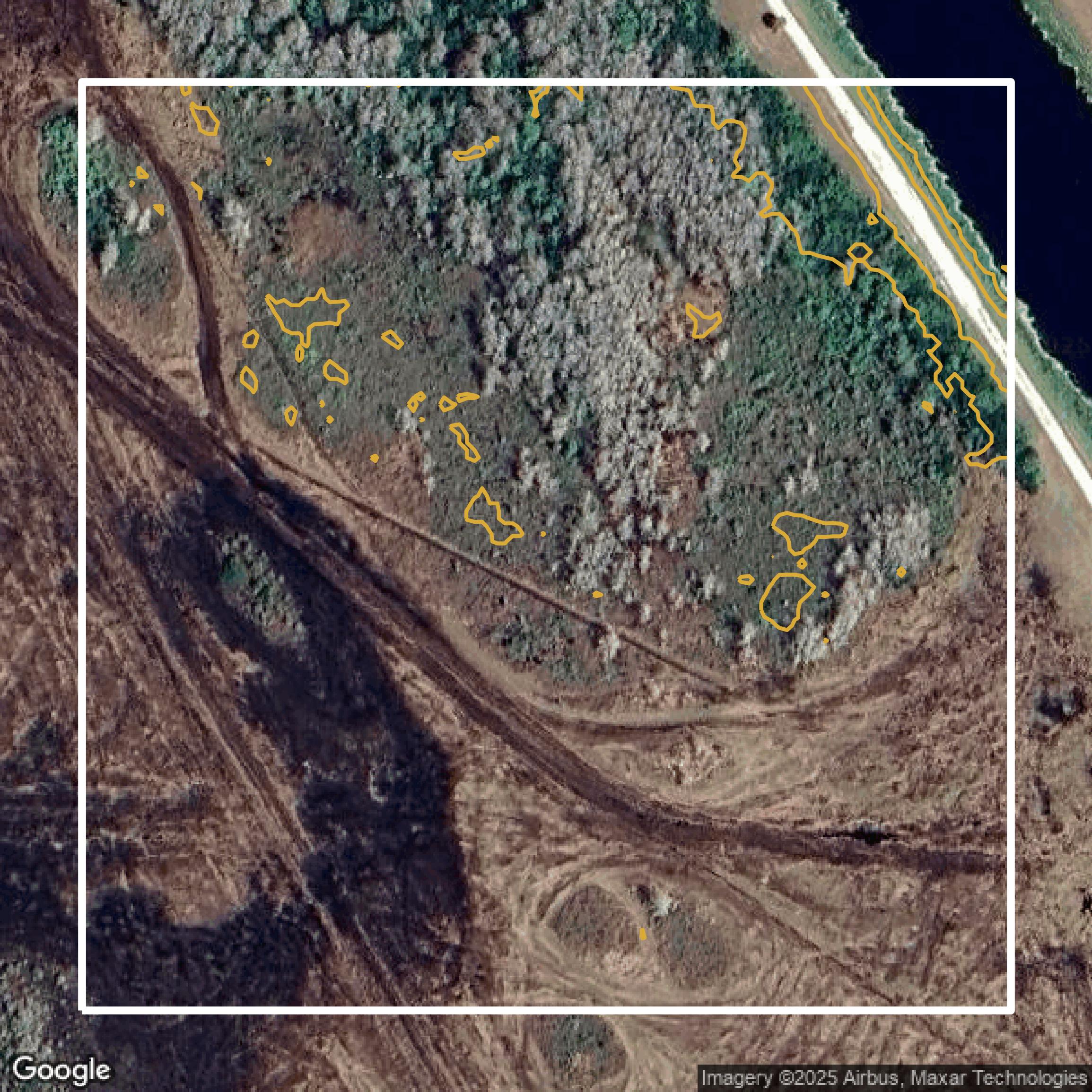
Contours
This image shows a contour map in Broward County created using GIS data in Equator.
Get Contours for Broward CountyFormats Available
Export Your Data Ready to Use in Multiple Formats
DWG
AutoCAD Drawing - Industry-standard CAD format
Supported Data:
Contour, Parcel, Building Outline
SHP
Shapefile - Standard GIS vector format
Supported Data:
Contour, Parcel, Building Outline
DXF
Drawing Exchange Format - Universal CAD interchange
Supported Data:
Contour, Building Outline
GeoJSON
Geographic JSON - Web-friendly spatial data format
Supported Data:
Contour, Parcel, Building Outline
LAZ
Compressed LAS - Efficient LiDAR point cloud format
Supported Data:
Point Cloud
SVG
Scalable Vector Graphics - Web vector format
Supported Data:
Contour, Building Outline
GPKG (Coming Soon)
GeoPackage - Modern OGC spatial database format
Supported Data:
Contour, Parcel, Building Outline
LandXML (Coming Soon)
Land XML - Civil engineering data exchange format
Supported Data:
Point Cloud
TIN (Coming Soon)
Triangulated Irregular Network - 3D surface model
Supported Data:
Point Cloud
XYZ (Coming Soon)
XYZ Point Cloud - Simple ASCII point cloud format
Supported Data:
Point Cloud
Background
GIS Data for Broward County
The Urban Planning Division GIS & Maps website for Broward County offers comprehensive geographic spatial analysis, mapping services, and enterprise-wide GIS governance, supporting various County agencies and providing a liaison role with GIS consultants. Visitors can explore a rich collection of interactive maps including "Current Aerial Photography," "Annexation History," "BMSD Land Use and Zoning," "Park Finder," "Census Data by City," "Commission Districts," "Community Redevelopment Areas," "FEMA Flood Information," plus future condition maps like the "100-Year Flood Map 2060" and "Water and Sewer Services." The site also features extensive GIS Download Data layers such as "Address Points," "Assisted Living Facilities," "City Boundaries," "Commissioner Districts," "Flood Hazard Areas," "Future Land Use Plan," "Hospitals," "Public Schools," "Traffic Signals," and more, many accessible via the Broward County GeoHub. It supports accessibility efforts aligned with the ADA and hosts a GIS Users Group for networking, training, and technology updates. This resource is ideal for professionals and the public seeking detailed spatial data, planning maps, and tools for analysis across environmental protection, municipal services, transportation, historic preservation, natural disaster preparation, and water management.
Access Broward County GIS Data in Equator →Broward County Portal →Showcase
Sample GIS Data for Broward County
Parcels and Buildings
Parcel and building data in Broward County are used in a variety of fields including architecture, real estate, and urban planning.
Get Parcels and Buildings for Broward County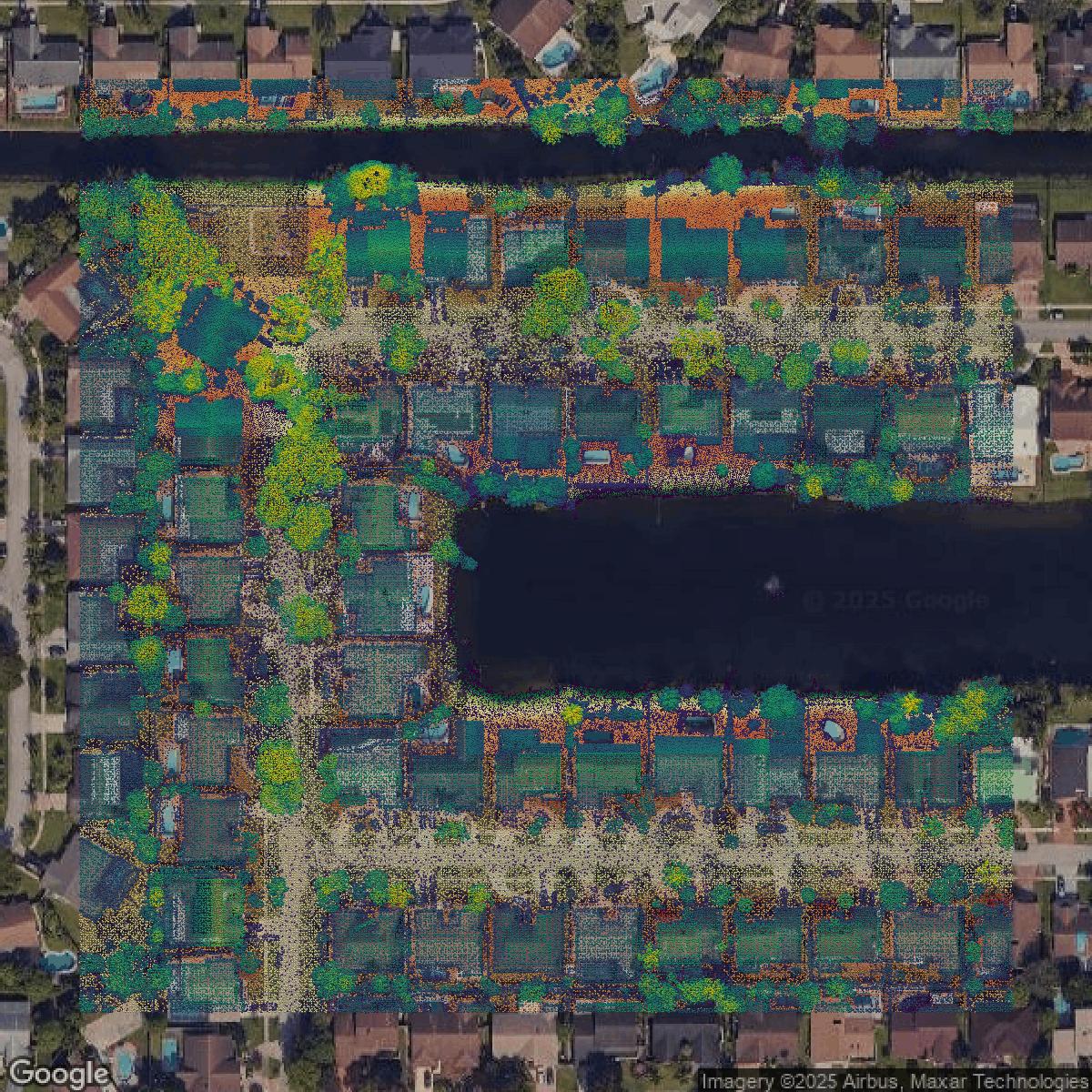
LiDAR
Point clouds (LiDAR) in Broward County can produce highly accurate 3D models of terrain, structures, and vegetation.
Get LiDAR for Broward County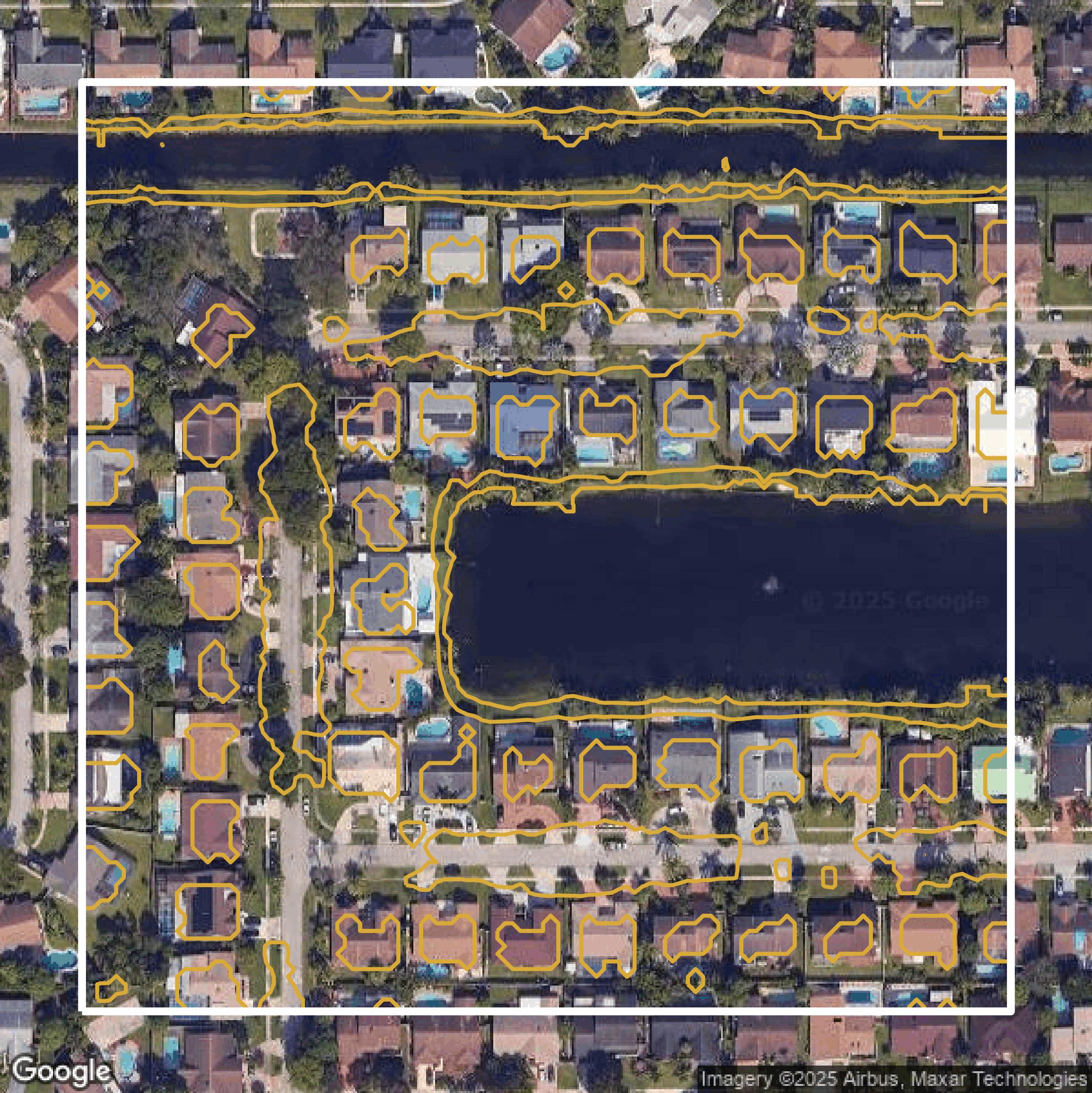
Contours
Contours in Broward County visualize 3D elevations on a 2D surface allowing you to better understand your site.
Get Contours for Broward County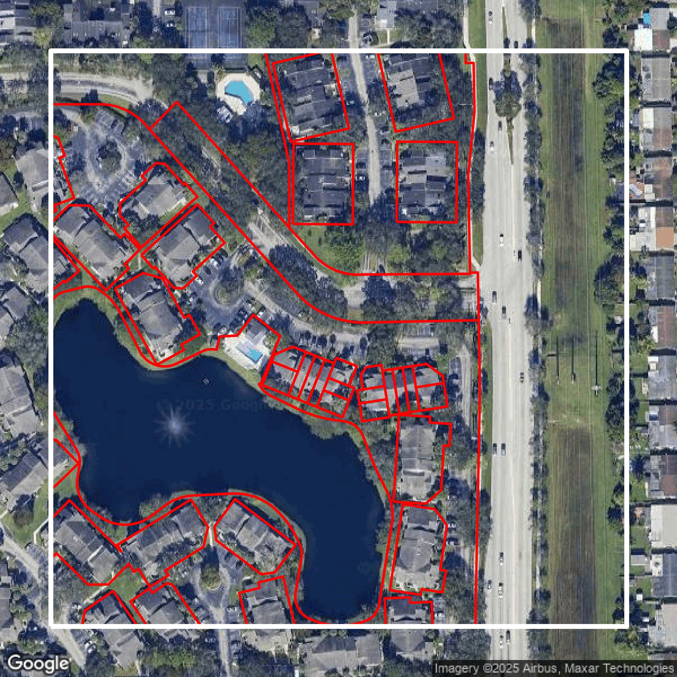
Parcels and Buildings
Accessing Broward County parcel and building data on Equator gives you access to coverage across the US.
Get Parcels and Buildings for Broward County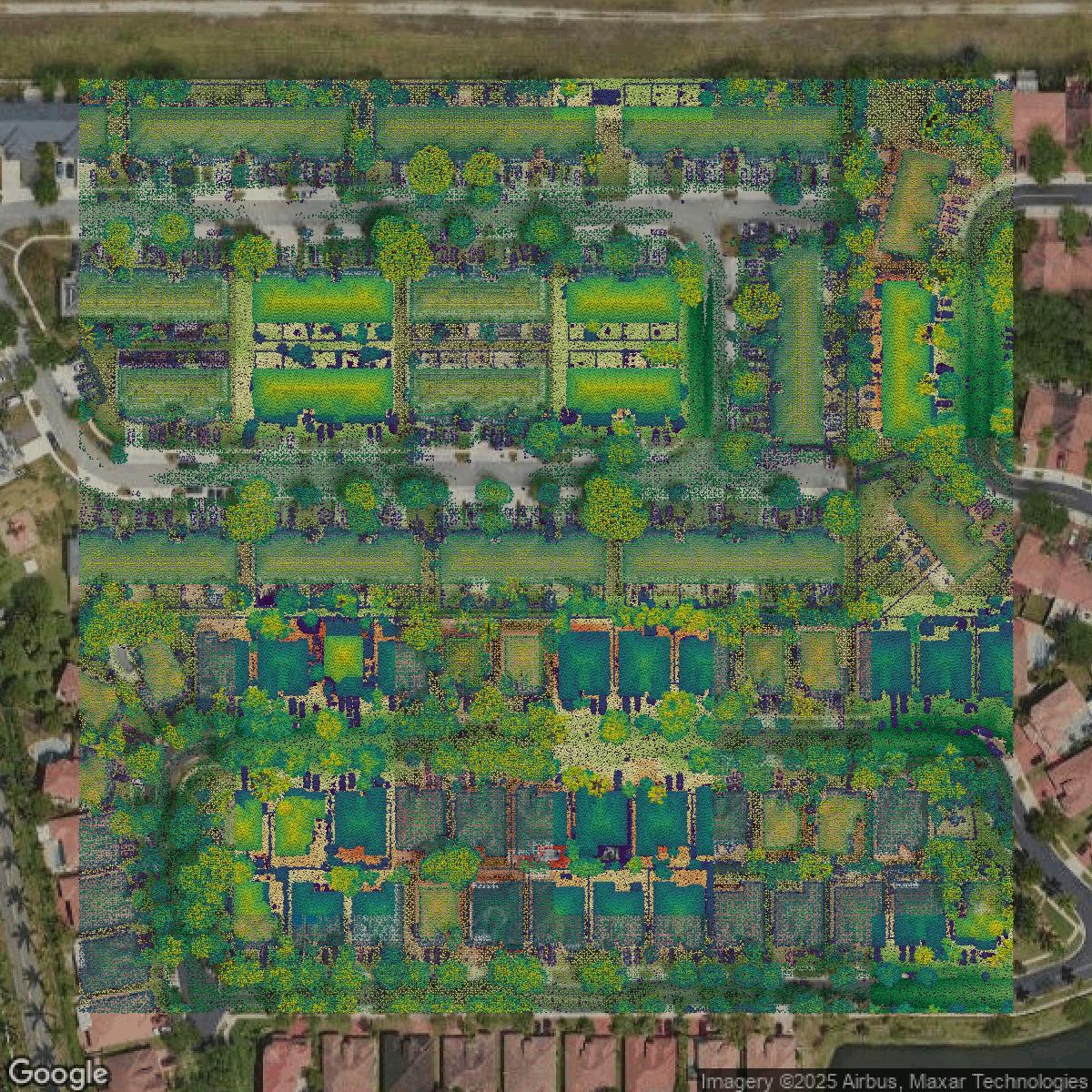
LiDAR
Broward County LiDAR uses include land surveying, analyzing crop health, or even archaeological studies.
Get LiDAR for Broward County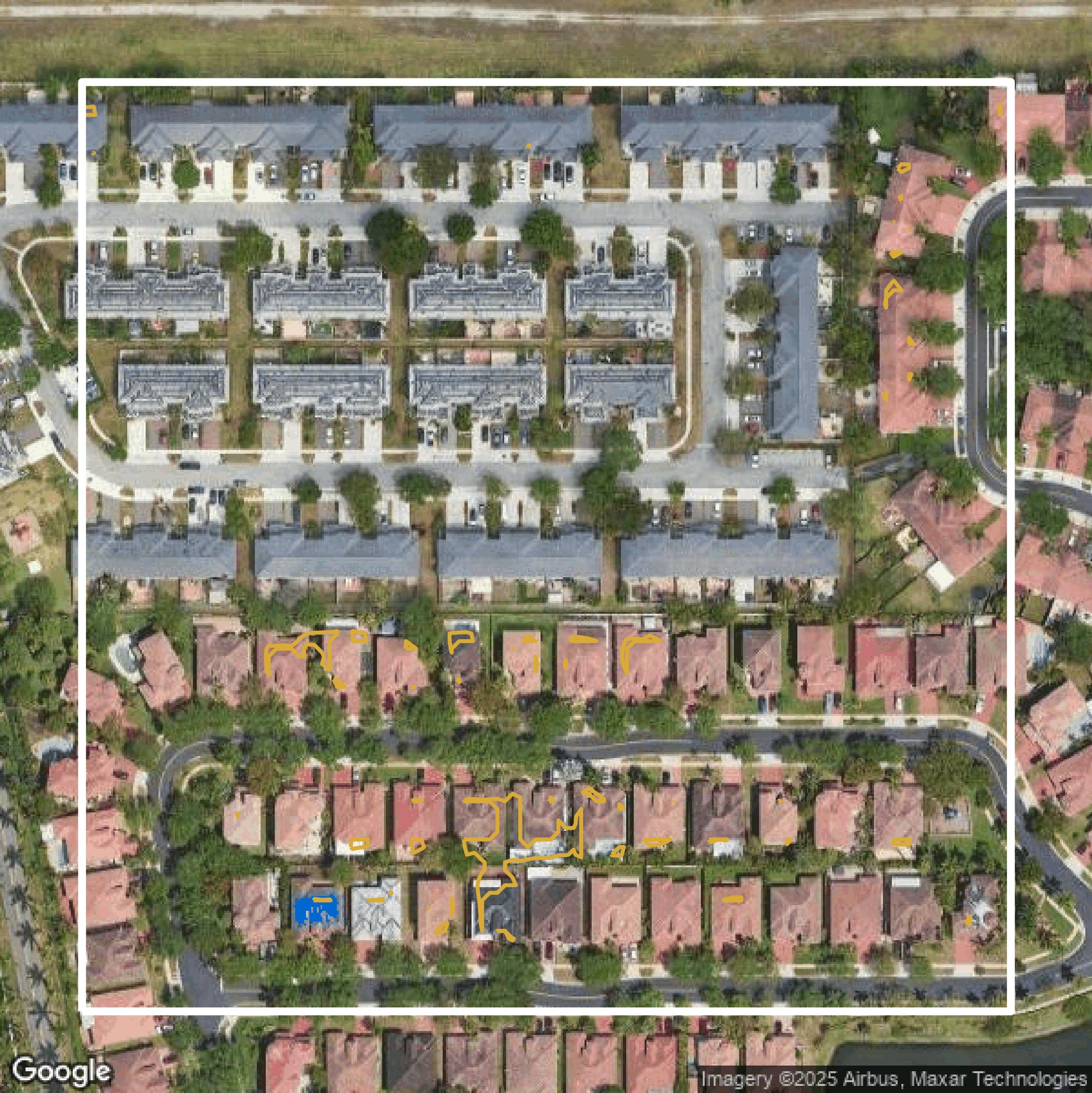
Contours
Broward County contours can be used for construction & engineering, environmental science, and more.
Get Contours for Broward County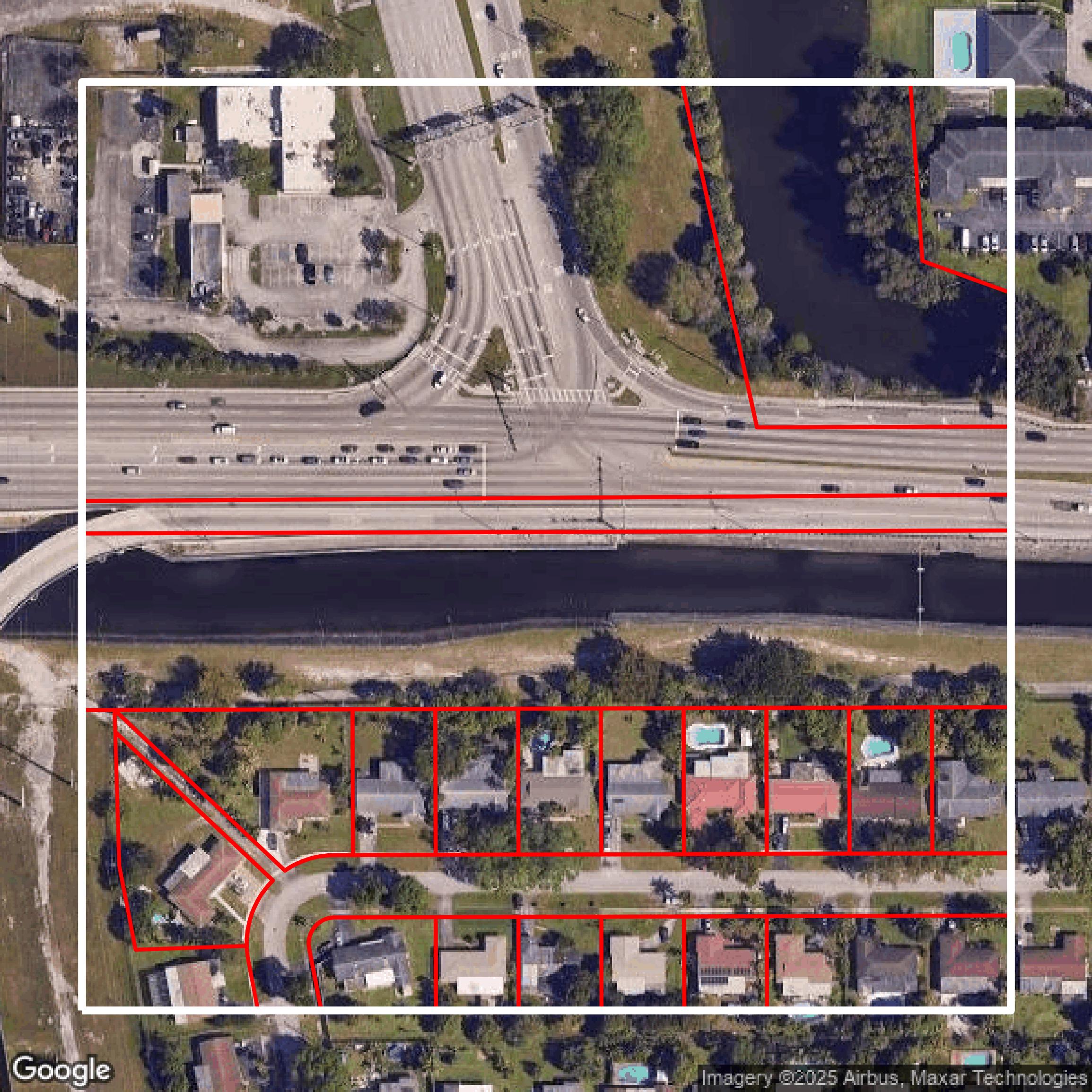
Parcels and Buildings
Dozens of fields are contained within each Broward County parcel and building data, including zoning, owners, and year built.
Get Parcels and Buildings for Broward County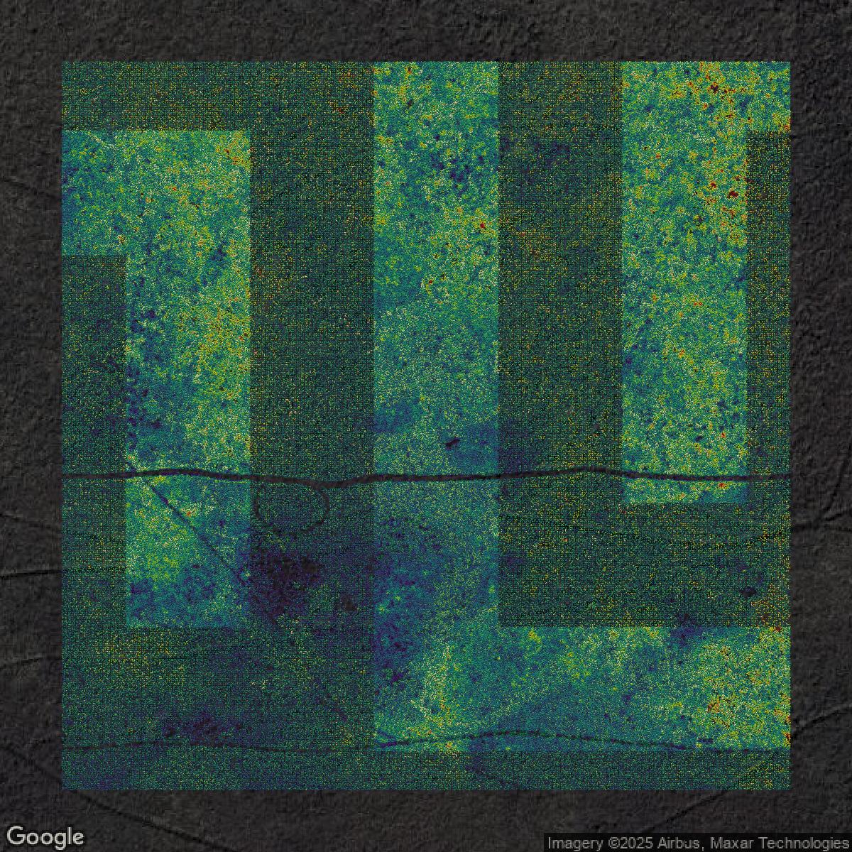
LiDAR
Equator turns Broward County LiDAR point clouds into various lidar-derived data sets, including DEMs.
Get LiDAR for Broward County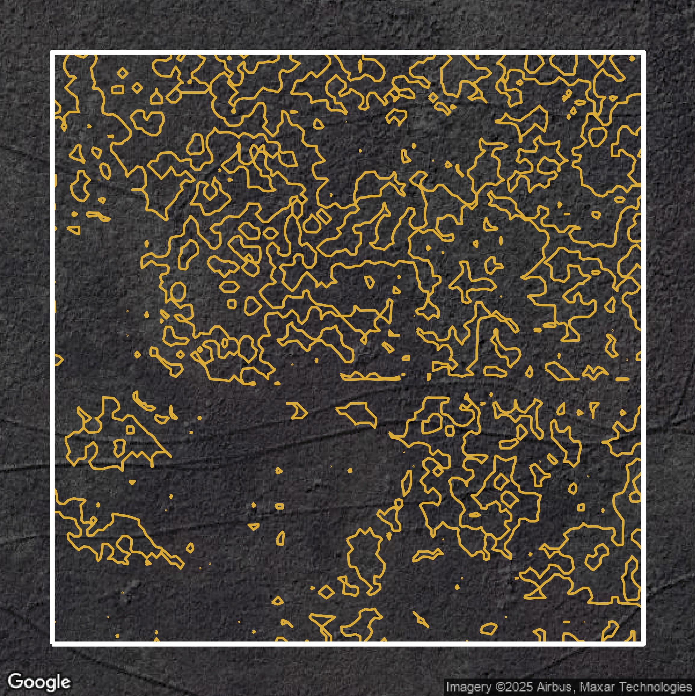
Contours
Broward County contours on Equator are produced from LiDAR coverage, allowing for high precision
Get Contours for Broward County