Overview
Washtenaw County GIS Data – For CAD
Equator helps civil engineering, architecture and consulting firms with the tools to instantly find, process and download accurate LiDAR, contours, parcel data, building footprints, DEMs, point clouds and other GIS data for Washtenaw County in an online web mapping portal.
Washtenaw County GIS Data →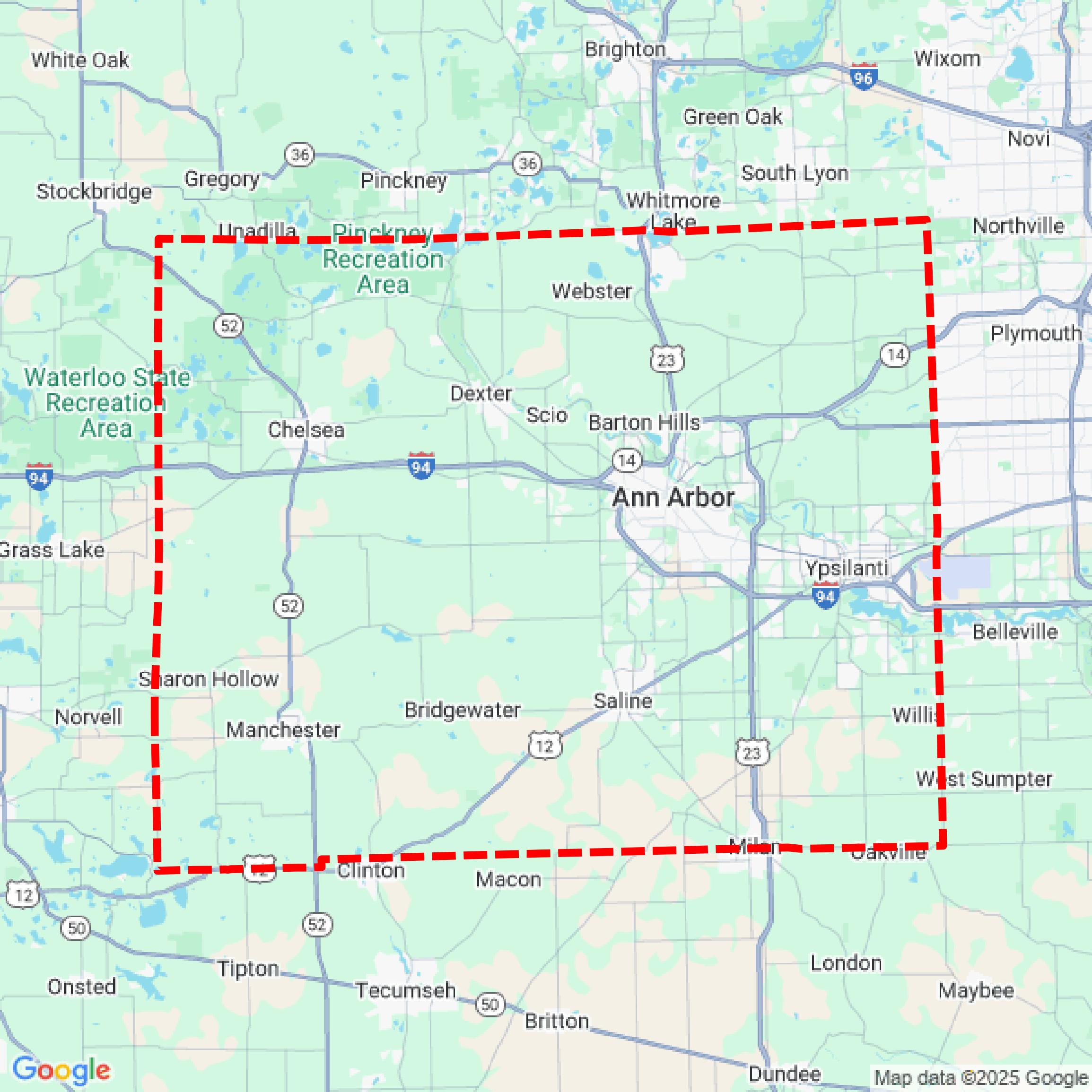

Data Available
Download GIS Data for Washtenaw County
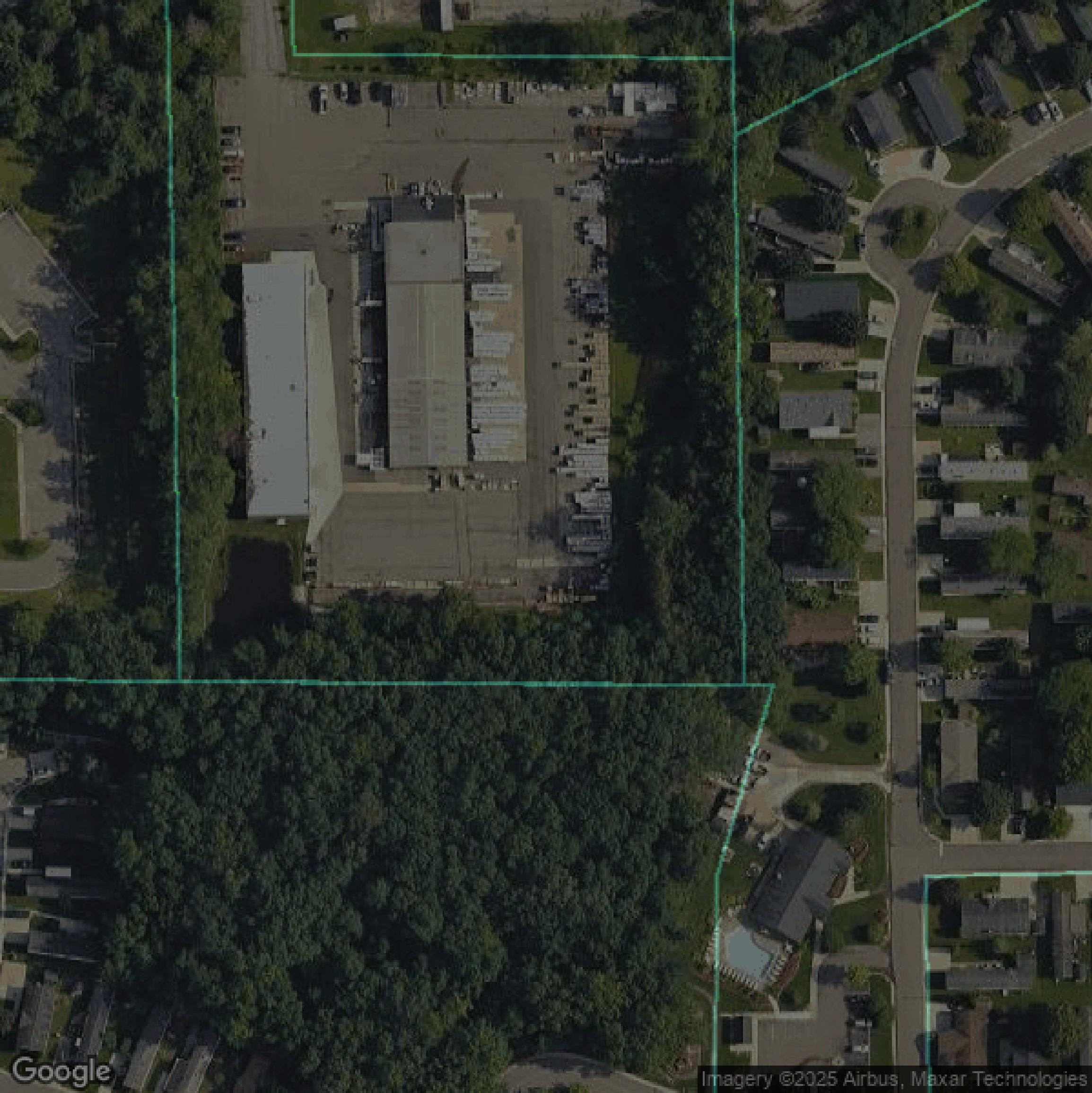
Parcels and Buildings
This image shows parcel and building data in Washtenaw County created using GIS data in Equator.
Get Parcels and Buildings for Washtenaw County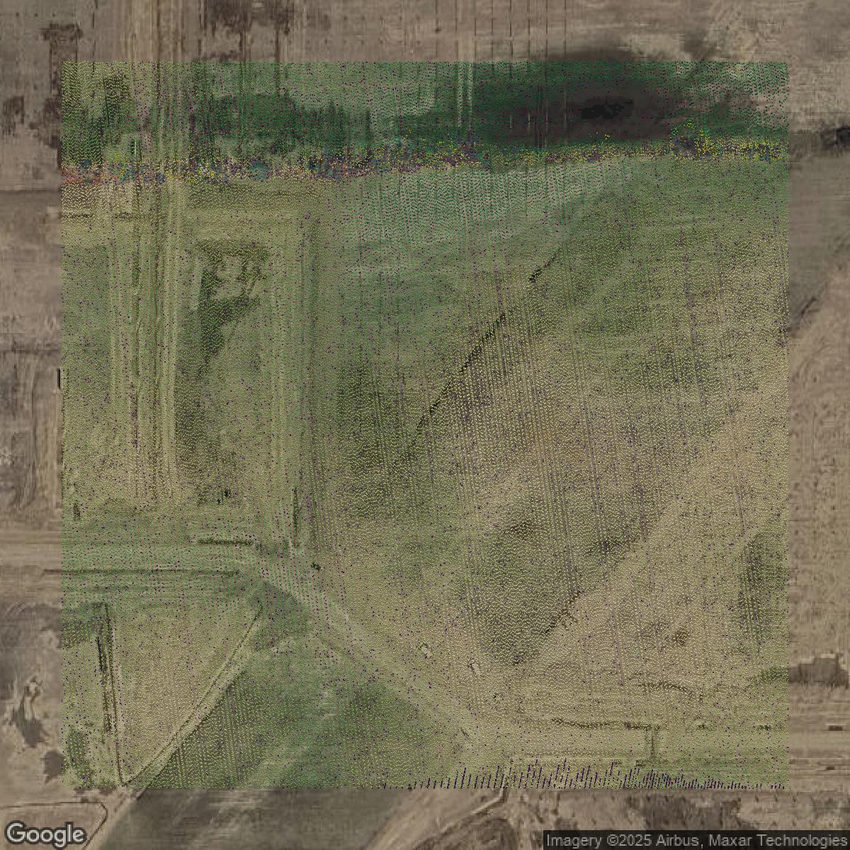
LiDAR
This image shows a LiDAR point cloud in Washtenaw County created using GIS data in Equator.
Get LiDAR for Washtenaw County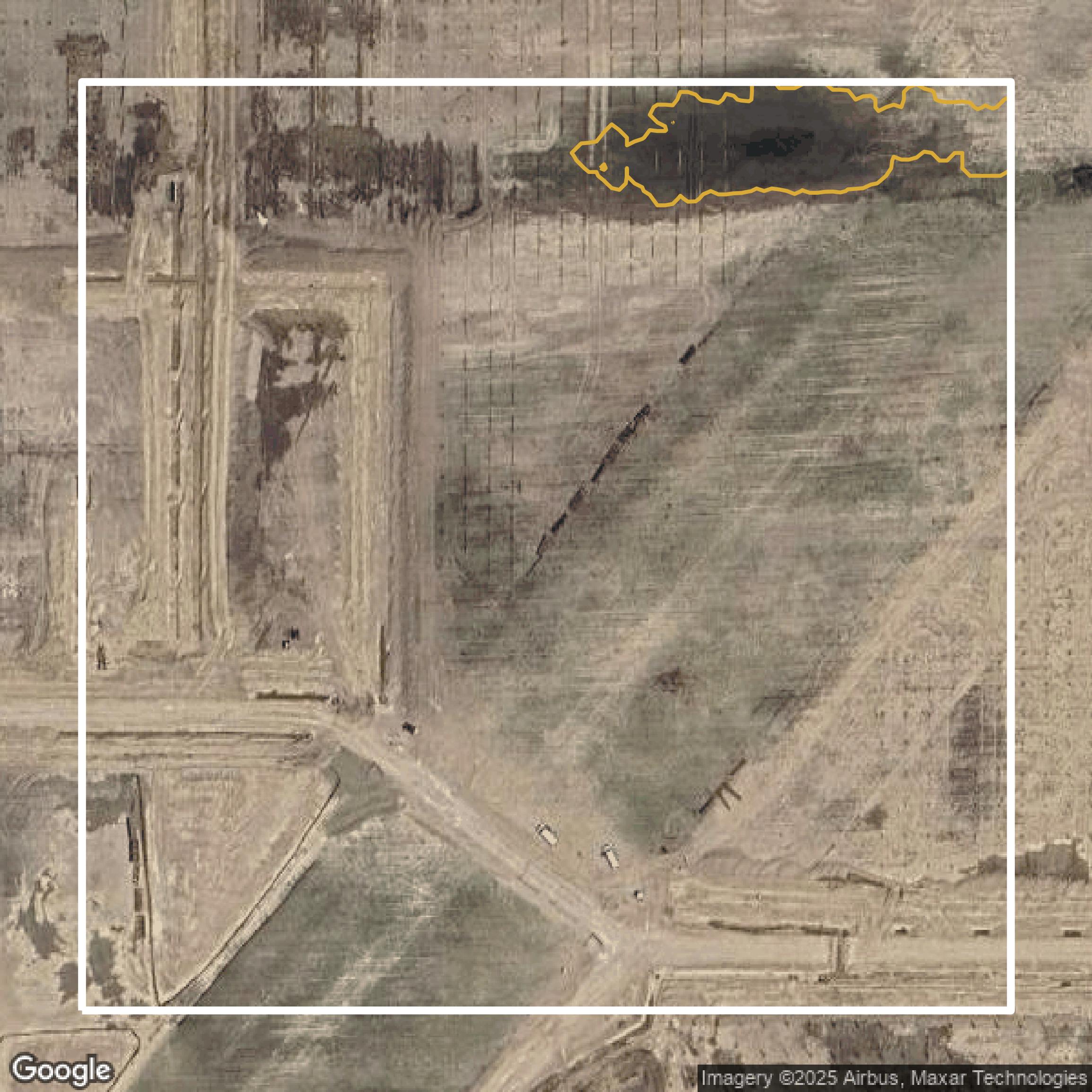
Contours
This image shows a contour map in Washtenaw County created using GIS data in Equator.
Get Contours for Washtenaw CountyFormats Available
Export Your Data Ready to Use in Multiple Formats
DWG
AutoCAD Drawing - Industry-standard CAD format
Supported Data:
Contour, Parcel, Building Outline
SHP
Shapefile - Standard GIS vector format
Supported Data:
Contour, Parcel, Building Outline
DXF
Drawing Exchange Format - Universal CAD interchange
Supported Data:
Contour, Building Outline
GeoJSON
Geographic JSON - Web-friendly spatial data format
Supported Data:
Contour, Parcel, Building Outline
LAZ
Compressed LAS - Efficient LiDAR point cloud format
Supported Data:
Point Cloud
SVG
Scalable Vector Graphics - Web vector format
Supported Data:
Contour, Building Outline
GPKG (Coming Soon)
GeoPackage - Modern OGC spatial database format
Supported Data:
Contour, Parcel, Building Outline
LandXML (Coming Soon)
Land XML - Civil engineering data exchange format
Supported Data:
Point Cloud
TIN (Coming Soon)
Triangulated Irregular Network - 3D surface model
Supported Data:
Point Cloud
XYZ (Coming Soon)
XYZ Point Cloud - Simple ASCII point cloud format
Supported Data:
Point Cloud
Background
GIS Data for Washtenaw County
The MapWashtenaw webpage serves as an interactive mapping application for Washtenaw County, Michigan, providing access to a variety of Geographic Information System (GIS) datasets. Users can explore property data, including tax parcel information, zoning details, aerial imagery, natural features, and topographical maps. The platform aggregates data from county departments, local municipalities, and other governmental entities, facilitating a comprehensive visual display of spatial data. While the information is intended for reference purposes, it is not suitable for legal or engineering use, and users are advised to validate any critical decisions with appropriate county offices.
Access Washtenaw County GIS Data in Equator →Washtenaw County Portal →Showcase
Sample GIS Data for Washtenaw County
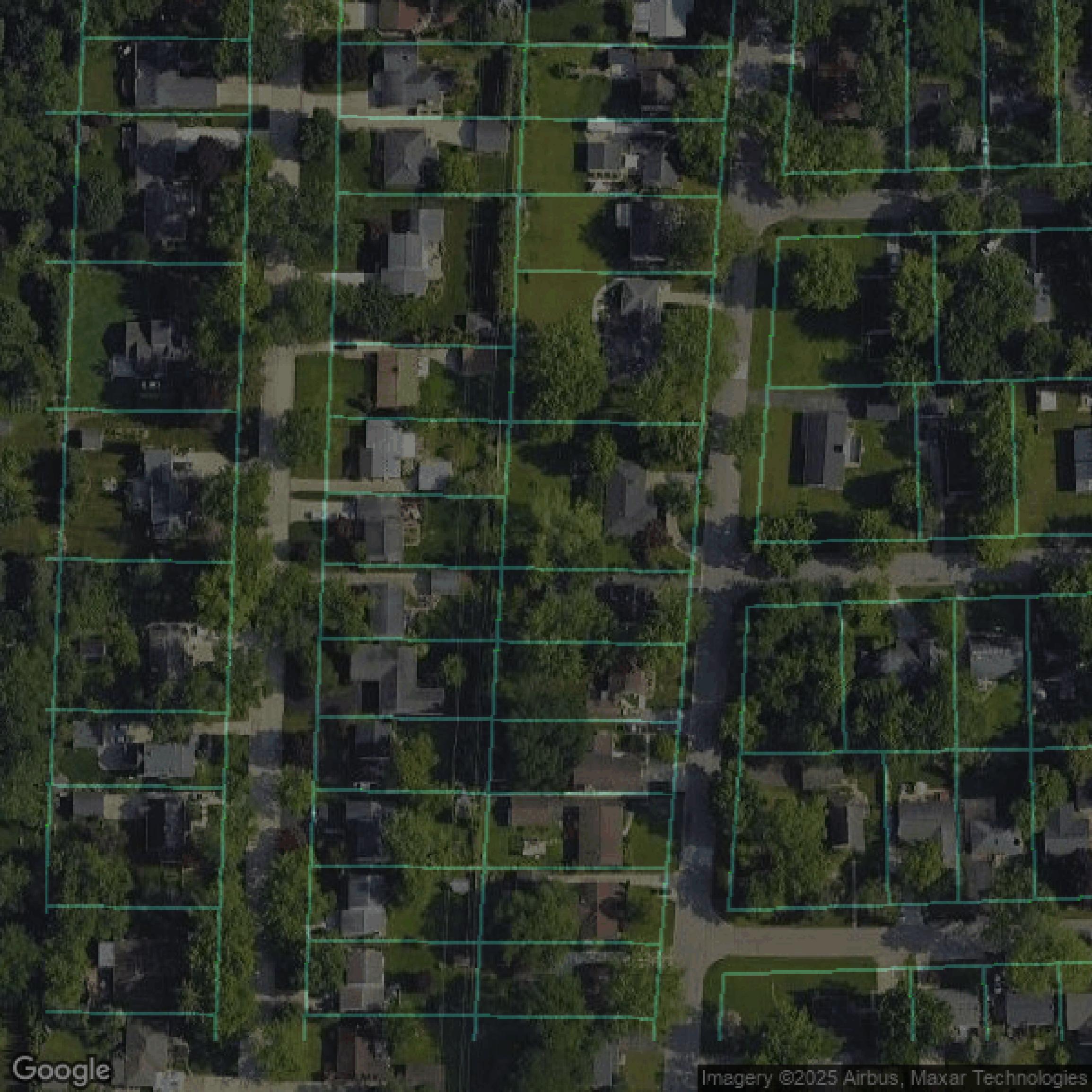
Parcels and Buildings
Parcel and building data in Washtenaw County are used in a variety of fields including architecture, real estate, and urban planning.
Get Parcels and Buildings for Washtenaw County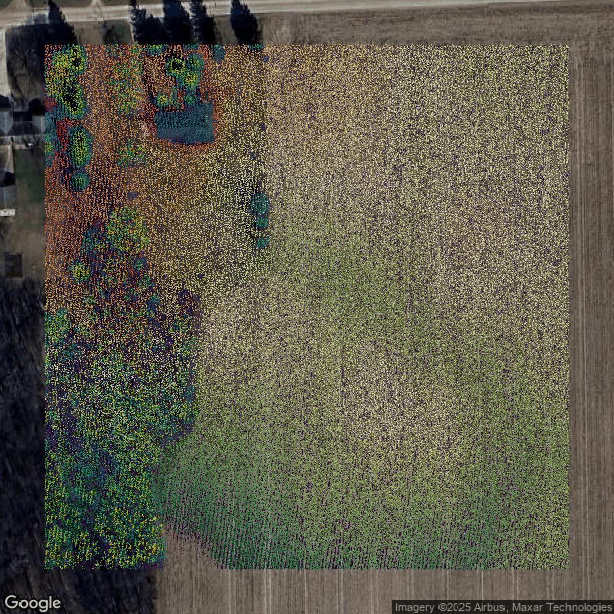
LiDAR
Point clouds (LiDAR) in Washtenaw County can produce highly accurate 3D models of terrain, structures, and vegetation.
Get LiDAR for Washtenaw County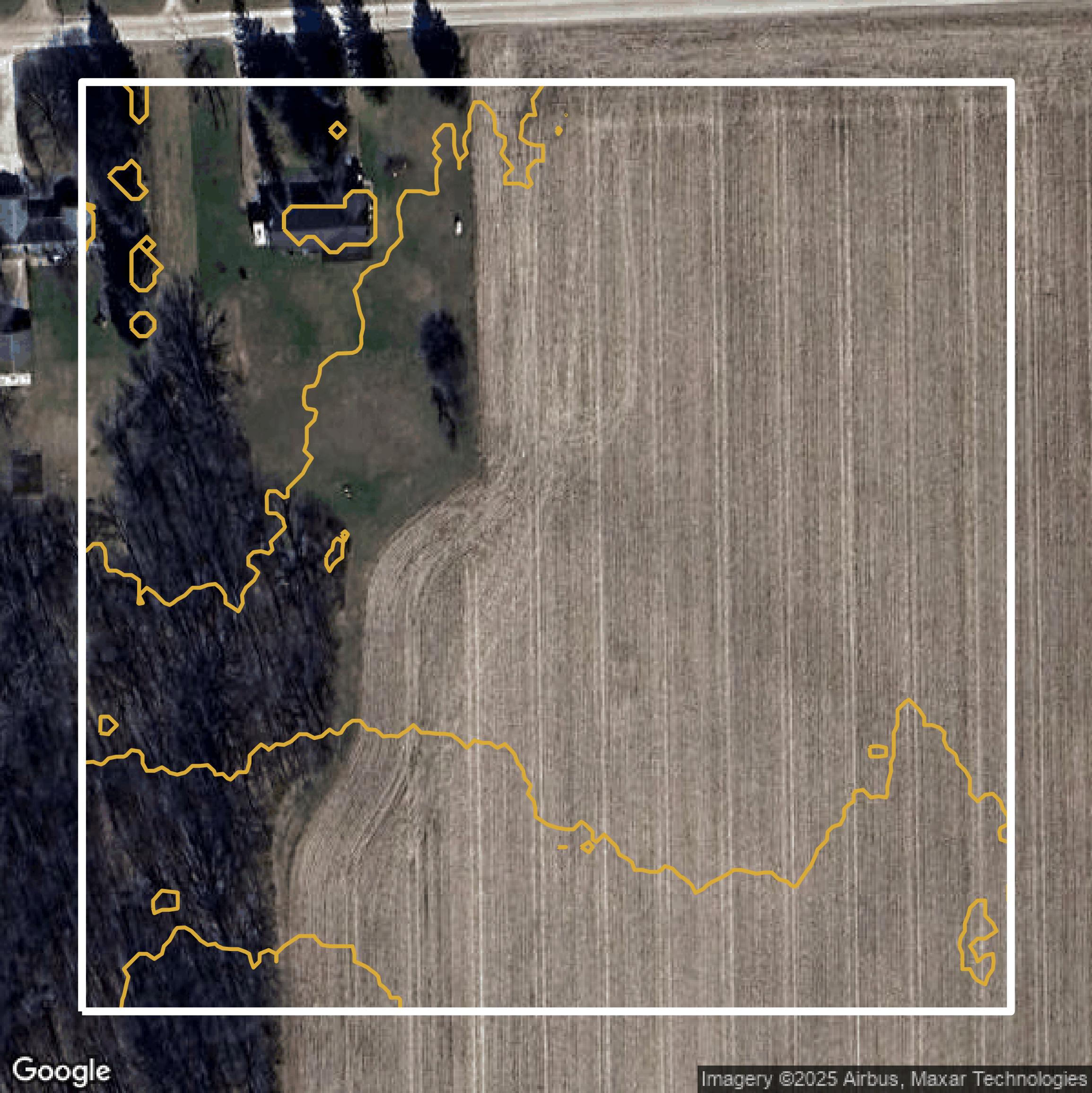
Contours
Contours in Washtenaw County visualize 3D elevations on a 2D surface allowing you to better understand your site.
Get Contours for Washtenaw County