Overview
Ventura County GIS Data – For CAD
Equator helps civil engineering, architecture and consulting firms with the tools to instantly find, process and download accurate LiDAR, contours, parcel data, building footprints, DEMs, point clouds and other GIS data for Ventura County in an online web mapping portal.
Ventura County GIS Data →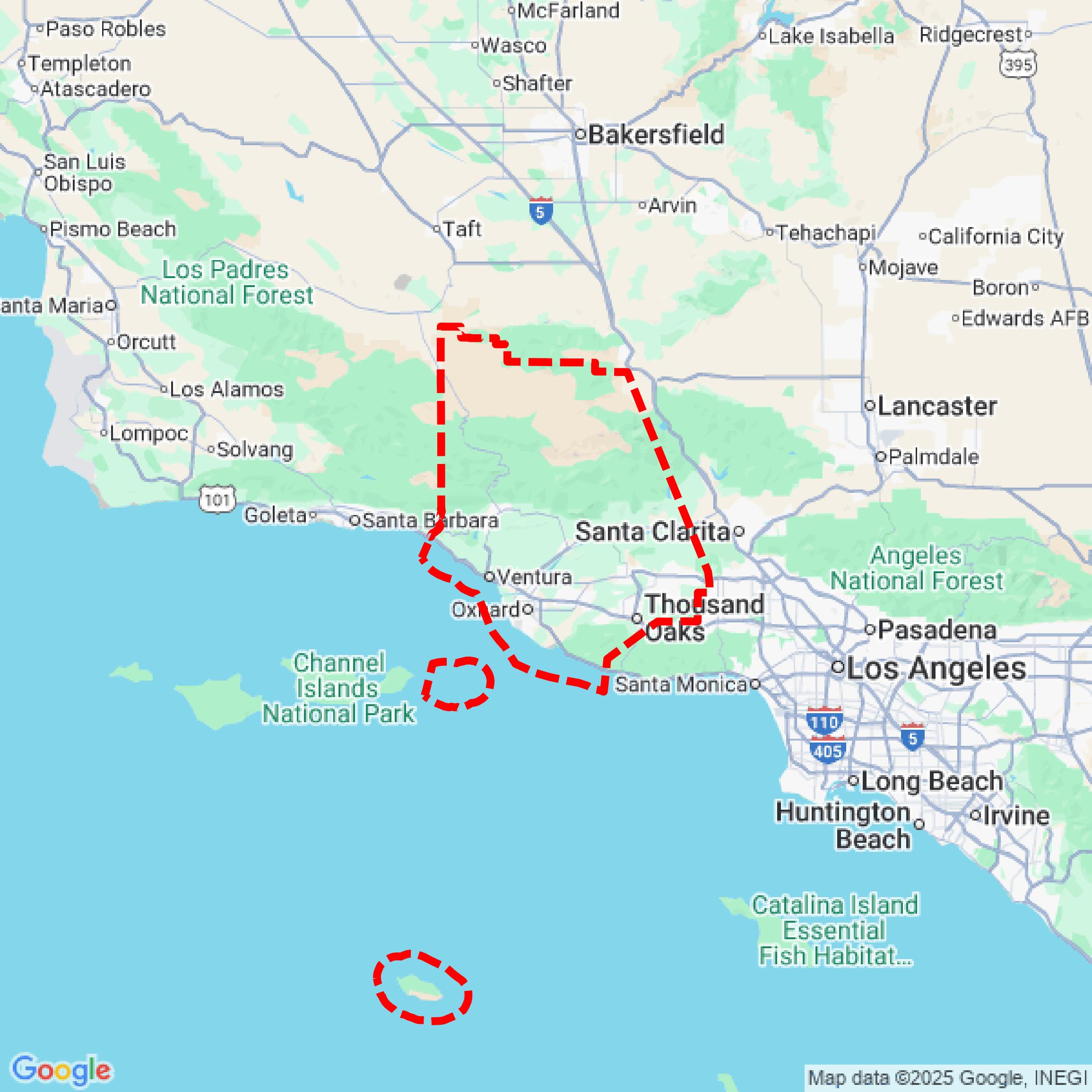

Data Available
Download GIS Data for Ventura County
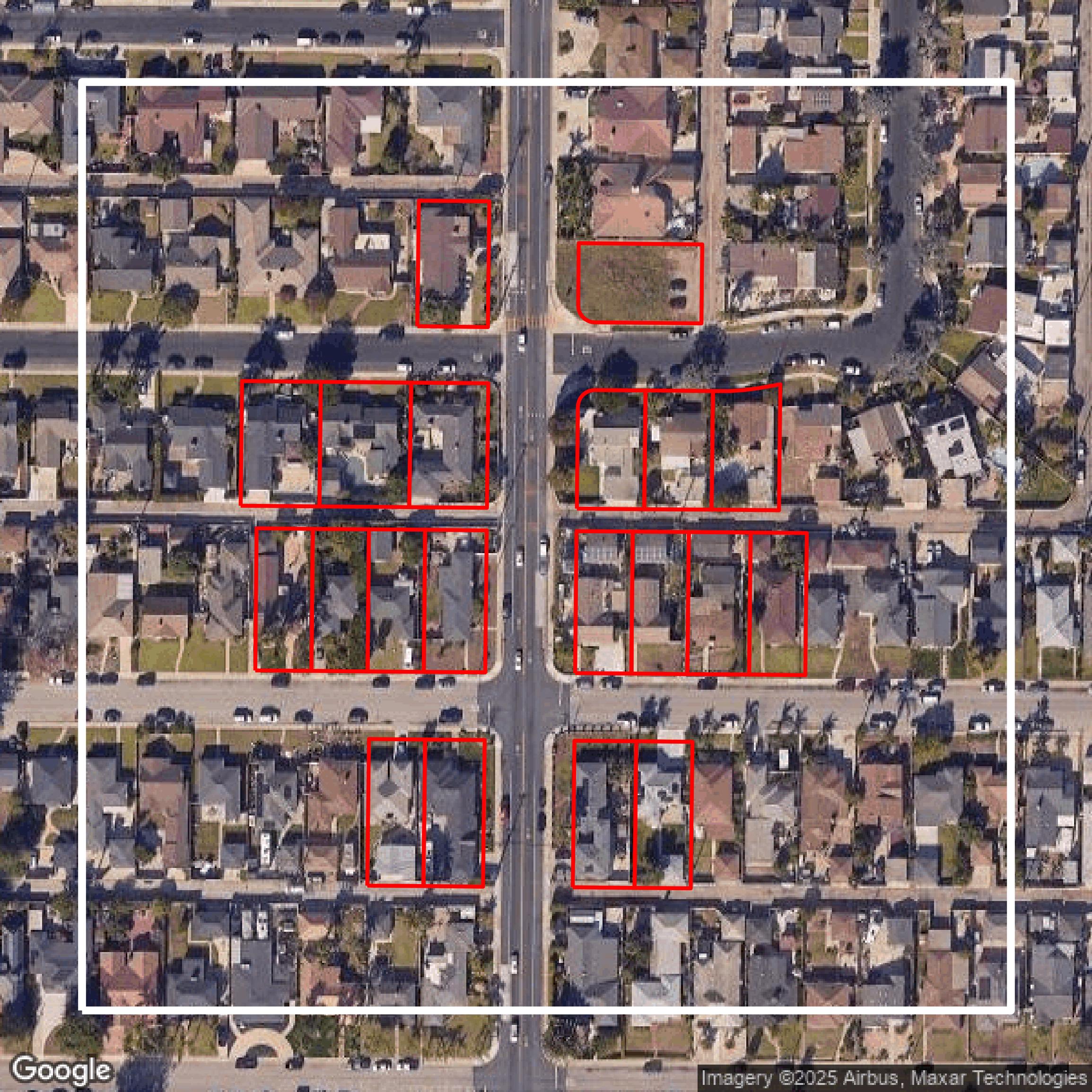
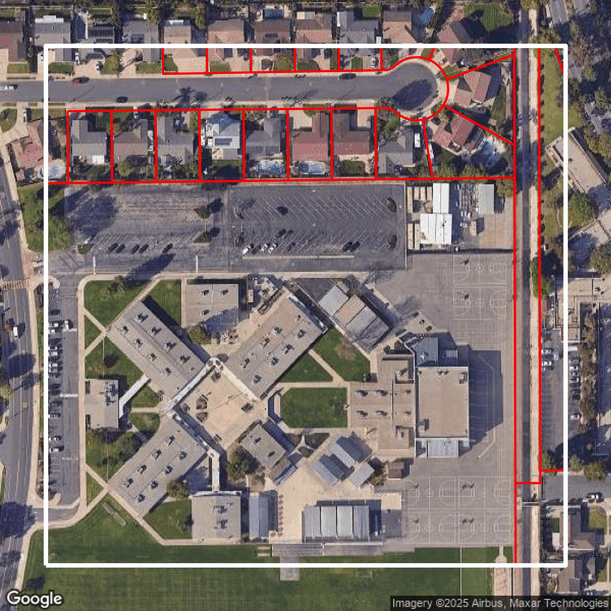
Parcels and Buildings
This image shows parcel and building data in Ventura County created using GIS data in Equator.
Get Parcels and Buildings for Ventura County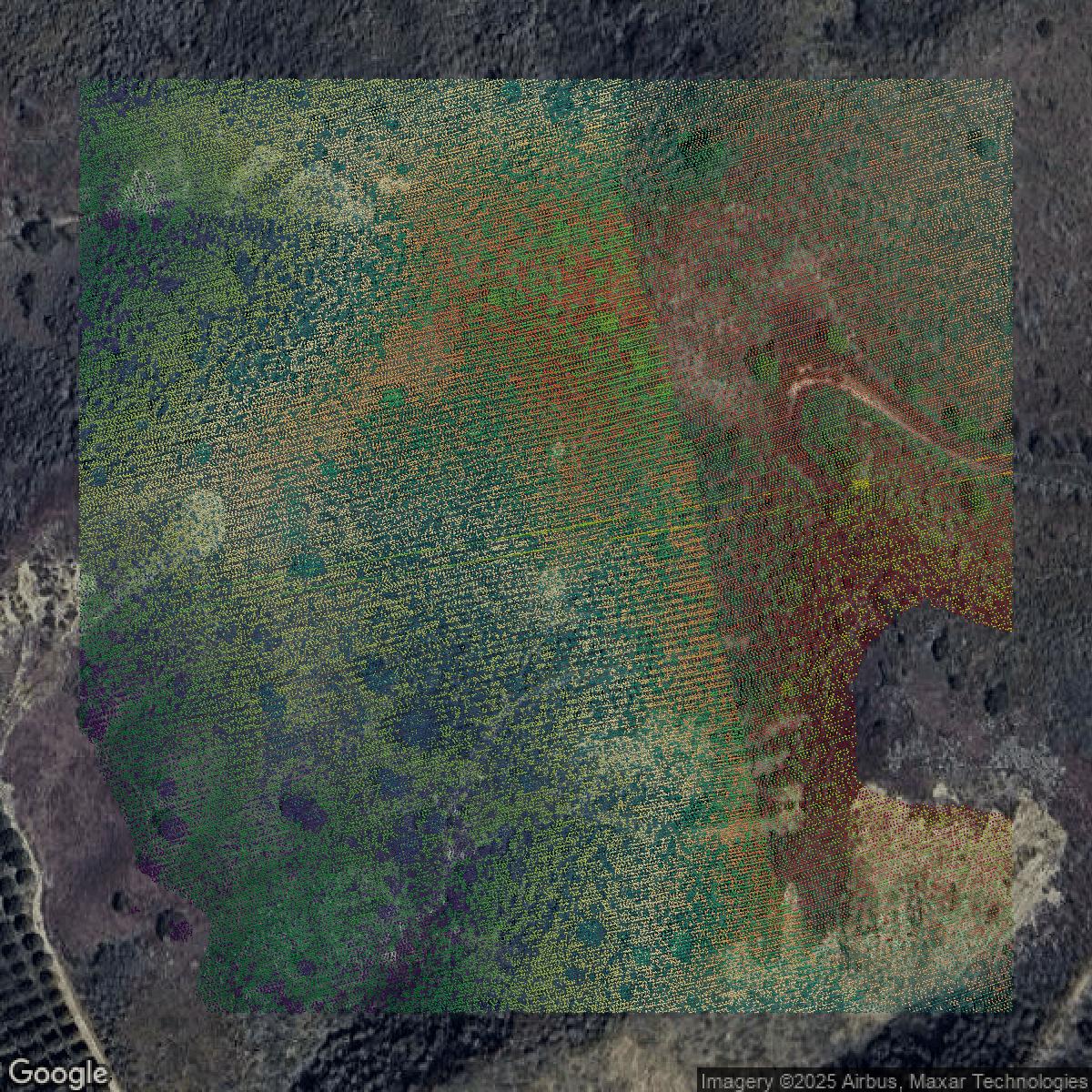
LiDAR
This image shows a LiDAR point cloud in Ventura County created using GIS data in Equator.
Get LiDAR for Ventura County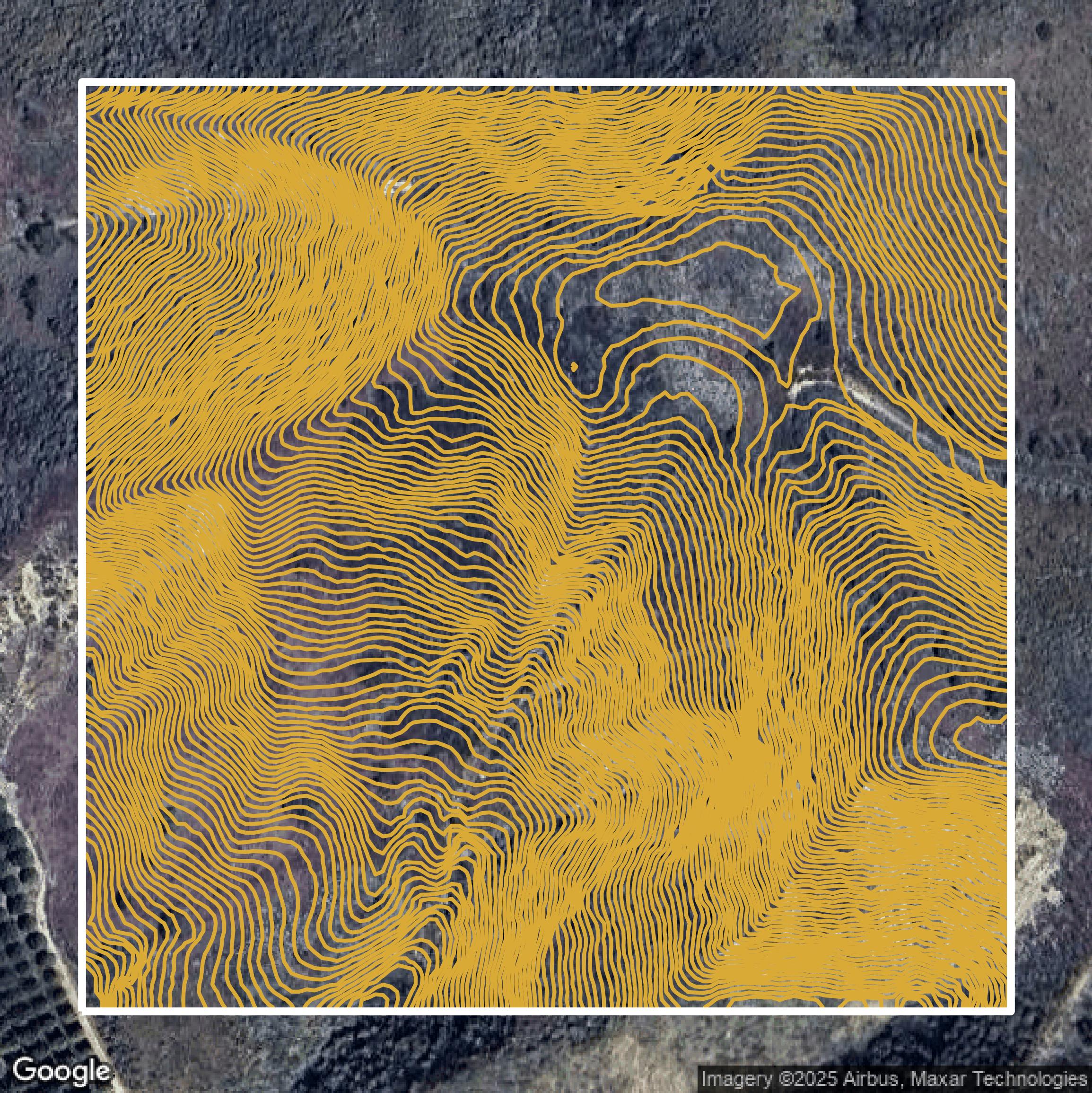
Contours
This image shows a contour map in Ventura County created using GIS data in Equator.
Get Contours for Ventura CountyFormats Available
Export Your Data Ready to Use in Multiple Formats
DWG
AutoCAD Drawing - Industry-standard CAD format
Supported Data:
Contour, Parcel, Building Outline
SHP
Shapefile - Standard GIS vector format
Supported Data:
Contour, Parcel, Building Outline
DXF
Drawing Exchange Format - Universal CAD interchange
Supported Data:
Contour, Building Outline
GeoJSON
Geographic JSON - Web-friendly spatial data format
Supported Data:
Contour, Parcel, Building Outline
LAZ
Compressed LAS - Efficient LiDAR point cloud format
Supported Data:
Point Cloud
SVG
Scalable Vector Graphics - Web vector format
Supported Data:
Contour, Building Outline
GPKG (Coming Soon)
GeoPackage - Modern OGC spatial database format
Supported Data:
Contour, Parcel, Building Outline
LandXML (Coming Soon)
Land XML - Civil engineering data exchange format
Supported Data:
Point Cloud
TIN (Coming Soon)
Triangulated Irregular Network - 3D surface model
Supported Data:
Point Cloud
XYZ (Coming Soon)
XYZ Point Cloud - Simple ASCII point cloud format
Supported Data:
Point Cloud
Background
GIS Data for Ventura County
The Ventura County GIS website offers a comprehensive suite of Geographic Information Systems tools and geospatial data designed to provide the highest quality geographic information and services efficiently. Visitors can explore a wide range of interactive mapping applications, including **County View**, **Political Landscape**, **Ventura Outdoors**, **Watersheds Coalition**, **PWA GIS Viewer**, **EV Application**, and **SB-1 Transportation** to analyze zoning, transportation projects, natural hazard risks such as earthquakes and wildfires, and community resources. The site features a curated **Map Gallery** and a **GIS Downloads** hub with thousands of layers of geospatial reference data managed through the ESRI ArcGIS System and Geocortex Applications, supported by up-to-date aerial imagery. Users can also create customized maps through the **Create Your Own Maps** tool. The Ventura County GIS resources are integral for municipal planning, redistricting, property tax assessment, environmental management, and public safety, making it an essential platform for government agencies, businesses, and residents seeking detailed, location-based information and data-driven decision support.
Access Ventura County GIS Data in Equator →Ventura County Portal →Showcase
Sample GIS Data for Ventura County
Parcels and Buildings
Parcel and building data in Ventura County are used in a variety of fields including architecture, real estate, and urban planning.
Get Parcels and Buildings for Ventura County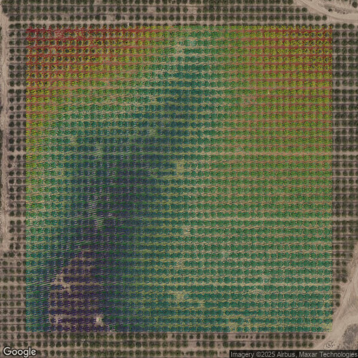
LiDAR
Point clouds (LiDAR) in Ventura County can produce highly accurate 3D models of terrain, structures, and vegetation.
Get LiDAR for Ventura County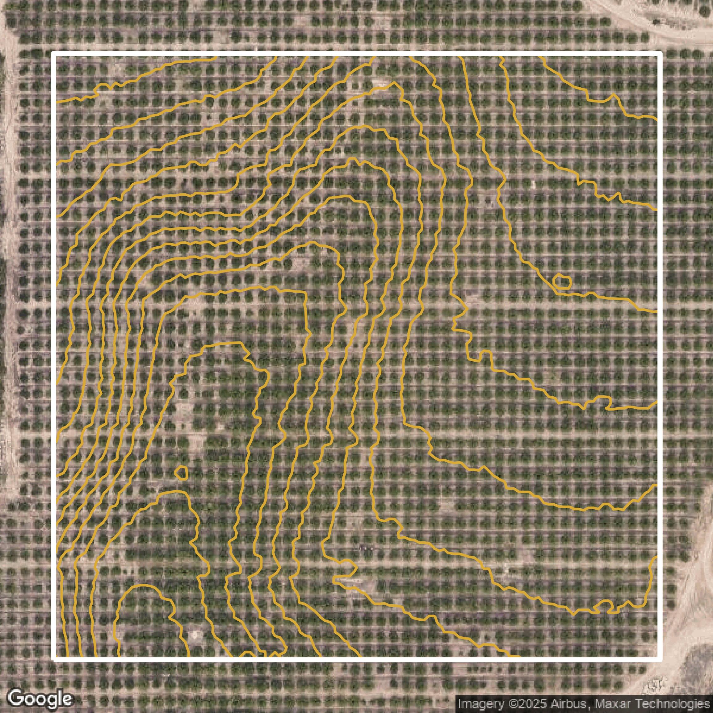
Contours
Contours in Ventura County visualize 3D elevations on a 2D surface allowing you to better understand your site.
Get Contours for Ventura County
Parcels and Buildings
Accessing Ventura County parcel and building data on Equator gives you access to coverage across the US.
Get Parcels and Buildings for Ventura County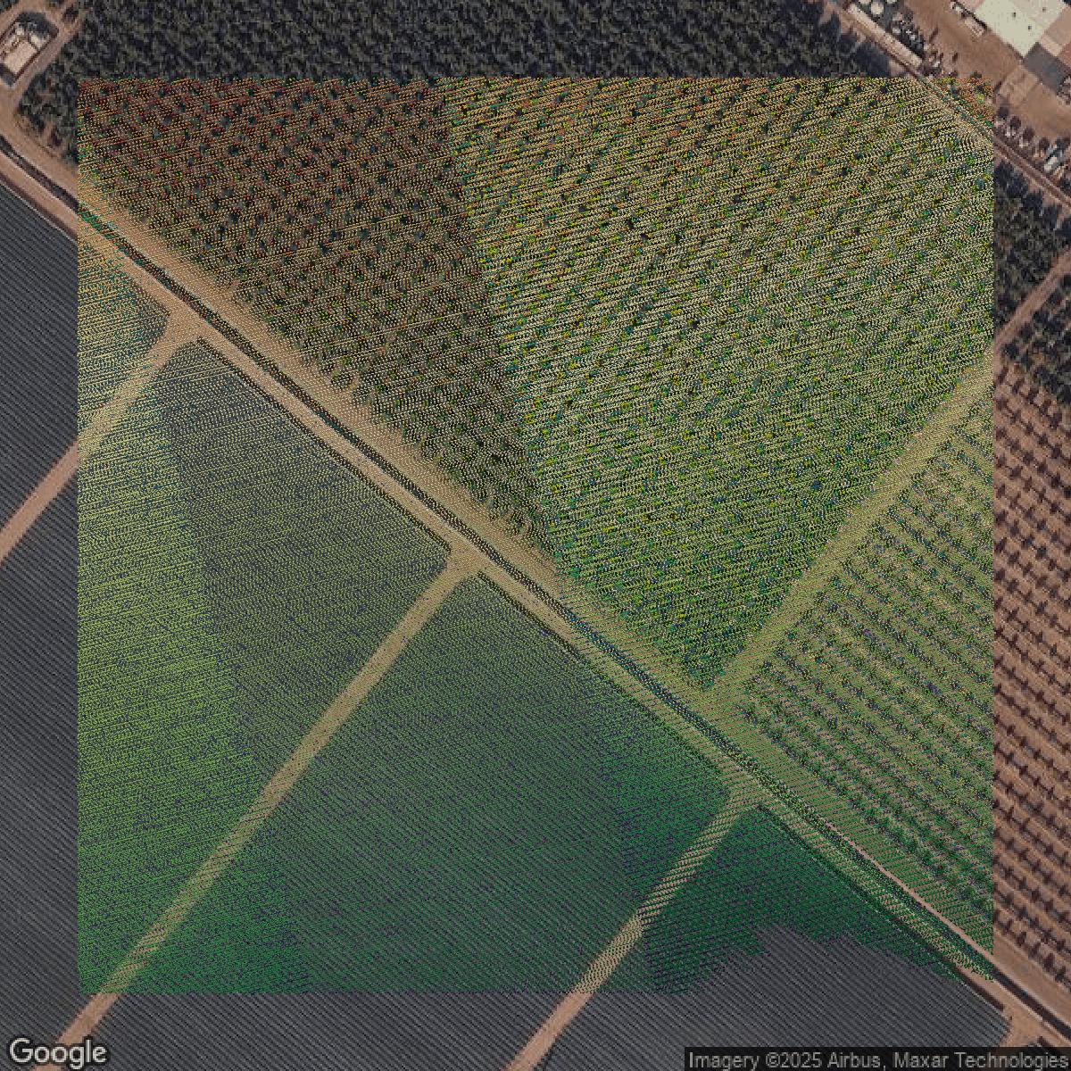
LiDAR
Ventura County LiDAR uses include land surveying, analyzing crop health, or even archaeological studies.
Get LiDAR for Ventura County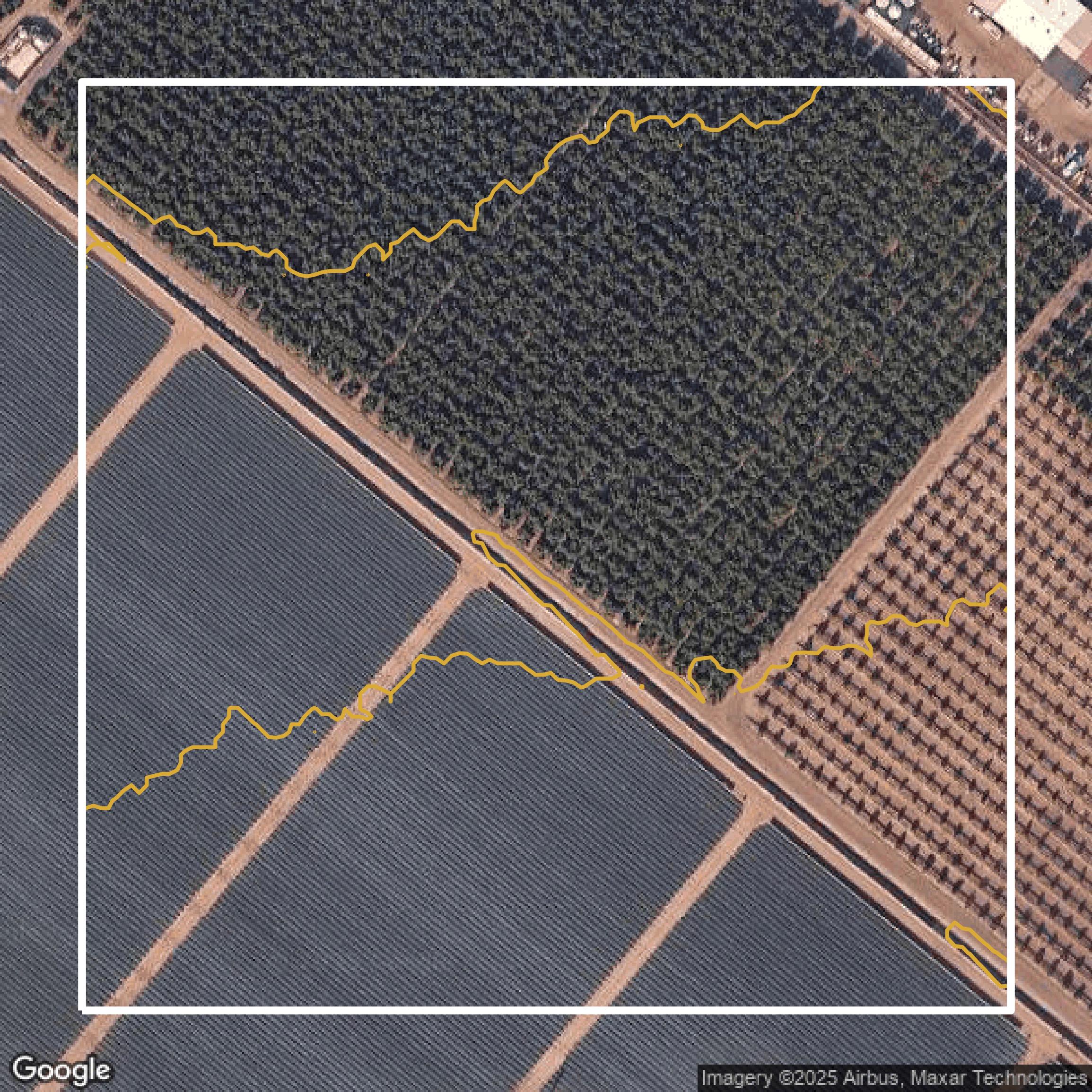
Contours
Ventura County contours can be used for construction & engineering, environmental science, and more.
Get Contours for Ventura County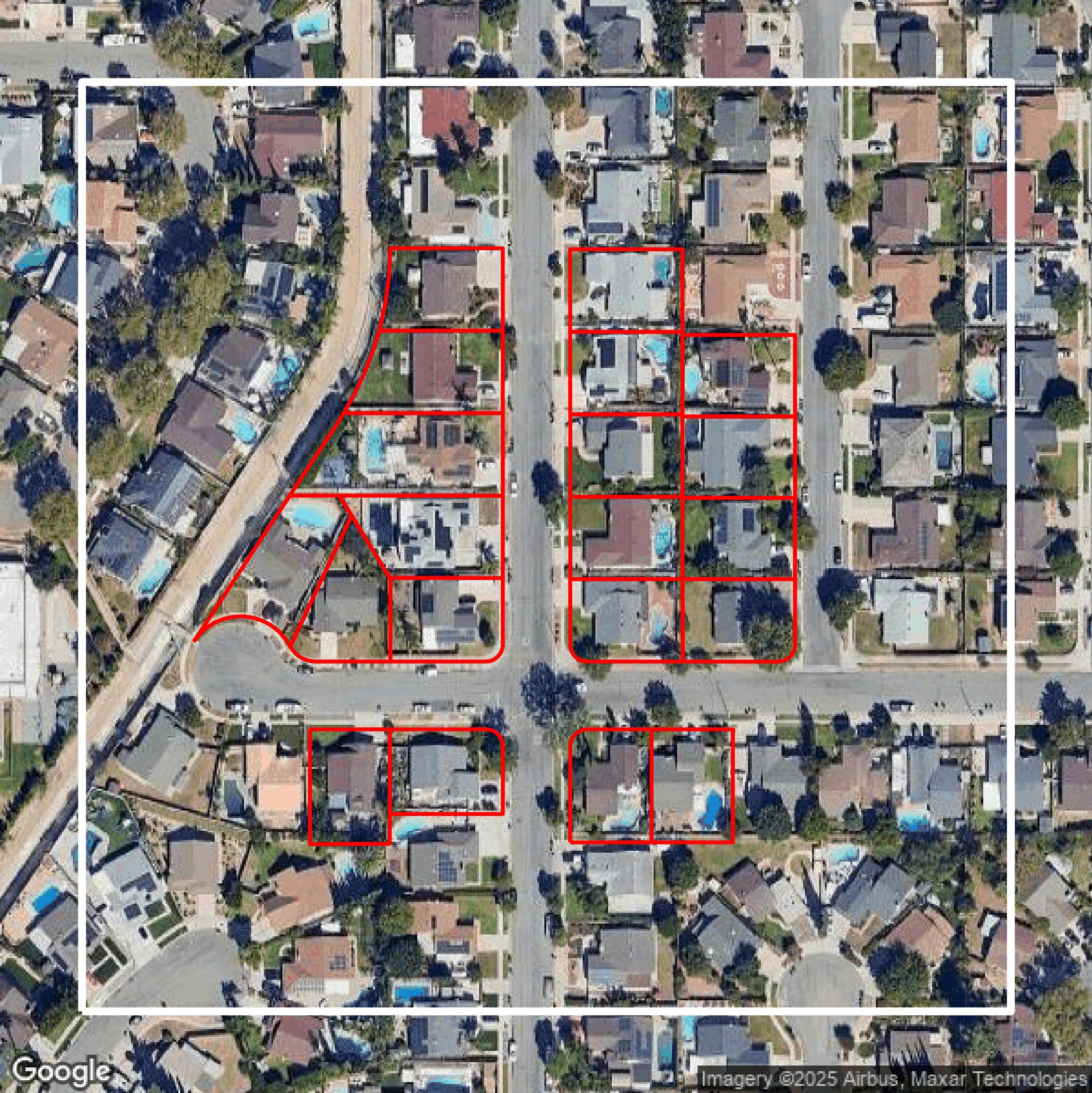
Parcels and Buildings
Dozens of fields are contained within each Ventura County parcel and building data, including zoning, owners, and year built.
Get Parcels and Buildings for Ventura County
LiDAR
Equator turns Ventura County LiDAR point clouds into various lidar-derived data sets, including DEMs.
Get LiDAR for Ventura County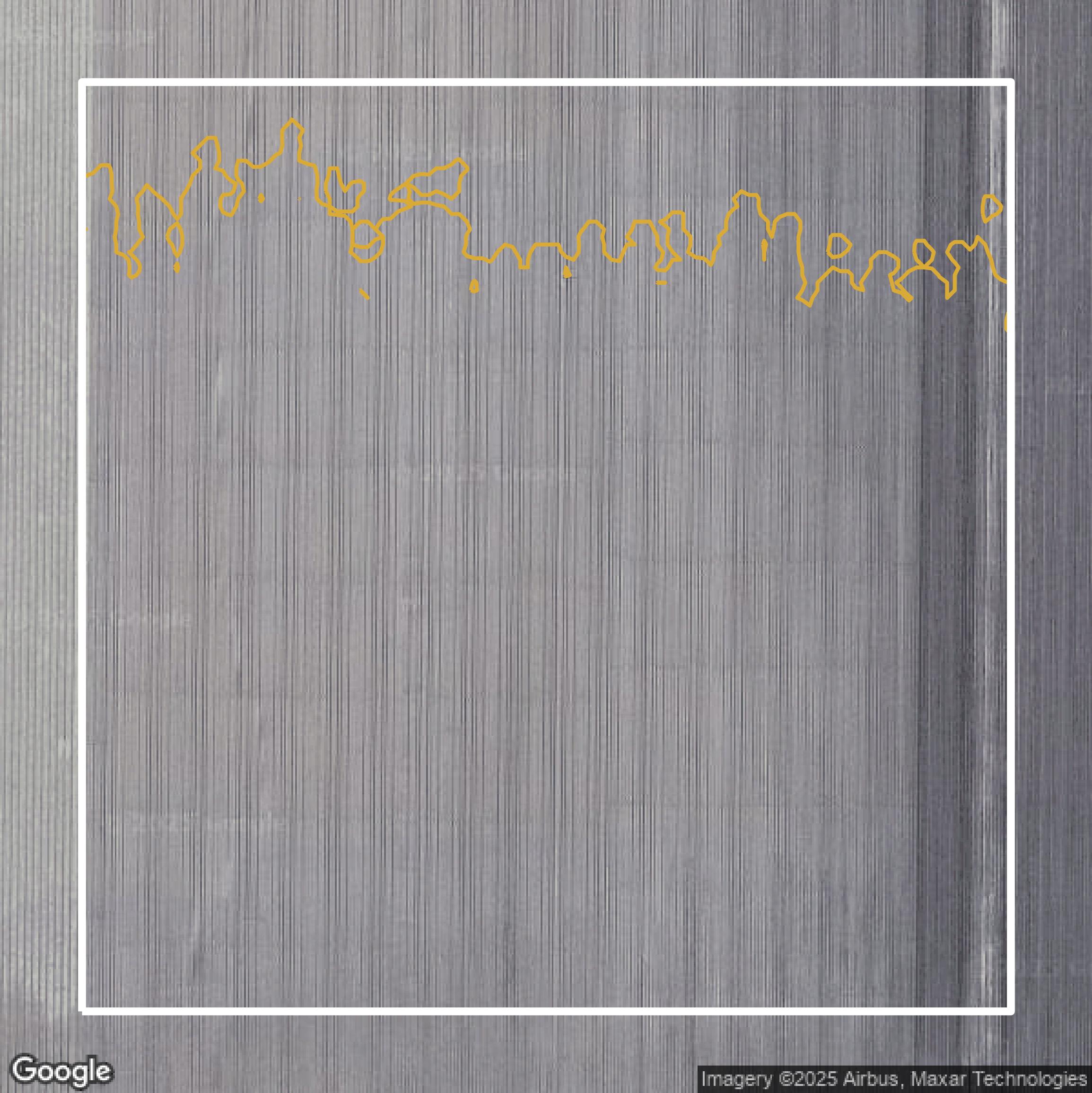
Contours
Ventura County contours on Equator are produced from LiDAR coverage, allowing for high precision
Get Contours for Ventura County