Overview
Snohomish County GIS Data – For CAD
Equator helps civil engineering, architecture and consulting firms with the tools to instantly find, process and download accurate LiDAR, contours, parcel data, building footprints, DEMs, point clouds and other GIS data for Snohomish County in an online web mapping portal.
Snohomish County GIS Data →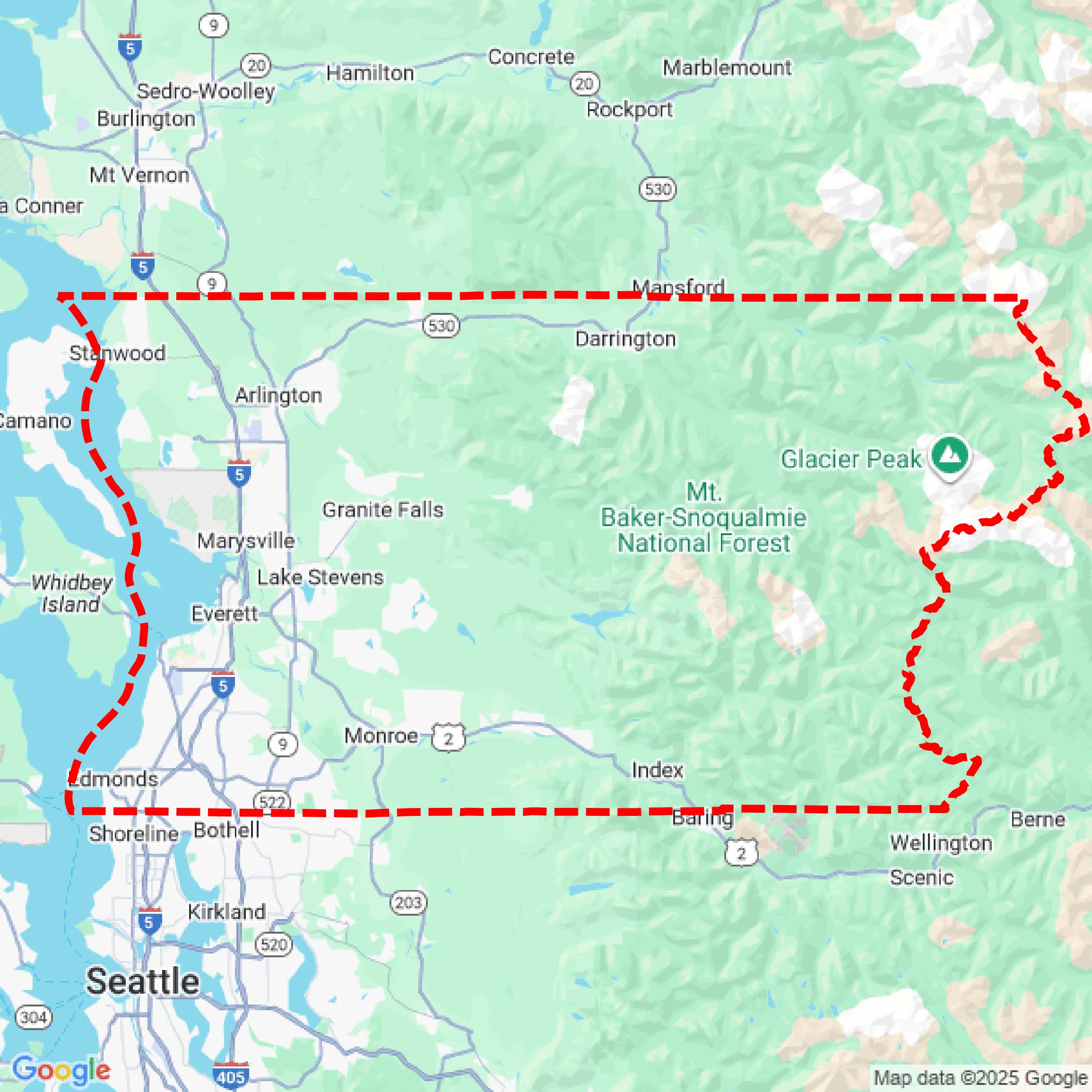

Data Available
Download GIS Data for Snohomish County
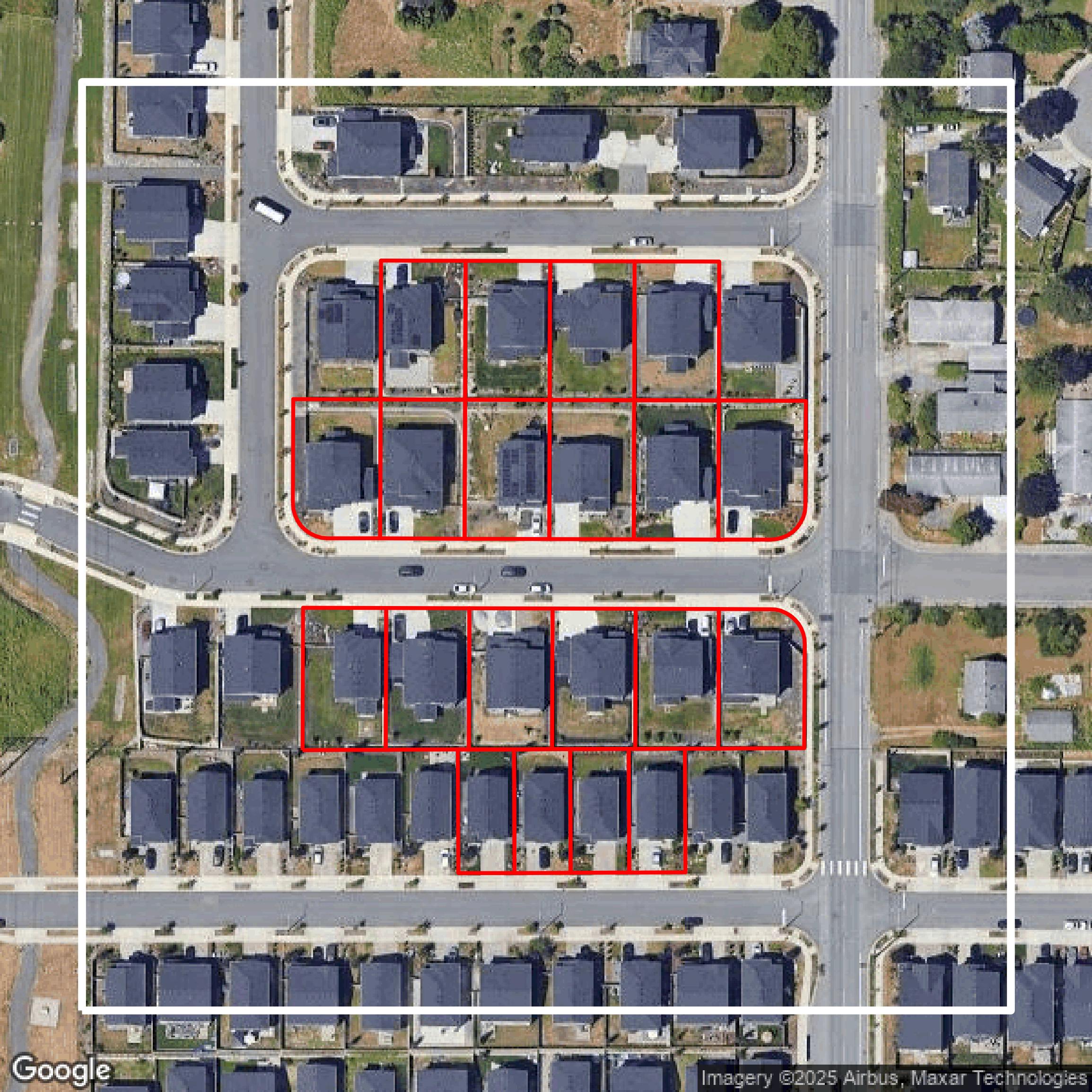
Parcels and Buildings
This image shows parcel and building data in Snohomish County created using GIS data in Equator.
Get Parcels and Buildings for Snohomish CountyLiDAR
This image shows a LiDAR point cloud in Snohomish County created using GIS data in Equator.
Get LiDAR for Snohomish CountyContours
This image shows a contour map in Snohomish County created using GIS data in Equator.
Get Contours for Snohomish CountyFormats Available
Export Your Data Ready to Use in Multiple Formats
DWG
AutoCAD Drawing - Industry-standard CAD format
Supported Data:
Contour, Parcel, Building Outline
SHP
Shapefile - Standard GIS vector format
Supported Data:
Contour, Parcel, Building Outline
DXF
Drawing Exchange Format - Universal CAD interchange
Supported Data:
Contour, Building Outline
GeoJSON
Geographic JSON - Web-friendly spatial data format
Supported Data:
Contour, Parcel, Building Outline
LAZ
Compressed LAS - Efficient LiDAR point cloud format
Supported Data:
Point Cloud
SVG
Scalable Vector Graphics - Web vector format
Supported Data:
Contour, Building Outline
GPKG (Coming Soon)
GeoPackage - Modern OGC spatial database format
Supported Data:
Contour, Parcel, Building Outline
LandXML (Coming Soon)
Land XML - Civil engineering data exchange format
Supported Data:
Point Cloud
TIN (Coming Soon)
Triangulated Irregular Network - 3D surface model
Supported Data:
Point Cloud
XYZ (Coming Soon)
XYZ Point Cloud - Simple ASCII point cloud format
Supported Data:
Point Cloud
Background
GIS Data for Snohomish County
On the Snohomish County GIS Open Data website, visitors can access a comprehensive collection of Assessor's Office spatial and tabular data freely available for download via the Snohomish County Open Data Portal. The site features a variety of frequently updated spatial data layers including "All Parcels (Past and Present)," "Cadastral Annotation," "City Boundaries," "Current Parcels," "Easements," "Municipal Annexation History," "Parcel Centroids," "Public Land Survey Grid," "Recent Property Sales," "Right of Way," "Subdivision Boundaries," "Subdivision Lots," and "Tax Code Areas," with most datasets updated three times per week or as needed. Additionally, users can download key tabular datasets such as the "Assessment roll" in CSV and Microsoft Excel formats, "Parcel Legal Descriptions," and the "Plat Listing by Name" with document hyperlinks, all updated regularly. The site also provides access to a zip file of "Unrecorded Plat PDFs," offering scanned plat documents. While the Assessor's Office strives to keep this data freely and readily accessible, technical assistance for downloads is limited due to system variability. This platform serves as a valuable resource for detailed land records, property boundaries, and related GIS data, with ongoing enhancements planned to expand data offerings.
Access Snohomish County GIS Data in Equator →Snohomish County Portal →Showcase
Sample GIS Data for Snohomish County
Parcels and Buildings
Parcel and building data in Snohomish County are used in a variety of fields including architecture, real estate, and urban planning.
Get Parcels and Buildings for Snohomish CountyLiDAR
Point clouds (LiDAR) in Snohomish County can produce highly accurate 3D models of terrain, structures, and vegetation.
Get LiDAR for Snohomish CountyContours
Contours in Snohomish County visualize 3D elevations on a 2D surface allowing you to better understand your site.
Get Contours for Snohomish CountyParcels and Buildings
Accessing Snohomish County parcel and building data on Equator gives you access to coverage across the US.
Get Parcels and Buildings for Snohomish CountyLiDAR
Snohomish County LiDAR uses include land surveying, analyzing crop health, or even archaeological studies.
Get LiDAR for Snohomish CountyContours
Snohomish County contours can be used for construction & engineering, environmental science, and more.
Get Contours for Snohomish CountyParcels and Buildings
Dozens of fields are contained within each Snohomish County parcel and building data, including zoning, owners, and year built.
Get Parcels and Buildings for Snohomish CountyLiDAR
Equator turns Snohomish County LiDAR point clouds into various lidar-derived data sets, including DEMs.
Get LiDAR for Snohomish CountyContours
Snohomish County contours on Equator are produced from LiDAR coverage, allowing for high precision
Get Contours for Snohomish County