Overview
King County GIS Data – For CAD
Equator helps civil engineering, architecture and consulting firms with the tools to instantly find, process and download accurate LiDAR, contours, parcel data, building footprints, DEMs, point clouds and other GIS data for King County in an online web mapping portal.
King County GIS Data →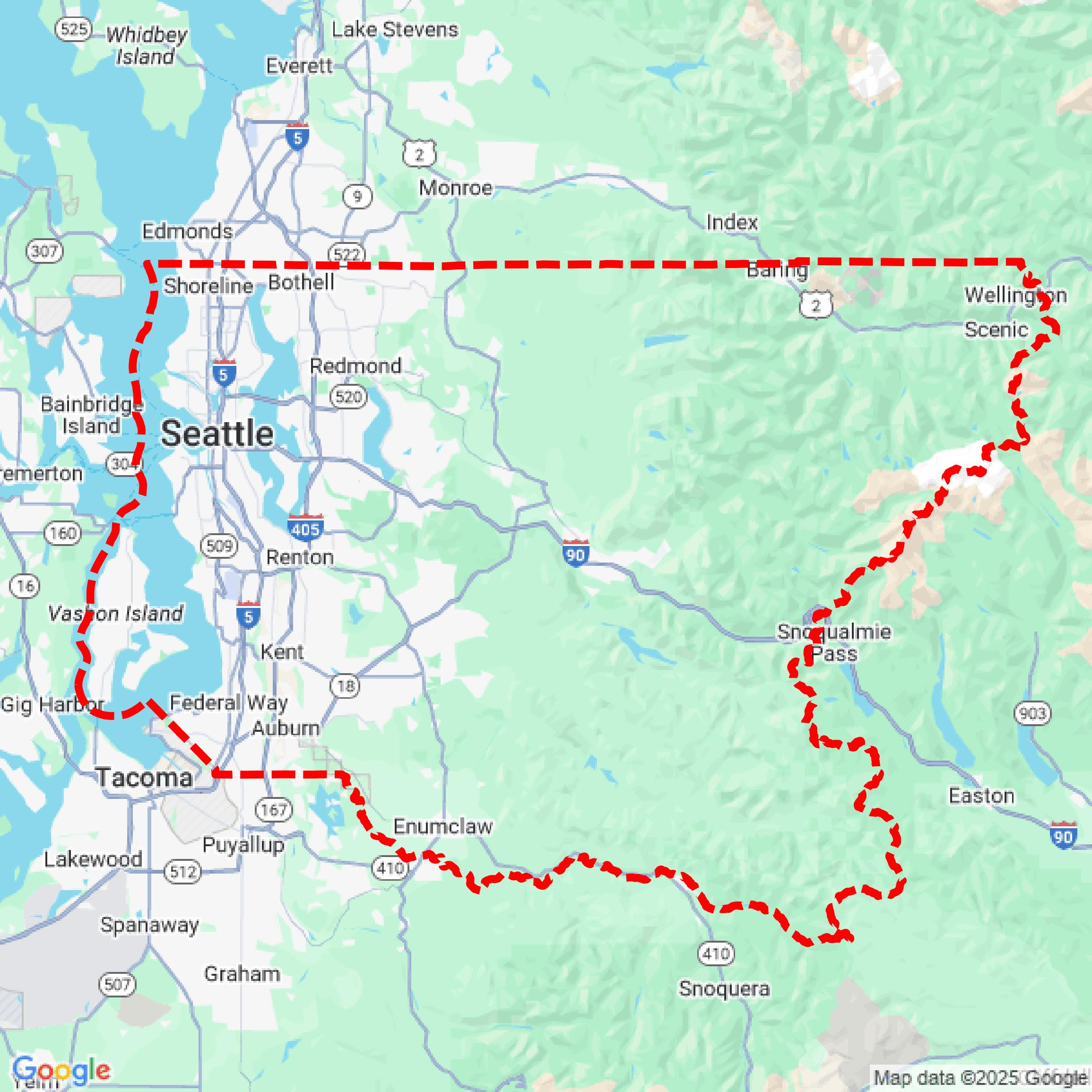

Data Available
Download GIS Data for King County
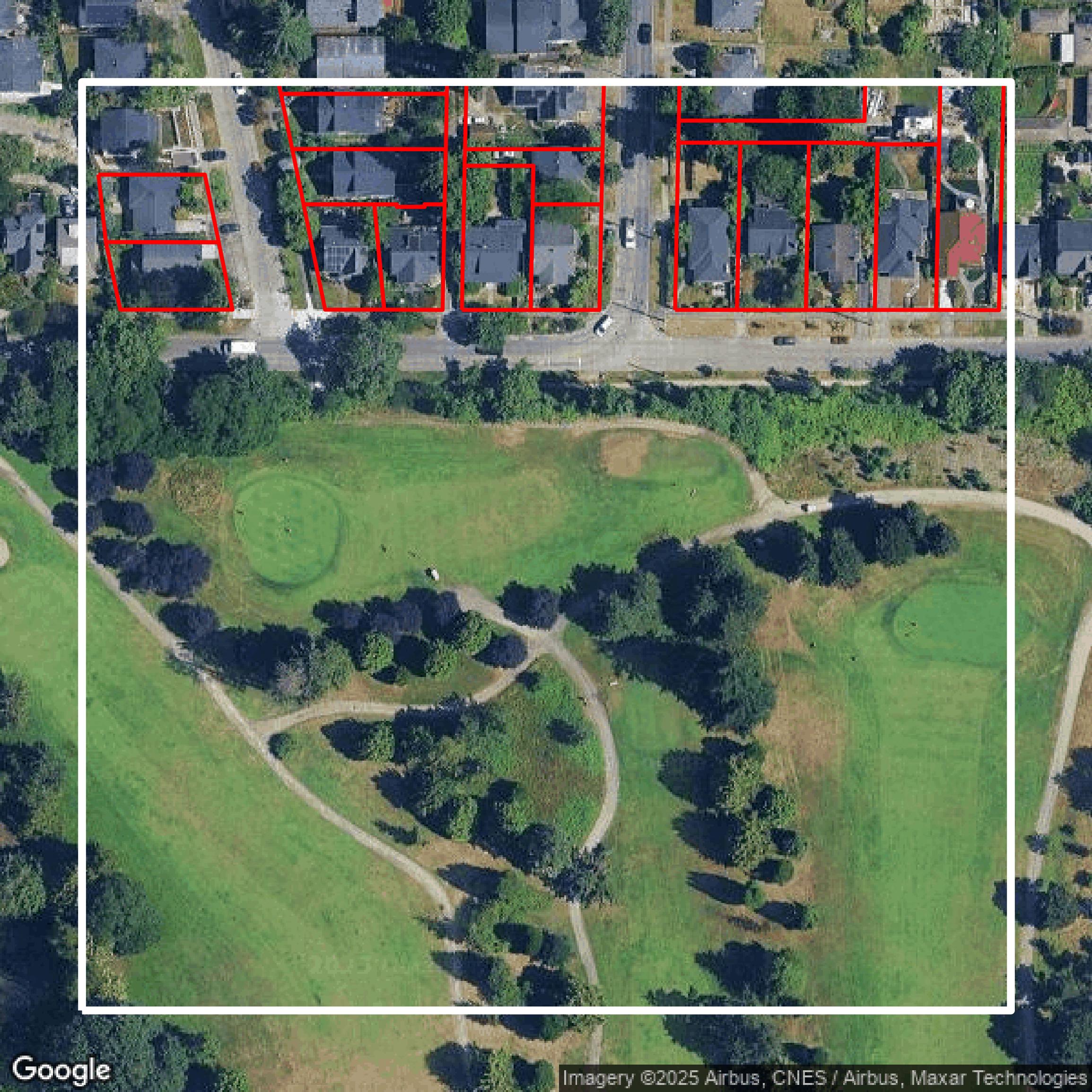
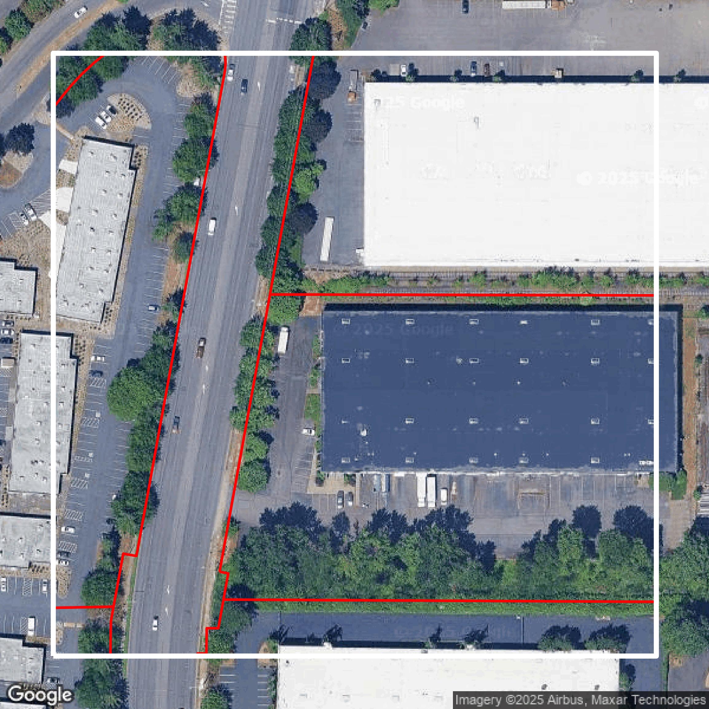
Parcels and Buildings
This image shows parcel and building data in King County created using GIS data in Equator.
Get Parcels and Buildings for King County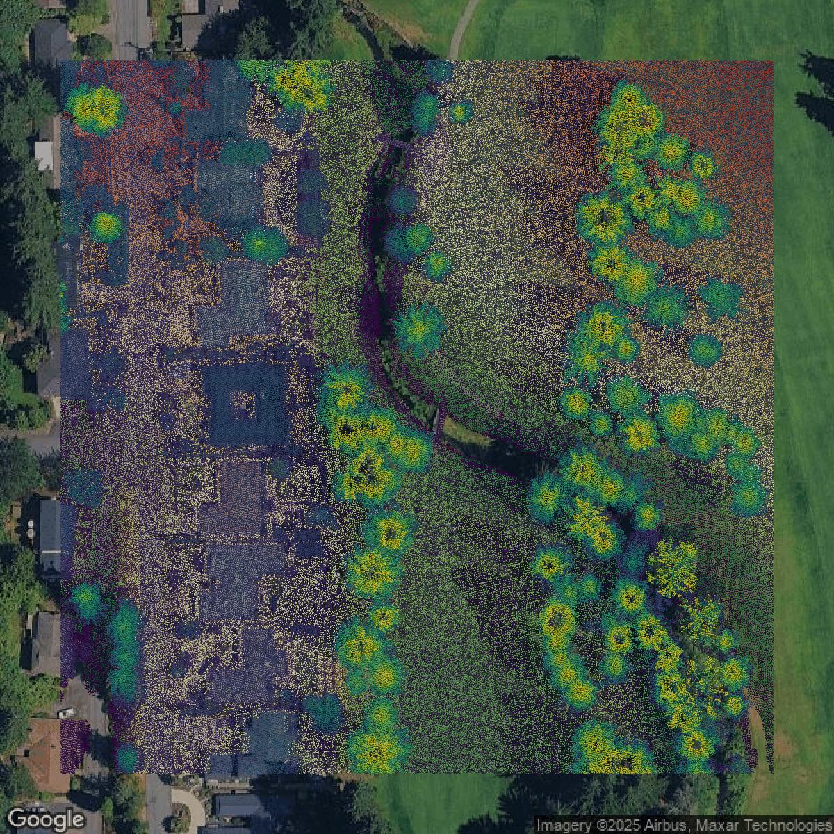
LiDAR
This image shows a LiDAR point cloud in King County created using GIS data in Equator.
Get LiDAR for King County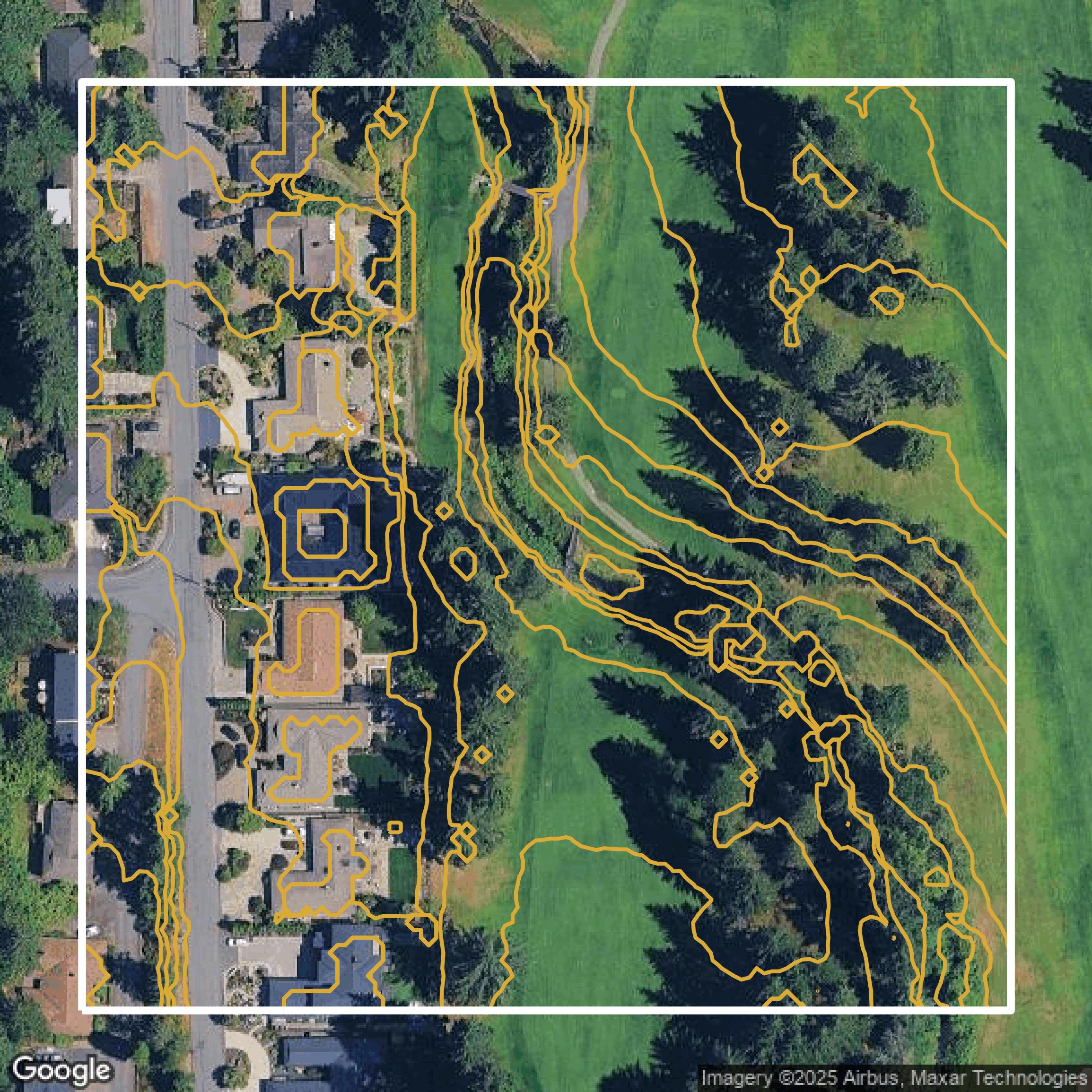
Contours
This image shows a contour map in King County created using GIS data in Equator.
Get Contours for King CountyFormats Available
Export Your Data Ready to Use in Multiple Formats
DWG
AutoCAD Drawing - Industry-standard CAD format
Supported Data:
Contour, Parcel, Building Outline
SHP
Shapefile - Standard GIS vector format
Supported Data:
Contour, Parcel, Building Outline
DXF
Drawing Exchange Format - Universal CAD interchange
Supported Data:
Contour, Building Outline
GeoJSON
Geographic JSON - Web-friendly spatial data format
Supported Data:
Contour, Parcel, Building Outline
LAZ
Compressed LAS - Efficient LiDAR point cloud format
Supported Data:
Point Cloud
SVG
Scalable Vector Graphics - Web vector format
Supported Data:
Contour, Building Outline
GPKG (Coming Soon)
GeoPackage - Modern OGC spatial database format
Supported Data:
Contour, Parcel, Building Outline
LandXML (Coming Soon)
Land XML - Civil engineering data exchange format
Supported Data:
Point Cloud
TIN (Coming Soon)
Triangulated Irregular Network - 3D surface model
Supported Data:
Point Cloud
XYZ (Coming Soon)
XYZ Point Cloud - Simple ASCII point cloud format
Supported Data:
Point Cloud
Background
GIS Data for King County
King County GIS Open Data offers a comprehensive Geographic Information System (GIS) platform where users can explore, visualize, and download a wide variety of spatial data sets related to King County. The website features data organized into rich thematic categories including Administrative, Census, Districts, Environment, Hydrography, Natural Resources, Planning, Political, Property, Public Safety, Recreation, Survey, Topography, Transportation, and Utilities. Users can access specialized resources such as the Climate Change GIS Open Data Site for historic and projected climate conditions, the Spatial Data Catalog for metadata and data indexing, and custom data orders. The portal also links to additional valuable data repositories like Data.KingCounty.gov with over a thousand datasets, LocalScape community maps, and Metro Transit developer resources including GTFS files. For enhanced user engagement, King County showcases web mapping applications like the multifunctional iMap, the King County Voter Turnout by Precinct Story Map, the My Commute travel alerts app, and the Metro Transit System viewer, demonstrating dynamic and interactive uses of GIS data. This makes the King County GIS Open Data website an essential resource for anyone seeking detailed spatial insights and tools to analyze and understand the geographic dimensions of neighborhoods, environments, infrastructure, and services within King County.
Access King County GIS Data in Equator →King County Portal →Showcase
Sample GIS Data for King County
Parcels and Buildings
Parcel and building data in King County are used in a variety of fields including architecture, real estate, and urban planning.
Get Parcels and Buildings for King County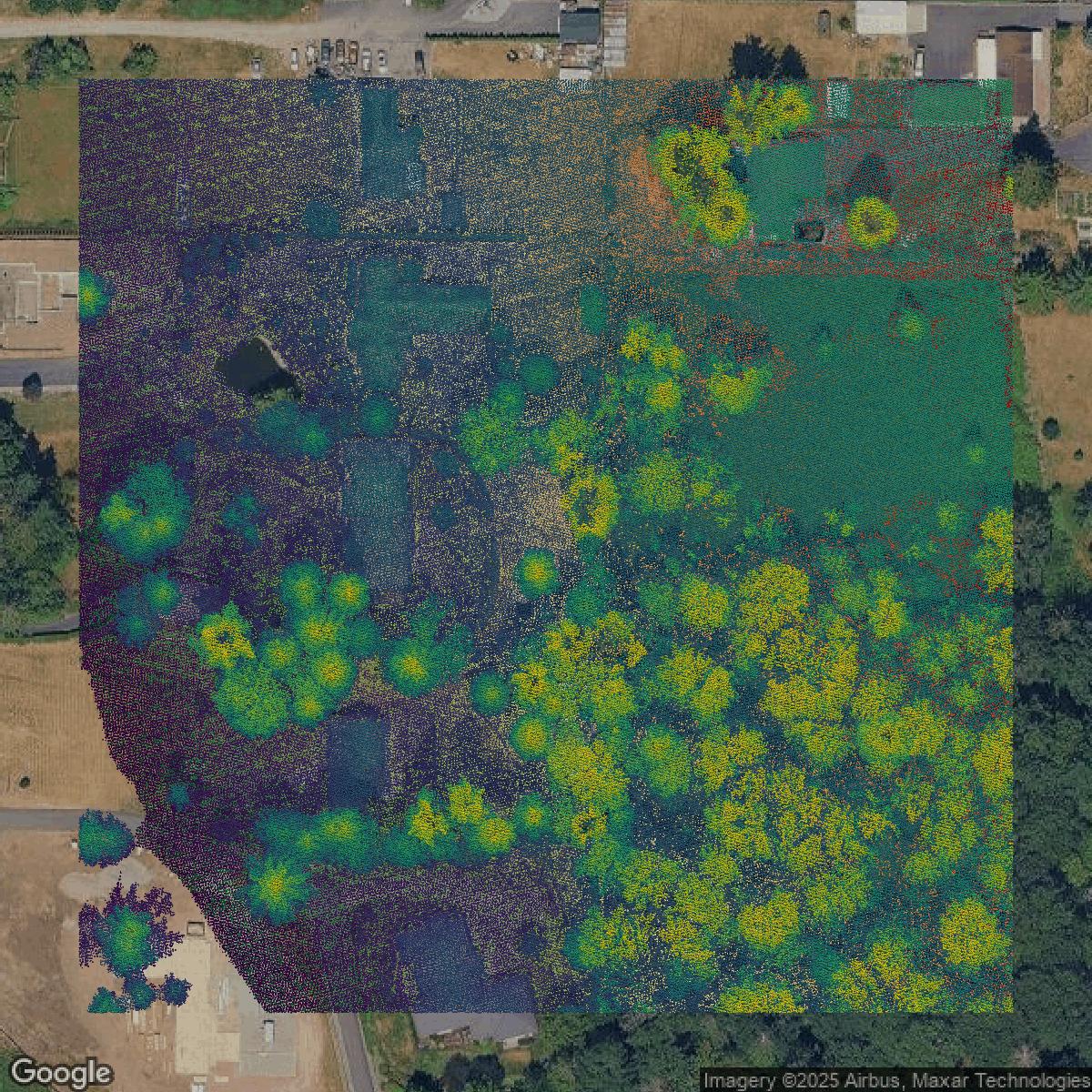
LiDAR
Point clouds (LiDAR) in King County can produce highly accurate 3D models of terrain, structures, and vegetation.
Get LiDAR for King County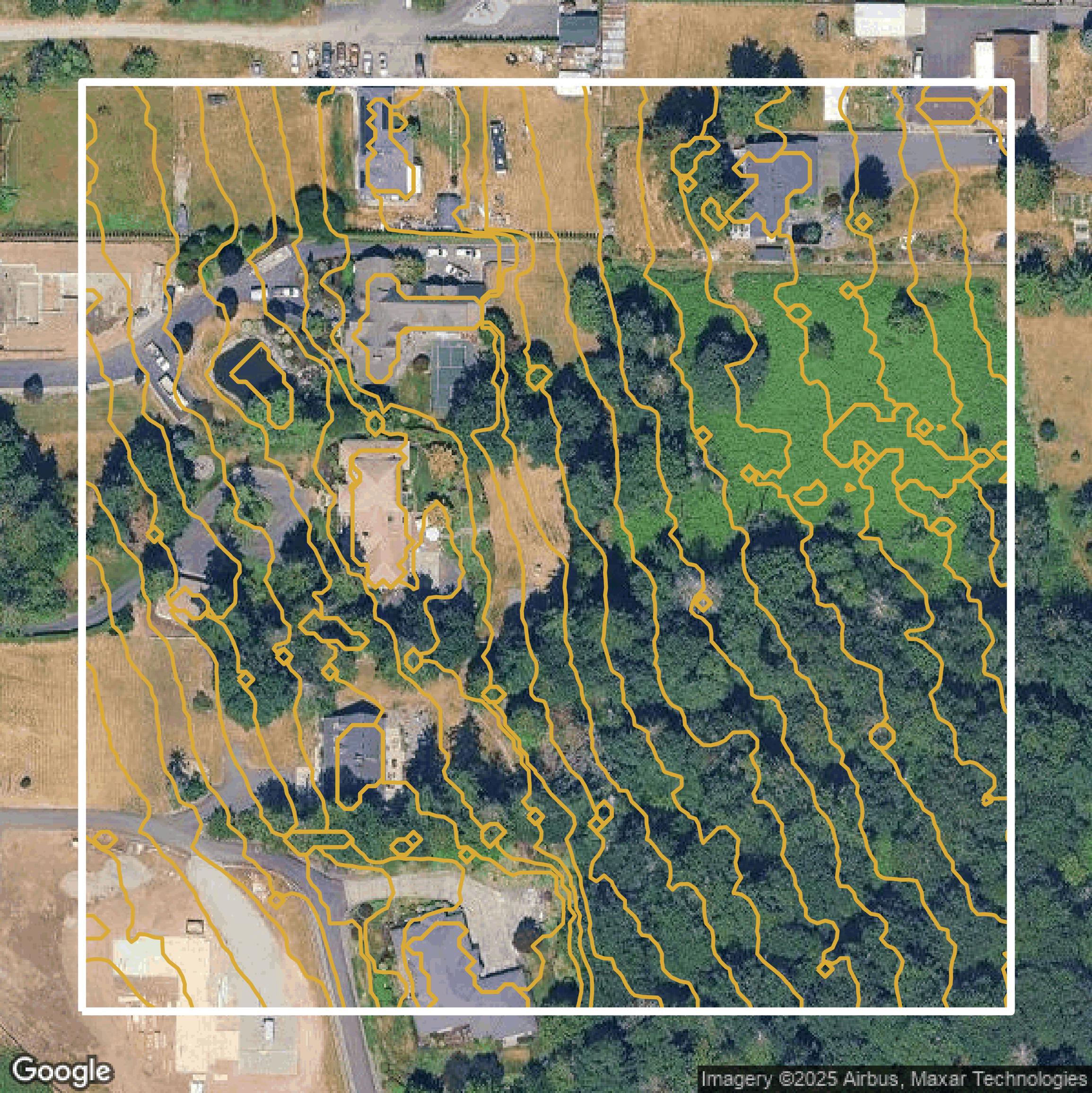
Contours
Contours in King County visualize 3D elevations on a 2D surface allowing you to better understand your site.
Get Contours for King County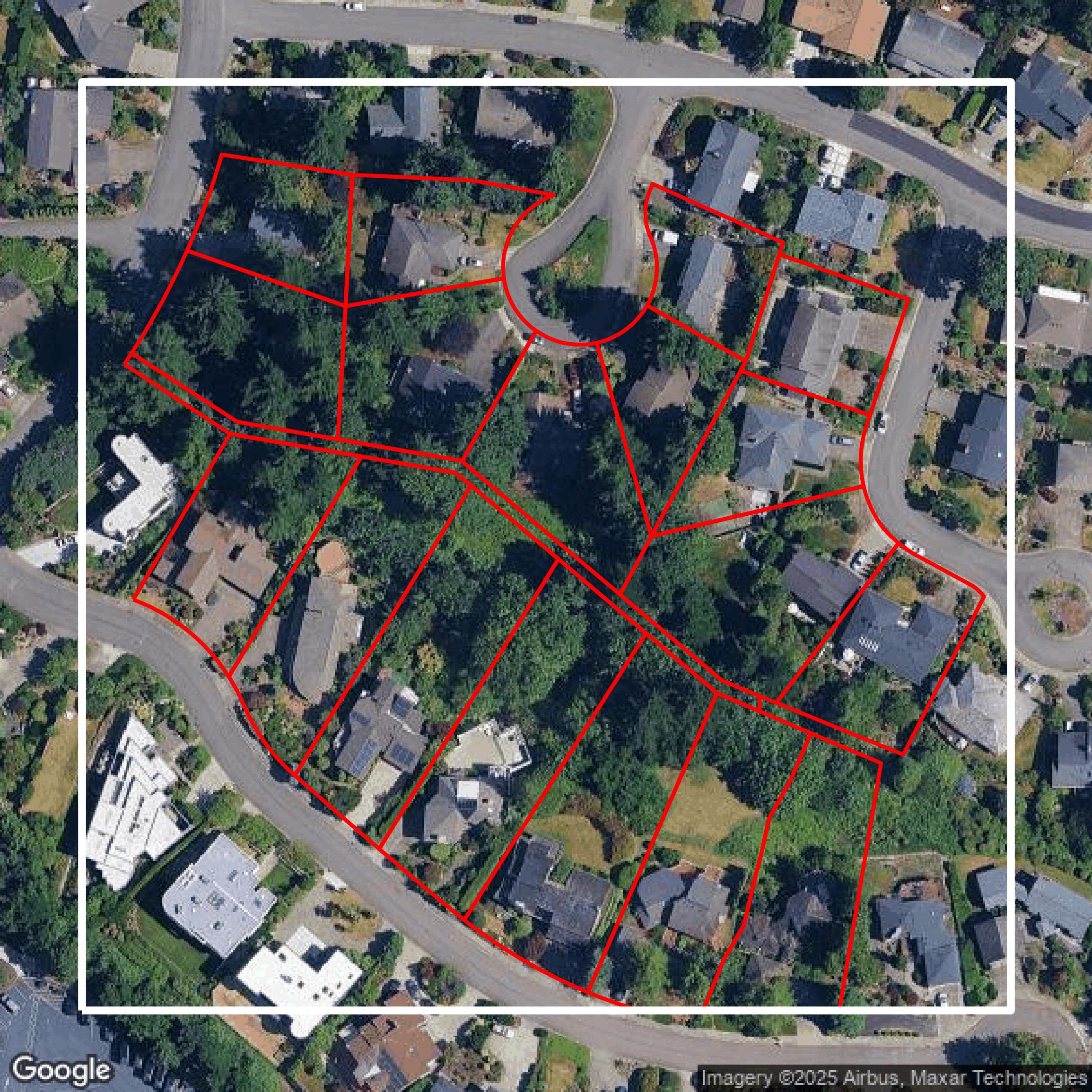
Parcels and Buildings
Accessing King County parcel and building data on Equator gives you access to coverage across the US.
Get Parcels and Buildings for King County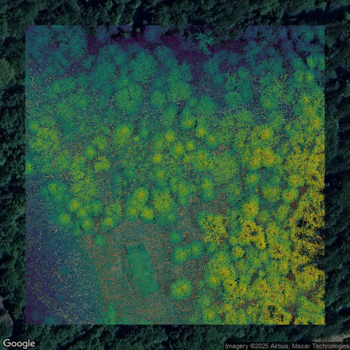
LiDAR
King County LiDAR uses include land surveying, analyzing crop health, or even archaeological studies.
Get LiDAR for King County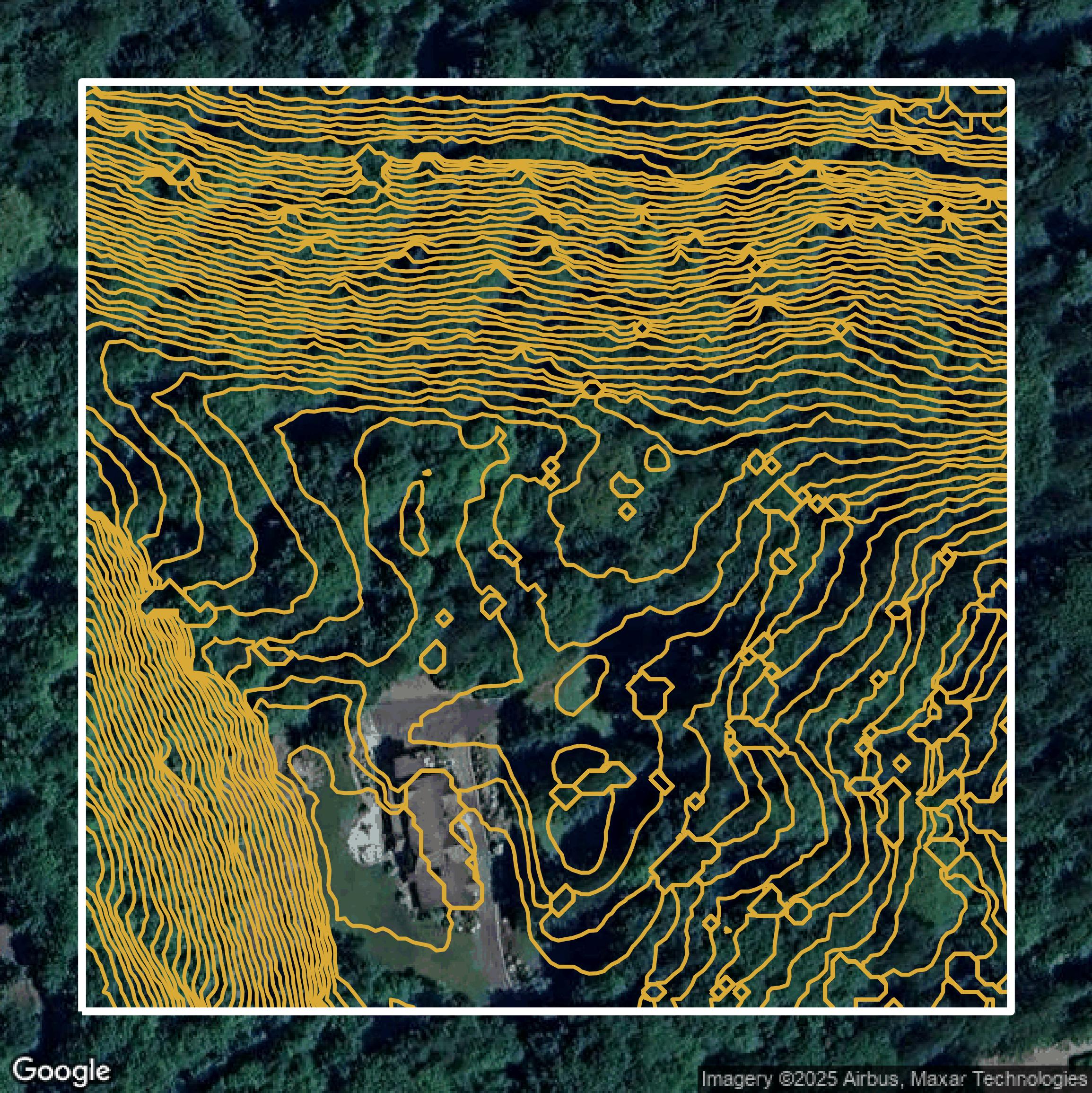
Contours
King County contours can be used for construction & engineering, environmental science, and more.
Get Contours for King County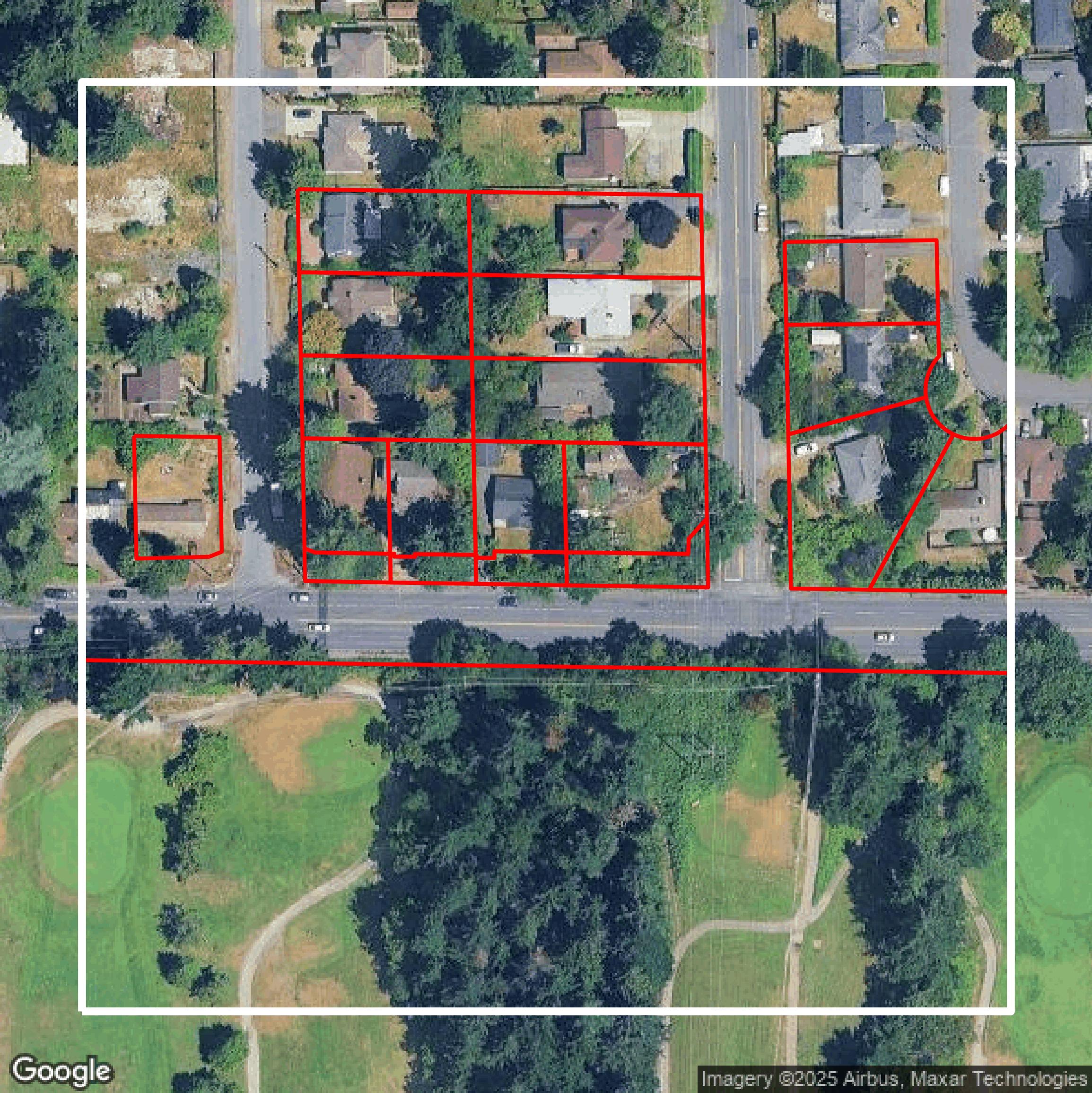
Parcels and Buildings
Dozens of fields are contained within each King County parcel and building data, including zoning, owners, and year built.
Get Parcels and Buildings for King County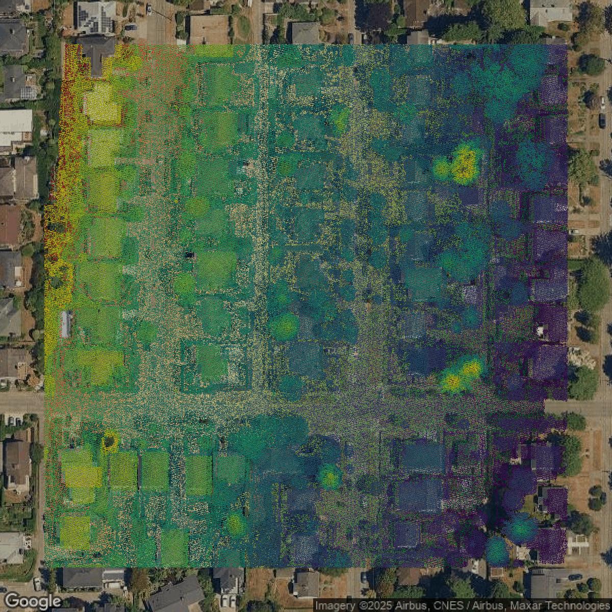
LiDAR
Equator turns King County LiDAR point clouds into various lidar-derived data sets, including DEMs.
Get LiDAR for King County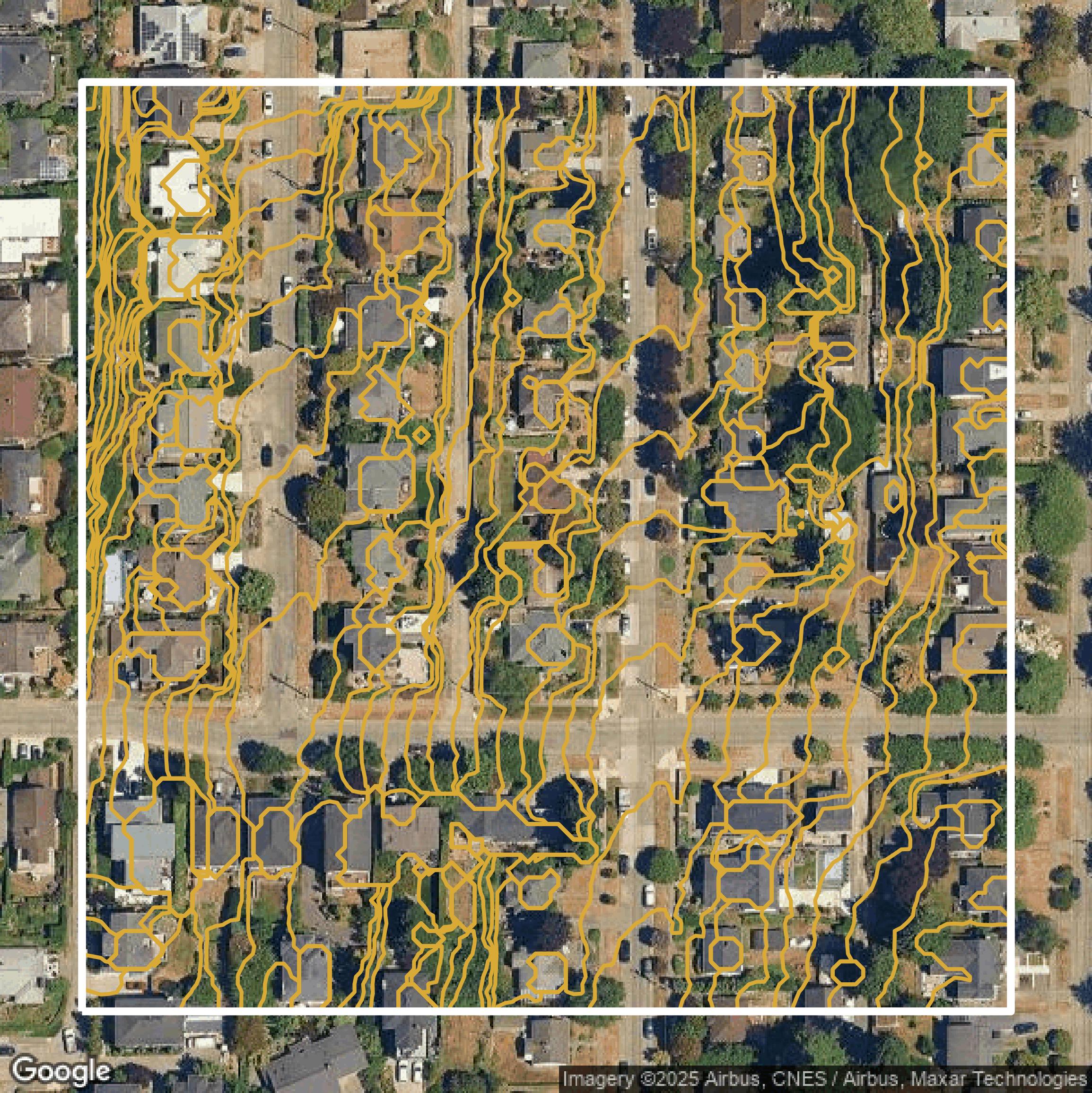
Contours
King County contours on Equator are produced from LiDAR coverage, allowing for high precision
Get Contours for King County